File:71634 1880layersfaultslabeled.jpg
Size of this preview: 800 × 365 pixels. Other resolutions: 320 × 146 pixels | 1,307 × 597 pixels.
Original file (1,307 × 597 pixels, file size: 293 KB, MIME type: image/jpeg)
Summary
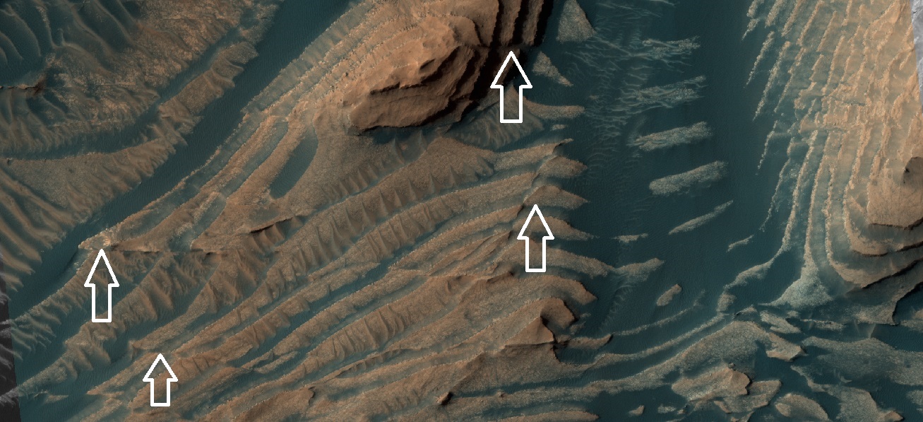
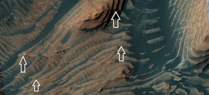
Faults in layered terrain, as seen by HiRISE under HiWish program Some faults are indicated with white arrow. The location is Danielson Crater in the Oxia Palus quadrangle at 7.688 N and 353.101 E (ESP_071634_1880).
Source: hirise.lpl.arizona.edu/ESP_071634_1880
Image credit: NASA/JPL/University of Arizona/Secosky
Licensing
Public domain images are available for anybody to use without any licenses, royalties, or special permissions.
File history
Click on a date/time to view the file as it appeared at that time.
| Date/Time | Thumbnail | Dimensions | User | Comment | |
|---|---|---|---|---|---|
| current | 07:15, 13 January 2022 | | 1,307 × 597 (293 KB) | Suitupandshowup (talk | contribs) | Faults in layered terrain, as seen by HiRISE under HiWish program Some faults are indicated with white arrow. The location is Danielson Crater in the Oxia Palus quadrangle at 7.688 N and 353.101 E (ESP_071634_1880). Source: hirise.lpl.arizona.edu/ESP_071634_1880 Image credit: NASA/JPL/University of Arizona/Secosky |
You cannot overwrite this file.
File usage
The following 2 pages use this file:


