File:Argyre MOLA zoom 64.jpg
Size of this preview: 712 × 600 pixels. Other resolutions: 285 × 240 pixels | 570 × 480 pixels | 911 × 768 pixels | 1,215 × 1,024 pixels | 4,220 × 3,556 pixels.
Original file (4,220 × 3,556 pixels, file size: 6.74 MB, MIME type: image/jpeg)
Summary
| Description |
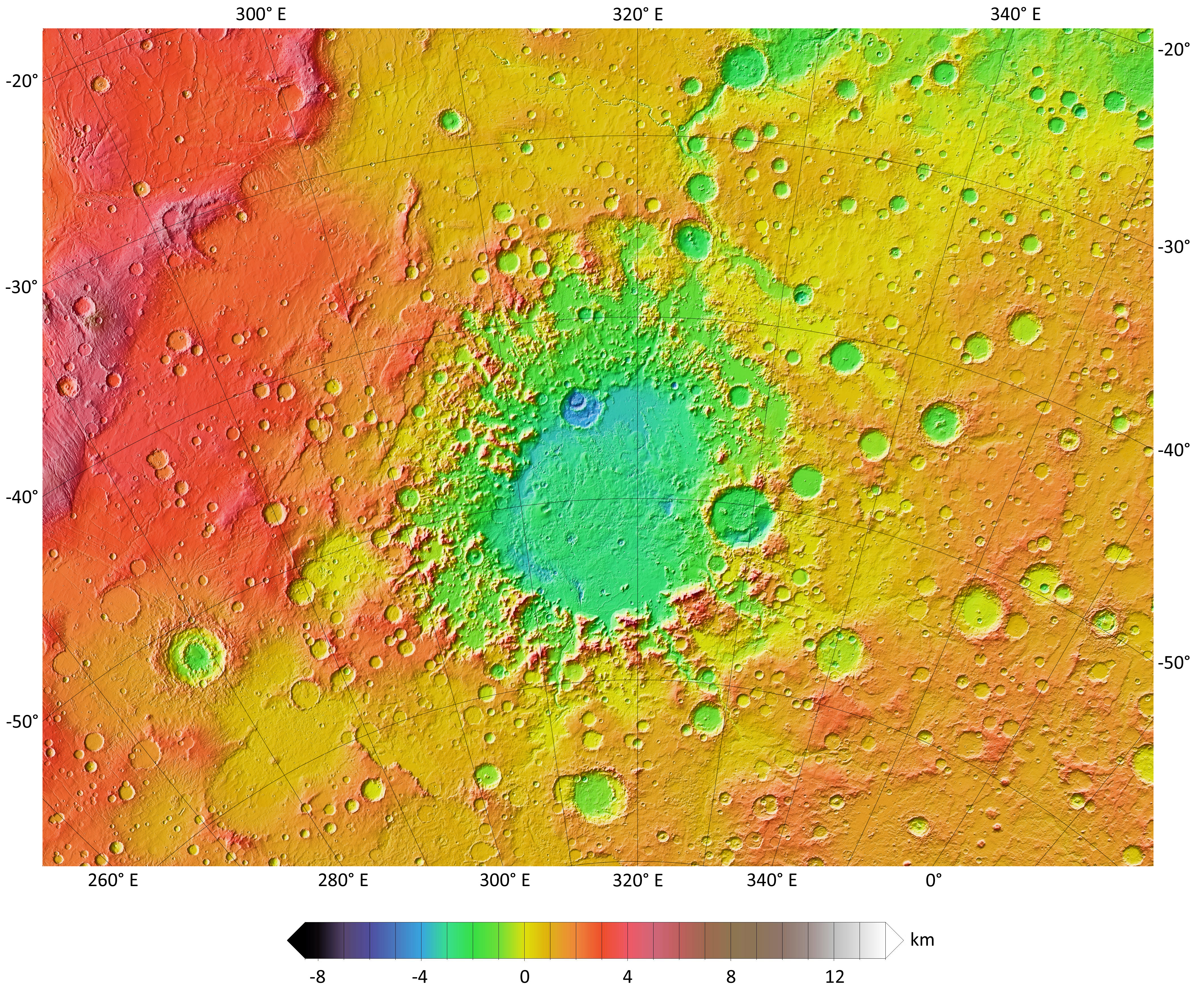
English: A colorized topographic map of the martian impact basin Argyre, together with its surroundings, from the Mars Orbiter Laser Altimeter (MOLA) instrument of the Mars Global Surveyor spacecraft. Argyre, the second deepest basin on Mars, lies in the southern hemisphere, southeast of the canyon system Valles Marineris. Some of the features in this image have been annotated in Wikimedia Commons. |
| Date | |
| Source | JMARS |
| Author | NASA / JPL-Caltech / Arizona State University |
| Other versions |
.jpg)
Licensing
| This file is in the public domain in the United States because it was solely created by NASA. NASA copyright policy states that "NASA material is not protected by copyright unless noted". (See Template:PD-USGov, NASA copyright policy page or JPL Image Use Policy.) | ||
 |
Warnings:
|
| Annotations | This image is annotated: View the annotations at Commons |
File history
Click on a date/time to view the file as it appeared at that time.
| Date/Time | Thumbnail | Dimensions | User | Comment | |
|---|---|---|---|---|---|
| current | 15:23, 29 November 2013 | | 4,220 × 3,556 (6.74 MB) | WolfmanSF | increase font size in elevation key |
File usage
The following page uses this file:


