File:ESP 057389 2195ldacropped.jpg
Size of this preview: 365 × 599 pixels. Other resolutions: 146 × 240 pixels | 1,194 × 1,960 pixels.
Original file (1,194 × 1,960 pixels, file size: 1.07 MB, MIME type: image/jpeg)
Summary
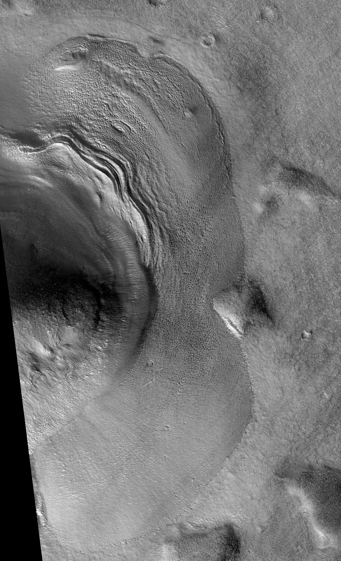
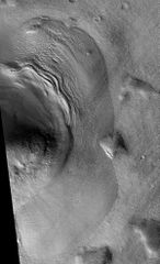
Lobate Debris Apron These are believed to be glaciers because radar has detected pure ice that lies just meters below the surface.
The location is the Ismenius Lacus quadrangle at 39.236 N and 23.599 E (ESP_057389_2195).
Source: http://hirise.lpl.arizona.edu/ESP_057389_2195
Image credit is NASA/JPL/University of Arizona.
Licensing
Public domain images are available for anybody to use without any licenses, royalties, or special permissions.
File history
Click on a date/time to view the file as it appeared at that time.
| Date/Time | Thumbnail | Dimensions | User | Comment | |
|---|---|---|---|---|---|
| current | 15:32, 6 December 2019 | | 1,194 × 1,960 (1.07 MB) | Suitupandshowup (talk | contribs) | Lobate Debris Apron These are believed to be glaciers because radar has detected pure ice that lies just meters below the surface. The location is the Ismenius Lacus quadrangle at 39.236 N and 23.599 E (ESP_057389_2195). Source: http://hirise.lpl... |
You cannot overwrite this file.
File usage
The following 3 pages use this file:


