File:Hellasplanitiamap.jpg
No higher resolution available.
Hellasplanitiamap.jpg (800 × 450 pixels, file size: 113 KB, MIME type: image/jpeg)
Summary
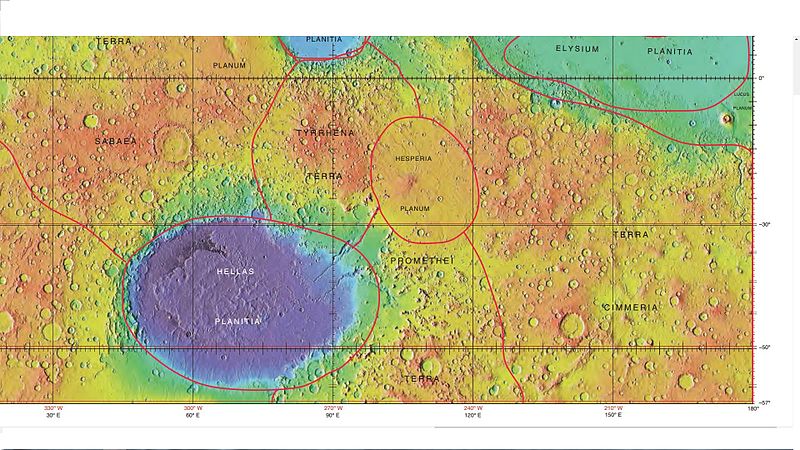
Mola map showing boundaries for Hellas Planitia and other nearby regions. Colors indicate elevations. Image credit is NASA/International Astronomical Union Working Group for Planetary System Nomenclature. "Gazetteer of Planetary Nomenclature." Source: https://upload.wikimedia.org/wikipedia/commons/3/38/USGS-Mars-MC-23-AeolisRegion-mola.png
Licensing
Public domain images are available for anybody to use without any licenses, royalties, or special permissions.
File history
Click on a date/time to view the file as it appeared at that time.
| Date/Time | Thumbnail | Dimensions | User | Comment | |
|---|---|---|---|---|---|
| current | 09:01, 7 February 2018 | | 800 × 450 (113 KB) | Suitupandshowup (talk | contribs) | Mola map showing boundaries for Hellas Planitia and other nearby regions. Colors indicate elevations. Image credit is NASA/International Astronomical Union Working Group for Planetary System Nomenclature. "Gazetteer of Planetary Nomenclature." Sourc... |
You cannot overwrite this file.
File usage
The following page uses this file:


