File:Mars MGS colorhillshade mola 1024.jpg
Size of this preview: 800 × 400 pixels. Other resolutions: 320 × 160 pixels | 1,024 × 512 pixels.
Original file (1,024 × 512 pixels, file size: 132 KB, MIME type: image/jpeg)
Summary
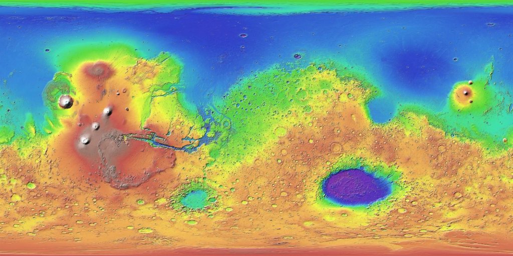
Topographic map of Mars. Colors show relative elevations. Map is based on data set from the Mars Global Surveyor spacecraft. A laser altimeter on the spacecraft provided the altitudes. Source: http://mola.gsfc.nasa.gov/images.html and http://photojournal.jpl.nasa.gov/catalog/PIA02993
Image credit: NASA / JPL / USGS
Licensing
Public domain images are available for anybody to use without any licenses, royalties, or special permissions.
File history
Click on a date/time to view the file as it appeared at that time.
| Date/Time | Thumbnail | Dimensions | User | Comment | |
|---|---|---|---|---|---|
| current | 16:04, 25 June 2018 | | 1,024 × 512 (132 KB) | Suitupandshowup (talk | contribs) | Topographic map of Mars. Colors show relative elevations. Map is based on data set from the Mars Global Surveyor spacecraft. A laser altimeter on the spacecraft provided the altitudes. Source: http://mola.gsfc.nasa.gov/images.html and http://photoj... |
You cannot overwrite this file.
File usage
The following 3 pages use this file:


