File:PIA00177-MC-17-PhoenicisRegion-19980605.jpg

Size of this preview: 800 × 557 pixels. Other resolutions: 320 × 223 pixels | 640 × 446 pixels | 1,024 × 713 pixels | 1,280 × 891 pixels | 7,170 × 4,991 pixels.
Original file (7,170 × 4,991 pixels, file size: 3.78 MB, MIME type: image/jpeg)
Summary
| Description |
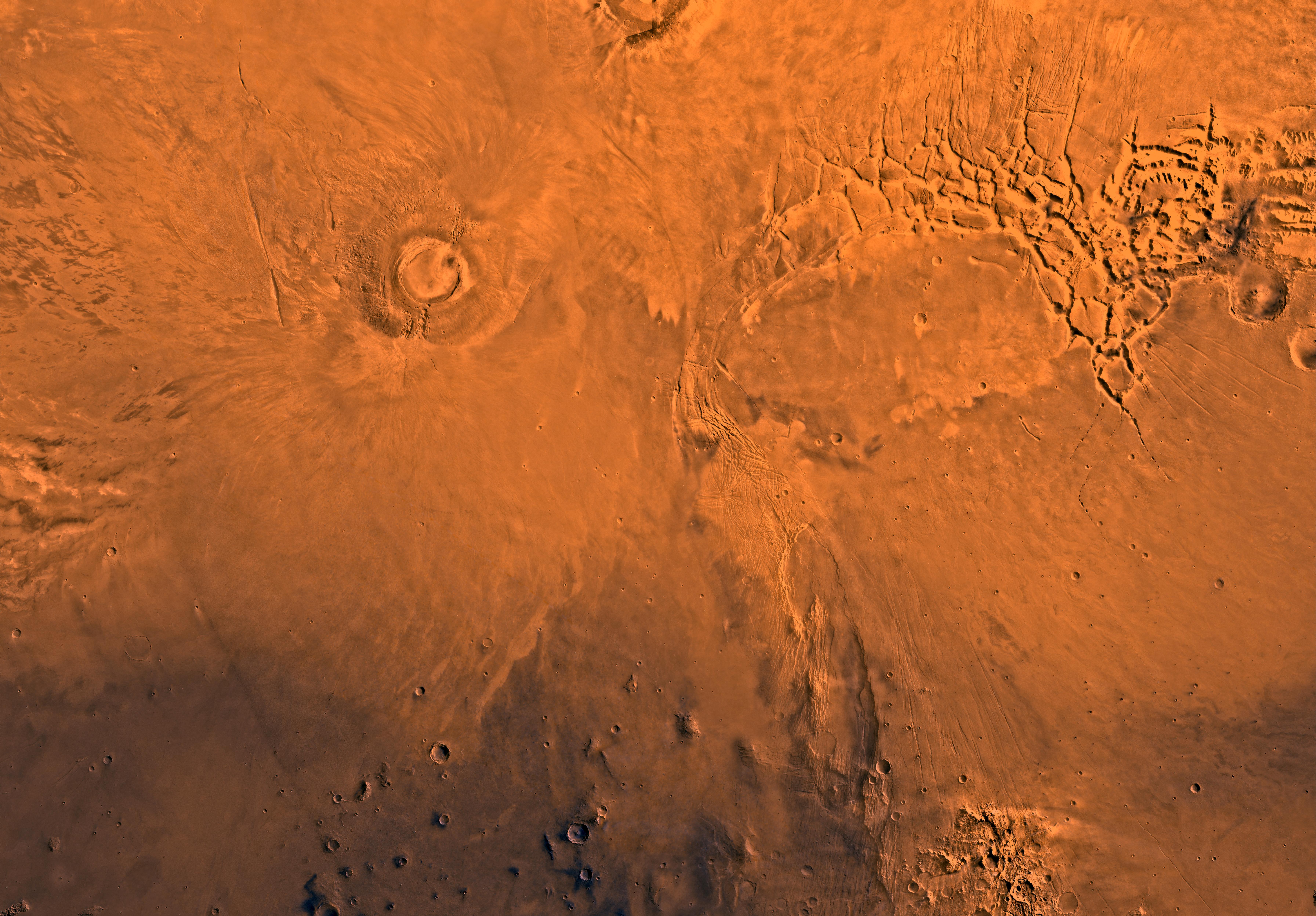
English: PIA00177: MC-17 Phoenicis Region
Mars digital-image mosaic merged with color of the MC-17 quadrangle, Phoenicis Lacus region of Mars. Two of the four largest shield volcanoes on Mars are within the northwestern part, the south half of Pavonis Mons and Arsia Mons. The eastern part includes Syria and Sinai Plana. Most of the quadrangle forms the Tharsis plateau--the highest plateau on Mars; its elevation, 10 km, is twice that of the Tibetan Plateau, the highest plateau on Earth. Also in the northeastern part is Noctis Labyrinthus, a complex system of fault valleys at the west end of Valles Marineris. The south-central part is marked by the large fault system, Claritas Fossae. Latitude range -30 to 0 degrees, longitude range 90 to 135 degrees. |
| Date | |
| Source | http://photojournal.jpl.nasa.gov/jpeg/PIA00177.jpg |
| Author | NASA/JPL/USGS |
| Other versions |
.jpg)
Licensing
| This file is in the public domain in the United States because it was solely created by NASA. NASA copyright policy states that "NASA material is not protected by copyright unless noted". (See Template:PD-USGov, NASA copyright policy page or JPL Image Use Policy.) | ||
 |
Warnings:
|
File history
Click on a date/time to view the file as it appeared at that time.
| Date/Time | Thumbnail | Dimensions | User | Comment | |
|---|---|---|---|---|---|
| current | 05:15, 17 May 2013 | | 7,170 × 4,991 (3.78 MB) | Drbogdan | User created page with UploadWizard |
File usage
The following page uses this file:


