File:Sol1167B P2419 L257atc br2victoriacrater.jpg
Original file (1,024 × 545 pixels, file size: 88 KB, MIME type: image/jpeg)
Summary
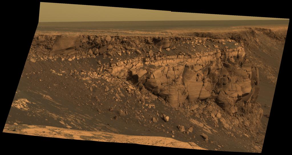
This image captured by NASA's Mars Exploration Rover Opportunity shows "Cape St. Vincent," one of the many promontories that jut out from the walls of Victoria Crater, Mars. The material at the top of the promontory consists of loose, jumbled rock, then a bit further down into the crater, abruptly transitions to solid bedrock. This transition point is marked by a bright band of rock, visible around the entire crater.
Scientists say this bright band represents what used to be the surface of Mars before it was impacted to form Victoria Crater.
This image was taken by Opportunity's panoramic camera on sol 1167 (May 6, 2007). It is presented in approximately true color.
Image credit: NASA/JPL/Cornell
Licensing
Public domain images are available for anybody to use without any licenses, royalties, or special permissions.
File history
Click on a date/time to view the file as it appeared at that time.
| Date/Time | Thumbnail | Dimensions | User | Comment | |
|---|---|---|---|---|---|
| current | 17:41, 20 December 2018 | | 1,024 × 545 (88 KB) | Suitupandshowup (talk | contribs) | This image captured by NASA's Mars Exploration Rover Opportunity shows "Cape St. Vincent," one of the many promontories that jut out from the walls of Victoria Crater, Mars. The material at the top of the promontory consists of loose, jumbled rock, the... |
You cannot overwrite this file.
File usage
The following 2 pages use this file:


