Difference between revisions of "File:Wikimolaargyre.jpg"
(MOLA map showing boundaries in southern hemisphere of Mars Source: http://planetarynames.wr.usgs.gov/images/mola_regional_boundaries.pdf Picture credit: NASA/Astronomical Union Working Group for Planetary System Nomenclature. "Gazetteer of Planetar...) |
m (→Summary) |
||
| Line 1: | Line 1: | ||
== Summary == | == Summary == | ||
| − | MOLA map showing boundaries in southern hemisphere of Mars | + | MOLA map showing boundaries in southern hemisphere of Mars, including Margaritifer Terra |
Source: http://planetarynames.wr.usgs.gov/images/mola_regional_boundaries.pdf | Source: http://planetarynames.wr.usgs.gov/images/mola_regional_boundaries.pdf | ||
Latest revision as of 10:12, 15 March 2018
Summary
MOLA map showing boundaries in southern hemisphere of Mars, including Margaritifer Terra
Source: http://planetarynames.wr.usgs.gov/images/mola_regional_boundaries.pdf
Picture credit: NASA/Astronomical Union Working Group for Planetary System Nomenclature. "Gazetteer of Planetary Nomenclature."
Licensing
Public domain images are available for anybody to use without any licenses, royalties, or special permissions.
File history
Click on a date/time to view the file as it appeared at that time.
| Date/Time | Thumbnail | Dimensions | User | Comment | |
|---|---|---|---|---|---|
| current | 10:11, 15 March 2018 | 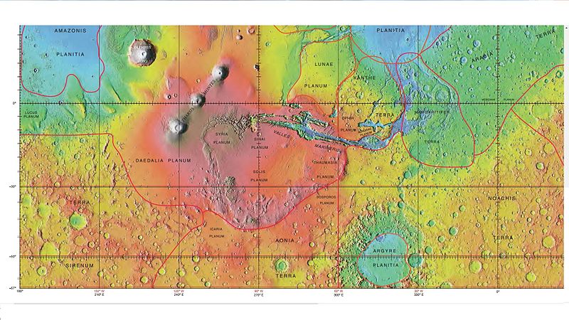 | 800 × 450 (107 KB) | Suitupandshowup (talk | contribs) | MOLA map showing boundaries in southern hemisphere of Mars Source: http://planetarynames.wr.usgs.gov/images/mola_regional_boundaries.pdf Picture credit: NASA/Astronomical Union Working Group for Planetary System Nomenclature. "Gazetteer of Planetar... |
You cannot overwrite this file.
File usage
The following 3 pages use this file:


