Difference between revisions of "Mars Atlas"
| Line 6: | Line 6: | ||
<imagemap> | <imagemap> | ||
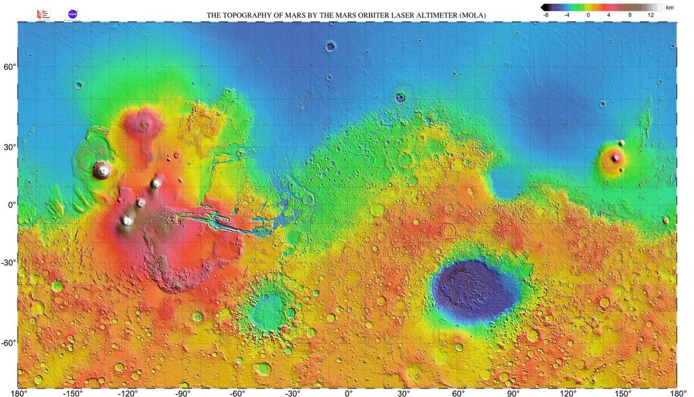
| − | File:Mars topography (MOLA dataset) HiRes (1).jpg|center|thumb|1000x1000px| | + | File:Mars topography (MOLA dataset) HiRes (1).jpg|center|thumb|1000x1000px|Move the Mouse over the image and click on the region you want to see close up. |
rect 1150 50 1250 150 [[Storage|Water storage]] | rect 1150 50 1250 150 [[Storage|Water storage]] | ||
rect 620 150 720 250 [[Health care]] | rect 620 150 720 250 [[Health care]] | ||
Revision as of 20:49, 6 January 2020
Mars Atlas. Move the Mouse over the following image to highlight the region you want to see close up:
_HiRes_(1).jpg)