File:Henry Crater Mound.JPG
Henry_Crater_Mound.JPG (632 × 480 pixels, file size: 45 KB, MIME type: image/jpeg)
Summary
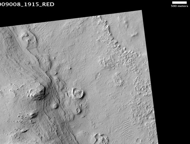
Henry Crater Mound, as seen by hirise. Location is 11.3 degrees north latitude and 23.7 degrees east longitude. Image was taken by the Mars Reconnaissance Orbiter's HiRISE. The HiRISE camera was built by Ball Aerospace and Technology Corporation and is operated by the University of Arizona. Image courtesy: NASA/JPL/University of Arizona.
Source http://hirise.lpl.arizona.edu/PSP_001756_1995
Licensing
Public domain images are available for anybody to use without any licenses, royalties, or special permissions.
File history
Click on a date/time to view the file as it appeared at that time.
| Date/Time | Thumbnail | Dimensions | User | Comment | |
|---|---|---|---|---|---|
| current | 15:29, 14 November 2018 | | 632 × 480 (45 KB) | Suitupandshowup (talk | contribs) | Henry Crater Mound, as seen by hirise. Location is 11.3 degrees north latitude and 23.7 degrees east longitude. Image was taken by the Mars Reconnaissance Orbiter's HiRISE. The HiRISE camera was built by Ball Aerospace and Technology Corporation and is... |
You cannot overwrite this file.
File usage
The following file is a duplicate of this file (more details):
- File:Henry Crater Mound.JPG from Wikimedia Commons
The following 2 pages use this file:


