File:Mapmariner.jpg
Size of this preview: 800 × 470 pixels. Other resolutions: 320 × 188 pixels | 1,012 × 595 pixels.
Original file (1,012 × 595 pixels, file size: 315 KB, MIME type: image/jpeg)
Summary
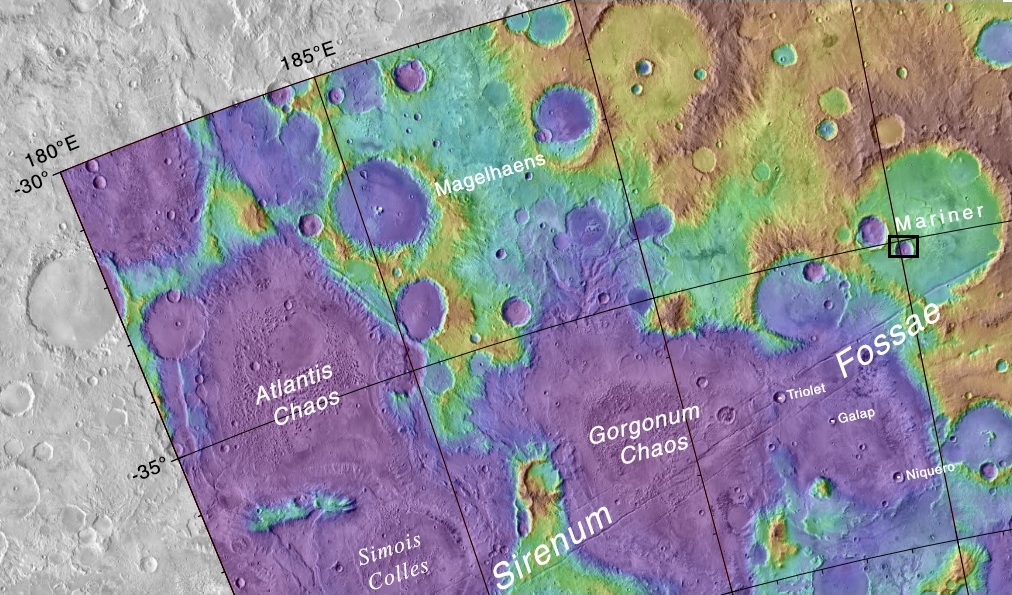
Labeled topographic map showing area around Mariner Crater Black box show location of some pictures from CTX and HiRISE.
Source https://planetarynames.wr.usgs.gov/images/mc24_2014.pdf Author Jim Secosky modified NASA image NASA/USGS/Secosky
Licensing
Public domain images are available for anybody to use without any licenses, royalties, or special permissions.
File history
Click on a date/time to view the file as it appeared at that time.
| Date/Time | Thumbnail | Dimensions | User | Comment | |
|---|---|---|---|---|---|
| current | 15:27, 22 October 2018 | | 1,012 × 595 (315 KB) | Suitupandshowup (talk | contribs) | Labeled topographic map showing area around Mariner Crater Black and red boxes show locations of some pictures from CTX and HiRISE. Source https://planetarynames.wr.usgs.gov/images/mc24_2014.pdf Author Jim Secosky modified NASA image NASA/USGS/Secosky |
You cannot overwrite this file.
File usage
The following file is a duplicate of this file (more details):
- File:Mapmariner.jpg from Wikimedia Commons
The following 2 pages use this file:


