File:Mars Géolocalisation.jpg
Size of this preview: 800 × 400 pixels. Other resolutions: 320 × 160 pixels | 640 × 320 pixels | 1,024 × 512 pixels | 1,280 × 640 pixels | 2,048 × 1,024 pixels.
Original file (2,048 × 1,024 pixels, file size: 1.55 MB, MIME type: image/jpeg)
Summary
| Description |
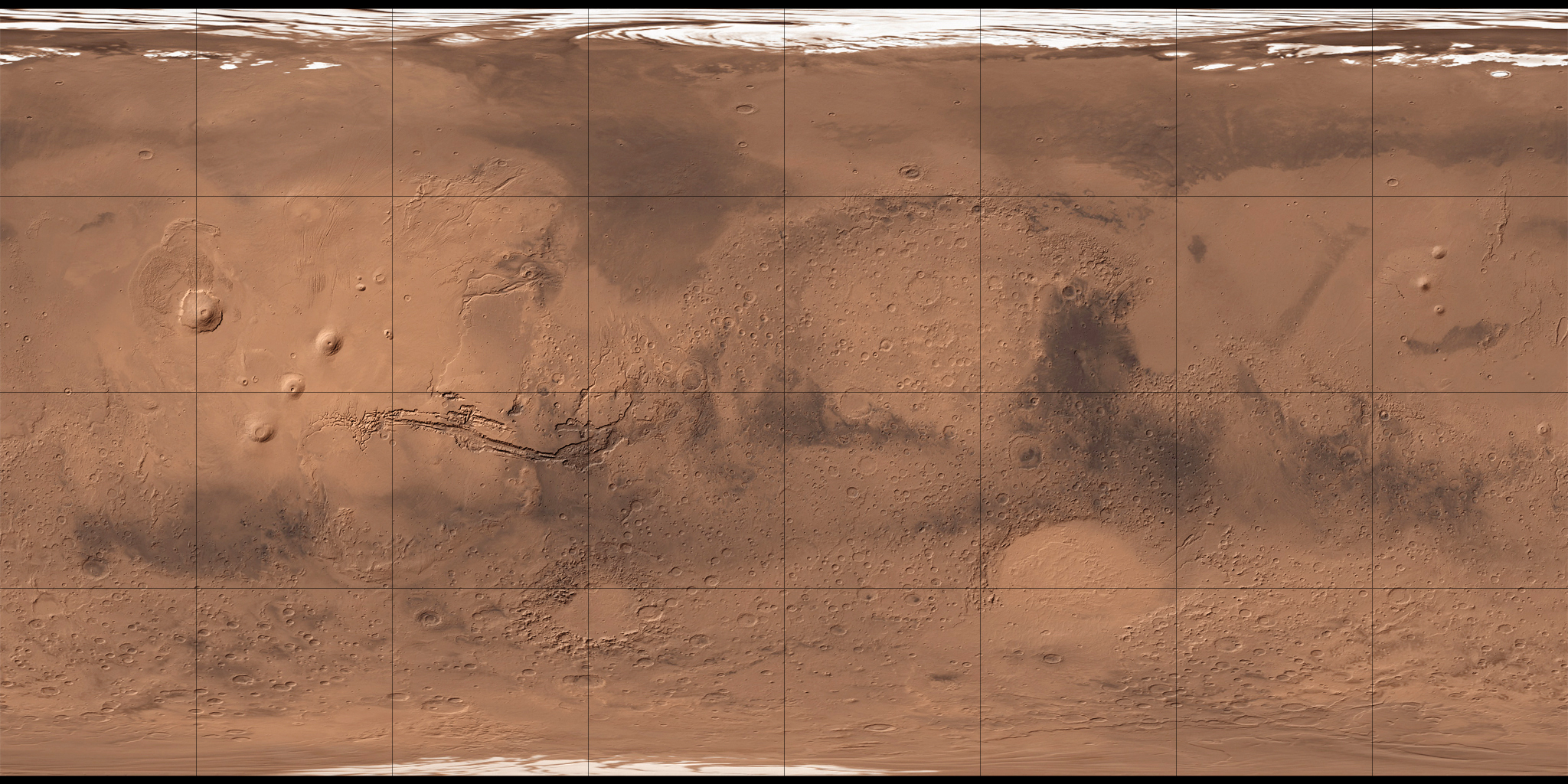
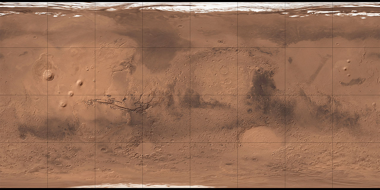
Français : Carte de Mars reconstituée à partir des mesures de Mars Global Surveyor (MOLA) et des observations de Viking. |
| Date | 2 August 2008 (upload date) |
| Source | MOLA Shaded Relief & Viking. |
| Author | NASA, USGS et Who killed Bambi ? pour les retouches. |
| Other versions |

Licensing
| This file is in the public domain in the United States because it was solely created by NASA. NASA copyright policy states that "NASA material is not protected by copyright unless noted". (See Template:PD-USGov, NASA copyright policy page or JPL Image Use Policy.) | ||
 |
Warnings:
|
This image is in the public domain in the United States because it only contains materials that originally came from the United States Geological Survey, an agency of the United States Department of the Interior. For more information, see the official USGS copyright policy.
|
| Annotations | This image is annotated: View the annotations at Commons |
File history
Click on a date/time to view the file as it appeared at that time.
| Date/Time | Thumbnail | Dimensions | User | Comment | |
|---|---|---|---|---|---|
| current | 04:34, 2 August 2008 | | 2,048 × 1,024 (1.55 MB) | Who killed Bambi ? | {{Information |Description= |Source= |Date= |Author= |Permission= |other_versions= }} |
File usage
The following page uses this file:


