File:Olympus Mons Region map-la.svg

Size of this PNG preview of this SVG file: 800 × 600 pixels. Other resolutions: 320 × 240 pixels | 640 × 480 pixels | 1,024 × 768 pixels | 1,280 × 960 pixels | 2,000 × 1,500 pixels.
Original file (SVG file, nominally 2,000 × 1,500 pixels, file size: 492 KB)
Summary
| Description |
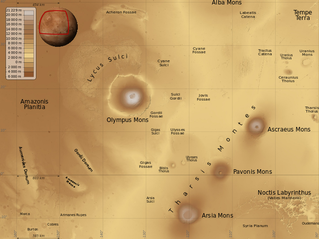
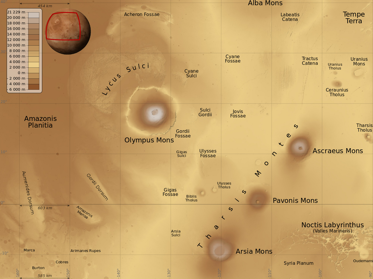
English: Map of Olympus Mons and Tharsis Montes region, on Mars planet. Latin (also international) version.
Français : Carte de la région de l'Olympus Mons et des Monts Tharsis sur la planète Mars. Version latine (et aussi internationale). |
| Date | |
| Source |
travail personnel (own work). Sources :
|
| Author | Sémhur |
| Other versions |
[]
Derivative works of this file: |


| Location on Mars | | View this and other nearby images on: Google Maps |
|---|

|
This SVG file contains embedded text that can be translated into your language, using any capable SVG editor, text editor or the SVG Translate tool. For more information see: About translating SVG files. |
| Annotations | This image is annotated: View the annotations at Commons |

This W3C-unspecified vector image was created with Inkscape .
Licensing
This file is licensed under the Creative Commons Attribution-Share Alike 4.0 International, 3.0 Unported, 2.5 Generic, 2.0 Generic and 1.0 Generic license.
- You are free:
- to share – to copy, distribute and transmit the work
- to remix – to adapt the work
- Under the following conditions:
- attribution – You must give appropriate credit, provide a link to the license, and indicate if changes were made. You may do so in any reasonable manner, but not in any way that suggests the licensor endorses you or your use.
- share alike – If you remix, transform, or build upon the material, you must distribute your contributions under the same or compatible license as the original.
| This image is in the public domain because it is a screenshot from NASA’s globe software World Wind using a public domain layer, such as Blue Marble, MODIS, Landsat, SRTM, USGS or GLOBE.
|
 |
File history
Click on a date/time to view the file as it appeared at that time.
| Date/Time | Thumbnail | Dimensions | User | Comment | |
|---|---|---|---|---|---|
| current | 12:05, 2 December 2012 | | 2,000 × 1,500 (492 KB) | Szczureq | Uranius Patera -> Uranius Mons, Équateur -> 0° |
File usage
The following page uses this file:


