File:PIA00164-MC-4-MareAcidaliumRegion-19980604.jpg
Size of this preview: 800 × 575 pixels. Other resolutions: 320 × 230 pixels | 640 × 460 pixels | 1,024 × 736 pixels | 1,280 × 920 pixels | 6,994 × 5,029 pixels.
Original file (6,994 × 5,029 pixels, file size: 2.24 MB, MIME type: image/jpeg)
Summary
| Description |
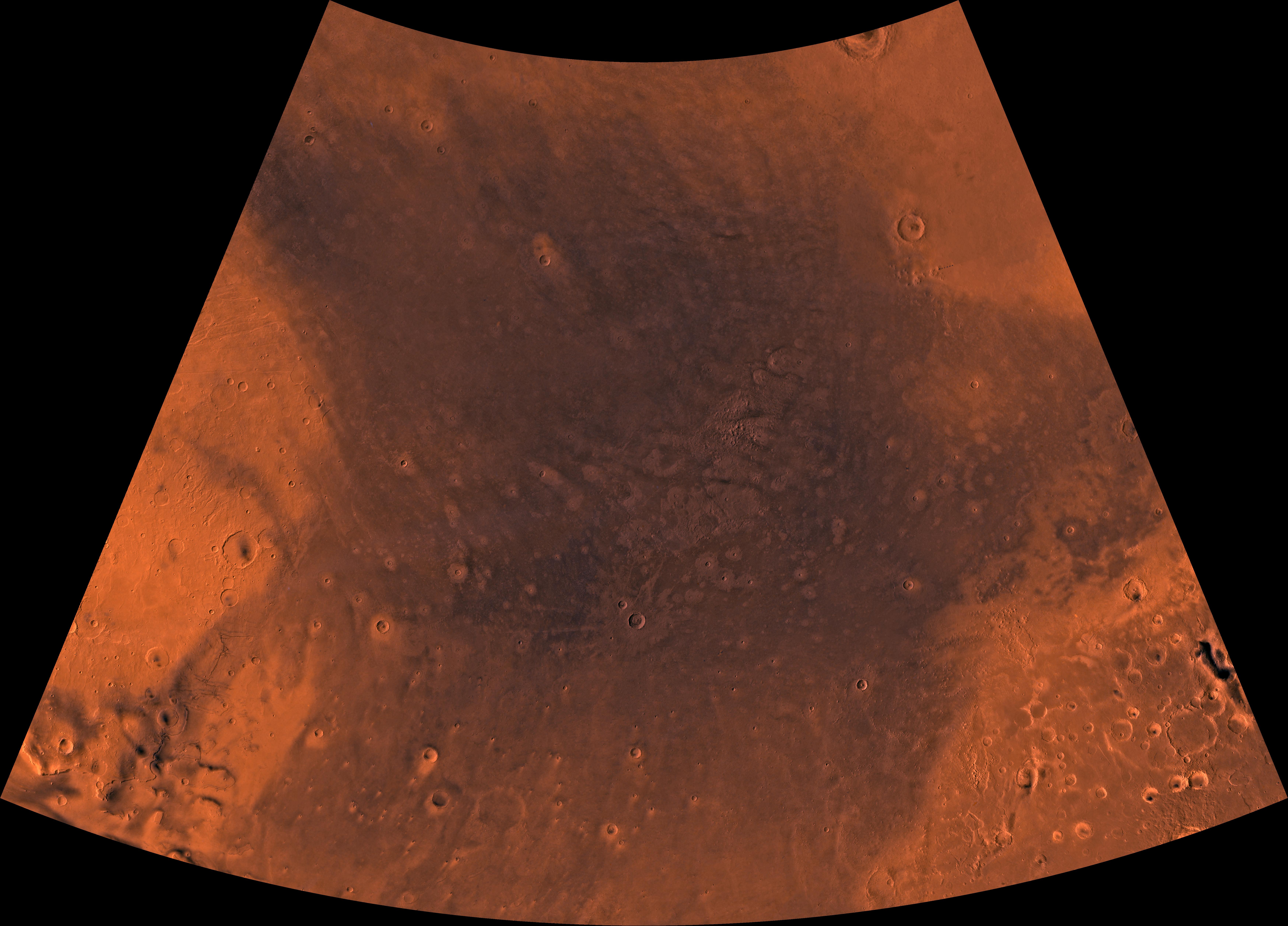
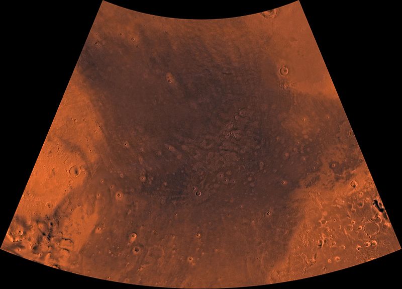
English: PIA00164: MC-4 Mare Acidalium Region
Mars digital-image mosaic merged with color of the MC-4 quadrangle, Mare Acidalium region of Mars. The central part is characterized by dark depression--the northern Chryse basin, which contains relatively smooth plains where several large outflow channels terminate. The depression is partly bounded to the southwest by the highly faulted and heavily cratered Tempe Terra province, to the southeast by the heavily cratered Arabia Terra province, and to the north by relatively smooth plains of Vastitas Borealis. Latitude range 30 to 65 degrees, longitude range 0 to 60 degrees. |
| Date | |
| Source | http://photojournal.jpl.nasa.gov/jpeg/PIA00164.jpg |
| Author | NASA/JPL/USGS |
Licensing
| This file is in the public domain in the United States because it was solely created by NASA. NASA copyright policy states that "NASA material is not protected by copyright unless noted". (See Template:PD-USGov, NASA copyright policy page or JPL Image Use Policy.) | ||
 |
Warnings:
|
File history
Click on a date/time to view the file as it appeared at that time.
| Date/Time | Thumbnail | Dimensions | User | Comment | |
|---|---|---|---|---|---|
| current | 08:08, 13 May 2013 | | 6,994 × 5,029 (2.24 MB) | Drbogdan | User created page with UploadWizard |
File usage
The following page uses this file:


