File:PIA17085-MarsCuriosityRover-TraverseMap-Sol351-20130801.jpg
Original file (3,300 × 2,550 pixels, file size: 2.15 MB, MIME type: image/jpeg)
Summary
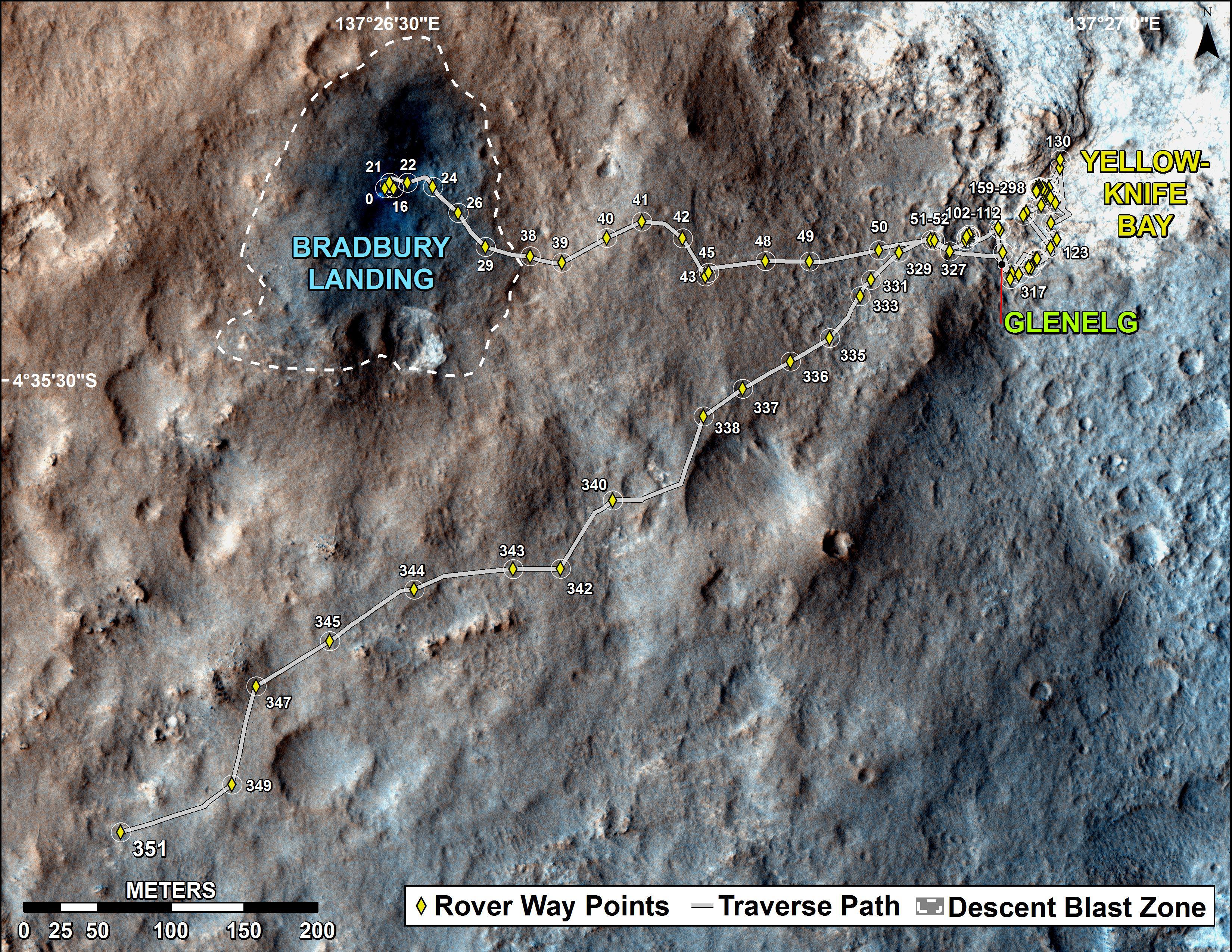
The total distance driven by NASA's Mars rover Curiosity passed the one-mile mark a few days before the first anniversary of the rover's landing on Mars.
This map traces where Curiosity drove between landing at "Bradbury Landing" on Aug. 5, 2012, PDT, (Aug. 6, 2012 (Universal Time and EDT) and the position reached during the mission's 351st Martian day, or sol, (Aug. 1, 2013). The Sol 351 leg added 279 feet (85.1 meters) and brought the odometry since landing to about 1.05 miles (1,686 meters).
The mapped area is within Gale Crater and north of the mountain called Mount Sharp in the middle of the crater. After the first use of the drill, the rover's main science destination will be on the lower reaches of Mount Sharp. For broader-context images of the area, see PIA16064 and PIA16058.
The base image from the map is from the High Resolution Imaging Science Experiment Camera (HiRISE) in NASA's Mars Reconnaissance Orbiter.
Source: http://photojournal.jpl.nasa.gov/jpeg/PIA17085.jpg
Image credit: NASA/JPL-Caltech/Univ. of Arizona
Licensing
Public domain images are available for anybody to use without any licenses, royalties, or special permissions.
File history
Click on a date/time to view the file as it appeared at that time.
| Date/Time | Thumbnail | Dimensions | User | Comment | |
|---|---|---|---|---|---|
| current | 12:53, 29 December 2018 | | 3,300 × 2,550 (2.15 MB) | Suitupandshowup (talk | contribs) | The total distance driven by NASA's Mars rover Curiosity passed the one-mile mark a few days before the first anniversary of the rover's landing on Mars. This map traces where Curiosity drove between landing at "Bradbury Landing" on Aug. 5, 2012, PDT,... |
You cannot overwrite this file.
File usage
The following file is a duplicate of this file (more details):
- File:PIA17085-MarsCuriosityRover-TraverseMap-Sol351-20130801.jpg from Wikimedia Commons
The following page uses this file:


