File:PSP 010277 1650fallingdunes.croppedjpg.jpg
Original file (952 × 1,642 pixels, file size: 257 KB, MIME type: image/jpeg)
Summary
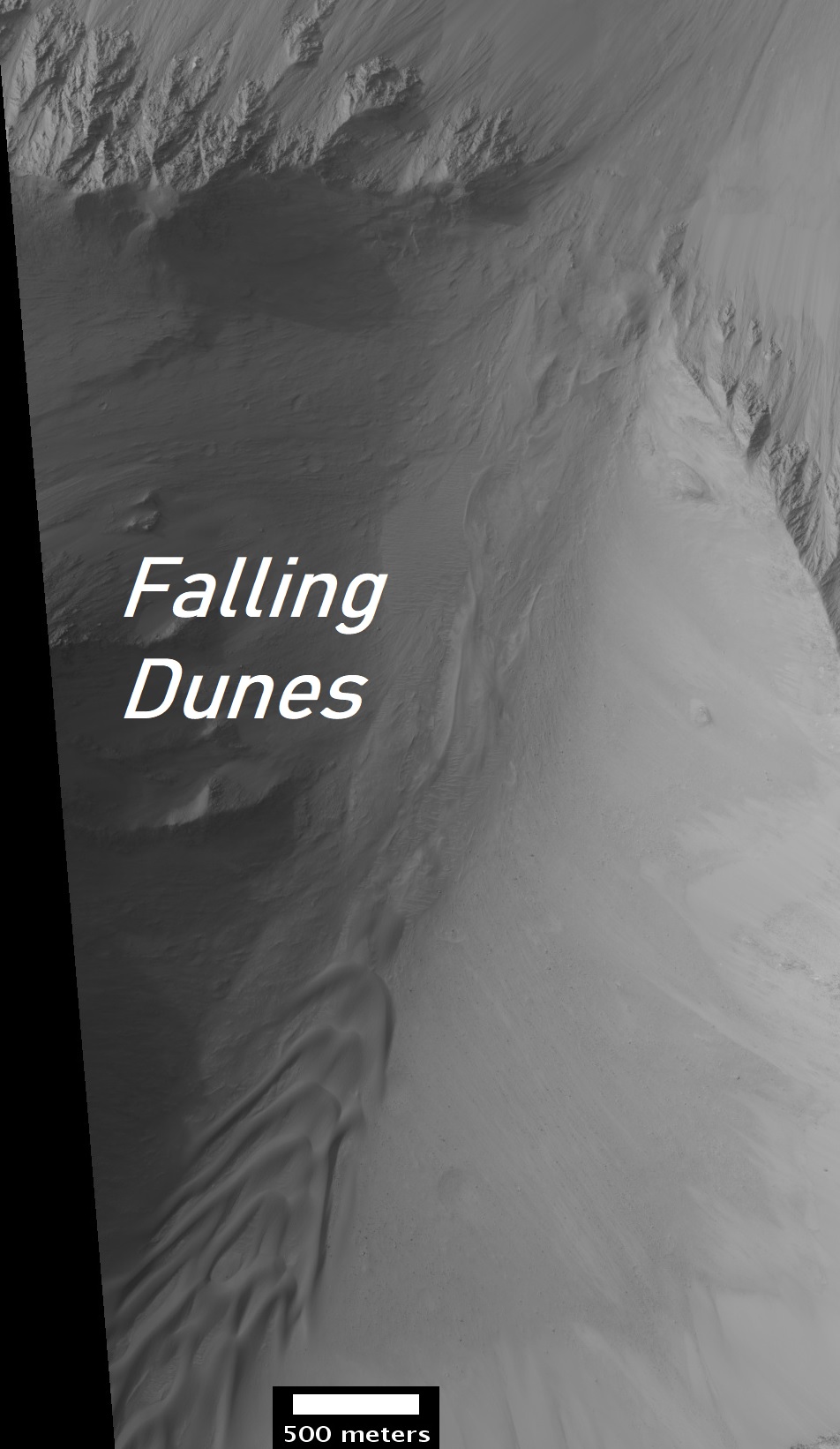
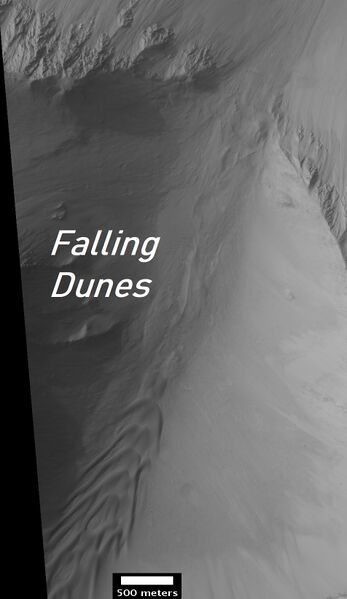
Falling dunes, as seen by HiRISE. Source: https://www.uahirise.org/PSP_010277_1650 Image credit: NASA/JPL/University of Arizona/Secosky
This image shows a transect of approximately 8-kilometers of Coprates Chasma wall stratigraphy, which includes (moving down sequence): the southern plateau, wall spurs, fans of eroded material, gullies, sand dunes, and canyon floor.
Dunes located in the center left show slip faces on the downhill side and aligned with the local gradient, indicating down slope transport (see cutout, white arrow). These “falling dunes” are a type of topographically-controlled sand dune that formed when down-slope winds were focused by the gully topography. Although rare across Mars, eastern Coprates Chasma has an abundance of these falling dunes, particularly on north-facing walls.
As with all dunes, wind regime, sediment supply, topography, and climate are all important factors in where dunes form and persist. An abundant sand supply from local wall layer and persistent down-slope winds are likely contributors to why these dunes are so common here.
Note: the above image (and the cutout) are non map-projected, so north is approximately down).
Licensing
Public domain images are available for anybody to use without any licenses, royalties, or special permissions.
File history
Click on a date/time to view the file as it appeared at that time.
| Date/Time | Thumbnail | Dimensions | User | Comment | |
|---|---|---|---|---|---|
| current | 06:42, 24 January 2022 | | 952 × 1,642 (257 KB) | Suitupandshowup (talk | contribs) | Falling dunes, as seen by HiRISE. Source: https://www.uahirise.org/PSP_010277_1650 Image credit: NASA/JPL/University of Arizona/Secosky This image shows a transect of approximately 8-kilometers of Coprates Chasma wall stratigraphy, which includes (moving down sequence): the southern plateau, wall spurs, fans of eroded material, gullies, sand dunes, and canyon floor. Dunes located in the center left show slip faces on the downhill side and aligned with the local gradient, indicating down sl... |
You cannot overwrite this file.
File usage
The following page uses this file:


