File:USGS-Mars-MC-23-AeolisRegion-mola.png
No higher resolution available.
USGS-Mars-MC-23-AeolisRegion-mola.png (750 × 600 pixels, file size: 664 KB, MIME type: image/png)
Summary
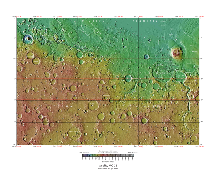
MOLA Topographic Map of Aeolis Quadrangle (MC-23) on the planet Mars.
NOTE: Converted the original PDF file to a PNG File (via GIMP v2.8.4 program) - and uploaded to Wikimedia Commons. Date 04/03/2013 11:52:31 AM Source http://planetarynames.wr.usgs.gov/images/mc23_mola.pdf
Image credit: USGS (United States Geological Survey)
Licensing
Public domain images are available for anybody to use without any licenses, royalties, or special permissions.
File history
Click on a date/time to view the file as it appeared at that time.
| Date/Time | Thumbnail | Dimensions | User | Comment | |
|---|---|---|---|---|---|
| current | 08:58, 26 January 2019 | | 750 × 600 (664 KB) | Suitupandshowup (talk | contribs) | MOLA Topographic Map of Aeolis Quadrangle (MC-23) on the planet Mars. NOTE: Converted the original PDF file to a PNG File (via GIMP v2.8.4 program) - and uploaded to Wikimedia Commons. Date 04/03/2013 11:52:31 AM Source http://planetarynames.wr.usgs.g... |
You cannot overwrite this file.
File usage
The following 2 pages use this file:


