Difference between revisions of "File:Wikimolasouthpole.jpg"
(MOLA map showing boundaries around south pole of Mars Source: http://planetarynames.wr.usgs.gov/images/mola_regional_boundaries.pdf Image credit: NASA/International Astronomical Union Working Group for Planetary System Nomenclature. "Gazetteer of Pla...) |
(No difference)
|
Latest revision as of 07:43, 28 March 2018
Summary
MOLA map showing boundaries around south pole of Mars
Source: http://planetarynames.wr.usgs.gov/images/mola_regional_boundaries.pdf
Image credit: NASA/International Astronomical Union Working Group for Planetary System Nomenclature. "Gazetteer of Planetary Nomenclature."
Licensing
Public domain images are available for anybody to use without any licenses, royalties, or special permissions.
File history
Click on a date/time to view the file as it appeared at that time.
| Date/Time | Thumbnail | Dimensions | User | Comment | |
|---|---|---|---|---|---|
| current | 07:43, 28 March 2018 | 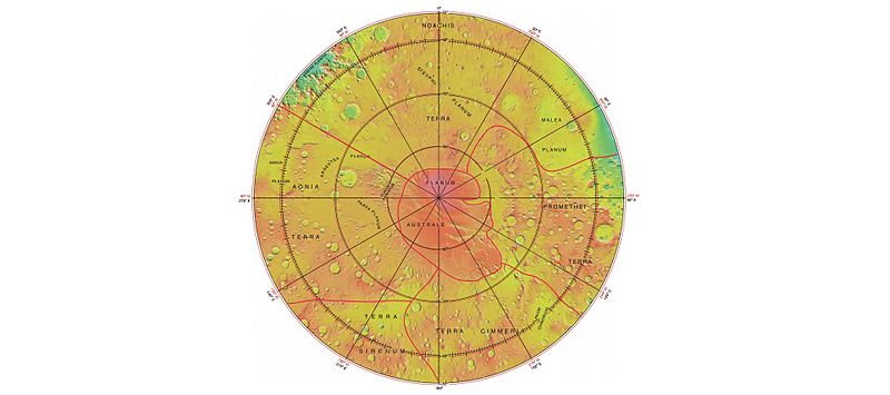 | 800 × 355 (36 KB) | Suitupandshowup (talk | contribs) | MOLA map showing boundaries around south pole of Mars Source: http://planetarynames.wr.usgs.gov/images/mola_regional_boundaries.pdf Image credit: NASA/International Astronomical Union Working Group for Planetary System Nomenclature. "Gazetteer of Pla... |
You cannot overwrite this file.
File usage
The following page uses this file:


