Difference between revisions of "Google Mars"
| (One intermediate revision by one other user not shown) | |||
| Line 5: | Line 5: | ||
'''Google Mars''' is an online beta application by [http://www.google.com Google] to map the surface of Mars. Where the [http://maps.google.com Google Maps] online system uses a combination of international road maps and Earth orbital photography, Google Mars uses orbital imaging from the [[Mars Global Surveyor]] (the ''Mars Orbiter Laser Altimeter'' and ''Mars Orbiter Camera'' instruments) and [[Mars Odyssey]] (the ''Thermal Emission Imaging System'' instrument) spacecraft. Optical and Infrared images are available and the powerful Google search engine is implemented. | '''Google Mars''' is an online beta application by [http://www.google.com Google] to map the surface of Mars. Where the [http://maps.google.com Google Maps] online system uses a combination of international road maps and Earth orbital photography, Google Mars uses orbital imaging from the [[Mars Global Surveyor]] (the ''Mars Orbiter Laser Altimeter'' and ''Mars Orbiter Camera'' instruments) and [[Mars Odyssey]] (the ''Thermal Emission Imaging System'' instrument) spacecraft. Optical and Infrared images are available and the powerful Google search engine is implemented. | ||
| − | + | ==See also== | |
| + | *[[Glossary of Mars features]] | ||
==Links== | ==Links== | ||
| Line 11: | Line 12: | ||
*[http://www.google.com/mars/about.html About Google Mars] | *[http://www.google.com/mars/about.html About Google Mars] | ||
| − | + | [[Category:Areography]] | |
| − | |||
Latest revision as of 15:47, 17 December 2018

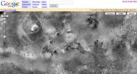
Screenshot from the Google Mars website
Overview
Google Mars is an online beta application by Google to map the surface of Mars. Where the Google Maps online system uses a combination of international road maps and Earth orbital photography, Google Mars uses orbital imaging from the Mars Global Surveyor (the Mars Orbiter Laser Altimeter and Mars Orbiter Camera instruments) and Mars Odyssey (the Thermal Emission Imaging System instrument) spacecraft. Optical and Infrared images are available and the powerful Google search engine is implemented.


