File:Hutton Crater Area.JPG
No higher resolution available.
Hutton_Crater_Area.JPG (503 × 459 pixels, file size: 35 KB, MIME type: image/jpeg)
Summary
| Description |
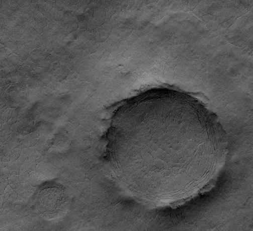
English: Hutton Crater Area, as seen by hirise. location is 71 degrees south latitude and 50 degrees east longitude. Image was taken by the Mars Reconnaissance Orbiter's HiRISE. The HiRISE camera was built by Ball Aerospace and Technology Corporation and is operated by the University of Arizona. Image courtesy NASA/JPL/University of Arizona. |
| Date | |
| Source | http://hirise.lpl.arizona.edu/PSP_004749_1090 |
| Author | Jim Secosky modified NASA image. |
Licensing
| This file is in the public domain in the United States because it was solely created by NASA. NASA copyright policy states that "NASA material is not protected by copyright unless noted". (See Template:PD-USGov, NASA copyright policy page or JPL Image Use Policy.) | ||
 |
Warnings:
|
Original upload log
The original description page was here. All following user names refer to en.wikipedia.
| Date/Time | Dimensions | User | Comment |
|---|---|---|---|
| 2009-03-25 18:32 | 503×459× (35347 bytes) | Jimmarsmars | {{Information |Description = Hutton Crater Area, as seen by hirise. location is 71 degrees south latitude and 50 degrees east longitude. |Source =http://hirise.lpl.arizona.edu/PSP_004749_1090 |Date = March 25, 2009 |Author |
File history
Click on a date/time to view the file as it appeared at that time.
| Date/Time | Thumbnail | Dimensions | User | Comment | |
|---|---|---|---|---|---|
| current | 04:21, 20 December 2016 | | 503 × 459 (35 KB) | Wiki LIC | Transferred from en.wikipedia |
File usage
There are no pages that use this file.


