File:Ladon Valles.JPG
Ladon_Valles.JPG (573 × 465 pixels, file size: 51 KB, MIME type: image/jpeg)
Summary
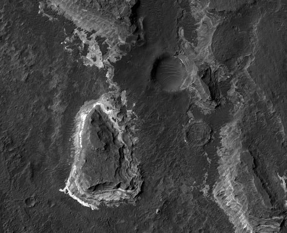
Ladon Valles layers, as seen by hirise. Location is 20.5 South and 330.1 East. Image was taken by the Mars Reconnaissance Orbiter's HiRISE. The HiRISE camera was built by Ball Aerospace and Technology Corporation and is operated by the University of Arizona.
Image courtesy NASA/JPL/University of Arizona.
Source http://hirise.lpl.arizona.edu/PSP_010632_1595
Image credit: NASA/JPL/University of Arizona
Licensing
Public domain images are available for anybody to use without any licenses, royalties, or special permissions.
File history
Click on a date/time to view the file as it appeared at that time.
| Date/Time | Thumbnail | Dimensions | User | Comment | |
|---|---|---|---|---|---|
| current | 19:20, 28 January 2019 | | 573 × 465 (51 KB) | Suitupandshowup (talk | contribs) | Ladon Valles layers, as seen by hirise. Location is 20.5 South and 330.1 East. Image was taken by the Mars Reconnaissance Orbiter's HiRISE. The HiRISE camera was built by Ball Aerospace and Technology Corporation and is operated by the University of Ar... |
You cannot overwrite this file.
File usage
The following file is a duplicate of this file (more details):
- File:Ladon Valles.JPG from Wikimedia Commons
The following page uses this file:


