File list
This special page shows all uploaded files.
| Date | Name | Thumbnail | Size | User | Description | Versions |
|---|---|---|---|---|---|---|
| 10:31, 25 February 2018 | Force relative mass.svg (file) |  |
7 KB | Denis nyrkov | Force relative mass formula | 1 |
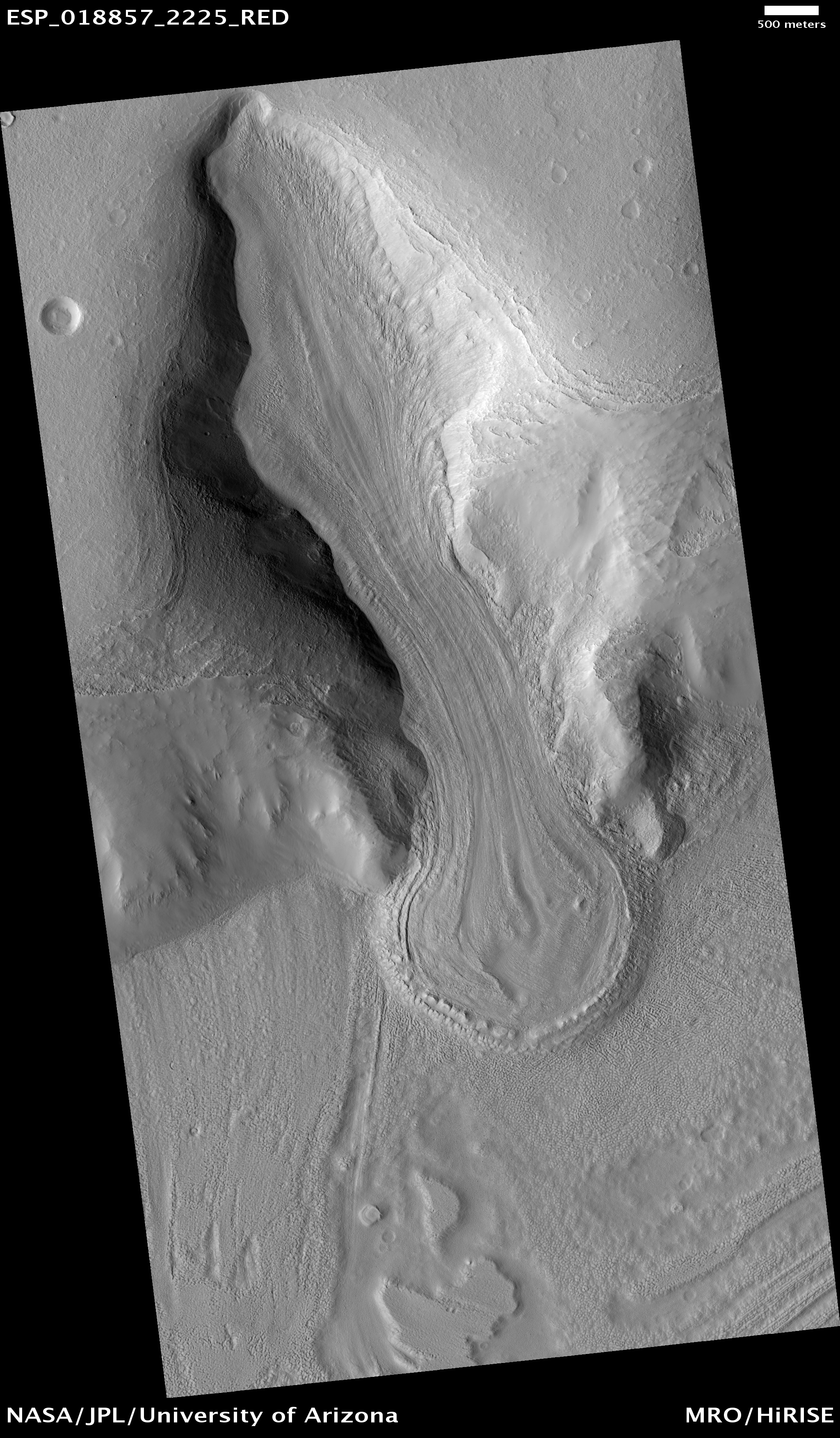
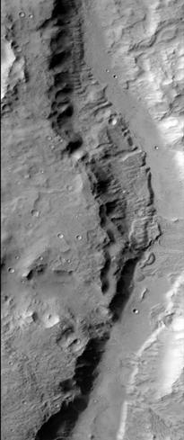
| 09:28, 26 February 2018 | ESP 018857 2225alpineglacier.jpg (file) |  |
1.95 MB | Suitupandshowup | Alpine glacier in Ismenius Lacus quadrangle, as seen by HiRISE under HiWish program Image Credit: NASA/JPL/University of Arizona | 1 |
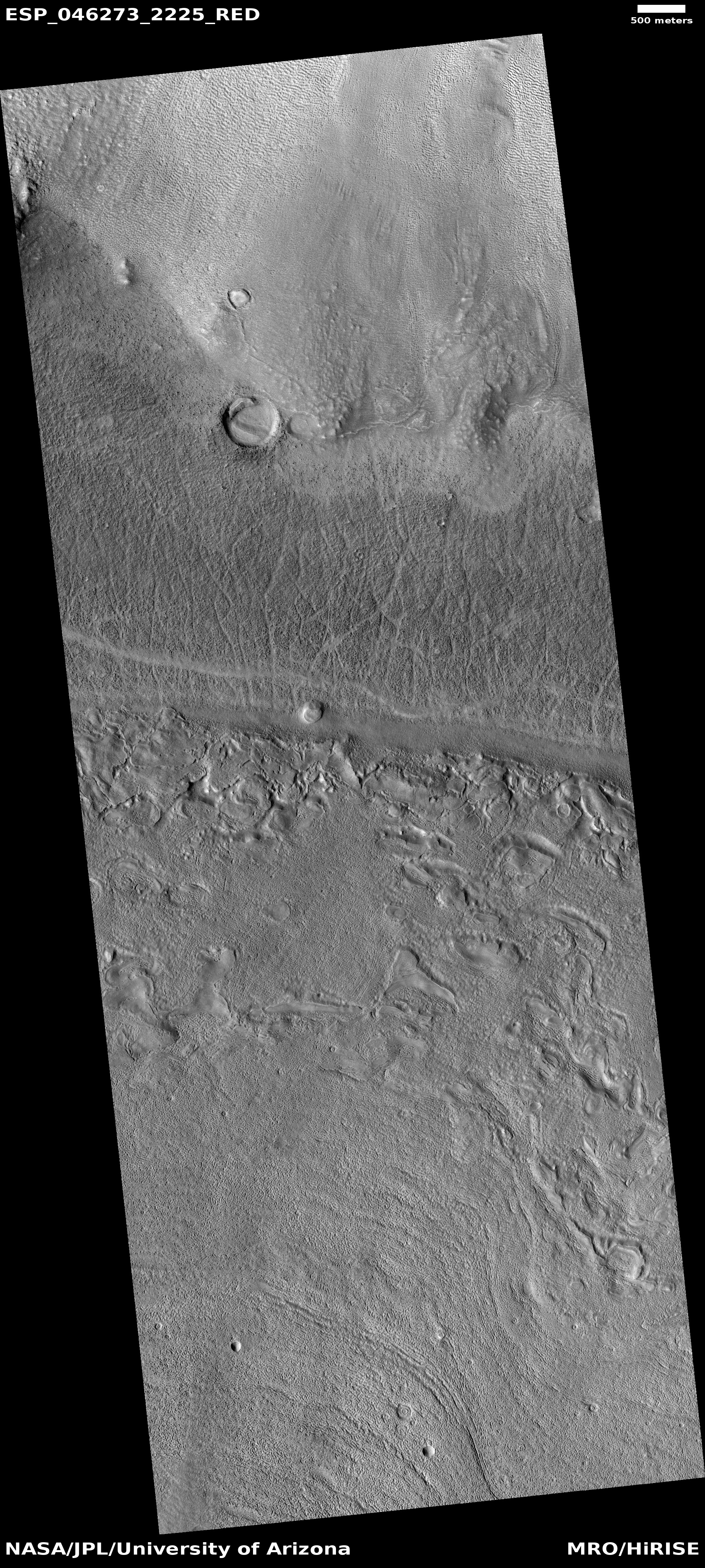
| 09:31, 26 February 2018 | ESP 046273 2225lda.jpg (file) |  |
3.35 MB | Suitupandshowup | Close view of Lobate Debris Apron, as seen by HiRISE, under HiWish program Image credit: NASA/JPL/University of Arizona | 1 |
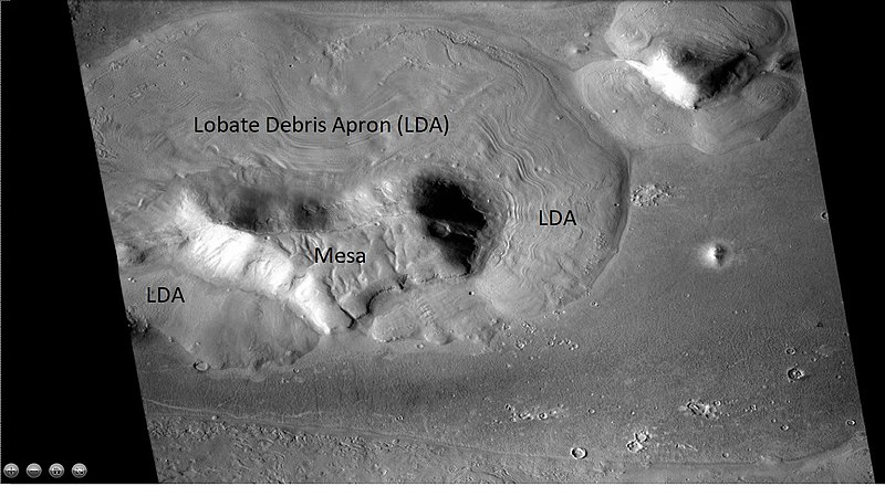
| 09:36, 26 February 2018 | 800px-Wideviewlda42n18e.jpg (file) |  |
92 KB | Suitupandshowup | Wide view of mesa with lobate debris apron, as seen with CTX This is a context image for HiRISE image ESP_046273_2225. | 1 |
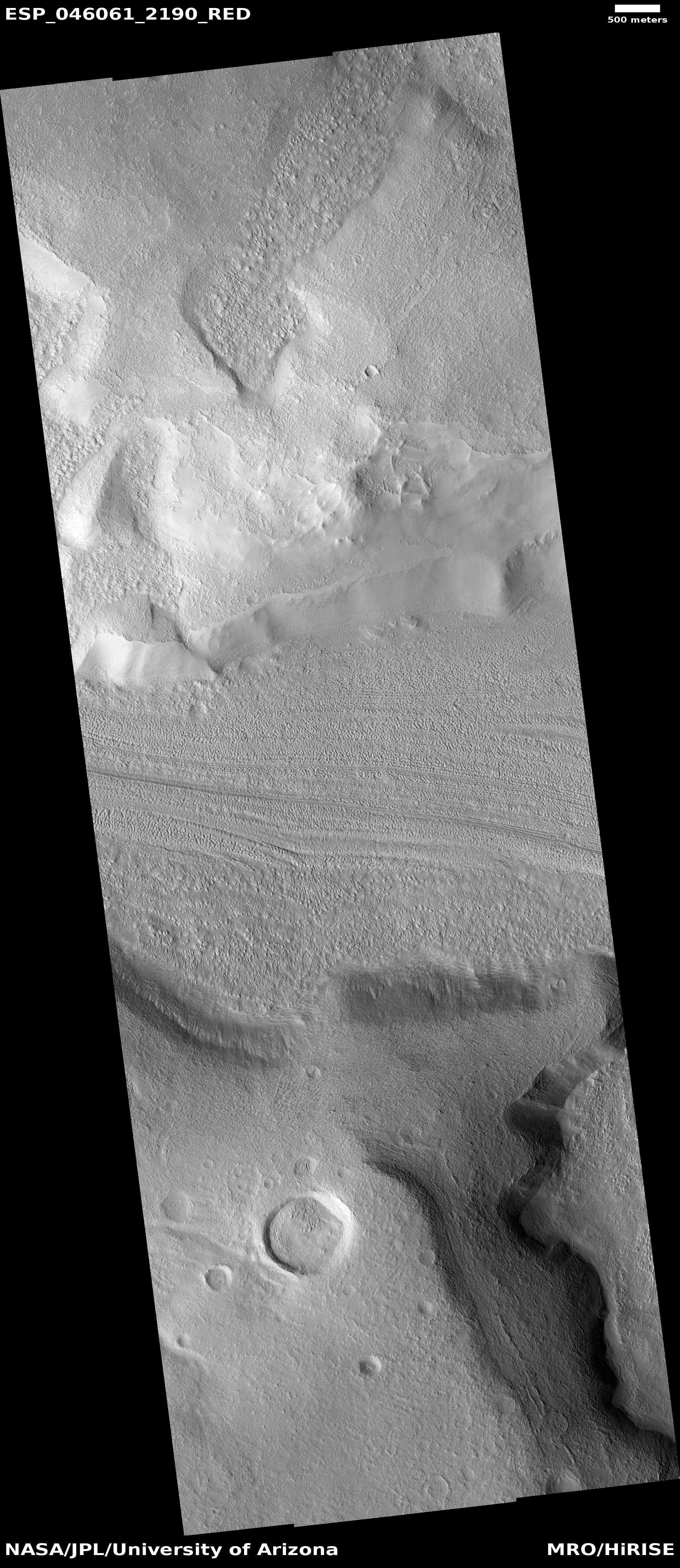
| 14:16, 26 February 2018 | ESP 046061 2190lvf.jpg (file) |  |
2.77 MB | Suitupandshowup | Lineated valley fill, as seen by HiRISE under HiWish program Image Credit: NASA/JPL/University of Arizona | 1 |
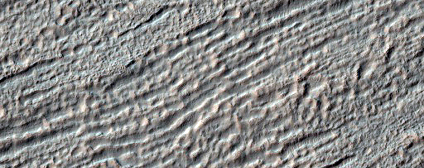
| 14:19, 26 February 2018 | 46061 2190closelvf..jpg (file) |  |
261 KB | Suitupandshowup | Close view of lineated valley fill, as seen by HiRISE under HiWish program Image credit: NASA/JPL/University of Arizona | 1 |
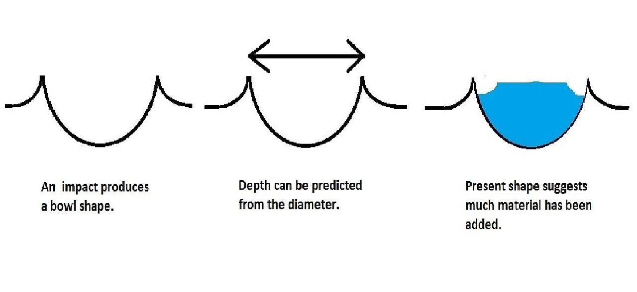
| 14:24, 26 February 2018 | Ccffigurecaptioned.jpg (file) |  |
43 KB | Suitupandshowup | Diagram of how concentric crater fill is formed Author: Jim Secosky | 1 |
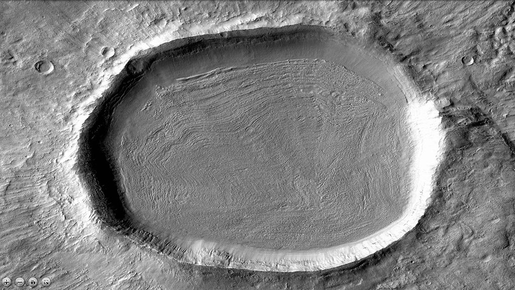
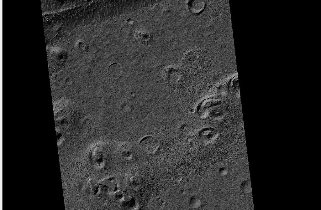
| 14:29, 26 February 2018 | 1024px-46622 1365contextccf.jpg (file) |  |
225 KB | Suitupandshowup | CTX image of crater with concentric crater fill. This is a context image for HiRISE image: ESP_046622_1365 Source: http://viewer.mars.asu.edu/planetview/inst/ctx/J05_046622_1364_XN_43S140W#P=J05_046622_1364_XN_43S140W&T=2 Image Credit: NASA/MSS | 1 |
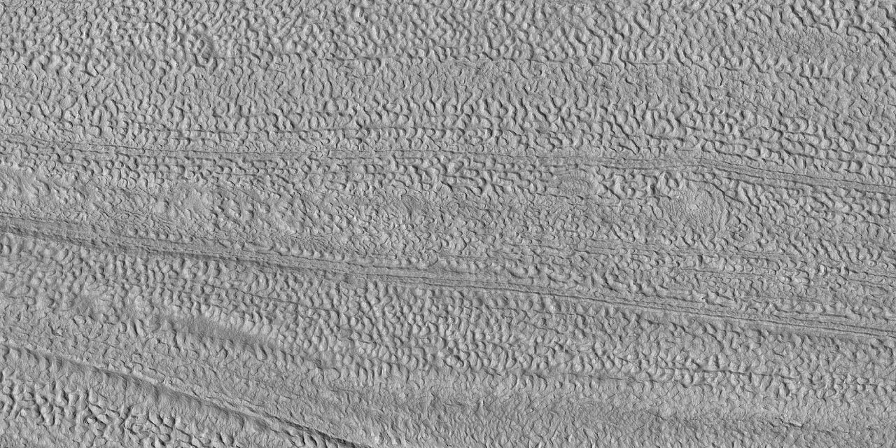
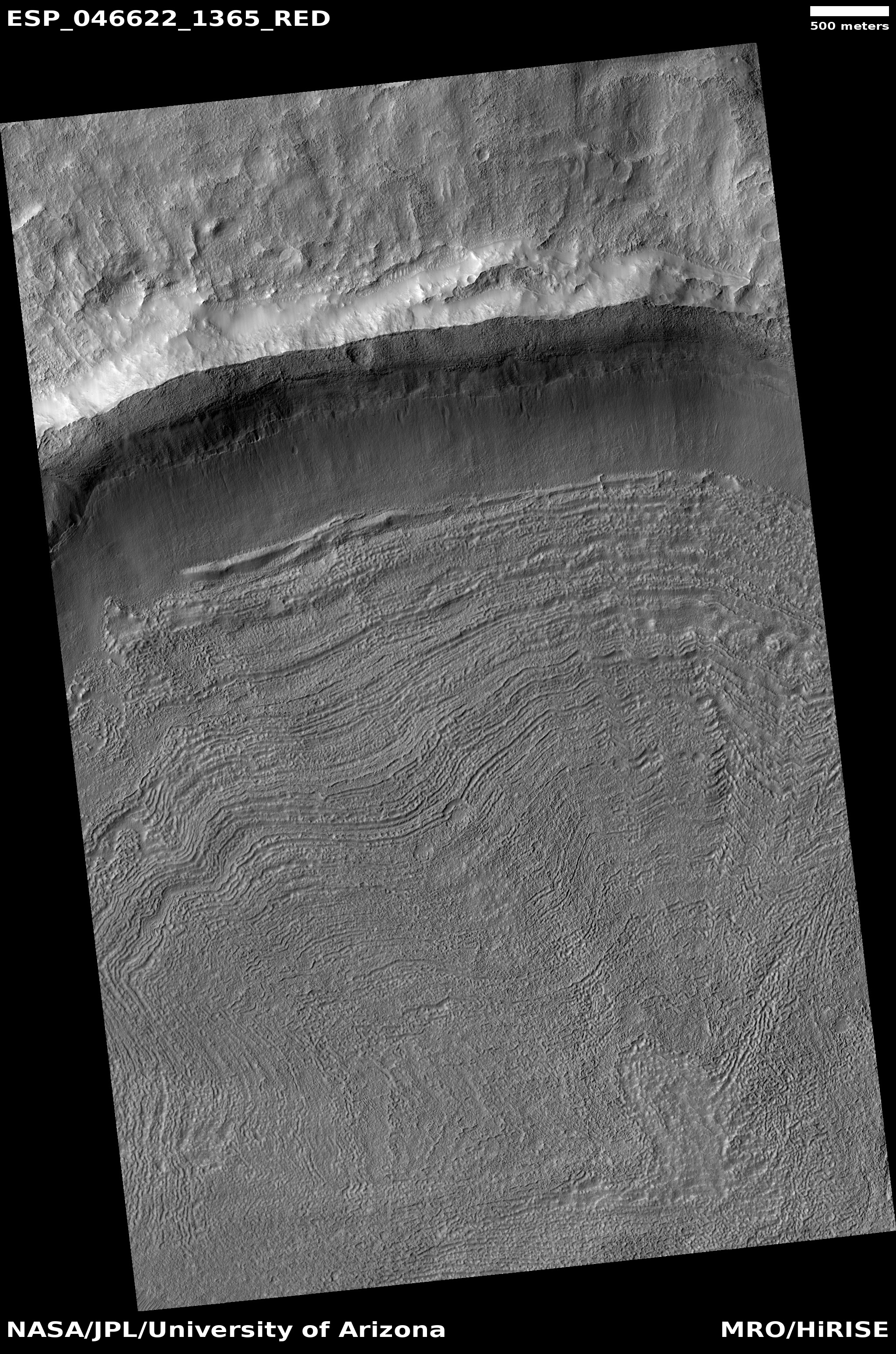
| 14:36, 26 February 2018 | ESP 046622 1365ccf.jpg (file) |  |
2.16 MB | Suitupandshowup | Concentric crater fill, as seen by HiRISE under HiWish program Image credit: NASA/JPL/University of Arizona | 1 |
| 14:43, 26 February 2018 | ESP 046622 1365ccfclosecolor.jpg (file) |  |
334 KB | Suitupandshowup | Close, color view of concentric crater fill, as seen by HiRISE under HiWish program Source: http://hirise.lpl.arizona.edu/ESP_046622_1365 Image credit: NASA/JPL/University of Arizona/ | 1 |
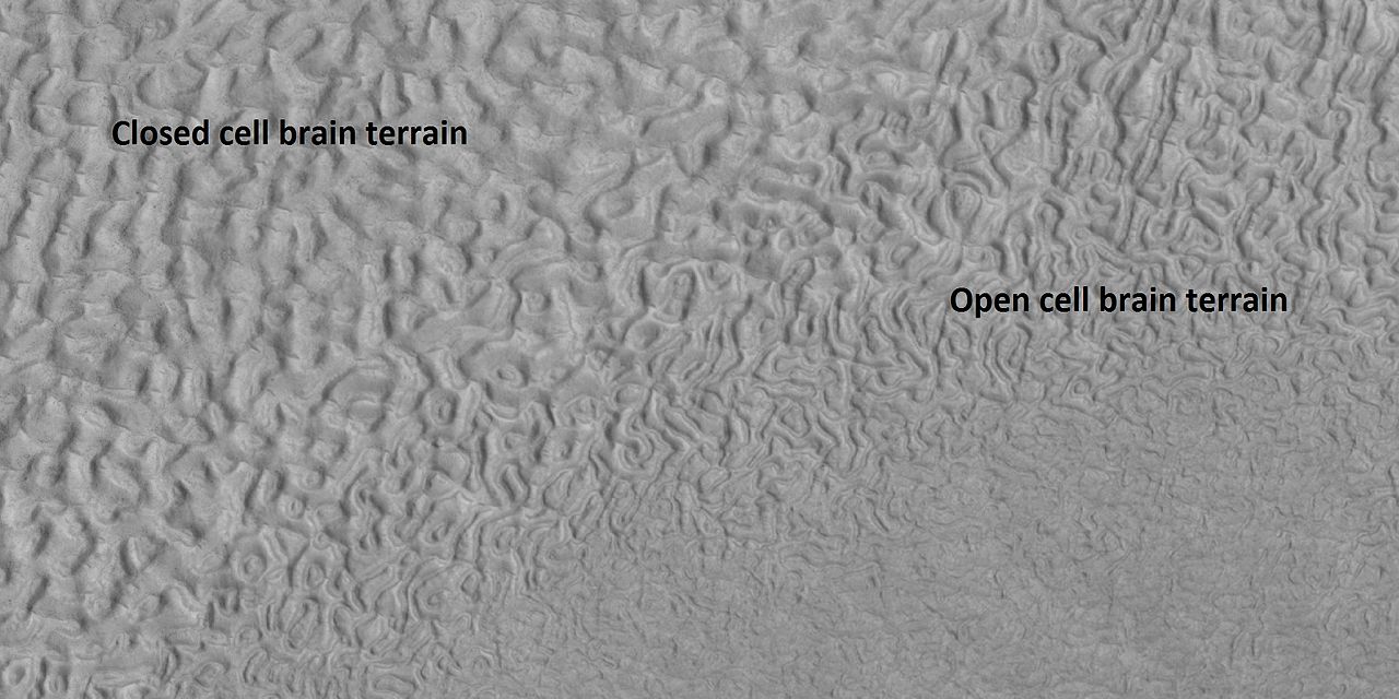
| 16:42, 26 February 2018 | 45917 2220brainsopenclosed.jpg (file) |  |
140 KB | Suitupandshowup | Labeled picture of open and closed brain terrain, as seen by HiRISE under HiWish program Source: http://hirise.lpl.arizona.edu/ESP_045917_2220 Image credit: NASA/JPL/University of Arizona | 1 |
| 16:46, 26 February 2018 | Ringmolddiagramlabeled.jpg (file) | 30 KB | Suitupandshowup | Series of diagrams showing how ring mold craters are formed. Author: Jim Secosky | 1 | |
| 16:50, 26 February 2018 | 26055cratermesaswide.jpg (file) |  |
151 KB | Suitupandshowup | Wide view of ring-mold craters, as seen by HiRISE under HiWish program Source: http://hirise.lpl.arizona.edu/ESP_026055_1445 | 1 |
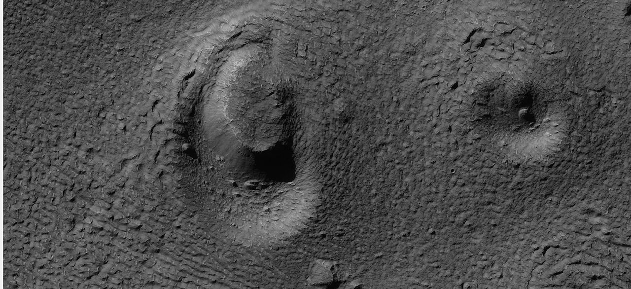
| 16:52, 26 February 2018 | 26055ringmoldcrater.jpg (file) |  |
198 KB | Suitupandshowup | Close view of ring mold crater, as seen by HiRISE under HiWish program Source: http://hirise.lpl.arizona.edu/ESP_026055_1445 | 1 |
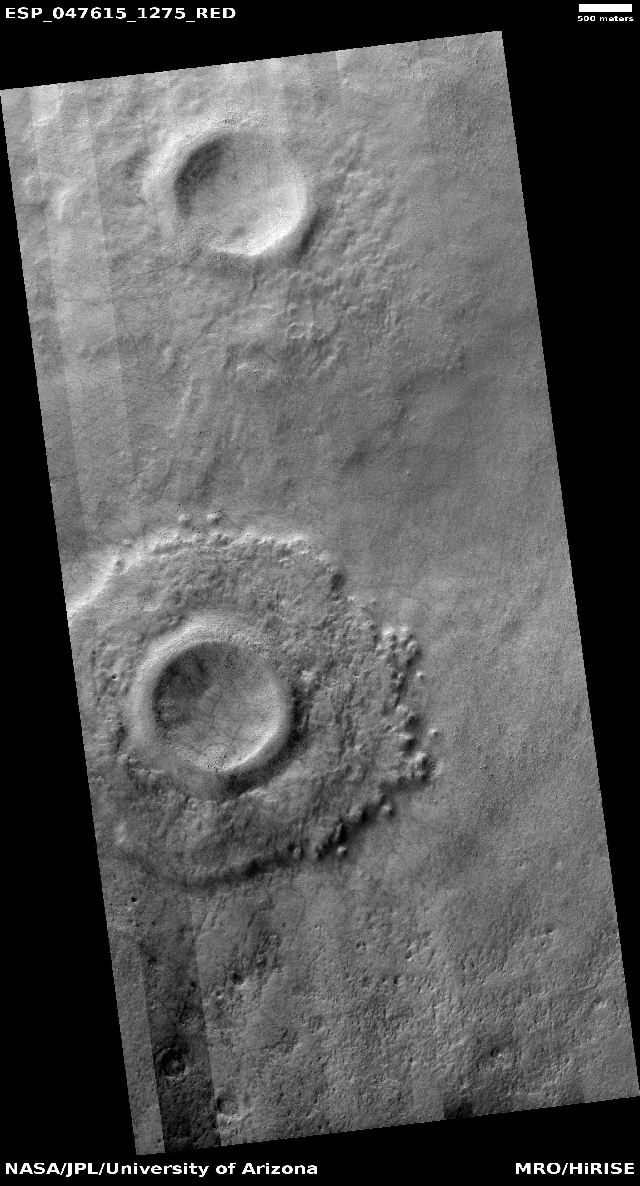
| 16:58, 26 February 2018 | ESP 047615 1275pedestal.jpg (file) |  |
2.25 MB | Suitupandshowup | Pedestal crater in Hellas quadrangle, as seen by HiRISE under HiWish program Source: http://hirise.lpl.arizona.edu/ESP_047615_1275 | 1 |
| 17:13, 26 February 2018 | 48011 1370upperunit.jpg (file) |  |
188 KB | Suitupandshowup | Upper plains unit breaking up, as seen by HiRISE under HiWish program Source:hirise.lpl.arizona.edu/ESP_048011_1370 Image credit: NASA/JPL/University of Arizona | 1 |
| 17:15, 26 February 2018 | ESP 019778 1385pyramid.jpg (file) |  |
207 KB | Suitupandshowup | Layers in upper plains unit, as seen by HiRISE, under HiWish program Source: http://hirise.lpl.arizona.edu/ESP_019778_1385 Image credit: NASA/JPL/University of Arizona | 1 |
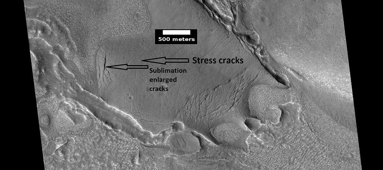
| 20:18, 26 February 2018 | ESP 028339 2245headarticle.jpg (file) |  |
137 KB | Suitupandshowup | Ribbed terrain in the upper plains unit, as seen by HiRISE under the HiWish program Small cracks become larger and larger because the more surface area the more sublimation. Source: http://hirise.lpl.arizona.edu/ESP_028339_2245 Image credit: NA... | 1 |
| 20:25, 26 February 2018 | ESP 042198 2235pyramid.jpg (file) |  |
163 KB | Suitupandshowup | Upper plains unit breaking up, by starting with cracks Image taken with HiRISE under HiWish program Source: http://hirise.lpl.arizona.edu/ESP_042198_2235 Image credit: NASA/JPL/University of Arizona | 1 |
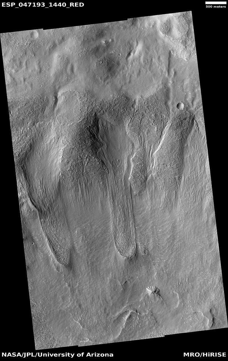
| 11:39, 27 February 2018 | ESP 047193 1440tongues.jpg (file) |  |
227 KB | Suitupandshowup | Tongue shaped glaciers in Hellas quadrangle, as seen by HiRISE under HiWish program Source: http://hirise.lpl.arizona.edu/ESP_047193_1440 Image credit: NASA/JPL/University of Arizona/Secosky | 1 |
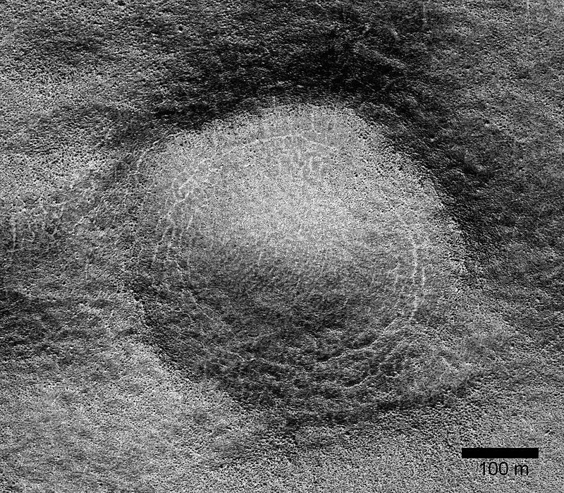
| 11:46, 27 February 2018 | ESP 046359 1250-2pingoscale.jpg (file) |  |
257 KB | Suitupandshowup | Possible pingo, as seen by HiRISE under HiWish program Location is the Phaethontis quadrangle. Source: http://hirise.lpl.arizona.edu/ESP_046359_1250 Image credit: NASA/JPL/University of Arizona/Secosky | 1 |
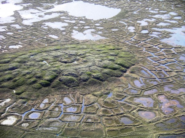
| 11:51, 27 February 2018 | Melting pingo wedge ice.jpg (file) |  |
104 KB | Suitupandshowup | Pingo on Earth with melting near Tuktoyaktuk, Northwest Territories, Canada. Source: Originally uploaded to English Wikipedia by en:User:ChrisNF 16 August 2007, as w:Image:Melting pingo wedge ice.jpg. Author: Emma Pike | 1 |
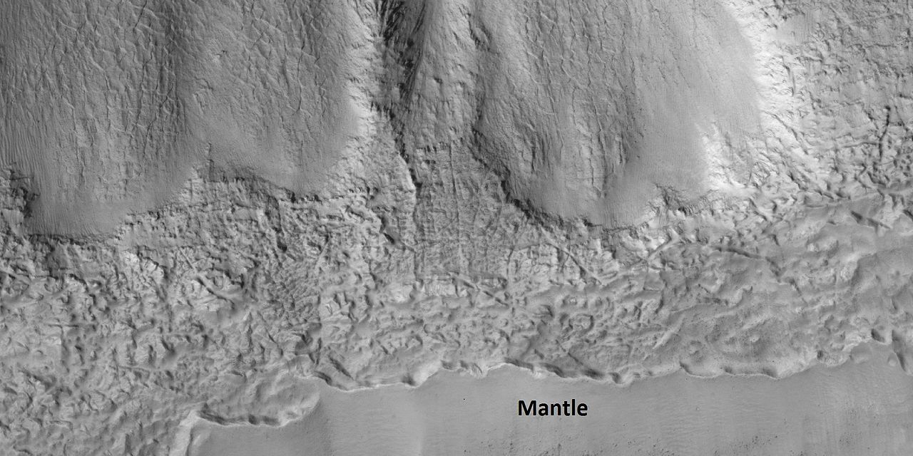
| 11:59, 27 February 2018 | 46444 2225mantle.jpg (file) |  |
151 KB | Suitupandshowup | Latitude dependent mantle, as seen by HiRISE under HiWish program A certain percentage of mantle is ice. Source: http://hirise.lpl.arizona.edu/ESP_046444_2225 Image Credit: NASA/JPL/University of Arizona | 1 |
| 12:03, 27 February 2018 | 45917 2220gulliesmantle.jpg (file) |  |
164 KB | Suitupandshowup | Close view of latitude dependent mantle, as seen by HiRISE under HiWish program A certain percentage of the mantle is ice; hence we may obtain water from this for future colonists. Source: http://hirise.lpl.arizona.edu/ESP_045917_2220 Image Credit:... | 1 |
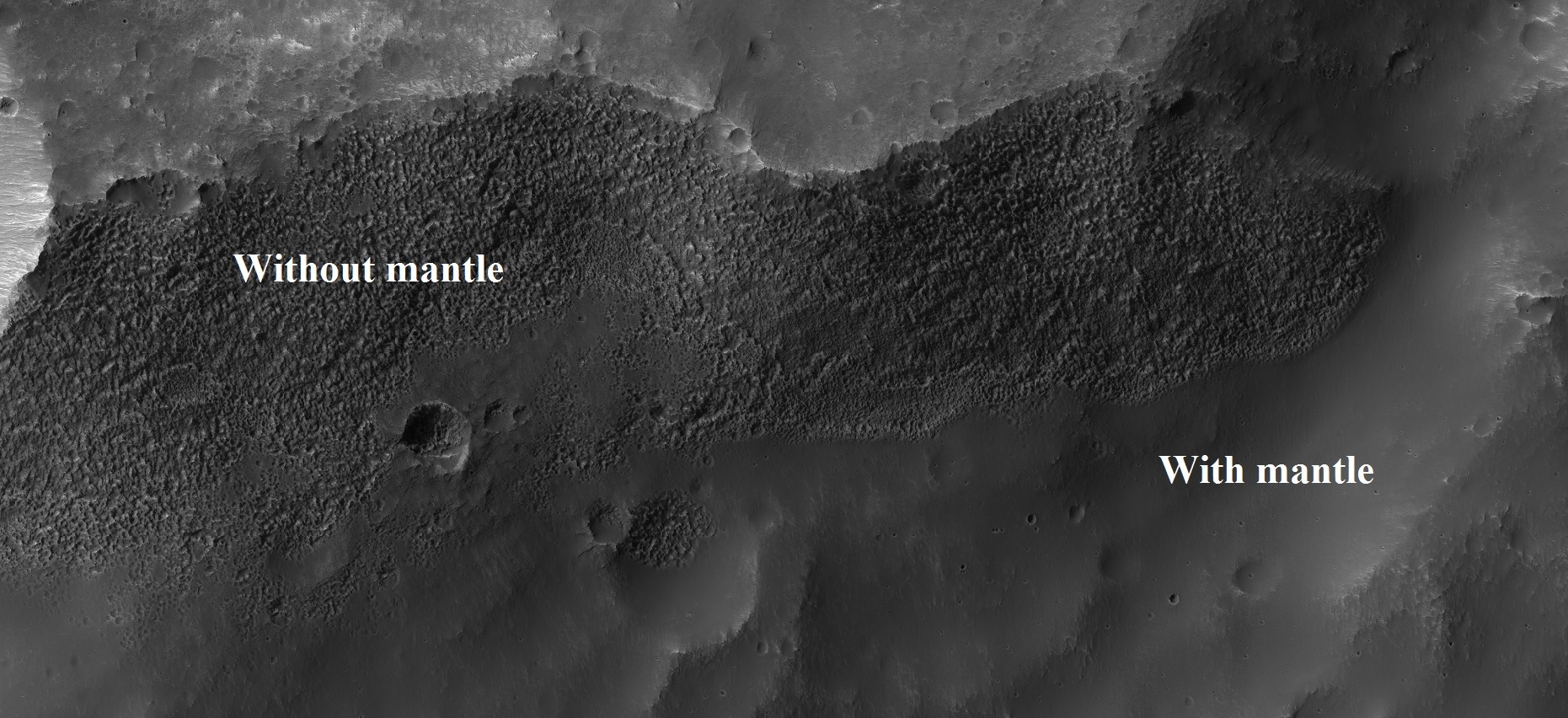
| 12:10, 27 February 2018 | Esp 037167 1445mantle.jpg (file) |  |
565 KB | Suitupandshowup | Parts of surface with and without mantle, as seen by HiRISE under HiWish program Mantle may supply future colonists with water. Source: http://hirise.lpl.arizona.edu/ESP_037167_1445 Image credit: NASA/JPL/University of Arizona | 1 |
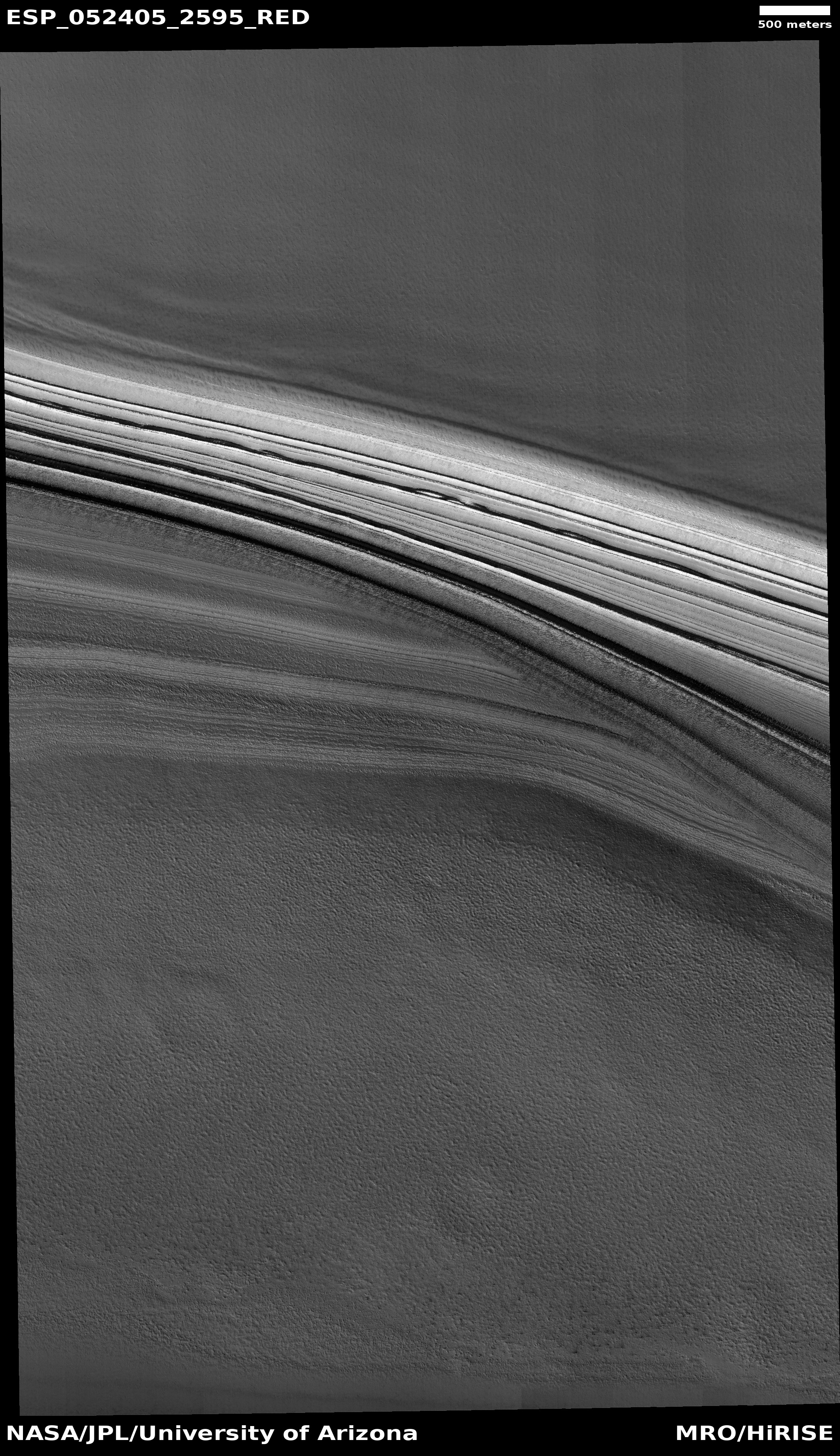
| 12:21, 27 February 2018 | ESP 052405 2595icelayers.jpg (file) |  |
2.5 MB | Suitupandshowup | Ice layers in northern ice cap, as seen by HiRISE under HiWish program Source: http://hirise.lpl.arizona.edu/ESP_052405_2595 Image credit: NASA/JPL/University of Arizona | 1 |
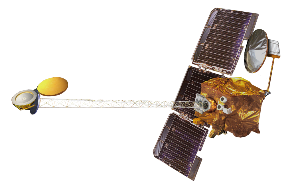
| 12:26, 27 February 2018 | Mars Odyssey spacecraft model.png (file) |  |
464 KB | Suitupandshowup | Artist's view of Mars Odyssey spacecraft Mars Odyssey mapped distribution of water on Mars Source: Published source': "Spacecraft Icons" at NASA Science Direct source: Image hosted by smd-prod.s3.amazonaws.com. Image credit: NASA | 1 |
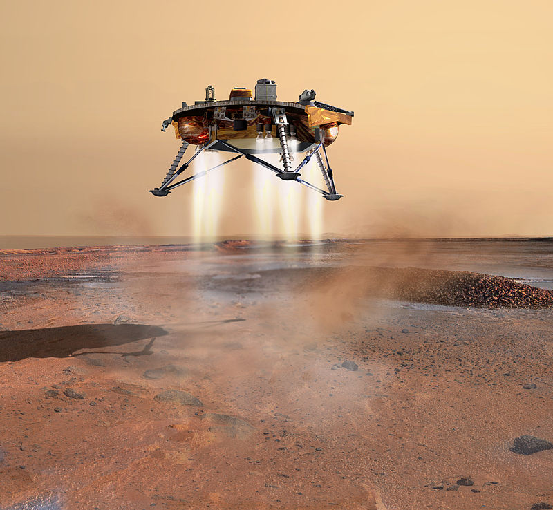
| 12:31, 27 February 2018 | Phoenix landing.jpg (file) |  |
112 KB | Suitupandshowup | An artist's rendition of the Phoenix Mars probe during landing. The sophisticated landing system on Phoenix allows the spacecraft to touch down within 10 kilometres (6.2 mi) of the targeted landing area. Thrusters are started when the lander is 570 met... | 1 |
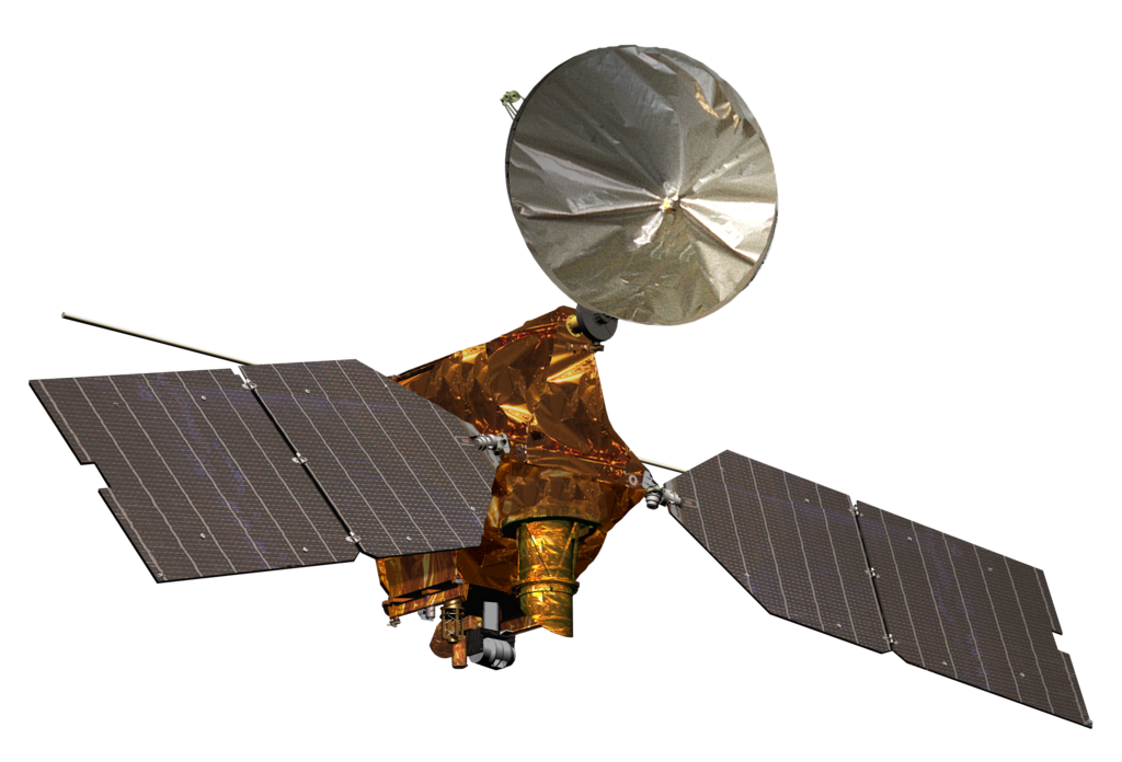
| 12:36, 27 February 2018 | Mars Reconnaissance Orbiter spacecraft model.png (file) |  |
491 KB | Suitupandshowup | Artist's rendering, from NASA, of the Mars Reconnaissance Orbiter spacecraft, in mission configuration. The spacecraft spent its prime mission in orbit around Mars, with its main objectives concerning more detailed and specialised studies of the planet... | 1 |
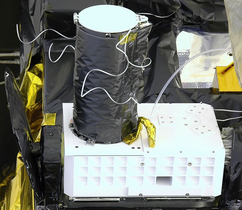
| 12:40, 27 February 2018 | MRO CRISM prelaunch 2.jpg (file) |  |
98 KB | Suitupandshowup | CRISM, the first visible-infrared spectrometer to fly on a NASA Mars mission, will look for the residue of minerals that form in the presence of water – the “fingerprints” left by evaporated hot springs, thermal vents, lakes or ponds. Source:... | 1 |
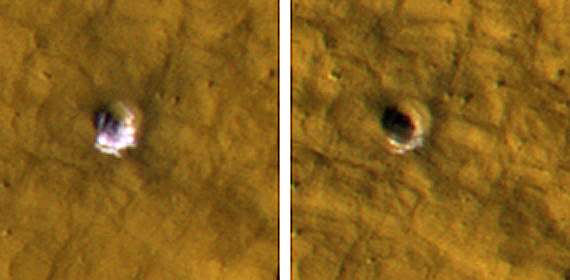
| 12:46, 27 February 2018 | Iceincraterscomparison.jpg (file) |  |
77 KB | Suitupandshowup | Ice in craters, as seen by HiRISE Picture on left shows ice exposed in small crater. In the later picture on right most of the ice is gone. Picture is from ESP_011574_2235 in the Cebrenia quadrangle. Source: https://www.nasa.gov/mission_pages/MRO... | 1 |
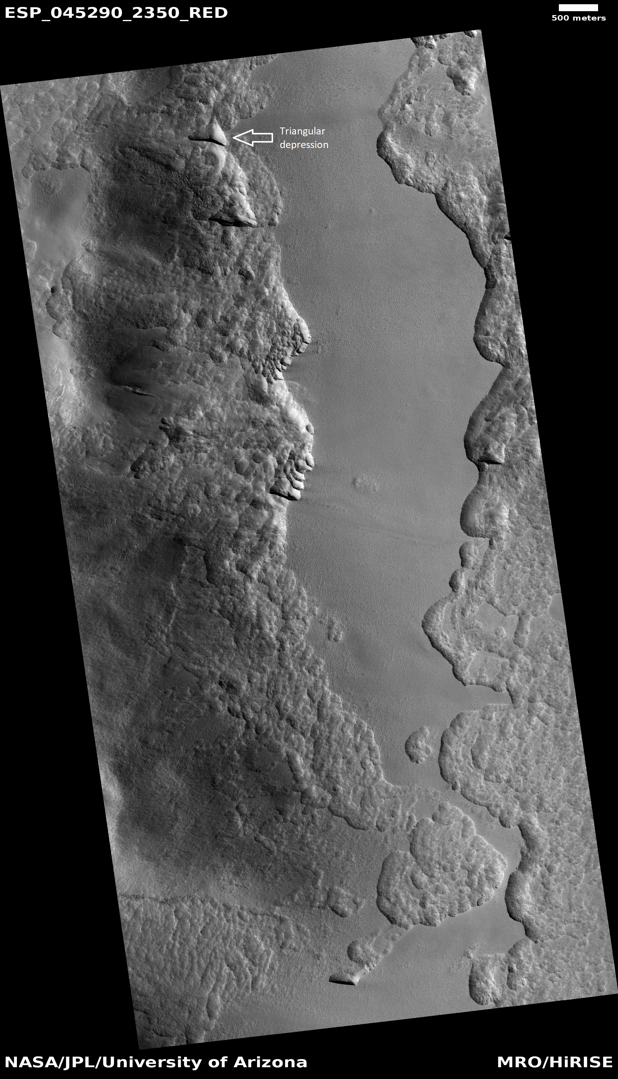
| 14:02, 28 February 2018 | ESP 045290 2350triangulardepression.jpg (file) |  |
2.07 MB | Suitupandshowup | Triangular depression that is associated with ice under a thin cover of debris. Image from HiRISE under HiWish program Image credit: http://hirise.lpl.arizona.edu/ESP_045290_2350 | 1 |
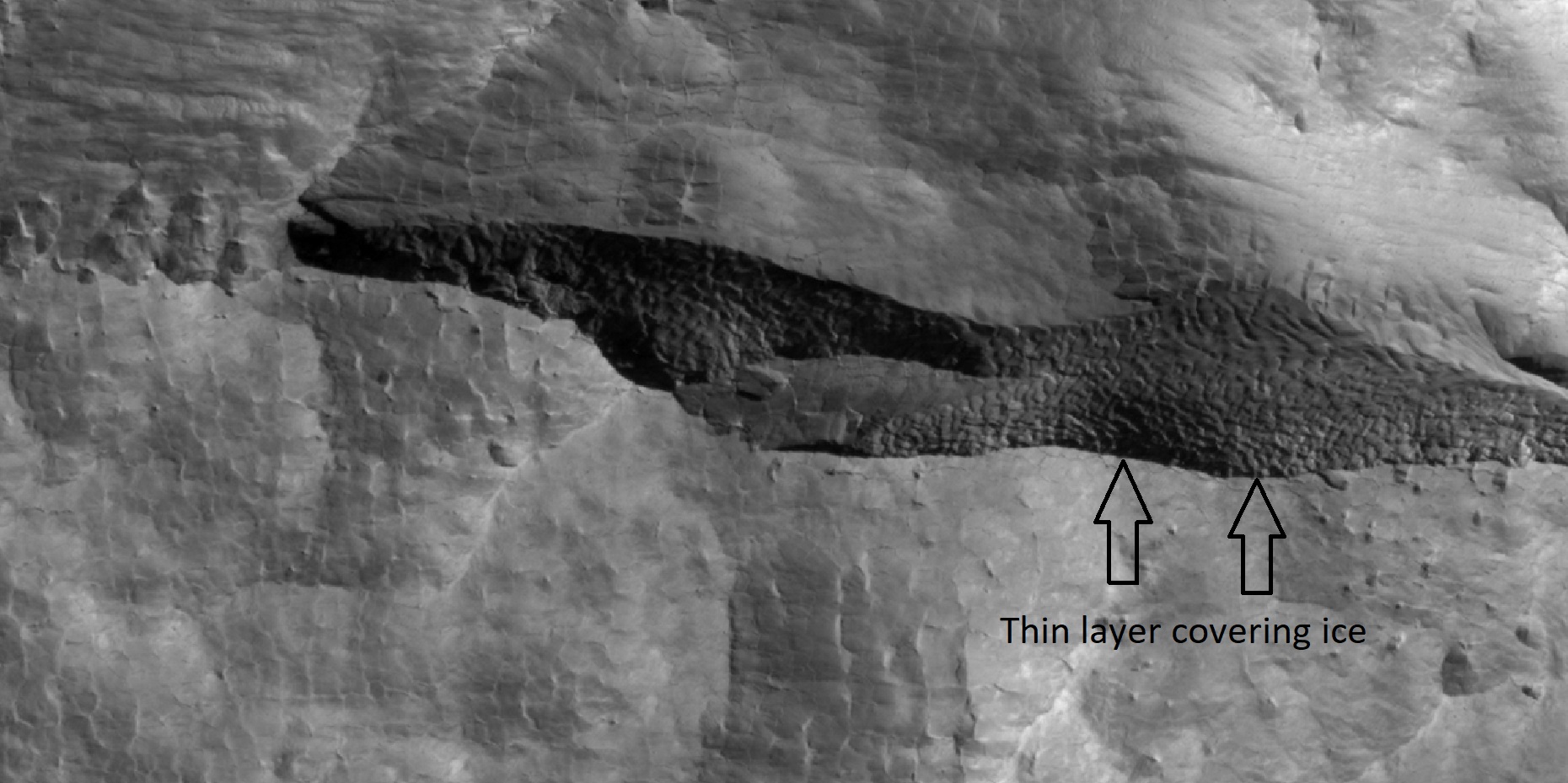
| 14:15, 28 February 2018 | 45290 2350icelayerscloseer.jpg (file) |  |
404 KB | Suitupandshowup | Close view of depression that contains layers of ice under only 1-2 meters of covering debris, as seen by HiRISE under HiWish program Location is the Diacria quadrangle. Arrows indicate thin covering over ice layers. Source: http://hirise.lpl.arizona.... | 1 |
| 14:21, 28 February 2018 | ESP 037461 2255scallopstop.jpg (file) |  |
648 KB | Suitupandshowup | Scalloped ground as seen by hirise under HiWish program Source: http://hirise.lpl.arizona.edu/ESP_037461_2255 Image credit: NASA/JPL/University of Arizona | 1 |
| 16:22, 28 February 2018 | 46622 1365ctxcontextccf.jpg (file) |  |
464 KB | Suitupandshowup | Context view of hirise image 46622_1365, as seen by CTX Concentric crater fill Source: http://viewer.mars.asu.edu/planetview/inst/ctx/G15_023941_1374_XN_42S140W#P=G15_023941_1374_XN_42S140W&T=2 Image credit: NASA/MSS | 1 |
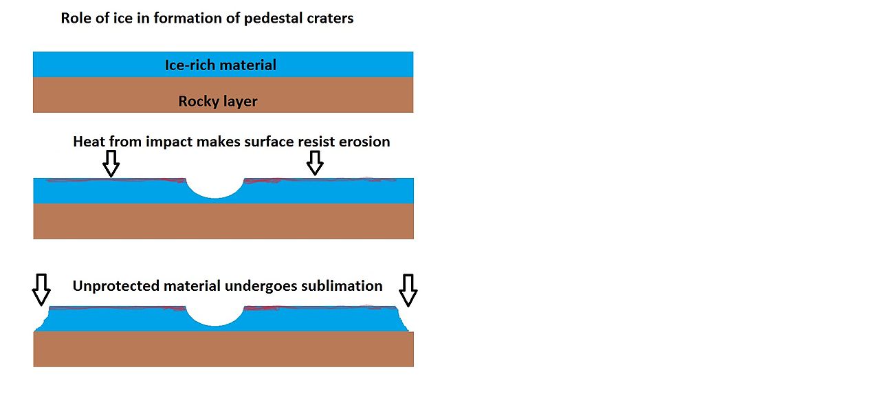
| 16:42, 28 February 2018 | Pedestaldrawingcolor2.jpg (file) |  |
39 KB | Suitupandshowup | Drawing showing one way a pedestal crater could form Image credit: Jim Secosky | 1 |
| 08:36, 1 March 2018 | Maadim Vallis.jpg (file) |  |
19 KB | Suitupandshowup | Ma'adim Vallis as seen by HiRISE. The location is 20.58 degrees south latitude and 182.58 degrees west longitude. Picture was taken with the Mars Reconnaissance Orbiter's HiRISE. Source:http://globaldata.mars.asu.edu/ctx/P02_001922_1595_XN_20S182W... | 1 |
| 08:39, 1 March 2018 | Gusev - Ma'adim Vallis.jpg (file) |  |
56 KB | Suitupandshowup | Ma'adim Vallis Source: http://www.jpl.nasa.gov/news/features.cfm?feature=527 Image credit: NASA | 1 |
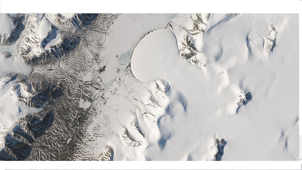
| 09:14, 1 March 2018 | Wikielephantglacier.jpg (file) |  |
113 KB | Suitupandshowup | Elephant Foot Glacier at Romer Lake, Northeast Greenland Centered at 80.9° N, 19.5° W, acquired by Landsat 8. Source: http://eoimages.gsfc.nasa.gov/images/imagerecords/85000/85303/elephantfoot_oli_2014172_lrg.jpg Image credit: NASA | 1 |
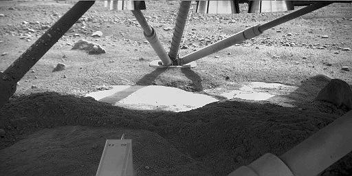
| 09:25, 1 March 2018 | PIA10741 Possible Ice Below Phoenix.jpg (file) |  |
33 KB | Suitupandshowup | View under Phoenix spacecraft showing ice that was uncovered by blast from landing rockets. The Robotic Arm Camera on NASA's Phoenix Mars Lander captured this image underneath the lander on the fifth Martian day, or sol, of the mission. Descent thruste... | 1 |
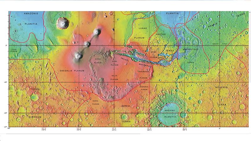
| 09:16, 9 March 2018 | Wikichaosmap.jpg (file) |  |
113 KB | Suitupandshowup | Modified map showing Ares Vallis and other nearby features including many chaos regions Source: http://planetarynames.wr.usgs.gov/images/mc11_mola.pdf Image credit: Image courtesy NASA/USGS/Secosky | 1 |
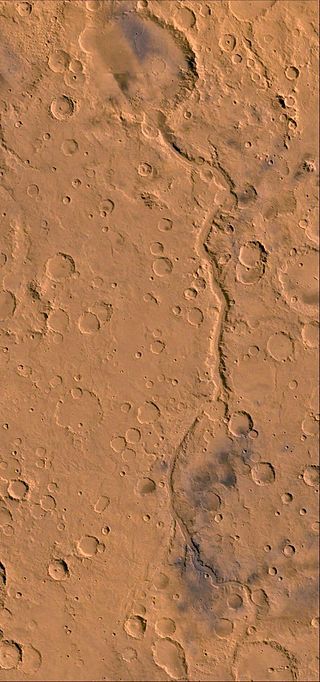
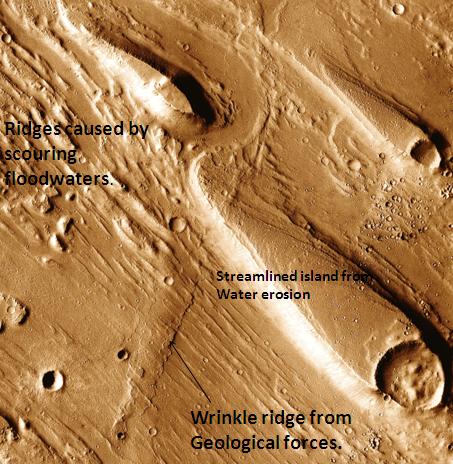
| 09:22, 9 March 2018 | Erosion features in Ares Vallis.jpg (file) |  |
59 KB | Suitupandshowup | Erosion features in Ares Vallis, as seen by themis. Location is 15.9 degrees north latitude and 30 degrees west longitude. Picture taken with Mars Odyssey's THEMIS. http://themis.asu.edu/features/aresvallis Photo credit NASA/JPL/ASU. | 1 |
| 10:11, 15 March 2018 | Wikimolaargyre.jpg (file) |  |
107 KB | Suitupandshowup | MOLA map showing boundaries in southern hemisphere of Mars Source: http://planetarynames.wr.usgs.gov/images/mola_regional_boundaries.pdf Picture credit: NASA/Astronomical Union Working Group for Planetary System Nomenclature. "Gazetteer of Planetar... | 1 |
| 10:16, 15 March 2018 | 24807whitebuttei.jpg (file) |  |
75 KB | Suitupandshowup | White butte in Margartifer Sinus quadrangle, as seen by HiRISE under HiWish program Box shows size of a football field. Source: http:hirise.lpl.arizona.edu/ESP_024807_1755 Picture credit: NASA/JPL/University of Arizona/Secosky | 1 |
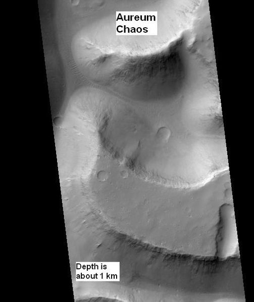
| 10:20, 15 March 2018 | Aureum Chaos wide view.jpg (file) |  |
28 KB | Suitupandshowup | Wide view of Aureum Chaos, one of first 8 images released in public suggestion program. Location is 2.438 S and 332.144 E. Source: http://hirise.lpl.arizona.edu/ESP_016869_1775 Image credit: NASA/JPL/University of Arizona/Secosky | 1 |
| 08:32, 16 March 2018 | Mars Greenhouse.jpg (file) |  |
105 KB | Suitupandshowup | A conceptual rendering of a greenhouse on the surface of Mars. Image credit: NASA/Human Systems Engineering and Development Division | 1 |
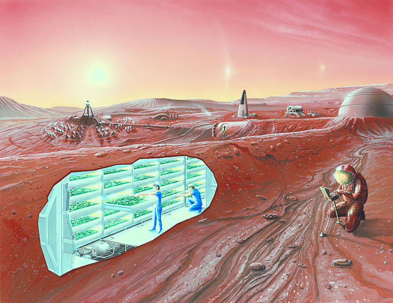
| 08:37, 16 March 2018 | Concept Mars colony-underground.jpg (file) |  |
144 KB | Suitupandshowup | Artist impression of a Mars settlement with cutaway view, including underground greenhouse Image credit: NASA Ames Research Center - NASA Ames featured images | 1 |
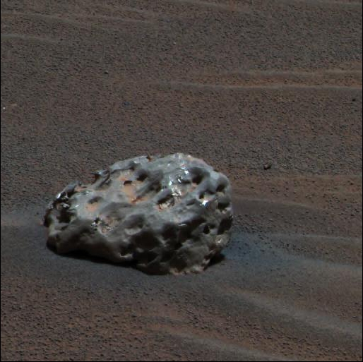
| 08:01, 17 March 2018 | Meteoritemars.jpg (file) |  |
152 KB | Suitupandshowup | Iron meteorite found on Mars by a rover Image credit: NASA | 1 |
| 08:16, 17 March 2018 | MarsDustDevi-AmazonisPlanitia-MGS-MOC-20010401-E03-00938.gif (file) |  |
154 KB | Suitupandshowup | One objective for the Mars Global Surveyor (MGS) Mars Orbiter Camera (MOC) in the Extended Mission is to continue looking for changes and dynamic events taking place on the red planet. The feature shown here elicited gasps of exitement among the MOC Op... | 1 |
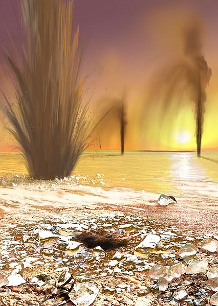
| 08:39, 17 March 2018 | Geysers on Mars.jpg (file) |  |
66 KB | Suitupandshowup | Artist concept showing sand-laden jets (Geysers on Mars) shoot into the Martian polar sky. Image credit: Arizona State University/Ron Miller Source: NASA's Jet Propulsion Laboratory: http://www.jpl.nasa.gov/news/news.cfm?release=2006-100 | 1 |


