Difference between revisions of "File:45290 2350icelayerscloseer.jpg"
(Close view of depression that contains layers of ice under only 1-2 meters of covering debris, as seen by HiRISE under HiWish program Location is the Diacria quadrangle. Arrows indicate thin covering over ice layers. Source: http://hirise.lpl.arizona....) |
(No difference)
|
Latest revision as of 14:15, 28 February 2018
Summary
Close view of depression that contains layers of ice under only 1-2 meters of covering debris, as seen by HiRISE under HiWish program Location is the Diacria quadrangle. Arrows indicate thin covering over ice layers.
Source: http://hirise.lpl.arizona.edu/http://ESP_045290_2350
Image credit: NASA/JPL/University of Arizona/Secosky
Licensing
Public domain images are available for anybody to use without any licenses, royalties, or special permissions.
File history
Click on a date/time to view the file as it appeared at that time.
| Date/Time | Thumbnail | Dimensions | User | Comment | |
|---|---|---|---|---|---|
| current | 14:15, 28 February 2018 | 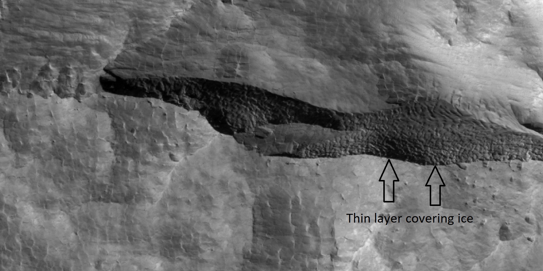 | 1,860 × 929 (404 KB) | Suitupandshowup (talk | contribs) | Close view of depression that contains layers of ice under only 1-2 meters of covering debris, as seen by HiRISE under HiWish program Location is the Diacria quadrangle. Arrows indicate thin covering over ice layers. Source: http://hirise.lpl.arizona.... |
You cannot overwrite this file.
File usage
The following file is a duplicate of this file (more details):
- File:45290 2350icelayerscloseer.jpg from Wikimedia Commons
The following 3 pages use this file:


