Difference between revisions of "File:Meridianicropped.png"
(Map showing the location of Opportunity's landing site and nearby features Source This file was derived from: Mapbeer.jpg https://commons.wikimedia.org/wiki/File:Meridianicropped.png Image credit: NASA) |
(No difference)
|
Latest revision as of 14:19, 20 December 2018
Summary
Map showing the location of Opportunity's landing site and nearby features
Source This file was derived from: Mapbeer.jpg https://commons.wikimedia.org/wiki/File:Meridianicropped.png Image credit: NASA
Licensing
Public domain images are available for anybody to use without any licenses, royalties, or special permissions.
File history
Click on a date/time to view the file as it appeared at that time.
| Date/Time | Thumbnail | Dimensions | User | Comment | |
|---|---|---|---|---|---|
| current | 14:19, 20 December 2018 | 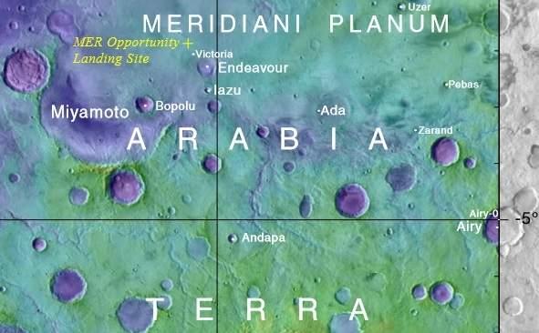 | 591 × 366 (510 KB) | Suitupandshowup (talk | contribs) | Map showing the location of Opportunity's landing site and nearby features Source This file was derived from: Mapbeer.jpg https://commons.wikimedia.org/wiki/File:Meridianicropped.png Image credit: NASA |
You cannot overwrite this file.
File usage
The following file is a duplicate of this file (more details):
- File:Meridianicropped.png from Wikimedia Commons
The following page uses this file:


