Difference between revisions of "File:MSL TraverseMap Sol1996-br2.jpg"
(This map shows the route driven by NASA's Mars rover Curiosity through the 1996 Martian day, or sol, of the rover's mission on Mars (March 22, 2018). Numbering of the dots along the line indicate the sol number of each drive. North is up. The scale ba...) |
(No difference)
|
Latest revision as of 14:08, 29 December 2018
Summary
This map shows the route driven by NASA's Mars rover Curiosity through the 1996 Martian day, or sol, of the rover's mission on Mars (March 22, 2018).
Numbering of the dots along the line indicate the sol number of each drive. North is up. The scale bar is 1 kilometer (~0.62 mile). From Sol 1993 to Sol 1996, Curiosity had driven a straight line distance of about 124.44 feet (37.93 meters), bringing the rover's total odometry for the mission to 11.46 miles (18.44 kilometers).
The base image from the map is from the High Resolution Imaging Science Experiment Camera (HiRISE) in NASA's Mars Reconnaissance Orbiter.
Source: https://mars.nasa.gov/msl/mission/whereistherovernow/?ImageID=9230
Image credit: NASA/JPL-Caltech/Univ. of Arizona
Licensing
Public domain images are available for anybody to use without any licenses, royalties, or special permissions.
File history
Click on a date/time to view the file as it appeared at that time.
| Date/Time | Thumbnail | Dimensions | User | Comment | |
|---|---|---|---|---|---|
| current | 14:08, 29 December 2018 | 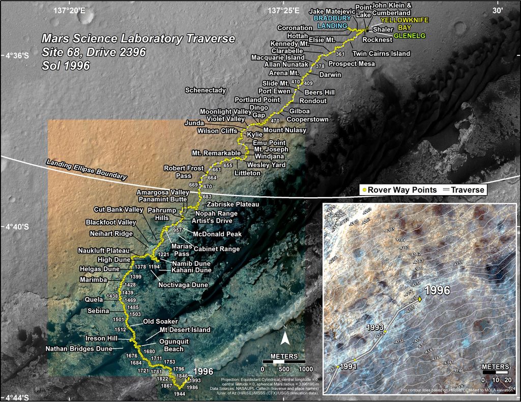 | 1,024 × 791 (246 KB) | Suitupandshowup (talk | contribs) | This map shows the route driven by NASA's Mars rover Curiosity through the 1996 Martian day, or sol, of the rover's mission on Mars (March 22, 2018). Numbering of the dots along the line indicate the sol number of each drive. North is up. The scale ba... |
You cannot overwrite this file.
File usage
The following page uses this file:


