Difference between revisions of "File:52030 1560crater.jpg"
(Crater Craters show us what lies beneath the surface. The location is west of Maadim Vallis in the Memnonia quadrangle at 23.774 S and 167.63 E (ESP_052030_1560). Source: HiRISE://hirise.lpl.arizona.edu/ESP_052030_1560 Image credit is NASA/JPL/University of Arizona.) |
(No difference)
|
Latest revision as of 12:20, 23 February 2020
Summary
Crater Craters show us what lies beneath the surface. The location is west of Maadim Vallis in the Memnonia quadrangle at 23.774 S and 167.63 E (ESP_052030_1560). Source: HiRISE://hirise.lpl.arizona.edu/ESP_052030_1560
Image credit is NASA/JPL/University of Arizona.
Licensing
Public domain images are available for anybody to use without any licenses, royalties, or special permissions.
File history
Click on a date/time to view the file as it appeared at that time.
| Date/Time | Thumbnail | Dimensions | User | Comment | |
|---|---|---|---|---|---|
| current | 12:20, 23 February 2020 | 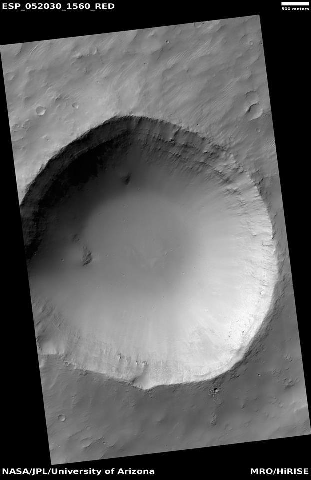 | 623 × 960 (47 KB) | Suitupandshowup (talk | contribs) | Crater Craters show us what lies beneath the surface. The location is west of Maadim Vallis in the Memnonia quadrangle at 23.774 S and 167.63 E (ESP_052030_1560). Source: HiRISE://hirise.lpl.arizona.edu/ESP_052030_1560 Image credit is NASA/JPL/University of Arizona. |
You cannot overwrite this file.
File usage
The following page uses this file:


