File list
This special page shows all uploaded files.
| Date | Name | Thumbnail | Size | User | Description | Versions |
|---|---|---|---|---|---|---|
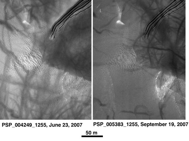
| 09:51, 12 September 2018 | New Streaks Formed PIA02379.jpg (file) |  |
86 KB | Suitupandshowup | Comparison of images showing new streaks that formed between February 1, 1998 and November 18, 1999, as seen my Mars Global Surveyor Source: http://photojournal.jpl.nasa.gov/catalog/PIA02379 Image credit: NASA/JPL/Malin Space Science Systems | 1 |
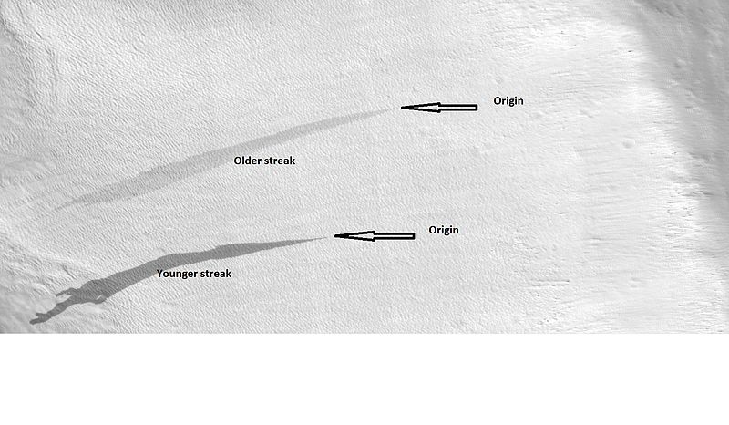
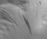
| 09:43, 12 September 2018 | 23677streakslabeled.jpg (file) |  |
64 KB | Suitupandshowup | Labeled view of streaks showing origins and relative age, as seen by HiRISE under HiWish program Location at 33.9N and 48.9 E in the Diacria quadrangle. Source: http://hirise.lpl.arizona.edu/ESP_023677_2140 Image credit: NASA/JPL/University of A... | 1 |
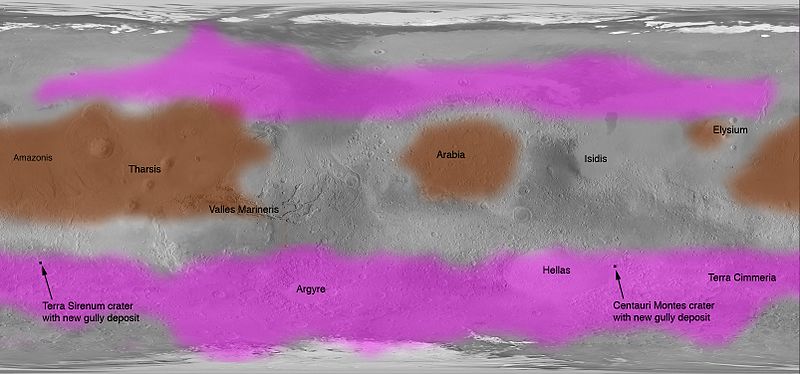
| 09:30, 12 September 2018 | Streak Locations PIA09030.jpg (file) |  |
50 KB | Suitupandshowup | Map showing locations on Mars with dark slope streaks (brown) and gullies (pink). Source: NASA Photojournal: http://photojournal.jpl.nasa.gov/catalog/PIA09030 Image credit: NASA/JPL | 1 |
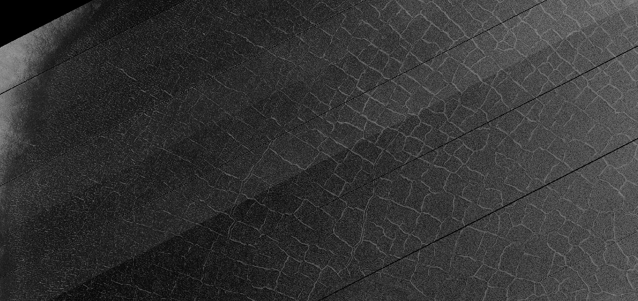
| 07:41, 11 September 2018 | 56148 1145polygonsveryclose.jpg (file) |  |
442 KB | Suitupandshowup | Closer view of polygons on crater floor, as seen by HiRISE under HiWish program Image credit: NASA/JPL/University of Arizona/Secosky | 1 |
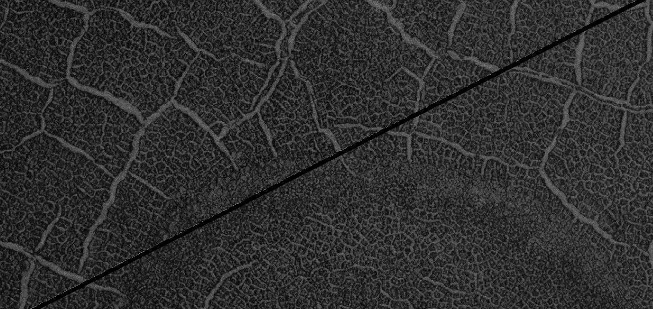
| 07:37, 11 September 2018 | 56148 1145polygonsclose.jpg (file) |  |
472 KB | Suitupandshowup | Close view of polygons with frost in low spots. Image taken with HiRISE under HiWish program Image credit: NASA/JPL/University of Arizona/Secosky | 1 |
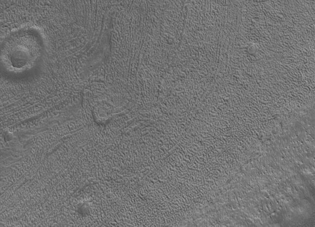
| 07:31, 11 September 2018 | 56148 1145polygonswide.jpg (file) |  |
249 KB | Suitupandshowup | Wide view of interior of crater floor that is covered in polygons with ice in the low areas The location is the mare Australe quadrangle at 75.052 S and 106.178 E (ESP_056015_1050). Image taken with HiRISE under HiWish program. Image credit: NASA/J... | 1 |
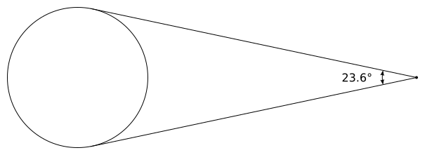
| 19:17, 31 August 2018 | StationarySatelliteFOV.png (file) |  |
14 KB | Pb | The field of view of a satellite in stationary orbit above Mars. | 1 |
| 18:58, 31 August 2018 | AreostationaryCoverage.png (file) |  |
670 KB | Pb | correct coverage zone sizes | 2 |
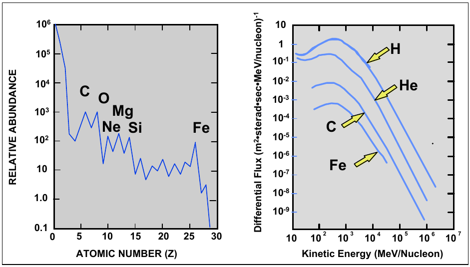
| 16:30, 31 July 2018 | Cucinotta 2009 Fig. 4-3.png (file) |  |
160 KB | JimL | 1 | |
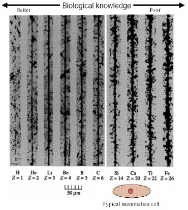
| 12:15, 29 July 2018 | Heavy ions in GCR.png (file) |  |
78 KB | JimL | 1 | |
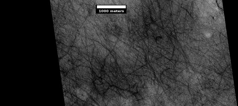
| 15:25, 26 June 2018 | Dark streaks in Diacria.JPG (file) |  |
4 KB | Suitupandshowup | Dark slope streaks, as seen by Mars Global Surveyor under the Public Target program Image Credit: NASA/MSSS/Secosky | 1 |
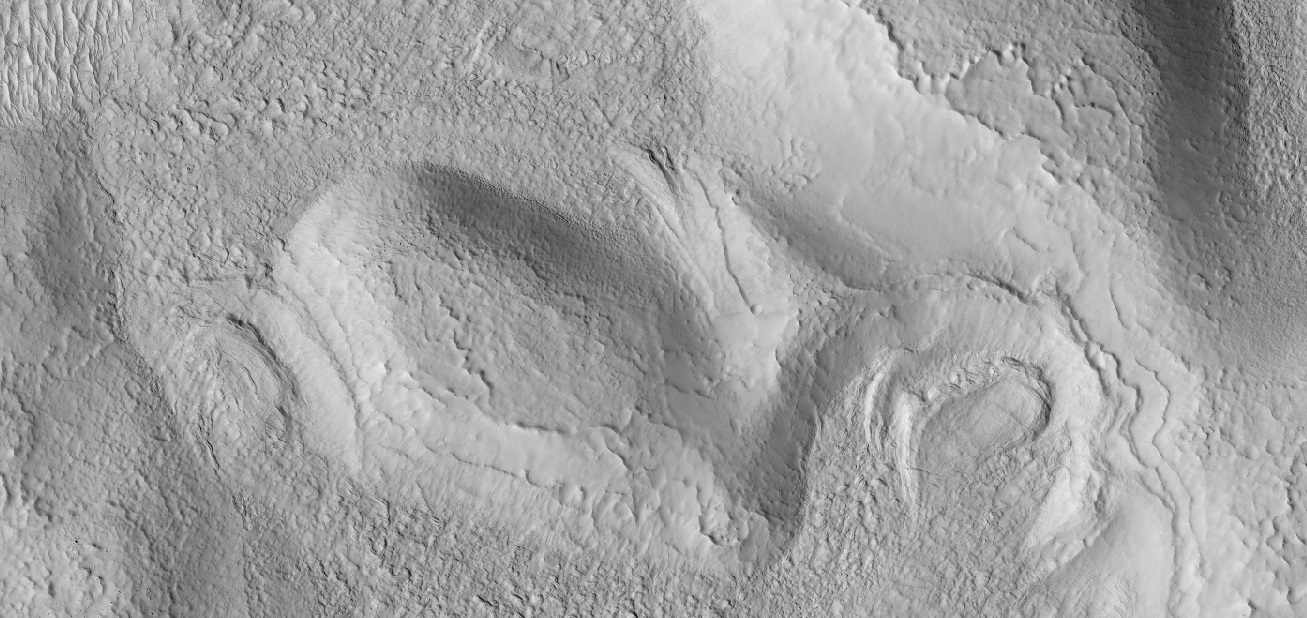
| 15:20, 26 June 2018 | Tikonravev Crater Floor.JPG (file) |  |
5 KB | Suitupandshowup | Features on floor of Tikonravev_Crater, as seen by Mars Global Surveyor Image Credit: NASA/MSSS/Secosky | 1 |
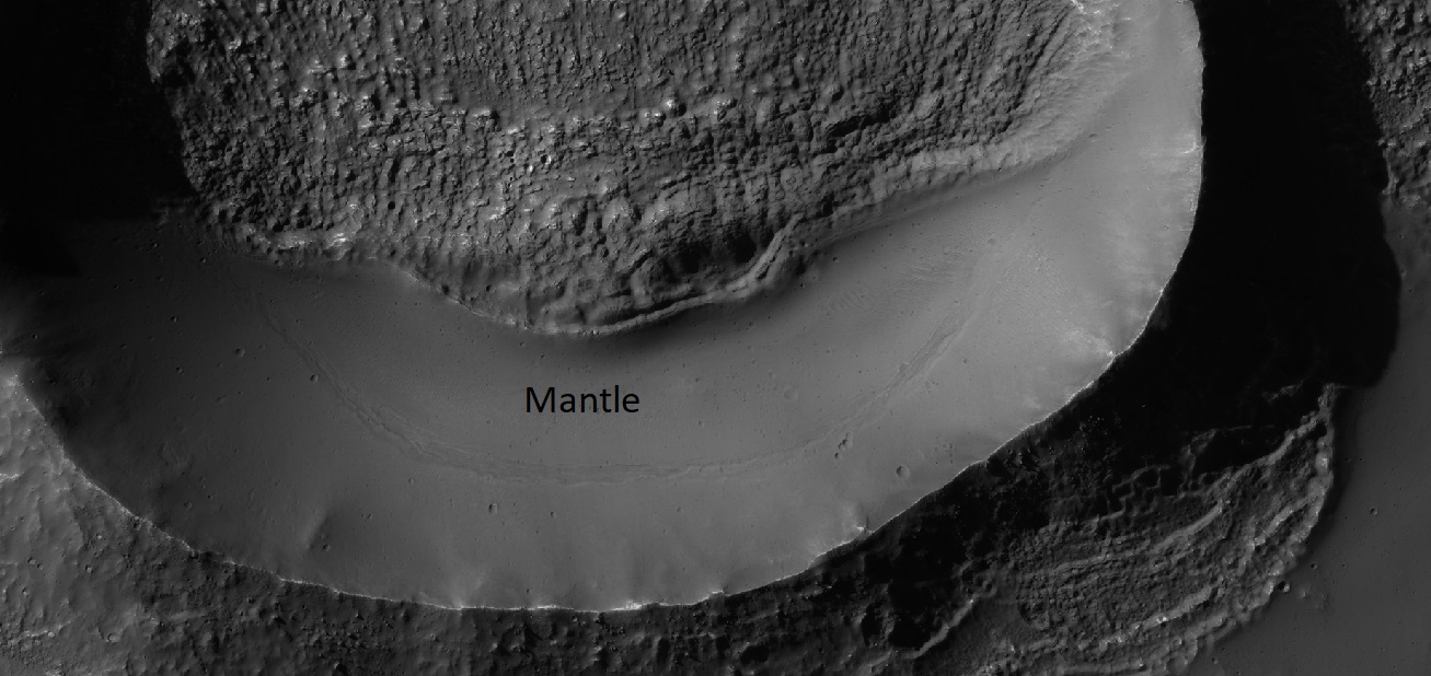
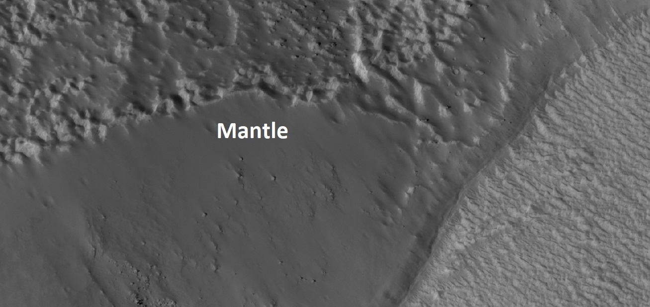
| 14:30, 26 June 2018 | Mantle on Cliff.jpg (file) |  |
139 KB | Suitupandshowup | Latitude dependent mantle along a cliff face. The circled part shows the edge of the mantle. Picture taken with the Mars Global Surveyor under the Public Target Program. Image Credit: NASA/MSSS/Secosky | 1 |
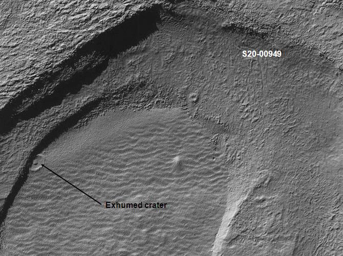
| 14:26, 26 June 2018 | Exhumed crater in Noachis.jpg (file) |  |
89 KB | Suitupandshowup | Exhumed crater, as seen by Mars Global Surveyor under the Public Target Program | 1 |
| 14:12, 26 June 2018 | Phaethontis surface.jpg (file) |  |
53 KB | Suitupandshowup | Brain terrain in Phaethontis quadrangle From MOC 12-00663. This image was taken with the Mars Orbital Camera MOC) on the Mars Global Surveyor (MGS). The photo credit is Malin Space Science Systems/NASA/Secosky. http://www.msss.com (public target pro... | 1 |
| 07:22, 26 June 2018 | 800px-Coprates layers.jpg (file) |  |
122 KB | Suitupandshowup | Layers in Coprates, as seen by Mars Global Surveyor, under MOC Public Targeting Program. Location is 8.8 degrees south latitude and 45.48 degrees west longitude. Source: http://www.msss.com/mars_images/moc/publicresults/2004/06/R18-00480p.gif Image cr... | 1 |
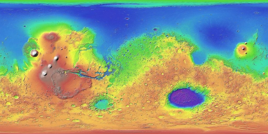
| 15:04, 25 June 2018 | Mars MGS colorhillshade mola 1024.jpg (file) |  |
132 KB | Suitupandshowup | Topographic map of Mars. Colors show relative elevations. Map is based on data set from the Mars Global Surveyor spacecraft. A laser altimeter on the spacecraft provided the altitudes. Source: http://mola.gsfc.nasa.gov/images.html and http://photoj... | 1 |
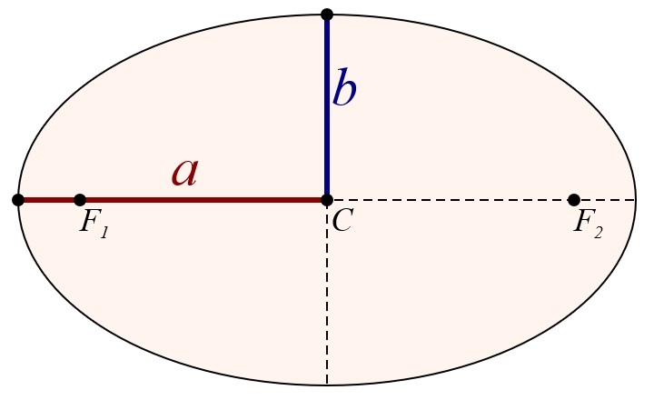
| 14:36, 25 June 2018 | Semi-major and semi-minor axes of an ellipse.jpg (file) |  |
31 KB | Suitupandshowup | Diagram showing semi-major and semi-minor axes of an ellipse. Source: Wikimedia Commons/M. W. Toews This file is made available under the Creative Commons CC0 1.0 Universal Public Domain Dedication. The person who associated a work with this deed ha... | 1 |
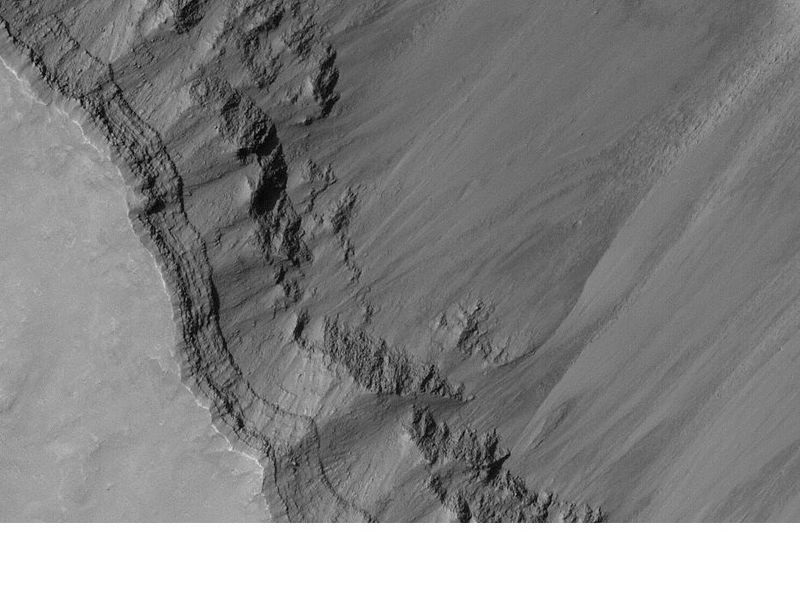
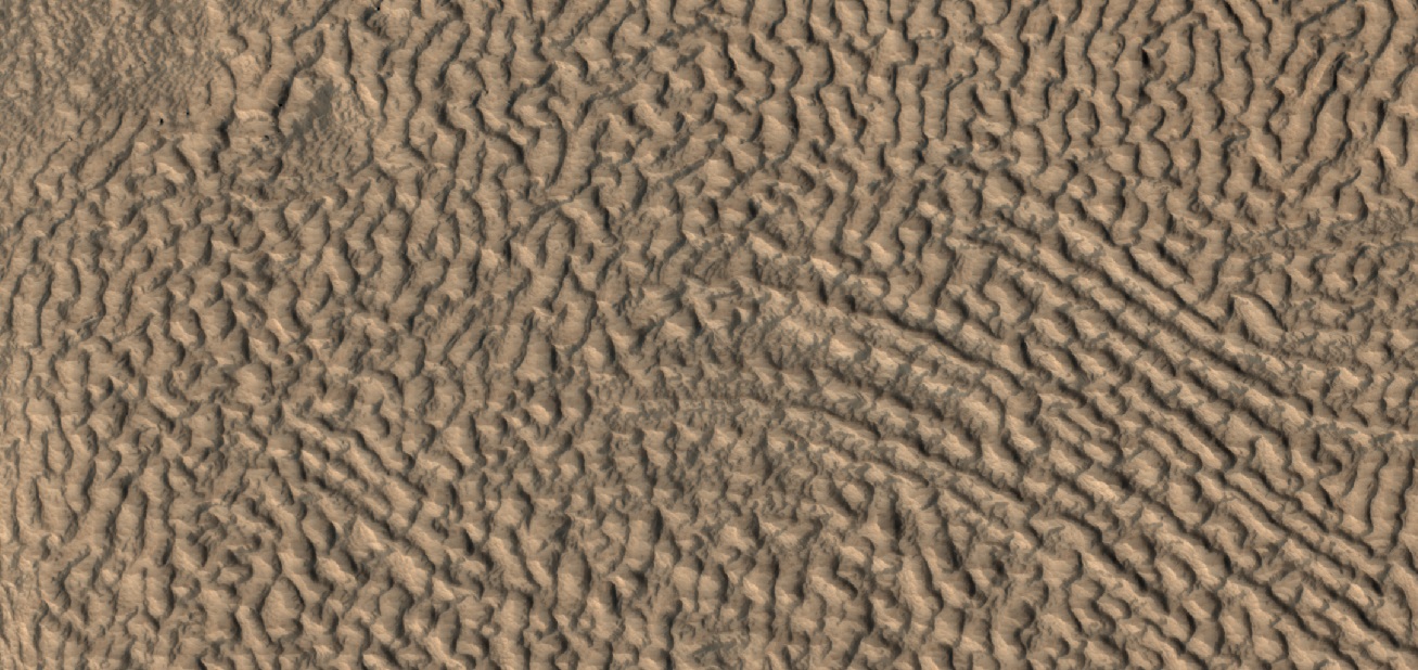
| 12:05, 22 June 2018 | 55198 2170dipping.jpg (file) |  |
332 KB | Suitupandshowup | Dipping layers, as seen by HiRISE under HiWish program Source: http://hirise.lpl.arizona.edu/ESP_55198_2170 Image credit: NASA/JPL/University of Arizona/Secosky | 1 |
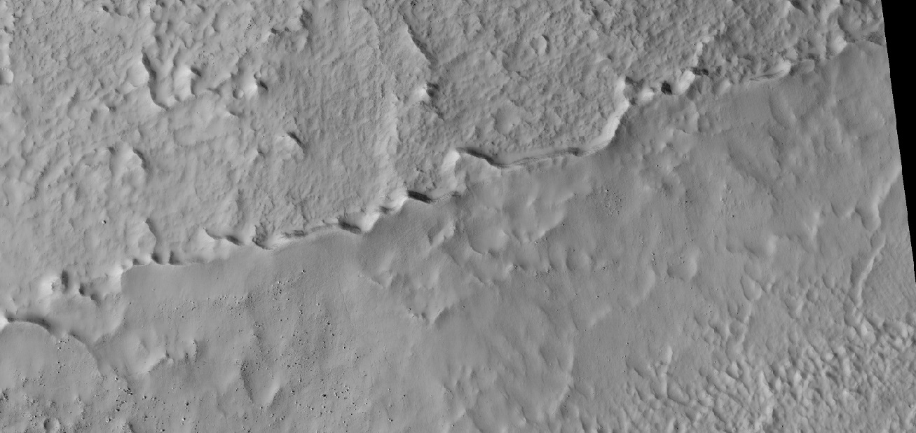
| 12:02, 22 June 2018 | 54742 1485mantle.jpg (file) |  |
230 KB | Suitupandshowup | Mantle in crater, as seen by HiRISE under HiWidh program Source: http://hirise.lpl.arizona.edu/ESP_54742_1485 Image credit: NASA/JPL/University of Arizona/Secosky | 1 |
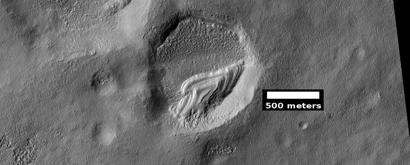
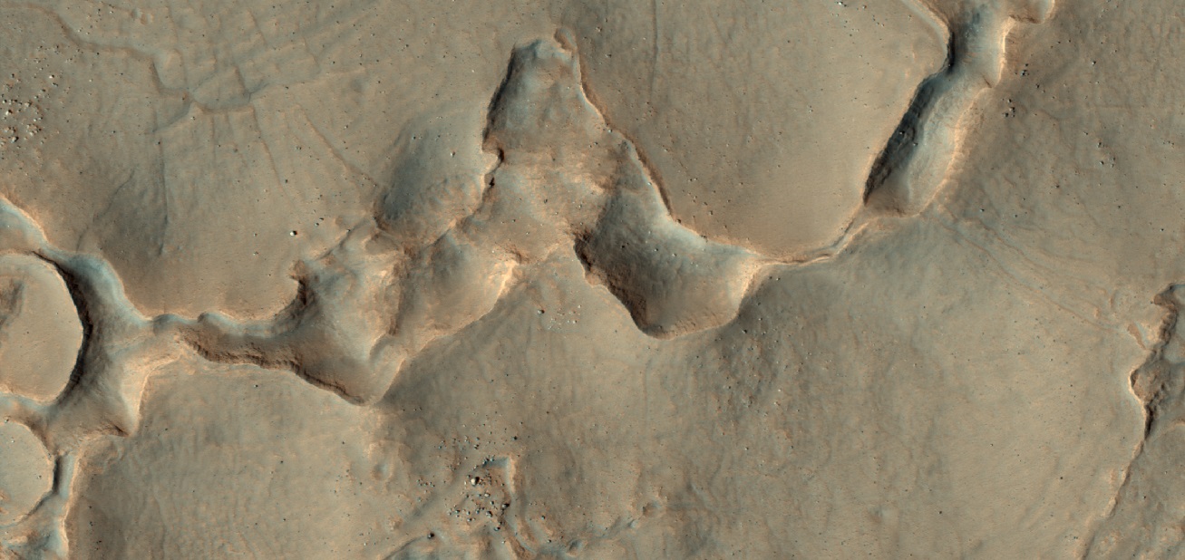
| 11:11, 22 June 2018 | ESP 055104 1385pyramid.jpg (file) |  |
336 KB | Suitupandshowup | Remains of mantle layers after erosion and shaping by winds, as seen by HiRISE under HiWish program Source: http://hirise.lpl.arizona.edu/ESP_055104_1385 Image credit: NASA/JPL/University of Arizona | 1 |
| 11:07, 22 June 2018 | ESP 054934 2160pyramid.jpg (file) |  |
280 KB | Suitupandshowup | Layered structure in crater, as seen by HiRISE under HiWish program This may be the remains of mantle layers after erosion and shaping by winds. Source: http://hirise.lpl.arizona.edu/ESP_054934_2160 Image credit: NASA/JPL/University of Arizona/Secosky | 1 |
| 11:03, 22 June 2018 | ESP 054896 2240hollowsrelease.jpg (file) |  |
327 KB | Suitupandshowup | Close, color view of hollows and cracks, as seen by HiRISE under HiWish program Source: http://hirise.lpl.arizona.edu/ESP_054896_2240 Image Credit: NASA/JPL/University of Arizona | 1 |
| 10:56, 22 June 2018 | 54896 2240hollow.jpg (file) |  |
244 KB | Suitupandshowup | Close, color view of hollows, as seen by HiRISE under HiWish program Source: http://hirise.lpl.arizon.edu/ESP_54896_2240hollow.jpg Image credit: NASA/JPL/University of Arizona/Secosky | 1 |
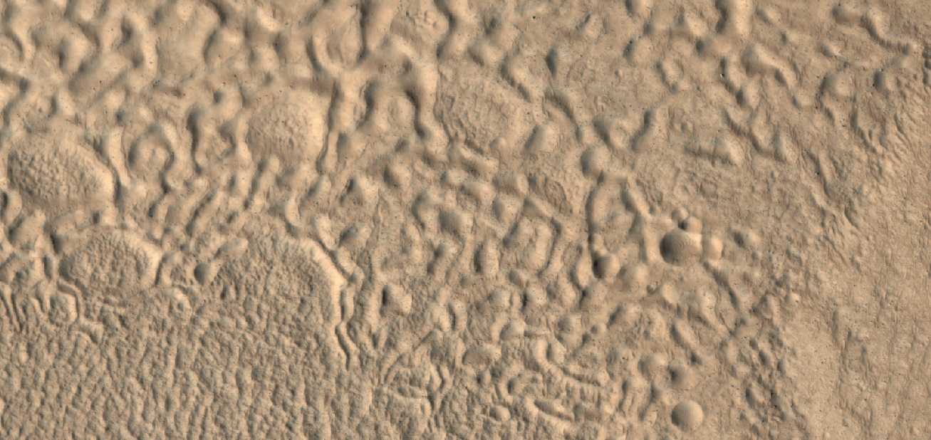
| 10:49, 22 June 2018 | 55027 2250hollows.jpg (file) |  |
339 KB | Suitupandshowup | Color view of open and closed brain terrain and hollows, as seen by HiRISE under HiWish program Source: http://hirise.lpl.arizona.edu/ESP_55027_2250 Image credit: NASA/JPL/University of Arizona/Secosky | 1 |
| 10:45, 22 June 2018 | 54996 2155brains.jpg (file) |  |
347 KB | Suitupandshowup | Close, color view of brain terrain, as seen by HiRISE under HiWish program Source: http://hirise.lpl.arizona.edu/ESP_54996_2155 Image credit: NASA/JPL/University of Arizona/Secosky | 1 |
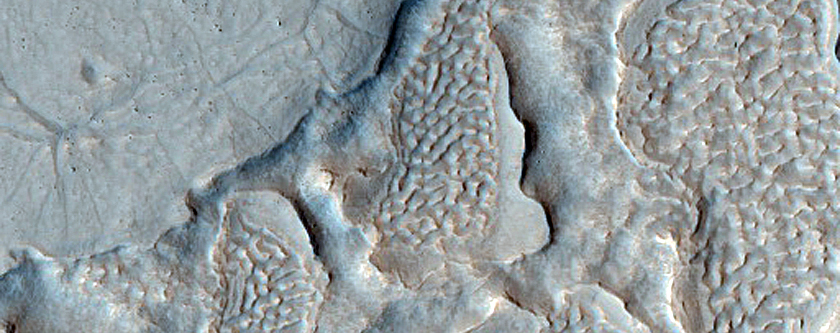
| 10:38, 22 June 2018 | 54526 2220brainscracks.jpg (file) |  |
288 KB | Suitupandshowup | Brain terrain, as seen by HiRISE under HiWish program Cracks are also visible. Brain terrain starts as cracks. With enhanced sublimation along cracks, the cracks grow wider. Source: http://hirise.lpl.arizona.edu/ESP_54526_2220 Image credit: NAS... | 1 |
| 10:21, 22 June 2018 | 55198 2170mantleclose.jpg (file) |  |
244 KB | Suitupandshowup | Close view of mantle, as seen by HiRISE under HiWish program Image source: http://hirise.lpl.arizona.edu/ESP_055198_2170 Image credit: NASA/JPL/Arizona/Secosky | 1 |
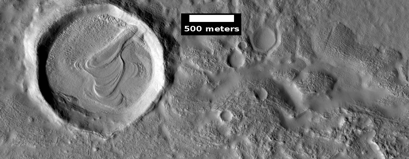
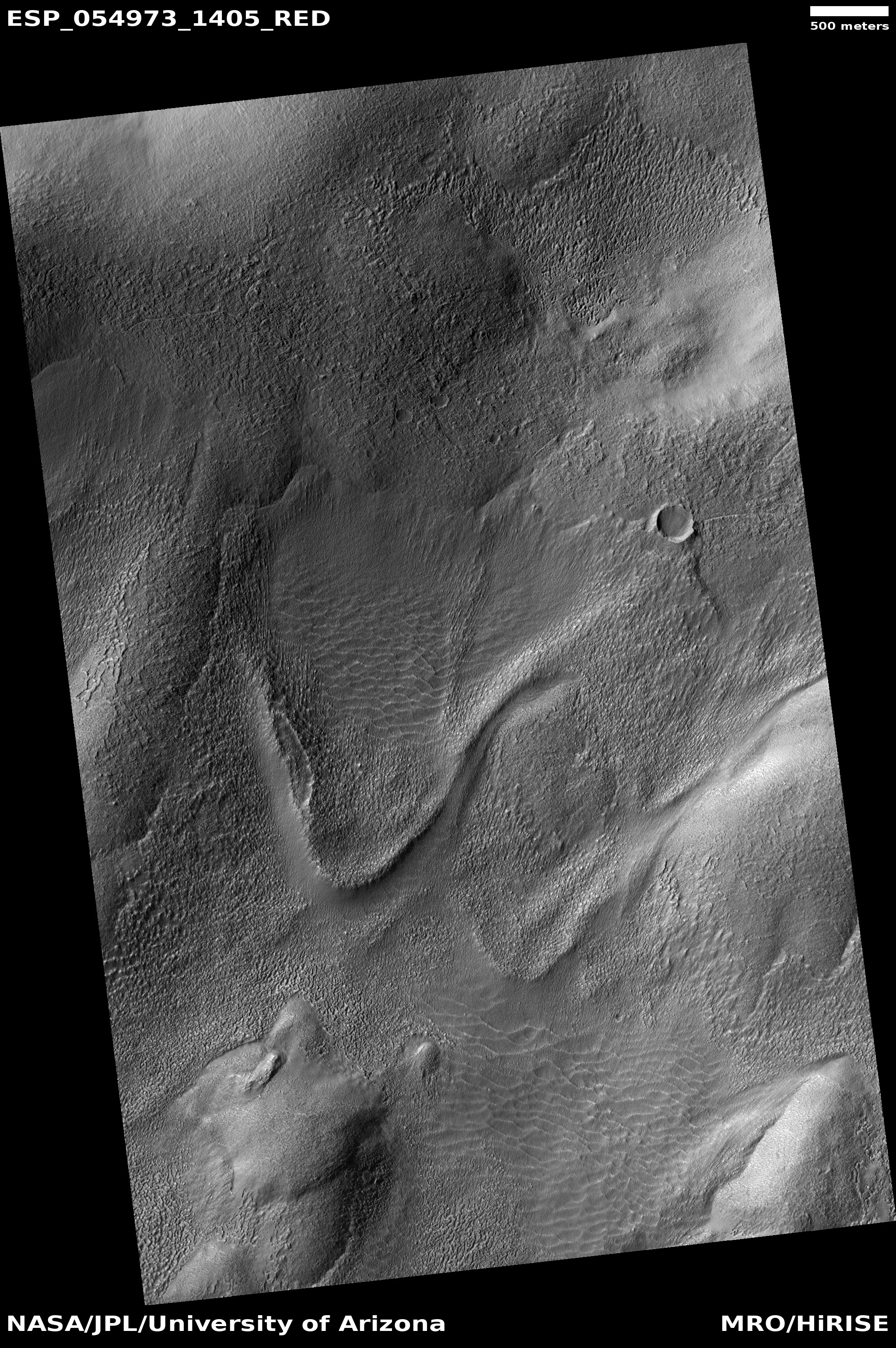
| 10:15, 22 June 2018 | ESP 054973 1405tongue.jpg (file) |  |
2.34 MB | Suitupandshowup | Old glacier, as seen by HiRISE under HiWish program Nearly all the ice has left this glacier. Source: http://hirise.lpl.arizona.edu/ESP_054973_1405 Image credit: NASA/JPL/University of Arizona | 1 |
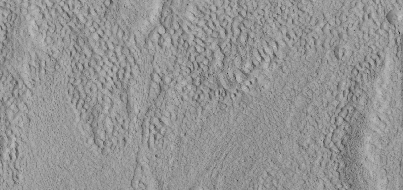
| 10:07, 22 June 2018 | 54996 2155mantle.jpg (file) |  |
171 KB | Suitupandshowup | Latitude dependent mantle, as seen by HiRISE under HiWish program Source: http://hirise.lpl.arizona.edu/54996_2155 Image credit: NASA/JPL/University of Arizona/Secosky | 1 |
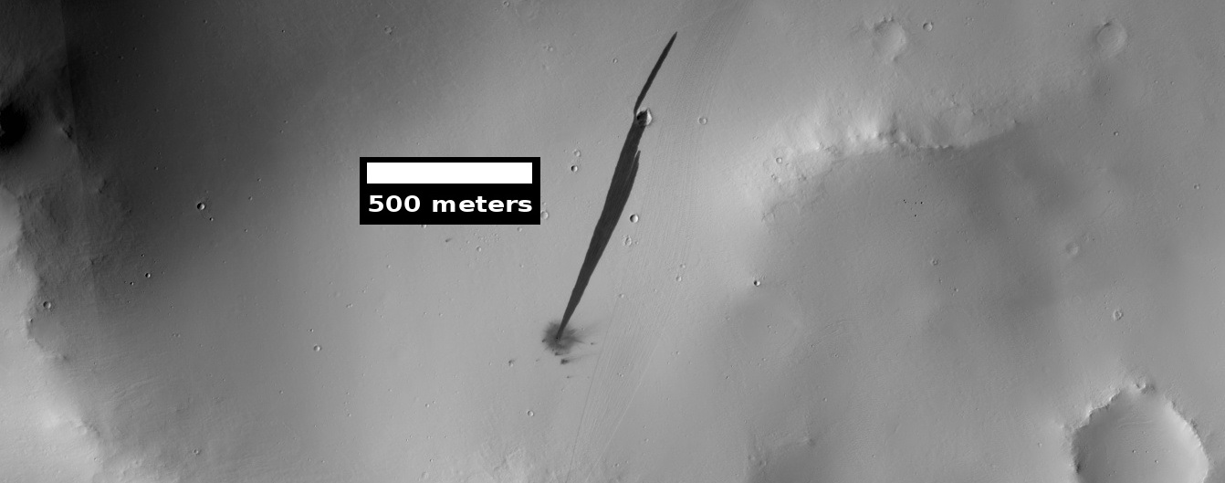
| 07:24, 12 June 2018 | ESP 054066 1920newstreak.jpg (file) |  |
131 KB | Suitupandshowup | This HiRISE image captures a new, dated (within about a decade) impact crater that triggered a slope streak. When the meteoroid hit the surface and exploded to make the crater, it also destabilized the slope and initiated this avalanche. The crater it... | 1 |
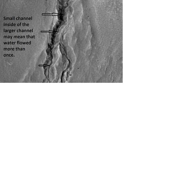
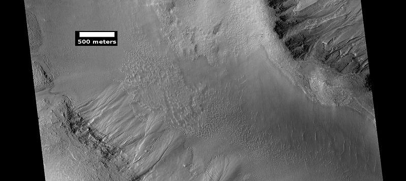
| 14:24, 1 June 2018 | Multiple channels in 21461.jpg (file) |  |
26 KB | Suitupandshowup | Enlargement of ESP_021461_1345, as seen by hirise, showing channel within larger channel. Image located 45.4 S and 248.3 E. Source: http://www.uahirise.org/ESP_021461_1345 Image credit: NASA/JPL/University of Arizona | 1 |
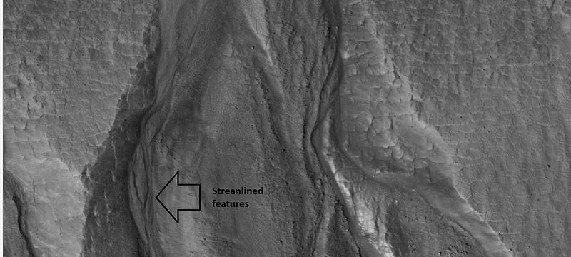
| 14:19, 1 June 2018 | 26420gulliesclose.jpg (file) |  |
52 KB | Suitupandshowup | Close-up of gullies, as seen by hirise under HiWish program. Location is 55.8 N and 208.1 E. Arrow points to streamlined features. Source: http://hirise.lpl.arizona.edu/ESP_026420_2360 Image credit: NASA/JPL/University of Arizona/Secosky | 1 |
| 14:06, 1 June 2018 | ESP 051770 1345dunegullies.jpg (file) |  |
59 KB | Suitupandshowup | Gullies on dunes, as seen by HiRISE Source: http://hirise.lpl.arizona.edu/ESP_051770_1345 Image credit: NASA/JPL/University of Arizona/Secosky | 1 |
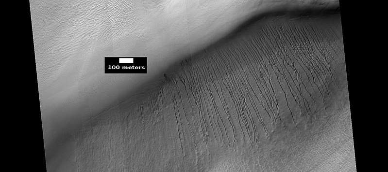
| 11:28, 1 June 2018 | 45752 1410gullies.jpg (file) |  |
126 KB | Suitupandshowup | Gullies, as seen by HiRISE under HiWish program The location is the Phaethontis quadrangle at 38.908 S and 212.491 E (ESP_045752_1410). Image credit is NASA/JPL/University of Arizona. Source: http://hirise.lpl.arizona.edu/ESP_045752_1410 | 1 |
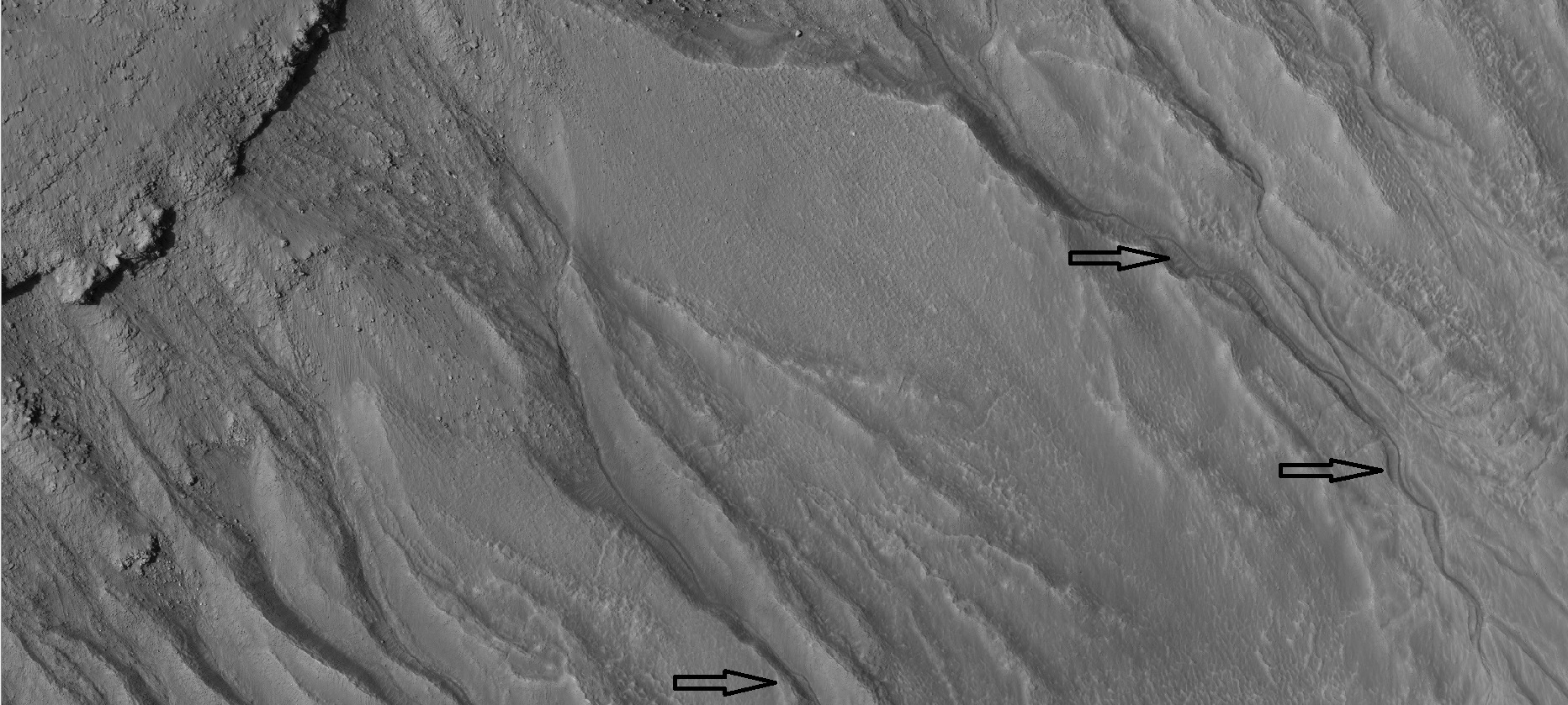
| 11:19, 1 June 2018 | ESP 039621 1315gullies2levels.jpg (file) |  |
46 KB | Suitupandshowup | Gullies in 2 levels in a crater, as seen by hirise under HiWish program Gullies at two levels suggest they were not made with an aquifer, as was first suggested. Location is Phaethontis quadrangle. Source: http://hirise.lpl.arizona.edu/ESP_0396... | 1 |
| 08:26, 1 June 2018 | Gully on mound.JPG (file) |  |
19 KB | Suitupandshowup | Gully on a mound, as seen by MGS, under the Public Target program. Location is 166.9 W and 40 S. Source: http://www.msss.com (S05-00188) Image credit: NASA/MSSS/Secosky | 1 |
| 08:23, 1 June 2018 | Wide view of gully on hill.jpg (file) |  |
23 KB | Suitupandshowup | Wide, context view of gully on a hill Source: http://viewer.mars.asu.edu/planetview/inst/ctx/P06_003227_1345_XN_45S167W#start Image credit: NASA/MSSS | 1 |
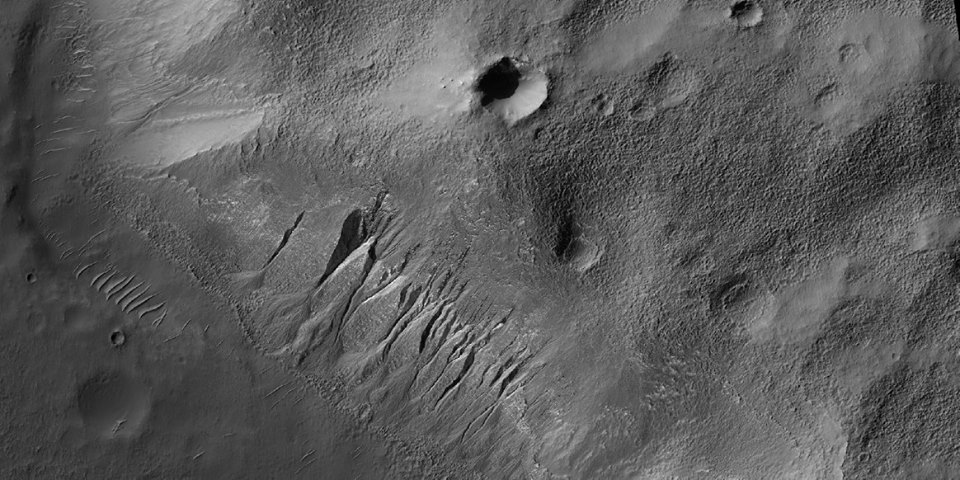
| 08:19, 1 June 2018 | ESP 039793 1385channeldetails.jpg (file) |  |
617 KB | Suitupandshowup | Gullies in crater with arrows showing channels within larger valleys, as seen by hirise under HiWish program Source: http://hirise.lpl.arizona.edu/ESP_039793_1385 Image credit: NASA/JPL/University of Arizona/Secosky | 1 |
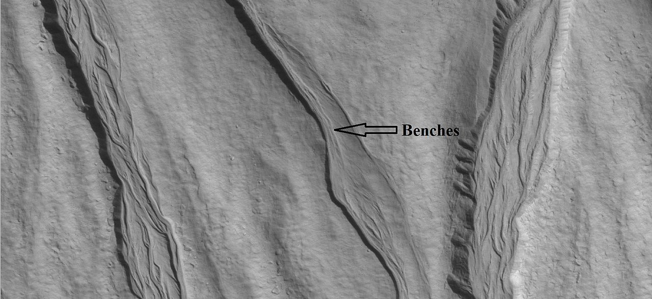
| 08:14, 1 June 2018 | ESP 037506 2285gullychannelsclose.jpg (file) |  |
131 KB | Suitupandshowup | Gully channel up close as seen by hirise under HiWish program Arrow points to benches in valley, so the level of water changed over time. Source: http://hirise.lpl.arizona.edu/ESP_037506_2285 Image credit: NASA/JPL/University of Arizona/Secosky | 1 |
| 08:08, 1 June 2018 | 46386 1420gullies.jpg (file) |  |
74 KB | Suitupandshowup | Gullies, as seen by HiRISE under HiWish program The location is Phaethontis quadrangle at 37.608 S and 182.221 E (ESP_046386_1420). Source: http://hirise.lpl.arizona.edu/ESP_046386_1420 Image credit is NASA/JPL/University of Arizona. | 1 |
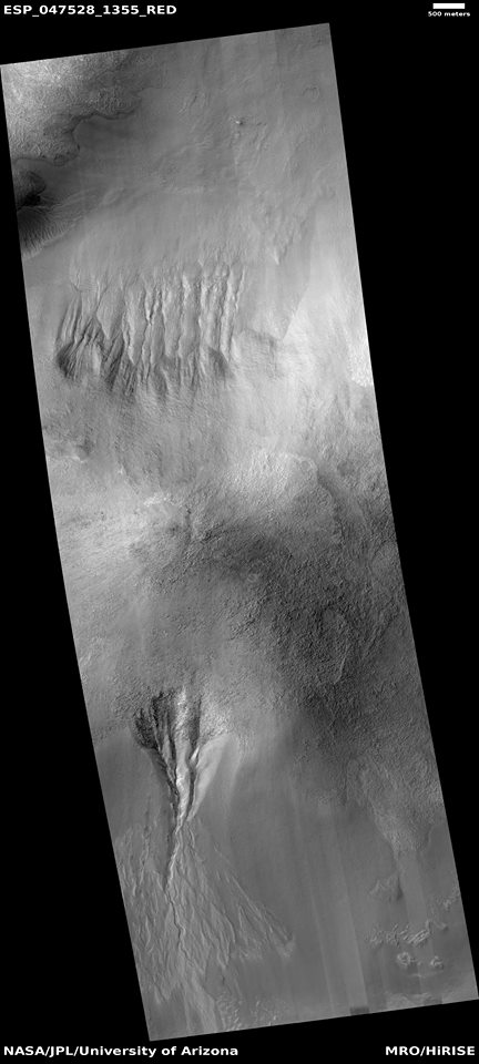
| 08:00, 1 June 2018 | 47528 1355gulliesmound.jpg (file) |  |
59 KB | Suitupandshowup | Gullies on 2 sides of a mound, as seen by HiRISE under HiWish program The location is Nereidum Montes in the Argyre quadrangle at 44.178 S and 326.195 E (ESP_047528_1355). Source: http://hirise.lpl.arizona.edu/ESP_047528_1355 Image credit is NASA/... | 1 |
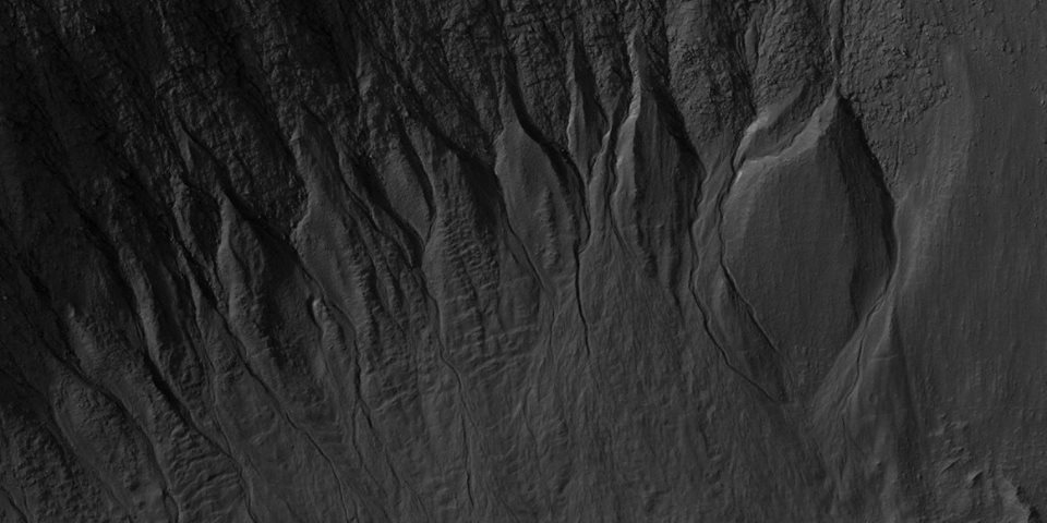
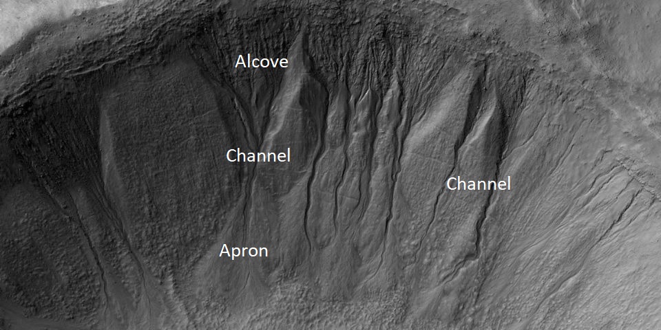
| 07:41, 1 June 2018 | 50858 1435gullies.jpg (file) |  |
153 KB | Suitupandshowup | Gullies with alcove, channels, and apron labeled, as seen by HiRISE under HiWish program The location is 36.353 S and 125.289 E (ESP_050858_1435). Source: http://hirise.lpl.arizona.edu/ESP_050858_1435 Image credit is NASA/JPL/University of Arizona. | 1 |
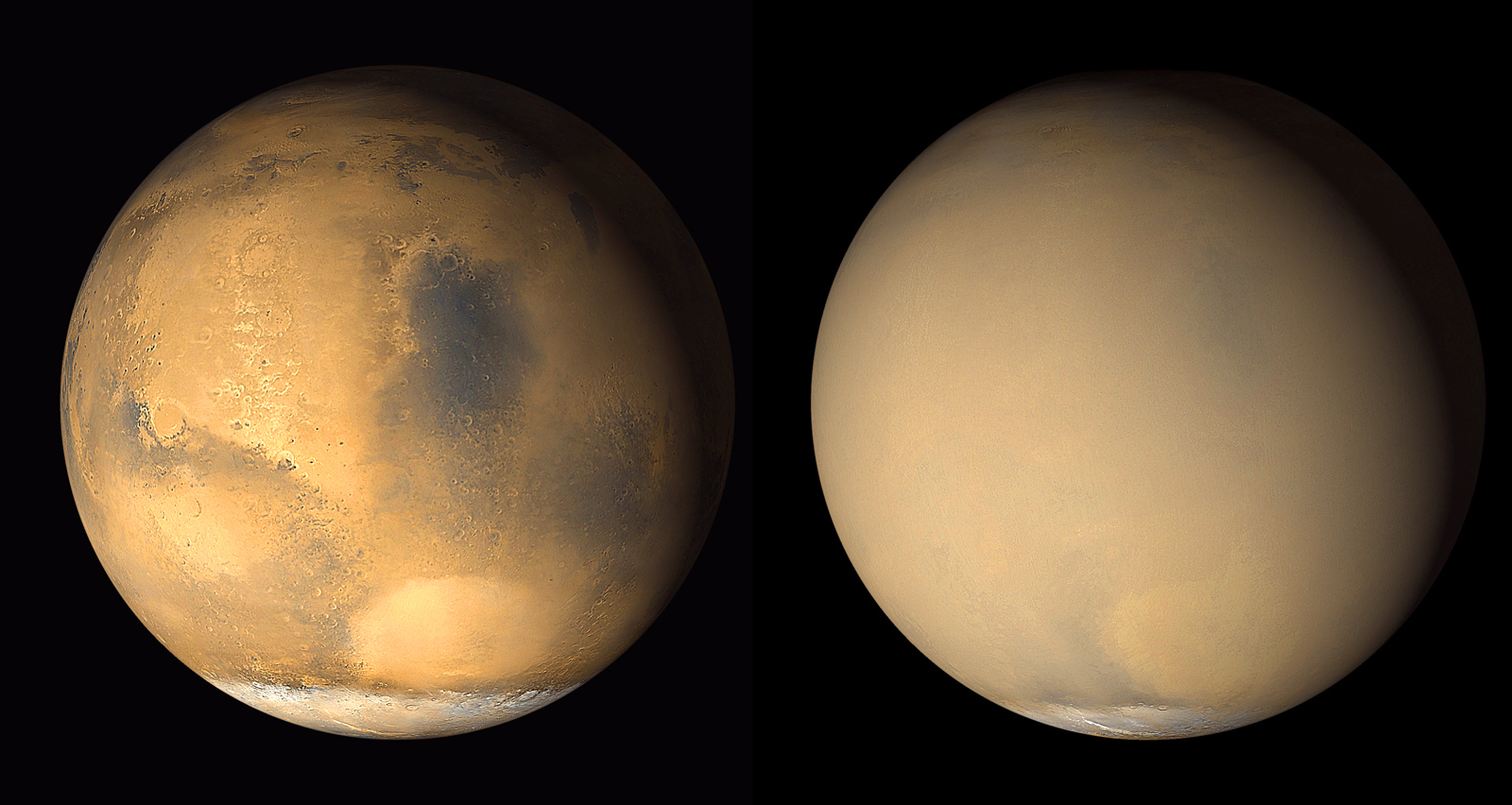
| 10:34, 29 May 2018 | PIA03170 fig1duststroms.jpg (file) |  |
959 KB | Suitupandshowup | Mars without a dust storm on June 2001 (on left) and with a dust storm on July 2001 (on right), as seen by Mars Global Surveyor. Source: https://photojournal.jpl.nasa.gov/figures/PIA03170_fig1.jpg Image credit: NASA/JPL/MSSS | 1 |
| 17:11, 28 May 2018 | WikidanielsonPSP 002522 1880devil.jpg (file) |  |
50 KB | Suitupandshowup | Dust devil tracks and layers in Danielson Crater in the Arabia quadrangle, as seen by HiRISE under HiWish program Source: http://hirise.lpl.arizona.edu/PSP_002522_1880 Image Credit: NASA/JPL/University of Arizona/Secosky | 1 |
| 17:09, 28 May 2018 | ESP 036631 2335devilsbottom.jpg (file) |  |
60 KB | Suitupandshowup | Dust devil tracks, as seen by hirise under HiWish program Location is Casius quadrangle. Source: http://hirise.lpl.arizona.edu/ESP_036631_2335 Image credit: NASA?JPL/University of Arizona/Secosky | 1 |
| 17:06, 28 May 2018 | Russel Crater Dust Devil Changes.jpg (file) |  |
43 KB | Suitupandshowup | Russel Crater Dust Devil Changes, as seen by hirise. Location is 54.3 degrees south latitude and 13 degrees east longitude. Image was taken by the Mars Reconnaissance Orbiter's HiRISE. The HiRISE camera was built by Ball Aerospace and Technology Corpor... | 1 |
| 16:58, 28 May 2018 | Martian Dust Devil Trails.jpg (file) |  |
147 KB | Suitupandshowup | This portion of a recent high-resolution picture from the HiRISE camera on board the Mars Reconnaissance Orbiter shows twisting dark trails criss-crossing light coloured terrain on the Martian surface. Newly formed trails like these had presented resea... | 1 |
| 16:54, 28 May 2018 | Dust.devil.mars.arp.750pix.jpg (file) |  |
76 KB | Suitupandshowup | A dust devil on Mars, photographed by Mars Global Surveyor. The long dark streak is formed by a moving swirling column of Martian atmosphere. The dust devil itself (the black spot) is climbing the crater wall. The streaks on the right are sand dunes on... | 1 |
| 05:44, 25 May 2018 | 53630 2195brainslvf.jpg (file) |  |
241 KB | Suitupandshowup | Brain terrain The wide ridges probably still contain a core of ice. The location is the Ismenius Lacus quadrangle at 39.374 N and 34.883 E (ESP_053630_2195). Image credit is NASA/JPL/University of Arizona. | 1 |


