File list
This special page shows all uploaded files.
| Date | Name | Thumbnail | Size | User | Description | Versions |
|---|---|---|---|---|---|---|
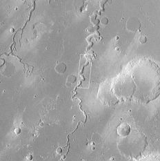
| 07:57, 11 April 2018 | Nanedivalles.gif (file) |  |
47 KB | Suitupandshowup | Viking 1 orbiter image of Nanedi Vallis The box shows location of an enlargement. Source: http://www.msss.com/mars_images/moc/2_2_98_release/8704/index.html Image Credit: NASA/MSSS | 1 |
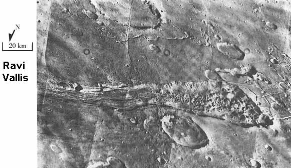
| 07:41, 11 April 2018 | Ravi Vallis.jpg (file) |  |
60 KB | Suitupandshowup | Ravi Vallis, as seen by Viking 1. Location is 1 S and 43 W. Source: http://history.nasa.gov/SP-441/ch4.htm Image credit: NASA | 1 |
| 08:40, 10 April 2018 | Marspedia Dark Logo 2018.png (file) | 85 KB | Jburk | Dark version of Marspedia logo. Original logo by Paul Conrad. This variant created by James Burk. | 1 | |
| 12:44, 9 April 2018 | Marspedia Logo 2018 Trans.png (file) | 11 KB | Jburk | The new Marspedia Project logo by Paul Conrad (2018). Approved by the Marspedia Governing Council on 3/30/2018. | 1 | |
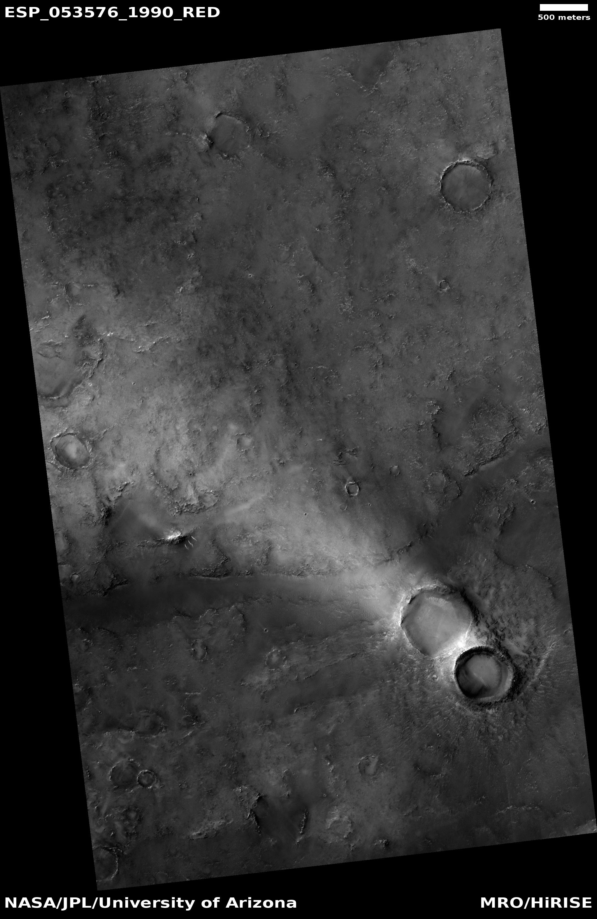
| 07:15, 4 April 2018 | ESP 053576 1990lightstreak.jpg (file) |  |
1.44 MB | Suitupandshowup | Crater with light streak, as seen by HiRISE under HiWish program Source: http://hirise.lpl.arizona.edu/ESP_053576_1990 Image credit: NASA/JPL/University of Arizona | 1 |
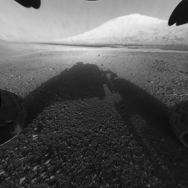
| 11:15, 3 April 2018 | 673885main PIA15986-full full.jpg (file) |  |
58 KB | Suitupandshowup | This image taken by NASA's Curiosity shows what lies ahead for the rover -- its main science target, Mount Sharp. The rover's shadow can be seen in the foreground, and the dark bands beyond are dunes. Rising up in the distance is the highest peak Mount... | 1 |
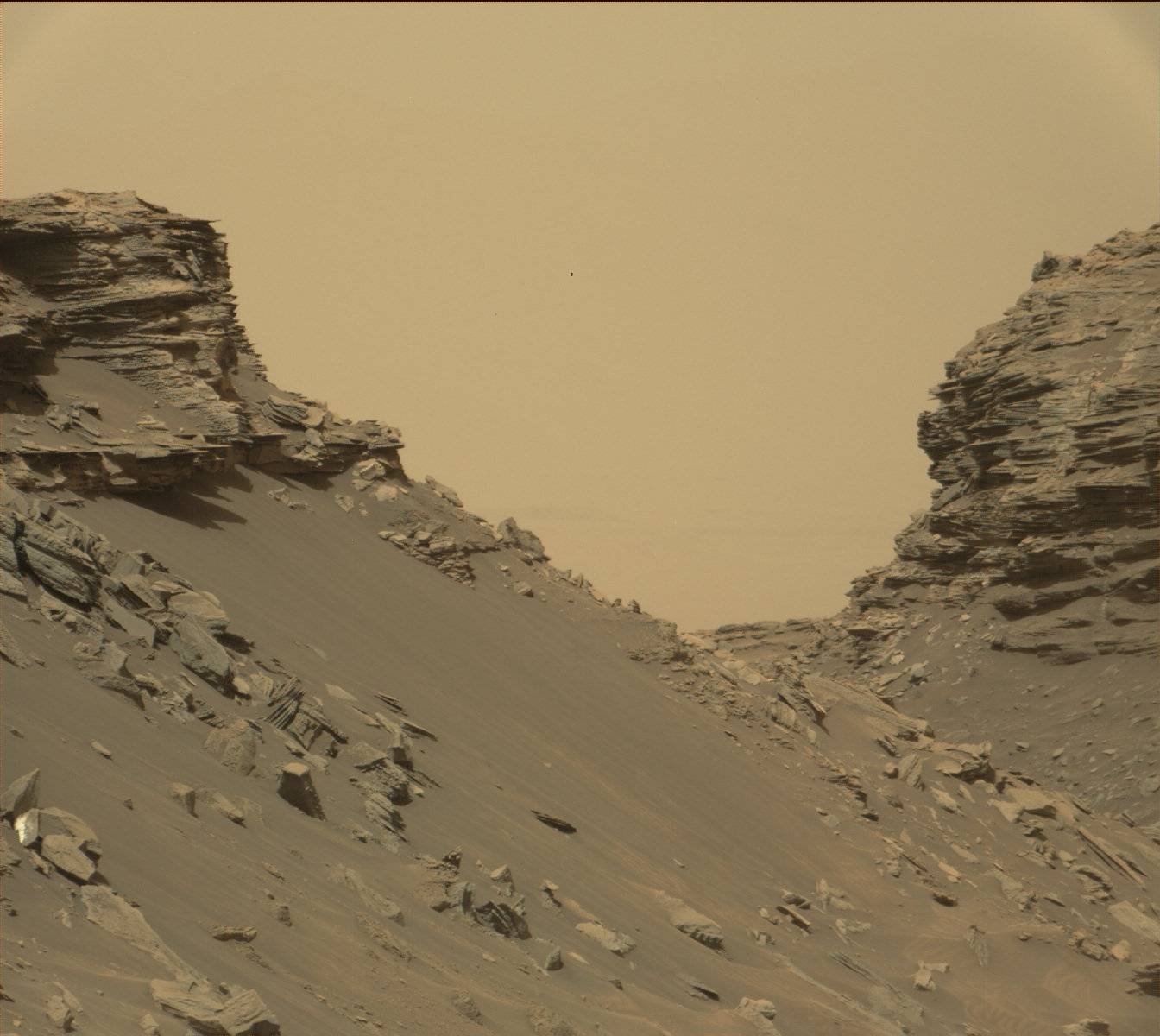
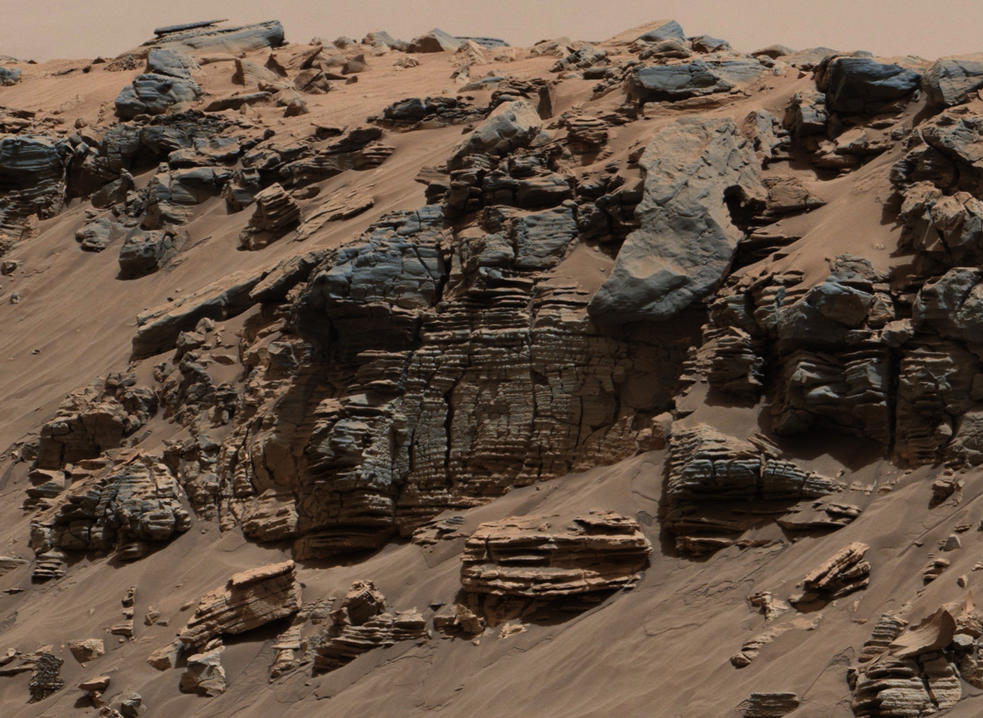
| 11:10, 3 April 2018 | Mars-curiosity-rover-msl-rock-layers-PIA21042-full2.jpg (file) |  |
135 KB | Suitupandshowup | Rock layers, as seen by Curiosity Rover View from Mastcam on Curiosity showing sloping buttes and layered outcrops on lower Mount Sharp Source: https://mars.nasa.gov/resources/farewell-to-murray-buttes-image-2/ Image credit: NASA/JPL-Caltech/MSSS | 1 |
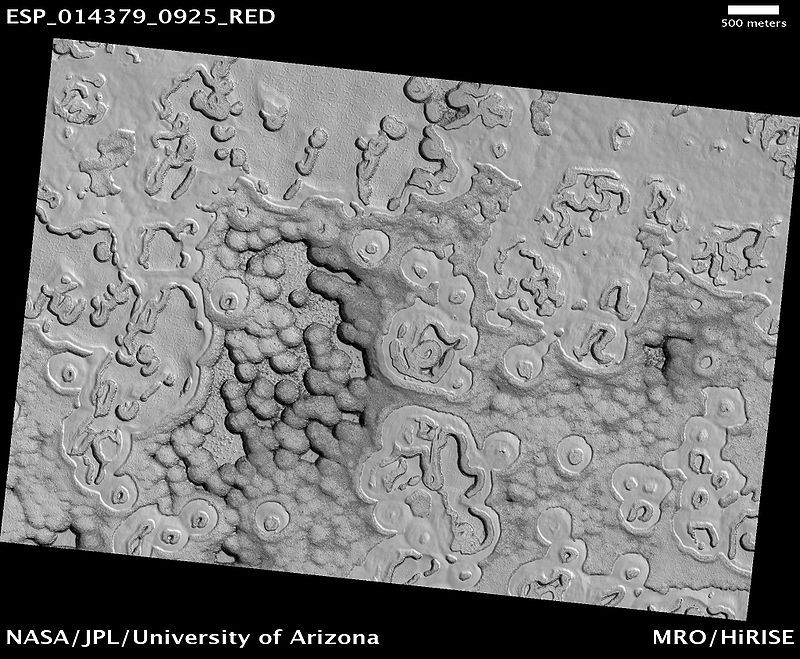
| 10:51, 3 April 2018 | South Pole Terrain.jpg (file) |  |
135 KB | Suitupandshowup | South Pole Terrain, as seen by hirise. Location is 87.6 S and 1.4 E. Terrain is called Swiss cheese terrain Source: http://hirise.lpl.arizona.edu/ESP_014379_0925 Image credit: NASA/JPL/University of Arizona | 1 |
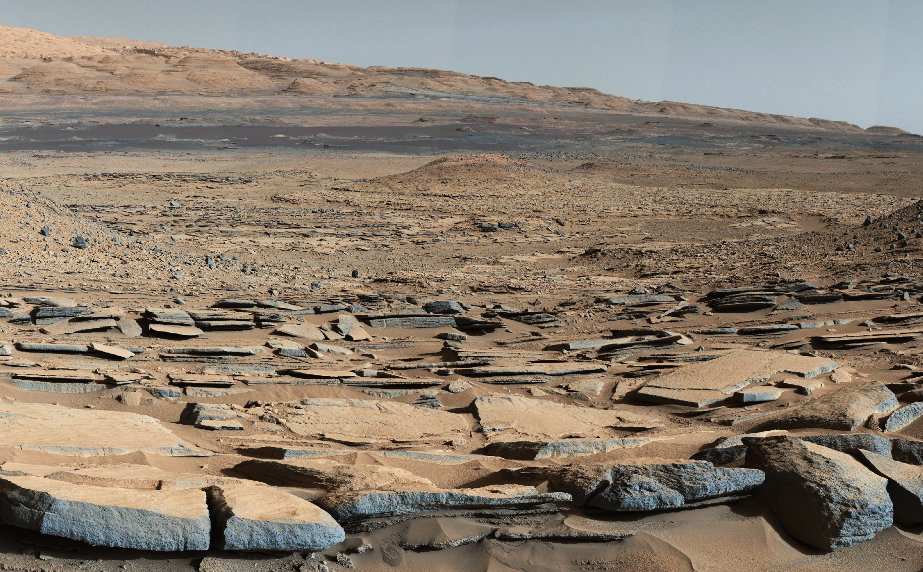
| 08:04, 3 April 2018 | 7505 mars-curiosity-rover-gale-crater-beauty-shot-pia19839-full2.jpg (file) |  |
3.32 MB | Suitupandshowup | A view from the "Kimberley" formation on Mars taken by NASA's Curiosity rover. The strata in the foreground dip towards the base of Mount Sharp, indicating flow of water toward a basin that existed before the larger bulk of the mountain formed. The col... | 1 |
| 08:02, 3 April 2018 | 6866 mars-curiosity-rover-mastcam-sedimentary-deposit-lakebed-rocks-pia19074-full2.jpg (file) |  |
161 KB | Suitupandshowup | This evenly layered rock photographed by the Mast Camera (Mastcam) on NASA's Curiosity Mars Rover shows a pattern typical of a lake-floor sedimentary deposit not far from where flowing water entered a lake. The scene combines multiple frames taken with... | 1 |
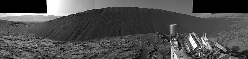
| 07:59, 3 April 2018 | 7623 mars-slip-face-downwind-sand-dune-namib-sol1196-pia20281-full2.jpg (file) | 326 KB | Suitupandshowup | Slip Face on Downwind Side of 'Namib' Sand Dune on Mars, as seen by Curiosity Dune stands about 13 feet (4 meters) high. Picture taken with Navcam. Source: https://mars.nasa.gov/resources/7623/ Image credit: NASA/JPL-Caltech | 1 | |
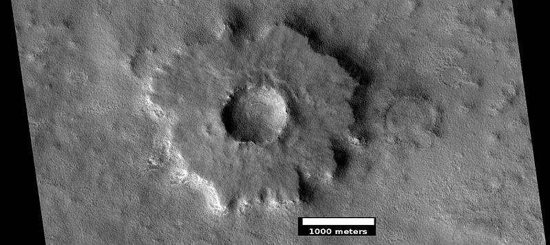
| 07:45, 3 April 2018 | ESP 037528 2350pedestal.jpg (file) |  |
64 KB | Suitupandshowup | Pedestal crater, as seen by hirise under HiWish program Source: http://hirise.lpl.arizona.edu/ESP_037528_2350 Image credit: NASA/JPL/University of Arizona/Secosky | 1 |
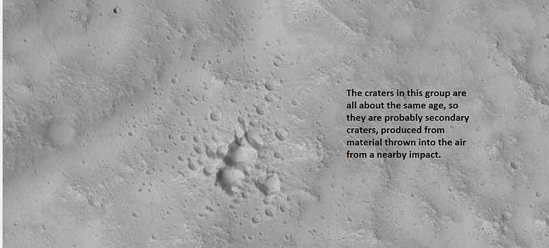
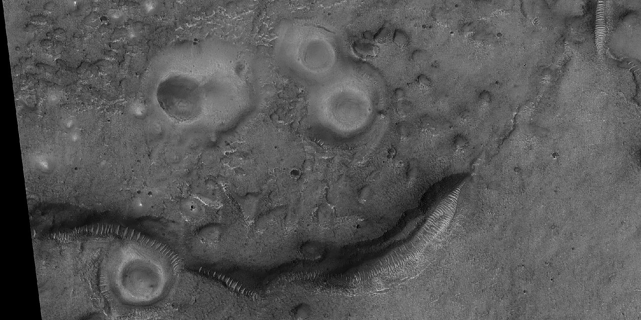
| 09:05, 2 April 2018 | 26079secondaries.jpg (file) |  |
49 KB | Suitupandshowup | Example of a group of secondary craters, as seen by hirise under HiWish program. Location is 30.1 N and 162.6 E. Source=http://hirise.lpl.arizona.edu/ESP_026079_2105 Image credit: NASA/JPL/University of Arizona | 1 |
| 08:55, 2 April 2018 | ESP 049660 1200polygonsclosecolor.jpg (file) |  |
327 KB | Suitupandshowup | Close, color view of polygons, as seen by HiRISE under HiWish program Source: https://www.uahirise.org/ESP_049660_1200 Image credit: NASA/JPL/University of Arizona | 1 |
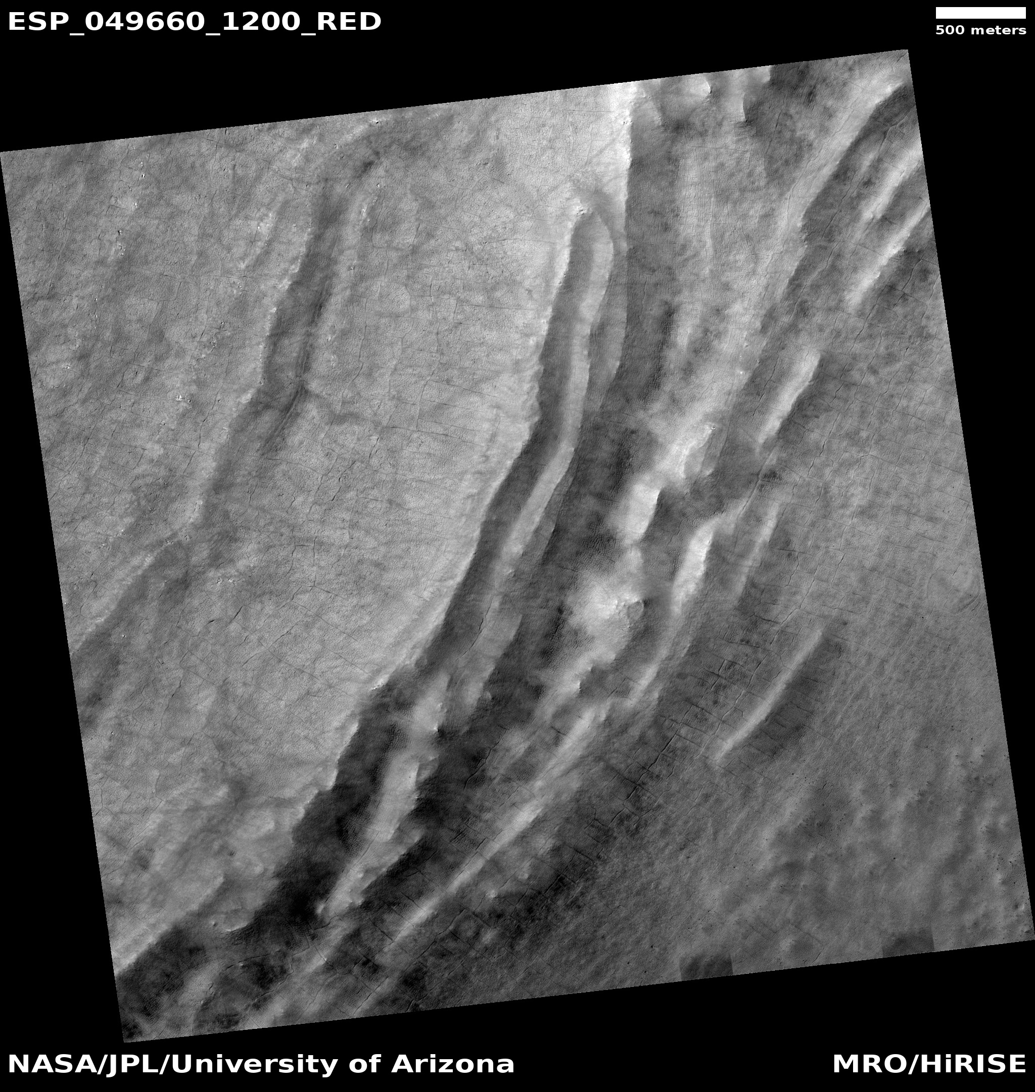
| 08:51, 2 April 2018 | ESP 049660 1200polygonswide.jpg (file) |  |
1.45 MB | Suitupandshowup | Wide view of large and small polygons, as seen by HiRISE under HiWish program Source: https://www.uahirise.org/ESP_049660_1200 Image credit: NASA/JPL/University of Arizona | 1 |
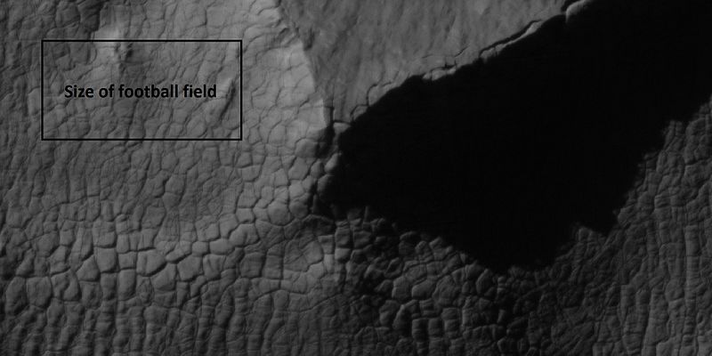
| 08:37, 2 April 2018 | 45070 1440polygonscloseshadows.jpg (file) |  |
43 KB | Suitupandshowup | High center polygons, as seen by hirise under HiWish program Box indicates size of football field. Source: http://hirise.lpl.arizona.edu/ESP_045070_1440 Image credit: NASA/JPL/ University of Arizona | 1 |
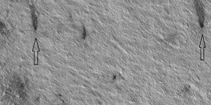
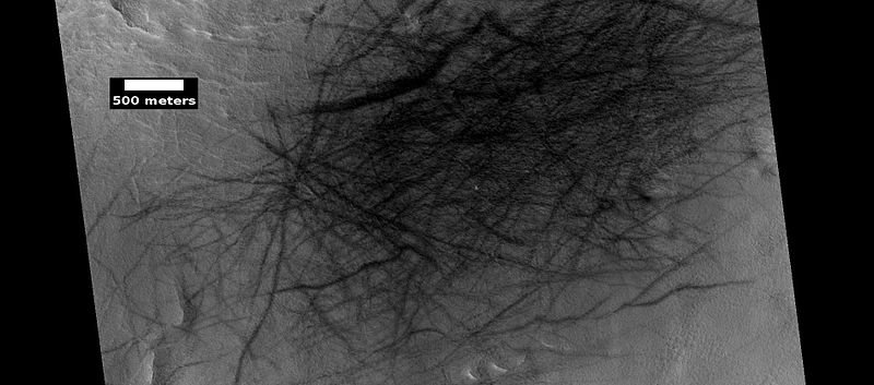
| 08:30, 2 April 2018 | 47609 0985spiders.jpg (file) |  |
75 KB | Suitupandshowup | Spiders and plumes, as seen by HiRISE under HiWish program Source: http:hirise.lpl.arizona.edu/ESP_047609_0985 Image credit: NASA/JPL/University of Arizona/Secosky | 1 |
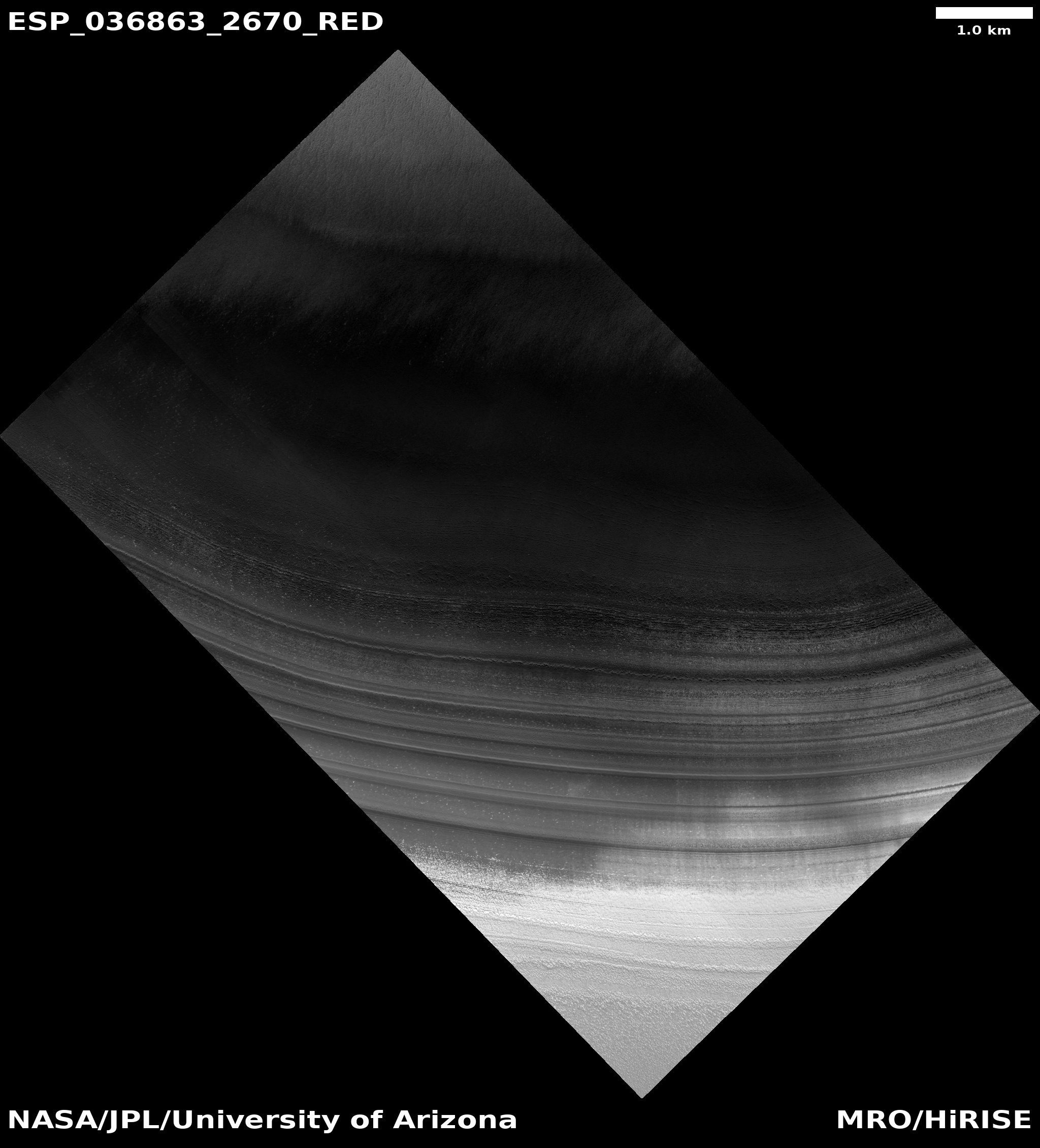
| 08:14, 2 April 2018 | ESP 036863 2670icecaplayers.jpg (file) |  |
724 KB | Suitupandshowup | Ice layers in Mare Boreum quadrangle, as seen by HiRISE Source: https://www.uahirise.org/ESP_036863_2670 Image credit: NASA/JPL/University of Arizona | 1 |
| 08:08, 2 April 2018 | ESP 044934 2670icecaplayers.jpg (file) |  |
32 KB | Suitupandshowup | Wide view of layers in north ice cap, as seen by hirise under HiWish program Source : http://hirise.lpl.arizona.edu/ESP_044934_2670 Image credit: NASA/JPL/University of Arizona | 1 |
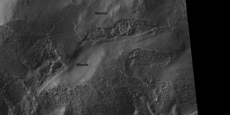
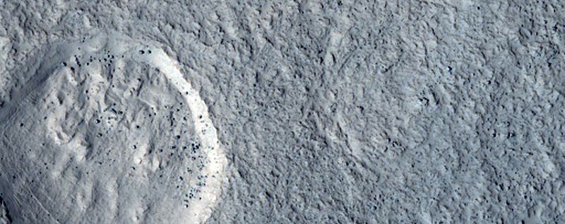
| 07:54, 2 April 2018 | 46294 1395mantle.jpg (file) |  |
47 KB | Suitupandshowup | Mantle in Eridania quadrangle, as seen by hirise under HiWish program Source: http://hirise.lpl.arizona.edu/ESP_046294_1395 Image credit: NASA/JPL/Jim Secosky | 1 |
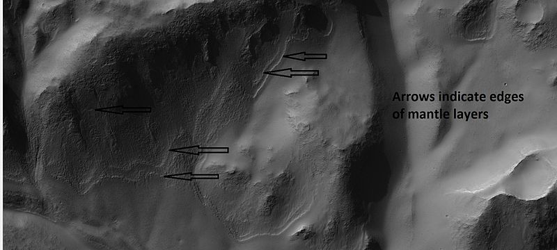
| 07:47, 2 April 2018 | 2509mantlelayers.jpg (file) |  |
46 KB | Suitupandshowup | Layers in mantle, as seen by hirise under HiWish program. Location is 33.6 S and 169.7 E. Source: http://hirise.lpl.arizona.edu/ESP_025090_1460 Image credit: NASA/JPL/University of Arizona | 1 |
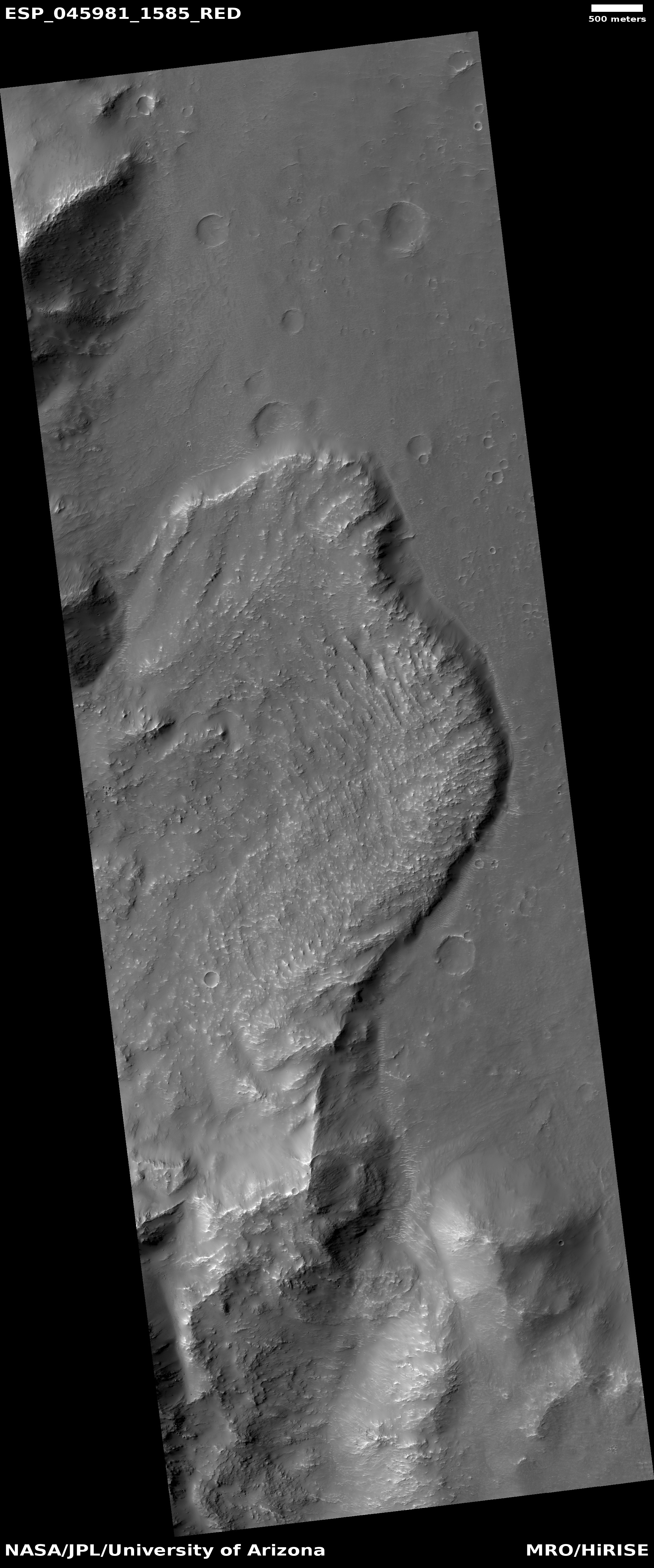
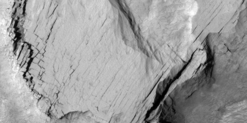
| 06:50, 2 April 2018 | ESP 045981 1585landslide.jpg (file) |  |
1.74 MB | Suitupandshowup | Landslide, as seen by HiRISE under HIWish program Source: http://hirise.lpl.arizona.edu/ESP_045981_1585 Image credit: NASA/JPL/University of Arizona | 1 |
| 06:43, 2 April 2018 | ESP 043963 1550landslide.jpg (file) |  |
1.97 MB | Suitupandshowup | Landslide, as seen by HiRISE under HiWish program Source: http://hirise.lpl.arizona.edu/ESP_043963_1550 Image credit: NASA/JPL/University of Arizona | 1 |
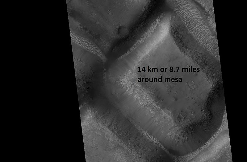
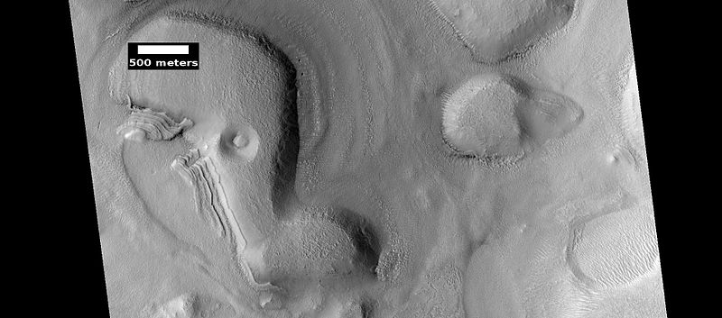
| 11:03, 1 April 2018 | 46050 1775race.jpg (file) |  |
44 KB | Suitupandshowup | Mesa with a perimeter of 8.7 miles, as seen by hirise under HiWish program Source: http://hirise.lpl.arizona.edu/ESP_46050_1775 Image credit: NASA/JPL/University of Arizona/Secosky | 1 |
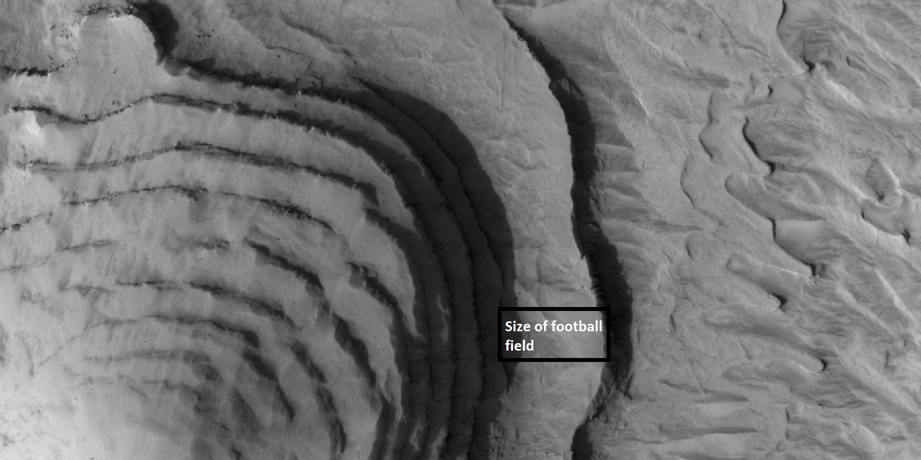
| 10:58, 1 April 2018 | 47421 1890bigbutte.jpg (file) |  |
388 KB | Suitupandshowup | layers in mesa, as seen by HiRISE under HiWish program Box shows size of football field. Source: http://hirise.lpl.arizona.edu/47421_1890 | 1 |
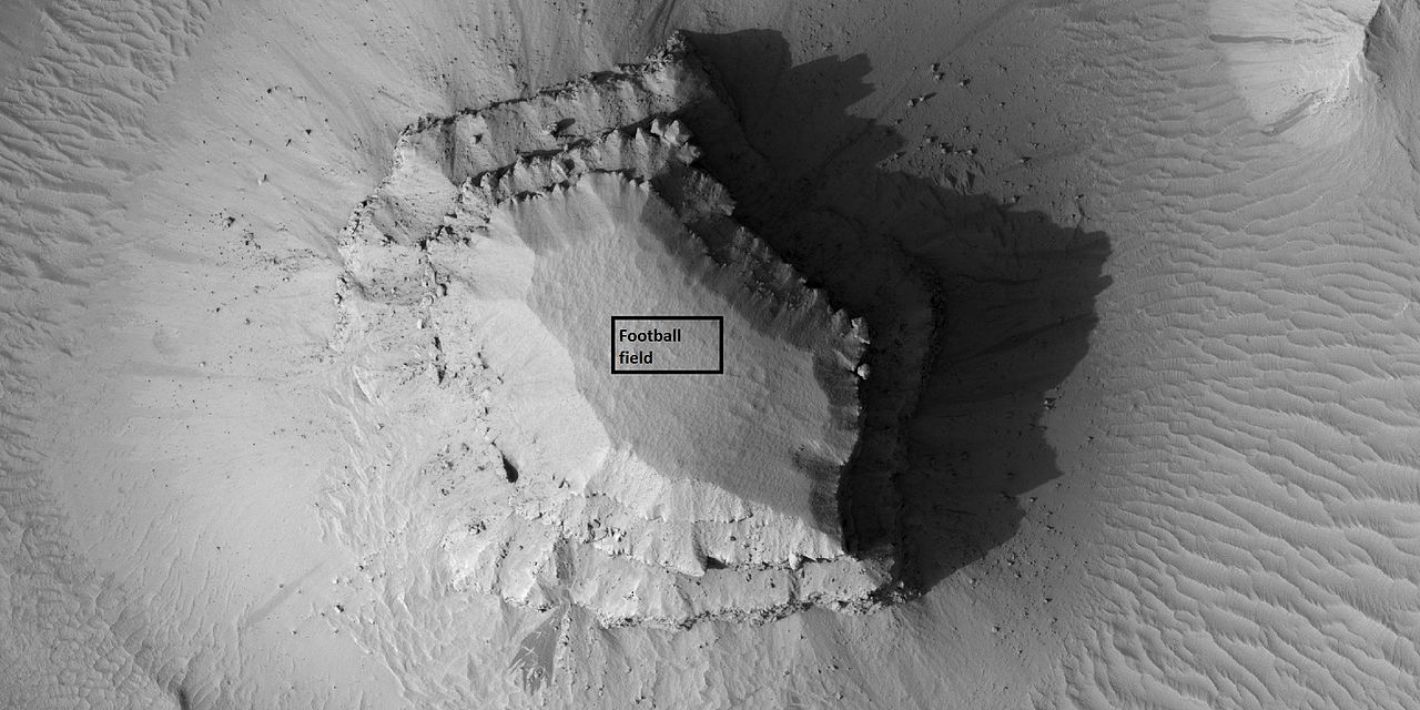
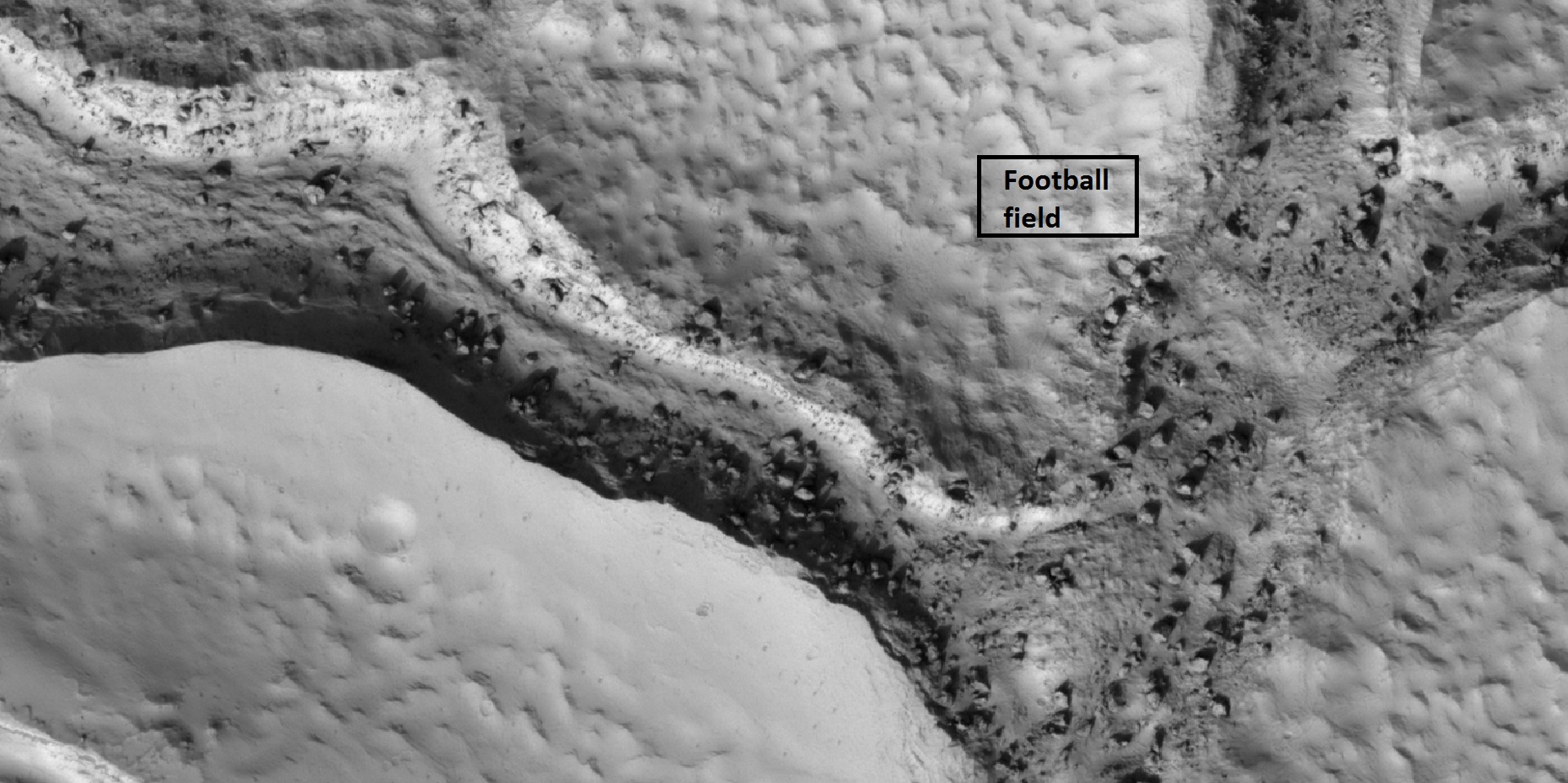
| 10:54, 1 April 2018 | 47441 1800mesaclose.jpg (file) |  |
152 KB | Suitupandshowup | Mesa, as seen by HiRISE under HiWish program Box shows the size of a football field. Source: https://commons.wikimedia.org/wiki/File:47441_1800mesaclose.jpg Image credit: NASA/JPL/University of Arizona | 1 |
| 10:36, 1 April 2018 | ESP 026042 1470hollows.jpg (file) |  |
294 KB | Suitupandshowup | Hollows, as seen by HiRISE under HiWish program Source: https://www.uahirise.org/ESP_026042_1470 Image credit: NASA/JPL/University of Arizona | 1 |
| 10:26, 1 April 2018 | ESP 043688 2245closecolor.jpg (file) |  |
340 KB | Suitupandshowup | Close view of hollows, as seen by HiRISE under HiWish program Source: https://www.uahirise.org/ESP_043688_2245 Image credit: NASA/JPL/University of Arizona/Secosky | 1 |
| 10:23, 1 April 2018 | ESP 043688 2245hollows.jpg (file) |  |
236 KB | Suitupandshowup | Hollows, as seen by HiRISE under HiWish program Source: https://www.uahirise.org/ESP_043688_2245 Image credit: NASA/JPL/University of Arizona/Secosky | 1 |
| 16:54, 31 March 2018 | 45575 2535dunebouldertracks.jpg (file) |  |
36 KB | Suitupandshowup | close view of dunes showing boulders with arrows, as seen by hirise under HiWish program Source: http://hirise.lpl.arizona.edu/ESP_045575_2535 Image credit: NASA/JPL/University of Arizona | 1 |
| 16:49, 31 March 2018 | ESP 045415 2220boulders.jpg (file) |  |
70 KB | Suitupandshowup | Color view of boulders, as seen by hirise under HiWish program Source: http://hirise.lpl.arizona.edu/ESP_045415_2220 Image credit: NASA/JPL/University of Arizona | 1 |
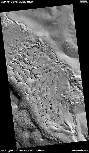
| 16:44, 31 March 2018 | 48878 2095fracturesboulders.jpg (file) |  |
493 KB | Suitupandshowup | Fractures and boulders in Elysium quadrangle as seen by HiRISE under the HiWish program Box shows size of football field. Source: http://hirise.lpl.arizona.edu/ESP_048878_2095 Image credit: NASA/JPL/University of Arizona/Secosky | 1 |
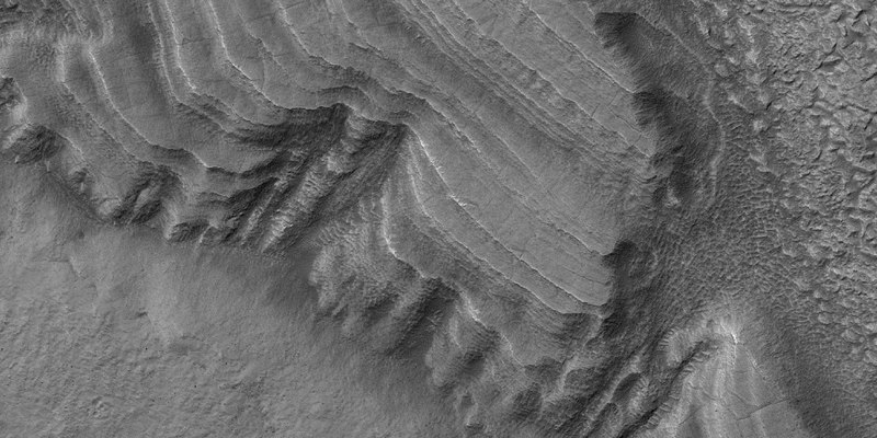
| 16:28, 31 March 2018 | ESP 035801 2210pyramidsismenius.jpg (file) |  |
50 KB | Suitupandshowup | Layered features in Ismenius Lacus, as seen by hirise under HiWish program Source: http://hirise.lpl.arizona.edu/ESP_035801_2210 Image courtesy NASA/JPL/University of Arizona | 1 |
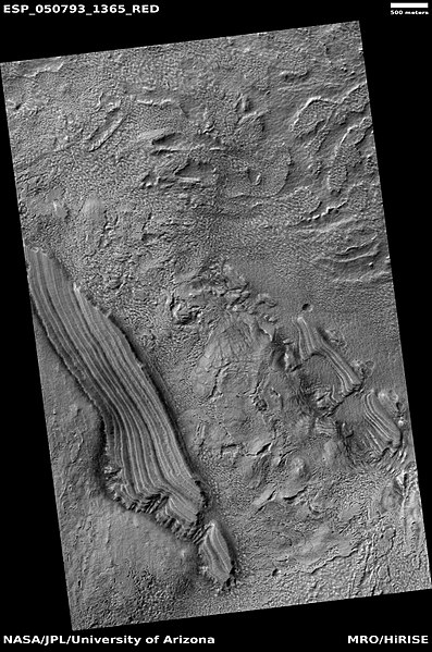
| 16:22, 31 March 2018 | 50793 1365layers2.jpg (file) |  |
91 KB | Suitupandshowup | Close view of layered features in Hellas quadrangle as seen by HiRISE under HiWish program Layers may reflect changes in climate. Source: http://hirise.lpl.arizona.edu/ESP_050793_1365 Image credit: NASA/JPL/University of Arizona/Secosky | 1 |
| 16:16, 31 March 2018 | ESP 050793 1365pyramids.jpg (file) |  |
88 KB | Suitupandshowup | Layered features in Hellas quadrangle as seen by HiRISE under HiWish program Source: http://hirise.lpl.arizona.edu/ESP_050793_1365 Image credit: NASA/JPL/University of Arizona | 1 |
| 16:11, 31 March 2018 | 48878 2095fractures.jpg (file) |  |
126 KB | Suitupandshowup | Close view of fractures in Elysium quadrangle as seen by HiRISE under the HiWish program Source: http://hirise.lpl.arizona.edu/ESP_048878_2095 Image credit: NASA/JPL/University of Arizona/Secosky | 1 |
| 16:03, 31 March 2018 | ESP 048878 2095fractures.jpg (file) |  |
67 KB | Suitupandshowup | Wide view of fractures in Elysium quadrangle as seen by HiRISE under the HiWish program Source: http://hirise.lpl.arizona.edu/ESP_048878_2095 Image credit: NASA/JPL/University of Arizona | 1 |
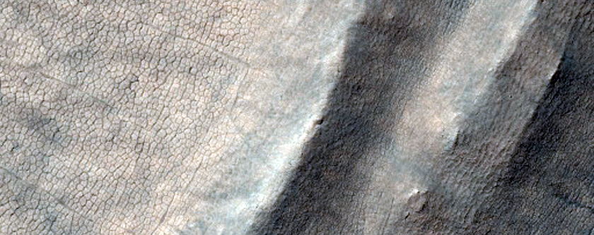
| 15:53, 31 March 2018 | 44757 2185closeleft.jpg (file) |  |
52 KB | Suitupandshowup | Fractured surface enlarged greatly, as seen by hirise under HiWish program, location Ismenius Lacus Source: http://hirise.lpl.arizona.edu/ESP_044757_2185 Image credit: NASA/JPL/ University of Arizona/Secosky | 1 |
| 15:39, 31 March 2018 | 52050 2200mudvolcanoes.jpg (file) |  |
246 KB | Suitupandshowup | Mud volcanoes in Mare Acidalium quadrangle, as seen by HiRISE under HiWish program Source: http://hirise.lpl.arizona.edu/ESP_052050_2200 Image credit: NASA/JPL/University of Arizona/Secosky | 1 |
| 15:34, 31 March 2018 | 45384 2065cones.jpg (file) |  |
71 KB | Suitupandshowup | Rootless cones caused by lava flowing over ice-rich ground in Elysium quadrangle, as seen by hirise under HiWish program Source: http://hirise.lpl.arizona.edu/ESP_045384_2065 Image credit: NASA/JPL/ University of Arizona | 1 |
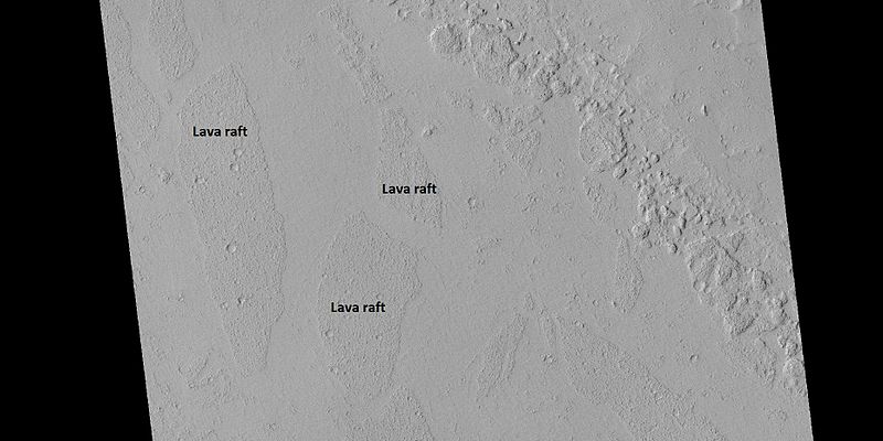
| 15:30, 31 March 2018 | 45133 1970lvarafts.jpg (file) |  |
49 KB | Suitupandshowup | Rafts of lava in Amazonis quadrangle, as seen by hirise under HiWish program Source: http://hirise.lpl.arizona.edu/ESP_045133_1970 Image credit: NASA/JPL/ University of Arizona | 1 |
| 15:26, 31 March 2018 | ESP 044840 1620lavaflow.jpg (file) |  |
43 KB | Suitupandshowup | Lava flows in Phoenicis Lacus quadrangle, as seen by hirise under HiWish program Source: http://hirise.lpl.arizona.edu/ESP_044840_1620 Image credit: NASA/JPL/ University of Arizona | 1 |
| 14:46, 31 March 2018 | Marspedia Logo 2018.png (file) | 16 KB | Jburk | The new Marspedia Project logo by Paul Conrad (2018). Approved by the Marspedia Governing Council on 3/30/2018. | 1 | |
| 14:25, 31 March 2018 | ESP 045435 2055troughlayers.jpg (file) |  |
37 KB | Suitupandshowup | Dark slope streaks in a trough, as seen by HiRISE under HiWish program Layers are also visible in the photo. http://hirise.lpl.arizona.edu/ESP_045435_2055 Image credit: NASA/JPL/University of Arizona/Secosky | 1 |
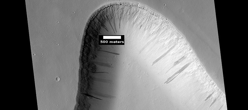
| 13:15, 31 March 2018 | ESP 048078 1160devils.jpg (file) |  |
311 KB | Suitupandshowup | Dust devil tracks in Hellas quadrangle, as seen by HiRISE under HiWish program Source: https://www.uahirise.org/ESP_048078_1160 Image credit: NASA/JPL/University of Arizona/Secosky | 1 |
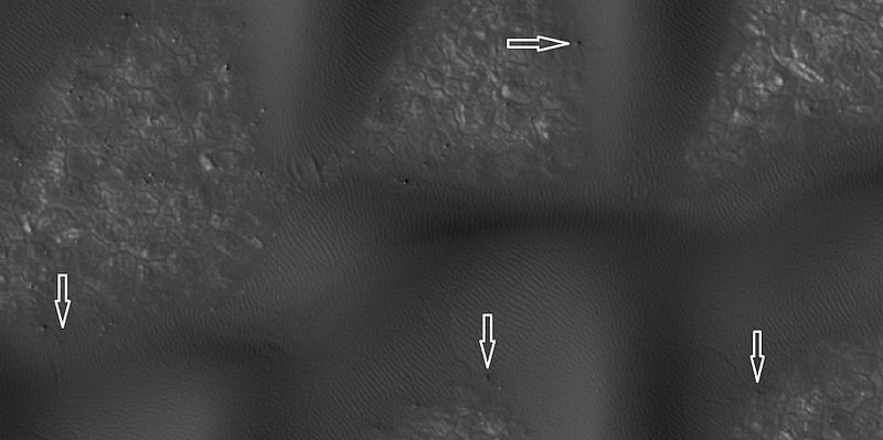
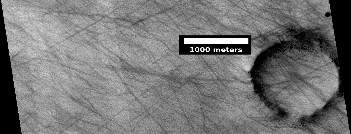
| 13:04, 31 March 2018 | ESP 036297 2370devils.jpg (file) |  |
49 KB | Suitupandshowup | Dust devil tracks, as seen by hirise under HiWish program Source: http://hirise.lpl.arizona.edu/ESP_036297_2370 Image credit: NASA/JPL/University of Arizona | 1 |
| 12:29, 31 March 2018 | ESP 045831 1750yardangscolor.jpg (file) |  |
286 KB | Suitupandshowup | Close, color view of a field of yardangs, as seen by HiRISE under HiWish program Source: https://www.uahirise.org/ESP_045831_1750 Image credit: NASA/JPL/University of Arizona | 1 |
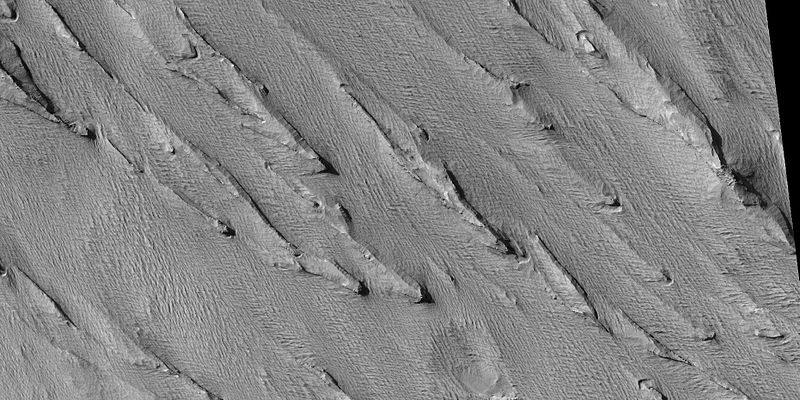
| 12:24, 31 March 2018 | ESP 045831 1750yardangswide.jpg (file) |  |
334 KB | Suitupandshowup | Wide view of field of yardangs, as seen by HiRISE under HiWish program Source: https://www.uahirise.org/ESP_045831_1750 Image credit: NASA/JPL/University of Arizona/Secosky | 1 |
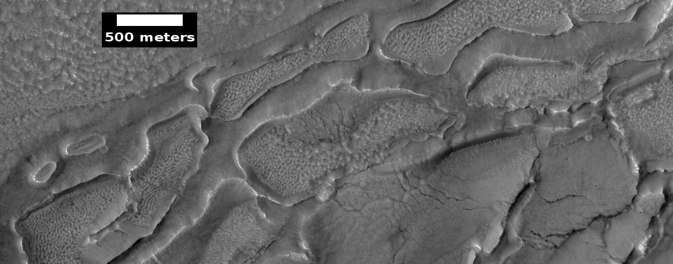
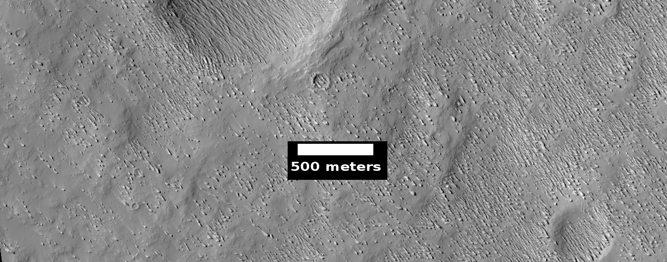
| 09:14, 31 March 2018 | 35558 1830yardangs.jpg (file) |  |
97 KB | Suitupandshowup | Yardangs, as seen by hirise under HiWish program Location is the Amazonis quadrangle. Source: http://hirise.lpl.arizona.edu/ESP_35558_1830 Image credit: NASA/JPL/ University of Arizona | 1 |
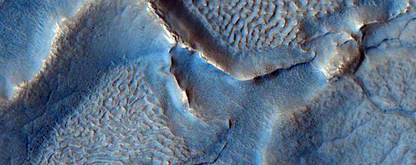
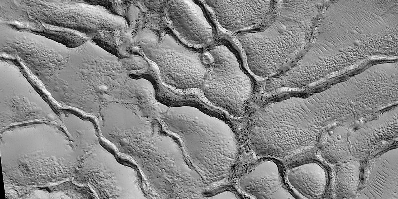
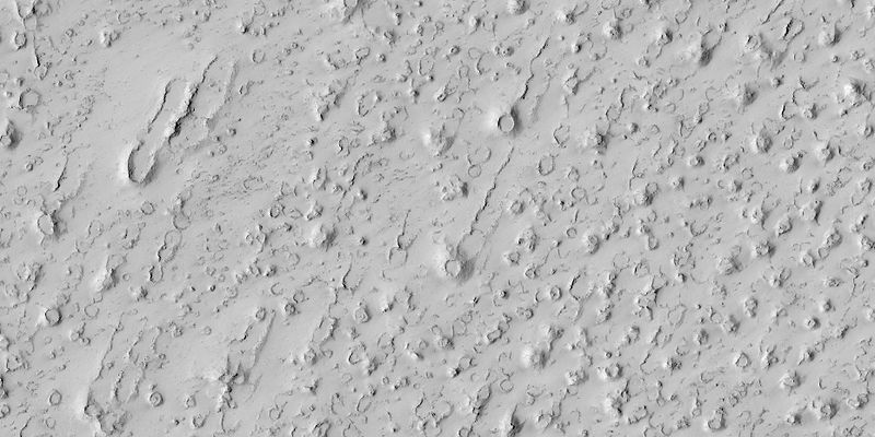
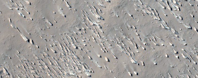
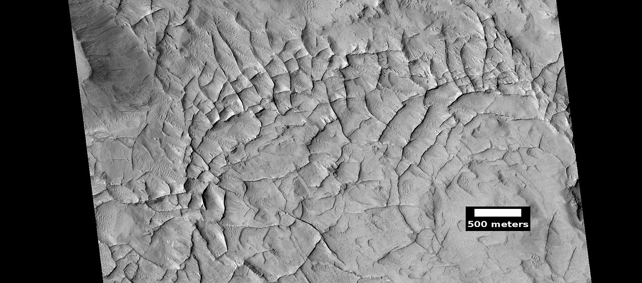
| 08:50, 31 March 2018 | ESP 036745 1905top.jpg (file) |  |
154 KB | Suitupandshowup | Linear ridge networks, as seen by hirise under HiWish program Location is the Amazonis quadrangle. Source: http://hirise.lpl.arizona.edu/ESP_036745_1905 Image credit: NASA/JPL/ University of Arizona | 1 |


