Uploads by Suitupandshowup
This special page shows all uploaded files.
| Date | Name | Thumbnail | Size | Description | Versions |
|---|---|---|---|---|---|
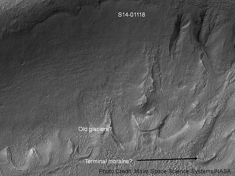
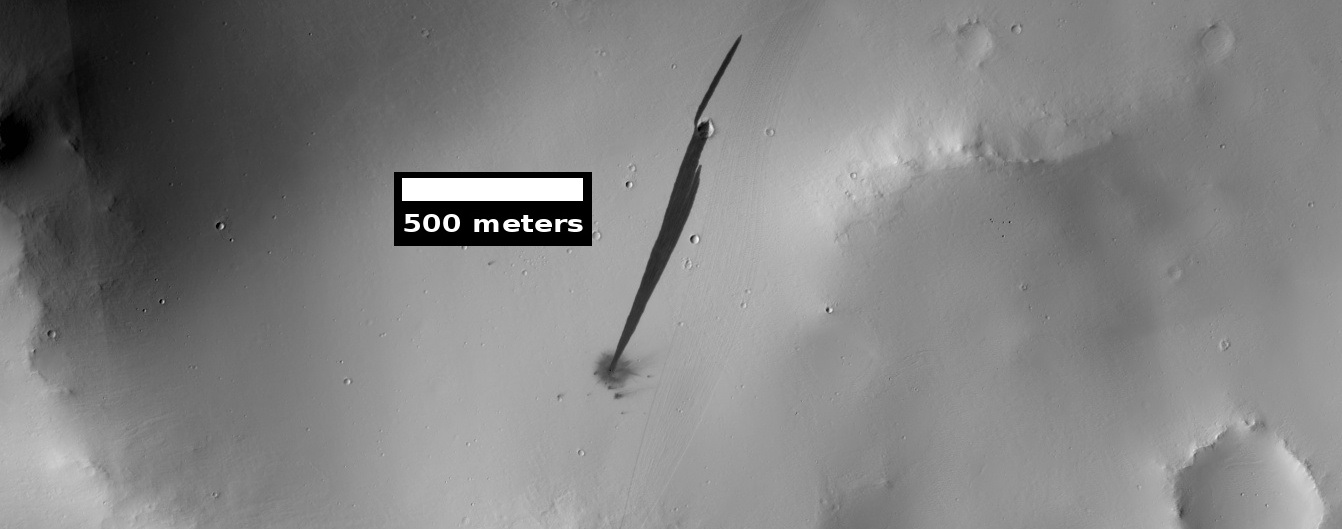
| 16:06, 8 October 2018 | Gullies and tongue-shaped glacier.jpg (file) |  |
117 KB | Gullies and remains of old glaciers This image was taken with the Mars Orbital Camera MOC) on the Mars Global Surveyor MGS). It's id number is S14-01118, and its location is 222.93 degrees west longitude and 37.43 degrees south latitude. The photo c... | 1 |
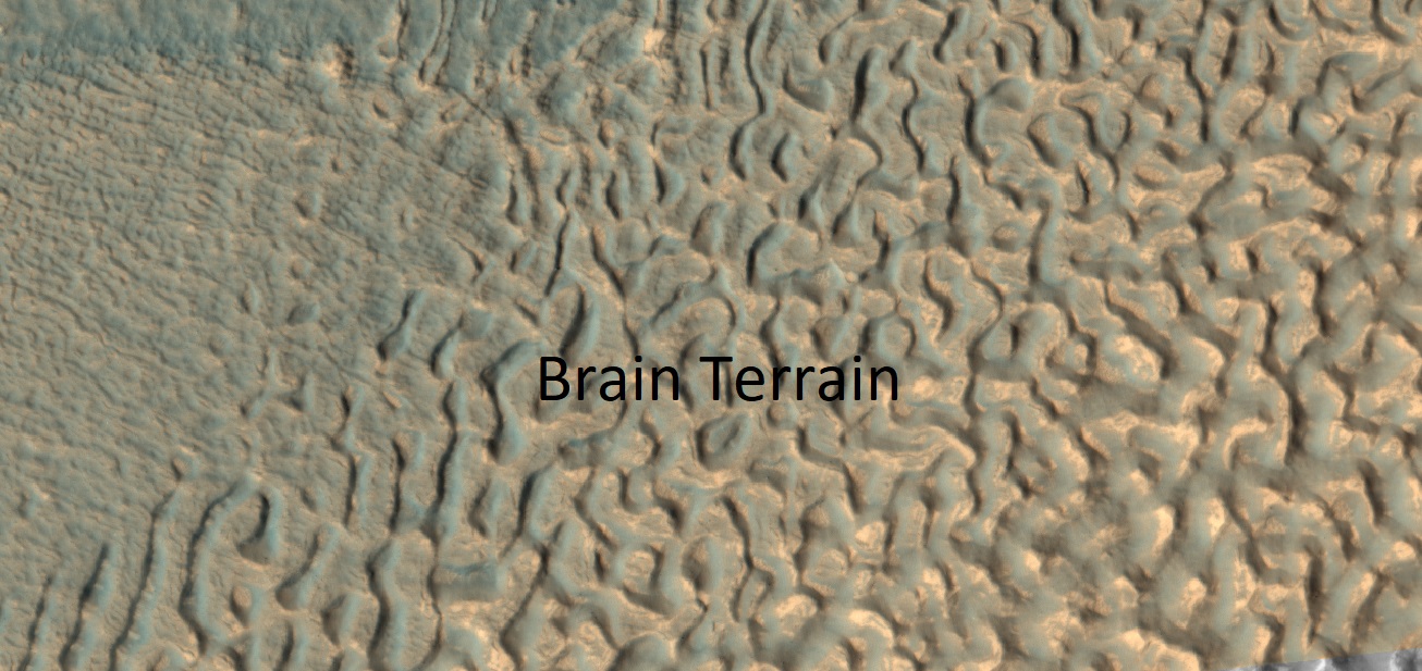
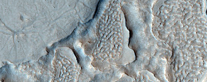
| 15:57, 8 October 2018 | 54527 2225brainsclosecolor.jpg (file) |  |
284 KB | Close, color view of brain terrain Source: https://www.uahirise.org/ESP_054527_2225 Image credit: NASA/JPL/University of Arizona/Secosky | 1 |
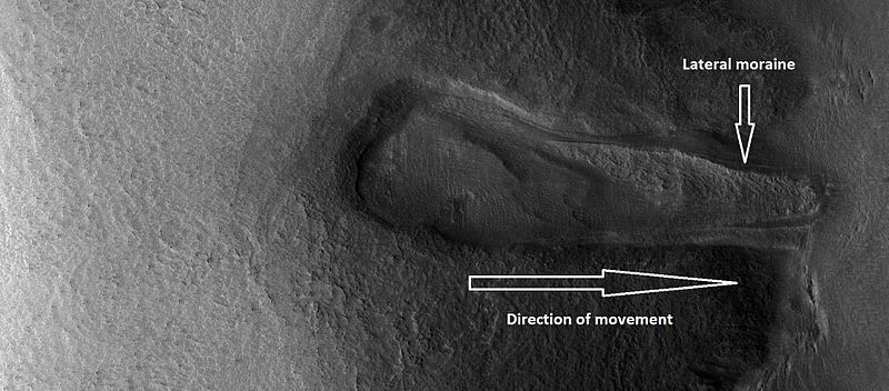
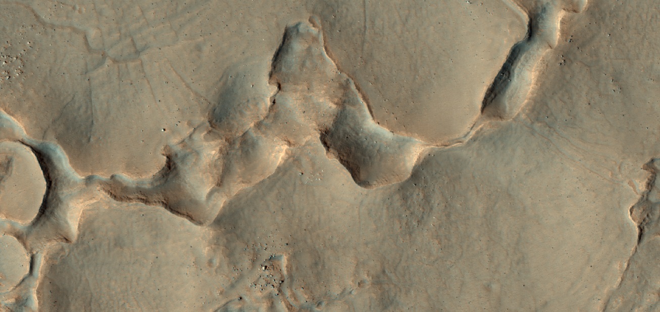
| 15:40, 8 October 2018 | ESP 028352 2245glacier.jpg (file) |  |
67 KB | Glacier flowing down valley It has lost most of its ice, but has left a moraine. Source: http://hirise.lpl.arizona.edu/ESP_028352_2245 Image credit: NASA/JPL/University of Arizona/Secosky | 1 |
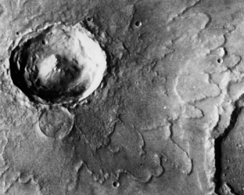
| 15:24, 28 September 2018 | Mars rampart crater.jpg (file) |  |
149 KB | Multiple-layer rampart crater ejecta, Mars; as seen by Viking Source: http://solarsystem.nasa.gov/multimedia/display.cfm?IM_ID=824 Picture credit: NASA | 1 |
| 15:06, 28 September 2018 | MarsLomonosovCraterWinter.jpg (file) |  |
250 KB | The Martian crater Lomonosov in winter as seen by Mars Global Surveyor. The photo credit is Malin Space Science Systems/JPL/NASA. Source: http://mars.jpl.nasa.gov/mgs/msss/camera/images/4_27_00_wintercrater/moc2_msss_crater_100.jpg | 1 |
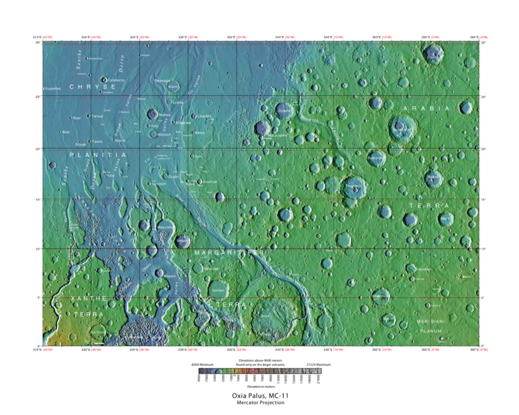
| 08:53, 27 September 2018 | USGS-Mars-MC-11-OxiaPalusRegion-mola.png (file) |  |
649 KB | Labeled typo map of outflow channels in the Oxia Palus region Source: http://planetarynames.wr.usgs.gov/images/mc11_mola.pdf Image credit: USGS (United States Geological Survey) | 1 |
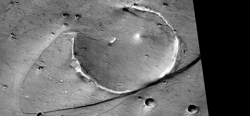
| 08:32, 27 September 2018 | Tsunamisstreamlinedp20008931.jpg (file) |  |
72 KB | Streamlined form eroded on one side by tsunamis, as seen by CTX Image credit: NASA/Malin Space Science Systems/Secosky Image source: http://viewer.mars.asu.edu/planetview/inst/ctx/P20_008931_2108_XI_30N036W#P=P20_008931_2108_XI_30N036W&T=2 | 1 |
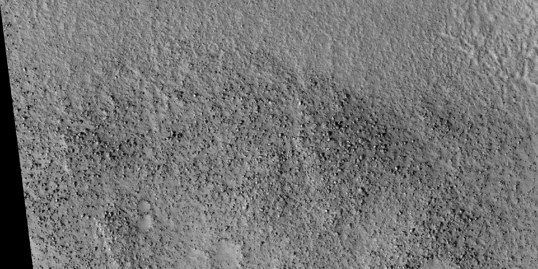
| 08:28, 27 September 2018 | 28537 2270tsunamisboulders.jpg (file) |  |
860 KB | Boulders making up channels from previous image, as seen by HiRISE These boulders were carried by tsunamis Image credit: NASA/JPL/University of Arizona/Secosky Source: http://hirise.lpl.arizona.edu/ESP_028537_2270 | 1 |
| 08:23, 27 September 2018 | ESP 028537 2270tsunamischannels.jpg (file) |  |
84 KB | Channels created by backwash fromtsunamis, as seen by hirise Source: http://hirise.lpl.arizona.edu/ESP_028537_2270 Image credit: NASA/JPL/University of Arizona/Secosky | 1 |
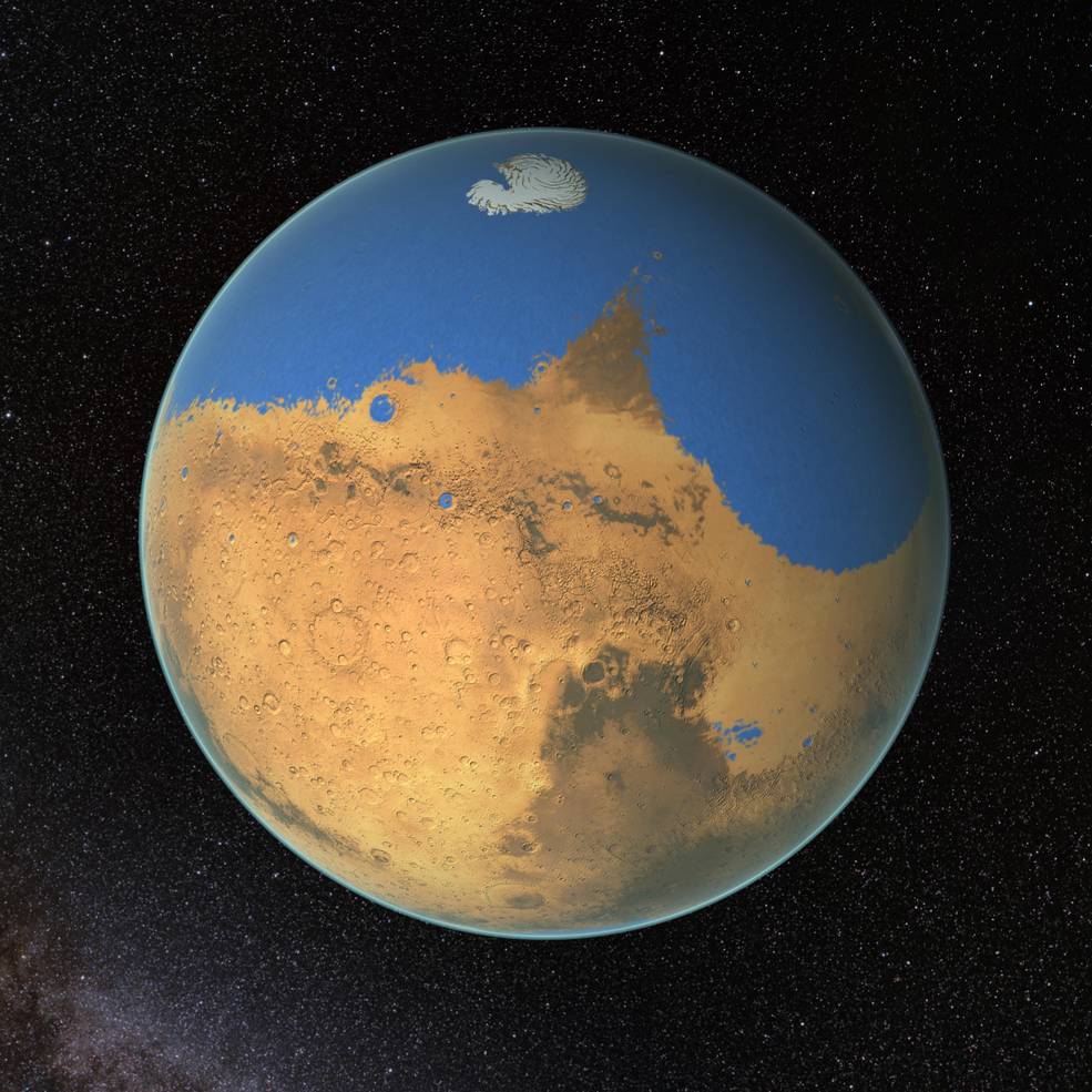
| 07:56, 27 September 2018 | Marsoceanimage.jpg (file) |  |
128 KB | Drawing showing the extent of ocean on Mars Image credit: NASA/GSFC along with some lakes that may have existed at the time. Source: https://www.airspacemag.com/daily-planet/mars-once-had-ocean-big-one-180954522/ | 1 |
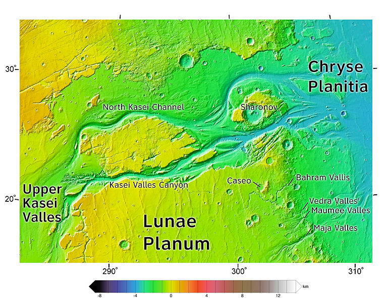
| 16:33, 26 September 2018 | Kasei Valles topolabled.JPG (file) |  |
169 KB | Labeled topo map of kasei Valles and many outflow channels Source: Kasei_Valles_topo.jpg Author: Kasei_Valles_topo.jpg: Areong derivative work: Aldaron (talk) 20:26, 4 September 2012 (UTC) | 1 |
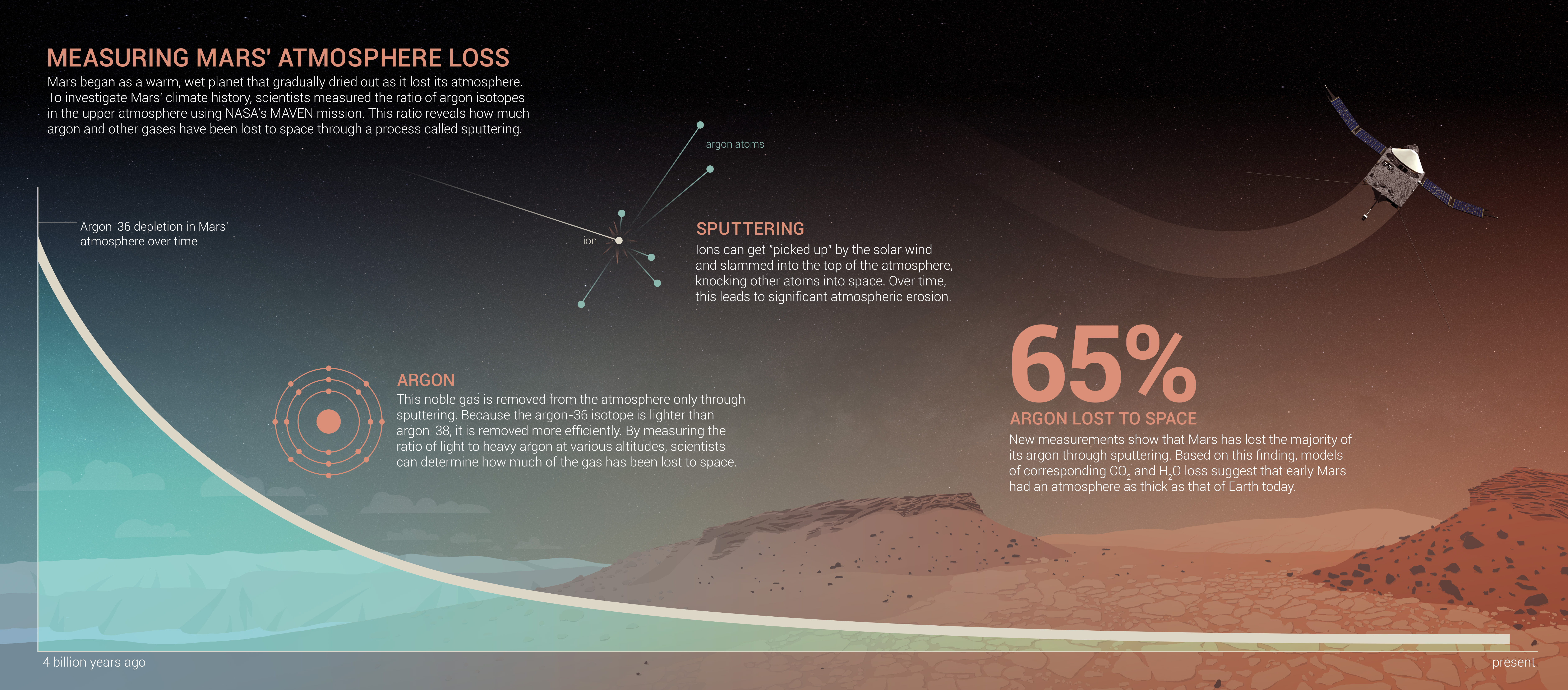
| 16:18, 26 September 2018 | Mavenargoninfographic2.jpg (file) |  |
4.1 MB | Drawing showing how Mars lost argon and other gases Image credit: NASA/Goddard Space Flight Center Source: https://www.nasa.gov/press-release/nasas-maven-reveals-most-of-mars-atmosphere-was-lost-to-space | 1 |
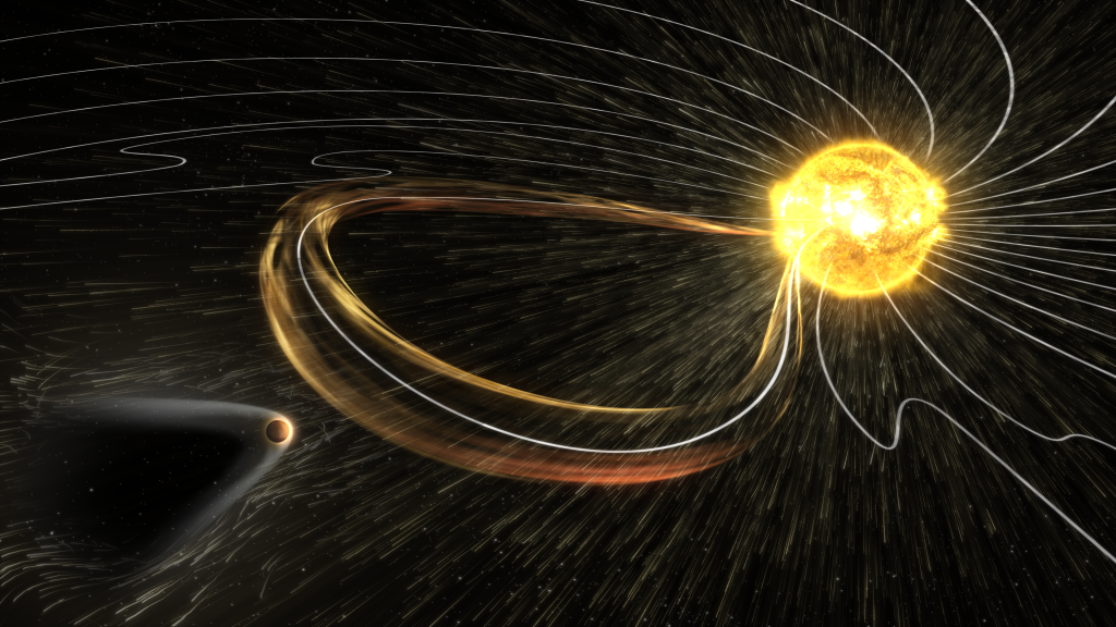
| 16:11, 26 September 2018 | Mars vs Solar Storm-1024x576.png (file) |  |
889 KB | Drawing of solar storm about to strike Mars Such extreme space weather events has caused Mars to have lost much of its atmosphere. Image credit: NASA/GSFC Source: http://lasp.colorado.edu/home/maven/mars-in-the-path-of-a-solar-storm/ | 1 |
| 16:06, 26 September 2018 | 1-Mars limb-1024x665maveninorbit.jpg (file) |  |
116 KB | Artist's conception of MAVEN in orbit around Mars Image credit: NASA/GSFC Source: http://lasp.colorado.edu/home/maven/maven-spacecraft-carrying-out-science-operations-at-mars/ | 1 |
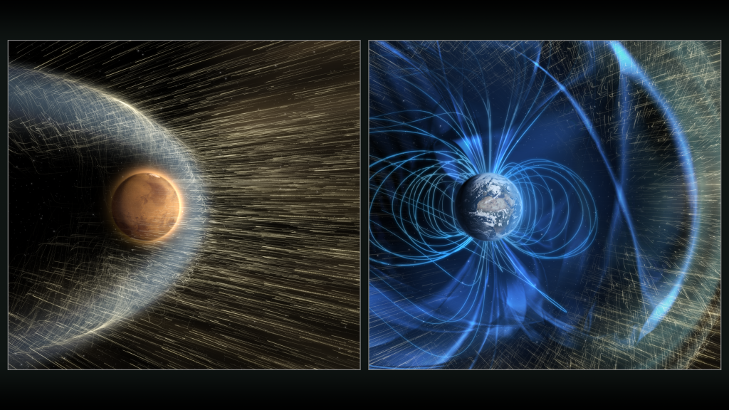
| 16:00, 26 September 2018 | Mars vs Earth Solar Wind-1024x576.png (file) |  |
914 KB | Artist’s conception of how the solar wind interacts with Mars’ upper atmosphere, but does not get through to the Earht's surface because of Earth's magnietic field Source: http://lasp.colorado.edu/home/maven/the-solar-wind-at-mars-and-earth/ Imag... | 1 |
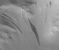
| 06:37, 14 September 2018 | Fan-shaped Streaks ESP 012410 1835cropped.jpg (file) |  |
23 KB | Close view of streaks, as seen by HiRISE Source: http://hirise.lpl.arizona.edu/ESP_012410_1835 Image credit: NASA/JPL/University of Arizona | 1 |
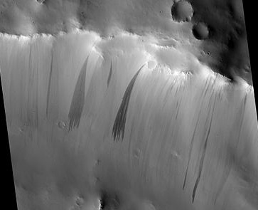
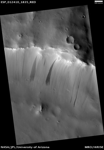
| 09:45, 13 September 2018 | Fan-shaped Streaks ESP 012410 1835.jpg (file) |  |
25 KB | Dark Slope Streaks in Arabia Terra, Mars. Picture taken with HiRISE. Source: http://hirise.lpl.arizona.edu/ESP_012410_1835 Image credit: NASA/JPL/University of Arizona. | 1 |
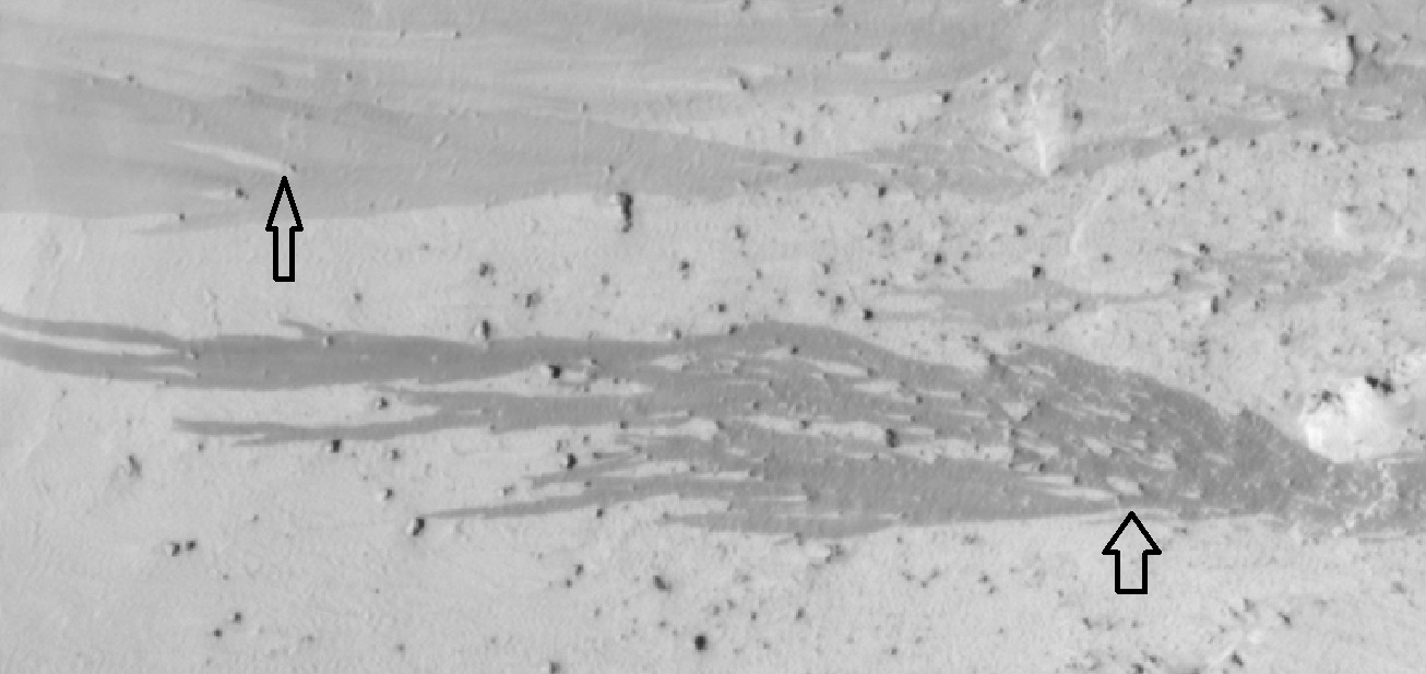
| 11:15, 12 September 2018 | 55107 1930streaksclose.jpg (file) |  |
172 KB | Close view of streaks being affected by boulders Arrows show positions of some boulders. Source: http://hirise.lpl.arizona.edu/ESP_55107_1930 Image credit: NASA/JPL/University of Arizona/Secosky | 1 |
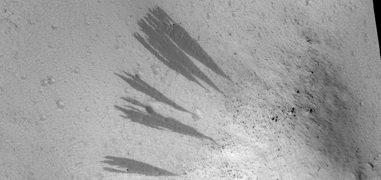
| 11:10, 12 September 2018 | 55480 2060streaksobstacles.jpg (file) |  |
255 KB | Streaks showing how boulders divide the streak Image from HiRISE under HiWish program Source: http://hirise.lpl.arizona.edu/ESP_55480_2060 Image credit: NASA/JPL/University of Arizona/Secosky | 1 |
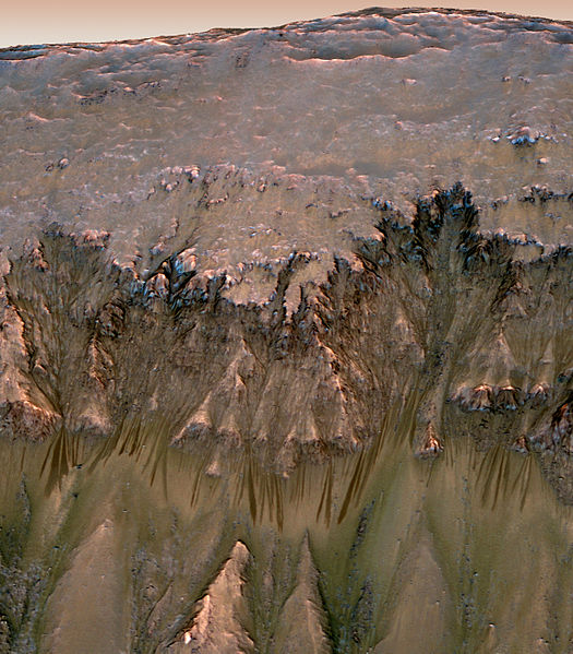
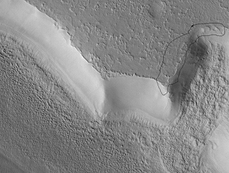
| 10:58, 12 September 2018 | Oblique View of Warm Season Flows in Newton Crater.jpg (file) |  |
95 KB | Recurrent slope lineae, as seen by HiRISE Location is Newton Crater. The flow features are narrow (one-half to five yards or meters wide), relatively dark markings on steep (25 to 40 degree) slopes at several southern hemisphere locations. Repeat im... | 1 |
| 10:51, 12 September 2018 | New Streaks Formed PIA02379.jpg (file) |  |
86 KB | Comparison of images showing new streaks that formed between February 1, 1998 and November 18, 1999, as seen my Mars Global Surveyor Source: http://photojournal.jpl.nasa.gov/catalog/PIA02379 Image credit: NASA/JPL/Malin Space Science Systems | 1 |
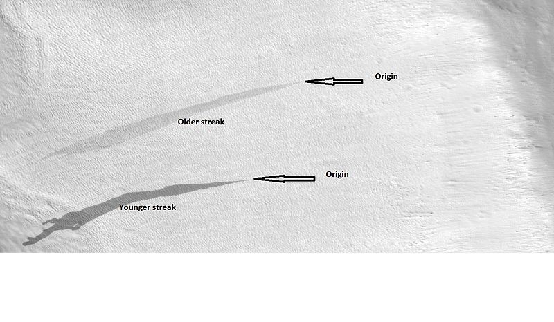
| 10:43, 12 September 2018 | 23677streakslabeled.jpg (file) |  |
64 KB | Labeled view of streaks showing origins and relative age, as seen by HiRISE under HiWish program Location at 33.9N and 48.9 E in the Diacria quadrangle. Source: http://hirise.lpl.arizona.edu/ESP_023677_2140 Image credit: NASA/JPL/University of A... | 1 |
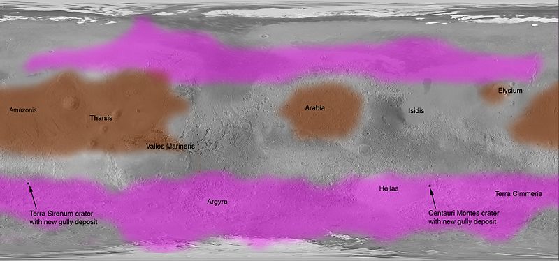
| 10:30, 12 September 2018 | Streak Locations PIA09030.jpg (file) |  |
50 KB | Map showing locations on Mars with dark slope streaks (brown) and gullies (pink). Source: NASA Photojournal: http://photojournal.jpl.nasa.gov/catalog/PIA09030 Image credit: NASA/JPL | 1 |
| 08:41, 11 September 2018 | 56148 1145polygonsveryclose.jpg (file) |  |
442 KB | Closer view of polygons on crater floor, as seen by HiRISE under HiWish program Image credit: NASA/JPL/University of Arizona/Secosky | 1 |
| 08:37, 11 September 2018 | 56148 1145polygonsclose.jpg (file) |  |
472 KB | Close view of polygons with frost in low spots. Image taken with HiRISE under HiWish program Image credit: NASA/JPL/University of Arizona/Secosky | 1 |
| 08:31, 11 September 2018 | 56148 1145polygonswide.jpg (file) |  |
249 KB | Wide view of interior of crater floor that is covered in polygons with ice in the low areas The location is the mare Australe quadrangle at 75.052 S and 106.178 E (ESP_056015_1050). Image taken with HiRISE under HiWish program. Image credit: NASA/J... | 1 |
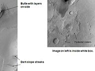
| 16:25, 26 June 2018 | Dark streaks in Diacria.JPG (file) |  |
4 KB | Dark slope streaks, as seen by Mars Global Surveyor under the Public Target program Image Credit: NASA/MSSS/Secosky | 1 |
| 16:20, 26 June 2018 | Tikonravev Crater Floor.JPG (file) |  |
5 KB | Features on floor of Tikonravev_Crater, as seen by Mars Global Surveyor Image Credit: NASA/MSSS/Secosky | 1 |
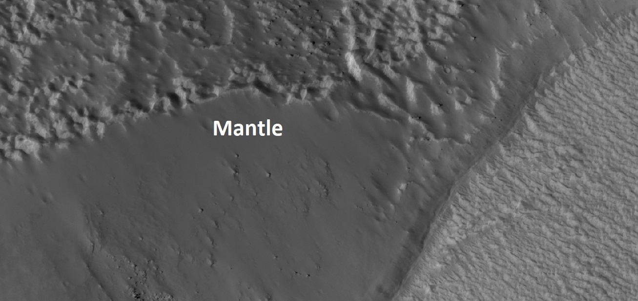
| 15:30, 26 June 2018 | Mantle on Cliff.jpg (file) |  |
139 KB | Latitude dependent mantle along a cliff face. The circled part shows the edge of the mantle. Picture taken with the Mars Global Surveyor under the Public Target Program. Image Credit: NASA/MSSS/Secosky | 1 |
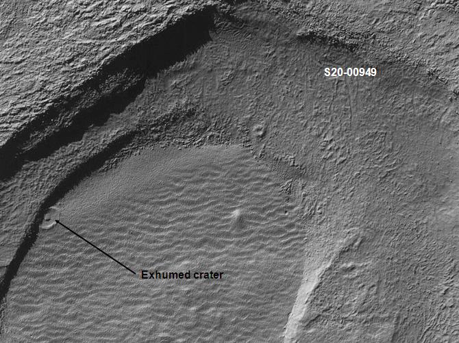
| 15:26, 26 June 2018 | Exhumed crater in Noachis.jpg (file) |  |
89 KB | Exhumed crater, as seen by Mars Global Surveyor under the Public Target Program | 1 |
| 15:12, 26 June 2018 | Phaethontis surface.jpg (file) |  |
53 KB | Brain terrain in Phaethontis quadrangle From MOC 12-00663. This image was taken with the Mars Orbital Camera MOC) on the Mars Global Surveyor (MGS). The photo credit is Malin Space Science Systems/NASA/Secosky. http://www.msss.com (public target pro... | 1 |
| 08:22, 26 June 2018 | 800px-Coprates layers.jpg (file) |  |
122 KB | Layers in Coprates, as seen by Mars Global Surveyor, under MOC Public Targeting Program. Location is 8.8 degrees south latitude and 45.48 degrees west longitude. Source: http://www.msss.com/mars_images/moc/publicresults/2004/06/R18-00480p.gif Image cr... | 1 |
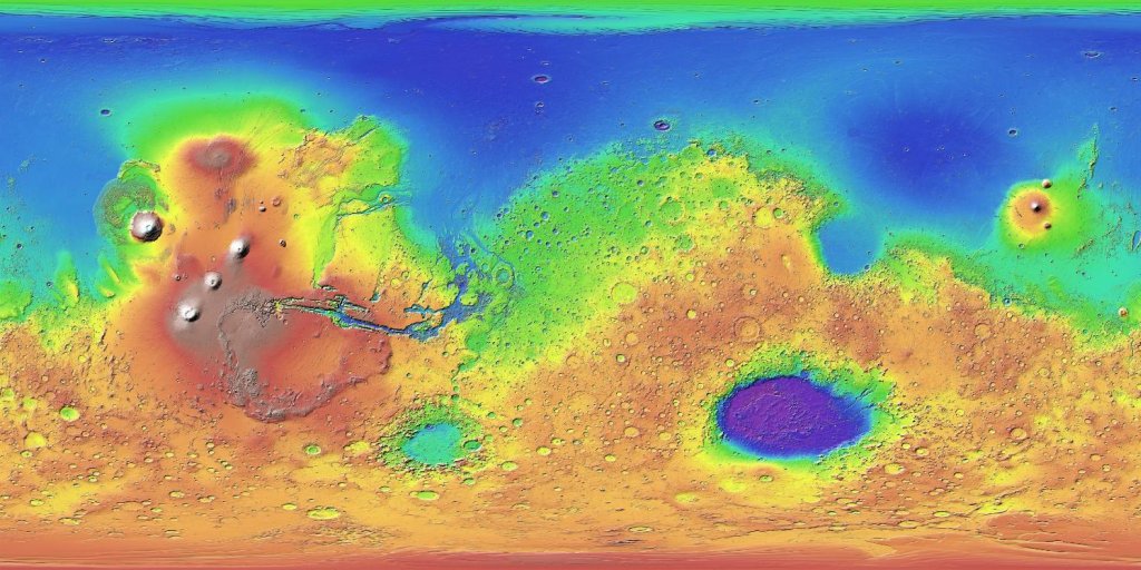
| 16:04, 25 June 2018 | Mars MGS colorhillshade mola 1024.jpg (file) |  |
132 KB | Topographic map of Mars. Colors show relative elevations. Map is based on data set from the Mars Global Surveyor spacecraft. A laser altimeter on the spacecraft provided the altitudes. Source: http://mola.gsfc.nasa.gov/images.html and http://photoj... | 1 |
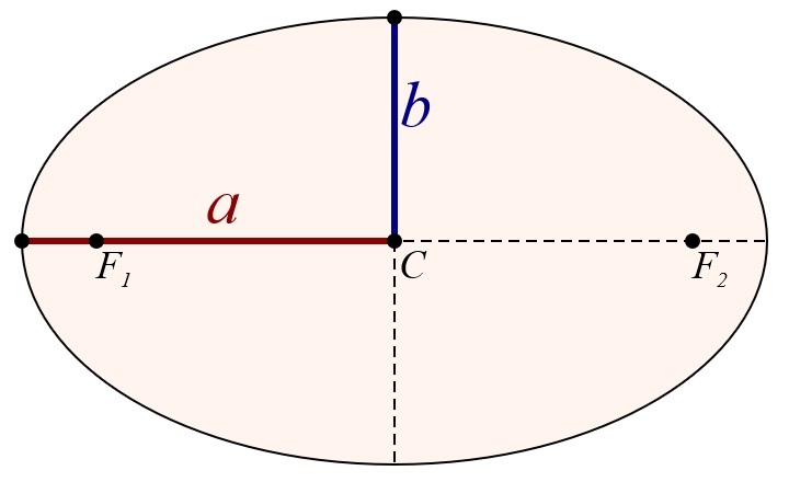
| 15:36, 25 June 2018 | Semi-major and semi-minor axes of an ellipse.jpg (file) |  |
31 KB | Diagram showing semi-major and semi-minor axes of an ellipse. Source: Wikimedia Commons/M. W. Toews This file is made available under the Creative Commons CC0 1.0 Universal Public Domain Dedication. The person who associated a work with this deed ha... | 1 |
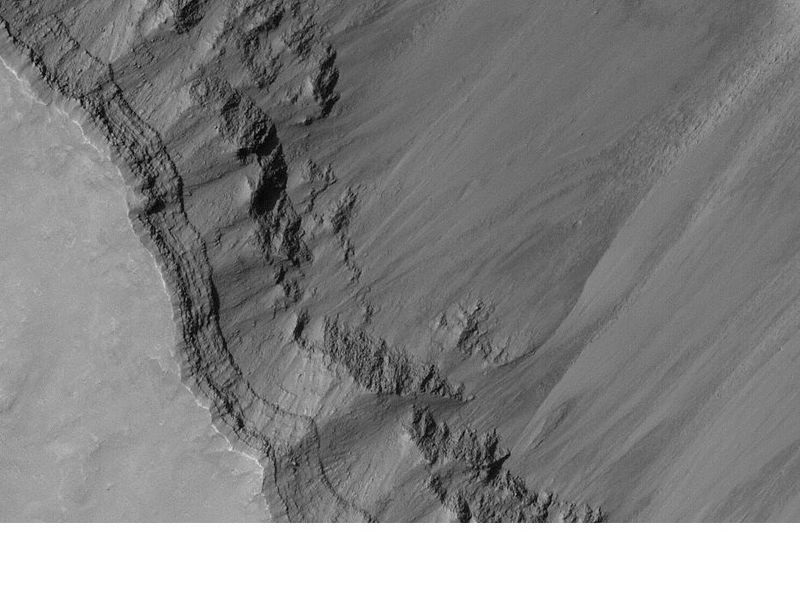
| 13:05, 22 June 2018 | 55198 2170dipping.jpg (file) |  |
332 KB | Dipping layers, as seen by HiRISE under HiWish program Source: http://hirise.lpl.arizona.edu/ESP_55198_2170 Image credit: NASA/JPL/University of Arizona/Secosky | 1 |
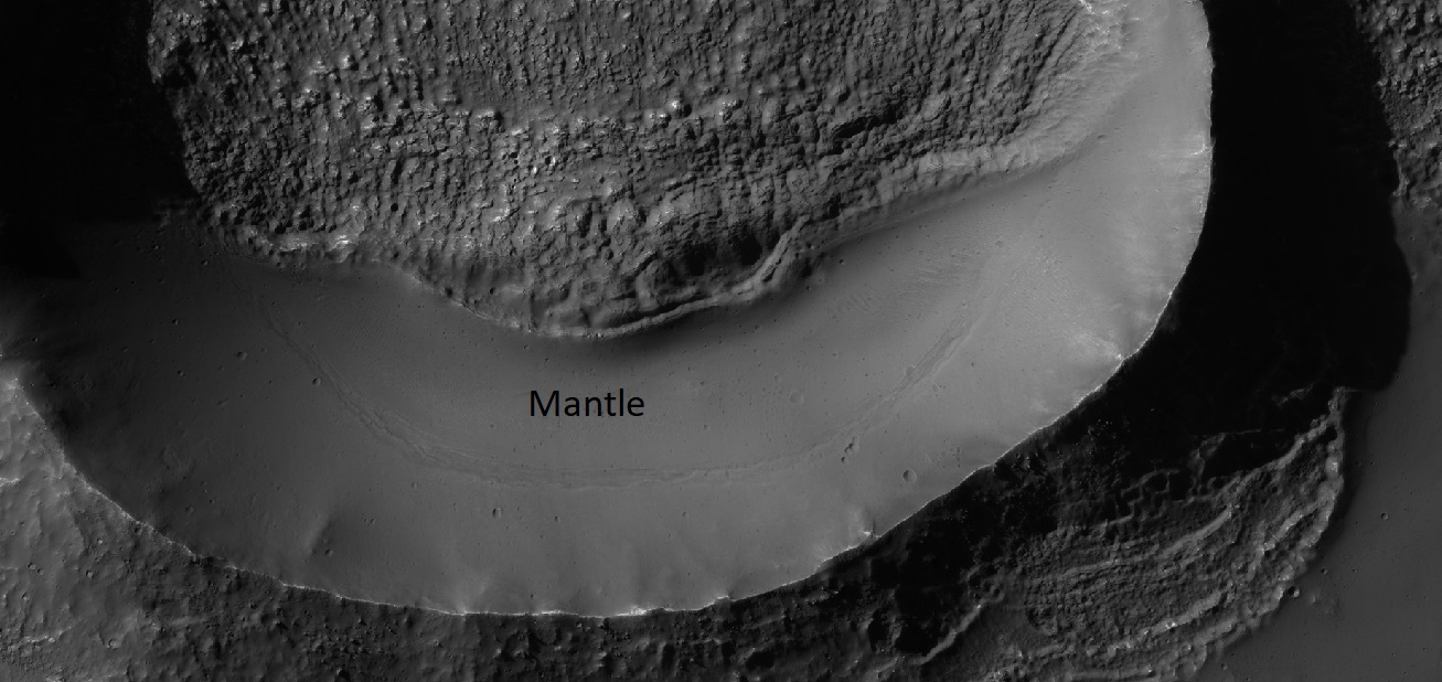
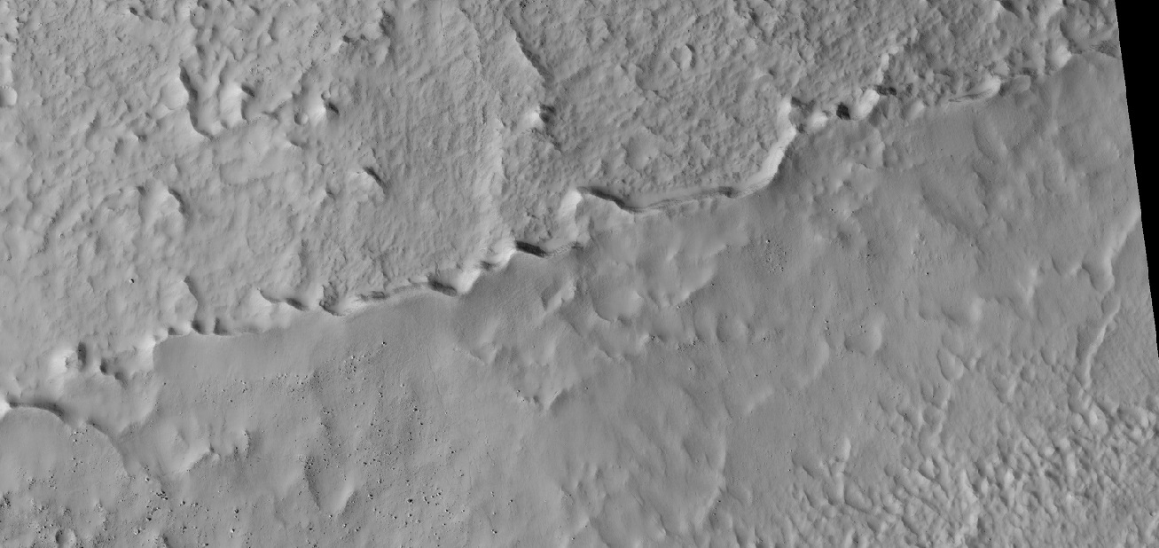
| 13:02, 22 June 2018 | 54742 1485mantle.jpg (file) |  |
230 KB | Mantle in crater, as seen by HiRISE under HiWidh program Source: http://hirise.lpl.arizona.edu/ESP_54742_1485 Image credit: NASA/JPL/University of Arizona/Secosky | 1 |
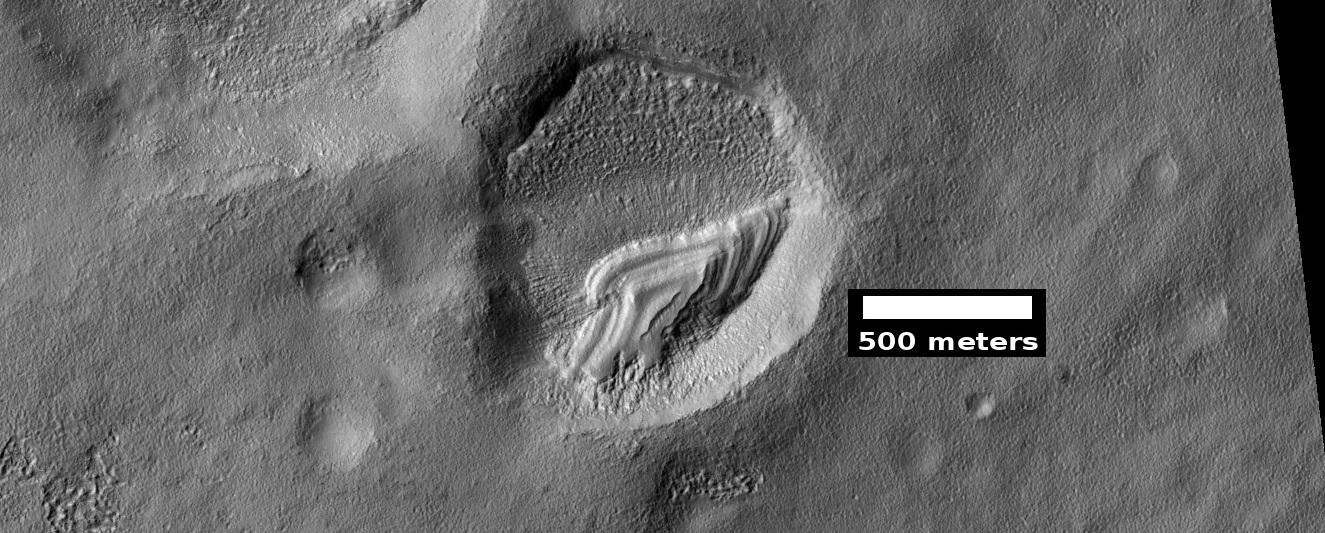
| 12:11, 22 June 2018 | ESP 055104 1385pyramid.jpg (file) |  |
336 KB | Remains of mantle layers after erosion and shaping by winds, as seen by HiRISE under HiWish program Source: http://hirise.lpl.arizona.edu/ESP_055104_1385 Image credit: NASA/JPL/University of Arizona | 1 |
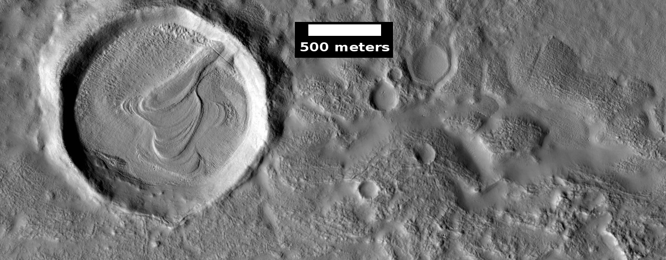
| 12:07, 22 June 2018 | ESP 054934 2160pyramid.jpg (file) |  |
280 KB | Layered structure in crater, as seen by HiRISE under HiWish program This may be the remains of mantle layers after erosion and shaping by winds. Source: http://hirise.lpl.arizona.edu/ESP_054934_2160 Image credit: NASA/JPL/University of Arizona/Secosky | 1 |
| 12:03, 22 June 2018 | ESP 054896 2240hollowsrelease.jpg (file) |  |
327 KB | Close, color view of hollows and cracks, as seen by HiRISE under HiWish program Source: http://hirise.lpl.arizona.edu/ESP_054896_2240 Image Credit: NASA/JPL/University of Arizona | 1 |
| 11:56, 22 June 2018 | 54896 2240hollow.jpg (file) |  |
244 KB | Close, color view of hollows, as seen by HiRISE under HiWish program Source: http://hirise.lpl.arizon.edu/ESP_54896_2240hollow.jpg Image credit: NASA/JPL/University of Arizona/Secosky | 1 |
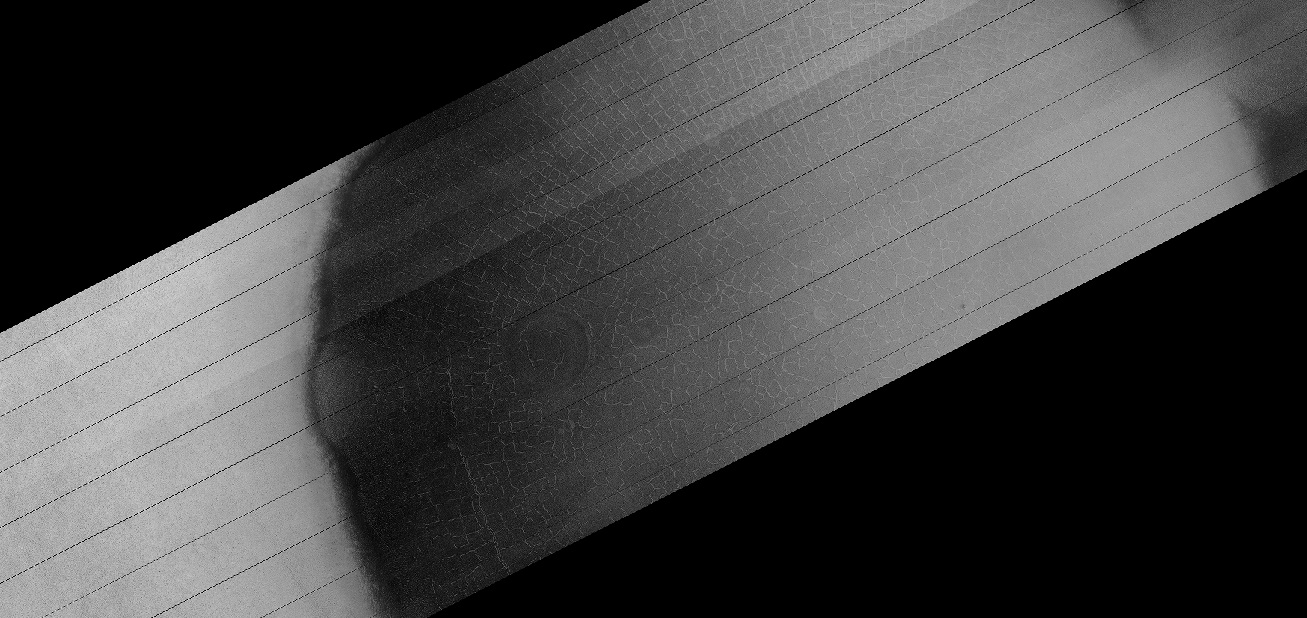
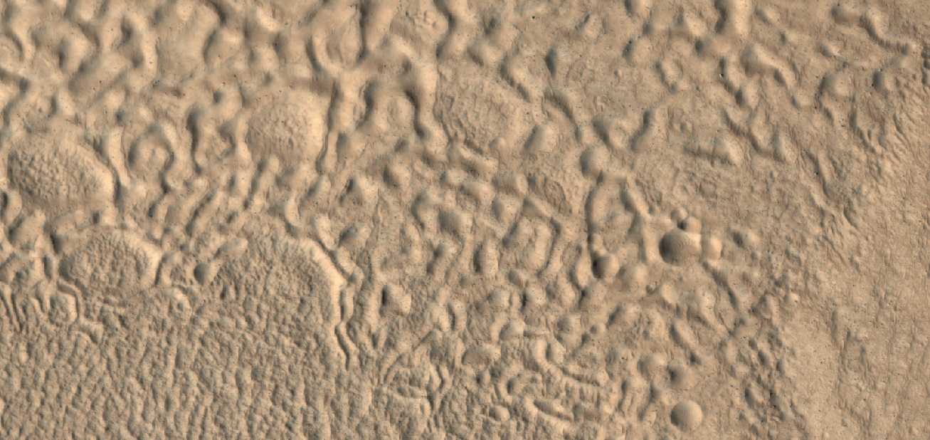
| 11:49, 22 June 2018 | 55027 2250hollows.jpg (file) |  |
339 KB | Color view of open and closed brain terrain and hollows, as seen by HiRISE under HiWish program Source: http://hirise.lpl.arizona.edu/ESP_55027_2250 Image credit: NASA/JPL/University of Arizona/Secosky | 1 |
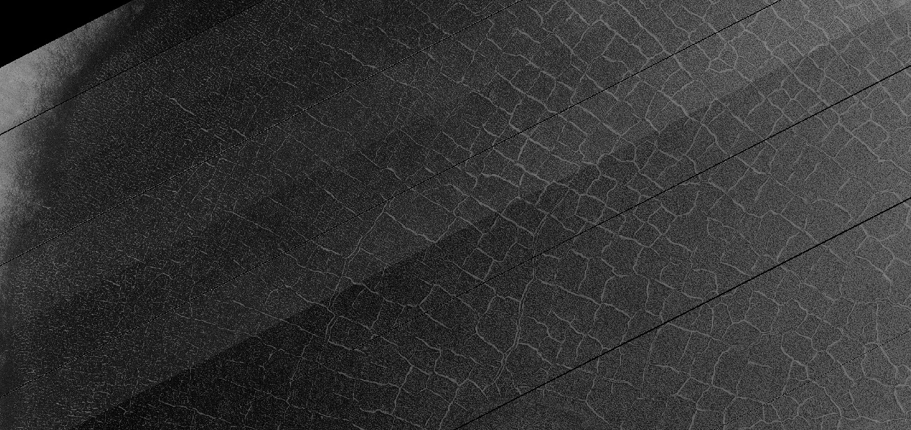
| 11:45, 22 June 2018 | 54996 2155brains.jpg (file) |  |
347 KB | Close, color view of brain terrain, as seen by HiRISE under HiWish program Source: http://hirise.lpl.arizona.edu/ESP_54996_2155 Image credit: NASA/JPL/University of Arizona/Secosky | 1 |
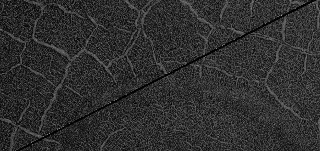
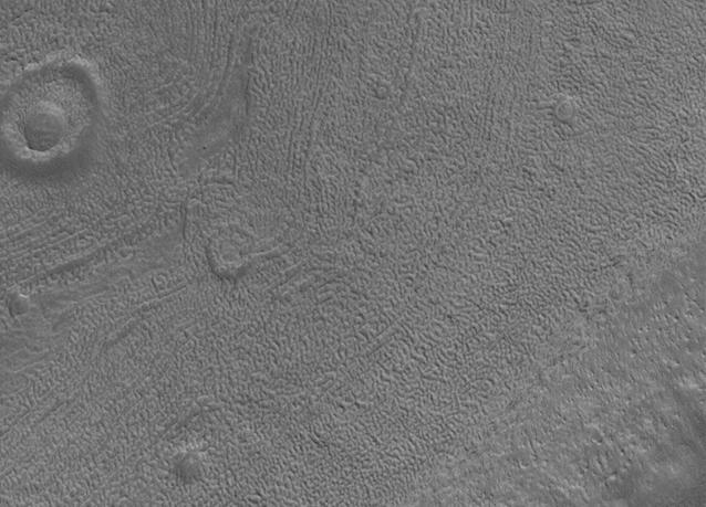
| 11:38, 22 June 2018 | 54526 2220brainscracks.jpg (file) |  |
288 KB | Brain terrain, as seen by HiRISE under HiWish program Cracks are also visible. Brain terrain starts as cracks. With enhanced sublimation along cracks, the cracks grow wider. Source: http://hirise.lpl.arizona.edu/ESP_54526_2220 Image credit: NAS... | 1 |
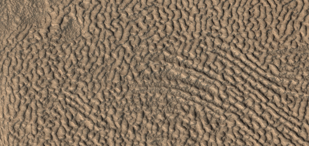
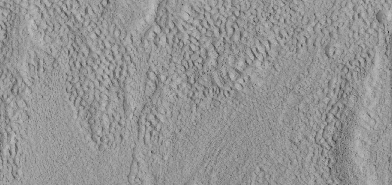
| 11:21, 22 June 2018 | 55198 2170mantleclose.jpg (file) |  |
244 KB | Close view of mantle, as seen by HiRISE under HiWish program Image source: http://hirise.lpl.arizona.edu/ESP_055198_2170 Image credit: NASA/JPL/Arizona/Secosky | 1 |
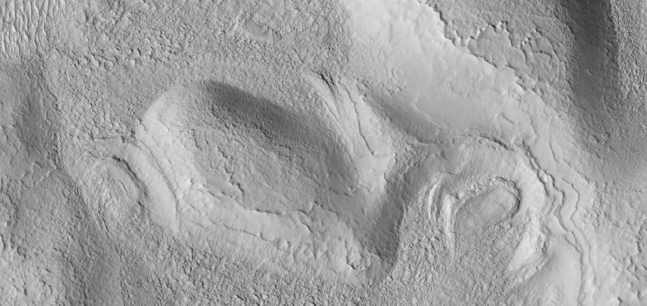
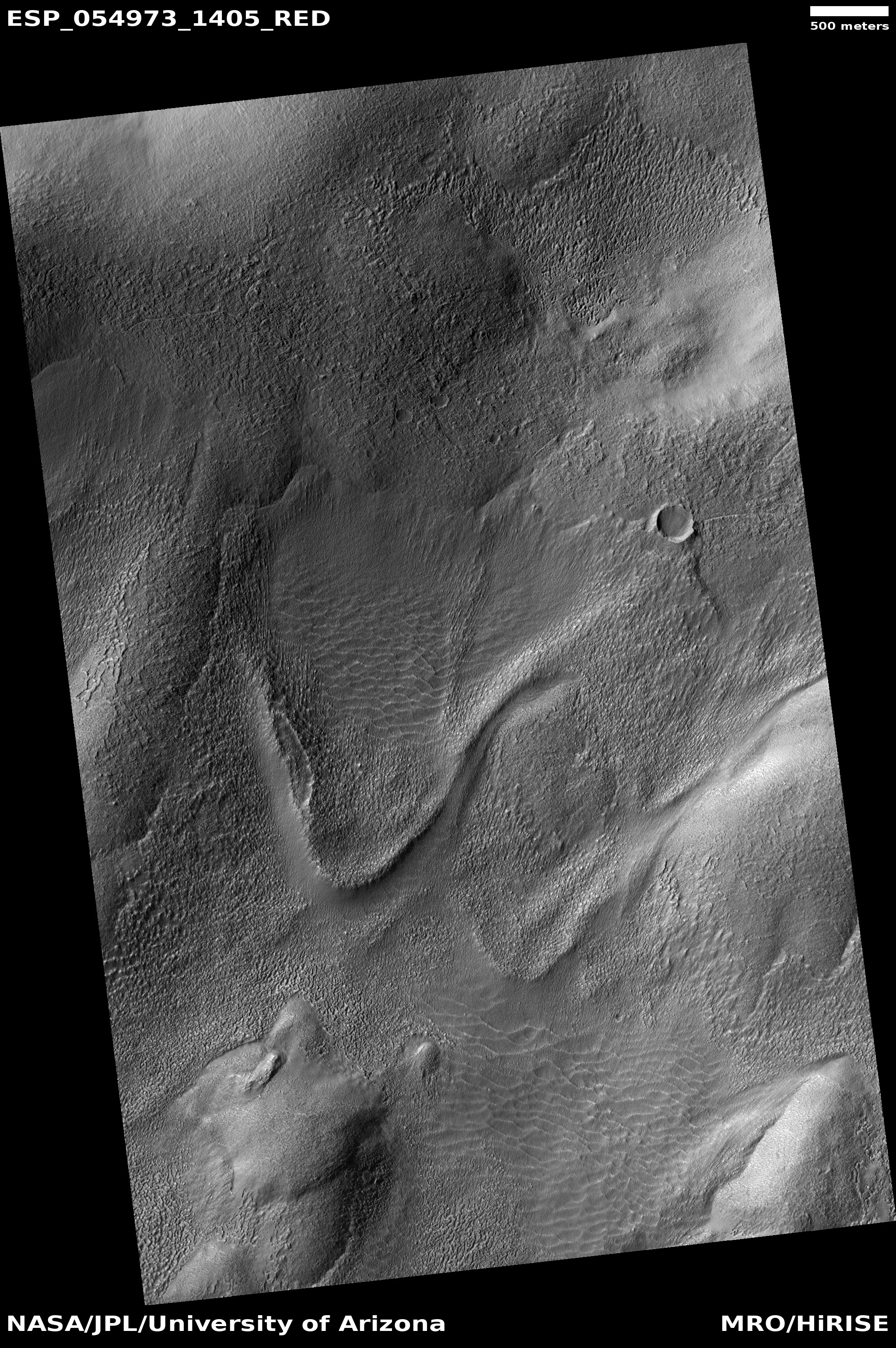
| 11:15, 22 June 2018 | ESP 054973 1405tongue.jpg (file) |  |
2.34 MB | Old glacier, as seen by HiRISE under HiWish program Nearly all the ice has left this glacier. Source: http://hirise.lpl.arizona.edu/ESP_054973_1405 Image credit: NASA/JPL/University of Arizona | 1 |
| 11:07, 22 June 2018 | 54996 2155mantle.jpg (file) |  |
171 KB | Latitude dependent mantle, as seen by HiRISE under HiWish program Source: http://hirise.lpl.arizona.edu/54996_2155 Image credit: NASA/JPL/University of Arizona/Secosky | 1 |
| 08:24, 12 June 2018 | ESP 054066 1920newstreak.jpg (file) |  |
131 KB | This HiRISE image captures a new, dated (within about a decade) impact crater that triggered a slope streak. When the meteoroid hit the surface and exploded to make the crater, it also destabilized the slope and initiated this avalanche. The crater it... | 1 |
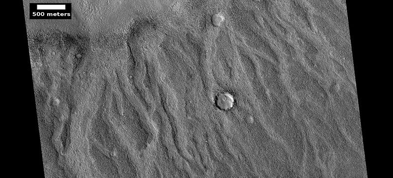
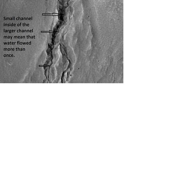
| 15:24, 1 June 2018 | Multiple channels in 21461.jpg (file) |  |
26 KB | Enlargement of ESP_021461_1345, as seen by hirise, showing channel within larger channel. Image located 45.4 S and 248.3 E. Source: http://www.uahirise.org/ESP_021461_1345 Image credit: NASA/JPL/University of Arizona | 1 |
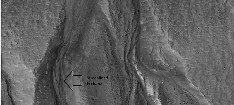
| 15:19, 1 June 2018 | 26420gulliesclose.jpg (file) |  |
52 KB | Close-up of gullies, as seen by hirise under HiWish program. Location is 55.8 N and 208.1 E. Arrow points to streamlined features. Source: http://hirise.lpl.arizona.edu/ESP_026420_2360 Image credit: NASA/JPL/University of Arizona/Secosky | 1 |
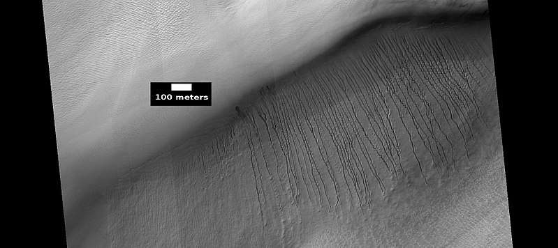
| 15:06, 1 June 2018 | ESP 051770 1345dunegullies.jpg (file) |  |
59 KB | Gullies on dunes, as seen by HiRISE Source: http://hirise.lpl.arizona.edu/ESP_051770_1345 Image credit: NASA/JPL/University of Arizona/Secosky | 1 |


