File list
This special page shows all uploaded files.
| Date | Name | Thumbnail | Size | User | Description | Versions |
|---|---|---|---|---|---|---|
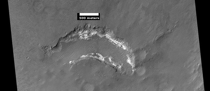
| 10:59, 30 November 2018 | Wikiwislicenus.jpg (file) |  |
104 KB | Suitupandshowup | Western side of Wislicenus crater (Mars), as seen by CTX. Source http://viewer.mars.asu.edu/planetview/inst/ctx/G04_019729_1614_XI_18S349W#P=G04_019729_1614_XI_18S349W&T=2 Image Credit: NASA/MSSS | 1 |
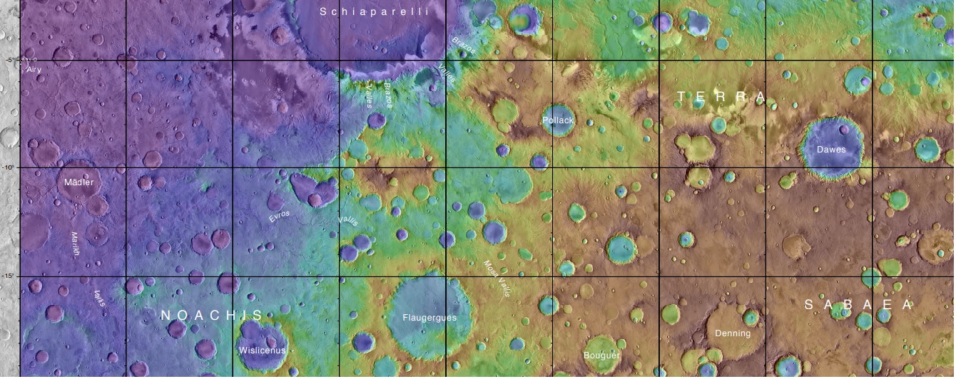
| 10:53, 30 November 2018 | Marspediaflaugerguesmap.jpg (file) |  |
351 KB | Suitupandshowup | Topo map showing Flaugergues, Wislicenus, and other nearby craters. Flaugergues, Wislicenus Craters were imaged by Mariner 6. Source: https://planetarynames.wr.usgs.gov/images/mc20_2014.pdf Image Credit: NASA/USGS | 1 |
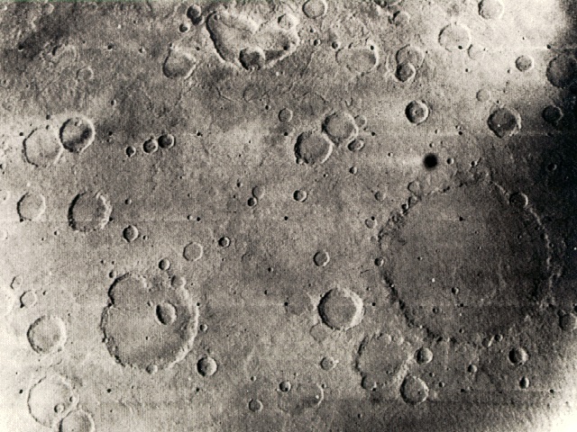
| 08:36, 28 November 2018 | Mar6cratmariner6.jpg (file) |  |
170 KB | Suitupandshowup | 1969 Mariner 6 view of the Sinus Sabaeus and Deucalionis Regio portion of Mars. The large crater (lower right) is Flaugergues (~200 km diameter; 18 S, 341 W). The double crater toward the lower left is Wislicenus (18 S, 348 W). (Mariner 6 image 6N21; c... | 1 |
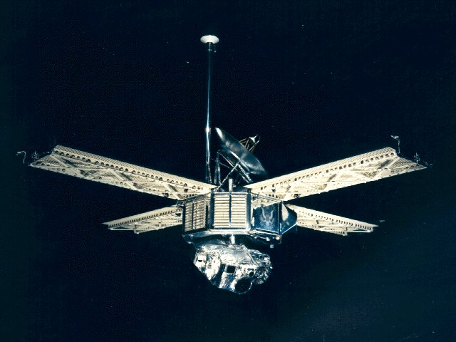
| 12:36, 27 November 2018 | Mariner 6-7.png (file) |  |
408 KB | Suitupandshowup | Mariner 6 and 7 spacecraft The two are identical. Source http://nssdc.gsfc.nasa.gov/nmc/masterCatalog.do?sc=1969-014A Image credit:NASA | 1 |
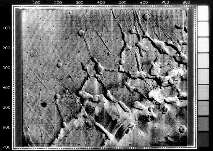
| 07:21, 26 November 2018 | ESP 056561 2170channels.jpg (file) |  |
2.74 MB | Suitupandshowup | Branched channels, as seen by HiRISE under HiWish program Source: HiRISE.lpl.arizona.edu/ESP_056561_2170 Image credit: NASA/JPL/University of Arizona | 1 |
| 15:52, 24 November 2018 | M09 mtvs4187 45noctismariner9help.jpg (file) |  |
224 KB | Suitupandshowup | Noctis, as seen by Mariner 9 Image credit: NASA | 1 |
| 09:51, 23 November 2018 | M09 mtvs4187 45noctismariner9.gif (file) |  |
415 KB | Suitupandshowup | Mariner 9 view of the Noctis Labyrinthus "labyrinth" at the western end of Valles Marineris on Mars. Linear graben, grooves, and crater chains dominate this region, along with a number of flat-topped mesas. The image is roughly 400 km across, centered... | 1 |
| 09:46, 23 November 2018 | Mariner8&9 schematics.jpg (file) |  |
31 KB | Suitupandshowup | Mariner 9 schematics Image credit: NASA Source: https://upload.wikimedia.org/wikipedia/commons/1/16/Mariner8%269_schematics.jpg | 1 |
| 10:16, 21 November 2018 | NASA-Mars-JezeroCrater-20181116.jpg (file) |  |
141 KB | Suitupandshowup | JEZERO CRATER - PLANET MARS Overflowing Crater Lakes Carved Canyons Across Mars https://news.utexas.edu/2018/11/16/overflowing-crater-lakes-carved-canyons-across-mars/ http://redplanet.asu.edu/?p=31676 IMAGE CAPTION Jezero crater is a paleolake an... | 1 |
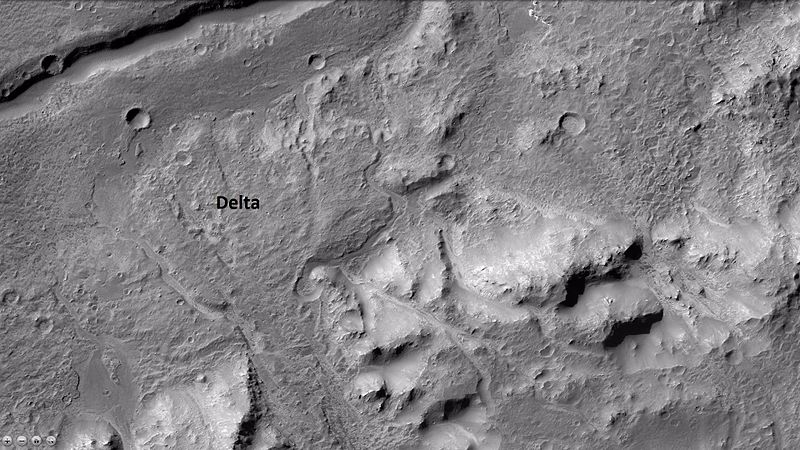
| 09:58, 21 November 2018 | JezeroCraterdelta.jpg (file) |  |
797 KB | Suitupandshowup | Jezero Crater's delta https://www.jpl.nasa.gov/news/news.php?feature=7286&utm_source=iContact&utm_medium=email&utm_campaign=nasajpl&utm_content=daily20181119-2 Credit: NASA/JPL-Caltech/MSSS/JHU-APL | 1 |
| 09:54, 21 November 2018 | IMAGE2-MOLAmapjezero.jpg (file) |  |
59.07 MB | Suitupandshowup | MOLA topo map showing location of Jezero Crater Source: https://www.jpl.nasa.gov/images/mars2020/20181119/IMAGE2-MOLAmap.jpg Credit: NASA/JPL-Caltech/MSSS/JHU-APL | 1 |
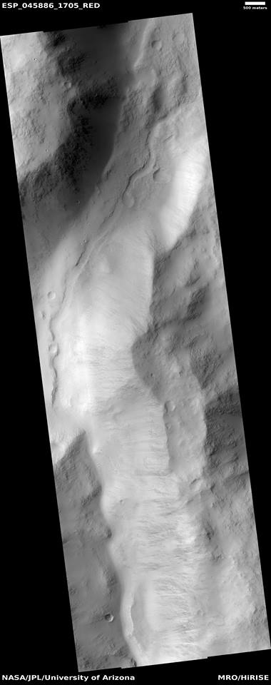
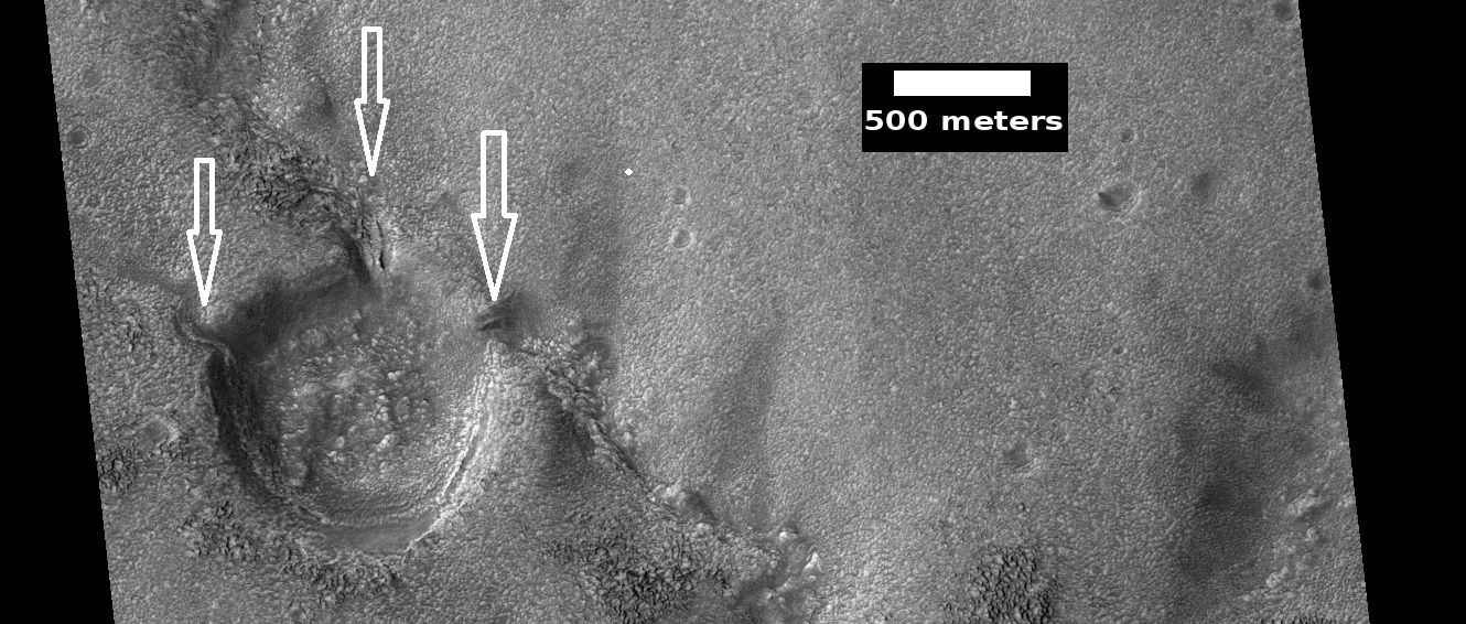
| 09:45, 19 November 2018 | 13882282 10207143921535802 7740003704272946655 nchannelinvalley.jpg (file) |  |
37 KB | Suitupandshowup | Channel within a larger channel, as seen by HiRISE under HiWish program Source: http://hirise.lpl.arizona.edu/ESP_045886_1705 Image credit: NASA/JPL/University of Arizona/Secosky | 1 |
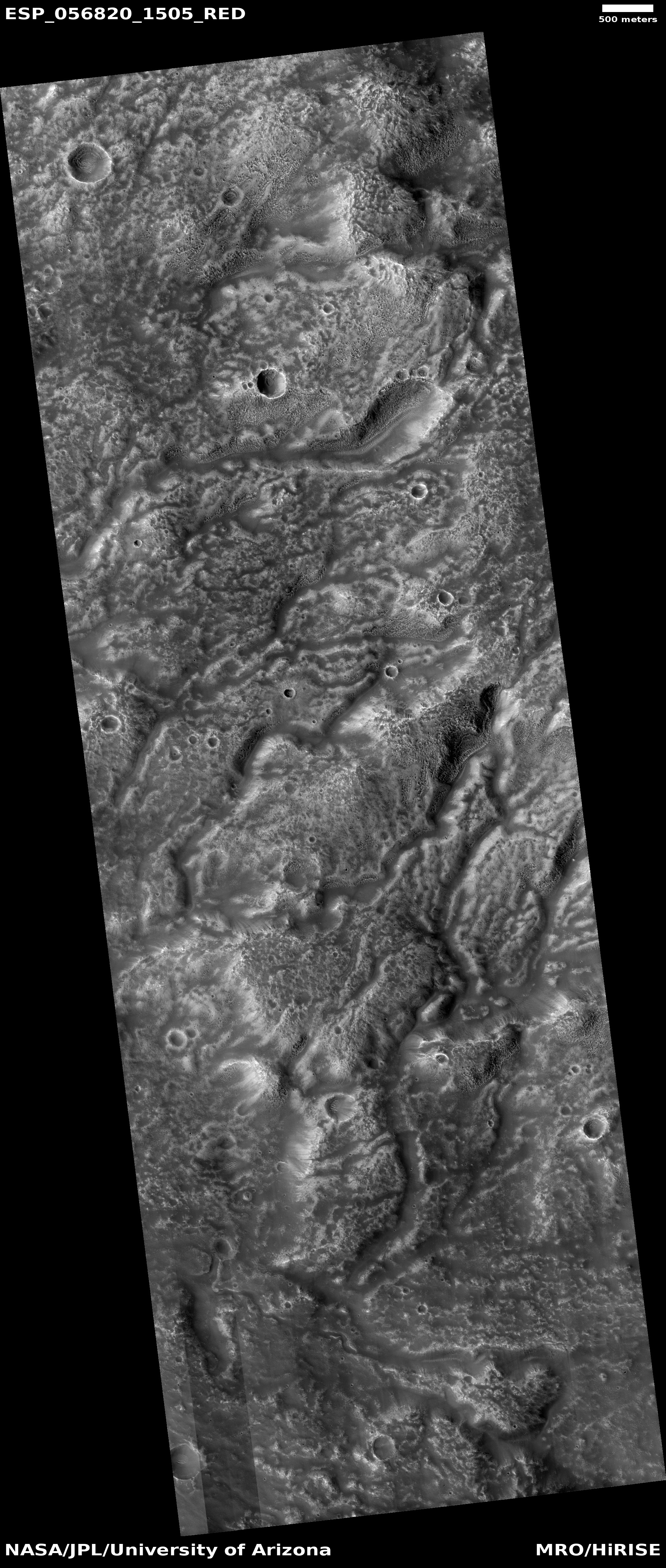
| 18:34, 17 November 2018 | ESP 056820 1505channelnetwork.jpg (file) |  |
2.6 MB | Suitupandshowup | Channel network in the Iapygia quadrangle, as seen by HiRISE under HiWish program Source: http://hirise.lpl.arizona.edu/ESP_056820_1505 Image credit: NASA/JPL/University of Arizona | 1 |
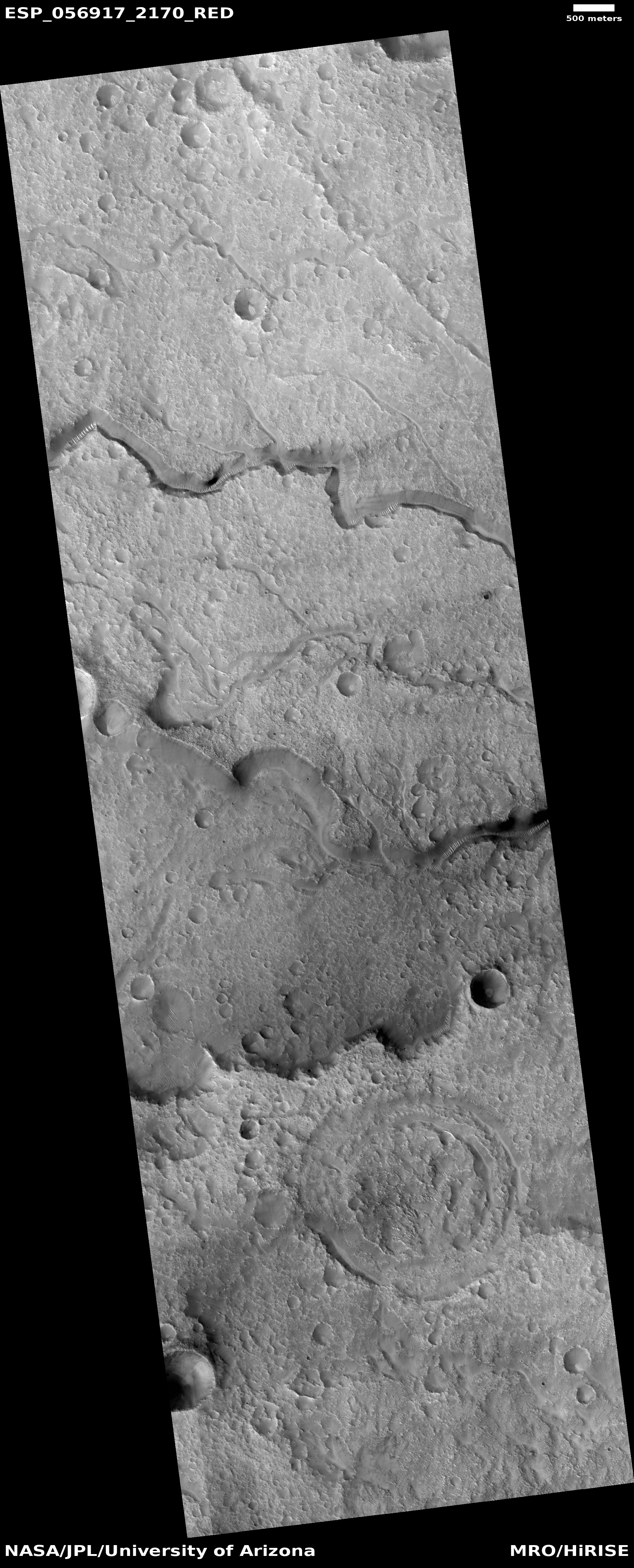
| 18:28, 17 November 2018 | ESP 056917 2170channels.jpg (file) |  |
2.69 MB | Suitupandshowup | Channels in the Mare Acidalium quadrangle, as seen by HiRISE under HiWish program Source: http://hirise.lpl.Arizona.edu/ESP_ESP_056917_2170 Image credit: NASA/JPL/University of Arizona | 1 |
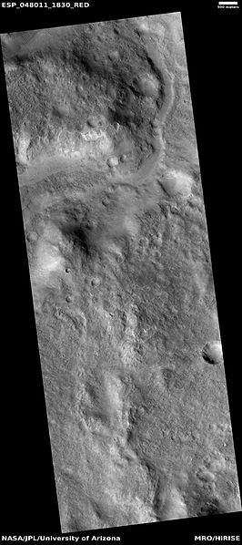
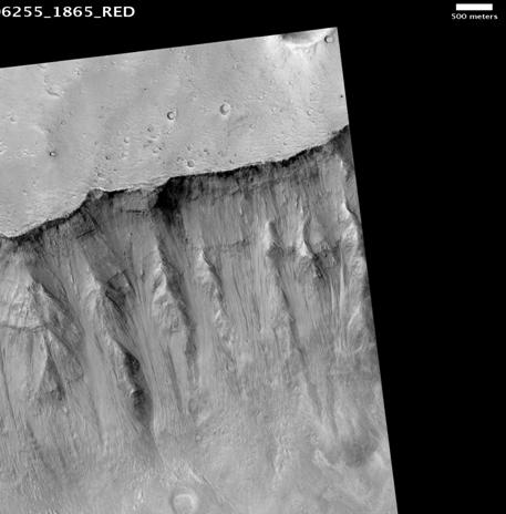
| 09:13, 17 November 2018 | ESP 048011 1830channel.jpg (file) |  |
35 KB | Suitupandshowup | Channel in Syrtis Major quadrangle, as seen by HiRISE under HiWish program This channel seems to have a smaller channel in a valley. Water may have flowed here more than once. Source http://hirise.lpl.arizona.edu/ESP_048011_1830 Image credit: NASA... | 1 |
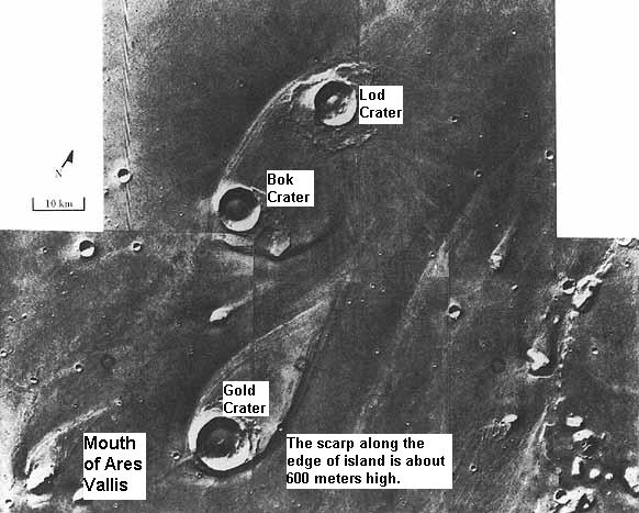
| 09:44, 16 November 2018 | 26126contextb22 018333 1548delta.jpg (file) |  |
104 KB | Suitupandshowup | Wide view of delta in holden crater as seen by ctx Source http://viewer.mars.asu.edu/planetview/inst/ctx/B22_018333_1548_XI_25S033W#P=B22_018333_1548_XI_25S033W&T=2 Image credit: NASA/Malin Space Science Systems | 1 |
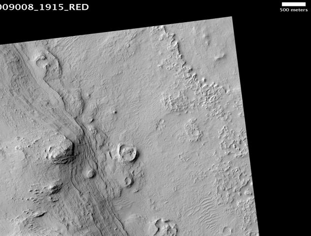
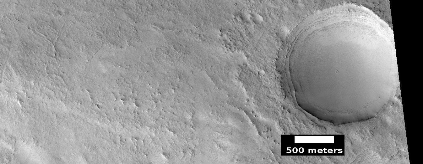
| 09:38, 16 November 2018 | ESP 056800 1385channels.jpg (file) |  |
344 KB | Suitupandshowup | Channels and crater in the Thaumasia quadrangle, as seen by HiRISE under HiWish program Source http://hirise.lpl.arizona.edu/ESP_056800_1385 Image credit: NASA/JPL/University of Arizona/Secosky | 1 |
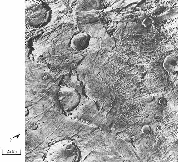
| 09:26, 16 November 2018 | Branched Channels from Viking.jpg (file) |  |
100 KB | Suitupandshowup | Branched channels, as seen by Viking. Location is 48 S and 98 W. These branched channels in Thaumasia quadrangle provide possible evidence of past rain on Mars. Source http://history.nasa.gov/SP-441/ch4.htm Image credit: NASA | 1 |
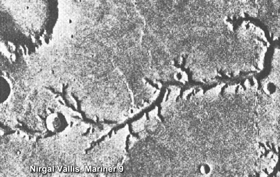
| 09:04, 16 November 2018 | PIA15090nirgalvallismariner9.jpg (file) |  |
136 KB | Suitupandshowup | Nirgal Vallis, as seen by mariner 9 Source: https://photojournal.jpl.nasa.gov/jpeg/PIA15090.jpg Image credit: NASA | 1 |
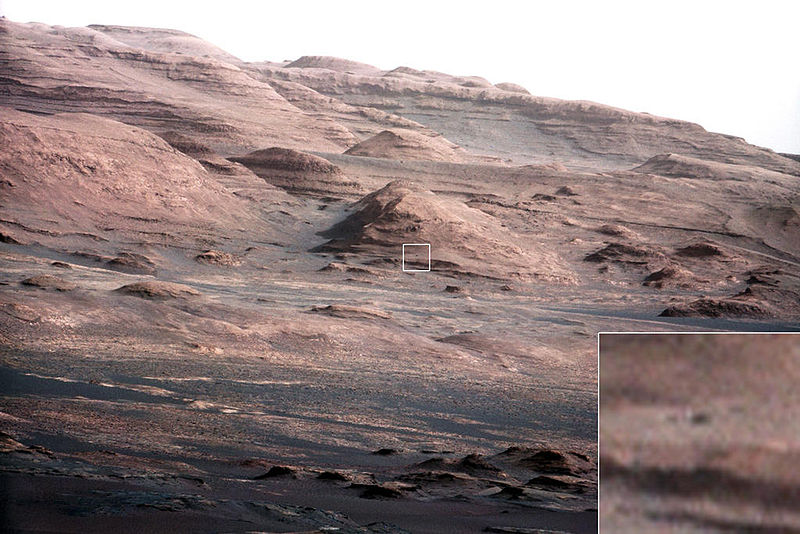
| 09:44, 15 November 2018 | PIA16105 malin04ano-br2.jpg (file) |  |
111 KB | Suitupandshowup | Layers at the Base of Mount Sharp A chapter of the layered geological history of Mars is laid bare in this postcard from NASA's Curiosity rover. The image shows the base of Mount Sharp, the rover's eventual science destination. This image is a portion... | 1 |
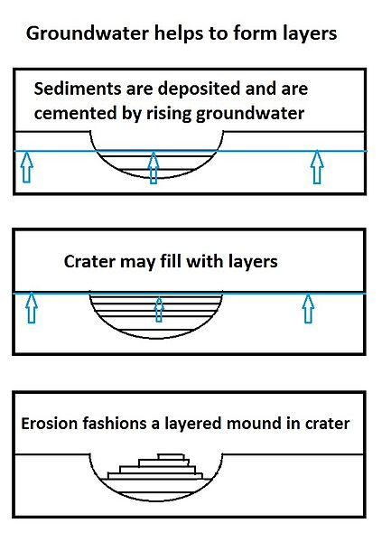
| 09:25, 15 November 2018 | Groundwaterseries8final.jpg (file) |  |
37 KB | Suitupandshowup | Series of drawings showing how groundwater can help to form layers in craters. Source: This is my own work. I give permission for anyone to use it. | 1 |
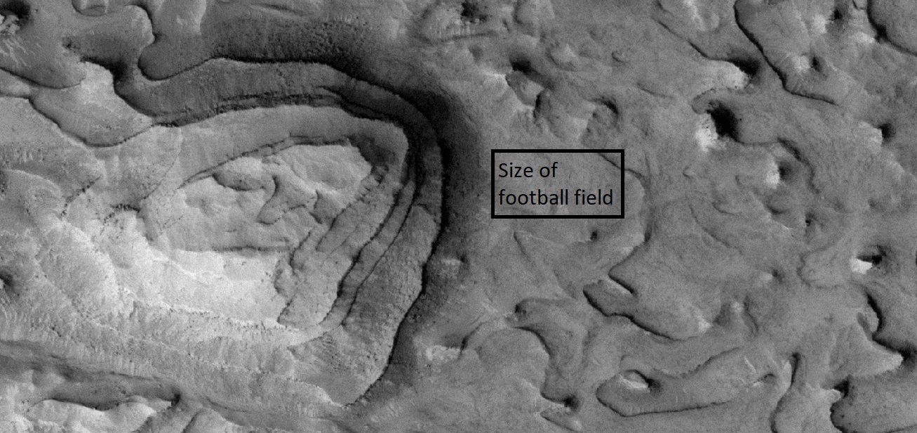
| 08:27, 15 November 2018 | 56836 1900layedmound2.jpg (file) |  |
365 KB | Suitupandshowup | Layered mound on floor of crater, as seen by HiRISE under HiWish program The black box shows the size of a football field. Location is the Arabia quadrangle. Source: http://hirise.lpl.arizona.edu/ESP_56836_1900 Image credit: NASA/JPL/University o... | 1 |
| 08:26, 15 November 2018 | 56836 1900layedmoundfootball.jpg (file) |  |
345 KB | Suitupandshowup | Layered mound on floor of crater, as seen by HiRISE under HiWish program The black box shows the size of a football field. Location is the Arabia quadrangle. Source: http://hirise.lpl.arizona.edu/ESP_56836_1900 Image credit: NASA/JPL/University o... | 1 |
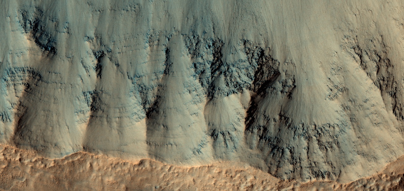
| 16:23, 14 November 2018 | ESP 042055 1580layers.jpg (file) |  |
53 KB | Suitupandshowup | Layers in depression in crater, as seen by hirise under HiWish program Source: http://hirise.lpl.arizona.edu/ESP_042055_1580 Image courtesy NASA/JPL/University of Arizona | 1 |
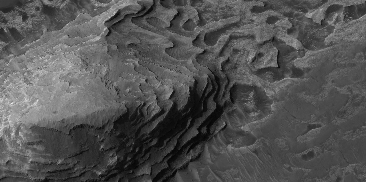
| 16:15, 14 November 2018 | Wikiesp 035896 1845crommelinhollows.jpg (file) |  |
136 KB | Suitupandshowup | Layers and hollows in Crommelin crater, as seen by hirise under HiWish program Source: http://hirise.lpl.arizona.edu/ESP_035896_1845 Image credit: NASA/JPL/University of Arizona/Secosky | 1 |
| 15:29, 14 November 2018 | Henry Crater Mound.JPG (file) |  |
45 KB | Suitupandshowup | Henry Crater Mound, as seen by hirise. Location is 11.3 degrees north latitude and 23.7 degrees east longitude. Image was taken by the Mars Reconnaissance Orbiter's HiRISE. The HiRISE camera was built by Ball Aerospace and Technology Corporation and is... | 1 |
| 15:19, 14 November 2018 | 56818 1790layersshadows.jpg (file) |  |
374 KB | Suitupandshowup | Layers in depression on floor of crater, as seen by HiRISE under HiWish program Source: http://hirise.lpl.arizona.edu/ESP_056818_1790 Image credit: NASA/JPL/University of Arizona/Secosky | 1 |
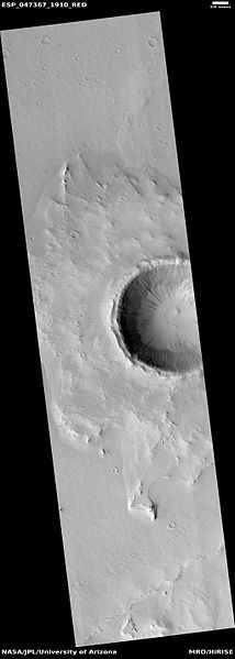
| 15:03, 14 November 2018 | ESP 047367 1910pedestal.jpg (file) |  |
18 KB | Suitupandshowup | Wide view of pedestal crater in Arabia quadrangle, as seen by hirise under HiWish program Source: http:hirise.lpl.arizona.edu/ESP_047367_1910 Image credit: NASA/JPL/University of Arizona/Secosky | 1 |
| 14:59, 14 November 2018 | 47367 1910pedestallayerssouth.jpg (file) |  |
46 KB | Suitupandshowup | Close view of layers in pedestal crater in Arabia quadrangle, as seen by hirise under HiWish program Source: http:hirise.lpl.arizona.edu/ESP_047367_1910 Image credit: NASA/JPL/University of Arizona/Secosky | 1 |
| 09:31, 14 November 2018 | 47080 2120layersclose.jpg (file) |  |
62 KB | Suitupandshowup | Close view of layers in mare Acidalium quadrangle, as seen by hirise under HiWish program Source: http:hirise.lpl.arizona.edu/ESP_047080_2120 Image credit: NASA/JPL/University of Arizona/Secosky | 1 |
| 09:27, 14 November 2018 | 43376 1710layersclose.jpg (file) |  |
54 KB | Suitupandshowup | Close up of layers in coprates quadrangle, as seen by hirise under HiWish program Source http://hirise.lpl.arizona.edu/ESP_43376_1710 Image credit: NASA/JPL/University of Arizona | 1 |
| 09:08, 14 November 2018 | Shalbatana Vallis.JPG (file) |  |
26 KB | Suitupandshowup | Shalbatana Vallis, as seen by hirise. Location is 6.3 degrees north latitude and 317.5 degrees east longitude. Image was taken by the Mars Reconnaissance Orbiter's HiRISE. The HiRISE camera was built by Ball Aerospace and Technology orporation and is o... | 1 |
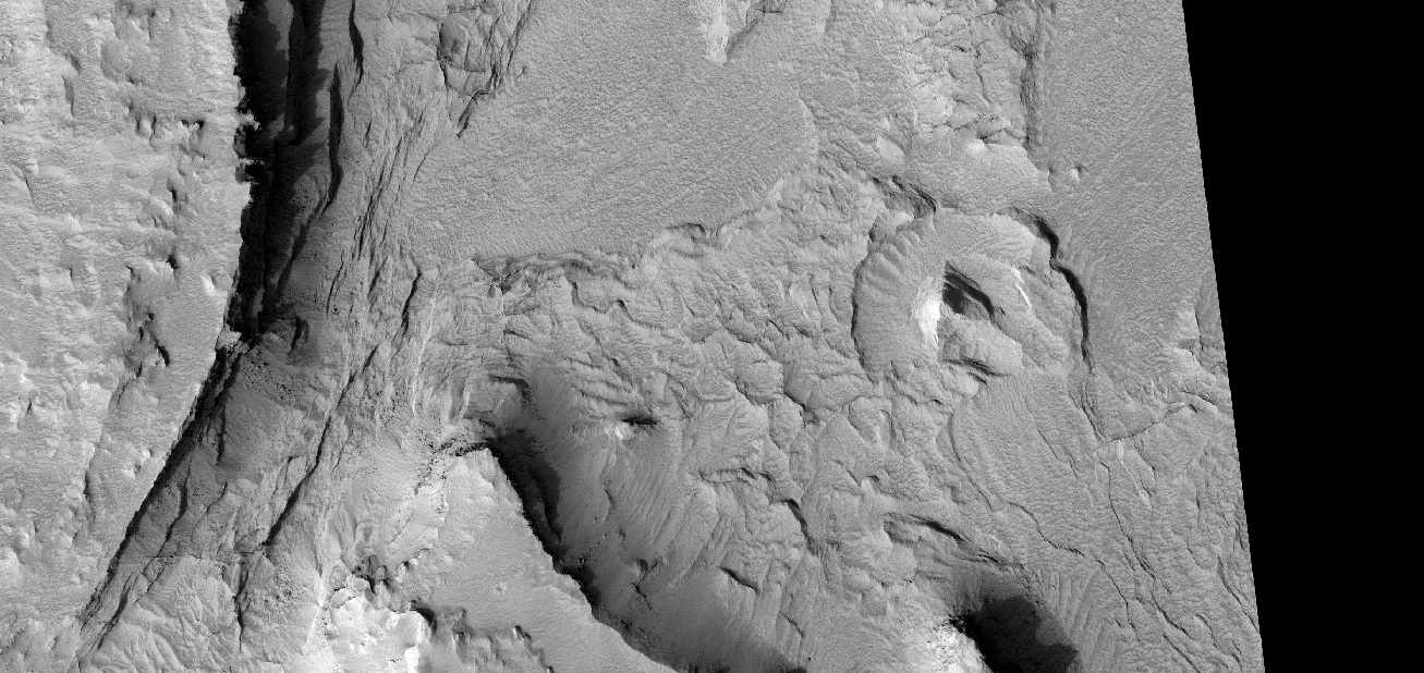
| 08:53, 14 November 2018 | ESP 057098 2050layers.jpg (file) |  |
270 KB | Suitupandshowup | Layers in crater, as seen by HiRISE under HiWish program Location is Syrtis Major quadrangle. Source: http://hirise.lpl.arizona.edu/ESP_057098_2050 Image credit: NASA/JPL/University of Arizona/Secosky NASA/JPL/University of Ari... | 1 |
| 08:39, 14 November 2018 | 57080 1380layerscratercolor.jpg (file) |  |
387 KB | Suitupandshowup | Layers in wall of crater, as seen by HiRISE under HiWish program Source: http://hirise.lpl.arizona.edu/ESP_57080_1380 Image credit: NASA/JPL/University of Arizona/Secosky | 1 |
| 12:34, 11 November 2018 | HAL-Base.png (file) |  |
67 KB | Jburk | Mockup of HAL v0.1.0 touchscreen display | 1 |
| 09:59, 8 November 2018 | TMS Trifold Brochure.pdf (file) | 2.89 MB | Jburk | Fixed typo | 4 | |
| 09:52, 8 November 2018 | TMS Trifold Brochure Back.jpg (file) |  |
495 KB | Jburk | 2 | |
| 09:06, 8 November 2018 | TMS Trifold Brochure Front.jpg (file) |  |
403 KB | Jburk | Front side of TMS Trifold Brochure | 1 |
| 12:28, 6 November 2018 | Phoenix mission horizon stitched high definition.jpg (file) |  |
30 KB | Suitupandshowup | Color view of polygons on the Martian surface, as seen by Phoenix lander Source NASA Jet Propulsion Laboratory Image credit: NASA/JPL Other versions Image extraction process This file has an extracted image: File:Phoenix mission patterned ground,... | 1 |
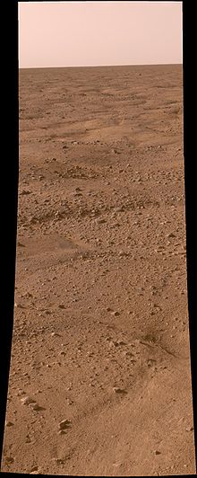
| 12:19, 6 November 2018 | 070802 phoenix lab 02labeled.jpg (file) |  |
73 KB | Suitupandshowup | Labelled instruments on the Phoenix Mars lander. Source http://www.nasa.gov/mission_pages/phoenix/multimedia/Lt1.html (image link) Image credit: NASA/JPL-Caltech/UA/Lockheed Martin | 1 |
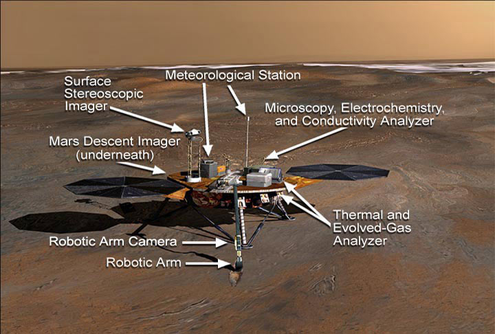
| 14:42, 3 November 2018 | Detail of Maja Valles Flow.jpg (file) |  |
70 KB | Suitupandshowup | Detail of water flow around Dromore crater within the ouflow channel Maja Valles, as seen by Viking 1. Location is 20N and 49 W. Source http://history.nass.gov/SP-414/ch4.htm Image credit: NASA/Secosky | 1 |
| 14:29, 3 November 2018 | Viking Teardrop Islands.jpg (file) |  |
62 KB | Suitupandshowup | Teardrop shaped islands, as seen by Viking 1. Location is 21 N and 31 W. These were shaped by floods. Source http://history.nasa.gov/SP-441/ch4.htm Image credit: NASA/Secosky | 1 |
| 09:54, 31 October 2018 | Capcom Calendar2.png (file) |  |
76 KB | Jburk | 1 | |
| 09:54, 31 October 2018 | Capcom Calendar.png (file) |  |
142 KB | Jburk | 1 | |
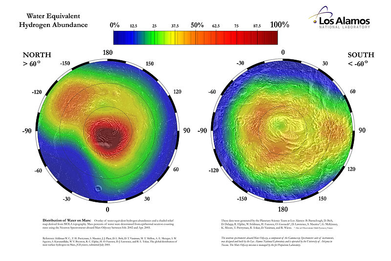
| 07:57, 31 October 2018 | Water equivalent hydrogen abundance in the high latitudes of Mars.jpg (file) |  |
94 KB | Suitupandshowup | This map displays the proportion of water ice present in the upper meter of the Martian surface within 30 degrees of the poles. The percentages are derived through stochiometric calculations based on epithermal neutron fluxes. These fluxes were detecte... | 1 |
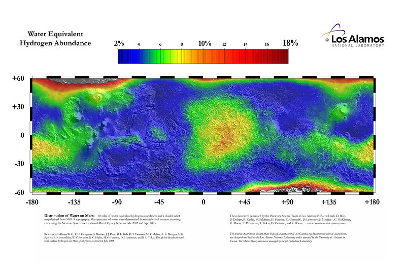
| 07:49, 31 October 2018 | Water equivalent hydrogen abundance in the lower latitudes of Mars 01.jpg (file) |  |
103 KB | Suitupandshowup | This map displays the proportion of water ice present in the upper meter of the Martian surface within 60 degrees of the equator. The percentages are derived through stochiometric calculations based on epithermal neutron fluxes. These fluxes were detec... | 1 |
| 11:05, 30 October 2018 | Vo1 084a47viking1.gif (file) |  |
94 KB | Suitupandshowup | 2 | |
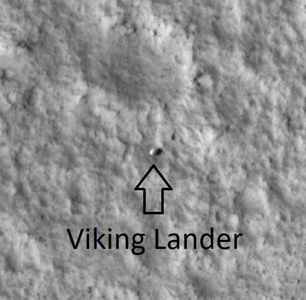
| 08:14, 30 October 2018 | PSP 001521 2025 RED VL-1 lander.png (file) |  |
274 KB | Suitupandshowup | Viking lander, as seen by HiRISE Image source: http://hirise.lpl.arizona.edu/PSP_001521_2025 Image credit: NASA/JPL/University of Arizona/Secosky | 1 |
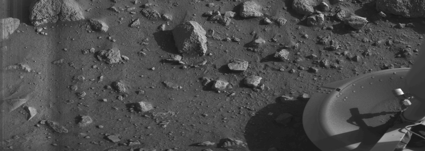
| 08:06, 30 October 2018 | Mars Viking 12a001first.png (file) |  |
299 KB | Suitupandshowup | First image from the Viking 1 lander, taken only a few minutes after the landing. Engineers decided to program the probe to quickly take and send an image of a footpad (in this case footpad number 3) because it was feared that earlier Soviet probes, wh... | 1 |
| 15:13, 29 October 2018 | Pathfinder01.jpg (file) |  |
89 KB | Suitupandshowup | Sojourner rover taking an Alpha Proton X-ray Spectrometer measurement of Yogi. Pathfinder mission - Mars exploration - NASA Date 1996 Source http://mars.jpl.nasa.gov/spotlight/pathfinder-image01.html Image credit: NASA | 1 |


