Uploads by Suitupandshowup
This special page shows all uploaded files.
| Date | Name | Thumbnail | Size | Description | Versions |
|---|---|---|---|---|---|
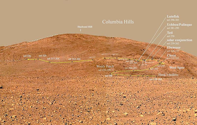
| 19:44, 17 December 2018 | Gusev - Colina Husbandlabeled.jpg (file) |  |
125 KB | Columbia Hills - Gusev Crater Source: Source: http://www.jpl.nasa.gov/news/news.cfm?release License: http://www.jpl.nasa.gov/images/policy/ JPL Image Policy Unless otherwise noted, images and video on JPL public web sites (public sites ending with... | 1 |
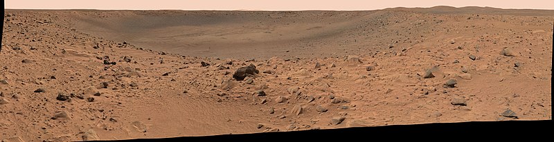
| 19:38, 17 December 2018 | PIA05591 Spirit's Destination (panorama).jpg (file) | 56 KB | This panoramic image mosaic from the Mars Exploration Rover Spirit panoramic camera, shows the rover's destination toward the hills nicknamed the "Columbia Hills," on the right. The rover's heatshield can be seen on the left as a tiny bright dot in the... | 1 | |
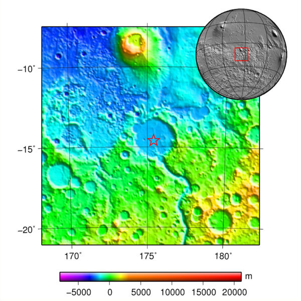
| 19:32, 17 December 2018 | MOLA spiritlandingmap.jpg (file) |  |
96 KB | Map and globe showing Spirit's landing location. Colors relate to elevation. Source: plotted using GMT and gridded MOLA data archive meg0031t.grd https://commons.wikimedia.org/wiki/File:MOLA_spirit.jpg Author: Martin Paue | 1 |
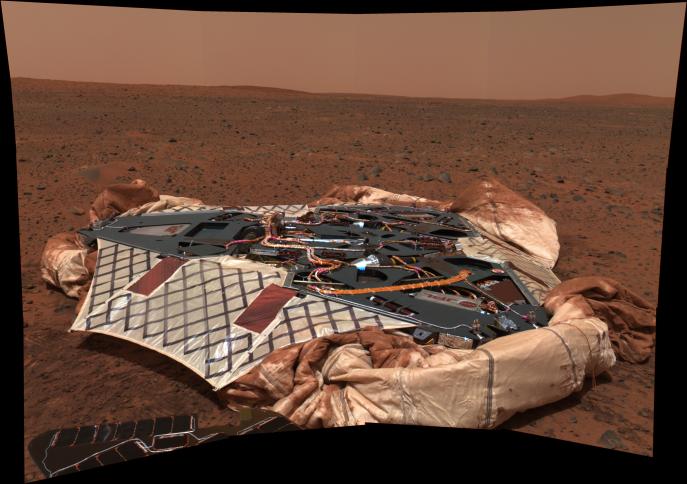
| 19:26, 17 December 2018 | PIA05117 modestspiritfolded.jpg (file) |  |
51 KB | This image mosaic taken by the panoramic camera onboard the Mars Exploration Rover Spirit shows the rover's landing site, the Columbia Memorial Station, at Gusev Crater, Mars. This spectacular view may encapsulate Spirit's entire journey, from lander t... | 1 |
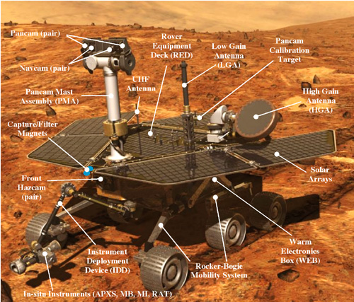
| 17:01, 17 December 2018 | Rover1 detail 500.jpg (file) |  |
154 KB | Mars Rover with parts labeled Source: https://mars.jpl.nasa.gov/mer/mission/images/rover1_detail_500.jpg Image Credit: NASA/JPL | 1 |
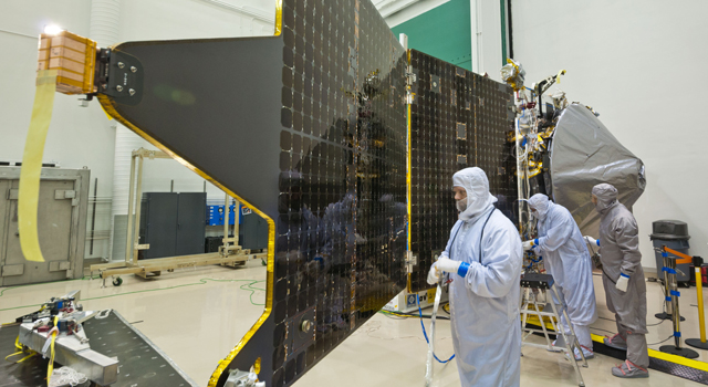
| 10:09, 17 December 2018 | Maven20130213-640solarpanels.jpg (file) |  |
199 KB | MAVEN showing solar panel while in clean room at Lockheed Martin with technicians installed the orbiter's two solar panels. Courtesy Lockheed Martin Source: https://www.jpl.nasa.gov/news/news.php?feature=3690 | 1 |
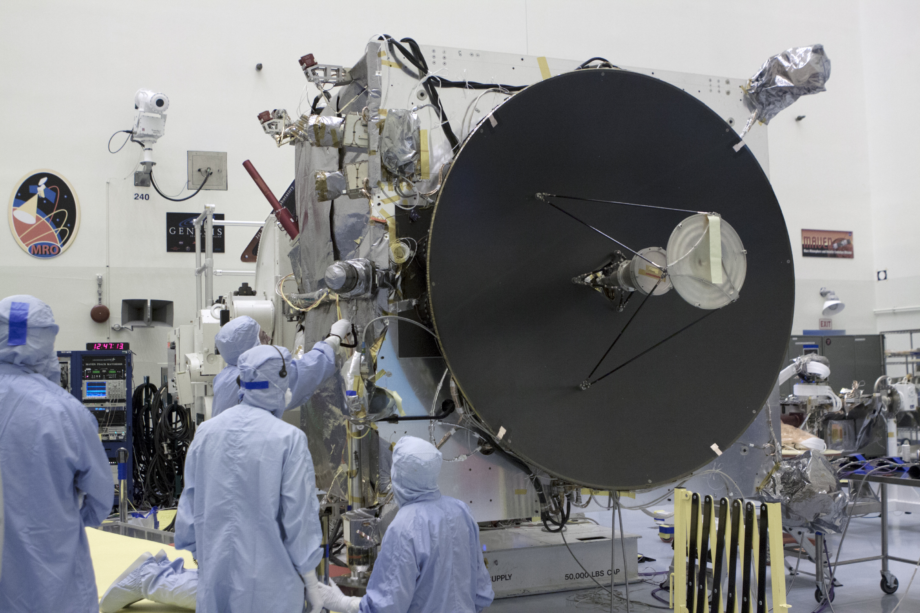
| 10:03, 17 December 2018 | Dsn-mavenhighgain.jpg (file) |  |
3.81 MB | MAVEN in clean room showing high-gain antenna Source: https://www.nasa.gov/sites/default/files/dsn-mavenhighgain.jpg Image credit: NASA/Gov | 1 |
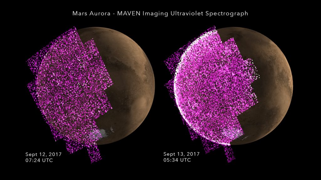
| 09:47, 17 December 2018 | MAVENAuroraBeforeDuring-1024x576.jpg (file) |  |
106 KB | Aurora before and during solar storm arrival, as seen by MAVEN Source: http://lasp.colorado.edu/home/maven/solar-storm-triggers-whole-planet-aurora-at-mars/ Courtesy NASA/University of Colorado Boulder-LASP | 1 |
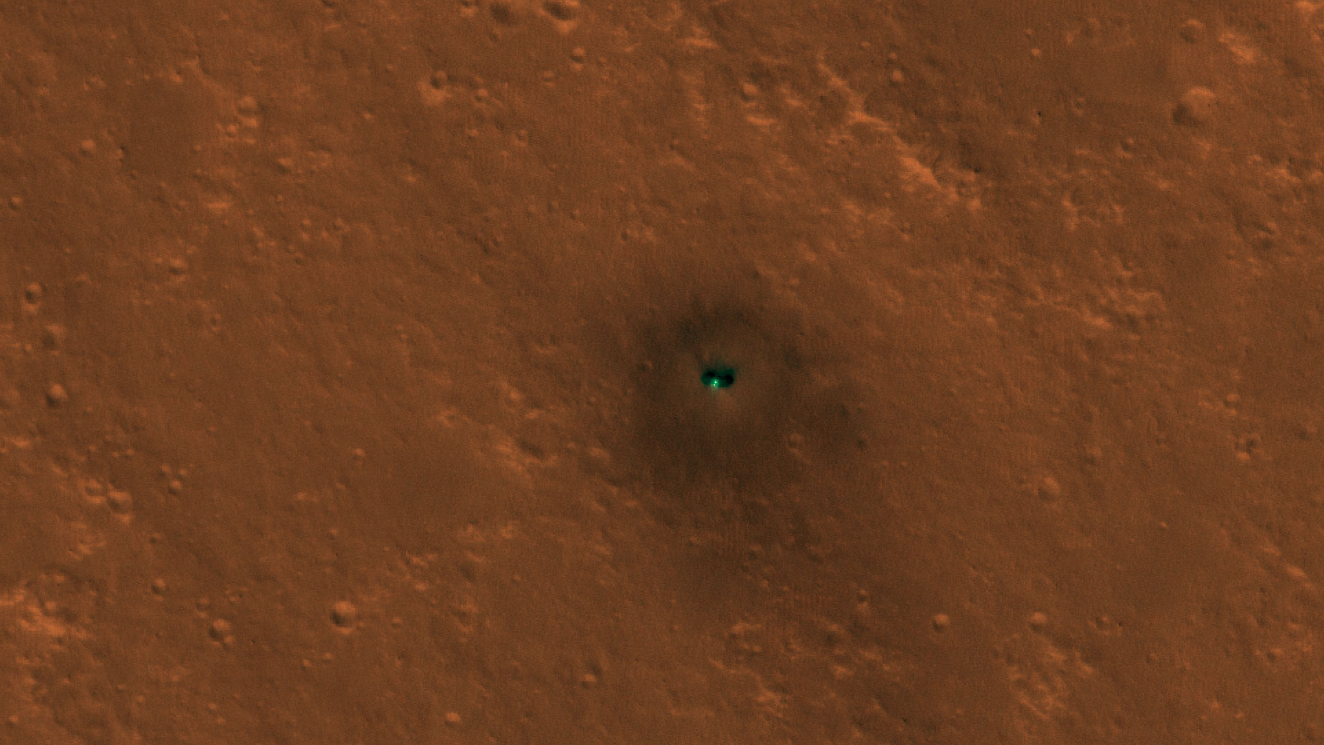
| 14:17, 15 December 2018 | ESP 058005 1845-lander-full-res.jpg (file) |  |
300 KB | InSight on Mars, as seen by HiRISE Source: https://static.uahirise.org/images/2018/details/cut/ESP_058005_1845-lander-full-res.jpg Image credit: NASA/JPL/University of Arizona | 1 |
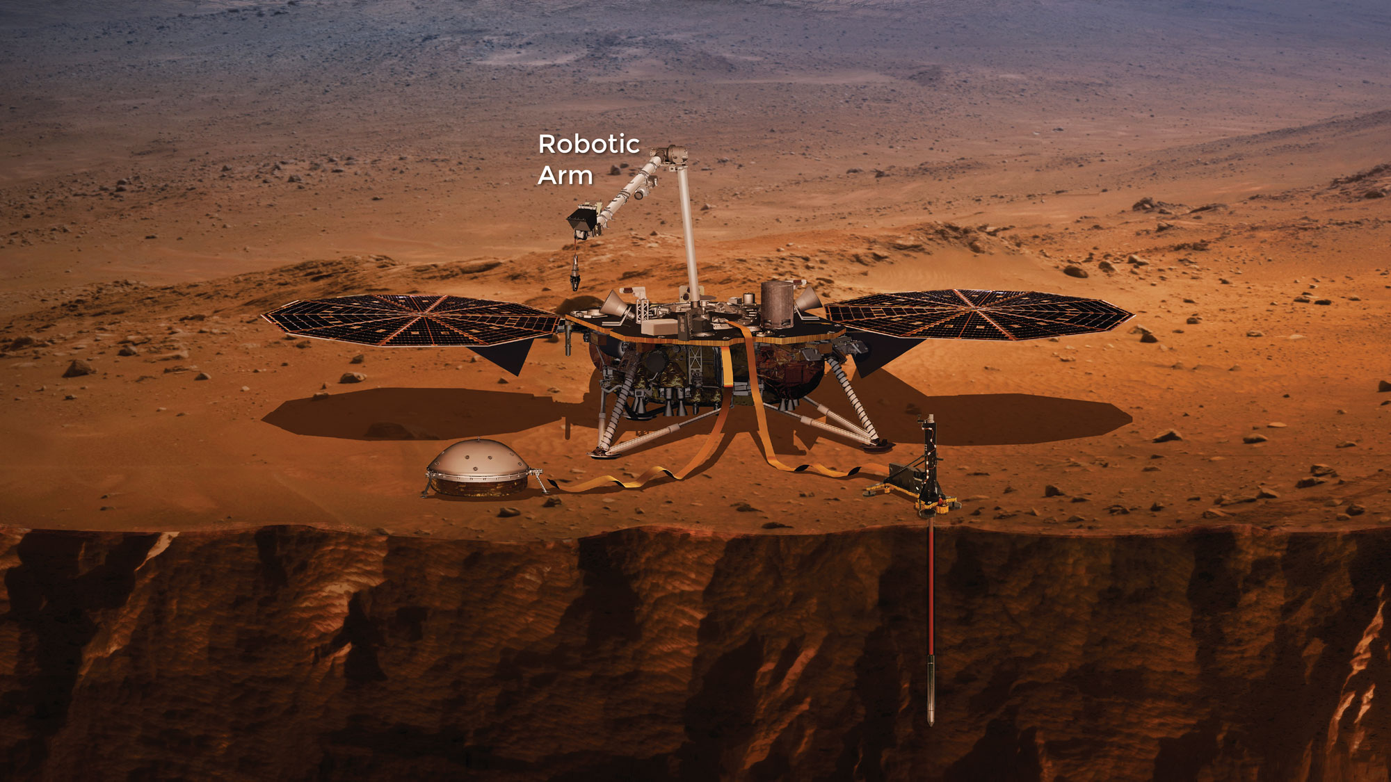
| 13:31, 15 December 2018 | Insightlander.jpg (file) |  |
405 KB | InSight lander Source: https://mars.nasa.gov/insight/spacecraft/about-the-lander/ Image credit: NASA/JPL/ | 1 |
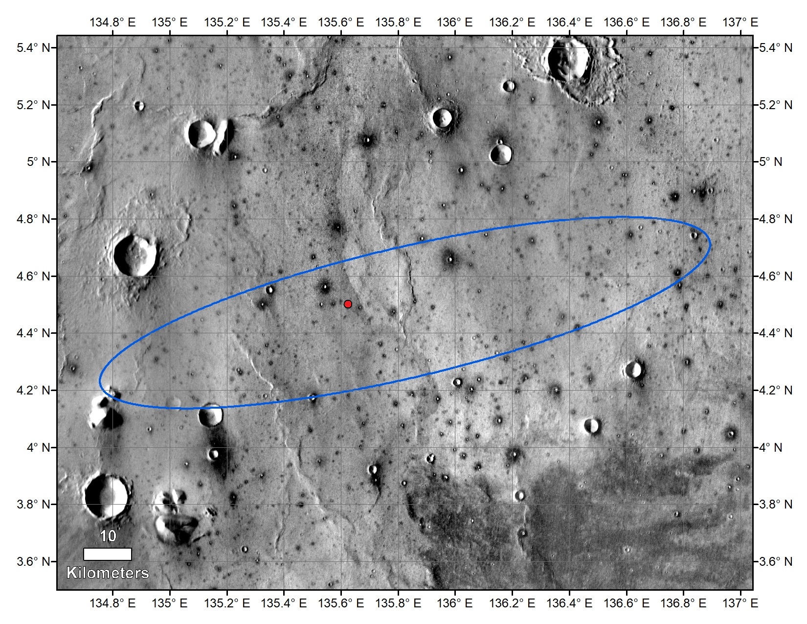
| 13:27, 15 December 2018 | PIA22878b-annotatedinsightlanding.jpg (file) |  |
874 KB | Map showing location of Insight lander--indicated with red dot. Picture taken by the THEMIS camera on NASA's 2001 Mars Odyssey orbiter in 2015 Source: https://mars.nasa.gov/insight/resources/22222/insights-final-location-on-mars/ Image credit: NASA... | 1 |
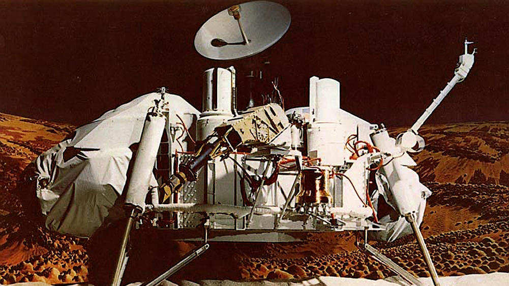
| 18:44, 14 December 2018 | Vikikinglander2.jpg (file) |  |
492 KB | Viking lander Source: https://www.jpl.nasa.gov/missions/web/viking.jpg Image credit: NASA/JPL | 1 |
| 17:37, 14 December 2018 | Vikinglander2-1viking2.jpg (file) |  |
844 KB | View of surface around Viking 2 Source: https://nssdc.gsfc.nasa.gov/image/planetary/mars/vikinglander2-1.jpg Image Credit: NASA/GSFC/NSSDC | 1 |
| 17:28, 14 December 2018 | Mars landsite globe.jpg (file) |  |
139 KB | Map of Mars showing landing sites of Vikings and pathfinder. Source: https://nssdc.gsfc.nasa.gov/planetary/image/mars_landsite_globe.gif Image credit: NASA/GSFC/NSSDC | 1 |
| 15:59, 14 December 2018 | Viking orbiter.jpg (file) |  |
15 KB | Viking as it traveled to Mars with orbiter at the top and lander inside the egg-shaped aeoshell at the bottom. Source: https://nssdc.gsfc.nasa.gov/photo_gallery/photogallery-spacecraft.html#viking Image credit: NASA | 1 |
| 07:51, 7 December 2018 | Marinercratermap.jpg (file) |  |
375 KB | Map showing Mariner Crater and other nearby features. Mariner Crater was named after the Mariner 4 spacecraft which first imaged the crater. Source: https://planetarynames.wr.usgs.gov/images/mc24_2014.pdf Image Credit: NASA/USGS | 1 |
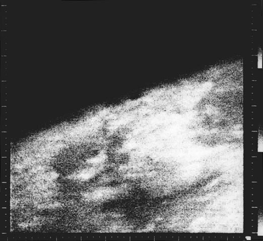
| 16:28, 5 December 2018 | Mars (Mariner 4)first image.jpg (file) | first_image.jpg) |
48 KB | Mariner 4 image, the first close-up image ever taken of Mars. This shows an area about 330 km across by 1200 km from limb to bottom of frame, centered at 37 N, 187 W. The area is near the boundary of Elysium Planitia to the west and Arcadia Planitia to... | 1 |
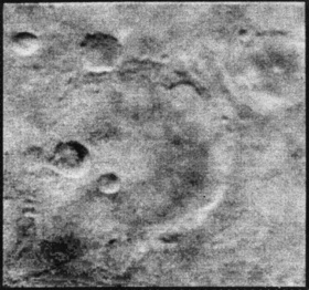
| 13:27, 5 December 2018 | Mariner 4 craters.jpg (file) |  |
37 KB | Mars craters, as seen by mariner 4 Image credit: NASA | 1 |
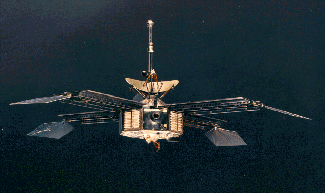
| 13:22, 5 December 2018 | Mariner 3 and 4.jpg (file) |  |
299 KB | Mariner 3 and 4 The two craft were identical. Source: http://solarsystem.nasa.gov/multimedia/display.cfm?IM_ID=1897 http://nssdc.gsfc.nasa.gov/image/spacecraft/mariner04.gif. Image credit: NASA | 1 |
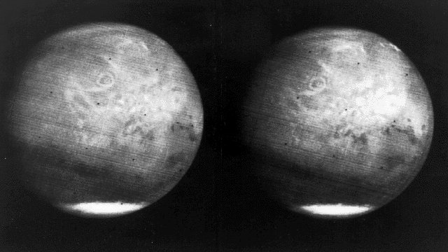
| 11:33, 30 November 2018 | Mars full disk approach view from Mariner 7.jpg (file) |  |
65 KB | (1969) View of the entire planet of Mars from Mariner 7, showing NIX Olympia (later identified as the giant shield volcano Olympus Mons), and polar caps. Photographed from 200,000 miles away. Mariner 7 was launched on March 27, 1969 and arrived on Au... | 1 |
| 10:59, 30 November 2018 | Wikiwislicenus.jpg (file) |  |
104 KB | Western side of Wislicenus crater (Mars), as seen by CTX. Source http://viewer.mars.asu.edu/planetview/inst/ctx/G04_019729_1614_XI_18S349W#P=G04_019729_1614_XI_18S349W&T=2 Image Credit: NASA/MSSS | 1 |
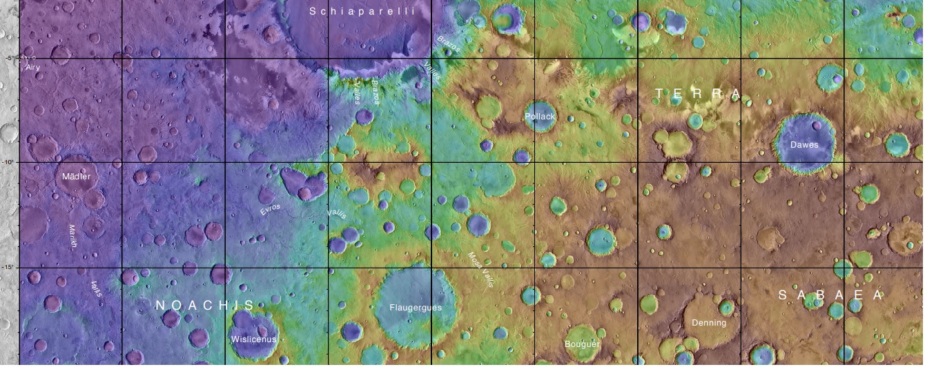
| 10:53, 30 November 2018 | Marspediaflaugerguesmap.jpg (file) |  |
351 KB | Topo map showing Flaugergues, Wislicenus, and other nearby craters. Flaugergues, Wislicenus Craters were imaged by Mariner 6. Source: https://planetarynames.wr.usgs.gov/images/mc20_2014.pdf Image Credit: NASA/USGS | 1 |
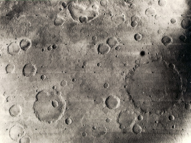
| 08:36, 28 November 2018 | Mar6cratmariner6.jpg (file) |  |
170 KB | 1969 Mariner 6 view of the Sinus Sabaeus and Deucalionis Regio portion of Mars. The large crater (lower right) is Flaugergues (~200 km diameter; 18 S, 341 W). The double crater toward the lower left is Wislicenus (18 S, 348 W). (Mariner 6 image 6N21; c... | 1 |
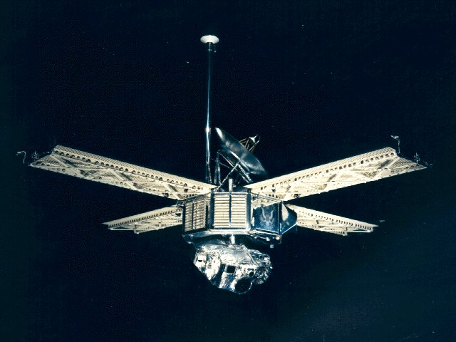
| 12:36, 27 November 2018 | Mariner 6-7.png (file) |  |
408 KB | Mariner 6 and 7 spacecraft The two are identical. Source http://nssdc.gsfc.nasa.gov/nmc/masterCatalog.do?sc=1969-014A Image credit:NASA | 1 |
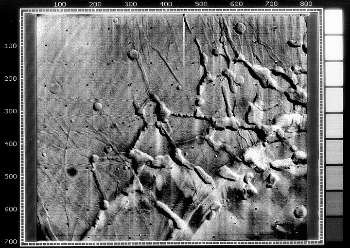
| 07:21, 26 November 2018 | ESP 056561 2170channels.jpg (file) |  |
2.74 MB | Branched channels, as seen by HiRISE under HiWish program Source: HiRISE.lpl.arizona.edu/ESP_056561_2170 Image credit: NASA/JPL/University of Arizona | 1 |
| 15:52, 24 November 2018 | M09 mtvs4187 45noctismariner9help.jpg (file) |  |
224 KB | Noctis, as seen by Mariner 9 Image credit: NASA | 1 |
| 09:51, 23 November 2018 | M09 mtvs4187 45noctismariner9.gif (file) |  |
415 KB | Mariner 9 view of the Noctis Labyrinthus "labyrinth" at the western end of Valles Marineris on Mars. Linear graben, grooves, and crater chains dominate this region, along with a number of flat-topped mesas. The image is roughly 400 km across, centered... | 1 |
| 09:46, 23 November 2018 | Mariner8&9 schematics.jpg (file) |  |
31 KB | Mariner 9 schematics Image credit: NASA Source: https://upload.wikimedia.org/wikipedia/commons/1/16/Mariner8%269_schematics.jpg | 1 |
| 10:16, 21 November 2018 | NASA-Mars-JezeroCrater-20181116.jpg (file) |  |
141 KB | JEZERO CRATER - PLANET MARS Overflowing Crater Lakes Carved Canyons Across Mars https://news.utexas.edu/2018/11/16/overflowing-crater-lakes-carved-canyons-across-mars/ http://redplanet.asu.edu/?p=31676 IMAGE CAPTION Jezero crater is a paleolake an... | 1 |
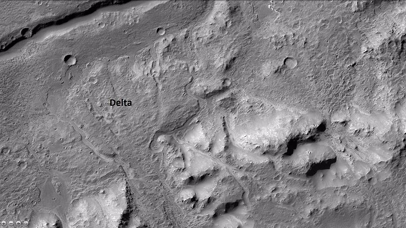
| 09:58, 21 November 2018 | JezeroCraterdelta.jpg (file) |  |
797 KB | Jezero Crater's delta https://www.jpl.nasa.gov/news/news.php?feature=7286&utm_source=iContact&utm_medium=email&utm_campaign=nasajpl&utm_content=daily20181119-2 Credit: NASA/JPL-Caltech/MSSS/JHU-APL | 1 |
| 09:54, 21 November 2018 | IMAGE2-MOLAmapjezero.jpg (file) |  |
59.07 MB | MOLA topo map showing location of Jezero Crater Source: https://www.jpl.nasa.gov/images/mars2020/20181119/IMAGE2-MOLAmap.jpg Credit: NASA/JPL-Caltech/MSSS/JHU-APL | 1 |
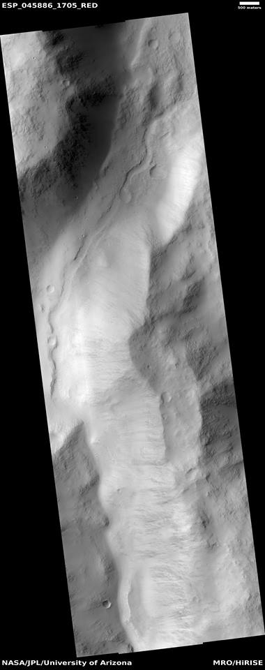
| 09:45, 19 November 2018 | 13882282 10207143921535802 7740003704272946655 nchannelinvalley.jpg (file) |  |
37 KB | Channel within a larger channel, as seen by HiRISE under HiWish program Source: http://hirise.lpl.arizona.edu/ESP_045886_1705 Image credit: NASA/JPL/University of Arizona/Secosky | 1 |
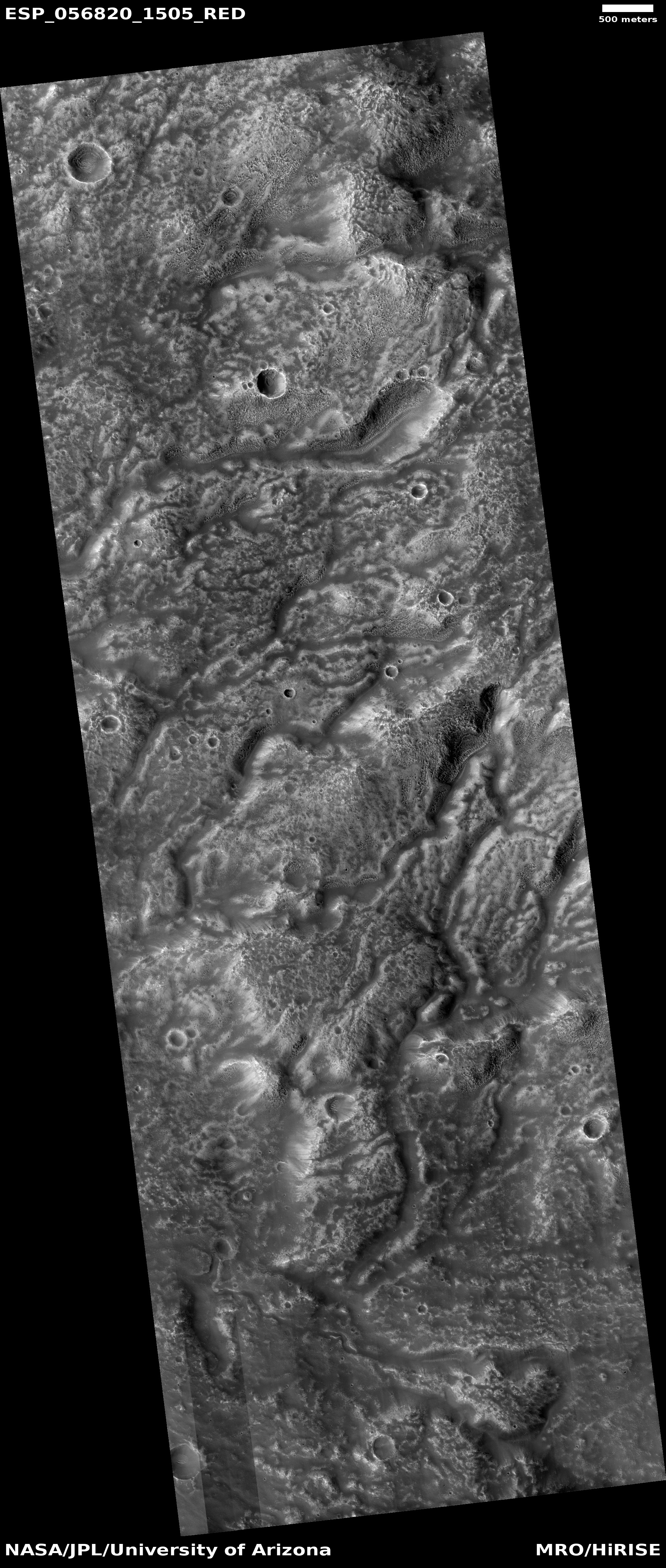
| 18:34, 17 November 2018 | ESP 056820 1505channelnetwork.jpg (file) |  |
2.6 MB | Channel network in the Iapygia quadrangle, as seen by HiRISE under HiWish program Source: http://hirise.lpl.arizona.edu/ESP_056820_1505 Image credit: NASA/JPL/University of Arizona | 1 |
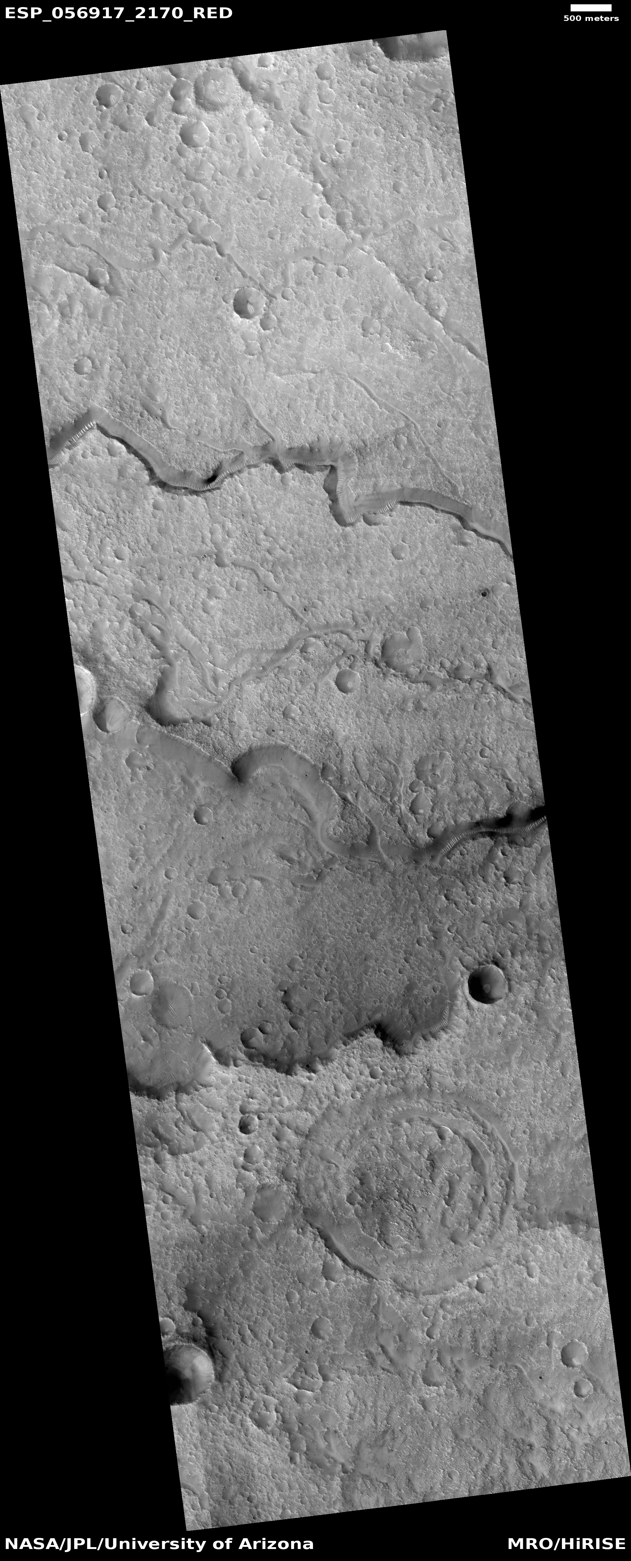
| 18:28, 17 November 2018 | ESP 056917 2170channels.jpg (file) |  |
2.69 MB | Channels in the Mare Acidalium quadrangle, as seen by HiRISE under HiWish program Source: http://hirise.lpl.Arizona.edu/ESP_ESP_056917_2170 Image credit: NASA/JPL/University of Arizona | 1 |
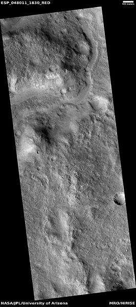
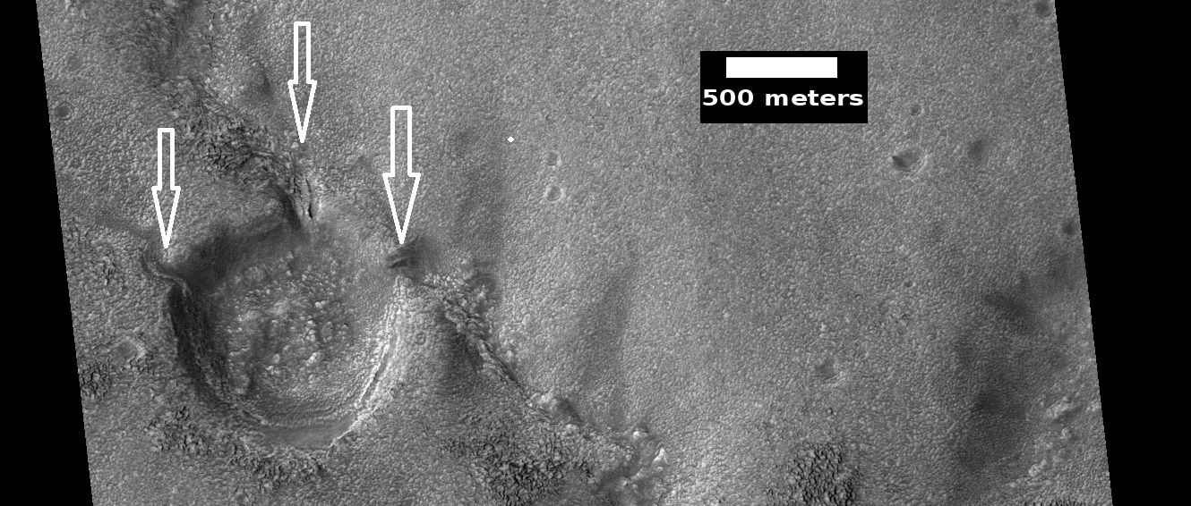
| 09:13, 17 November 2018 | ESP 048011 1830channel.jpg (file) |  |
35 KB | Channel in Syrtis Major quadrangle, as seen by HiRISE under HiWish program This channel seems to have a smaller channel in a valley. Water may have flowed here more than once. Source http://hirise.lpl.arizona.edu/ESP_048011_1830 Image credit: NASA... | 1 |
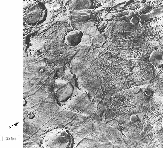
| 09:44, 16 November 2018 | 26126contextb22 018333 1548delta.jpg (file) |  |
104 KB | Wide view of delta in holden crater as seen by ctx Source http://viewer.mars.asu.edu/planetview/inst/ctx/B22_018333_1548_XI_25S033W#P=B22_018333_1548_XI_25S033W&T=2 Image credit: NASA/Malin Space Science Systems | 1 |
| 09:38, 16 November 2018 | ESP 056800 1385channels.jpg (file) |  |
344 KB | Channels and crater in the Thaumasia quadrangle, as seen by HiRISE under HiWish program Source http://hirise.lpl.arizona.edu/ESP_056800_1385 Image credit: NASA/JPL/University of Arizona/Secosky | 1 |
| 09:26, 16 November 2018 | Branched Channels from Viking.jpg (file) |  |
100 KB | Branched channels, as seen by Viking. Location is 48 S and 98 W. These branched channels in Thaumasia quadrangle provide possible evidence of past rain on Mars. Source http://history.nasa.gov/SP-441/ch4.htm Image credit: NASA | 1 |
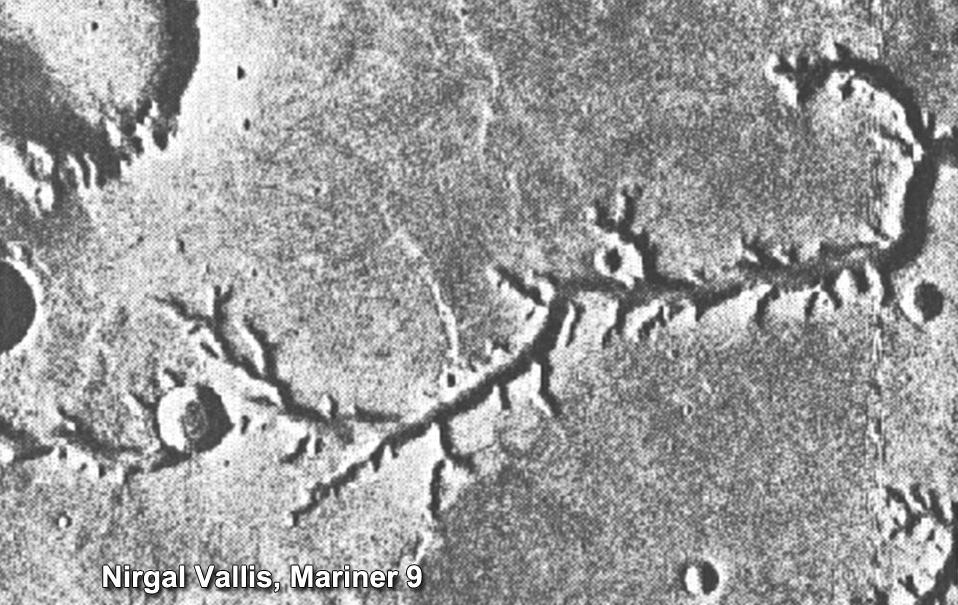
| 09:04, 16 November 2018 | PIA15090nirgalvallismariner9.jpg (file) |  |
136 KB | Nirgal Vallis, as seen by mariner 9 Source: https://photojournal.jpl.nasa.gov/jpeg/PIA15090.jpg Image credit: NASA | 1 |
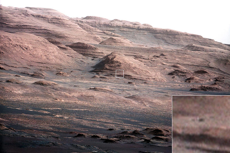
| 09:44, 15 November 2018 | PIA16105 malin04ano-br2.jpg (file) |  |
111 KB | Layers at the Base of Mount Sharp A chapter of the layered geological history of Mars is laid bare in this postcard from NASA's Curiosity rover. The image shows the base of Mount Sharp, the rover's eventual science destination. This image is a portion... | 1 |
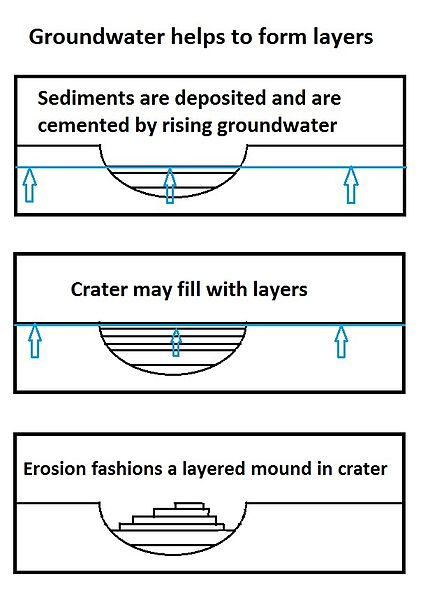
| 09:25, 15 November 2018 | Groundwaterseries8final.jpg (file) |  |
37 KB | Series of drawings showing how groundwater can help to form layers in craters. Source: This is my own work. I give permission for anyone to use it. | 1 |
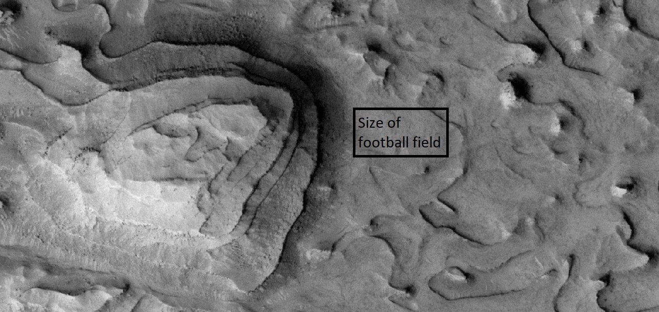
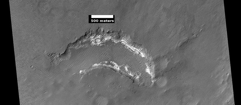
| 08:27, 15 November 2018 | 56836 1900layedmound2.jpg (file) |  |
365 KB | Layered mound on floor of crater, as seen by HiRISE under HiWish program The black box shows the size of a football field. Location is the Arabia quadrangle. Source: http://hirise.lpl.arizona.edu/ESP_56836_1900 Image credit: NASA/JPL/University o... | 1 |
| 08:26, 15 November 2018 | 56836 1900layedmoundfootball.jpg (file) |  |
345 KB | Layered mound on floor of crater, as seen by HiRISE under HiWish program The black box shows the size of a football field. Location is the Arabia quadrangle. Source: http://hirise.lpl.arizona.edu/ESP_56836_1900 Image credit: NASA/JPL/University o... | 1 |
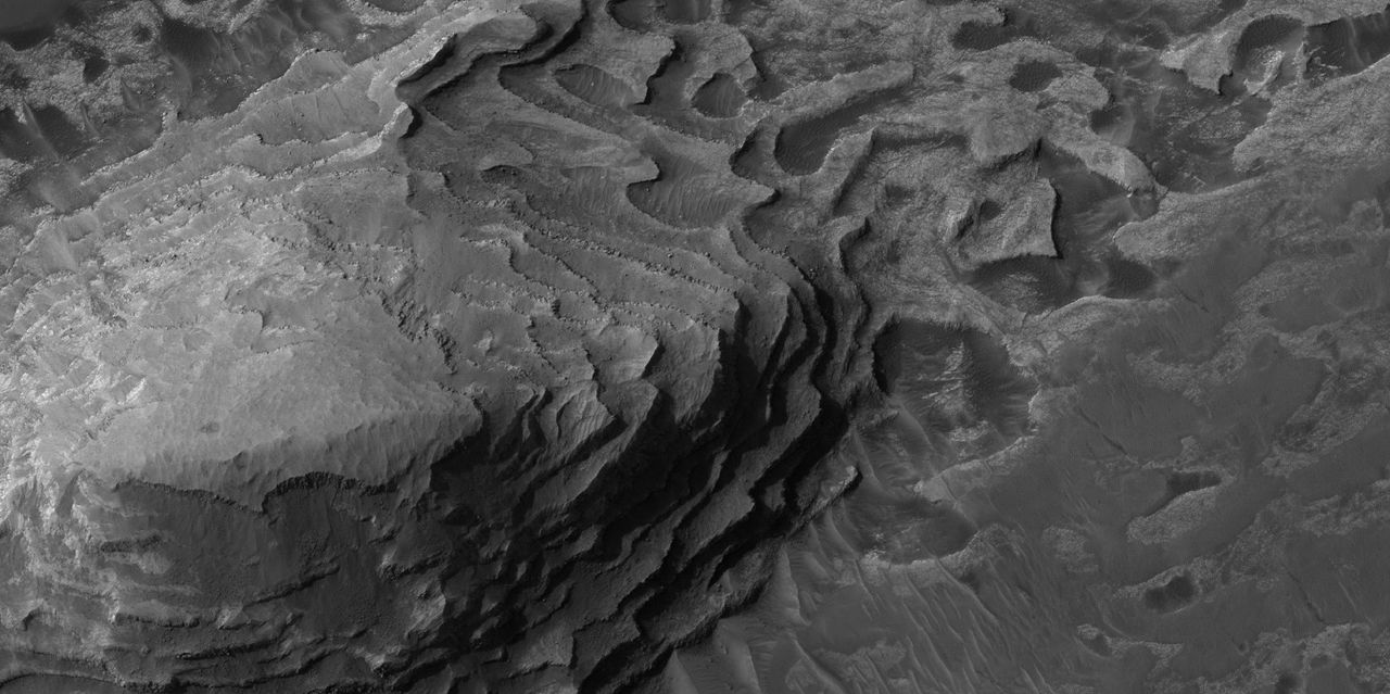
| 16:23, 14 November 2018 | ESP 042055 1580layers.jpg (file) |  |
53 KB | Layers in depression in crater, as seen by hirise under HiWish program Source: http://hirise.lpl.arizona.edu/ESP_042055_1580 Image courtesy NASA/JPL/University of Arizona | 1 |
| 16:15, 14 November 2018 | Wikiesp 035896 1845crommelinhollows.jpg (file) |  |
136 KB | Layers and hollows in Crommelin crater, as seen by hirise under HiWish program Source: http://hirise.lpl.arizona.edu/ESP_035896_1845 Image credit: NASA/JPL/University of Arizona/Secosky | 1 |
| 15:29, 14 November 2018 | Henry Crater Mound.JPG (file) |  |
45 KB | Henry Crater Mound, as seen by hirise. Location is 11.3 degrees north latitude and 23.7 degrees east longitude. Image was taken by the Mars Reconnaissance Orbiter's HiRISE. The HiRISE camera was built by Ball Aerospace and Technology Corporation and is... | 1 |
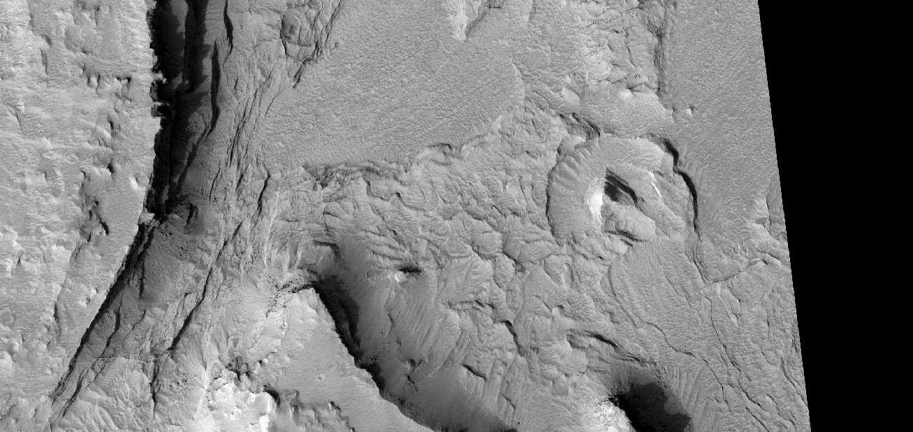
| 15:19, 14 November 2018 | 56818 1790layersshadows.jpg (file) |  |
374 KB | Layers in depression on floor of crater, as seen by HiRISE under HiWish program Source: http://hirise.lpl.arizona.edu/ESP_056818_1790 Image credit: NASA/JPL/University of Arizona/Secosky | 1 |
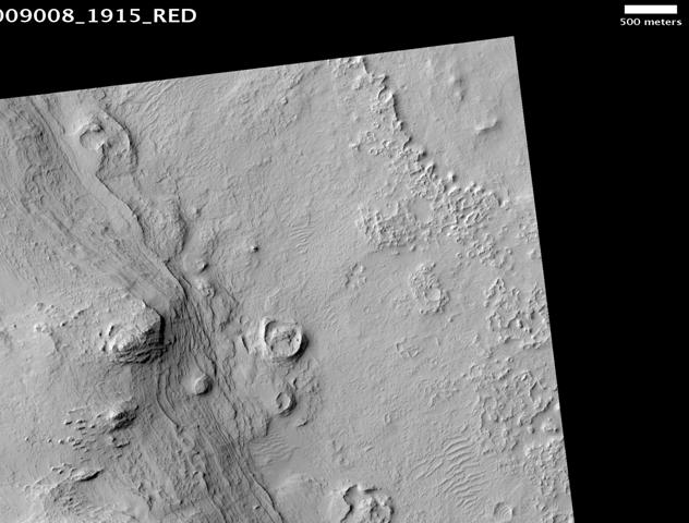
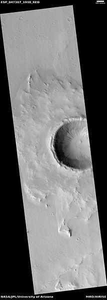
| 15:03, 14 November 2018 | ESP 047367 1910pedestal.jpg (file) |  |
18 KB | Wide view of pedestal crater in Arabia quadrangle, as seen by hirise under HiWish program Source: http:hirise.lpl.arizona.edu/ESP_047367_1910 Image credit: NASA/JPL/University of Arizona/Secosky | 1 |
| 14:59, 14 November 2018 | 47367 1910pedestallayerssouth.jpg (file) |  |
46 KB | Close view of layers in pedestal crater in Arabia quadrangle, as seen by hirise under HiWish program Source: http:hirise.lpl.arizona.edu/ESP_047367_1910 Image credit: NASA/JPL/University of Arizona/Secosky | 1 |
| 09:31, 14 November 2018 | 47080 2120layersclose.jpg (file) |  |
62 KB | Close view of layers in mare Acidalium quadrangle, as seen by hirise under HiWish program Source: http:hirise.lpl.arizona.edu/ESP_047080_2120 Image credit: NASA/JPL/University of Arizona/Secosky | 1 |


.jpg)