Uploads by Suitupandshowup
This special page shows all uploaded files.
| Date | Name | Thumbnail | Size | Description | Versions |
|---|---|---|---|---|---|
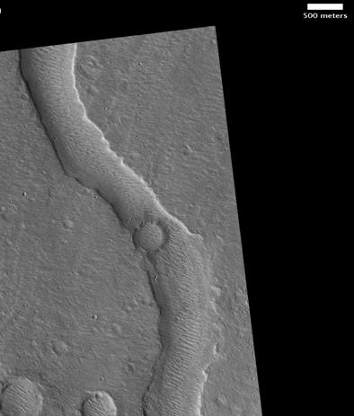
| 10:49, 23 January 2019 | Hypanis Vallis.JPG (file) |  |
21 KB | Hypanis Vallis, as seen by hirise. Location is 11.4 degrees north latitude and 314.7 degrees east longitude. Image was taken by the Mars Reconnaissance Orbiter's HiRISE. The HiRISE camera was built by Ball Aerospace and Technology Corporation and is op... | 1 |
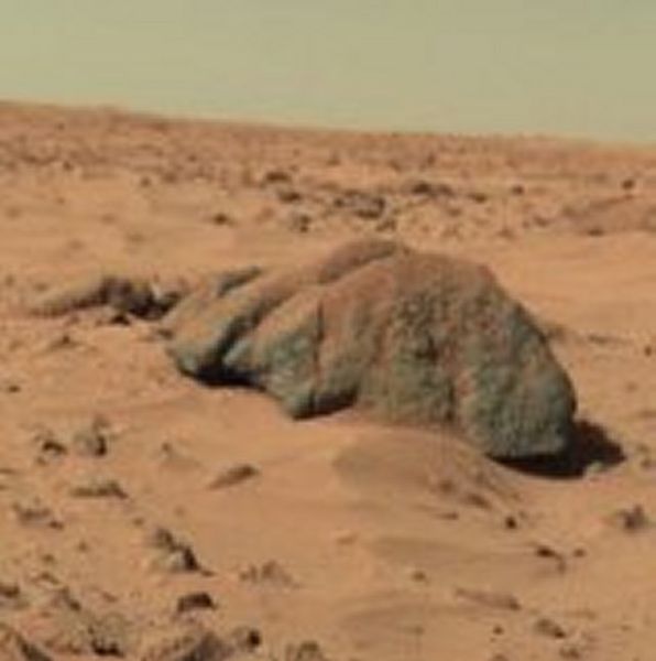
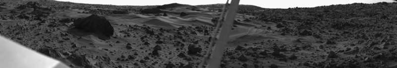
| 10:40, 23 January 2019 | MarsViking1Lander-BigJoeRock-19780211.jpg (file) |  |
29 KB | This picture was taken by the Viking Lander 1 on February 11, 1978 on Sol 556. The large rock just left of the center is about two meters wide. This rock was named "Big Joe" by the Viking scientists. The top of the rock is covered with red soil. Those... | 1 |
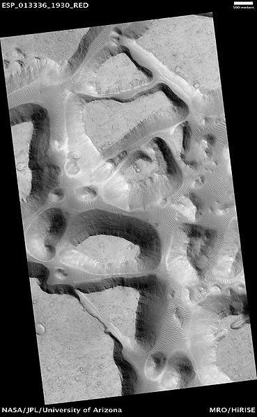
| 10:29, 23 January 2019 | Ister Chaos.jpg (file) |  |
45 KB | Ister Chaos, as seen by hirise. Location is 12.6 N and 303.1 E. Source http://hirise.lpl.arizona.edu/ESP_013336_1930 Image credit: NASA/JPL/University of Arizona | 1 |
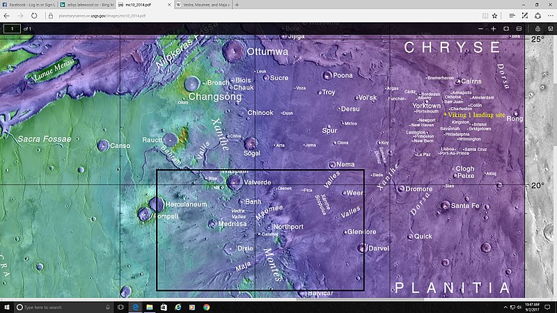
| 10:20, 23 January 2019 | Vallesmaumeevedraboxmap.jpg (file) |  |
132 KB | Map showing location of several valleys in Lunae Palus quadrangle Some are inside of a box Date 3 September 2017 Source https://planetarynames.wr.usgs.gov/Feature/6340 Image credit: NASA/Goddard/ASU/USGS/Secosky | 1 |
| 10:03, 23 January 2019 | Mars Viking 11a097wide.png (file) | 102 KB | Dust dunes on Mars, taken by the Viking 1 Lander in the early morning. The pole in the center is an instrument boom. Date 2009-01-24; original photo was taken 1976-08-03. Source Own work based on an image in the NASA Viking image archive Author "Roel... | 1 | |
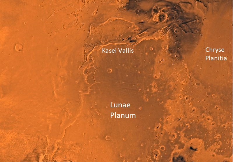
| 09:54, 23 January 2019 | PIA00170-MC-10-LunaePalusRegion-19980605.jpg (file) |  |
119 KB | PIA00170: MC-10 Lunae Palus Region http://photojournal.jpl.nasa.gov/catalog/pia00170 Mars digital-image mosaic merged with color of the MC-10 quadrangle, Lanae Palus region of Mars. The western part is dominated by lava flows of the Tharsis region. Th... | 1 |
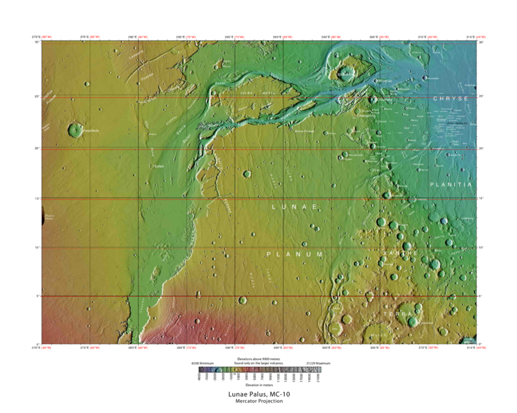
| 09:41, 23 January 2019 | USGS-Mars-MC-10-LunaePalusRegion-mola.png (file) |  |
542 KB | MOLA Topographic Map of Lunae Palus Quadrangle (MC-10) on the planet Mars. NOTE: Converted the original PDF file to a PNG File (via GIMP v2.8.4 program) - and uploaded to Wikimedia Commons. https://commons.wikimedia.org/wiki/File:USGS-Mars-MC-10-Luna... | 1 |
| 15:52, 22 January 2019 | Milankovic Craterdevils.jpg (file) |  |
58 KB | 1 | |
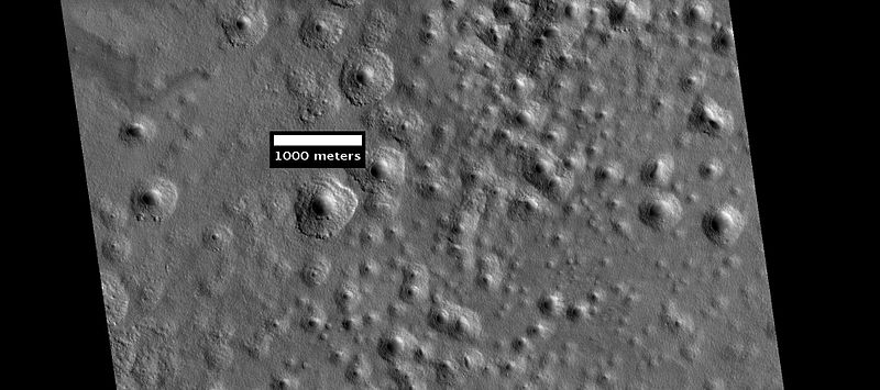
| 12:02, 22 January 2019 | Erebus Montes.JPG (file) |  |
50 KB | Erebus Montes edge of hills, as seen by hirise. Scale bar is 1 km long. Image was taken by the Mars Reconnaissance Orbiter's HiRISE. The HiRISE camera was built by Ball Aerospace and Technology Corporation and is operated by the University of Arizona.... | 1 |
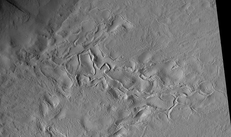
| 11:55, 22 January 2019 | Lycussulcictx.jpg (file) |  |
239 KB | Flows and channels at the northwest margin of the Lycus Sulci Source: http://viewer.mars.asu.edu/planetview/inst/ctx/D22_035769_2120_XI_32N146W#P=D22_035769_2120_XI_32N146W&T=2 Image credit: NASA/MSSS/Secosky | 1 |
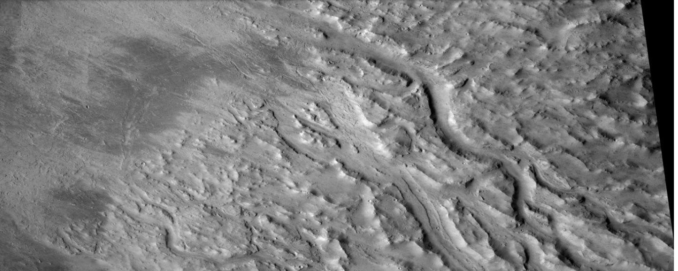
| 10:42, 22 January 2019 | Acheronchannelsctx.jpg (file) |  |
316 KB | Channels in Acheron region, as seen by CTX Source: http://viewer.mars.asu.edu/planetview/inst/ctx/F01_036072_2192_XI_39N136W#P=F01_036072_2192_XI_39N136W&T=2 Image Credit: NASA/MSSS/Secosky | 1 |
| 10:25, 22 January 2019 | ESP 057250 2165cracks.jpg (file) |  |
335 KB | Cracks in Dacria quadrangle, as seen by HiRISE under HiWish program Source http://hirise.lpl.arizona.edu/ESP_057250_2165 Image credit: NASA/JPL/University of Arizona | 1 |
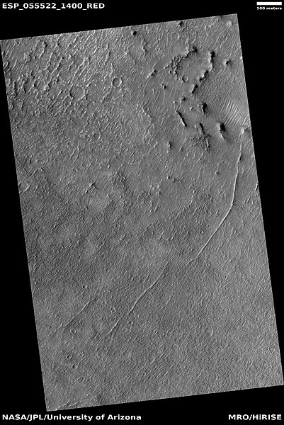
| 10:22, 22 January 2019 | ESP 055522 1400ridge.jpg (file) |  |
84 KB | Ridges in Diacria quadrangle, as seen by HiRISE under HiWish program These may be dikes. Source http://hirise.lpl.arizona.edu/ESP_055522_1400 Image credit: NASA/JPL/University of Arizona | 1 |
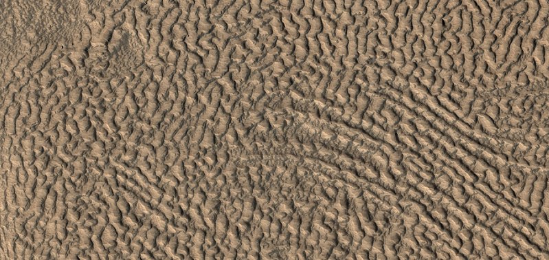
| 10:19, 22 January 2019 | 54996 2155brainscolor.jpg (file) |  |
122 KB | Color view of brain terrain in Diacria quadrangle, as seen by HiRISE under HiWish program Source http://hirise.lpl.arizona.edu/ESP_054996_2155 Image credit: NASA/JPL/Arizona/Secosky | 1 |
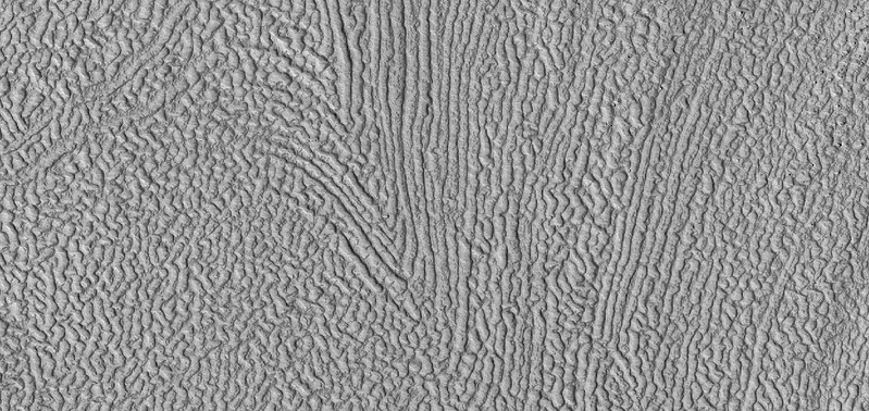
| 10:17, 22 January 2019 | 54996 2155brains2.jpg (file) |  |
135 KB | Brain terrain in Diacria quadrangle, as seen by HiRISE under HiWish program Source http://hirise.lpl.arizona.edu/ESP_054996_2155 Image credit: NASA/JPL/University of Arizona/Secosky | 1 |
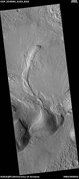
| 10:13, 22 January 2019 | ESP 054996 2155brainswide.jpg (file) |  |
45 KB | Wide view of mantle and brain terrain in Diacria quadrangle, as seen by HiRISE under HiWish program Brain terrain is visible if enlarged. Source http://hirise.lpl.arizona.edu/ESP_054996_2155 Image credit: NASA/JPL/Arizona | 1 |
| 10:10, 22 January 2019 | ESP 036362 2195inverted.jpg (file) |  |
50 KB | Inverted stream channel, as seen by HiRISE under HiWish program Source http:hirise.lpl.arizona.edu/ESP_036362_2195 Image credit: NASA/JPL/University of Arizona/Secosky | 1 |
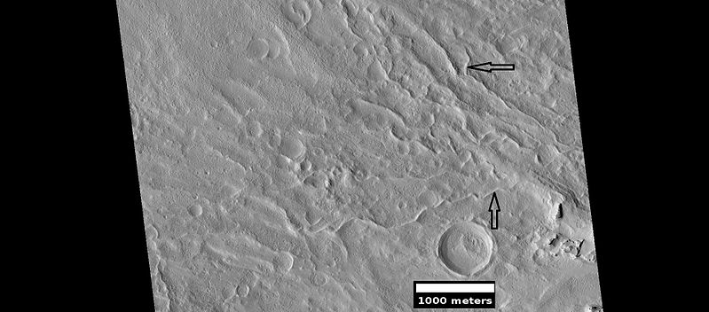
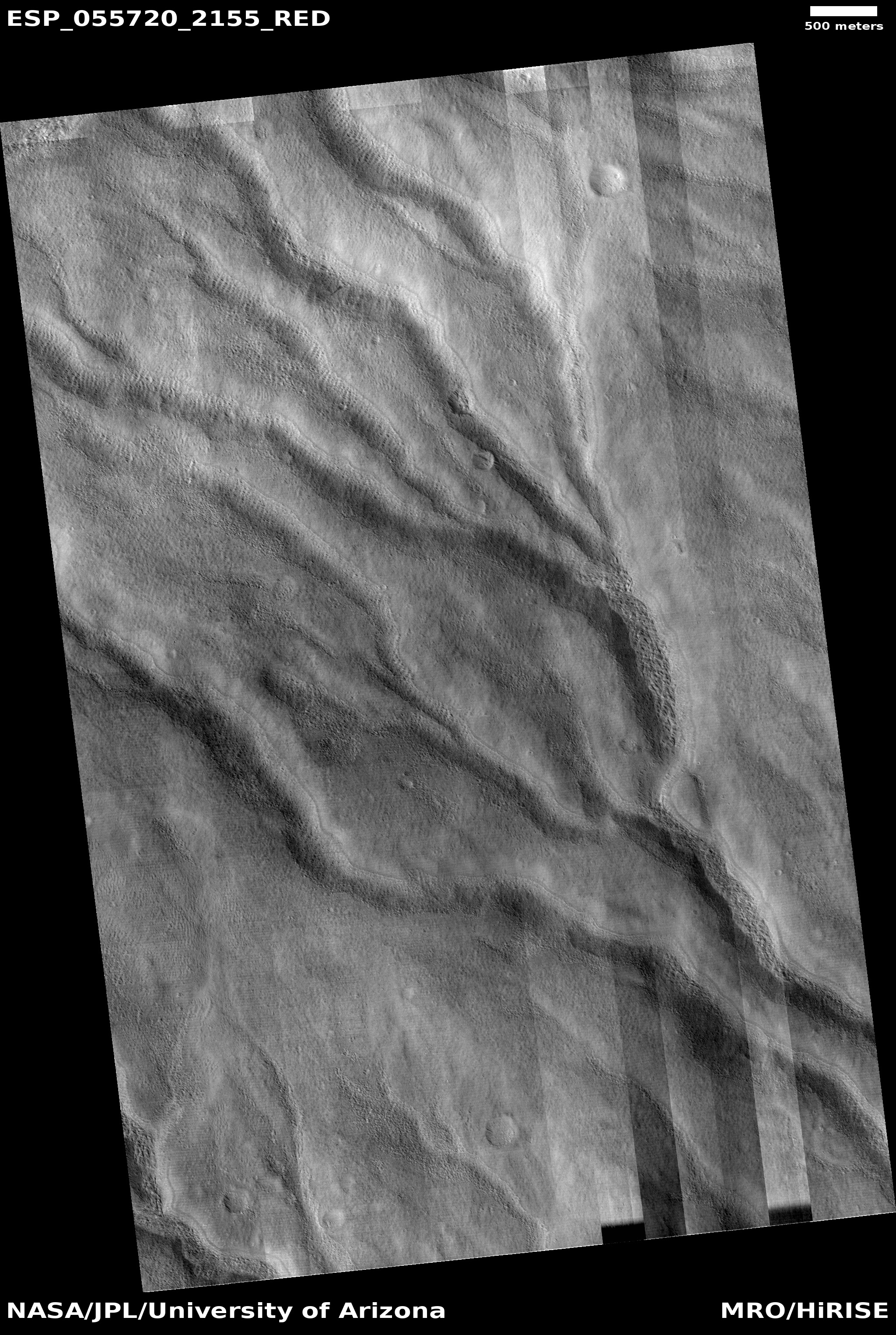
| 10:07, 22 January 2019 | ESP 055720 2155channels.jpg (file) |  |
2.03 MB | Channels in Diacria quadrangle, as seen by HiRISE under HiWish program Source http://hirise.lpl.arizona.edu/ESP_055720_2155 Image credit: NASA/JPL/University of Arizona | 1 |
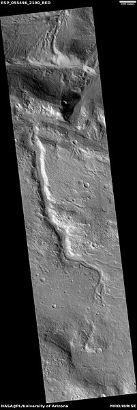
| 10:04, 22 January 2019 | ESP 055456 2190channels.jpg (file) |  |
35 KB | Channels in Diacria quadrangle, as seen by HiRISE under HiWish program Source http://hirise.lpl.arizona.edu/ESP_055456_2190 Image credit: NASA/JPL/University of Arizona | 1 |
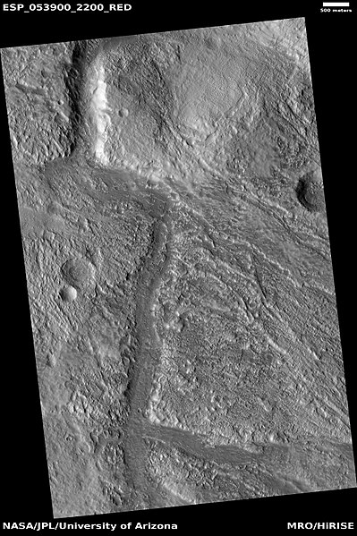
| 10:00, 22 January 2019 | ESP 053900 2200channel.jpg (file) |  |
87 KB | Channels in Diacria quadrangle, as seen by HiRISE under HiWish program Source http://hirise.lpl.arizona.edu/ESP_053900_2200 Image credit: NASA/JPL/University of Arizona/Secosky | 1 |
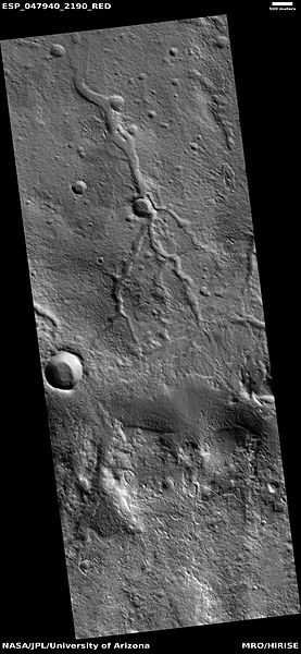
| 09:57, 22 January 2019 | ESP 047940 2190channelnetwork.jpg (file) |  |
43 KB | Close-up of gullies, as seen by hirise under HiWish program. Location is 55.8 N and 208.1 E. Date 5/7/12 Source http://hirise.lpl.arizona.edu/ESP_026420_2360 Image credit: NASA/JPL/University of Arizona/Secosky | 1 |
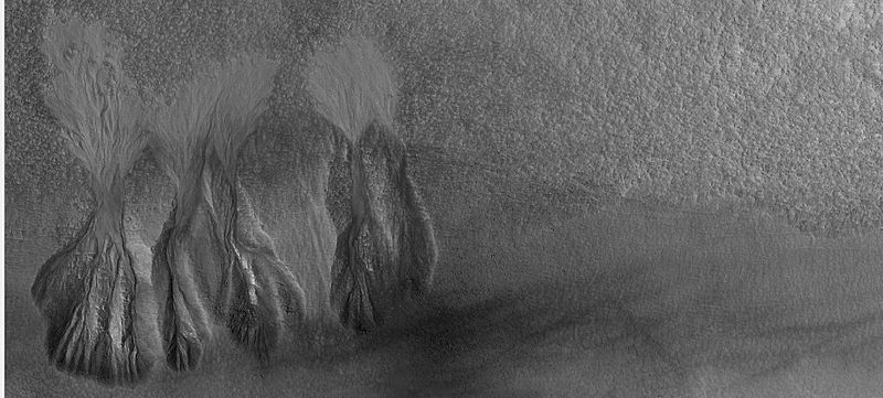
| 09:39, 22 January 2019 | 26420gullieswide.jpg (file) |  |
66 KB | Wide view of group of gullies in crater, as seen by HiRISE under HiWish program. Location is 55.8 N and 208.1 E. Source http://hirise.lpl.arizona.edu/ESP_026420_2360 Image credit: NASA/JPL/University of Arizona/Secosky | 1 |
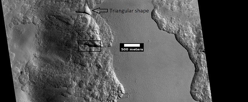
| 09:35, 22 January 2019 | ESP 045290 2350icelayersscale.jpg (file) |  |
77 KB | Wide view of depressions that contain layers of ice under only 1-2 meters of covering debris, as seen by HiRISE under HiWish program Location is the Diacria quadrangle. Box shows area covered imaged in a close view. Triangular shaped of depressions is... | 1 |
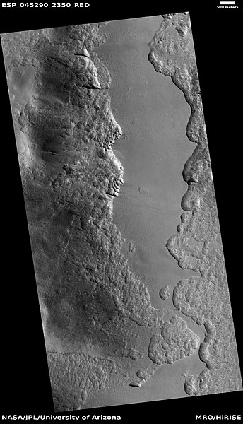
| 09:31, 22 January 2019 | ESP 045290 2350icelayers.jpg (file) |  |
57 KB | Wide view of depressions that contain layers of ice under only 1-2 meters of covering debris, as seen by HiRISE under HiWish program Location is the Diacria quadrangle. Source http://ESP_045290_2350 Image credit: NASA/JPL/University of Arizona | 1 |
| 09:28, 22 January 2019 | 24943straightedgeshawodsclose.jpg (file) |  |
46 KB | Extreme close up of straight edged valleys, as seen by hirise, under HiWish program. Location is 54.3 N and 212 E. Source http://hirise.lpl.arizona.edu/ESP_024943_2345 Image credit: NASA/JPL/University of Arizona/Secosky | 1 |
| 09:25, 22 January 2019 | 24943straightedgeshadows.jpg (file) |  |
52 KB | Enlarged view of valleys, as seen by hirise, under HiWish program. Location is 54.3 N and 212 E. Source http://hirise.lpl.arizona.edu/ESP_024943_2345 Image credit: NASA/JPL/University of Arizona/Secosky | 1 |
| 09:22, 22 January 2019 | ESP 024943straightvalleysboxed.jpg (file) |  |
38 KB | Valleys with stright southern edges, as seen by hirise, under HiWish program. Location is 54.3 N and 212 E. Source http://hirise.lpl.arizona.edu/ESP_024943_2345 Image credit: NASA/JPL/University of Arizona/Secosky | 1 |
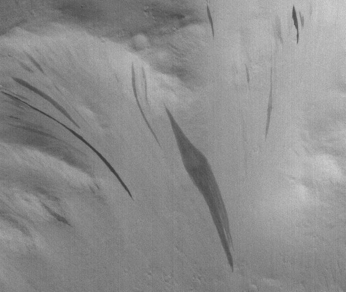
| 09:09, 22 January 2019 | Dark streaks in Diacriamgs.JPG (file) |  |
59 KB | Dark streaks in Diacria, public image S12-00400p.gif, photo credit NASA/Malin Space Science Systems Date Source http://www.msss.com/mars_images/moc/publicresults/2005/11/S12-00400p.gif Image credit: NASA/MSSS/Secosky | 1 |
| 09:04, 22 January 2019 | ESP 028411 2330expandedcraters.jpg (file) |  |
57 KB | Close view of expanded craters, as seen by HiRISE Source http:hirise.lpl.arizona.edu/ESP_028411_2330 Image credit: NASA/JPL/University of Arizona/Secosky | 1 |
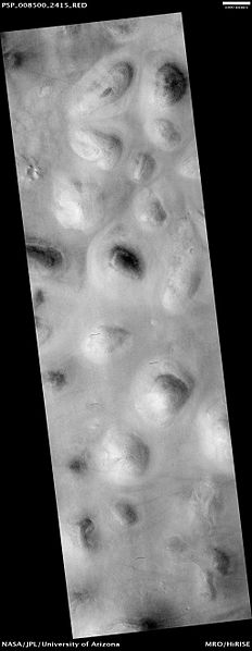
| 09:01, 22 January 2019 | Scandia Collesbasketballterrain.jpg (file) |  |
18 KB | HiRISE Image of Scandia Colles Basketball terrain is visible if it is enlarged. Source Source: http://hirise.lpl.arizona.edu/PSP_008500_2415 Image credit: NASA/LPL | 1 |
| 08:57, 22 January 2019 | Arcadia Planitia Texture.jpg (file) |  |
51 KB | Basketball texture in northern Arcadia Date 14 November 2009 (original upload date) Source Transferred from en.wikipedia by SreeBot Original text: https://commons.wikimedia.org/wiki/File:Arcadia_Planitia_Texture.jpg http://hirise.lpl.arizona.edu/PSP... | 1 |
| 08:54, 22 January 2019 | ESP 046002 2115layers.jpg (file) |  |
69 KB | Dark slope streaks and layers, as seen by hirise under HiWish program Date 19 July 2016 Source http://hirise.lpl.arizona.edu/ESP_046002_2115 Image credit: NASA/JPL/University of Arizona/Jim Secosky | 1 |
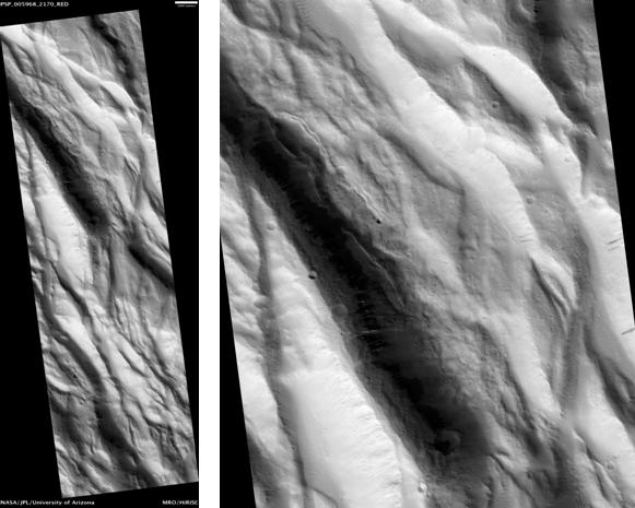
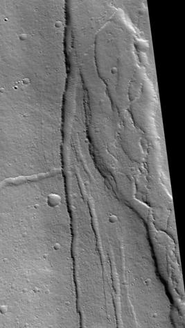
| 08:52, 22 January 2019 | Lycus Sulci from HiRISE.JPG (file) |  |
73 KB | Lycus Sulci, as seen by hirise under HiWish program. Location is 33.7 N and 218.2 E. Date 8/30/10 Source http://www.uahirise.org/ESP_018363_2140 Image credit: NASA/JPL/University of Arizona/Secosky | 1 |
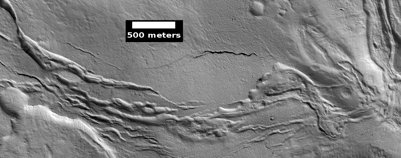
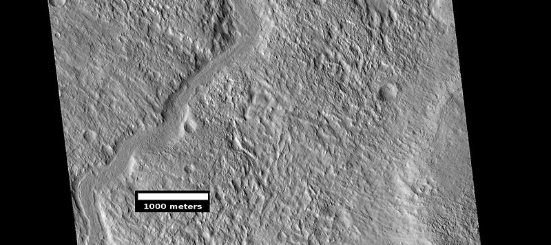
| 08:49, 22 January 2019 | ESP 045804 2200channel.jpg (file) |  |
69 KB | Winding channel in Diacria quadrangle, as seen by hirise under HiWish program Source http://hirise.lpl.arizona.edu/ESP_045804_2200 Image credit: NASA/JPL/University of Arizona/Jim Secosky | 1 |
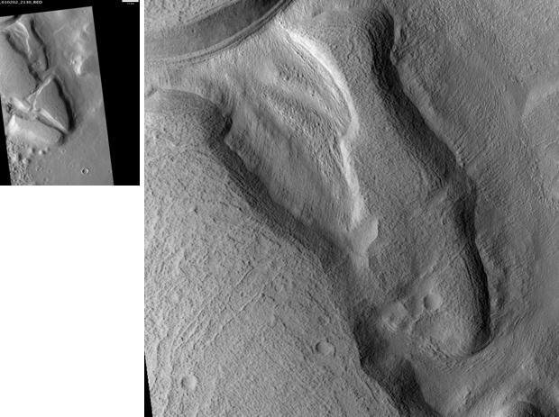
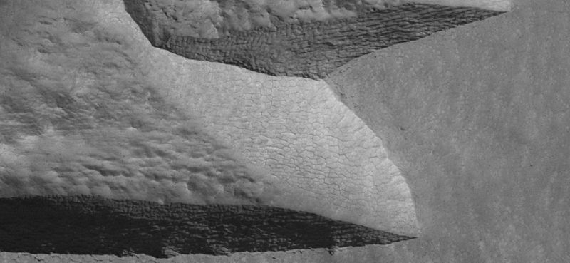
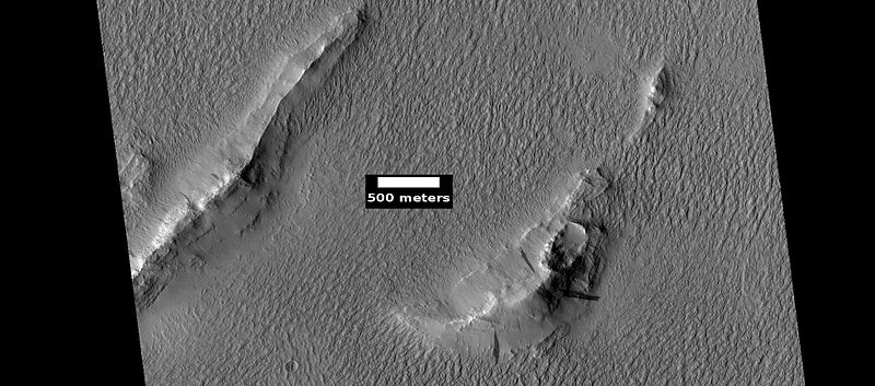
| 08:46, 22 January 2019 | Acheron Fossae.JPG (file) |  |
43 KB | Acheron Fossae, as seen by hirise. Scale bar is 1000 meters long. Location is 36.5 north and 292.2 east. Image was taken by the Mars Reconnaissance Orbiter's HiRISE. The HiRISE camera was built by Ball Aerospace and Technology Corporation and is operat... | 1 |
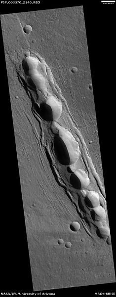
| 08:43, 22 January 2019 | PSP 003370 2140cyane.jpg (file) |  |
27 KB | Pit craters in Cyane Fossae Source http://hirise.lpl.arizona.edu/PSP_003370_2140 Image credit: HiRISE image/JPL | 1 |
| 08:40, 22 January 2019 | Cyane Fossae.JPG (file) |  |
21 KB | Cyane Fossae, as seen by hirise. Location is 38.1 degrees north latitude and 237.7 degrees east longitude. Image was taken by the Mars Reconnaissance Orbiter's HiRISE. The HiRISE camera was built by Ball Aerospace and Technology Corporation and is oper... | 1 |
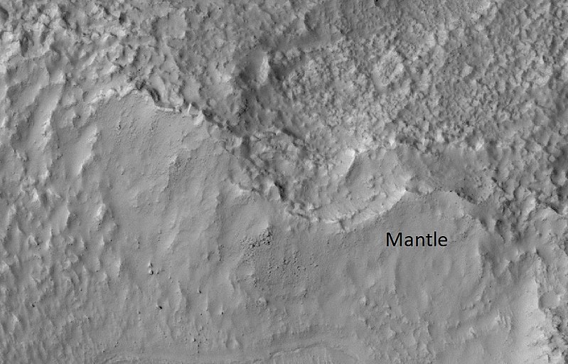
| 08:35, 22 January 2019 | 52530 2190mantle.jpg (file) |  |
103 KB | Mantle in Diacria quadrangle, as seen by HiRISE under HiWish program Source http://ESP_052530_2190 Image credit: NASA/JPL/University of Arizona/Secosky | 1 |
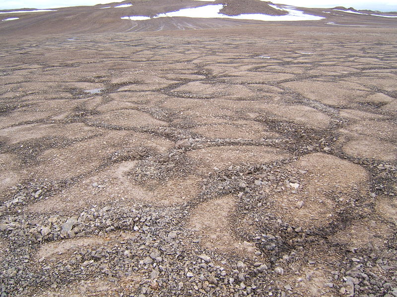
| 08:30, 22 January 2019 | Patterned ground devon island.jpg (file) |  |
185 KB | Patterned ground permafrost pattern seen on Devon Island, CA Date 23 July 2005 Source Own work https://commons.wikimedia.org/wiki/File:Patterned_ground_devon_island.jpg Author Anthonares | 1 |
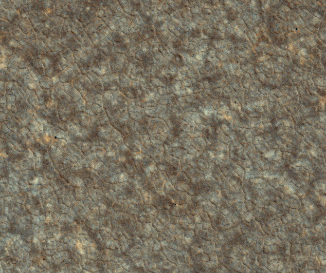
| 08:28, 22 January 2019 | PSP 008301 2480 cut a.jpg (file) |  |
397 KB | False-color Mars Reconnaissance Orbiter image of polygonal surface pattern near the Phoenix landing site. Source http://hirise.lpl.arizona.edu/images/2008/details/cut/PSP_008301_2480_cut_a.jpg Image credit: NASA/Jet Propulsion Lab/University of Ari... | 1 |
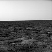
| 08:26, 22 January 2019 | Phoenix Sol 0 horizon.jpg (file) |  |
6 KB | One of the first images returned from the Phoenix Mars lander. Source http://phoenix.lpl.arizona.edu/images.php?gID=313&cID=7 Image credit: NASA/JPL-Caltech/University of Arizona | 1 |
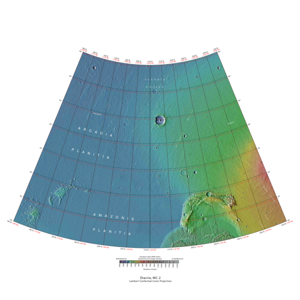
| 07:35, 22 January 2019 | USGS-Mars-MC-2-DiacriaRegion-mola.png (file) |  |
302 KB | MOLA Topographic Map of Diacria Quadrangle (MC-2) on the planet Mars. NOTE: Converted the original PDF file to a PNG File (via GIMP v2.8.4 program) - and uploaded to Wikimedia Commons. Source http://planetarynames.wr.usgs.gov/images/mc2_mola.pdf Ima... | 1 |
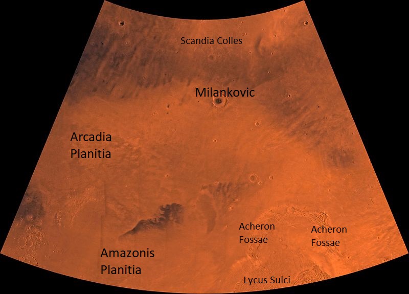
| 07:30, 22 January 2019 | PIA00162-Mars-MC-2-DiacriaRegion-19980604.jpg (file) |  |
91 KB | PIA00162: MC-2 Diacria Region http://photojournal.jpl.nasa.gov/catalog/pia00162 Mars digital-image mosaic merged with color of the MC-2 quadrangle, Diacria region of Mars. The northern two-thirds is dominated by relatively smooth plains. The southeast... | 1 |
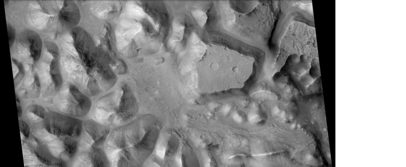
| 14:27, 17 January 2019 | Hydaspischaos3.jpg (file) |  |
152 KB | Hydaspis Chaos, as seen by CTX Image source: http://viewer.mars.asu.edu/planetview/inst/ctx/B11_014113_1836_XN_03N029W#P=B11_014113_1836_XN_03N029W&T=2 Image credit: NASA/MSSS | 1 |
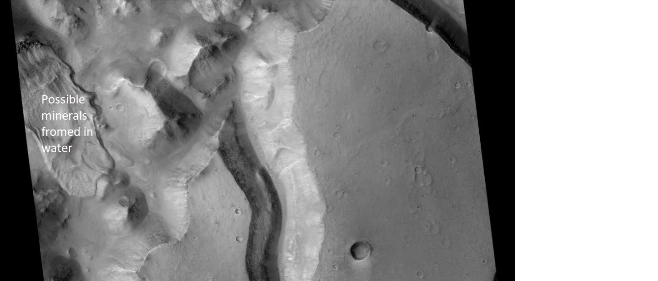
| 14:23, 17 January 2019 | HydaspisChaoshydrated.jpg (file) |  |
136 KB | Hydaspis Chaos, as seen by CTX Part of the scene may have been formed with the aid of water. Image source:http://viewer.mars.asu.edu/planetview/inst/ctx/B11_014113_1836_XN_03N029W#P=B11_014113_1836_XN_03N029W&T=2 Image credit: NASA/MSSS | 1 |
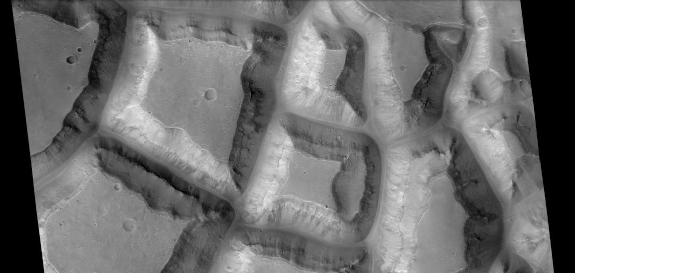
| 14:15, 17 January 2019 | Hydaspischaossquares.jpg (file) |  |
137 KB | Layered blocks in the Hydaspis Chaos, as seen by CTX Source:http://viewer.mars.asu.edu/planetview/inst/ctx/B11_014113_1836_XN_03N029W#P=B11_014113_1836_XN_03N029W&T=2 Image credit: NASA/MSSS | 1 |
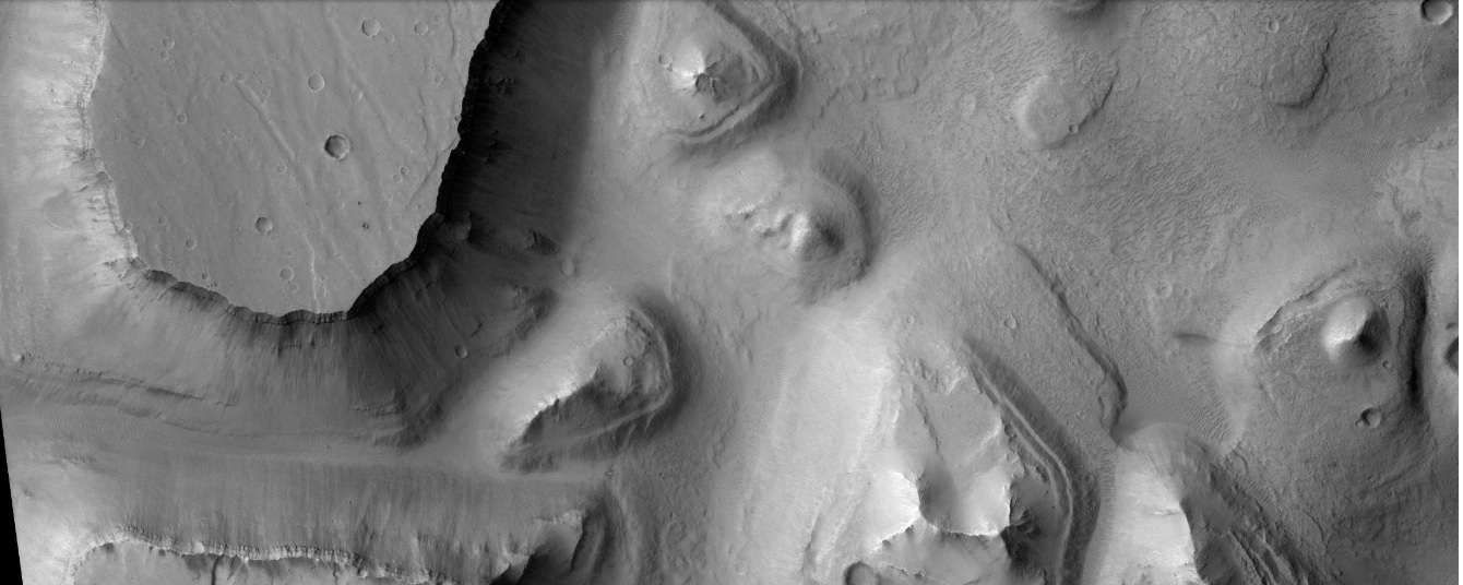
| 14:07, 17 January 2019 | Hydraoteschaosctx.jpg (file) |  |
202 KB | Hydraotes Chaos, as seen by CTX Source: http://viewer.mars.asu.edu/planetview/inst/ctx/P02_002022_1801_XN_00N035W#P=P02_002022_1801_XN_00N035W&T=2 Image credit: NASA/MSSS/Secosky | 1 |
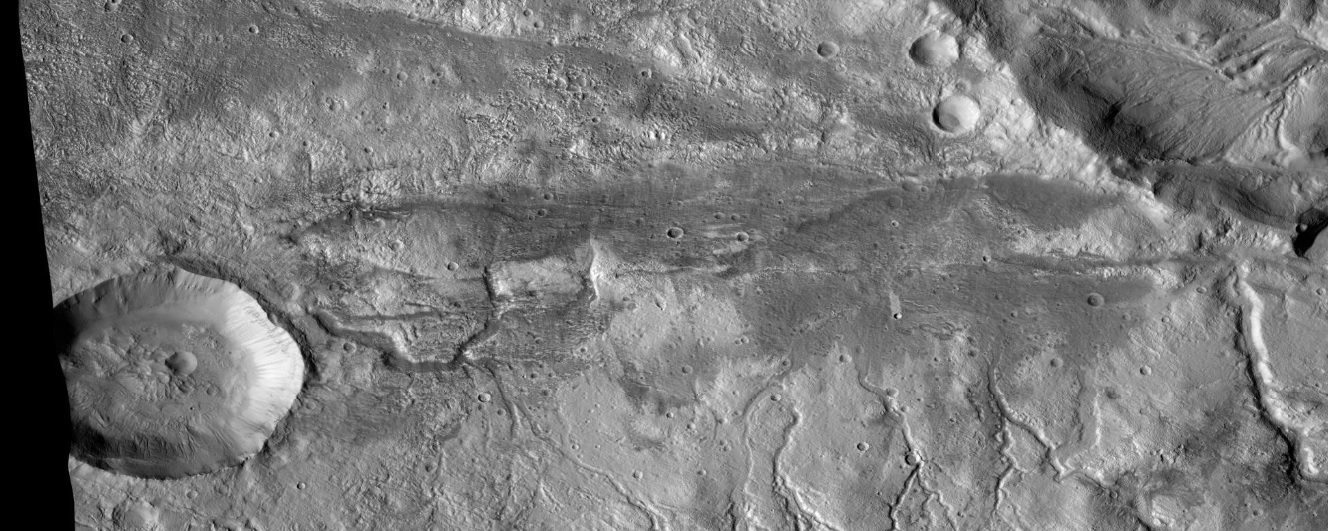
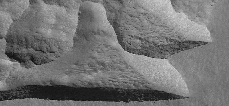
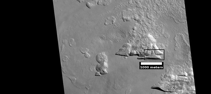
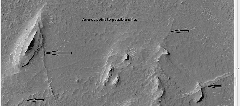
| 13:28, 17 January 2019 | 25558dikes.jpg (file) |  |
54 KB | Buttes and dikes, as seen by hirise, under HiWish program. Location is 6.9 N and 348.6 E. Source http://hirise.lpl.arizona.edu/ESP_025558_1870 Image credit: NASA/JPL/University of Arizona/Secosky | 1 |
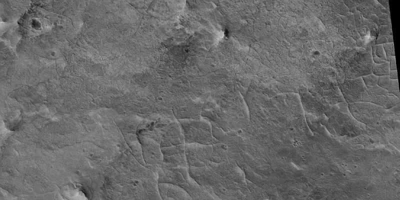
| 13:26, 17 January 2019 | 48054 1915ridgeswide.jpg (file) |  |
67 KB | Ridges in Oxia Palus quadrangle, as seen by HiRISE under HiWish program Source http://hirise.lpl.arizona.edu/ESP_048054_1915 Image credit: NASA/JPL/University of Arizona/Secosky | 1 |
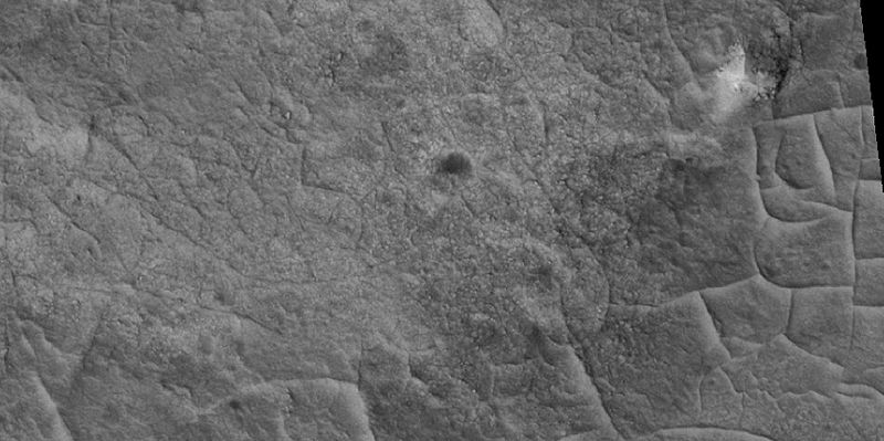
| 13:23, 17 January 2019 | 48054 1915ridgesclose.jpg (file) |  |
62 KB | Ridges in Oxia Palus quadrangle, as seen by HiRISE under HiWish program Source http://hirise.lpl.arizona.edu/ESP_048054_1915 Image credit: NASA/JPL/University of Arizona/Secosky | 1 |


