Uploads by Suitupandshowup
This special page shows all uploaded files.
| Date | Name | Thumbnail | Size | Description | Versions |
|---|---|---|---|---|---|
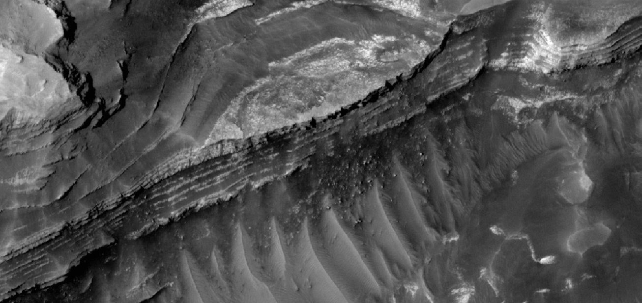
| 16:14, 21 February 2020 | 59619 1845layers3.jpg (file) |  |
251 KB | Close view of layers, as seen by HiRISE under HiWish program Source: http://hirise.lpl.arizona.edu/ESP_059619_1845 Image credit: NASA/JPL/University of Arizona | 1 |
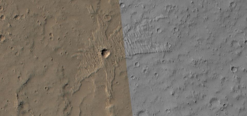
| 16:13, 21 February 2020 | 61167 1735crater.jpg (file) |  |
57 KB | Crater with thin ejecta, as seen by HiRISE under HiWish program Source: http://hirise.lpl.arizona.edu/ESP_061167_1735 Image credit: NASA/JPL/University of Arizona | 1 |
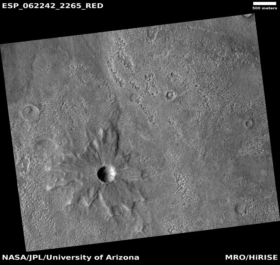
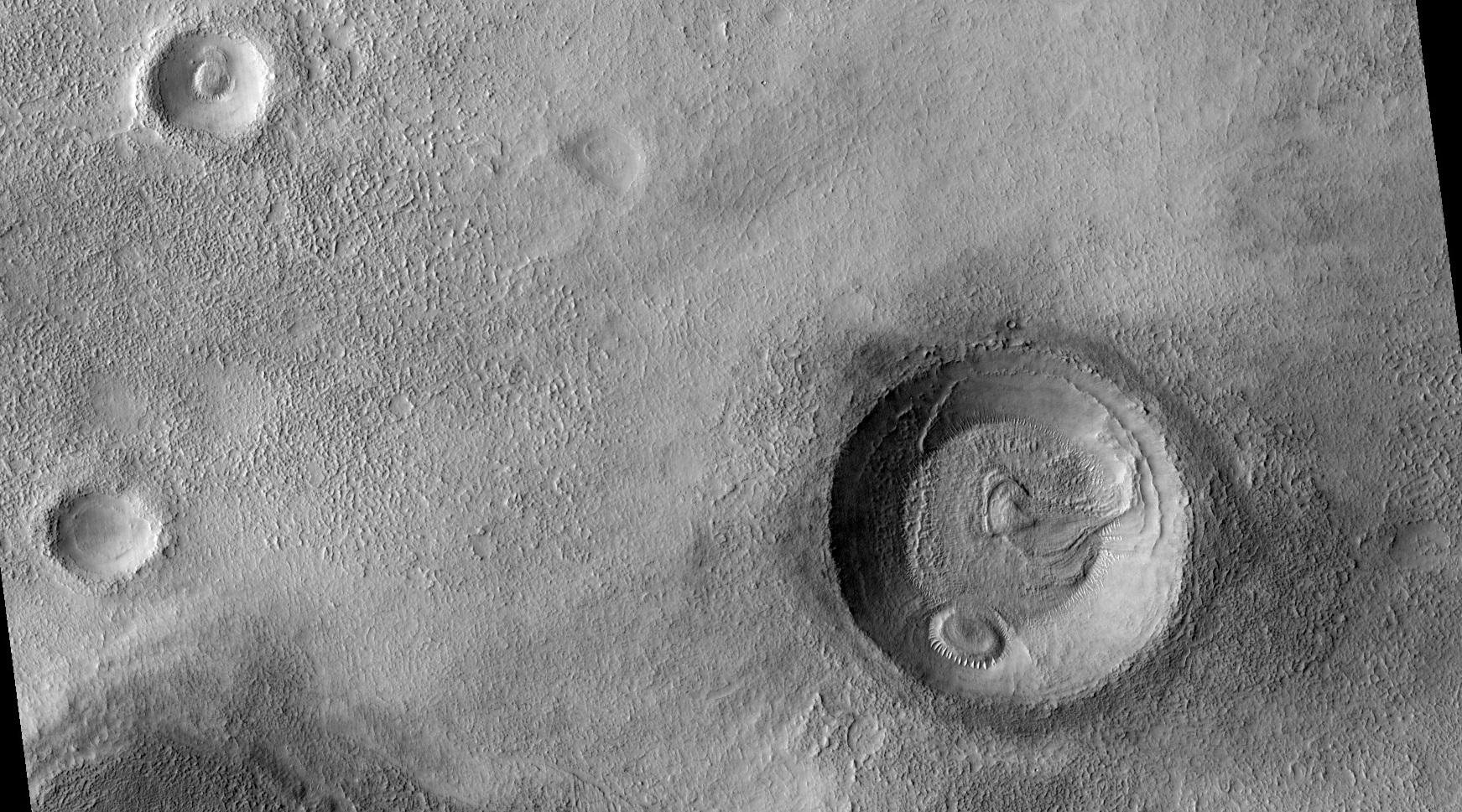
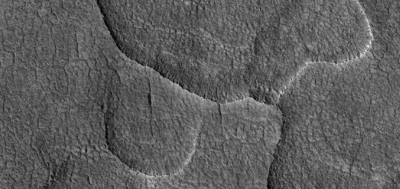
| 16:12, 21 February 2020 | 62242 2265pedestal.jpg (file) |  |
179 KB | Pedestal crater, as seen by HiRISE under HiWish program Source: http://hirise.lpl.arizona.edu/ESP_62242_2265 Image credit: NASA/JPL/University of Arizona | 1 |
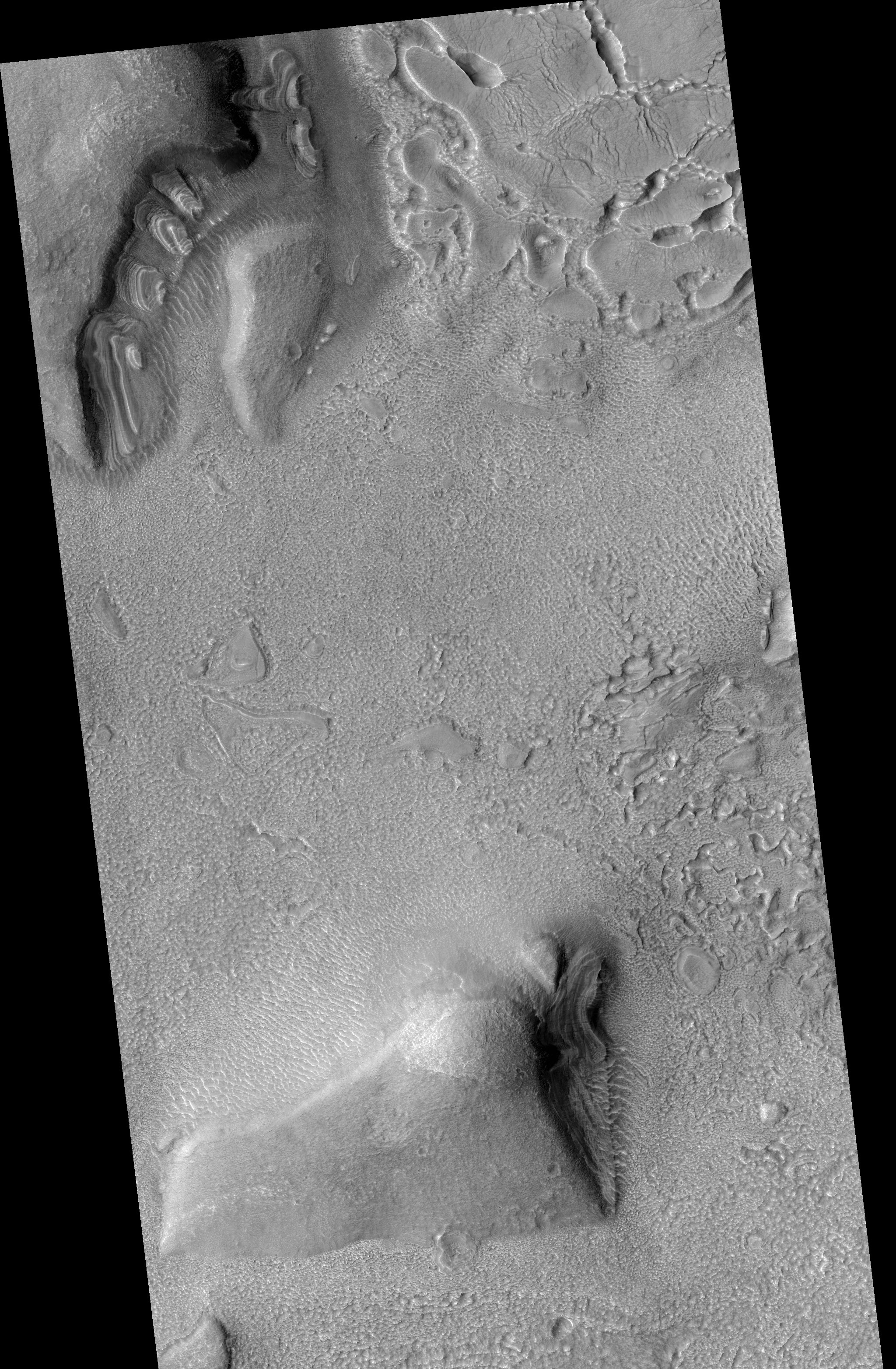
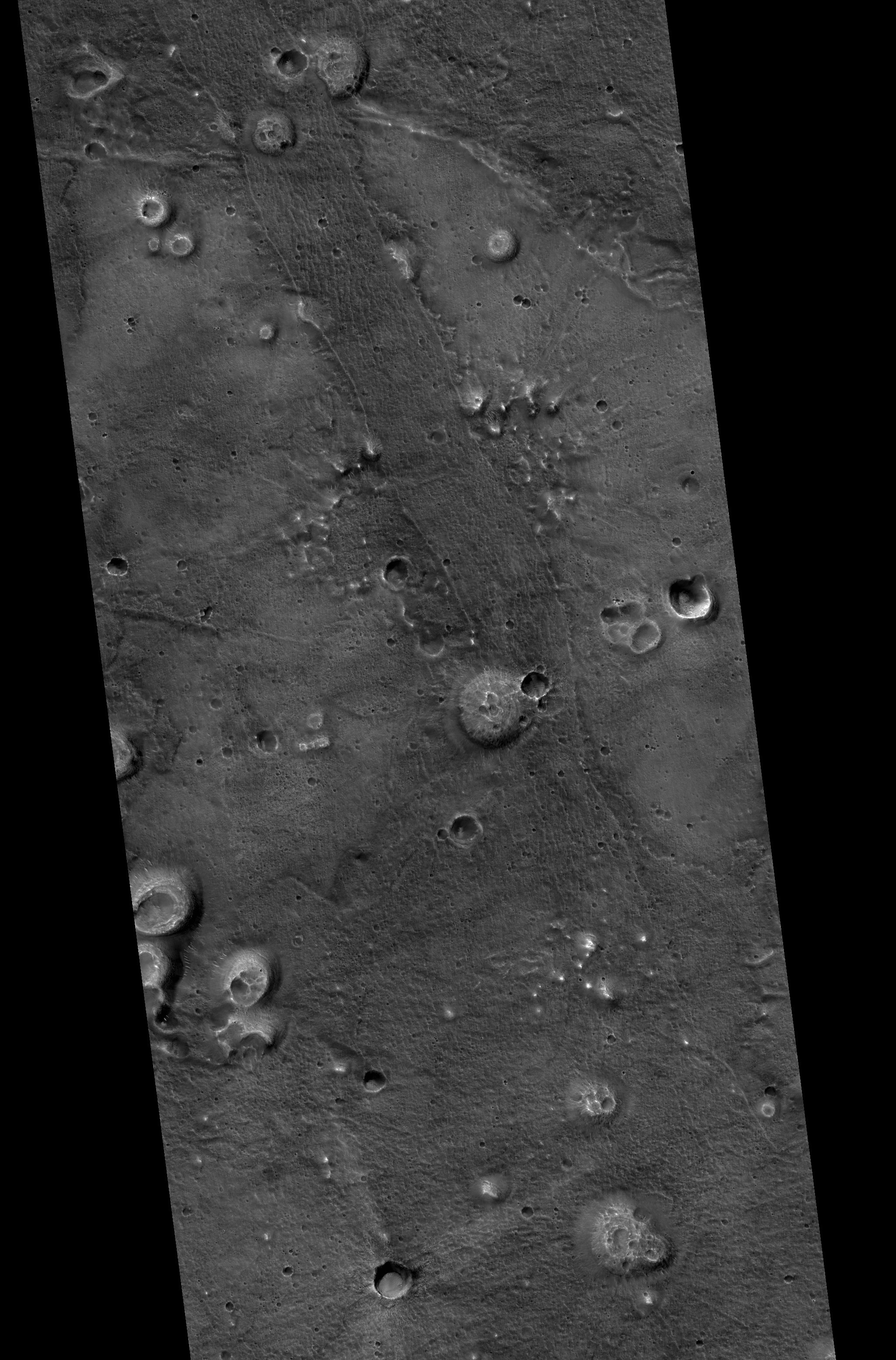
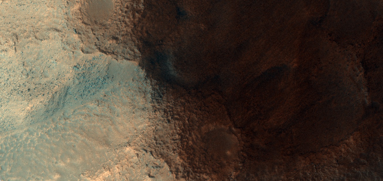
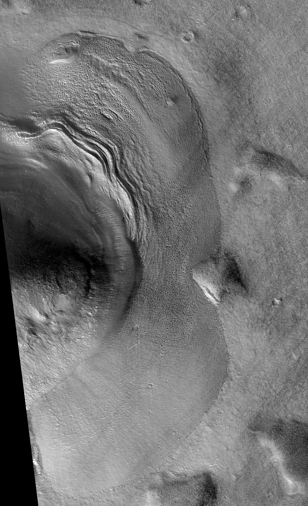
| 16:10, 21 February 2020 | ESP 035011 2240cropped.jpg (file) |  |
2.13 MB | Dipping layers, as seen by HiRISE under HiWish program Source: http://hirise.lpl.arizona.edu/ESP_035011_2240 Image credit: NASA/JPL/University of Arizona | 1 |
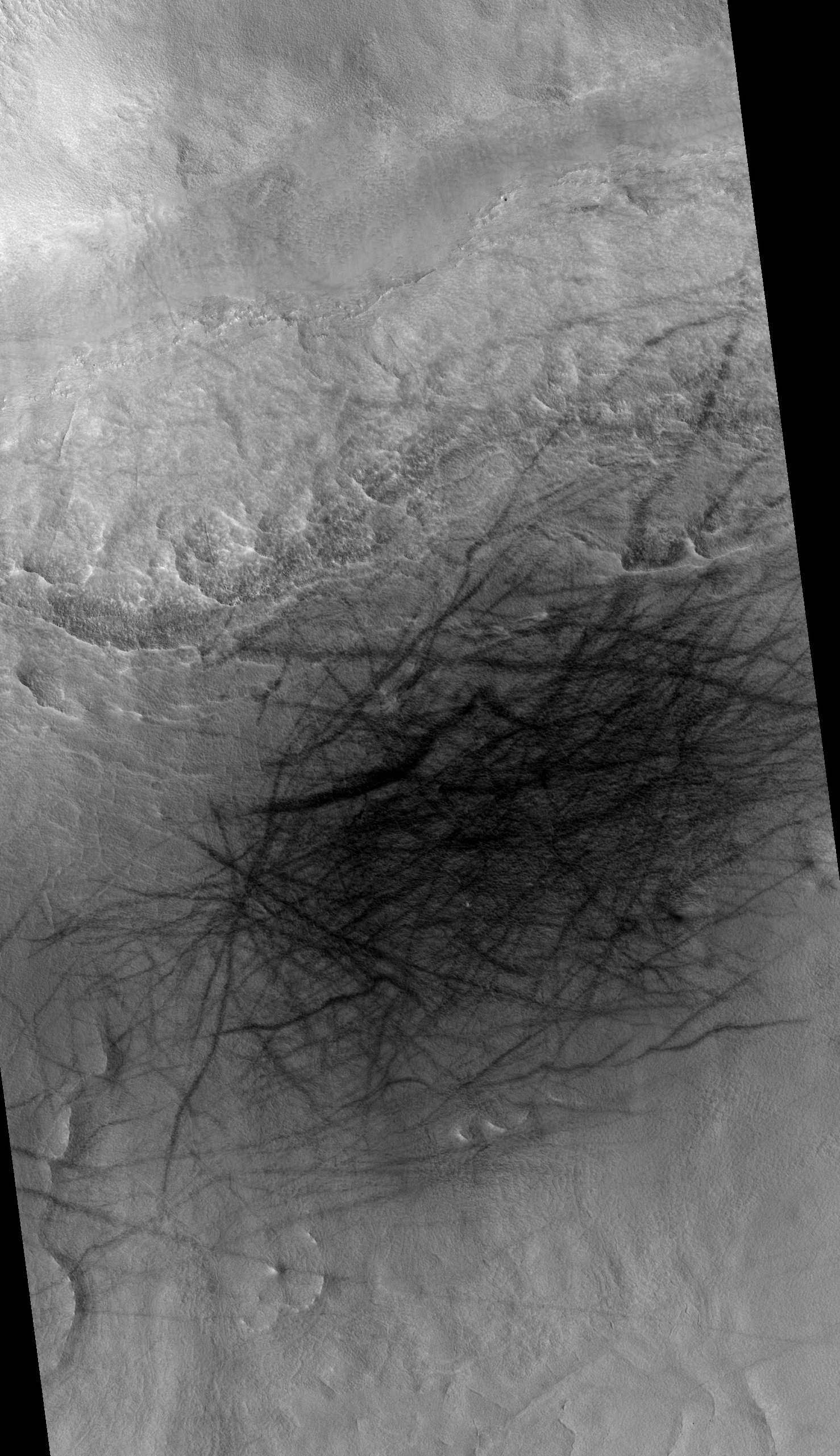
| 16:09, 21 February 2020 | ESP 036297 2370devilsme.jpg (file) |  |
1.2 MB | Wide view of field of dust devil tracks, as seen by HiRISE under HiWish program Source: http://hirise.lpl.arizona.edu/ESP_036297_2370 Image credit: NASA/JPL/University of Arizona | 1 |
| 16:08, 21 February 2020 | ESP 043580 2120mud.jpg (file) |  |
1.67 MB | Wide view of field of mud volcanoes, as seen by HiRISE under HiWish program Source: http://hirise.lpl.arizona.edu/ESP_043580 Image credit: NASA/JPL/University of Arizona | 1 |
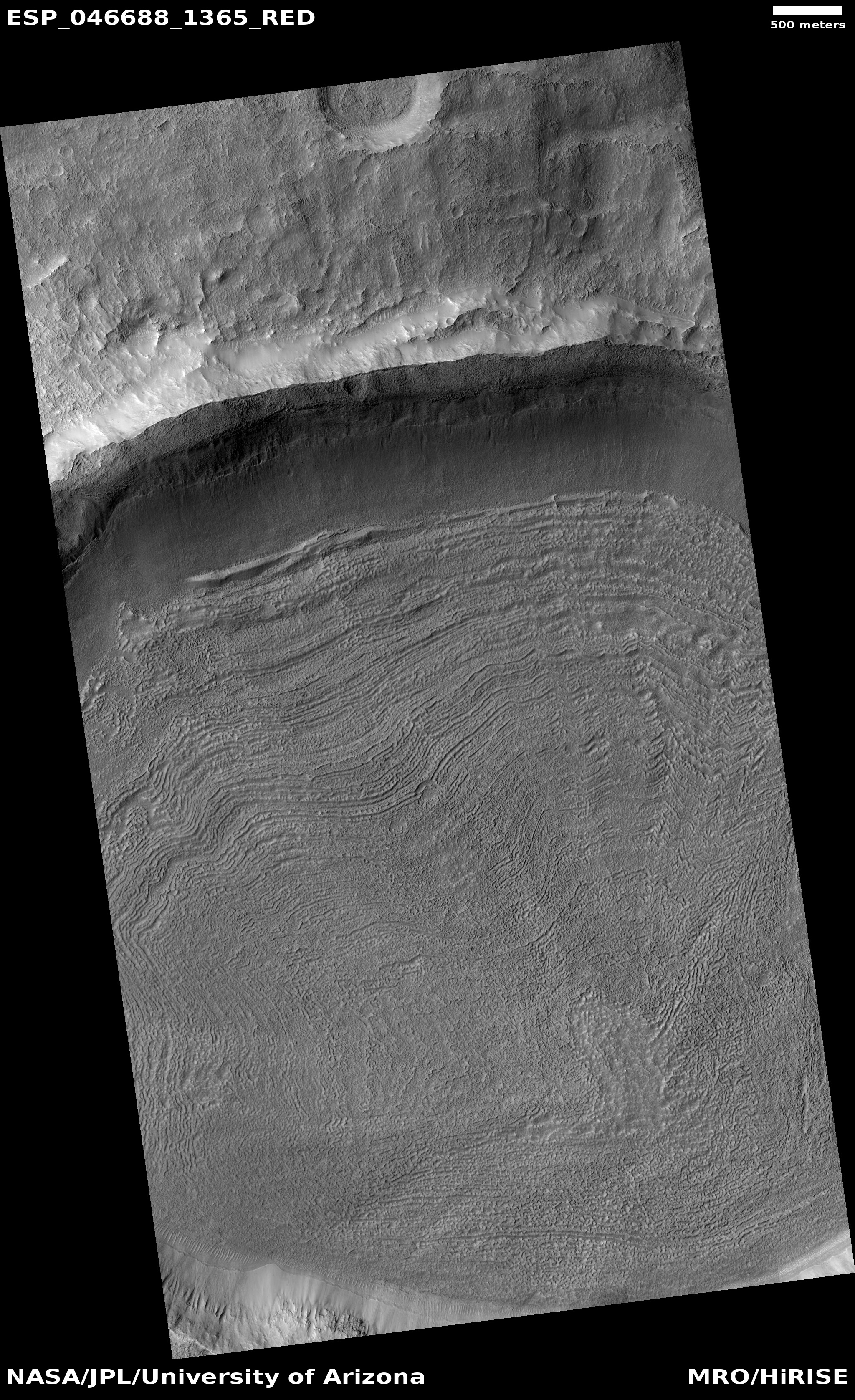
| 16:06, 21 February 2020 | ESP 046688 1365.jpg (file) |  |
2.17 MB | Concentric Crater Fill, as seen by HiRISE under HiWish program Source: http://hirise.lpl.arizona.edu/ESP_46688_1365 Image credit: NASA/JPL/University of Arizona | 1 |
| 16:04, 21 February 2020 | ESP 054763 1500layerscropped.jpg (file) |  |
1.21 MB | Wide view of layers, as seen by HiRISE under HiWish program Source: http://hirise.lpl.arizona.edu/ESP_54763_1500 Image credit: NASA/JPL/University of Arizona | 1 |
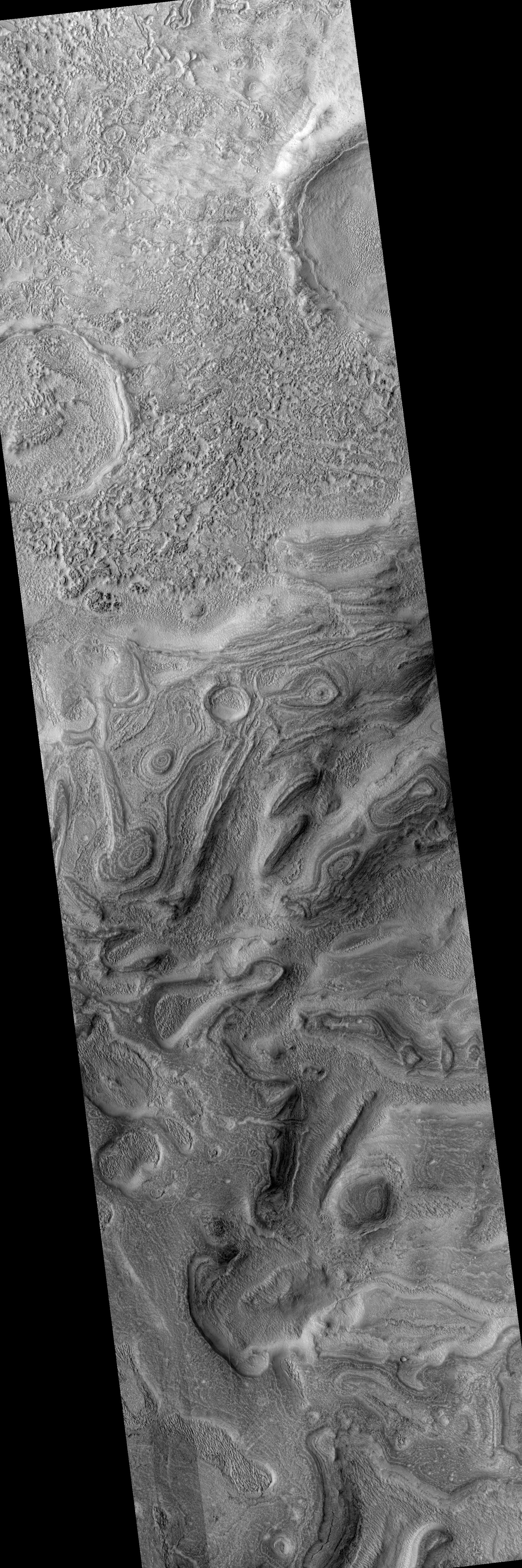
| 16:03, 21 February 2020 | ESP 057110 1365ridgeswide.jpg (file) |  |
3.27 MB | Wide view of ridges, as seen by HiRISE under HiWish program Source: http://hirise.lpl.arizona.edu/ESP_57110_1365 Image credit: NASA/JPL/University of Arizona | 1 |
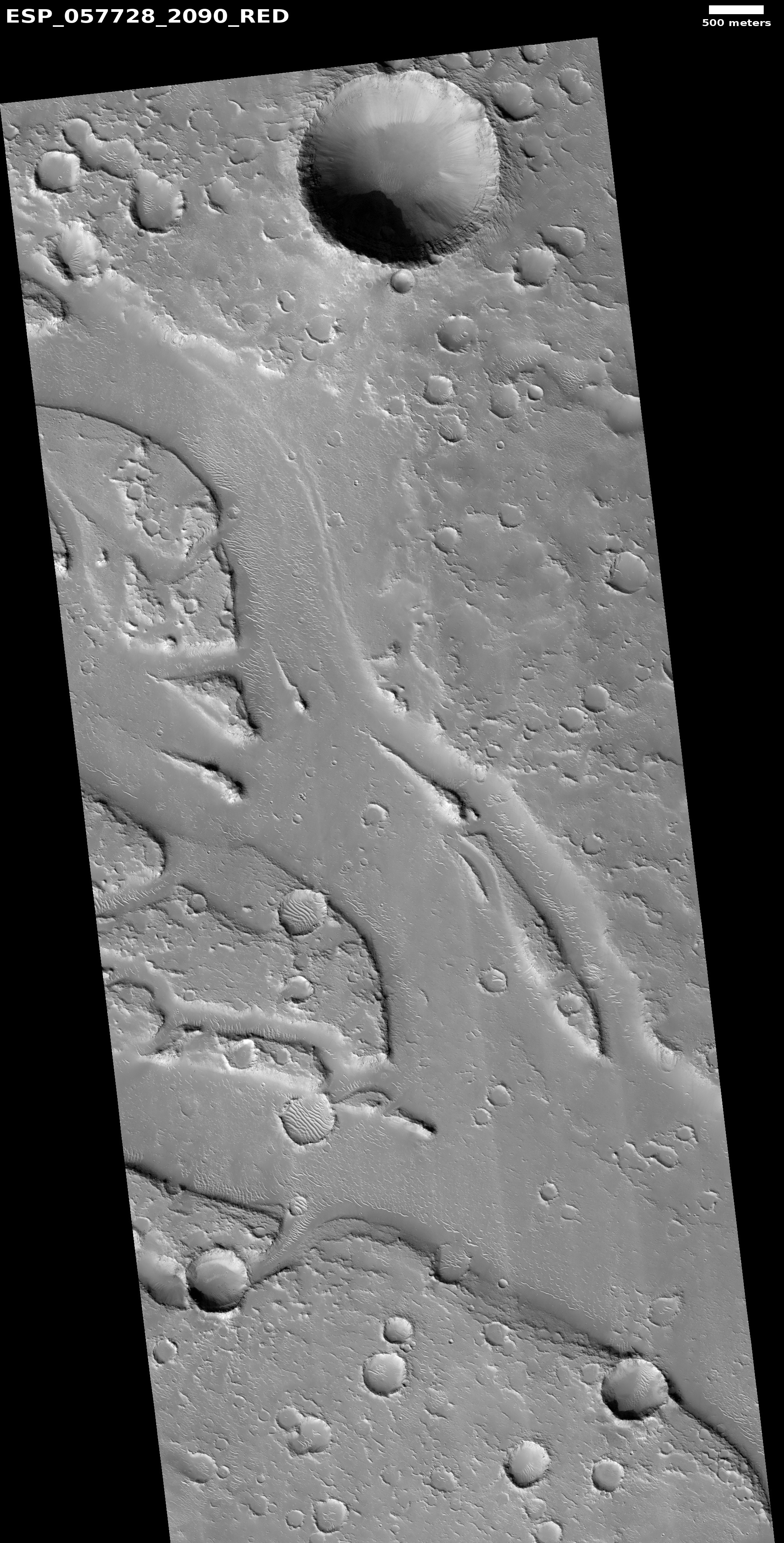
| 16:01, 21 February 2020 | ESP 057728 2090streamlined.jpg (file) |  |
2.21 MB | Streamlined forms, as seen by HiRISE under HiWish program These were carved by floods. Source: http://hirise.lpl.arizona.edu/ESP_57728_2090 Image credit: NASA/JPL/University of Arizona | 1 |
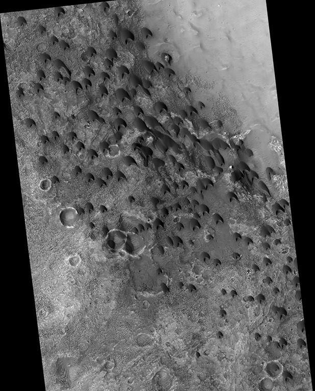
| 15:59, 21 February 2020 | ESP 061974 1710duneswideme2.jpg (file) |  |
1.06 MB | Wide view of field of dunes, as seen by HiRISE under HiWish program Source: http://hirise.lpl.arizona.edu/ESP_61974_1710 Image credit: NASA/JPL/University of Arizona | 1 |
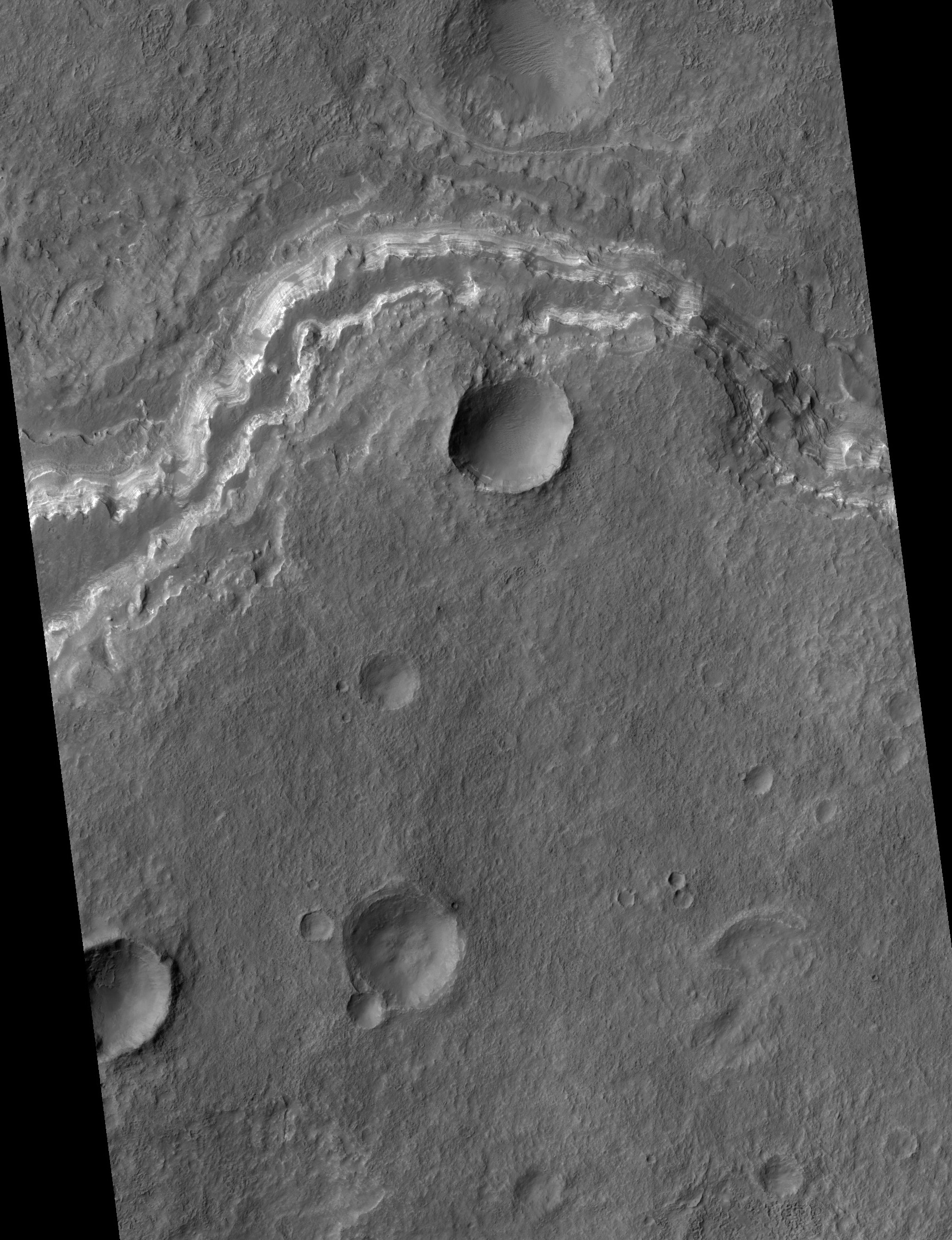
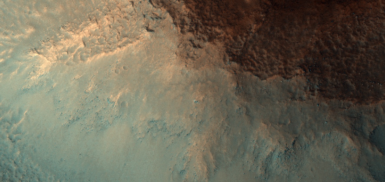
| 15:58, 21 February 2020 | ESP 062082 2175dippingcropped.jpg (file) |  |
790 KB | Dipping layers in a crater, as seen by HiRISE under HiWish program Source: http://hirise.lpl.arizona.edu/ESP_62082_2175 Image credit: NASA/JPL/University of Arizona | 1 |
| 15:56, 21 February 2020 | Yvideo55095 2170duneswidecropped.jpg (file) |  |
195 KB | Wide view of field of dunes, as seen by HiRISE under HiWish program Source: http://hirise.lpl.arizona.edu/ESP_55095_2170 Image credit: NASA/JPL/University of Arizona | 1 |
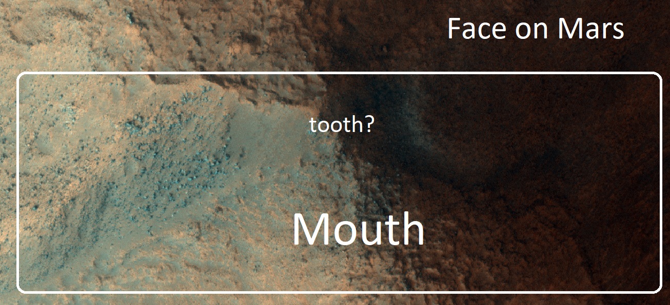
| 15:19, 17 February 2020 | 3234 2210faceemouthlabeled.jpg (file) |  |
354 KB | Enlargement of mouth on the Face on Mars, as seen by HiRISE and processed with HiView. | 1 |
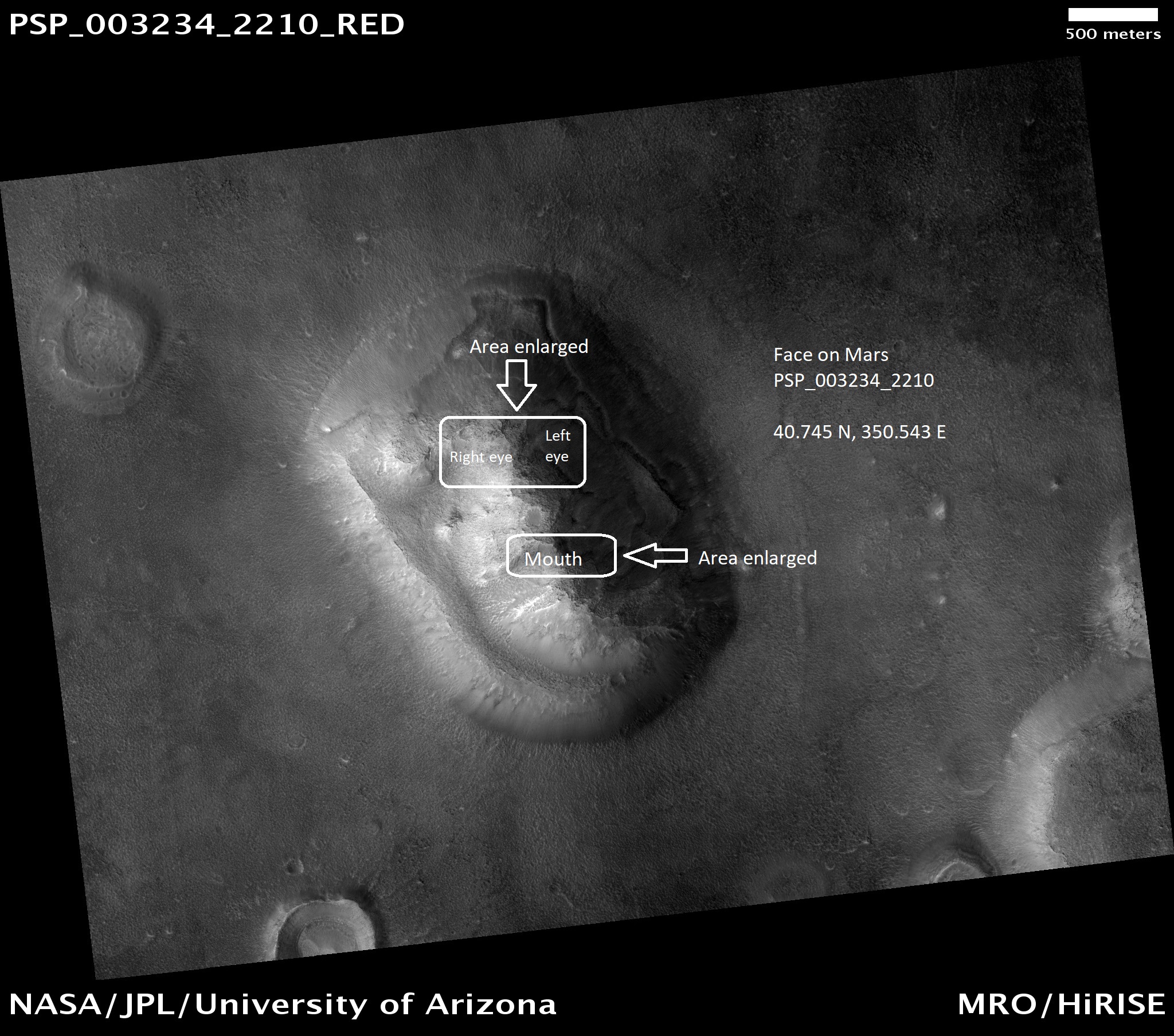
| 15:17, 17 February 2020 | PSP 003234 2210facewidelabeled.jpg (file) |  |
1.02 MB | Face of Mars with parts labeled that are enlarged in other images. | 1 |
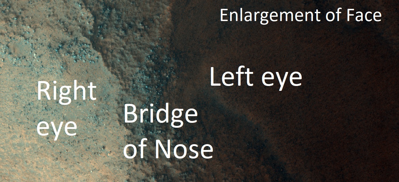
| 15:16, 17 February 2020 | 3234 2210faceeyescolor.jpg (file) |  |
359 KB | Enlargement of Face on Mars, as seen by HiRISE and processed with HiView Area show are parts of eyes and bridge of nose. | 1 |
| 11:00, 17 February 2020 | 3234 2210lowerface.jpg (file) |  |
351 KB | Close up of lower part of Mars face as seen by HiRISE. I enlarged it with the HiView program. Source: http://hirise.lpl.arizona.edu/PSP_003234_2210 Image credit: NASA/JPL/University of Arizona | 1 |
| 10:54, 17 February 2020 | 3234 2210lowelowerrface.jpg (file) |  |
337 KB | Enlarged view of lower face using HiView program | 1 |
| 10:49, 17 February 2020 | 3234 2210facelefteye.jpg (file) |  |
297 KB | close up of left eye of Mars face as seen by HiRISE. I enlarged it with the HiView program. Source: http://hirise.lpl.arizona.edu/PSP_003234_2210 Image credit: NASA/JPL/University of Arizona | 1 |
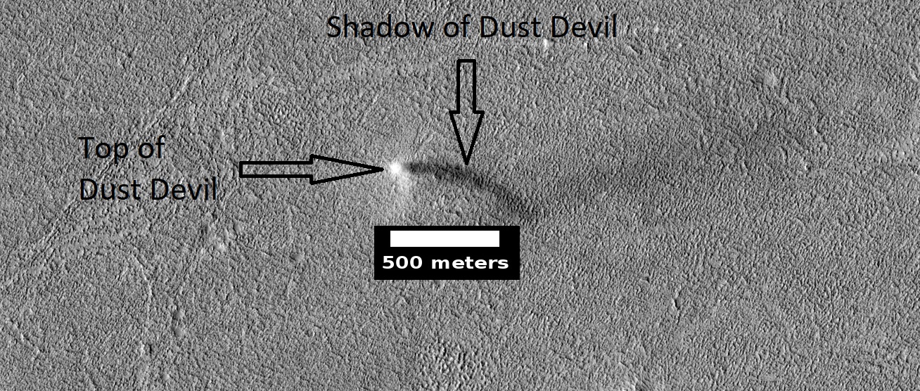
| 17:30, 11 February 2020 | ESP 061787 2140devilcropped.jpg (file) |  |
492 KB | Dust devil with shadow, as seen by HiRISE. Source: https://www.uahirise.org/ESP_061787_2140 Image credit: NASA/JPL/University of Arizona/Secosky | 1 |
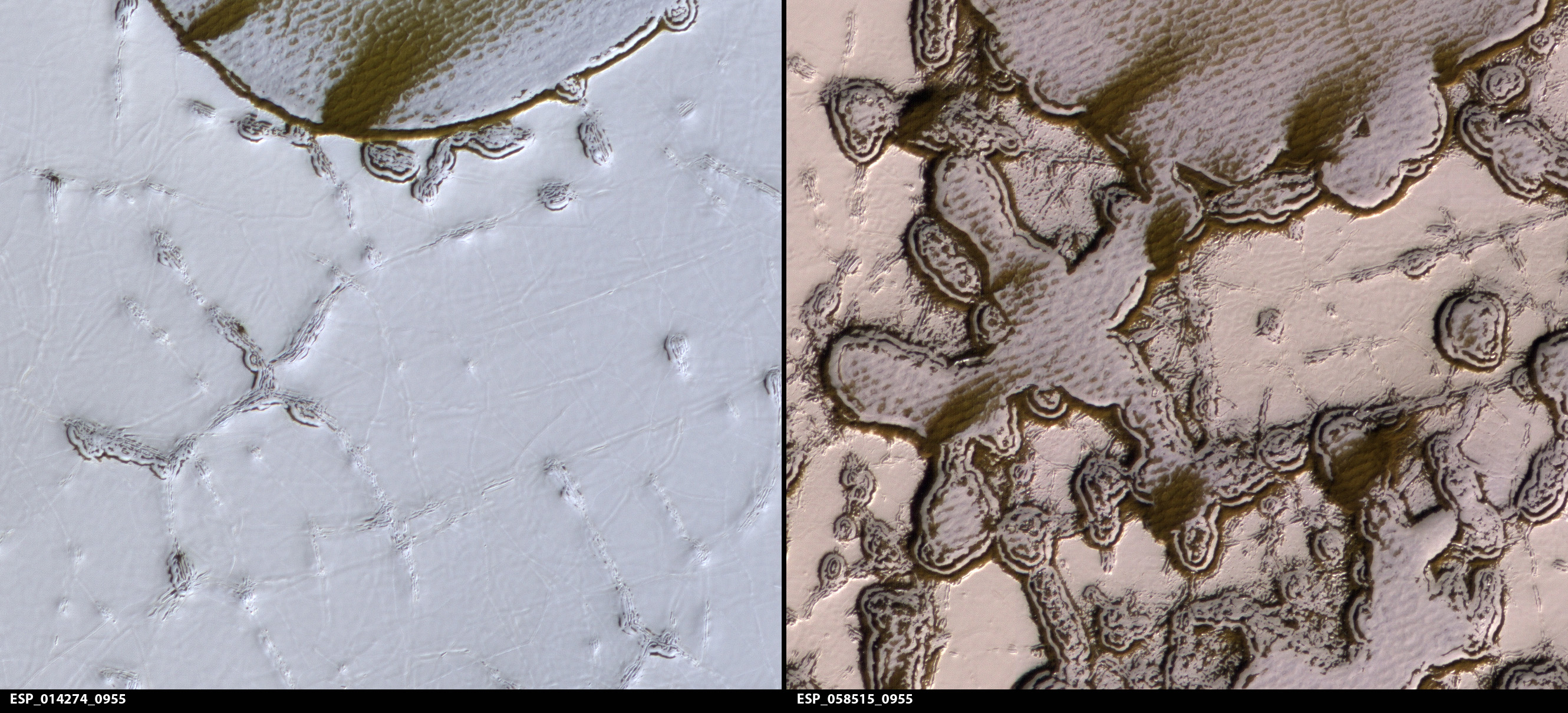
| 16:23, 5 January 2020 | ESP 058515 0955closechanges.jpg (file) |  |
1.65 MB | Changes in a small part of swiss cheese surface in South Pole region. Picture on left taken in August 2009--Picture on the right taken in January 2019. Source: http://hirise.lpl.arizona.ed/ESP_058515_0955 Image Credit: NASA/JPL/University of Arizona | 1 |
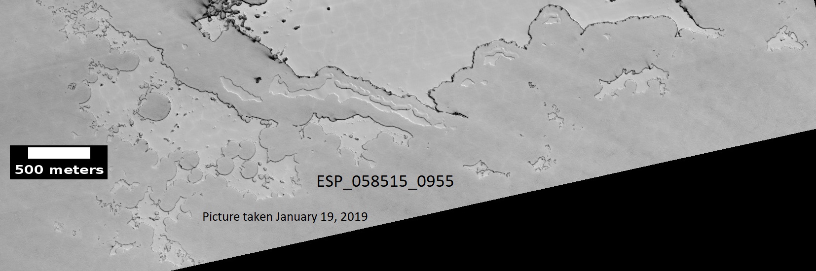
| 16:17, 5 January 2020 | ESP 058515 0955southpole2.jpg (file) |  |
200 KB | South pole swiss chees terrain, picture taken January 19, 2019. Source: http://hirise.lpl.arizona.edu/ESP_058515_0955 Image Credit: NASA/JPL/University of Arizona/ | 1 |
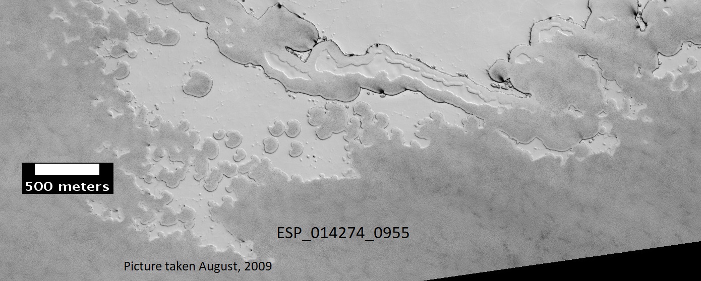
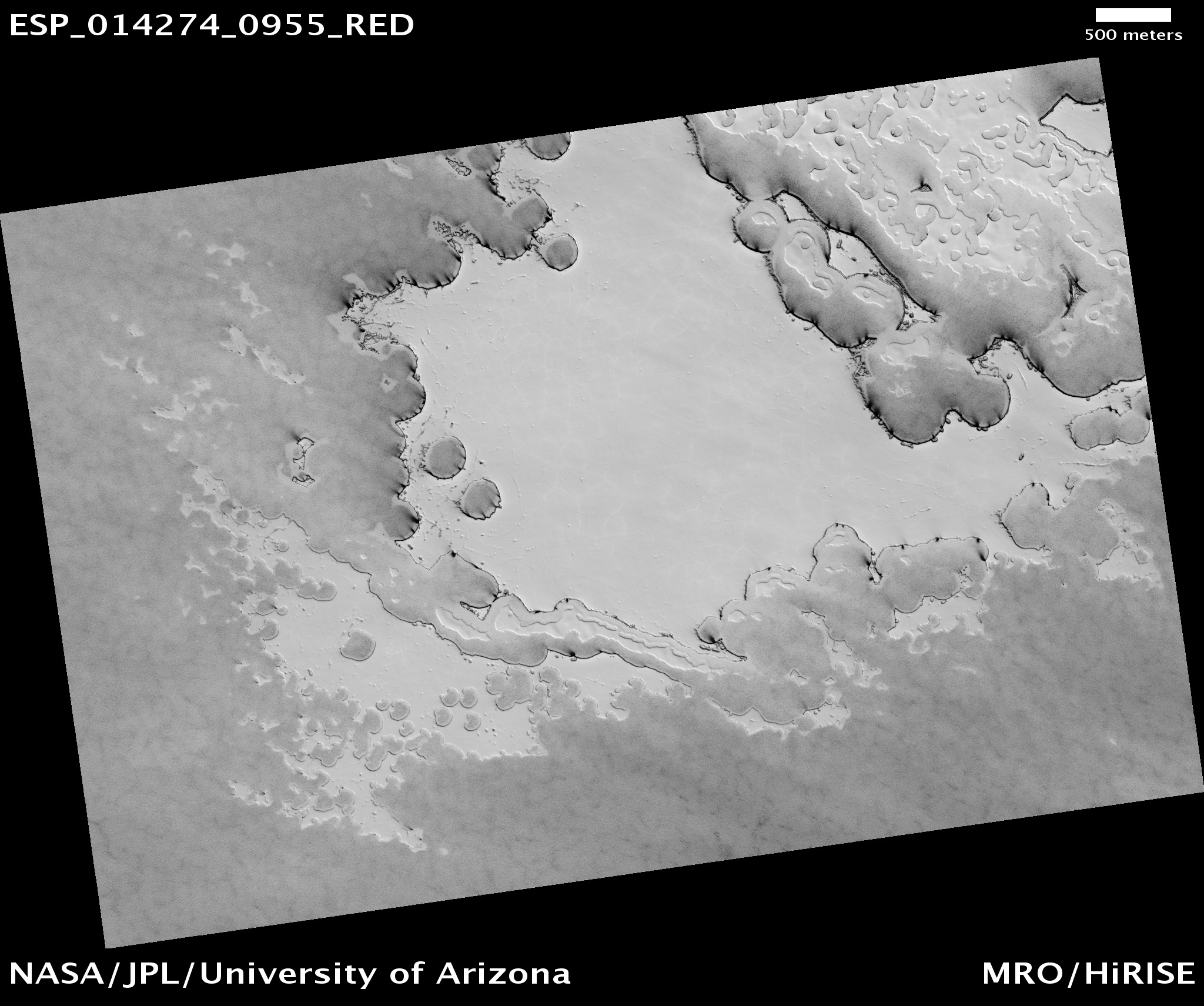
| 16:15, 5 January 2020 | ESP 014274 0955southpole3.jpg (file) |  |
273 KB | South pole swiss chees terrain, picture taken August, 2009. Source: http://hirise.lpl.arizona.edu/ESP_014274_0955 Image Credit: NASA/JPL/University of Arizona/ | 1 |
| 16:13, 5 January 2020 | ESP 014274 0955southpole.jpg (file) |  |
851 KB | South pole swiss chees terrain, picture taken August, 2009. Source: http://hirise.lpl.arizona.edu/ESP_014274_0955 Image Credit: NASA/JPL/University of Arizona/ | 1 |
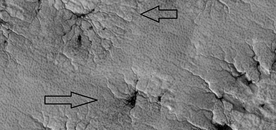
| 15:39, 5 January 2020 | Spidersmarspedia.jpg (file) |  |
63 KB | Close view of spiders As the temperature goes up in the spring, dry ice changes to a gas. The gas becomes pressurized under a slab of transparent ice until it blows out through a weak spot. The gas carries dark dust; thus producing dark legs of the spi... | 1 |
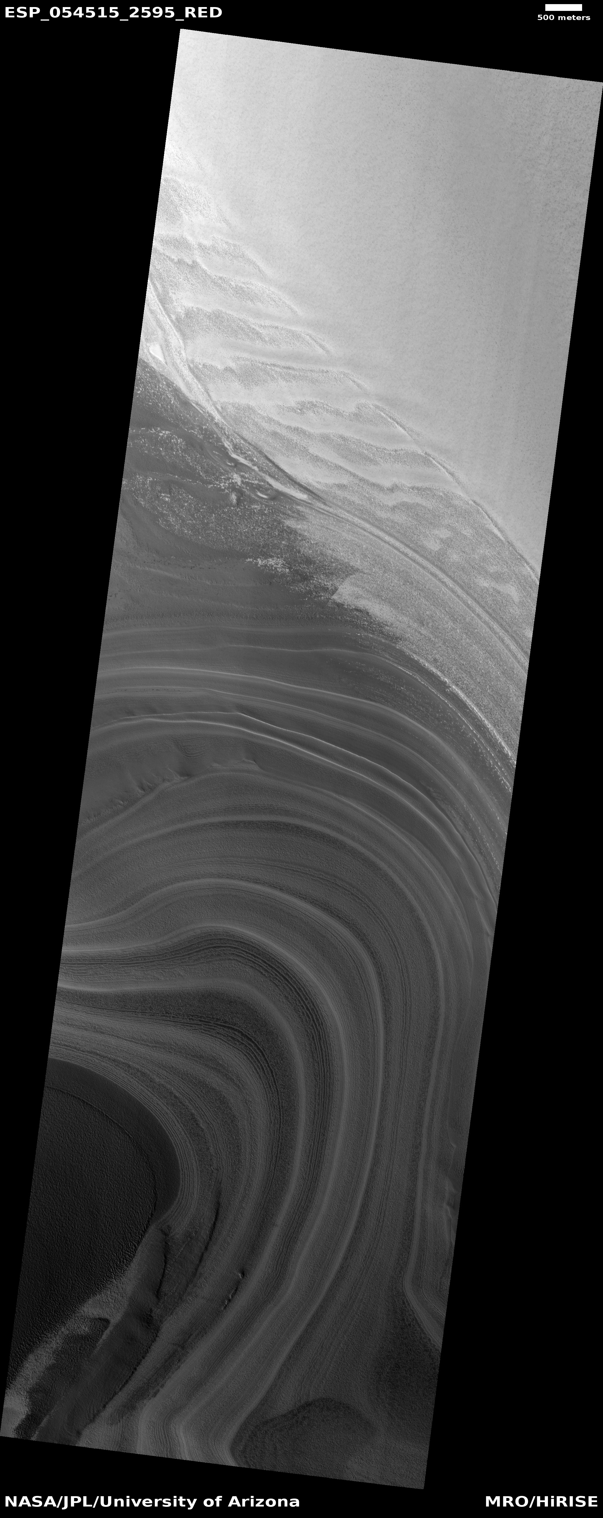
| 14:08, 5 January 2020 | ESP 054515 2595layersicecap.jpg (file) |  |
2.56 MB | Ice cap layers These are layers exposed in the northern ice cap of Mars. Each layer represents a change in the climate. The climate of Mars goes through many major changes because it does not have a large moon to control its tilt. The tilt of a planet... | 1 |
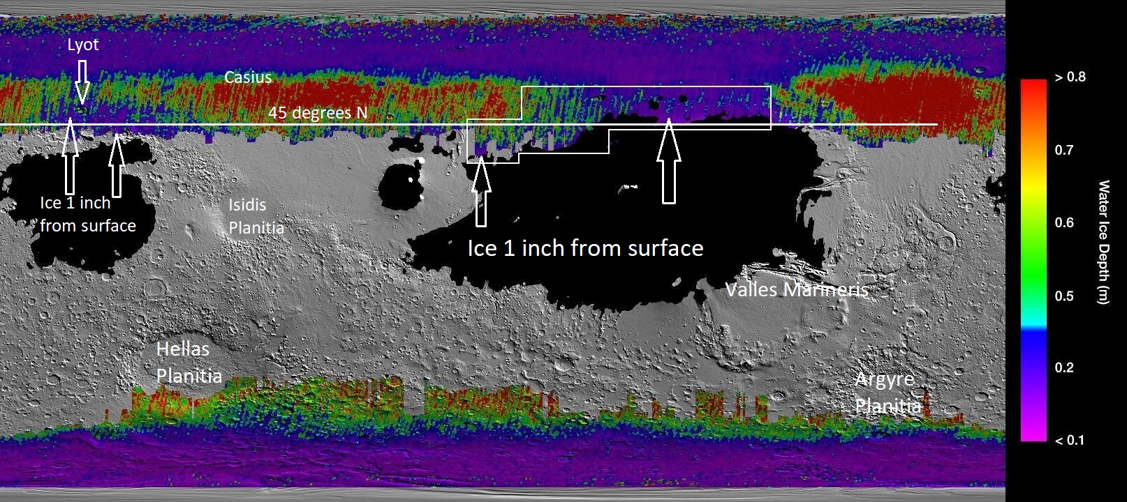
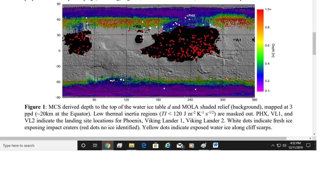
| 13:01, 19 December 2019 | Icemaplargelabeled454arrows.jpg (file) |  |
552 KB | Map that shows location of near surface ice based on data from Mars Climate sounder onboard the Mars Reconnaissance Orbiter and the Thermal Emission Imaging System (onboard the Mars Odyssey Orbiter). Image Credit: NASA/JPL/-Caltech/ASU/Secosky | 1 |
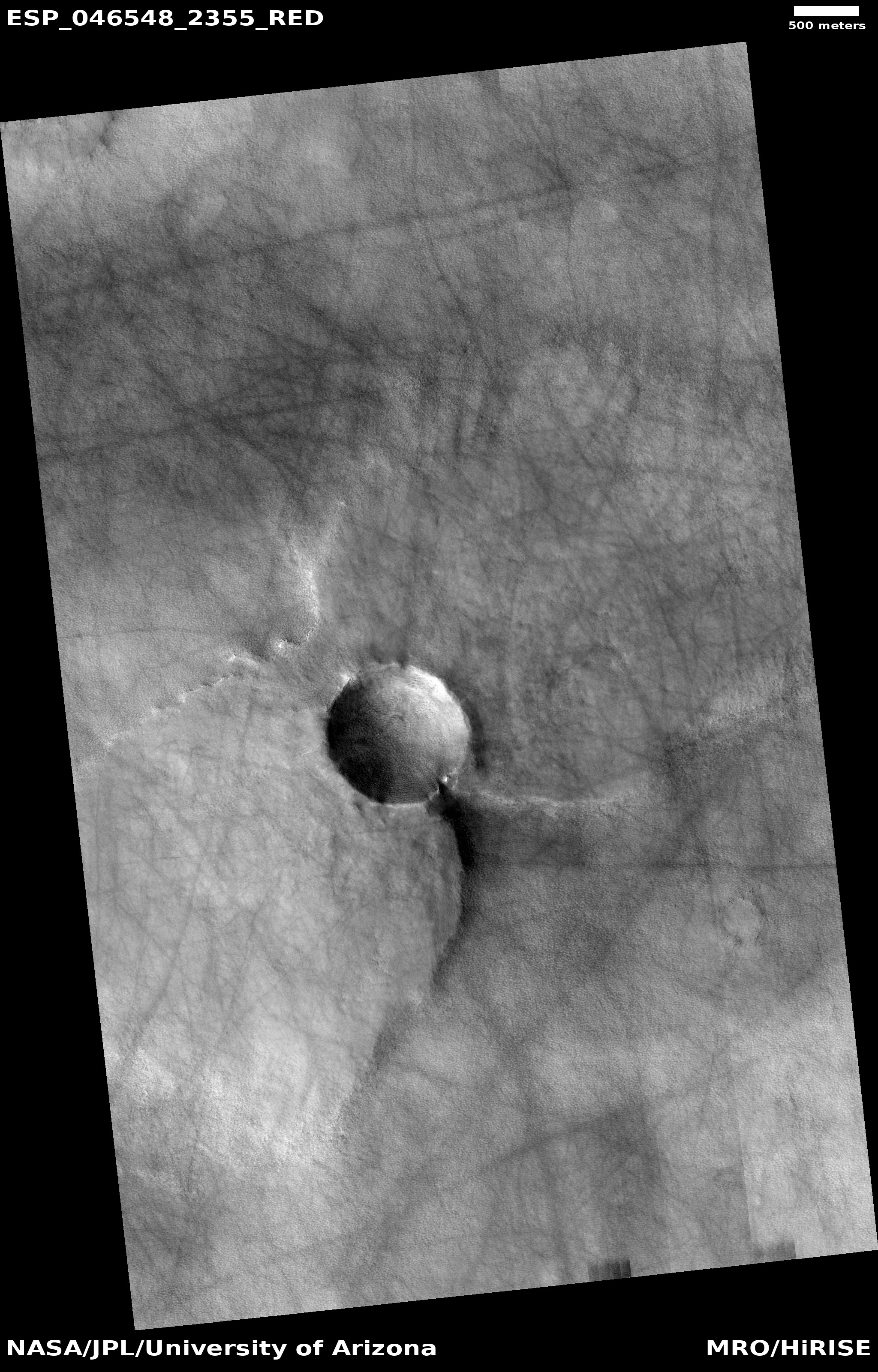
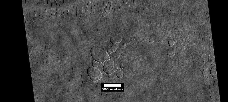
| 17:15, 16 December 2019 | ESP 046548 2355pedestalbutterfly.jpg (file) |  |
1.88 MB | Pedestal crater with a butterfly shape, as seen by HiRISE under HiWish program Source: http://hirise.lpl.arizona.edu/ESP_046548_2355 Image credit: NASA/JPL/University of Arizona | 1 |
| 17:07, 16 December 2019 | 46378 1415dunesirb2.jpg (file) |  |
348 KB | Close view of Dunes, as seen by HiRISE under HiWish program Color is displayed as IRB. Source: http://hirise.lpl.arizona.edu/ESP_046378_1415dunefield.jpg Image credit: NASA/JPL/University of Arizona | 1 |
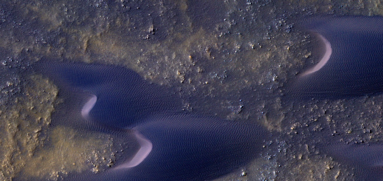
| 17:06, 16 December 2019 | 46378 1415dunesirb.jpg (file) |  |
369 KB | Close view of Dunes, as seen by HiRISE under HiWish program Color is processed as IRB. Source: http://hirise.lpl.arizona.edu/ESP_046378_1415dunefield.jpg Image credit: NASA/JPL/University of Arizona | 1 |
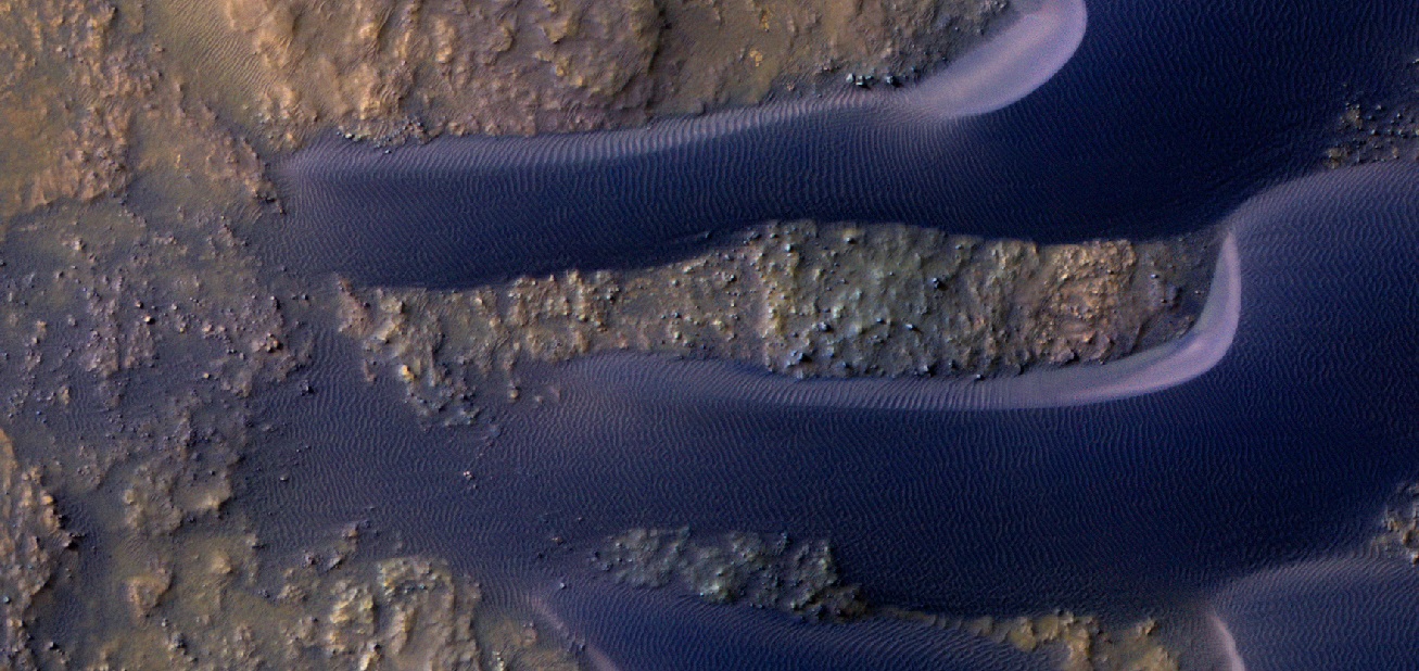
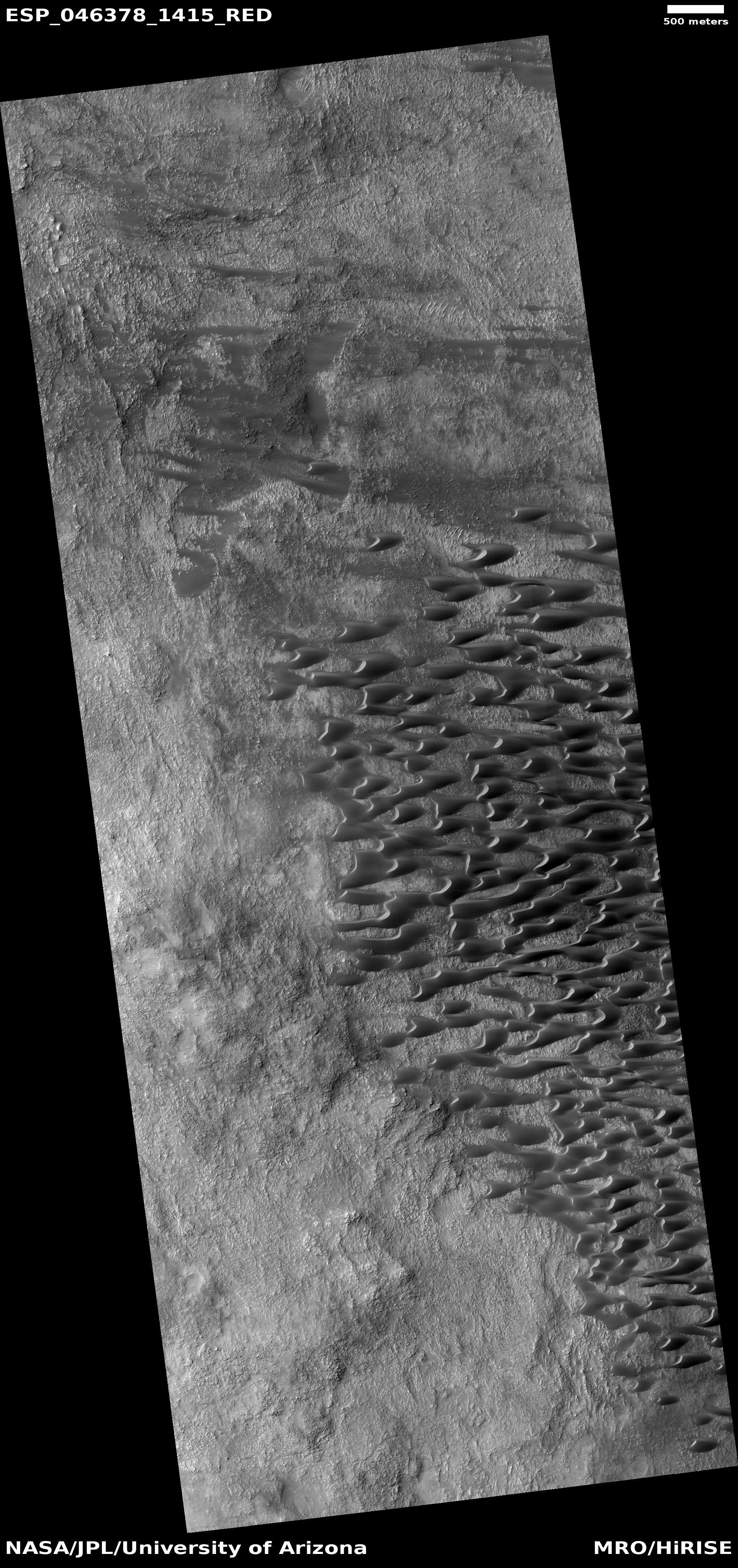
| 17:04, 16 December 2019 | ESP 046378 1415dunefield.jpg (file) |  |
2.66 MB | Dune field, as seen by HiRISE under HiWish program Source: http://hirise.lpl.arizona.edu/ESP_046378_1415dunefield.jpg Image credit: NASA/JPL/University of Arizona | 1 |
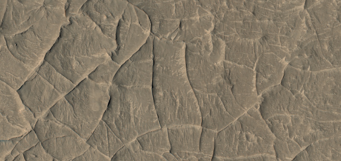
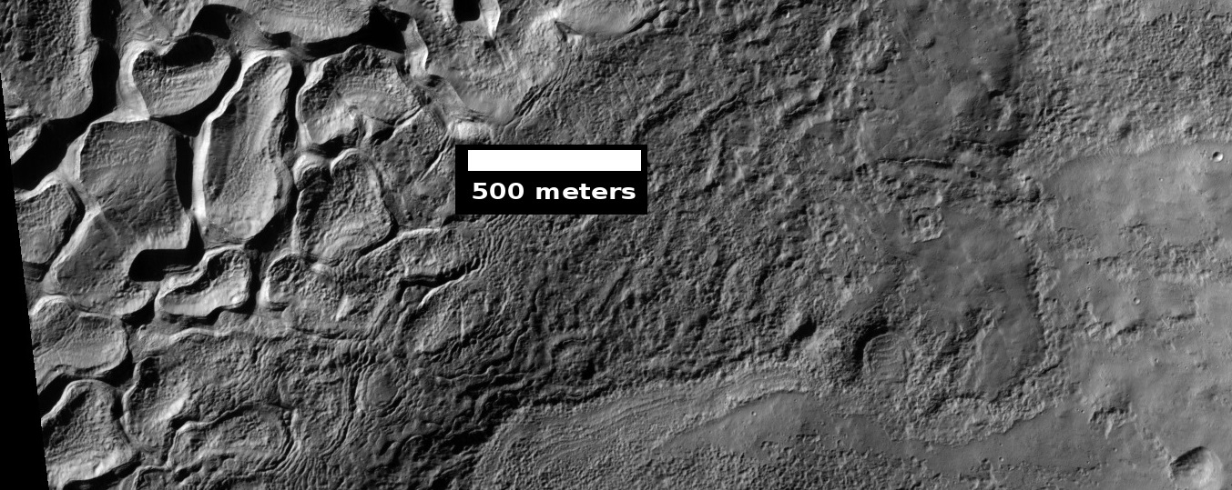
| 16:51, 16 December 2019 | 46269 1770ridgesmesa.jpg (file) |  |
257 KB | Ridge network, as seen by HiRISE under HiWish program Note that ridges are under the mesa; hence they formed before the mesa. Source: https://hirise.lpl.arizona.edu/ESP_46269_1770 Image credit: NASA/JPL/University of Arizona/Secosky | 1 |
| 16:50, 16 December 2019 | 46269 1770ridges2.jpg (file) |  |
263 KB | Ridge network, as seen by HiRISE under HiWish program Source: https://hirise.lpl.arizona.edu/ESP_46269_1770 Image credit: NASA/JPL/University of Arizona/Secosky | 1 |
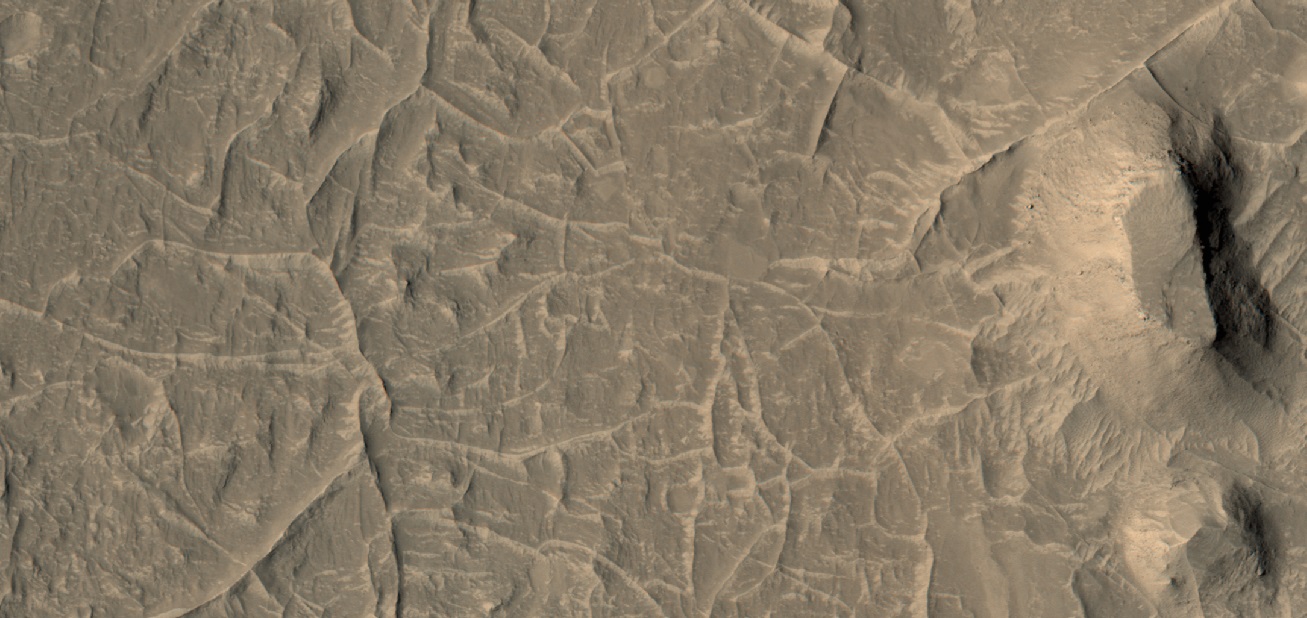
| 16:45, 16 December 2019 | ESP 046269 1770ridegenetworkmiddle.jpg (file) |  |
291 KB | Ridge network, as seen by HiRISE under the HiWish program Source: http://hirise,lpl.ariaona.edu/ESP_046269_1770 Image credit: NASA/JPL/University of Arizona/Secosky | 1 |
| 15:52, 12 December 2019 | Waterismeniuszoom.jpg (file) |  |
267 KB | Derived depth to ice as calculated with thermal inertia data from Mars Global Surveyor. Source:https://www.hou.usra.edu/meetings/ninthmars2019/pdf/6027.pdf Image Credit: NASA/Piqueux, et al. | 1 |
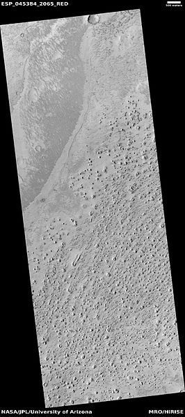
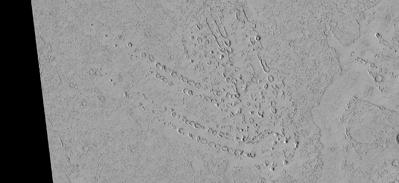
| 17:05, 10 December 2019 | ESP 045384 2065lavaice.jpg (file) |  |
43 KB | Field of rootless cones as seen by HiRISE under the HiWish program. Source: http://hirise.lpl.arizona.edu/ESP_45384_2065 Image credit: NASA/JPL/University of Arizona/Secosky | 1 |
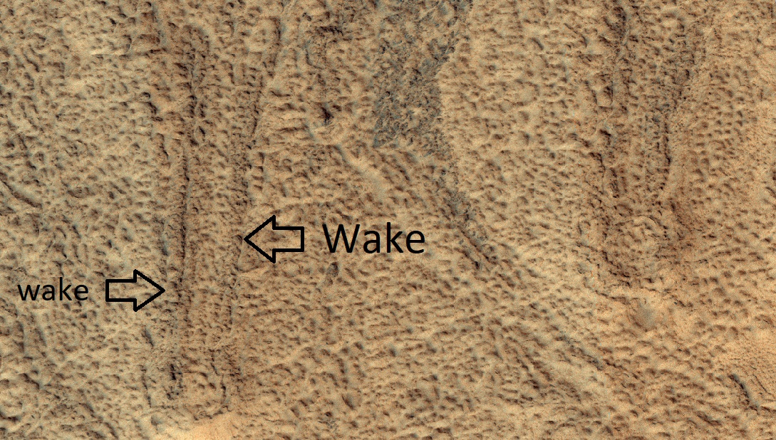
| 17:03, 10 December 2019 | 58610 2100coneswakeslabeled.jpg (file) |  |
418 KB | Rootless cones labeled, as seen by HiRISE under the HiWish program. Wakes are shown. They are formed when the lava keeps moving. Source: http://hirise.lpl.arizona.edu/ESP_58610_2100 Image credit: NASA/JPL/University of Arizona/Secosky | 1 |
| 17:02, 10 December 2019 | 58610 2100cones.jpg (file) |  |
484 KB | Rootless cones labeled, as seen by HiRISE under the HiWish program. Source: http://hirise.lpl.arizona.edu/ESP_58610_2100 Image credit: NASA/JPL/University of Arizona/Secosky | 1 |
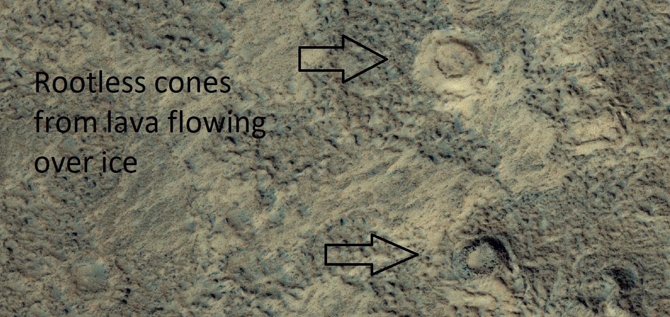
| 16:52, 10 December 2019 | Wikiesp37643 2060cones.jpg (file) |  |
188 KB | Field of rootless cones cause by lava flowing over ice or ice rich ground. the heat from the lava causes steam explosions that form cratered cones. Source: http://hirise.lpl.arizona.edu/ESP_37643_2060 Image credit: NASA/JPL/University of Arizona/... | 1 |
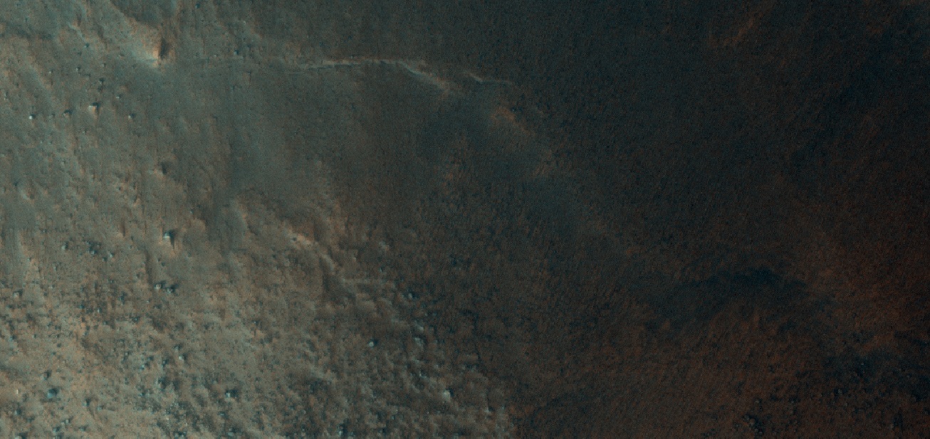
| 17:15, 6 December 2019 | ESP 057191 2150landslidecropped.jpg (file) |  |
847 KB | Landslide The location is the Ismenius Lacus quadrangle at 34.609 N and 27.879 E (ESP_057191_2150). Source: http://hirise.lpl.arizona.edu/ESP_057191_2150 Image credit is NASA/JPL/University of Arizona. | 1 |
| 17:00, 6 December 2019 | 62002 1470ribbedclose2.jpg (file) |  |
282 KB | Ribbed Terrain The white box represents the size of a football field. The location is the Hellas quadrangle at Latitude (centered) 32.477° S and Longitude 101.110° E (ESP_062002_1470). Source: http://hirise.lpl.arizona.edu/ESP_62002_1470ribbed.j... | 1 |
| 16:59, 6 December 2019 | 62002 1470ribbed.jpg (file) |  |
353 KB | Ribbed Terrain The location is the Hellas quadrangle at Latitude (centered) 32.477° S and Longitude 101.110° E (ESP_062002_1470). Source: http://hirise.lpl.arizona.edu/ESP_62002_1470ribbed.jpg Image credit: NASA/JPL/University of Arizona | 1 |
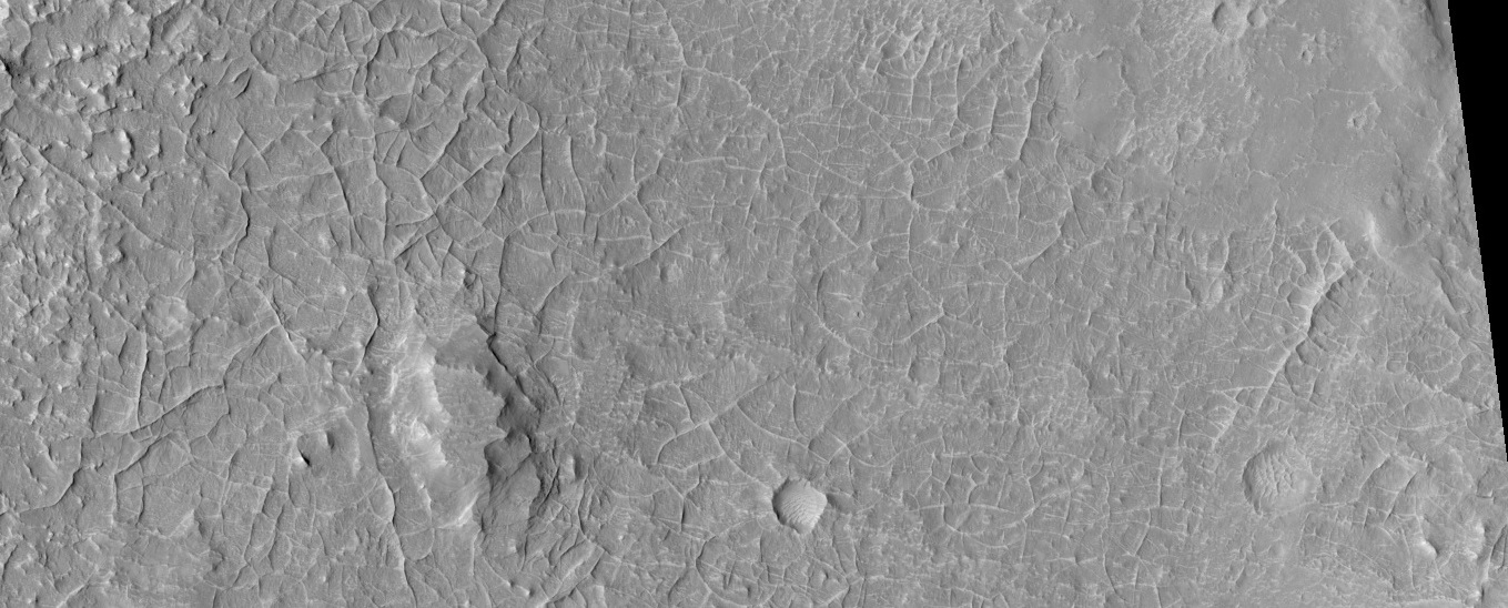
| 16:01, 6 December 2019 | 37461 2255scallopedscale.jpg (file) |  |
58 KB | Scalloped terrain Radar studies have shown that this type of surface contains much water ice, so it may be mined in the future by colonists. There may have been a channel running across the top of the image. The location is the Casius quadrangle at 4... | 1 |
| 15:53, 6 December 2019 | 37461 2255scallopedclose.jpg (file) |  |
70 KB | Close view of scalloped terrain High-centered polygons are visible, as well as some boulders. Radar studies have shown that this type of surface contains much water ice; hence, it may be mined in the future by colonists. Some of the scallops are mergin... | 1 |
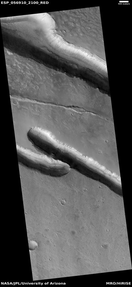
| 15:45, 6 December 2019 | 56910 2100trough.jpg (file) |  |
51 KB | Troughs The location is the Cebrenia quadrangle at 29.923 N and 138.463 E (ESP_056910_2100). Source: http://hirise.lpl.arizona.edu/ESP_56910_2100 Image credit: NASA/JPL/University of Arizona. | 1 |
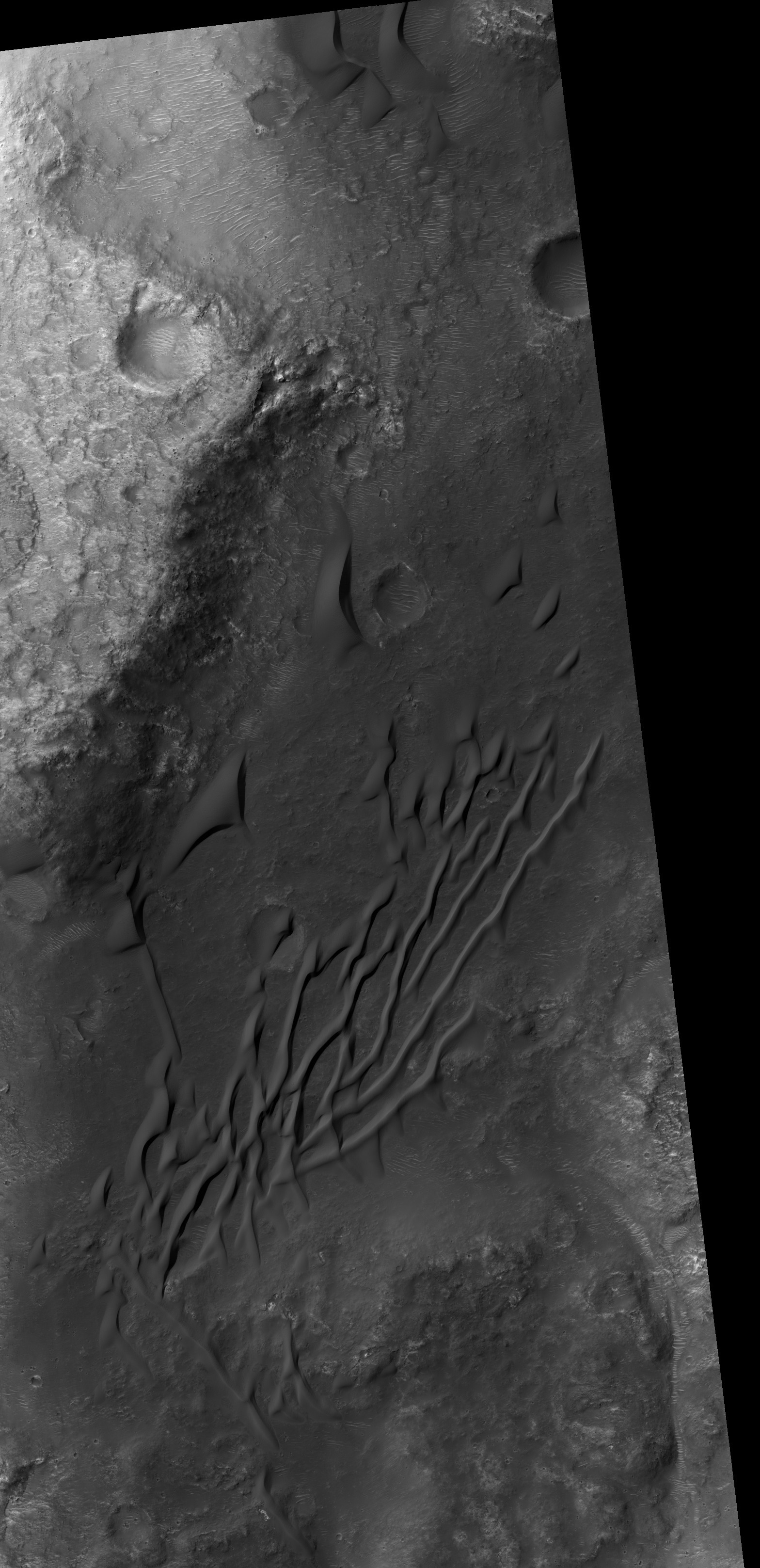
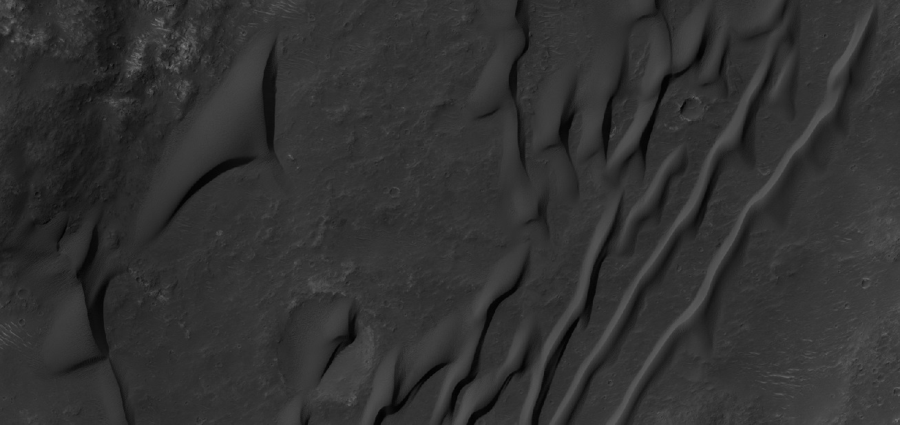
| 15:39, 6 December 2019 | 57707 1410gullycolorwide.jpg (file) |  |
390 KB | Close color view of gullies Patterned ground is visible; it is common in ice-rich ground. The location is 38.756 S and 354.808 E (ESP_057707_1410). Source: http://hirise.lpl.arizona.edu/ESP_057707_1410 Image credit is NASA/JPL/University of Arizon... | 1 |
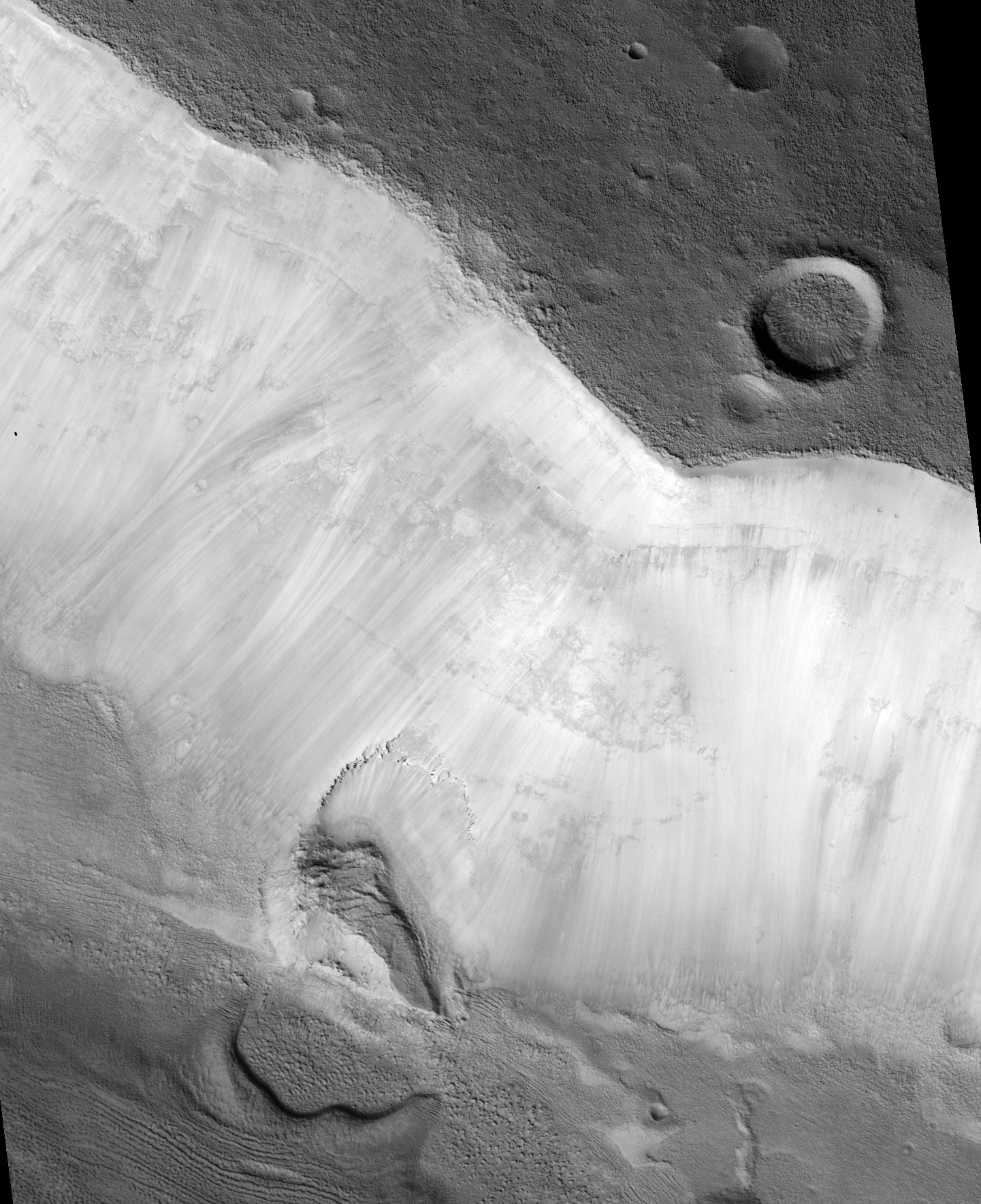
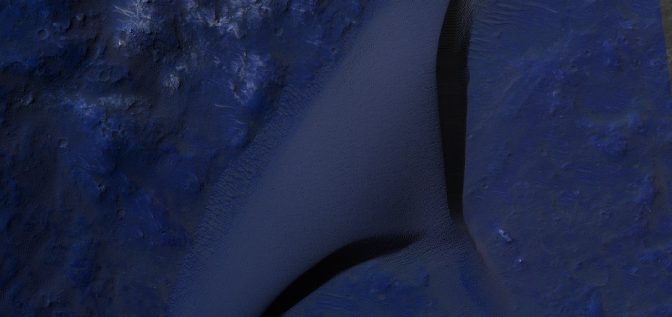
| 15:32, 6 December 2019 | ESP 057389 2195ldacropped.jpg (file) |  |
1.07 MB | Lobate Debris Apron These are believed to be glaciers because radar has detected pure ice that lies just meters below the surface. The location is the Ismenius Lacus quadrangle at 39.236 N and 23.599 E (ESP_057389_2195). Source: http://hirise.lpl... | 1 |
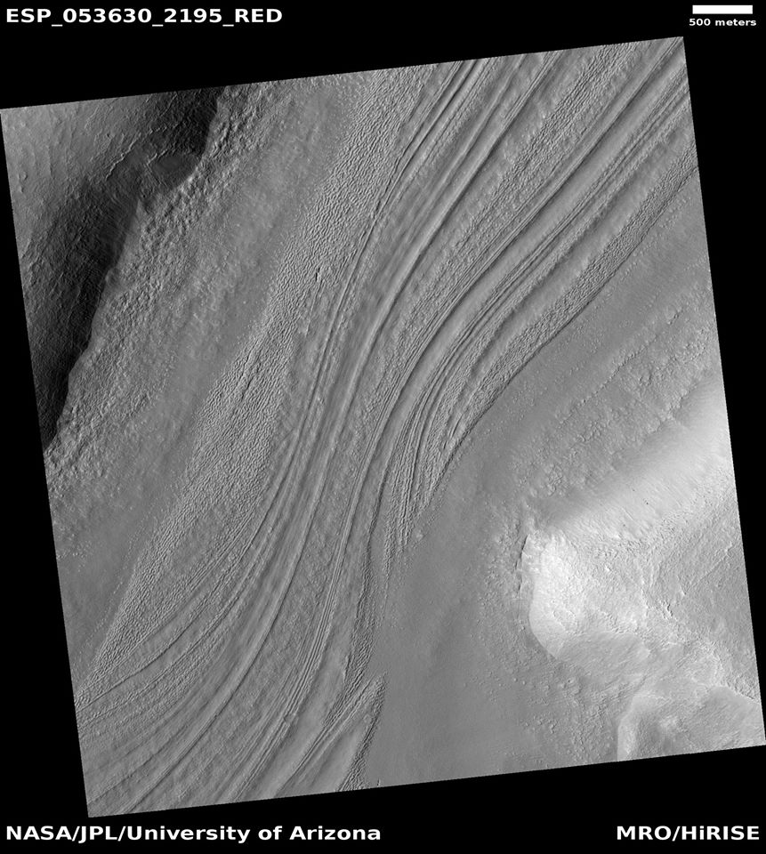
| 15:27, 6 December 2019 | 53630 2195lvf.jpg (file) |  |
148 KB | Lineated valley fill There is probably a great amount of ice here, under a thin cover of rocks. The location is the Ismenius Lacus quadrangle at 39.374 N and 34.883 E (ESP_053630_2195). Source: http://hirise.lpl.arizona.edu/ESP_053630_2195 Image... | 1 |
| 10:15, 6 December 2019 | 61974 1710duneswide.jpg (file) |  |
165 KB | Wide view of dunes in black and white only. The location is the Aeolis quadrangle at 9.11 S and 143.026 E. Source: http://hirise.lpl.arizona.edu/ESP_61974_1710 Image credit: NASA/JPL/University of Arizona/Secosky | 1 |
| 10:14, 6 December 2019 | 61974 1710dunesirb3.jpg (file) |  |
197 KB | Dunes with the color processed as irb. The location is the Aeolis quadrangle at 9.11 S and 143.026 E. Source: http://hirise.lpl.arizona.edu/ESP_61974_1710 Image credit: NASA/JPL/University of Arizona/Secosky | 1 |


