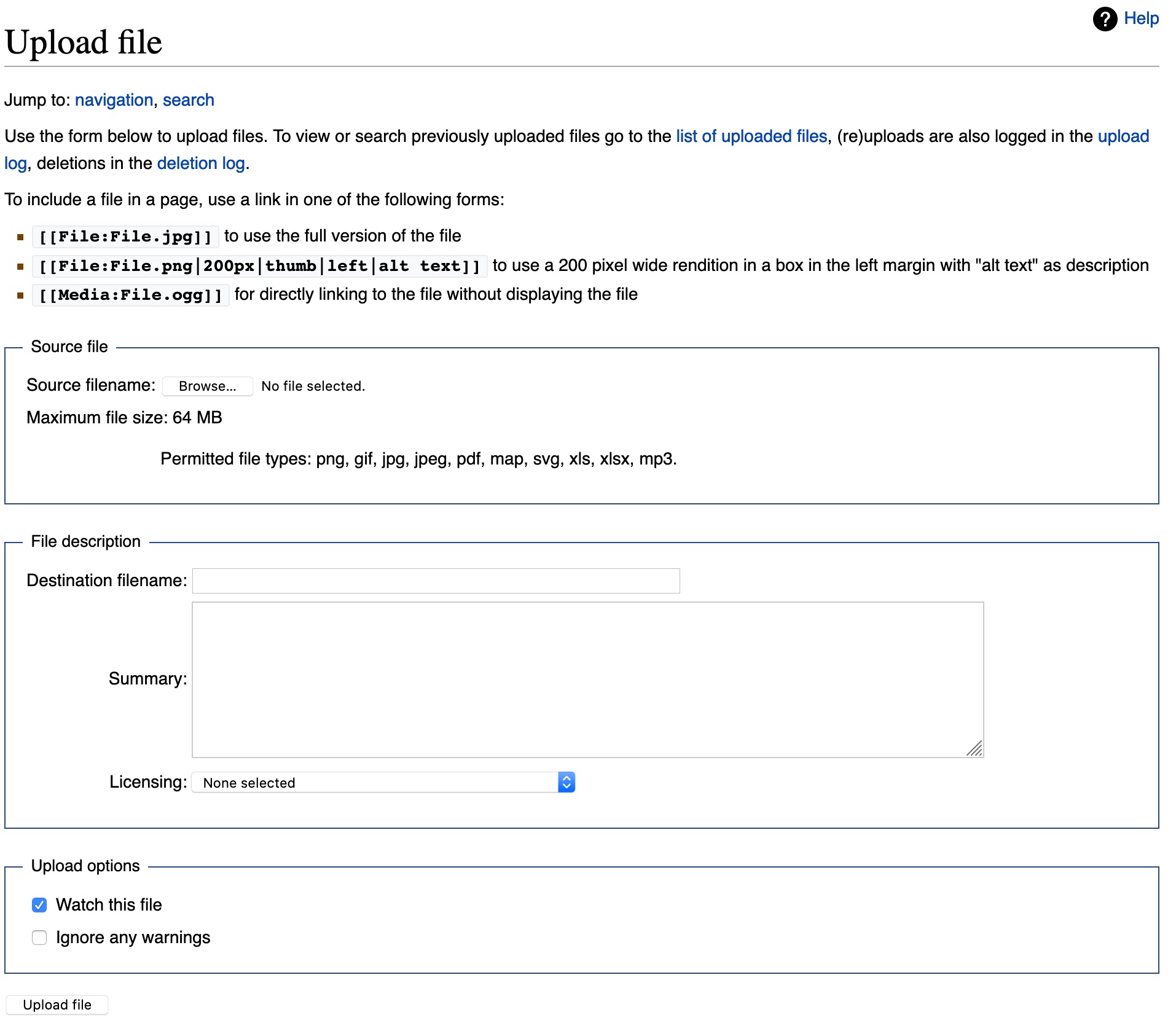
File list
This special page shows all uploaded files.
| Date | Name | Thumbnail | Size | User | Description | Versions |
|---|---|---|---|---|---|---|
| 11:23, 14 May 2020 | MT13 UploadExternalFile.jpg (file) |  |
309 KB | Frank C | 1 | |
| 11:22, 14 May 2020 | MT12 UploadOwnWorkFile.jpg (file) |  |
129 KB | Frank C | 1 | |
| 11:21, 14 May 2020 | MT11 MarspediaCategoryList.jpg (file) |  |
16 KB | Frank C | 1 | |
| 11:17, 14 May 2020 | MT10 AddCategoryExample.jpg (file) |  |
8 KB | Frank C | 1 | |
| 11:16, 14 May 2020 | MT9 TableExample.jpg (file) |  |
6 KB | Frank C | 1 | |
| 11:15, 14 May 2020 | MT8 TableProperties.jpg (file) | 9 KB | Frank C | 1 | ||
| 11:14, 14 May 2020 | MT7 ParsoidGraphic.jpg (file) |  |
5 KB | Frank C | 1 | |
| 11:12, 14 May 2020 | MT5 ResetSandbox.jpg (file) |  |
15 KB | Frank C | 1 | |
| 11:11, 14 May 2020 | MT4 VisualEditorPracticePage.jpg (file) | 9 KB | Frank C | 1 | ||
| 11:09, 14 May 2020 | MT3 Search Marspedia.jpg (file) |  |
116 KB | Frank C | 1 | |
| 09:20, 14 May 2020 | MT2 RequestAccount.jpg (file) |  |
277 KB | Frank C | 1 | |
| 09:10, 14 May 2020 | MT1 GuestLogin.jpg (file) |  |
259 KB | Frank C | Graphic in Marspedia Tutorials page | 1 |
| 04:45, 12 May 2020 | 64038 2155tarslabeled.jpg (file) |  |
230 KB | Suitupandshowup | TAR's, as seen by HiRISE under HiWish program TAR's are a type of sand dune found in low places, especially on the floors of old channels. Source: http://hirise.lpl.arizona.edu/ESP_64038_2155 Image Credit: NASA/JPL/University of Arizona/Secosky | 1 |
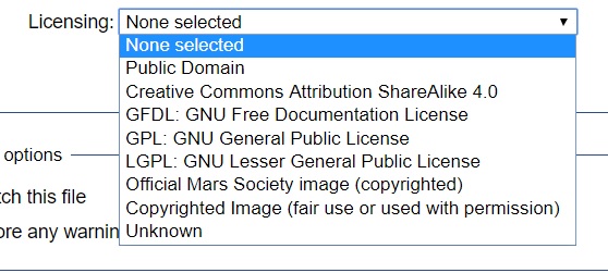
| 09:19, 11 May 2020 | Marspedia-Image-Licenses.jpg (file) |  |
62 KB | Jburk | Screenshot of Marspedia Image Licenses dropdown choices | 1 |
| 13:27, 1 May 2020 | Th 040305 NG 5x5 SmB10 016 EQ75 with2Logos web.jpg (file) |  |
305 KB | Michel Lamontagne | 1 | |
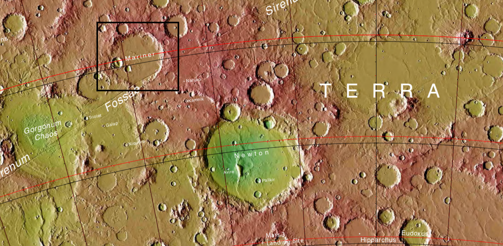
| 12:00, 28 April 2020 | Mariner.PNG (file) |  |
2.4 MB | Michel Lamontagne | 2 | |
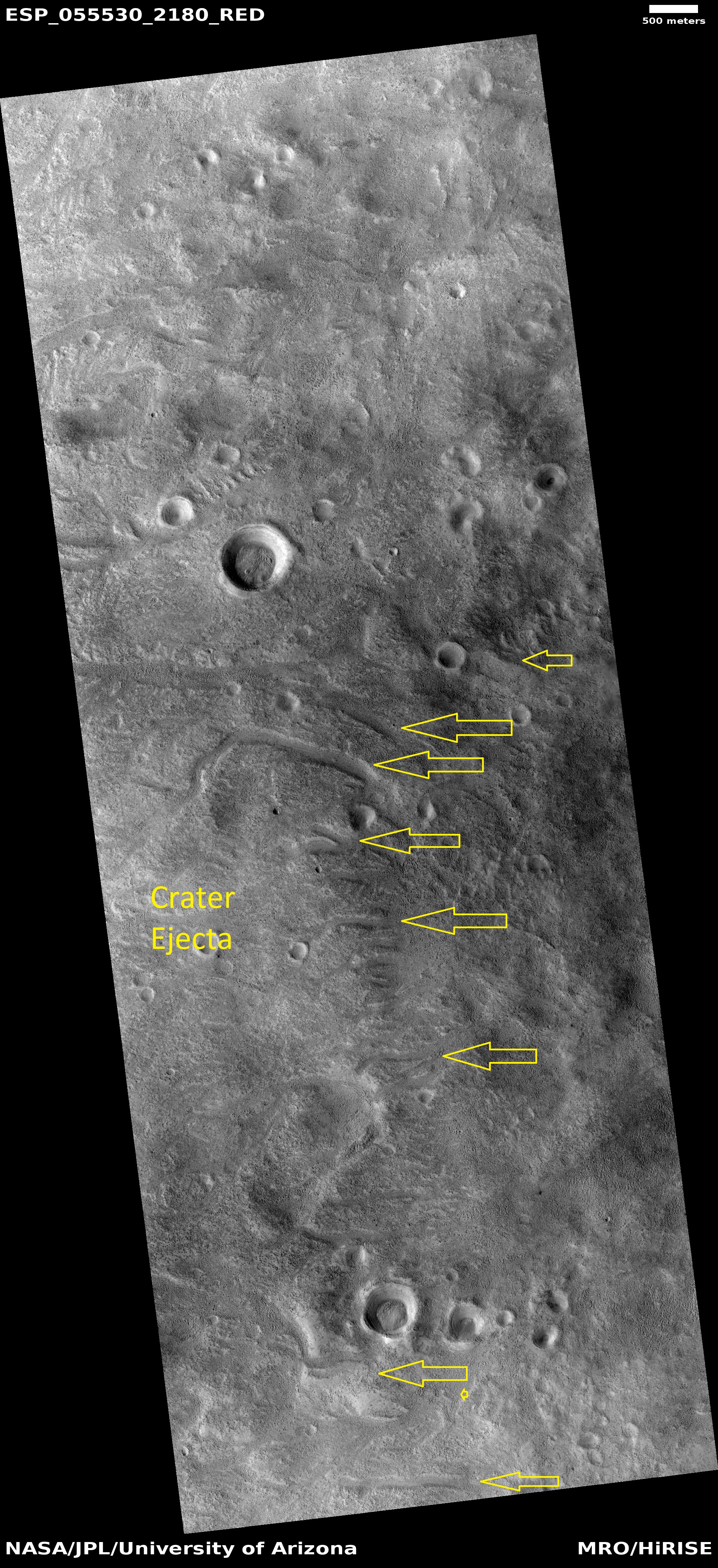
| 07:57, 21 April 2020 | ESP 055530 2180channels.jpg (file) |  |
3.4 MB | Suitupandshowup | Channels on the edge of a crater's ejecta. The heat form the impact ejecta may have melted ice in the ground and formed the channels we see. Source: http://hirise.lpl.arizona.edu/ESP_055530_2180 Image credit: NASA/JPL/University of Arizona | 1 |
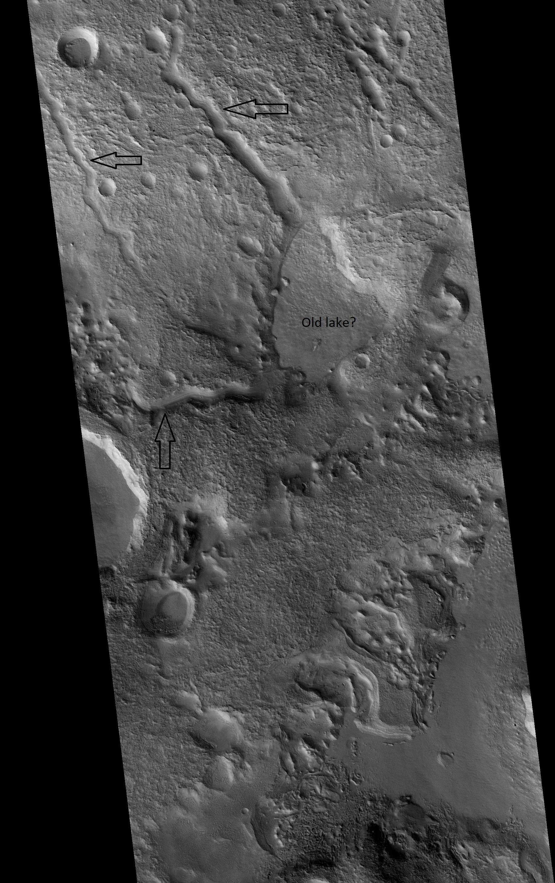
| 13:20, 20 April 2020 | ESP 056689 2210channelslowspotcropped.jpg (file) |  |
1.75 MB | Suitupandshowup | Channels emptying into a low area in the Ismenius Lacus quadrangle, as seen by HiRISE under HiWish program Date Source http://hirise.lpl.arizonia.edu/ESP_056689_2210 Image credit: NASA/JPL/University of Arizona/Secosky | 1 |
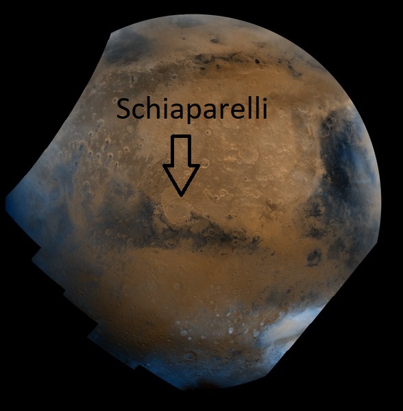
| 13:08, 20 April 2020 | Schiaparelli Hemisphere - PIA00004labeled.jpg (file) |  |
69 KB | Suitupandshowup | This mosaic is composed of about 100 red- and violet- filter Viking Orbiter images. The images were acquired in 1980 during mid northern summer on Mars (Ls = 89 degrees). The center of the image is near the impact crater Schiaparelli (latitude -3 degrees, longitude 343 degrees). The limits of this mosaic are approximately latitude -60 to 60 degrees and longitude 280 to 30 degrees. The color variations have been enhanced by a factor of two. The large circular area with a bright yellow color... | 1 |
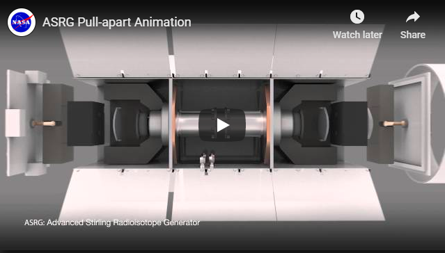
| 02:32, 19 April 2020 | RTGs ASRGPullApart.png (file) |  |
161 KB | Sdubois | 1 | |
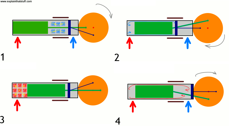
| 02:25, 19 April 2020 | RTGs Stirling.png (file) |  |
30 KB | Sdubois | 1 | |
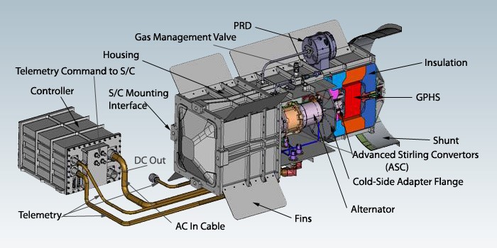
| 02:18, 19 April 2020 | RTGs ASRG.jpg (file) |  |
69 KB | Sdubois | 1 | |
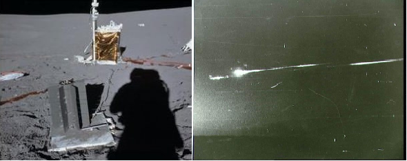
| 02:01, 19 April 2020 | RTGs Apollo13.png (file) |  |
202 KB | Sdubois | 1 | |
| 01:51, 19 April 2020 | RTGs Cleanup.jpg (file) |  |
20 KB | Sdubois | 1 | |
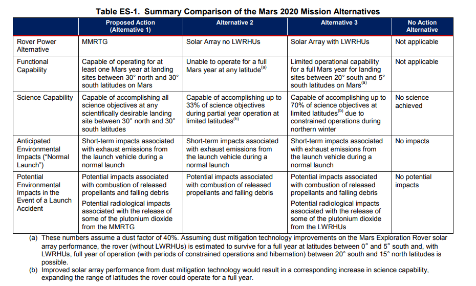
| 01:47, 19 April 2020 | RTG ComparisonSummary.png (file) |  |
171 KB | Sdubois | 1 | |
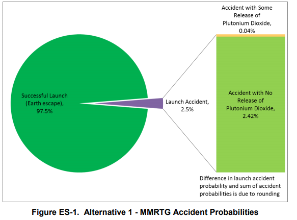
| 01:45, 19 April 2020 | RTGs MMRTGAccidents.png (file) |  |
44 KB | Sdubois | 1 | |
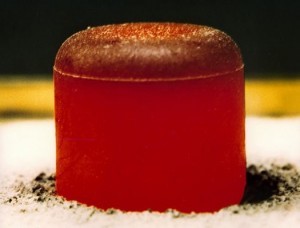
| 01:37, 19 April 2020 | RTGs Pu238.jpg (file) |  |
13 KB | Sdubois | 1 | |
| 01:27, 19 April 2020 | RTGs SolarRTGComparison.png (file) |  |
23 KB | Sdubois | 1 | |
| 01:15, 19 April 2020 | RTGs MMRTGPullApart.png (file) |  |
51 KB | Sdubois | 1 | |
| 01:06, 19 April 2020 | RTGs MMRTG.jpg (file) |  |
96 KB | Sdubois | 1 | |
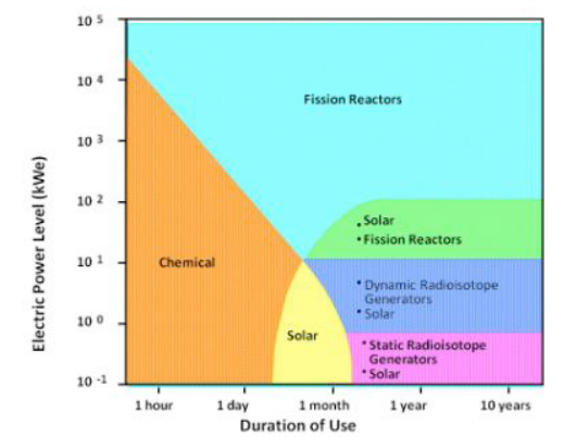
| 00:50, 19 April 2020 | RTGs FutureSolar.png (file) |  |
113 KB | Sdubois | 1 | |
| 00:46, 19 April 2020 | RTGs JunoBus.jpg (file) |  |
16 KB | Sdubois | 1 | |
| 00:35, 19 April 2020 | RTGs PreviousMissions.jpg (file) |  |
107 KB | Sdubois | 1 | |
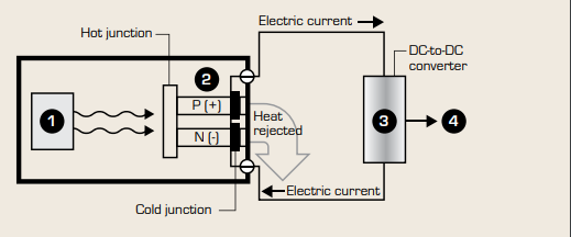
| 00:13, 19 April 2020 | RTGs Thermocouple.png (file) |  |
18 KB | Sdubois | 1 | |
| 00:04, 19 April 2020 | RTGs OpEnv.png (file) |  |
168 KB | Sdubois | 1 | |
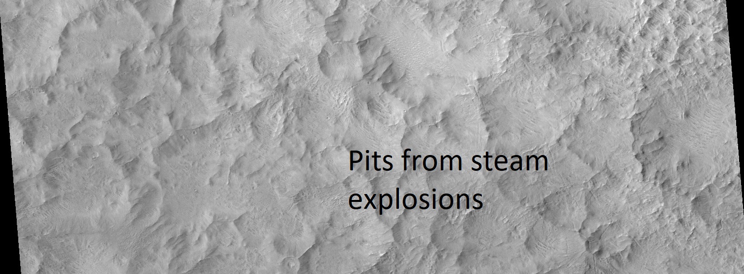
| 07:07, 18 April 2020 | ESP 012531 1435pits.jpg (file) |  |
304 KB | Suitupandshowup | Pits on floor of Hale crater from steam explosions, as seen by HiRISE Hot molted rock fell after impact and caused steam explosions in the ice rich ground. Source: https://www.uahirise.org/https://www.uahirise.org/ESP_012531_1435 Image credit: NASA/JPL/University of Arizona/Secosky | 1 |
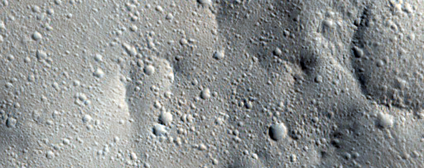
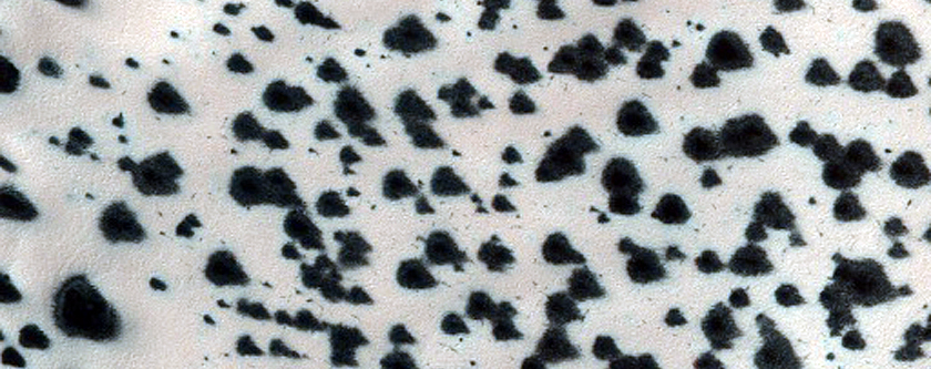
| 06:51, 18 April 2020 | ESP 030244 2040secondarycraters.jpg (file) |  |
339 KB | Suitupandshowup | Secondary craters, as seen by HiRISE Source: https://www.uahirise.org/ESP_030244_2040 Image credit: NASA/JPL/University of Arizona | 1 |
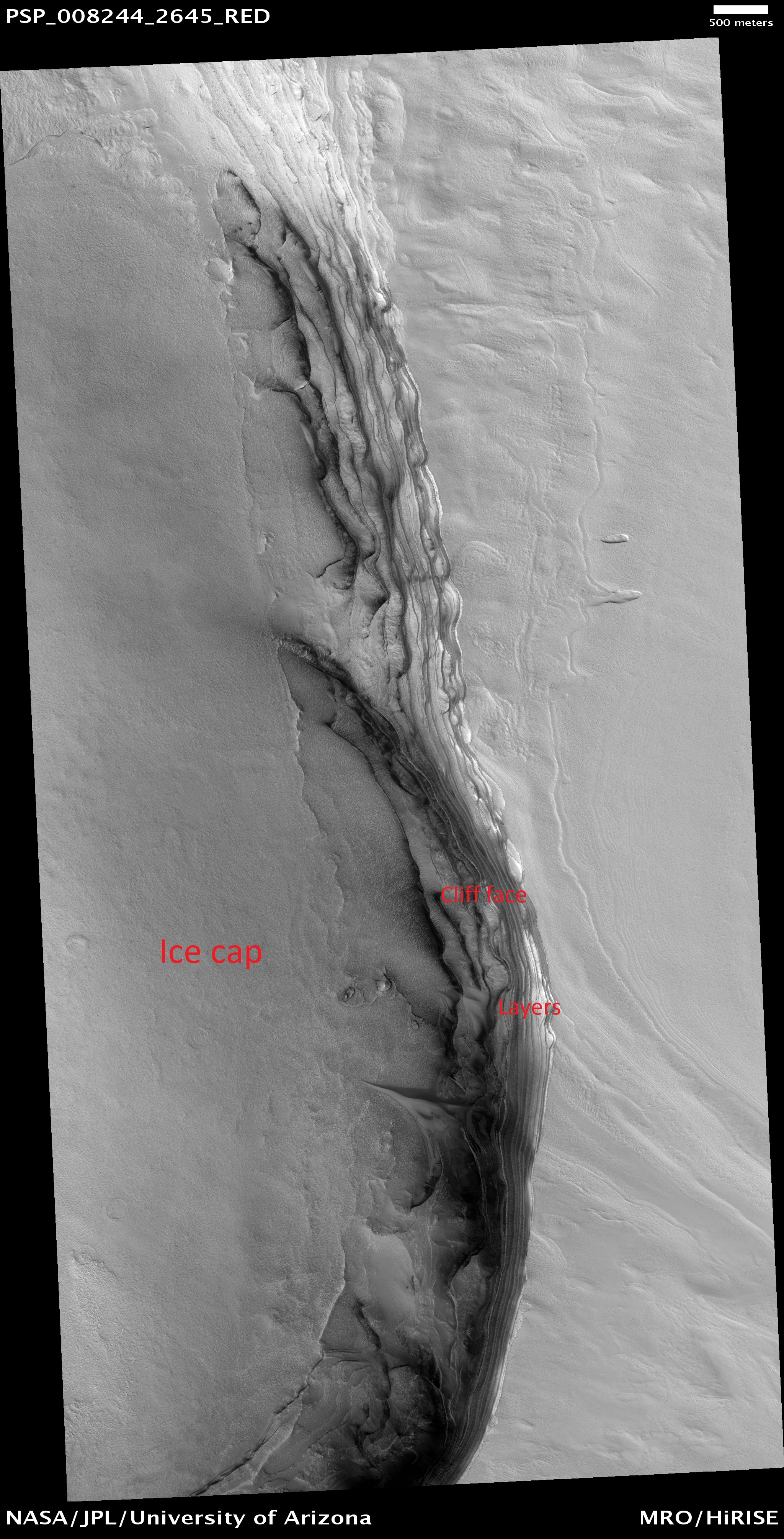
| 04:52, 18 April 2020 | PSP 008244 2645northicecaplabeled.jpg (file) |  |
2.66 MB | Suitupandshowup | Lava tubes and lava flows, as seen by HiRISE Source: https://www.uahirise.org/PSP_008244_2645 Image credit: NASA/JPL/University of Arizona/Secosky | 1 |
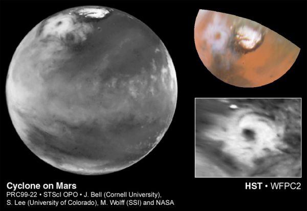
| 07:41, 17 April 2020 | Marscyclone hst.jpg (file) |  |
31 KB | Suitupandshowup | Cyclone on Mars, as seen by HST. Source: https://apod.nasa.gov/apod/ap990520.html Credit: J. Bell (Cornell), S. Lee (Univ. Colorado), M. Wolff (SSI), et al., NASA | 1 |
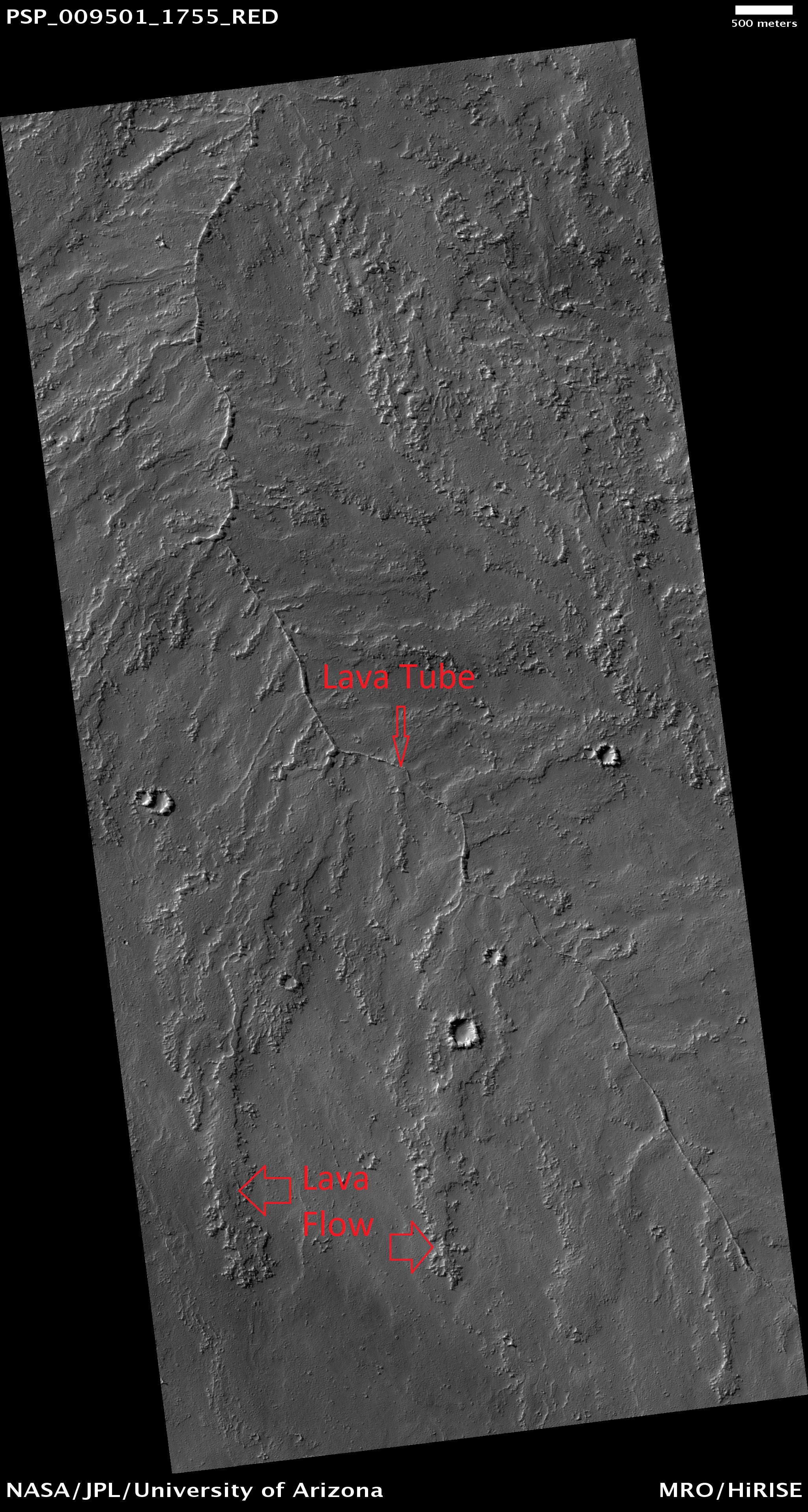
| 07:29, 17 April 2020 | PSP 009501 1755lavatube.jpg (file) |  |
2.55 MB | Suitupandshowup | Lava tubes and lava flows, as seen by HiRISE https://www.uahirise.org/PSP_009501_1755 Image credit: NASA/JPL/University of Arizona/Secosky | 1 |
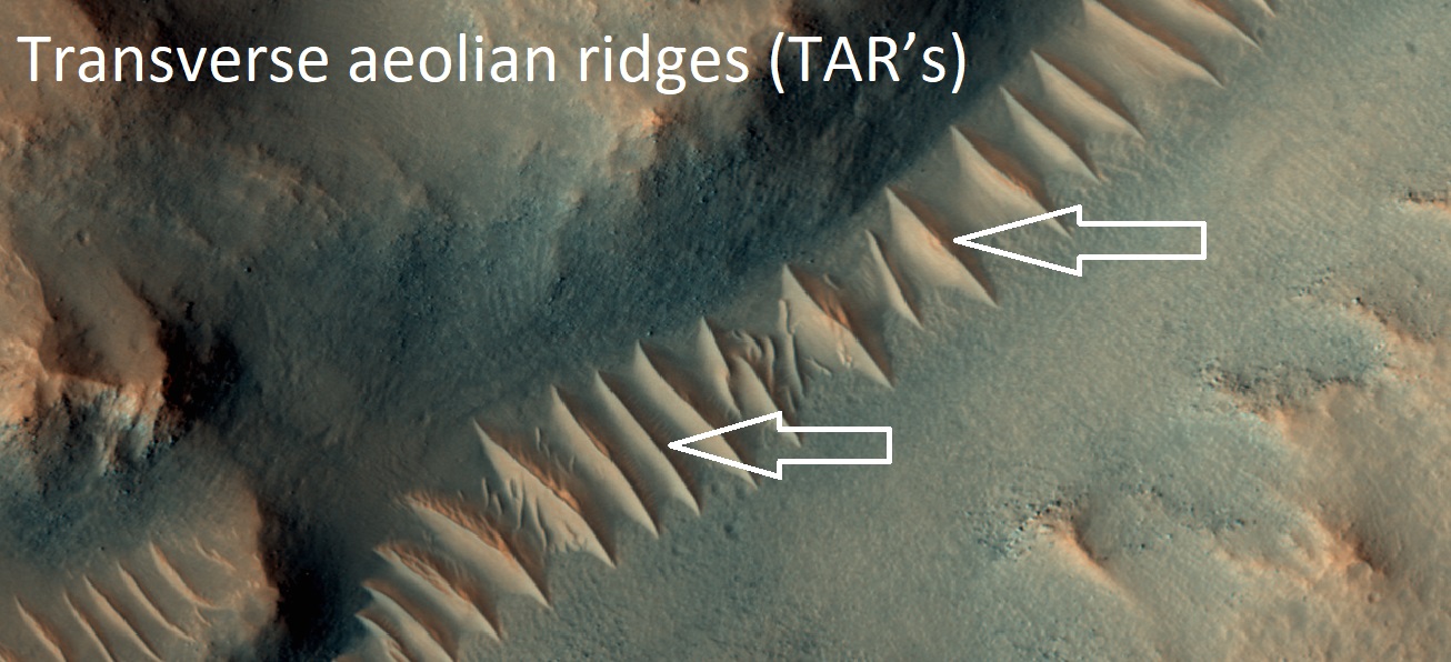
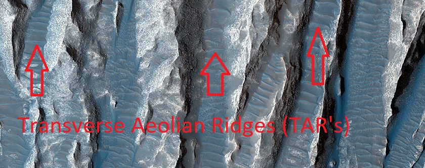
| 07:04, 17 April 2020 | ESP 042625 1655tars.jpg (file) |  |
763 KB | Suitupandshowup | Transverse aeolian ridges (TAR's) Transverse aeolian ridges—or TAR—are mysterious, wind-blown features that are intermediate in size between ripples and much larger sand dunes. Ripples form from hopping sand grains, and dunes form from sand grains being blown over longer distances. One hypothesis for TAR formation is that larger grains like pebbles are rolled on top of smaller ripples; then, finer dust settles into the cracks, “inflating” the pebbles, making the TAR larger than typical rip... | 1 |
| 06:56, 17 April 2020 | ESP 039563 1730tars.jpg (file) |  |
194 KB | Suitupandshowup | Transverse aeolian ridges (TAR's) These are sort of like small sand dunes. We do not understand these totally. Source: https://www.uahirise.org/ESP_039563_1730 Image credit: NASA/JPL/University of Arizona/Secosky | 1 |
| 06:43, 17 April 2020 | ESP 011605 1170defrosting.jpg (file) |  |
320 KB | Suitupandshowup | Defrosting The dark spots are where the ice has melted, allowing us to see the dark undersurface. This takes place each spring. https://www.uahirise.org/ESP_011605_1170 Image credit: NASA/JPL/University of Arizona | 1 |
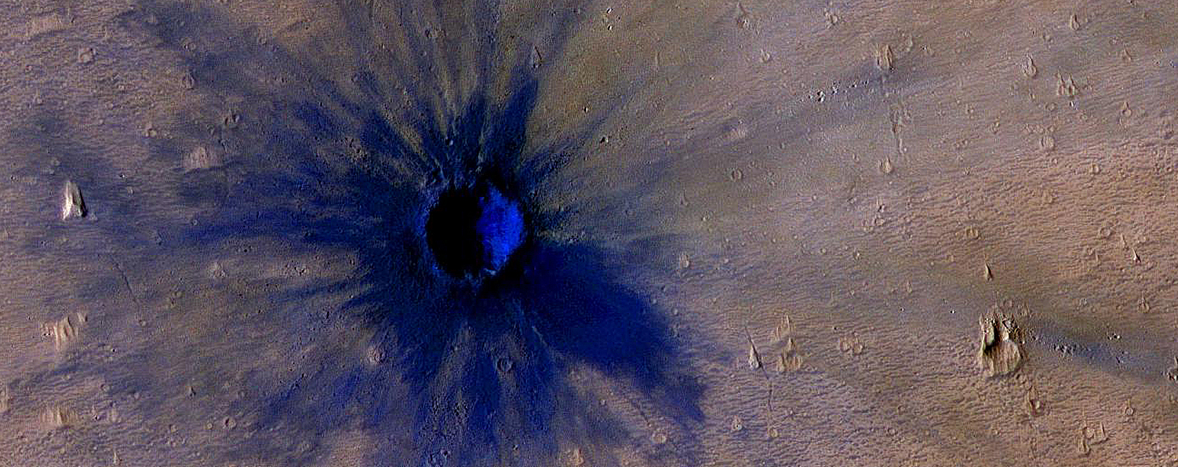
| 04:57, 17 April 2020 | ESP 011425 1775newcrater.jpg (file) |  |
1.18 MB | Suitupandshowup | New crater The dark represents the dark surface that lies under the dust. It is the dark volcanic rock basalt. Image credit: NASA/JPL/University of Arizona Source: https://www.uahirise.org/ESP_011425_1775 | 1 |
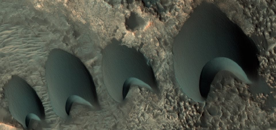
| 10:56, 16 April 2020 | ESP 55095 2170dunes.jpg (file) |  |
70 KB | Suitupandshowup | Close, color view of dunes The location is near Sklodowski Crater in North Arabia Terra in the Ismenius Lacus quadrangle at 36.66 N and 0.787 E (ESP_55095_2170). Picture taken with HiRISE under HiWish program Source: http://hirise.lpl.arizona.edu/ESP_55095_2170 Image credit is NASA/JPL/University of Arizona. | 1 |
| 08:48, 16 April 2020 | ESP 035801 2210dipping.jpg (file) |  |
46 KB | Suitupandshowup | Dipping layers The location is the Ismenius Lacus quadrangle at Latitude (centered) 40.417° N and Longitude 57.678° E. Source: http://hirise.lpl.arizona.edu/ESP_035801_2210 Image courtesy NASA/JPL/University of Arizona | 1 |
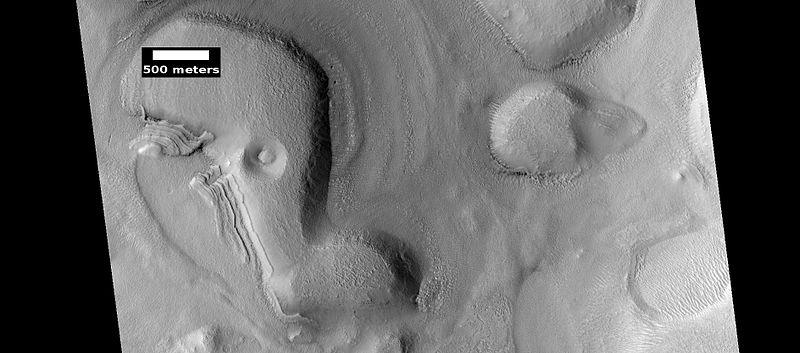
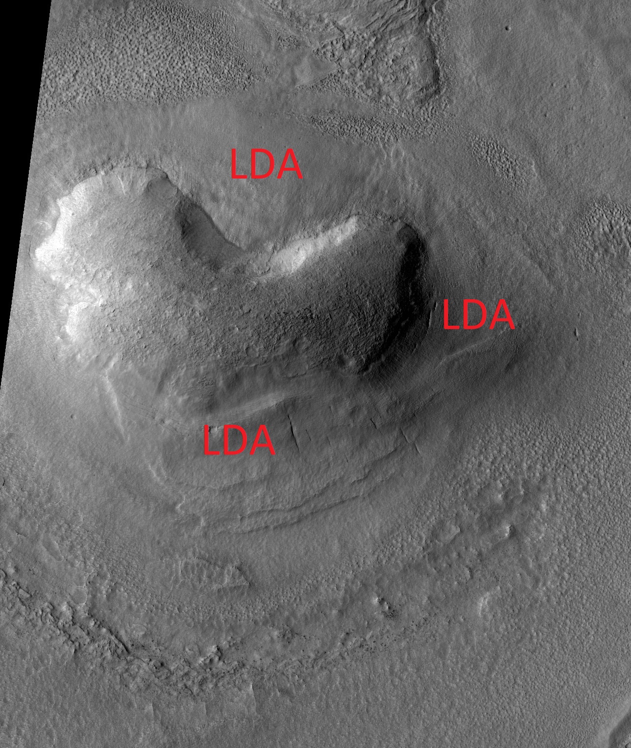
| 09:09, 15 April 2020 | ESP 036619 2275ldalabeled.jpg (file) |  |
808 KB | Suitupandshowup | Lobate debris apron around a mound, as seen by HiRISE under HiWish program Source: http://hirise.lpl.arizona.edu/ESP_036619_2275 Image credit: NASA/JPL/University of Arizona/Secosky | 1 |
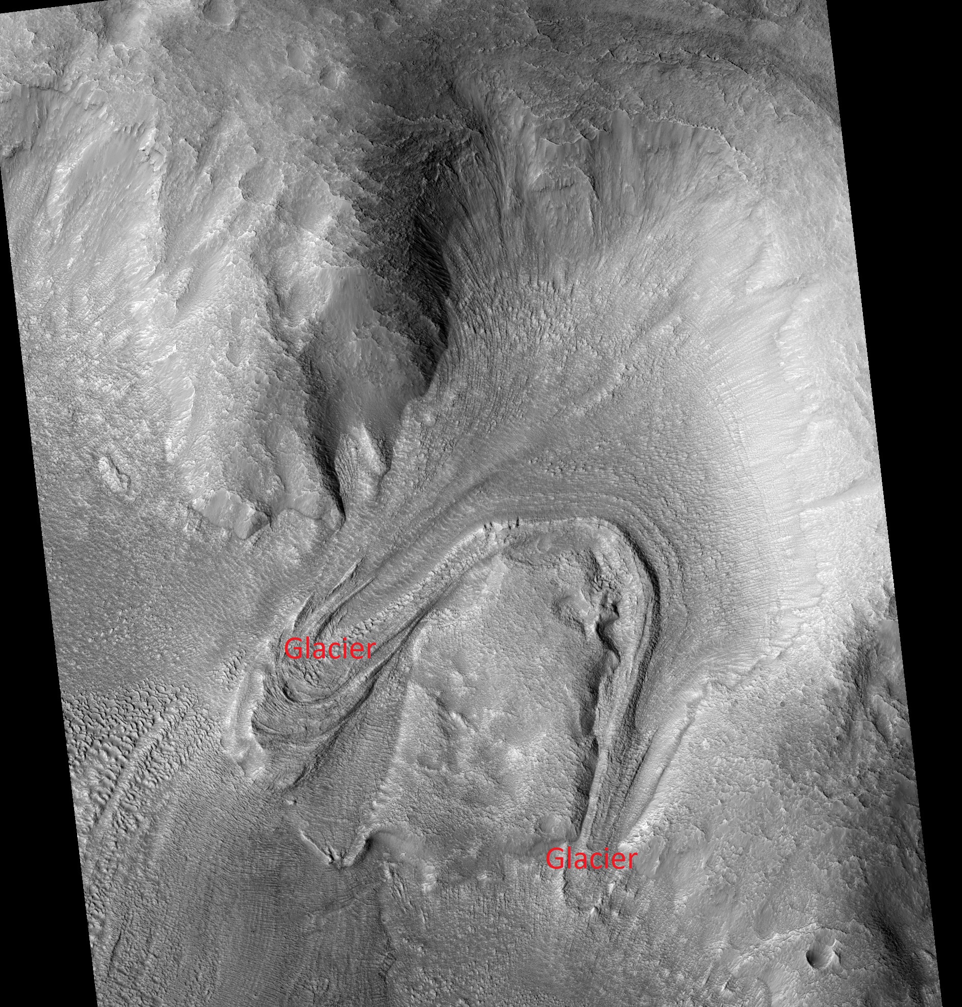
| 09:06, 15 April 2020 | ESP 035327 2255tongues.jpg (file) |  |
1.56 MB | Suitupandshowup | Tongue-shaped glaciers created when flow ran into an obstacle, causing it to split into two. Source: http://hirise.lpl.arizona.edu/ESP_035327_2255 Image credit: NASA/JPL/University of Arizona/Secosky | 1 |
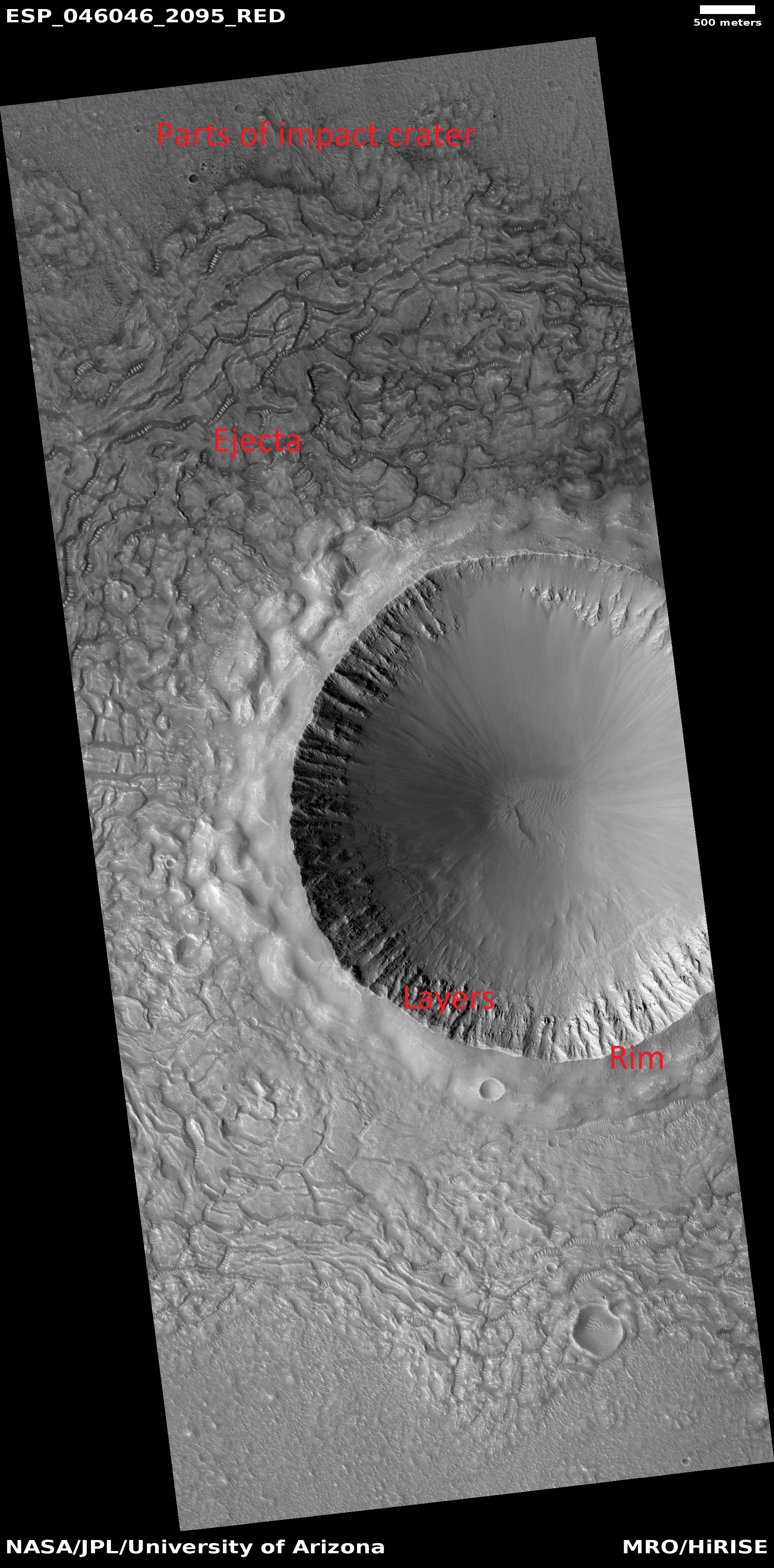
| 05:09, 15 April 2020 | ESP 046046 2095craterejectarim.jpg (file) |  |
2.18 MB | Suitupandshowup | Parts of crater in Amenthes quadrangle quadrangle, as seen by HiRISE under HiWish program Source: http://hirise.lpl.arizona.edu/ESP_046046_2095 Image credit: NASA/JPL/University of Arizona/Jim Secosky | 1 |
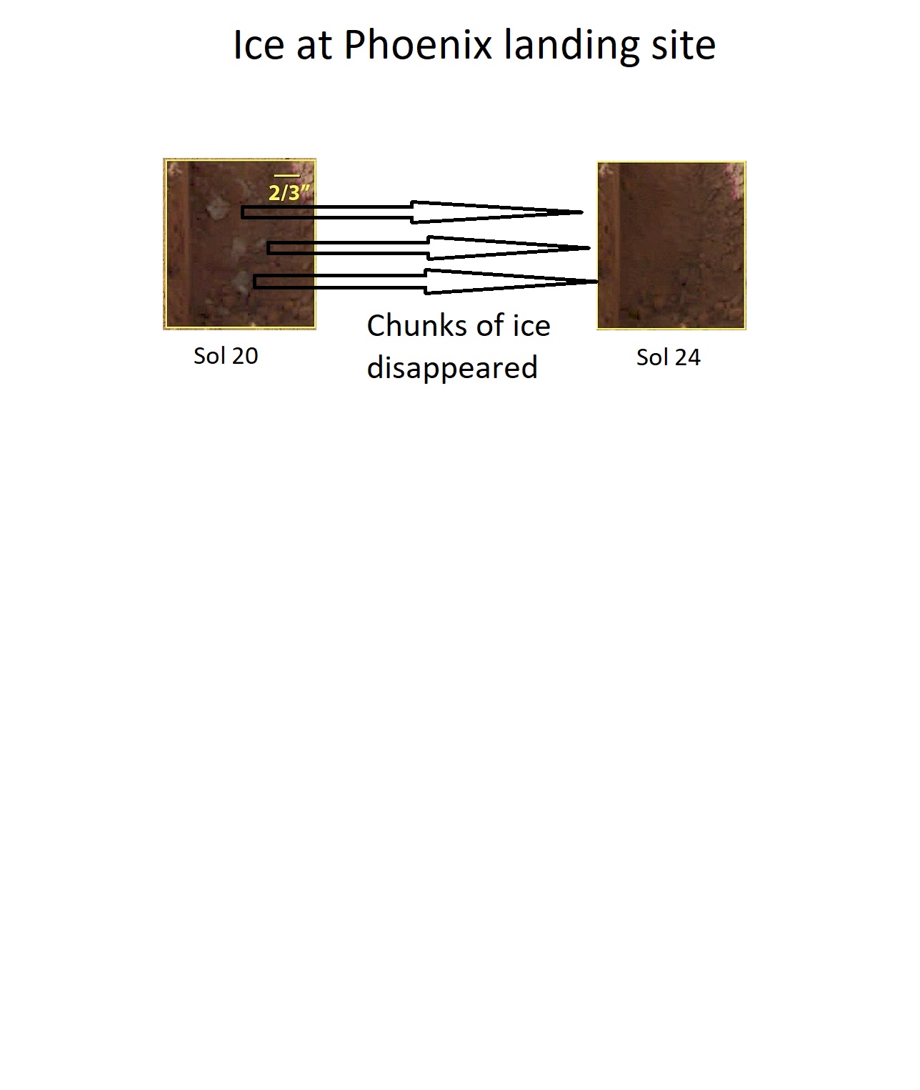
| 14:00, 12 April 2020 | Evaporatingicephoenix.jpg (file) |  |
112 KB | Suitupandshowup | These color images were acquired by NASA's Phoenix Mars Lander's Surface Stereo Imager on the 21st and 25th days of the mission, or Sols 20 and 24 (June 15 and 19, 2008). These images show sublimation of ice in the trench informally called "Dodo-Goldilocks" over the course of four days. In the lower left corner of the left image, a group of lumps is visible. In the right image, the lumps have disappeared, similar to the process of evaporation. Date June 15 and June 19, 2008 Source http://ww... | 1 |


