File list
This special page shows all uploaded files.
| Date | Name | Thumbnail | Size | User | Description | Versions |
|---|---|---|---|---|---|---|
| 06:57, 23 September 2021 | ESP 070377 2050chinawide.jpg (file) | 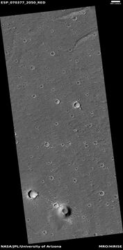 |
1.92 MB | Suitupandshowup | Wide view of landscape near China's lander, as seen by HiRISE The lander is called Zhurong and is in Utopia Planitia The scale bar at the top is 500 meters long. Source: HiRISE.lpl.arizona.edu/ESP_070377_2050 Image credit: NASA/JPL/University of Arizona | 1 |
| 06:48, 23 September 2021 | ESP 070377 2050china.jpg (file) | 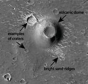 |
3.24 MB | Suitupandshowup | Features near China's lander, as seen by HiRISE The lander is called Zhurong and is in Utopia Planitia Source: HiRISE.lpl.arizona.edu/ESP_070377_2050 Image credit: NASA/JPL/University of Arizona | 1 |
| 08:30, 21 September 2021 | Sampletube26218 PIA24808.jpg (file) | 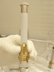 |
251 KB | Suitupandshowup | Sample tube like the one used to gather the first sample from Mars. It was from a rock called “Rochette.” Source: https://mars.nasa.gov/news/9029/nasas-perseverance-rover-collects-first-mars-rock-sample/ Credits: NASA/JPL-Caltech | 1 |
| 15:03, 20 September 2021 | 59515 2160tarswidearrows.jpg (file) |  |
294 KB | Suitupandshowup | TARs in low areas, as seen by HiRISE under HiWish program Arrows point to some of the TAR's. Source: HiRISE.lpl.arizona.edu/ESP_59515_2160 Image credit: NASA/JPL/University of Arizona | 1 |
| 15:01, 20 September 2021 | 59515 2160tarslabeled.jpg (file) |  |
286 KB | Suitupandshowup | TARs in low areas, as seen by HiRISE under HiWish program Source: HiRISE.lpl.arizona.edu/ESP_59515_2160 Image credit: NASA/JPL/University of Arizona | 1 |
| 14:42, 20 September 2021 | Com59515 2160meander.jpg (file) | 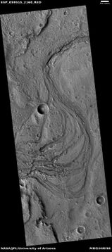 |
923 KB | Suitupandshowup | Meander with TARs in low areas, as seen by HiRISE under HiWish program Source: HiRISE.lpl.arizona.edu/ESP_59515_2160 Image credit: NASA/JPL/University of Arizona | 1 |
| 09:20, 16 September 2021 | ESP 031138 1380dunes.jpg (file) | 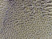 |
1.58 MB | Suitupandshowup | Dunes, as seen by HiRISE under HiWish program Source: HiRISE.lpl.arizona.edu/ESP_031138_1380 Image credit: NASA/JPL/University of Arizona | 1 |
| 08:42, 15 September 2021 | 69629 2605npolarlayerswide.jpg (file) |  |
275 KB | Suitupandshowup | Layers in north polar ice cap, as seen by HiRISE under HiWish program. Source: HiRISE.lpl.arizona.edu/ESP_69629_2605 Credit: NASA/JPL/University of Arizona/Secosky | 1 |
| 08:20, 10 September 2021 | 70288 1960craterstreaks.jpg (file) |  |
426 KB | Suitupandshowup | Streaks in crater This type of arrangement of streaks is common in Martian craters. The scene is the Arabia quadrangle at 15.744 N and 21.271 E (Streaks in crater This type of arrangement of streaks is common in Martian craters. The scene is the Arabia quadrangle at 15.744 N and 21.271 E (ESP_070288_1960). There is much dust in the Arabia quadrangle so streaks are common there. Image credit: NASA/JPL/University of Arizona/Secosky.). There is much dust in the Arabia quadrangle so strea... | 1 |
| 15:02, 7 September 2021 | B17 016128 1596glaciersmarssocietywithglaciersjpg.jpg (file) | 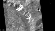 |
318 KB | Suitupandshowup | Channels from past glaciers in a crater, called crater B. It is believed that past glaciers that were on the crater wall made channels and a lake. This crater represents another way that lakes can be created in craters. Source: http://viewer.mars.asu.edu/planetview/inst/ctx/B17_016128_1596_XI_20S317W#P=B17_016128_1596_XI_20S317W&T=2 Credit: NASA/MSSS | 1 |
| 14:58, 7 September 2021 | B17 016128 1596glaciersmarssociety.jpg (file) | 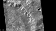 |
316 KB | Suitupandshowup | Channels from past glaciers in a crater, called crater B. It is believed that past glaciers that were on the crater wall made channels and a lake. This crater represents another way that lakes can be created in craters. Source: http://viewer.mars.asu.edu/planetview/inst/ctx/B17_016128_1596_XI_20S317W#P=B17_016128_1596_XI_20S317W&T=2 Credit: NASA/MSSS | 1 |
| 14:45, 7 September 2021 | J03 045825 2081sappingcraterdelta.jpg (file) | 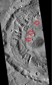 |
114 KB | Suitupandshowup | CTX image of deltas that formed from ground water. This is evidence for an extensive ground water system on Mars. In some craters like these water came out of the ground and formed a lake in craters. Source: http://viewer.mars.asu.edu/planetview/inst/ctx/J05_046932_1903_XI_10N327W#P=J05_046932_1903_XI_10N327W,J03_045825_2081_XN_28N348W&T=3 Image Credit: NASA/MSSS | 1 |
| 11:42, 5 September 2021 | J03 045825 2081sappingcraterarrowslabeled.jpg (file) | 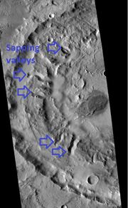 |
118 KB | Suitupandshowup | CTX image of sapping valleys that formed from ground water. Image Credit: NASA/MSSS | 1 |
| 20:52, 20 August 2021 | Olympus2.jpg (file) | 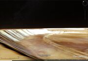 |
238 KB | Michel Lamontagne | 1 | |
| 20:50, 20 August 2021 | Olympus.jpg (file) | 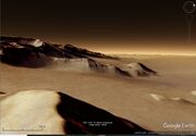 |
222 KB | Michel Lamontagne | 1 | |
| 20:36, 20 August 2021 | Nicholson Google.jpg (file) | 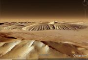 |
322 KB | Michel Lamontagne | 1 | |
| 20:28, 20 August 2021 | Nicholson Crater.jpg (file) |  |
296 KB | Michel Lamontagne | 1 | |
| 06:05, 4 June 2021 | Shell2.png (file) |  |
292 KB | Michel Lamontagne | 1 | |
| 06:04, 4 June 2021 | Shell1.jpg (file) |  |
34 KB | Michel Lamontagne | 1 | |
| 19:44, 25 May 2021 | Process-Acetic acid.png (file) | 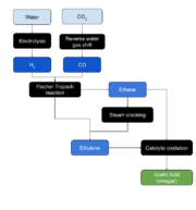 |
36 KB | Michel Lamontagne | 1 | |
| 07:59, 15 May 2021 | 68460 1945lavechannel.jpg (file) |  |
247 KB | Suitupandshowup | Lave channel from Olympus Mons, as seen by HiRISE under HiWish program Source: Image Credit: | 1 |
| 07:56, 15 May 2021 | 68460 1945laveolympus.jpg (file) |  |
252 KB | Suitupandshowup | Lava flowing down a slope, as seen by HiRISE under HiWish program Lava is coming from Olympus Mons, the largest volcano in the solar system. Source: http://hirise.lpl.arizona.edu/ESP_068460_1945 Image Credit: NASA.JPL.University of Arizona | 1 |
| 05:59, 13 May 2021 | 68206 1790ravicomposite.jpg (file) |  |
244 KB | Suitupandshowup | The Source Region of the Outflow Channel Ravi Vallis (1°S,42°W) This mosaic of the head of Ravi Vallis shows a 300-kilometer-long portion of the channel. Like many other channels that empty into the northern plains of Mars, Ravi Vallis originates in a region of collapsed and disrupted (“chaotic”) terrain within the planet's older, cratered highlands. Structures in these channels (slides #24 and #25) indicate that the channels were carved by liquid water moving at high flow rates. The abrupt... | 1 |
| 10:32, 12 May 2021 | Electrolysis.png (file) | 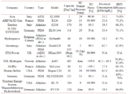 |
42 KB | Michel Lamontagne | 1 | |
| 10:04, 12 May 2021 | Helmeth implementation prototype.jpg (file) |  |
153 KB | Michel Lamontagne | 1 | |
| 17:00, 25 April 2021 | Helicoptersurfacepia24593-1400.jpg (file) |  |
96 KB | Suitupandshowup | This is the first color image of the Martian surface taken by an aerial vehicle while it was aloft. The Ingenuity Mars Helicopter captured it with its color camera during its second successful flight test on April 22, 2021. At the time this image, Ingenuity was 17 feet (5.2 meters) above the surface and pitching (moving the camera’s field of view upward) so the helicopter could begin its 7-foot (2-meter) translation to the west – away from the rover. The image, as well as the inset showing a... | 1 |
| 16:51, 25 April 2021 | Thirdflightpia24624.jpg (file) |  |
130 KB | Suitupandshowup | NASA’s Ingenuity Mars Helicopter can be seen hovering during its third flight on April 25, 2021, as seen by the left Navigation Camera aboard NASA’s Perseverance Mars rover. The Ingenuity Mars Helicopter was built by JPL, which also manages this technology demonstration project for NASA Headquarters. Credit: NASA/JPL-Caltech | 1 |
| 14:28, 24 April 2021 | Ingenuitypia24581-1200.jpg (file) | 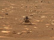 |
242 KB | Suitupandshowup | Wide view of Ingenuity This image was captured by the Mastcam-Z imager on NASA’s Perseverance Mars rover on the following sol, April 8, 2021. Source: https://www.nasa.gov/perseverance/images Credit: NASA/JPL-Caltech | 1 |
| 14:26, 24 April 2021 | Ingenuity1-pia24547-mastcam-z gives ingenuity.jpg (file) | 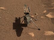 |
242 KB | Suitupandshowup | Close up of Ingenuity as seen with mastcam z. Source: https://www.nasa.gov/perseverance/images Credit: NASA/JPL-Caltech | 1 |
| 16:07, 18 April 2021 | Mars Initiative logo.png (file) |  |
55 KB | Mccormick | 1 | |
| 09:16, 9 March 2021 | PerseveranceMastcam-Z's First 360-Degree Panorama (1).jpg (file) |  |
56 KB | Suitupandshowup | This is the first 360-degree panorama taken by Mastcam-Z, a zoomable pair of cameras aboard NASA’s Perseverance Mars rover. Source: https://mars.nasa.gov/resources/25640/mastcam-zs-first-360-degree-panorama/ Image credit: NASA/JPL-Caltech/ASU/MSSS | 1 |
| 15:35, 8 March 2021 | Perseverancelandingcompositelabeled.jpg (file) |  |
252 KB | Suitupandshowup | Drawing and actual pictures of Perseverance landing on Mars. Source: https://www.nasa.gov/image-feature/jpl/perseverance-touches-down-on-mars and https://www.nasa.gov/perseverance/images Image credit: NASA/JPL-Caltech/Secosky | 1 |
| 11:14, 8 March 2021 | Perseverancebeforeafter.jpg (file) | 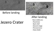 |
232 KB | Suitupandshowup | Jezero Crater before and after Perseverance landed as seen by HiRISE Source: https://www.nasa.gov/image-feature/jpl/perseverance-and-mars-2020-spacecraft-components-on-the-surface Credit: NASA/JPL-Caltech/University of Arizona | 1 |
| 11:02, 8 March 2021 | Perseverancelandingcomposite4arrows.jpg (file) | 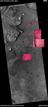 |
2.53 MB | Suitupandshowup | Pictures (in pink) taken from Perseverance before landing and matched up with features from orbit. Image Credit: NASA/JPL-Caltech and NASA/JPL/University of Arizona Source: https://mars.nasa.gov/mars2020/multimedia/raw-images/ and HiRISE.lpl.arizona.edu/ESP_45994_1985 | 1 |
| 10:42, 8 March 2021 | Perseverancetransvers.jpg (file) |  |
335 KB | Suitupandshowup | Possible paths that Perseverance may undertake. A mesa that may be visited is showed from HiRISE and from Perseverance. Image credit: NASA/JPL-Caltech/University of Arizona Source: https://www.nasa.gov/image-feature/jpl/the-road-ahead-for-perseverance | 1 |
| 09:31, 8 March 2021 | ESP 045994 1985jezerocroppedcircle.jpg (file) |  |
476 KB | Suitupandshowup | Jezero crater as seen by HiRISE. Perseverance landed inside circle. Source: hirise.lpl.arizona.edu/ESP_45994_1985 Image credit: NASA/JPL/University of Arizona | 1 |
| 09:28, 8 March 2021 | ESP 045994 1985jezerolcircle.jpg (file) |  |
2.48 MB | Suitupandshowup | Jezero crater as seen by HiRISE. Source: hirise.lpl.arizona.edu/ESP_45994_1985 Image credit: NASA/JPL/University of Arizona | 1 |
| 09:02, 8 March 2021 | ESP 045994 1985jezerokmcircles.jpg (file) |  |
781 KB | Suitupandshowup | Jezero crater as seen by HiRISE. Circles indicate distances from landing site. Source: hirise.lpl.arizona.edu/ESP_45994_1985 Image credit: NASA/JPL/University of Arizona | 1 |
| 09:23, 20 February 2021 | 45994 1985jezweocompositecompositearrows.jpg (file) | 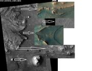 |
570 KB | Suitupandshowup | Jezero crater as seen by HiRISE. Arrows show enlargements of features around delta. Source: hirise.lpl.arizona.edu/ESP_45994_1985 Image credit: NASA/JPL/University of Arizona | 1 |
| 08:51, 19 February 2021 | ESP 045994 1985jezero.jpg (file) |  |
2.37 MB | Suitupandshowup | Landing site for Perseverance Rover in Jezero Crater, as seen by CTX. Source: http://hirise.lpl.arizonia.edu/ESP_045994_1985 Image credit: NASA/JPL/University of Arizona | 1 |
| 08:48, 19 February 2021 | Jezerocloselabeledforlanding.jpg (file) | 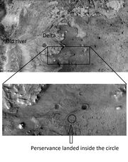 |
725 KB | Suitupandshowup | Landing site for Perseverance Rover in Jezero Crater, as seen by CTX. Source: http://viewer.mars.asu.edu/planetview/inst/ctx/F04_037396_1985_XN_18N282W#P=F04_037396_1985_XN_18N282W&T=2 Image credit: NASA/MSSS | 1 |
| 07:30, 17 February 2021 | Jezerocraterclose.jpg (file) |  |
319 KB | Suitupandshowup | 1 | |
| 07:17, 17 February 2021 | Jezerocraterwidenames.jpg (file) |  |
390 KB | Suitupandshowup | Map with names of features near Jezero Crater Source: https://planetarynames.wr.usgs.gov/images/mc13_2014.pdf Picture credit: NASA/USGS | 1 |
| 09:12, 21 January 2021 | ESP 067414 0945swisscheesechanges20112020.jpg (file) | 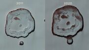 |
1,007 KB | Suitupandshowup | HiRISE images showing changes from 2011 to 2020. Source: https://www.uahirise.org/ESP_067414_0945 Image credit: NASA/JPL/University of Arizona | 1 |
| 14:25, 19 January 2021 | Lunarpedia new.png (file) |  |
4 KB | Michel Lamontagne | 1 | |
| 14:18, 21 December 2020 | 34189 1740cutoff.jpg (file) |  |
320 KB | Suitupandshowup | Cutoff meander. This forms as a river cuts its outer bank and curves more and more, until it decides to take a “short-cut.” The abandoned channel may have formed an oxbow lake, when water was present. This type of river system forms slowly over time, unlike the catastrophic flood channels seen elsewhere on Mars. Source: https://www.uahirise.org/ESP_034189_1740 Image credit: NASA/JUPL/University of Arizona/Secosky | 1 |
| 10:03, 18 December 2020 | Image 10.jpg (file) |  |
25 KB | Kmankame | 1 | |
| 10:00, 18 December 2020 | Image 9.jpg (file) |  |
178 KB | Kmankame | 1 | |
| 09:56, 18 December 2020 | Image 8.jpg (file) |  |
102 KB | Kmankame | 1 | |
| 09:53, 18 December 2020 | Image 7.png (file) |  |
79 KB | Kmankame | 1 |


