File:Marspediaflaugerguesmap.jpg
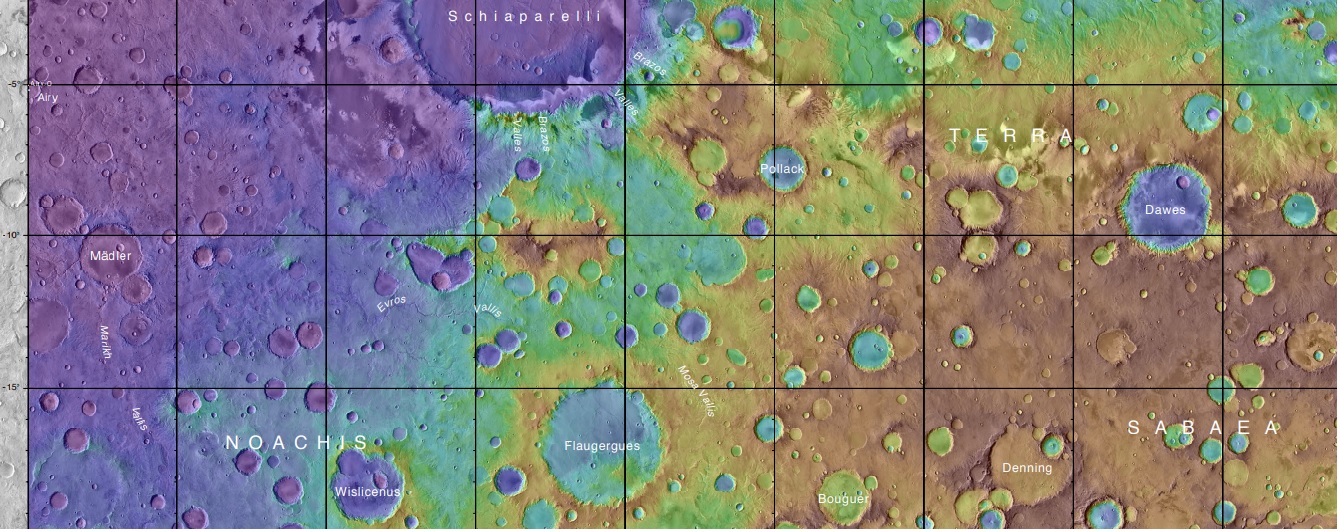
Revision as of 10:53, 30 November 2018 by Suitupandshowup (talk | contribs) (Topo map showing Flaugergues, Wislicenus, and other nearby craters. Flaugergues, Wislicenus Craters were imaged by Mariner 6. Source: https://planetarynames.wr.usgs.gov/images/mc20_2014.pdf Image Credit: NASA/USGS)
Size of this preview: 800 × 318 pixels. Other resolution: 320 × 127 pixels.
Original file (1,340 × 532 pixels, file size: 351 KB, MIME type: image/jpeg)
Summary
Topo map showing Flaugergues, Wislicenus, and other nearby craters. Flaugergues, Wislicenus Craters were imaged by Mariner 6.
Source: https://planetarynames.wr.usgs.gov/images/mc20_2014.pdf
Image Credit: NASA/USGS
Licensing
Public domain images are available for anybody to use without any licenses, royalties, or special permissions.
File history
Click on a date/time to view the file as it appeared at that time.
| Date/Time | Thumbnail | Dimensions | User | Comment | |
|---|---|---|---|---|---|
| current | 10:53, 30 November 2018 | 1,340 × 532 (351 KB) | Suitupandshowup (talk | contribs) | Topo map showing Flaugergues, Wislicenus, and other nearby craters. Flaugergues, Wislicenus Craters were imaged by Mariner 6. Source: https://planetarynames.wr.usgs.gov/images/mc20_2014.pdf Image Credit: NASA/USGS |
You cannot overwrite this file.
File usage
The following page uses this file:


