File:5001 pia16564 Sol-133 LNav SnakeRiver-full2yellowknife.jpg
Revision as of 16:41, 28 December 2018 by Suitupandshowup (talk | contribs) (The sinuous rock feature in the lower center of this mosaic of images recorded by the NASA Mars rover Curiosity is called "Snake River." The location is called "Yellowknife Bay." Source: https://mars.nasa.gov/news/1407/curiosity-rover-explores-yello...)

Size of this preview: 800 × 389 pixels. Other resolution: 320 × 155 pixels.
Original file (848 × 412 pixels, file size: 86 KB, MIME type: image/jpeg)
Summary
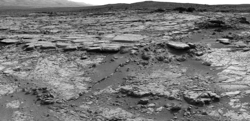
The sinuous rock feature in the lower center of this mosaic of images recorded by the NASA Mars rover Curiosity is called "Snake River." The location is called "Yellowknife Bay."
Source: https://mars.nasa.gov/news/1407/curiosity-rover-explores-yellowknife-bay/
Image credit: NASA/JPL-Caltech
Licensing
Public domain images are available for anybody to use without any licenses, royalties, or special permissions.
File history
Click on a date/time to view the file as it appeared at that time.
| Date/Time | Thumbnail | Dimensions | User | Comment | |
|---|---|---|---|---|---|
| current | 16:41, 28 December 2018 | | 848 × 412 (86 KB) | Suitupandshowup (talk | contribs) | The sinuous rock feature in the lower center of this mosaic of images recorded by the NASA Mars rover Curiosity is called "Snake River." The location is called "Yellowknife Bay." Source: https://mars.nasa.gov/news/1407/curiosity-rover-explores-yello... |
You cannot overwrite this file.
File usage
The following page uses this file:


