File:37461 2255scallopedscale.jpg
Revision as of 16:01, 6 December 2019 by Suitupandshowup (talk | contribs) (Scalloped terrain Radar studies have shown that this type of surface contains much water ice, so it may be mined in the future by colonists. There may have been a channel running across the top of the image. The location is the Casius quadrangle at 4...)
Error creating thumbnail: Unable to save thumbnail to destination
No higher resolution available.
37461_2255scallopedscale.jpg (799 × 358 pixels, file size: 58 KB, MIME type: image/jpeg)
Summary
Scalloped terrain Radar studies have shown that this type of surface contains much water ice, so it may be mined in the future by colonists. There may have been a channel running across the top of the image.
The location is the Casius quadrangle at 45.177 N and 97.86 E (ESP_37461_2255).
Source: http://hirise.lpl.arizona.edu/ESP_37461_2255
Image credit is NASA/JPL/University of Arizona.
Licensing
Public domain images are available for anybody to use without any licenses, royalties, or special permissions.
File history
Click on a date/time to view the file as it appeared at that time.
| Date/Time | Thumbnail | Dimensions | User | Comment | |
|---|---|---|---|---|---|
| current | 16:01, 6 December 2019 | 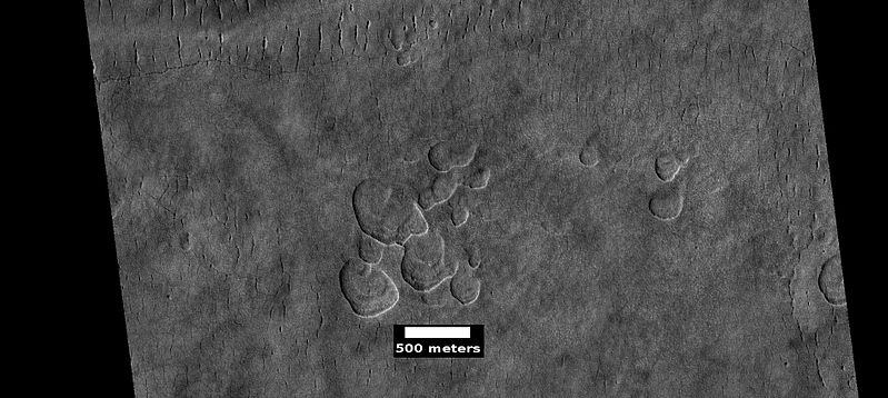 | 799 × 358 (58 KB) | Suitupandshowup (talk | contribs) | Scalloped terrain Radar studies have shown that this type of surface contains much water ice, so it may be mined in the future by colonists. There may have been a channel running across the top of the image. The location is the Casius quadrangle at 4... |
You cannot overwrite this file.
File usage
The following 3 pages use this file:


