File:Mare Boreum Map.JPG
No higher resolution available.
Mare_Boreum_Map.JPG (479 × 478 pixels, file size: 35 KB, MIME type: image/jpeg)
Summary
| Description |
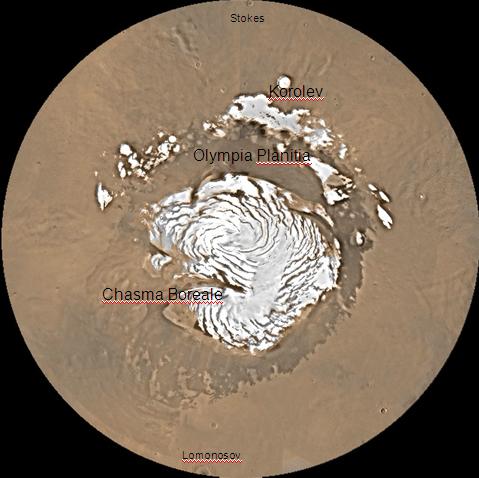
English: Map of Mare Boreum Mars quadrangle. The small, colored rectangles represent image footprints for the narrow angle camera on the Mars Global Surveyor. Some are about 1 mile wide, the otheers are about 2 miles wide. |
| Source | http://www.msss.com/moc_gallery/s05_s10/mc)1.html |
| Author | Jim Secosky (Jimmarsmars at en.wikipedia) modified NASA photo (U.S. Geological survey). |
Licensing
| This file is in the public domain in the United States because it was solely created by NASA. NASA copyright policy states that "NASA material is not protected by copyright unless noted". (See Template:PD-USGov, NASA copyright policy page or JPL Image Use Policy.) | ||
 |
Warnings:
|
Original upload log
Transferred from en.wikipedia to Commons by Magnus Manske using CommonsHelper.
The original description page was here. All following user names refer to en.wikipedia.
- 2008-12-22 20:16 Jimmarsmars 479×478× (35755 bytes) {{Information |Description=map of Mare Boreum Mars |Source=http://www.msss.com/moc_gallery/s05_s10/mc)1.html |Date=December 29, 2008 |Author=Jim Secosky modified NASA photo. |Permission= |other_versions= }}
File history
Click on a date/time to view the file as it appeared at that time.
| Date/Time | Thumbnail | Dimensions | User | Comment | |
|---|---|---|---|---|---|
| current | 23:31, 19 February 2011 | | 479 × 478 (35 KB) | File Upload Bot (Magnus Manske) | {{BotMoveToCommons|en.wikipedia|year={{subst:CURRENTYEAR}}|month={{subst:CURRENTMONTHNAME}}|day={{subst:CURRENTDAY}}}} {{Information |Description={{en|Map of Mare Boreum Mars quadrangle. The small, colored rectangles represent image footprints for the n |
File usage
The following page uses this file:


