Uploads by Suitupandshowup
This special page shows all uploaded files.
| Date | Name | Thumbnail | Size | Description | Versions |
|---|---|---|---|---|---|
| 17:15, 26 February 2018 | ESP 019778 1385pyramid.jpg (file) |  |
207 KB | Layers in upper plains unit, as seen by HiRISE, under HiWish program Source: http://hirise.lpl.arizona.edu/ESP_019778_1385 Image credit: NASA/JPL/University of Arizona | 1 |
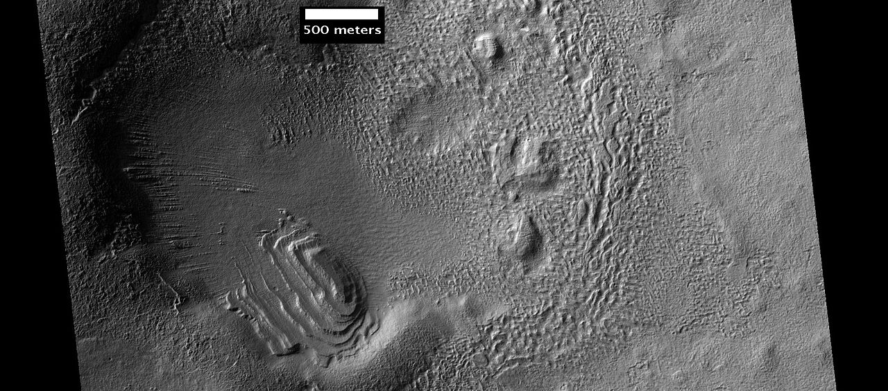
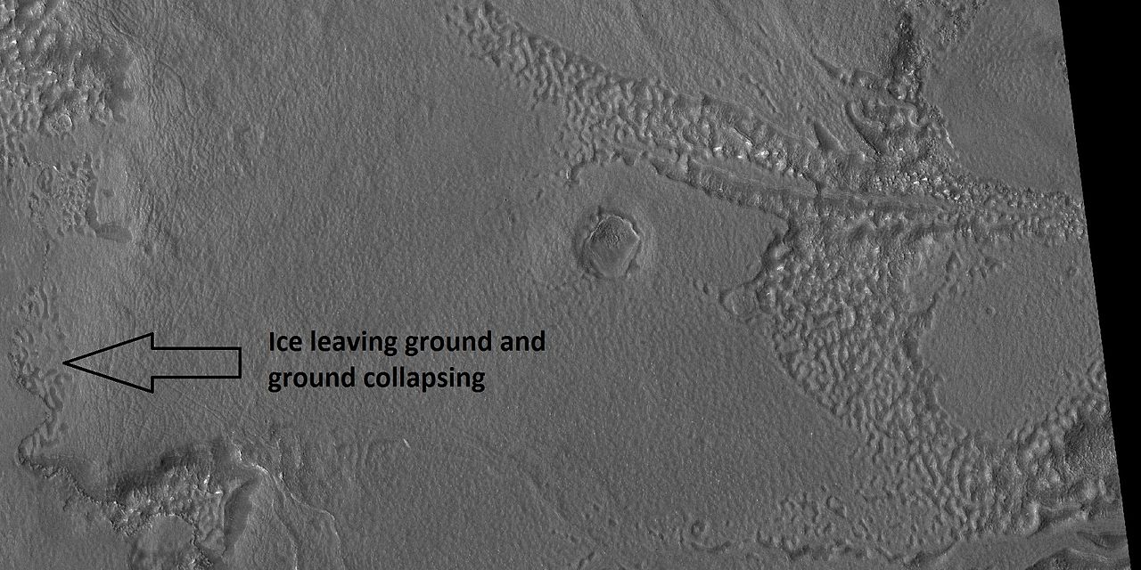
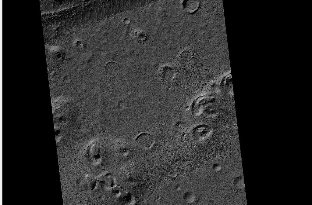
| 17:13, 26 February 2018 | 48011 1370upperunit.jpg (file) |  |
188 KB | Upper plains unit breaking up, as seen by HiRISE under HiWish program Source:hirise.lpl.arizona.edu/ESP_048011_1370 Image credit: NASA/JPL/University of Arizona | 1 |
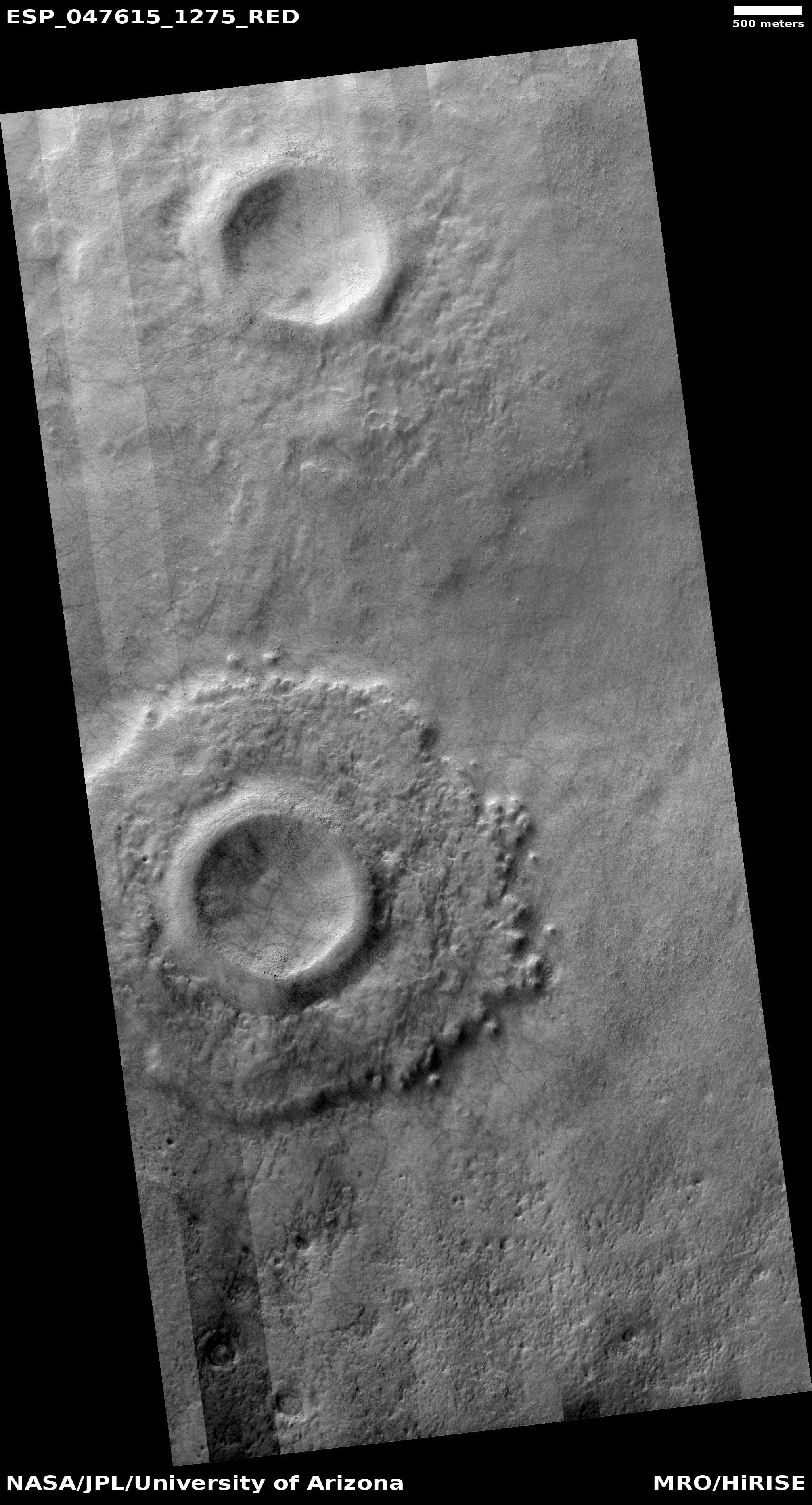
| 16:58, 26 February 2018 | ESP 047615 1275pedestal.jpg (file) |  |
2.25 MB | Pedestal crater in Hellas quadrangle, as seen by HiRISE under HiWish program Source: http://hirise.lpl.arizona.edu/ESP_047615_1275 | 1 |
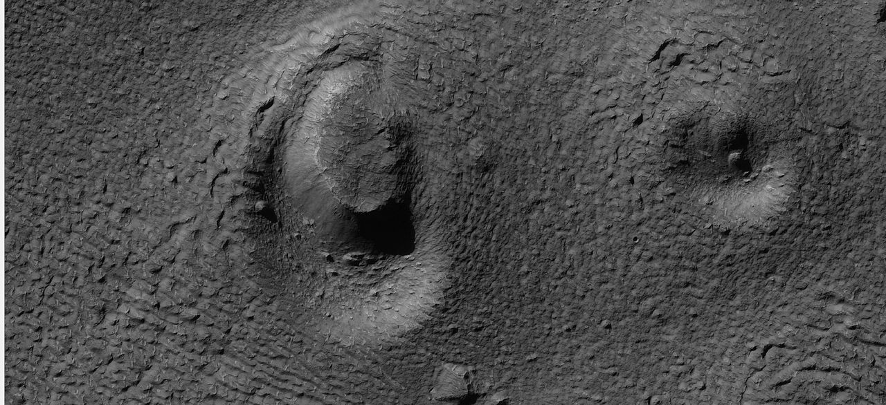
| 16:52, 26 February 2018 | 26055ringmoldcrater.jpg (file) |  |
198 KB | Close view of ring mold crater, as seen by HiRISE under HiWish program Source: http://hirise.lpl.arizona.edu/ESP_026055_1445 | 1 |
| 16:50, 26 February 2018 | 26055cratermesaswide.jpg (file) |  |
151 KB | Wide view of ring-mold craters, as seen by HiRISE under HiWish program Source: http://hirise.lpl.arizona.edu/ESP_026055_1445 | 1 |
| 16:46, 26 February 2018 | Ringmolddiagramlabeled.jpg (file) | 30 KB | Series of diagrams showing how ring mold craters are formed. Author: Jim Secosky | 1 | |
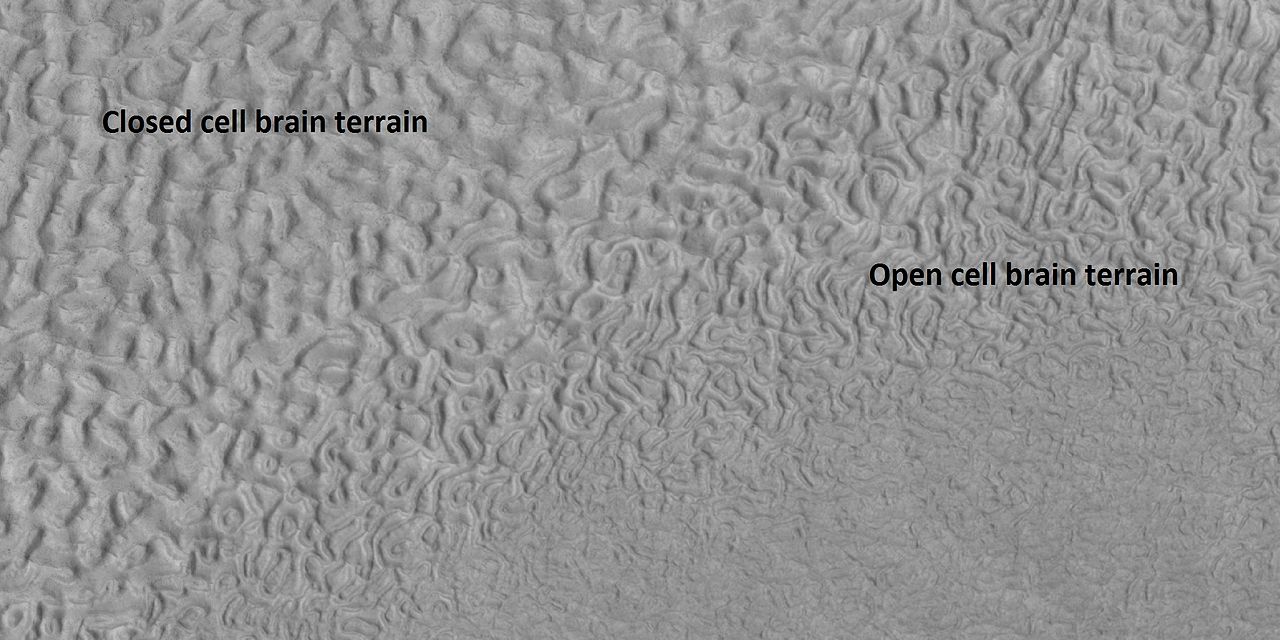
| 16:42, 26 February 2018 | 45917 2220brainsopenclosed.jpg (file) |  |
140 KB | Labeled picture of open and closed brain terrain, as seen by HiRISE under HiWish program Source: http://hirise.lpl.arizona.edu/ESP_045917_2220 Image credit: NASA/JPL/University of Arizona | 1 |
| 14:43, 26 February 2018 | ESP 046622 1365ccfclosecolor.jpg (file) |  |
334 KB | Close, color view of concentric crater fill, as seen by HiRISE under HiWish program Source: http://hirise.lpl.arizona.edu/ESP_046622_1365 Image credit: NASA/JPL/University of Arizona/ | 1 |
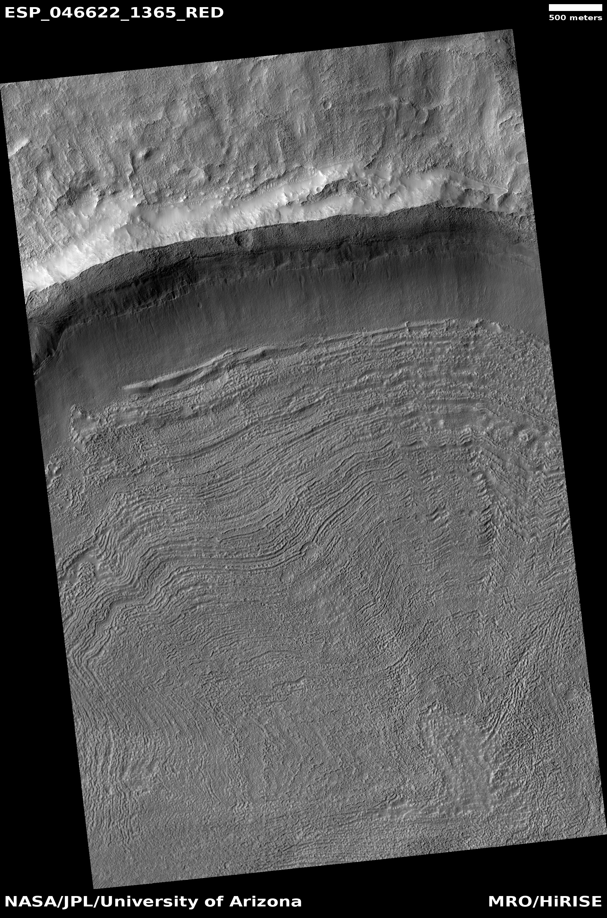
| 14:36, 26 February 2018 | ESP 046622 1365ccf.jpg (file) |  |
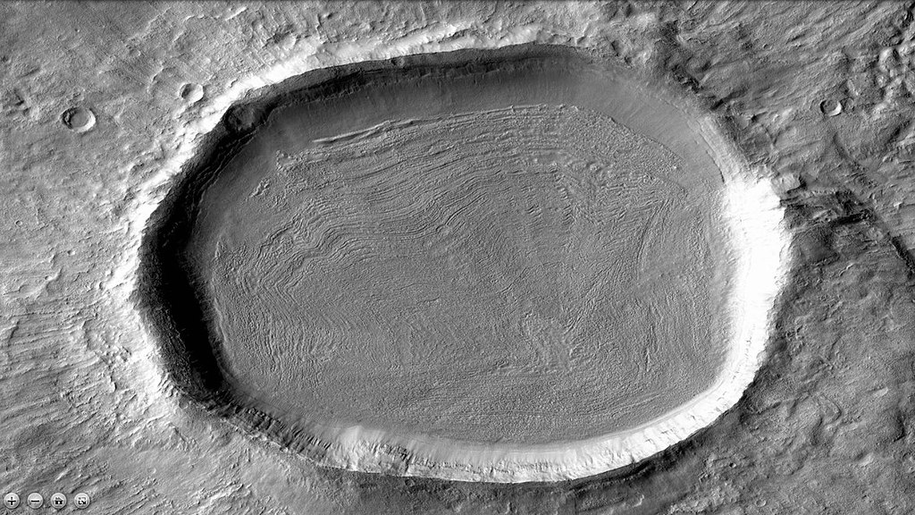
2.16 MB | Concentric crater fill, as seen by HiRISE under HiWish program Image credit: NASA/JPL/University of Arizona | 1 |
| 14:29, 26 February 2018 | 1024px-46622 1365contextccf.jpg (file) |  |
225 KB | CTX image of crater with concentric crater fill. This is a context image for HiRISE image: ESP_046622_1365 Source: http://viewer.mars.asu.edu/planetview/inst/ctx/J05_046622_1364_XN_43S140W#P=J05_046622_1364_XN_43S140W&T=2 Image Credit: NASA/MSS | 1 |
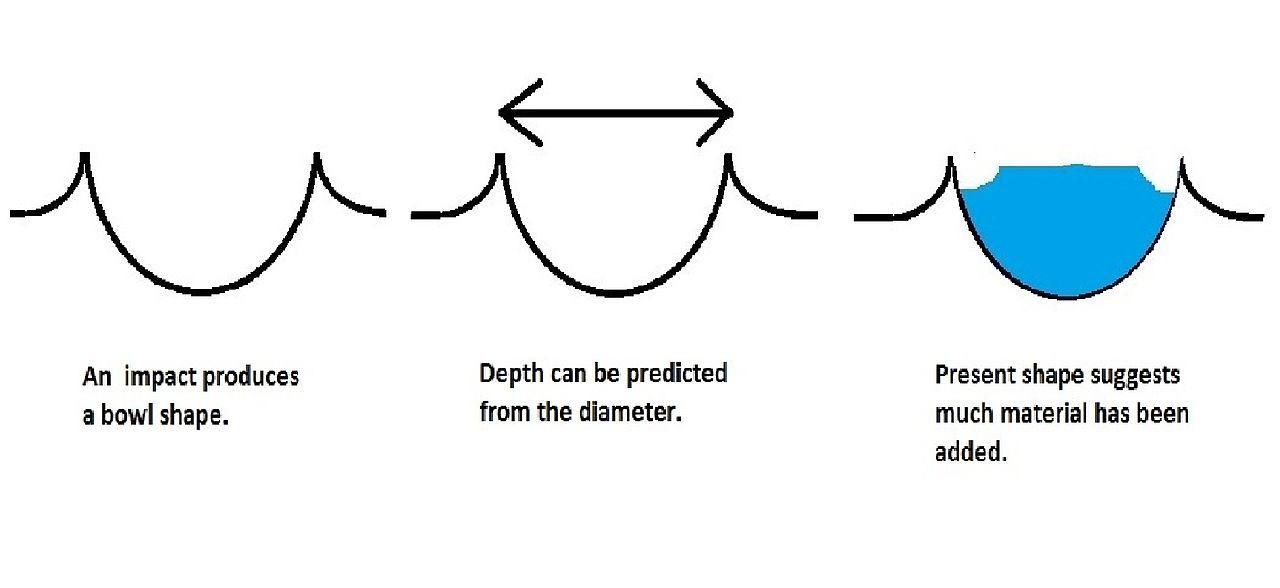
| 14:24, 26 February 2018 | Ccffigurecaptioned.jpg (file) |  |
43 KB | Diagram of how concentric crater fill is formed Author: Jim Secosky | 1 |
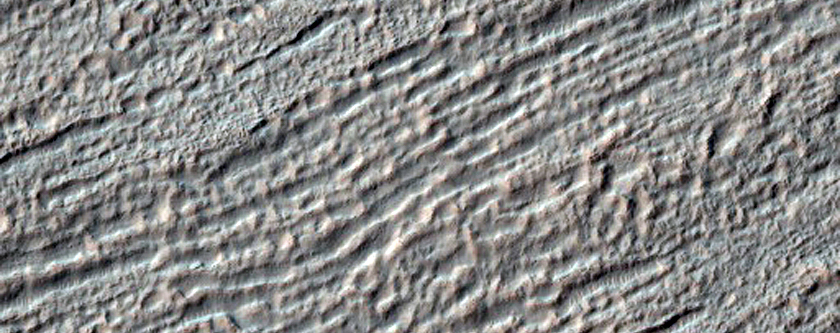
| 14:19, 26 February 2018 | 46061 2190closelvf..jpg (file) |  |
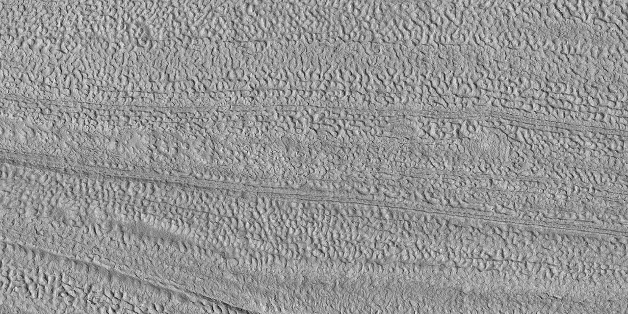
261 KB | Close view of lineated valley fill, as seen by HiRISE under HiWish program Image credit: NASA/JPL/University of Arizona | 1 |
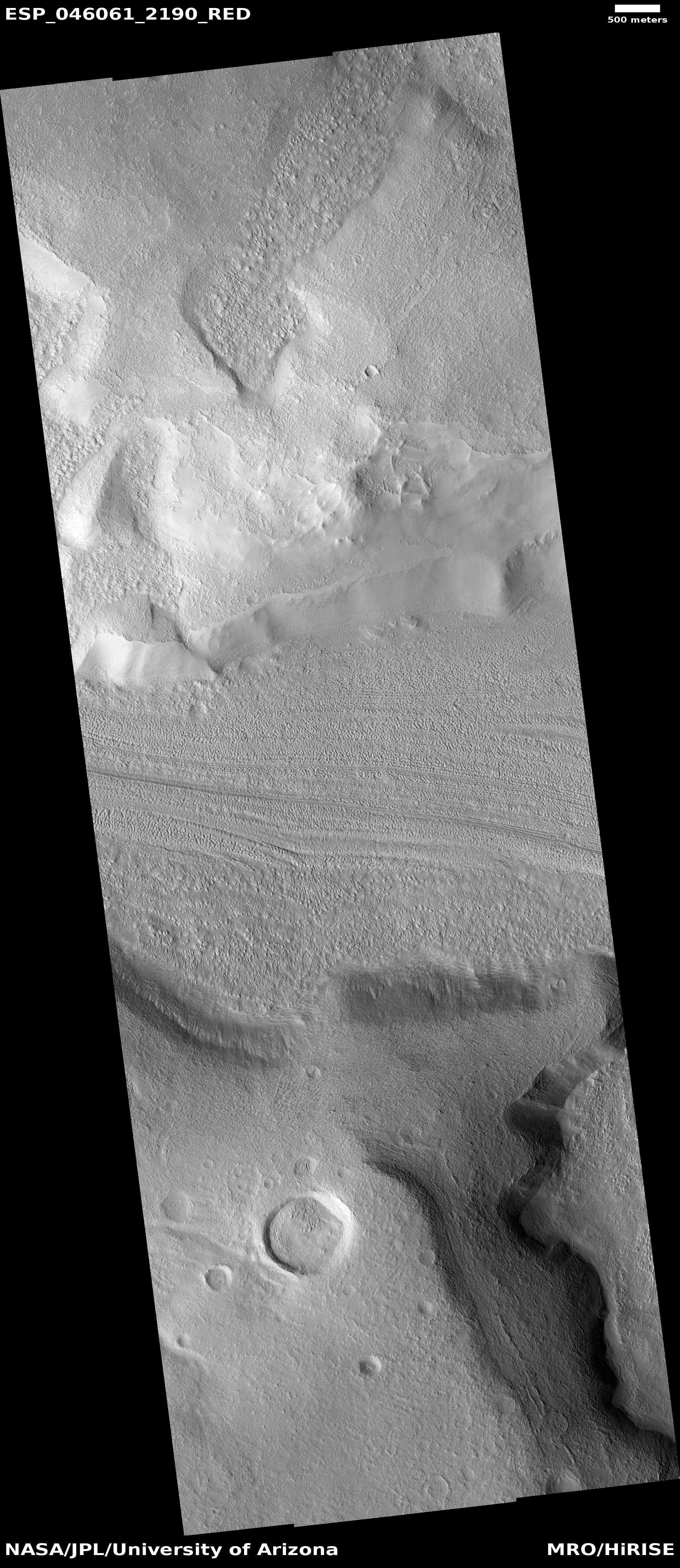
| 14:16, 26 February 2018 | ESP 046061 2190lvf.jpg (file) |  |
2.77 MB | Lineated valley fill, as seen by HiRISE under HiWish program Image Credit: NASA/JPL/University of Arizona | 1 |
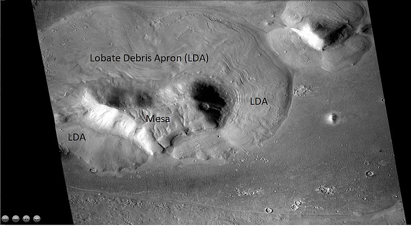
| 09:36, 26 February 2018 | 800px-Wideviewlda42n18e.jpg (file) |  |
92 KB | Wide view of mesa with lobate debris apron, as seen with CTX This is a context image for HiRISE image ESP_046273_2225. | 1 |
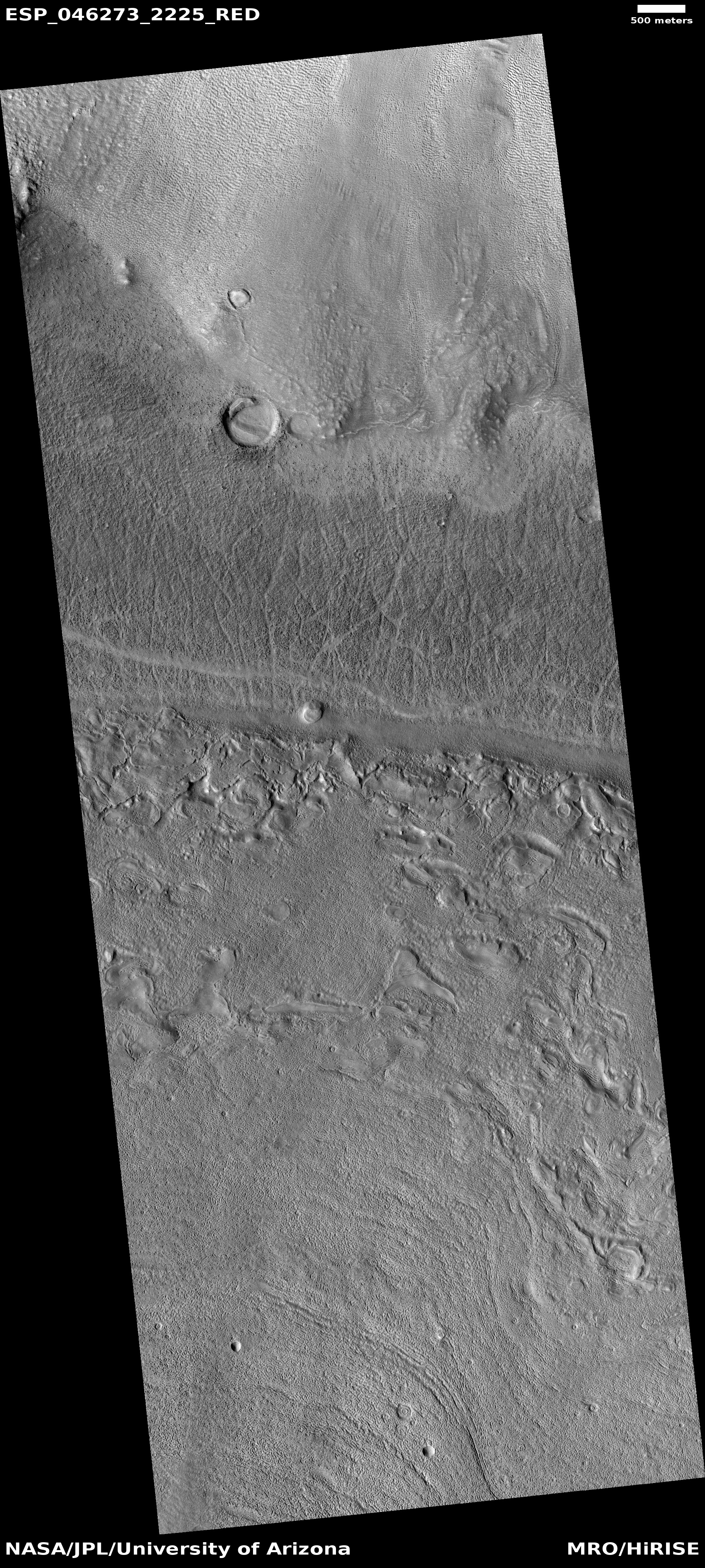
| 09:31, 26 February 2018 | ESP 046273 2225lda.jpg (file) |  |
3.35 MB | Close view of Lobate Debris Apron, as seen by HiRISE, under HiWish program Image credit: NASA/JPL/University of Arizona | 1 |
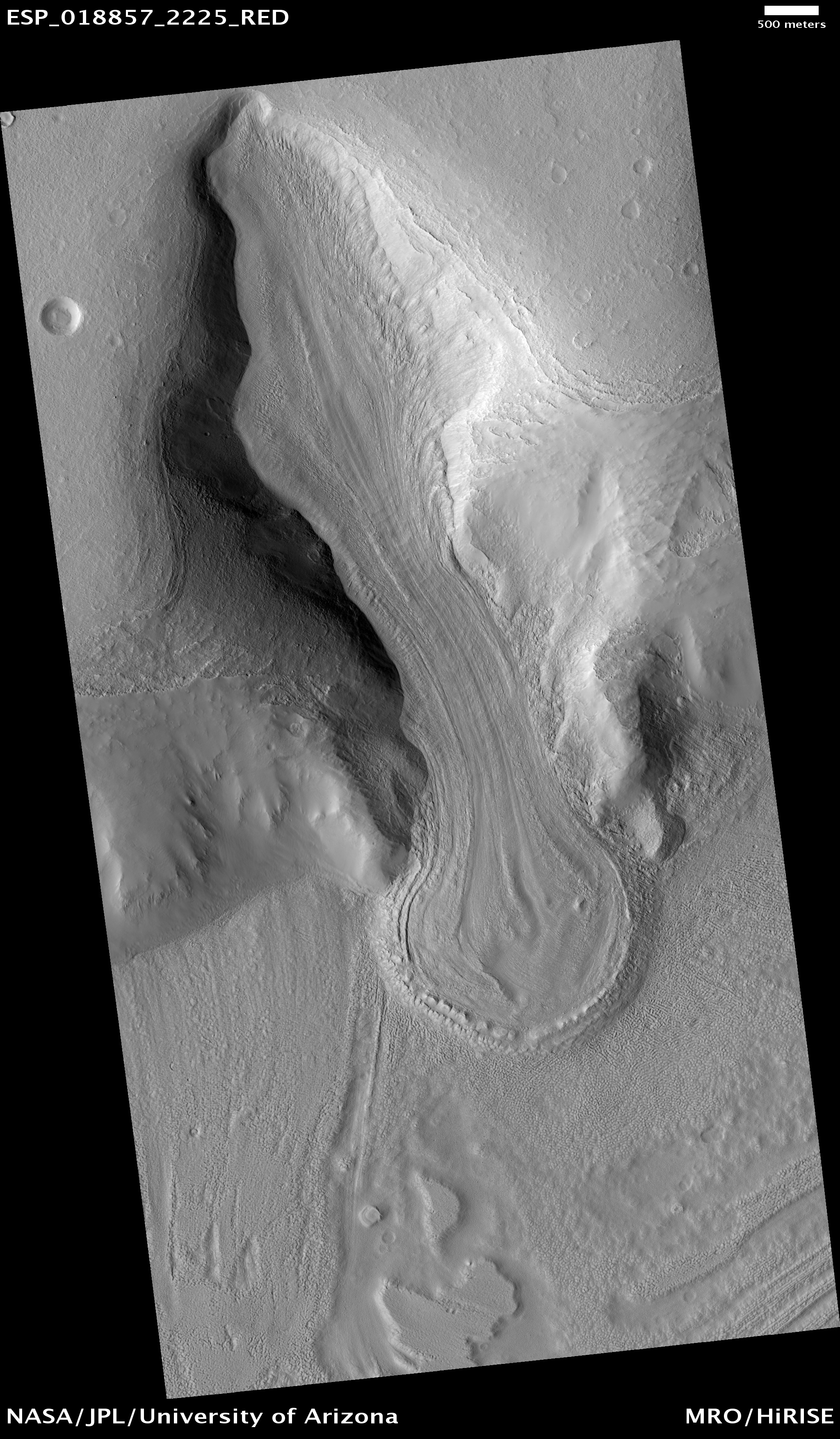
| 09:28, 26 February 2018 | ESP 018857 2225alpineglacier.jpg (file) |  |
1.95 MB | Alpine glacier in Ismenius Lacus quadrangle, as seen by HiRISE under HiWish program Image Credit: NASA/JPL/University of Arizona | 1 |
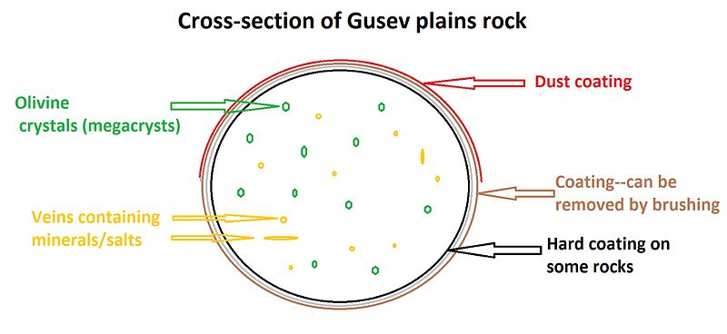
| 09:02, 21 February 2018 | Rockgusevdiagram.jpg (file) |  |
34 KB | Diagram of a typical rock on Gusev plains Source Jim Secosky | 1 |
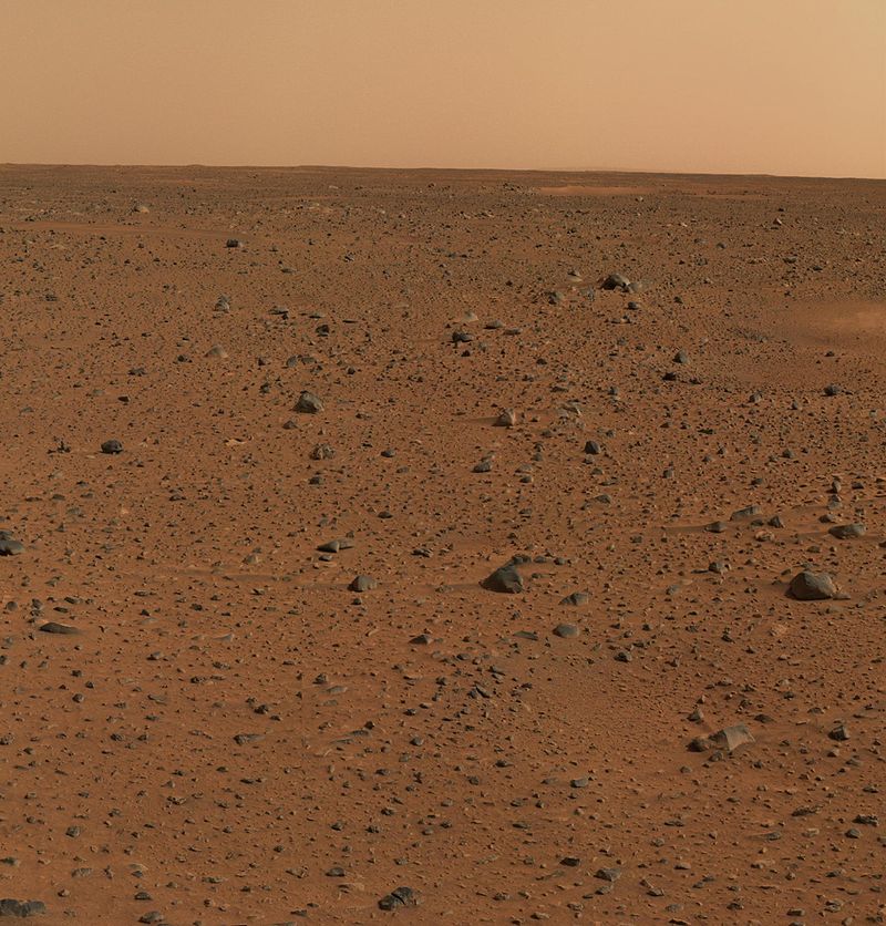
| 08:55, 21 February 2018 | Spirit's First Color Photograph Mars.jpg (file) |  |
144 KB | This is the first color image of Mars taken by the panoramic camera on the Mars Exploration Rover Spirit. It was the highest resolution image ever taken on the surface of another planet." This version has been cropped. Source: http://photojournal.jpl.... | 1 |
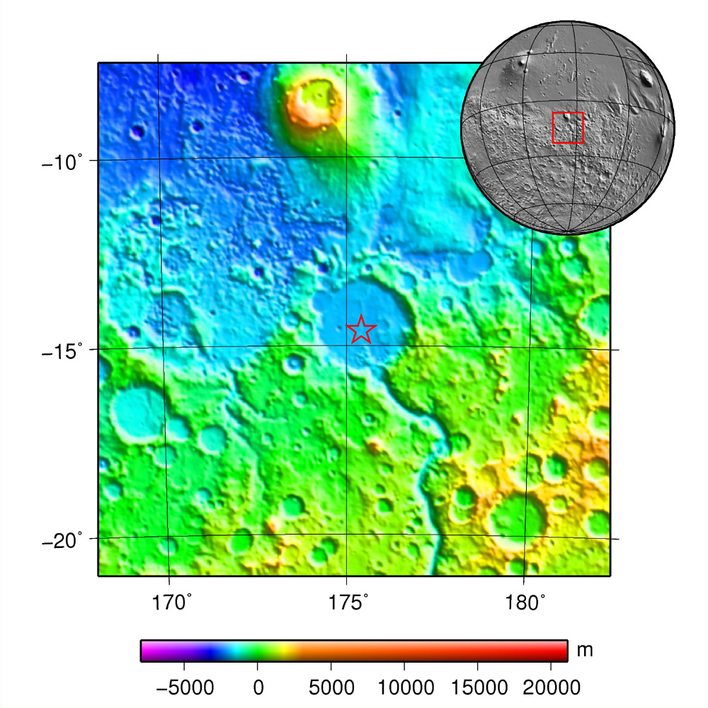
| 08:50, 21 February 2018 | MOLA spiritcontext.jpg (file) |  |
376 KB | MOLA map showing location of Spirit landing in Gusev Crater Source: plotted using GMT and gridded MOLA data archive meg0031t.grd Author: Martin Pauer (User:Power) | 1 |
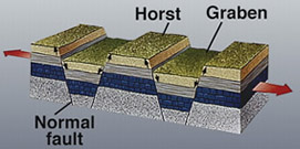
| 10:05, 20 February 2018 | Horst graben.jpg (file) |  |
41 KB | Diagram showing how a graben forms Source: https://earthquake.usgs.gov/learning/glossary.php?term=graben Author: U.S. Geological Survey | 1 |
| 09:58, 20 February 2018 | Alba MOLAlavaflows.jpg (file) |  |
105 KB | Radial lava flows NW of Alba Mons (MOLA) The lava flows extending north and northwest of Alba Mons are tube and channel lava flows. Image Credit: NASA/Arizona State University Source: JMars: http://jmars.asu.edu/ | 1 |
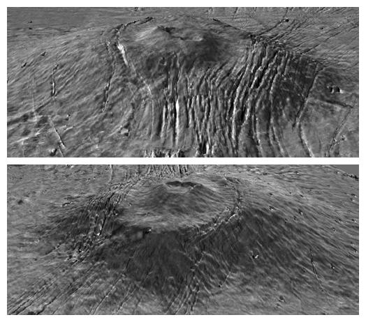
| 09:50, 20 February 2018 | Alba Caldera THEMIS IR.jpg (file) |  |
124 KB | THEMIS IR Daytime Mosaic of Alba Mons caldera complex Source: JMARS: http://jmars.asu.edu/ Image credit: NASA / JPL-Caltech / Arizona State University | 1 |
| 09:43, 20 February 2018 | Alba ExaggeratedPIA02803.jpg (file) |  |
52 KB | MOLA exaggerated view of Alba Mons. The height has been multiplied by 10. Source: NASA Photojournal (PIA02803) Author: NASA/MOLA Science Team | 1 |
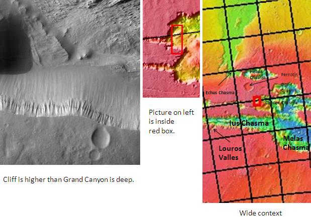
| 10:00, 19 February 2018 | Cliff in Candor Chasma.jpg (file) |  |
51 KB | Pictures of various scales showing location of Candor Chasma and other nearby features in a complex area of Mars. The location is 5.2 degrees south latitude and 282.9 degrees east longitude. Author: Jim Secosky modified NASA images. Source: http:/... | 1 |
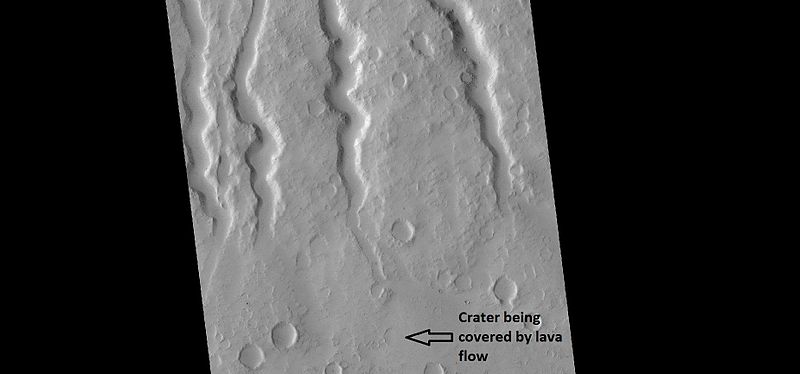
| 09:13, 15 February 2018 | 27108hecatechannels.jpg (file) |  |
28 KB | Lava channels on Hecates Tholus, as seen by HiRISE under HiWish program Author: Jim Secosky Source: Source http://hirise.lpl.arizona.edu/ESP_027108_2110 Image Credit: Credit:NASA/JPL/University of Arizona | 1 |
| 09:07, 15 February 2018 | MOLA hecates tholus.jpg (file) |  |
74 KB | Topographic map of Hecates Tholus with insert showing its location on the planet. Source: plotted using GMT and gridded MOLA data archive meg0031t.grd Author: Martin Pauer (Power) | 1 |
| 09:39, 13 February 2018 | Albor Tholus THEMIS.jpg (file) |  |
106 KB | Daytime infrared image mosaic of Albor Tholus from the Thermal Emission Imaging System (THEMIS) instrument of the 2001 Mars Odyssey spacecraft. Albor Tholus is a volcano in Elysium, a volcanic region on Mars. Image credit: NASA / JPL-Caltech / Arizon... | 1 |
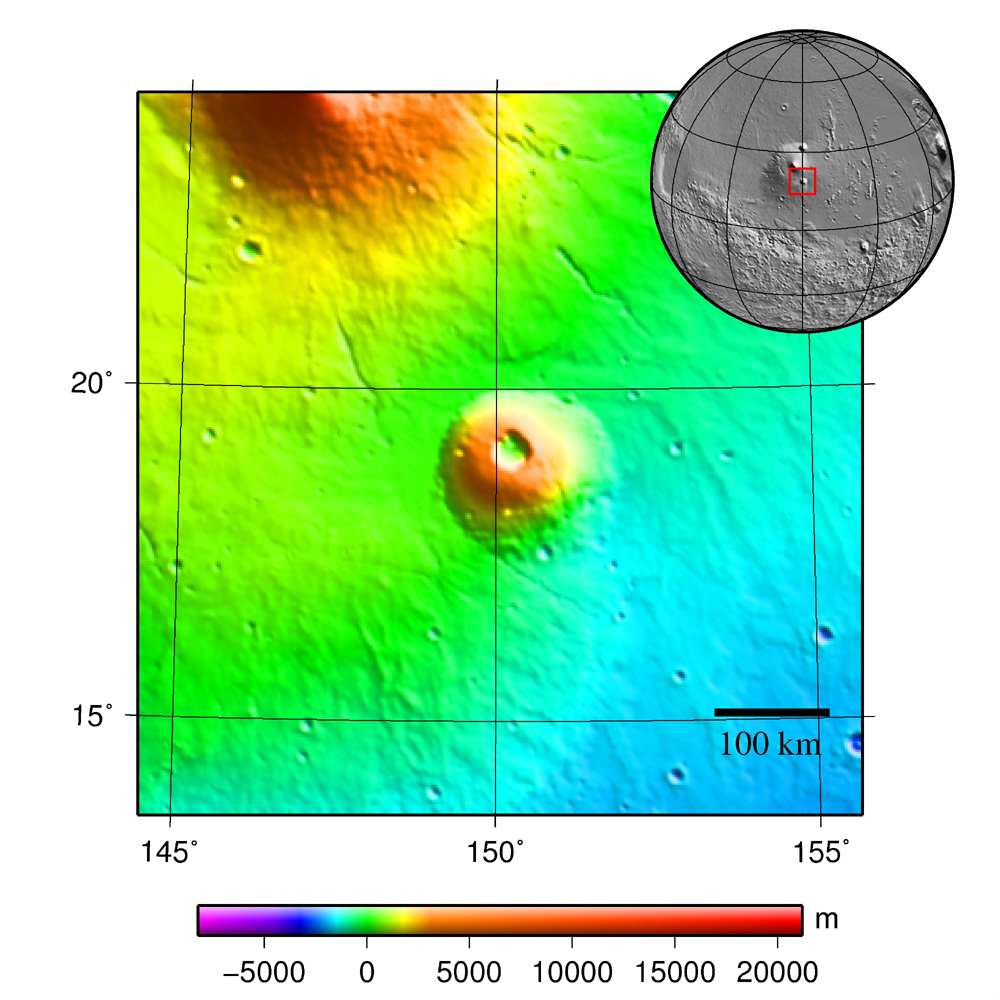
| 09:32, 13 February 2018 | MOLA albor tholus.jpg (file) |  |
489 KB | Albor Tholus volcano (Mars) topography. In this MOLA map, the colors indicate elevation. Designed by Martin Pauer (Power) | 1 |
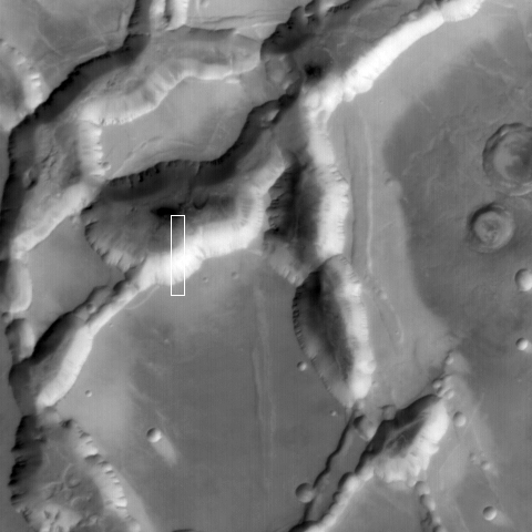
| 19:16, 11 February 2018 | NoctislabESP 027592 1685close.jpg (file) |  |
342 KB | Color view of layers on floor of Noctis Labyrinthus, as seen by HiRISE under HiWish program | 1 |
| 19:11, 11 February 2018 | Noctislabyrinthus49297 1715layersclosenorth.jpg (file) |  |
262 KB | Close view of layers on a south facing wall in Noctis Labyrinthus, as seen by HiRISE under HiWish program Image credit: NASA/JPL/University of Arizona/Secosky - Source: http://hirise.lpl.arizona.edu/ESP_049297_1715 | 1 |
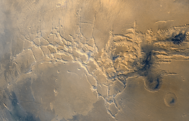
| 19:05, 11 February 2018 | Noctis Labyrinthusmgs.jpg (file) |  |
87 KB | Close view of Noctis Labyrinthus, as seen by Mars Global Surveyor under the Public Targeting Program. Image credit: NASA/Malin Space Science Systems. The picture ID is S18-0288 and the location is 97.17 degrees west longitude and 12.11 degrees south... | 1 |
| 18:57, 11 February 2018 | Part of Noctis Labyrinthus taken with the Mars Global Surveyor - 20060529.jpg (file) |  |
105 KB | Context image of part of Noctis Labyrinthus, as seen with Mars Global Surveyor Box shows the area covered by a high resolution picture. Picture taken under Public Target program. | 1 |
| 18:50, 11 February 2018 | Noctis Labyrinthus Viking 1 1980.png (file) |  |
468 KB | Close view of Noctis Labyrinthus, as seen by Viking 1 | 1 |
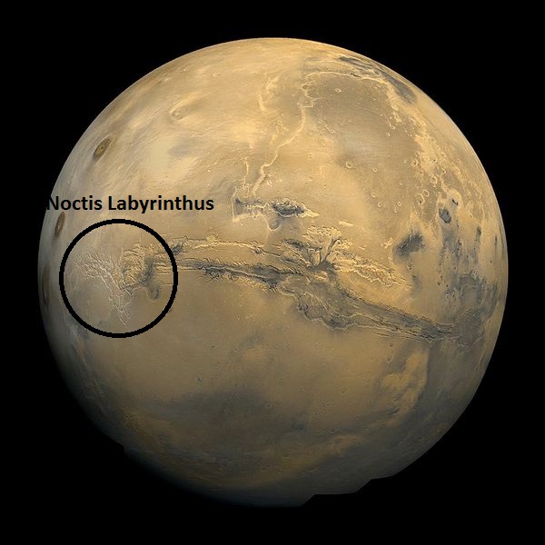
| 18:44, 11 February 2018 | Noctislabyrinthusviking1.jpg (file) |  |
71 KB | Viking 1 view of Mars showing Noctis Labyrinthus circled | 1 |
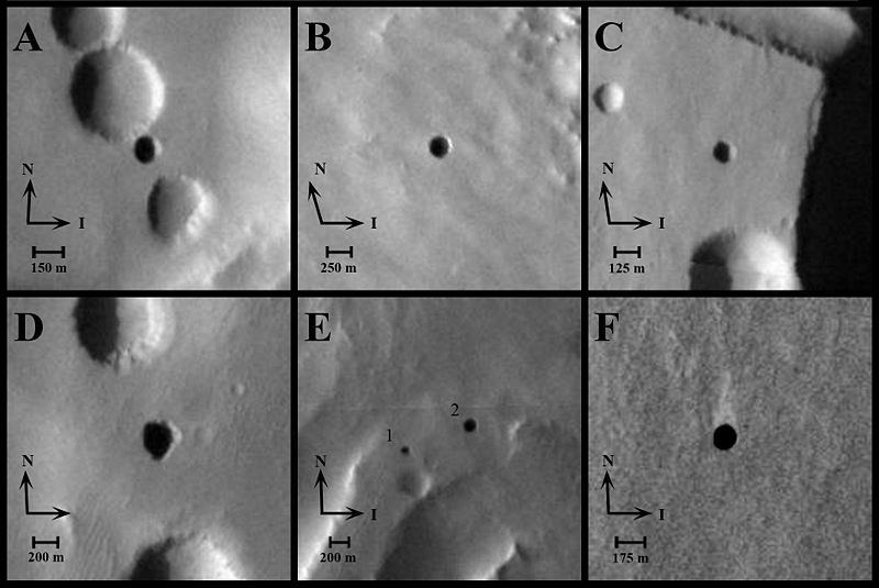
| 09:45, 10 February 2018 | Mars; Arsia Mons cave entrance -MROjeanne.jpg (file) |  |
55 KB | Possible cave entrance called Jeanne, as seen by HiRISE Dark pits on some of the Martian volcanoes have been speculated to be entrances into caves. A previous HiRISE image, looking essentially straight down, saw only darkness in this pit. This time t... | 1 |
| 09:41, 10 February 2018 | Mars caves from NASA orbiters.jpg (file) |  |
56 KB | Possible cave skylights, based on day-night temperature patterns suggesting they are openings to subsurface spaces. These six excerpts of images taken in visible-wavelength light by the Thermal Emission Imaging System camera on NASA's Mars Odyssey orbi... | 1 |
| 17:33, 9 February 2018 | Arsia Mons based on THEMIS Day IR.png (file) |  |
595 KB | THEMIS image of Arsia Mons with an insert showing its location on Mars. Image credit: NASA, modified by Chmee2 | 1 |
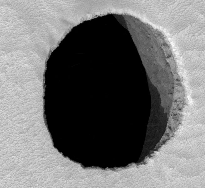
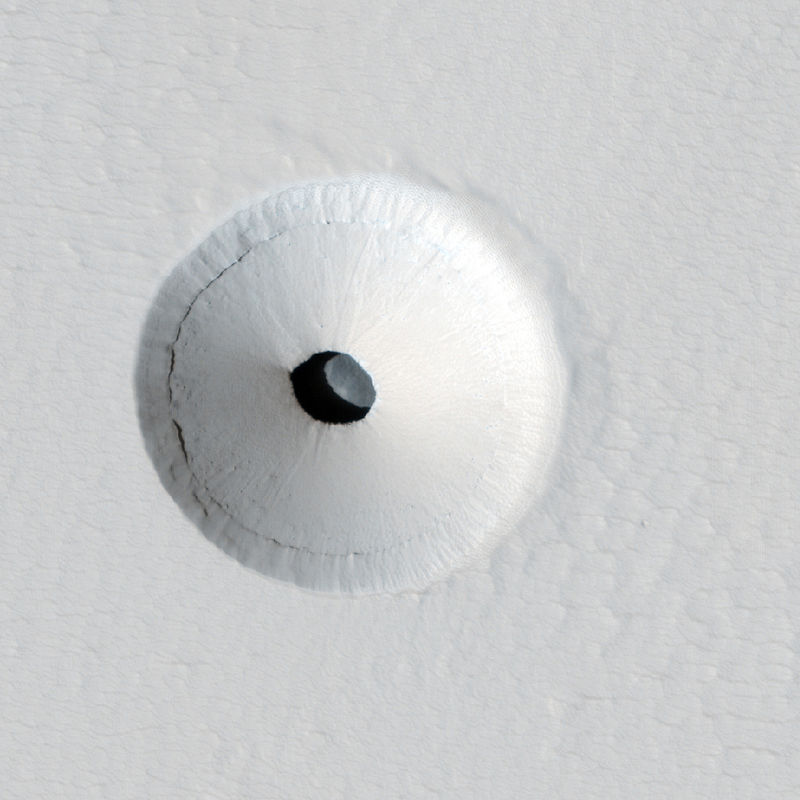
| 17:16, 9 February 2018 | Pavonis Mons lava tube skylight crop.jpg (file) |  |
64 KB | Hole that leads to a lava tube, an entry point for a possible Mars colony Image from HiRISE http://hirise.lpl.arizona.edu/ESP_023531_1840 The dark spot turned out to be a "skylight," an opening to an underground cavern, that is 35 meters (115 feet)... | 1 |
| 10:05, 9 February 2018 | Ascraeus Mons based on THEMIS Day IR.png (file) |  |
600 KB | Ascraeus Mons, as seen by THEMIS Circular insert shows location on globe of Mars. Image credit: NASA/JPL/Malin Space Science Systems modified by Chmee2 This product is an infrared image mosaic generated using Thermal Emission Imaging System (THEMI... | 1 |
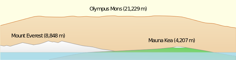
| 09:18, 9 February 2018 | Olympus Mons Side View.svg.png (file) | 26 KB | Side view of Olympus Mons as compared to mountains on Earth Author: Resident Mario This file is licensed under the Creative Commons Attribution-Share Alike 3.0 Unported license. | 1 | |
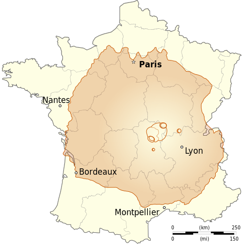
| 09:11, 9 February 2018 | France OlympusMons Size.svg.png (file) |  |
109 KB | Drawing showing area of Olympus Mons compared to the country of France. Credit: © Sémhur / Wikimedia Commons / CC-BY-SA-3.0, or Free Art License This file is licensed under the Creative Commons Attribution-Share Alike 4.0 International, 3.0 Unpor... | 1 |
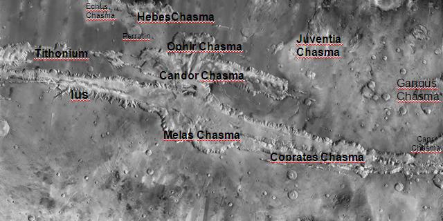
| 16:21, 7 February 2018 | Valles Marinerislabeled.jpg (file) |  |
46 KB | Picture of Valles Marineris with various parts labeled. Image was taken with the Mars Odyssey's THEMIS. The picture credit is NASA/JPL/ASU Source: http://themis.asu.edu/zoom-20041008a | 1 |
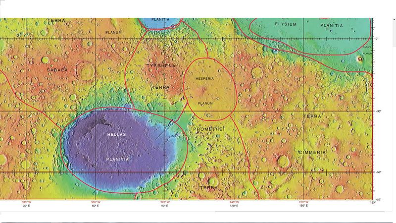
| 09:01, 7 February 2018 | Hellasplanitiamap.jpg (file) |  |
113 KB | Mola map showing boundaries for Hellas Planitia and other nearby regions. Colors indicate elevations. Image credit is NASA/International Astronomical Union Working Group for Planetary System Nomenclature. "Gazetteer of Planetary Nomenclature." Sourc... | 1 |
| 16:38, 6 February 2018 | Tongue23141 1435.jpg (file) |  |
29 KB | Tongue-shaped glacier, as seen by HiRISE under HiWish program | 1 |
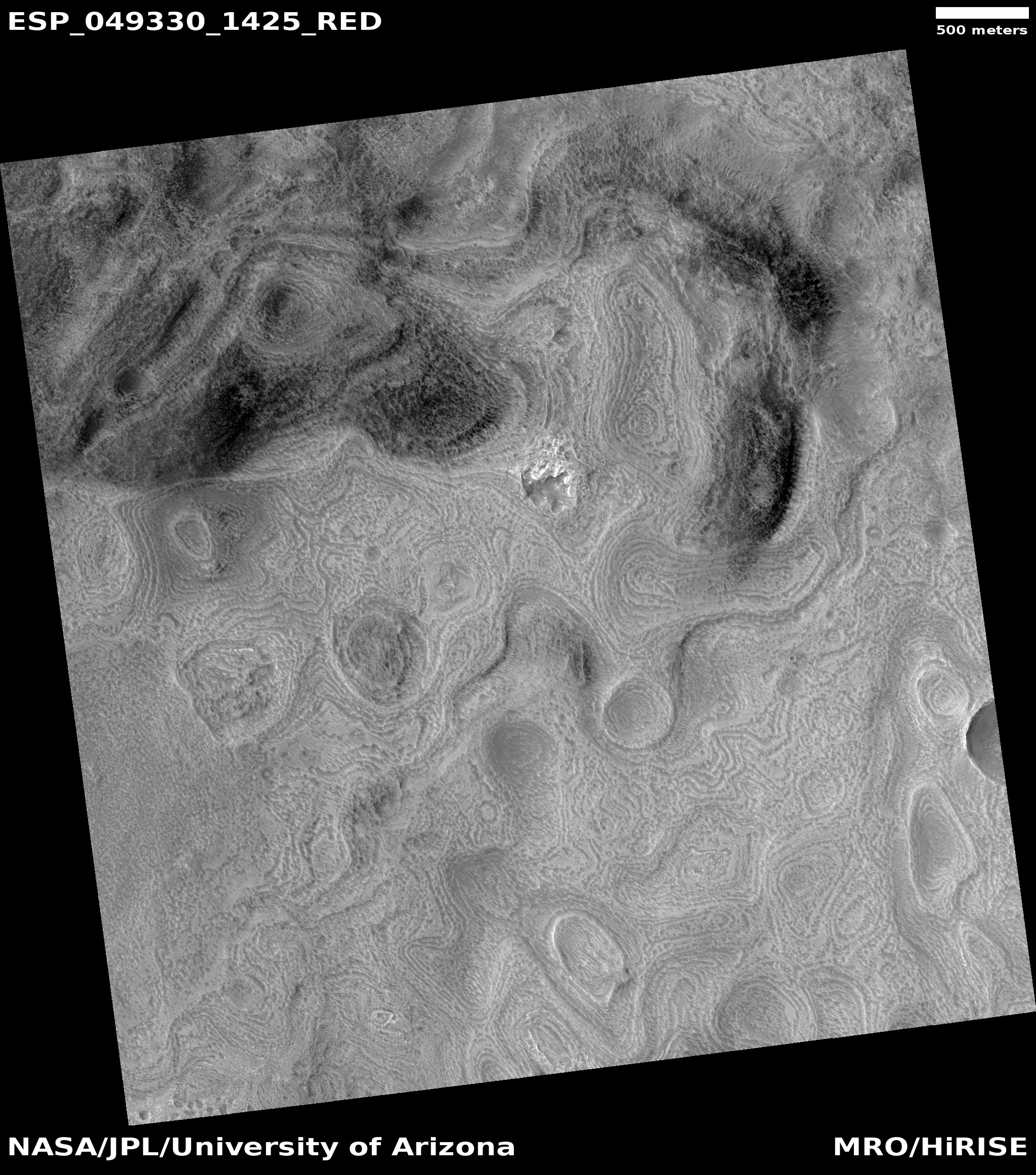
| 16:30, 6 February 2018 | ESP 049330 1425honeycomb.jpg (file) |  |
1.32 MB | "Honeycomb terrain" on the floor of Hellas Planitia, as seen by HiRISE under the HiWish program. | 1 |
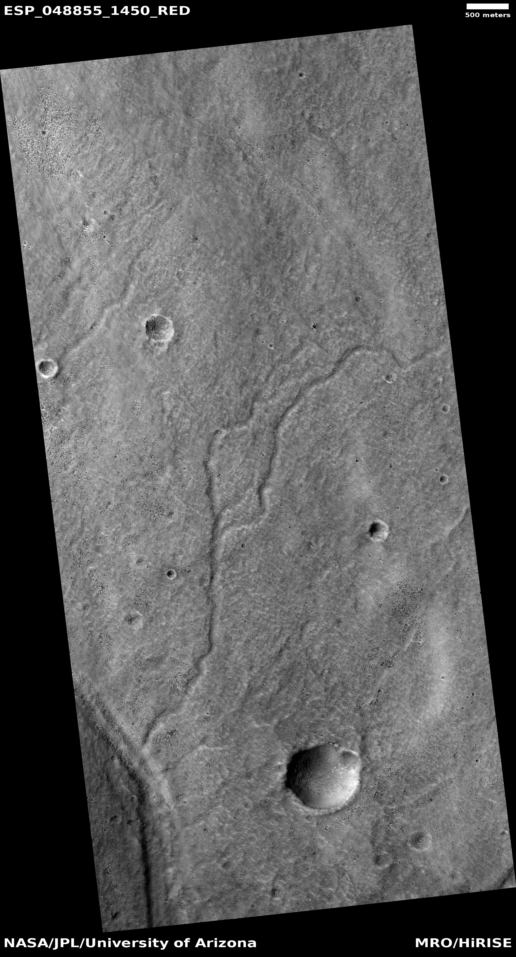
| 13:49, 6 February 2018 | ESP 048855 1450channels.jpg (file) |  |
2.23 MB | Channels in the Hellas quadrangle, as seen by HiRISE under the HiWish program | 1 |
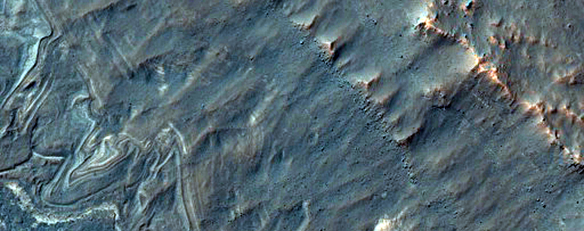
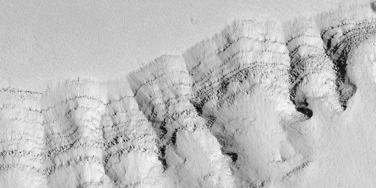
| 13:27, 6 February 2018 | 26997layersclose.jpg (file) |  |
88 KB | Close view of layers in north wall of Valles Marineris, as seen by HiRISE under HiWish program | 1 |
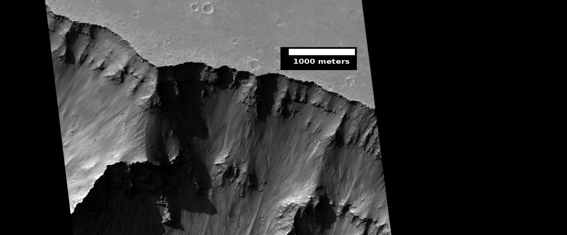
| 13:26, 6 February 2018 | ESP 026997 1660 RED abrowse.jpg (file) |  |
132 KB | Wall of Valles Marineris, as seen by HiRISE under HiWish program | 1 |
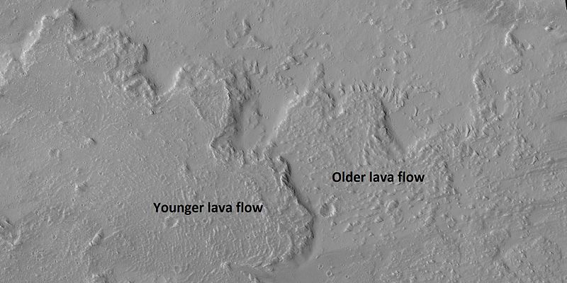
| 09:06, 6 February 2018 | 44828 2030lavaflow.jpg (file) |  |
60 KB | Lava flow on the northern edge of Olympus Mons, as seen by HiRISE under HiWish program. | 1 |
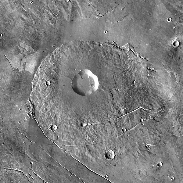
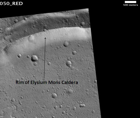
| 10:27, 5 February 2018 | MOLA elysium mons.jpg (file) |  |
32 KB | Picture from HiRISE (PSP_004758_2050) | 1 |


