Uploads by Suitupandshowup
This special page shows all uploaded files.
| Date | Name | Thumbnail | Size | Description | Versions |
|---|---|---|---|---|---|
| 14:18, 21 December 2020 | 34189 1740cutoff.jpg (file) |  |
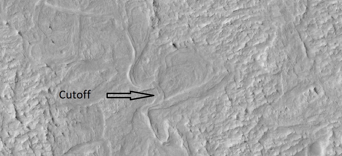
320 KB | Cutoff meander. This forms as a river cuts its outer bank and curves more and more, until it decides to take a “short-cut.” The abandoned channel may have formed an oxbow lake, when water was present. This type of river system forms slowly over time, unlike the catastrophic flood channels seen elsewhere on Mars. Source: https://www.uahirise.org/ESP_034189_1740 Image credit: NASA/JUPL/University of Arizona/Secosky | 1 |
| 09:14, 31 March 2018 | 35558 1830yardangs.jpg (file) |  |
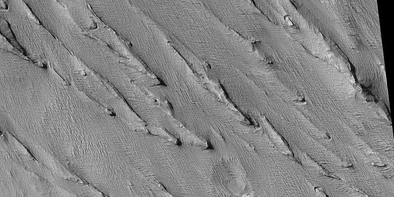
97 KB | Yardangs, as seen by hirise under HiWish program Location is the Amazonis quadrangle. Source: http://hirise.lpl.arizona.edu/ESP_35558_1830 Image credit: NASA/JPL/ University of Arizona | 1 |
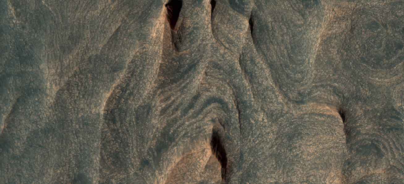
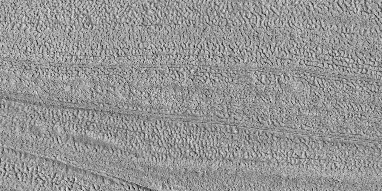
| 17:47, 21 February 2020 | 35934 2215brainsglacier.jpg (file) |  |
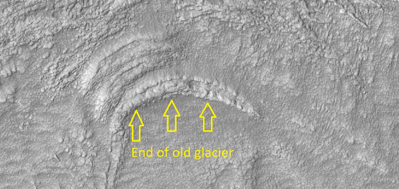
383 KB | End of glacier and brain terrain, as seen by HiRISE under HiWish program Source: http://hirise.lpl.arizona.edu/ESP_035934_2215 Image credit: NASA/JPL/University of Arizona | 1 |
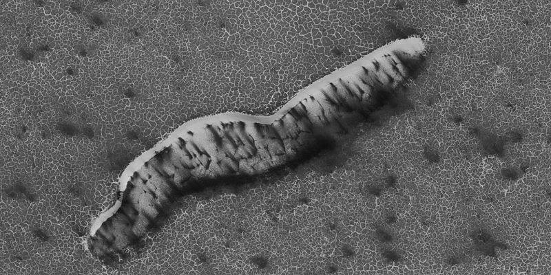
| 17:43, 21 February 2020 | 36745 1905ridgesv2.jpg (file) |  |
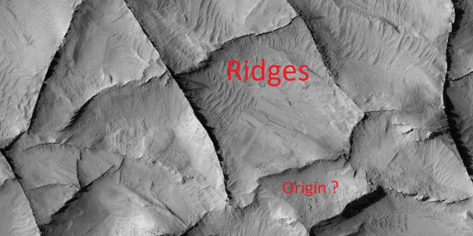
142 KB | Ridges, as seen by HiRISE under HiWish program Source: http://hirise.lpl.arizona.edu/ESP_036745_1905 Image credit: NASA/JPL/University of Arizona | 1 |
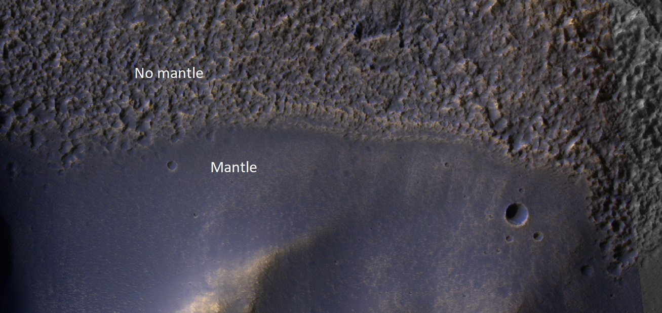
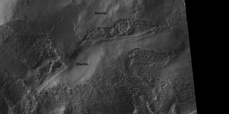
| 17:42, 21 February 2020 | 37167 1445mantlelabeled.jpg (file) |  |
273 KB | Color view of mantle, as seen by HiRISE under HiWish program Source: http://hirise.lpl.arizona.edu/ESP_37167_1445 Image credit: NASA/JPL/University of Arizona | 1 |
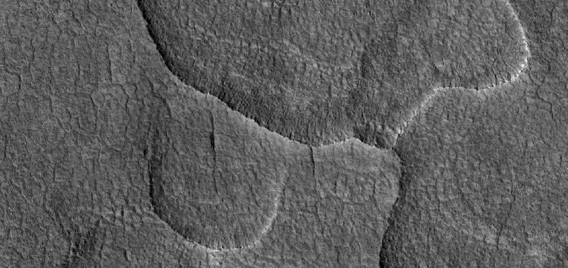
| 15:53, 6 December 2019 | 37461 2255scallopedclose.jpg (file) |  |
70 KB | Close view of scalloped terrain High-centered polygons are visible, as well as some boulders. Radar studies have shown that this type of surface contains much water ice; hence, it may be mined in the future by colonists. Some of the scallops are mergin... | 1 |
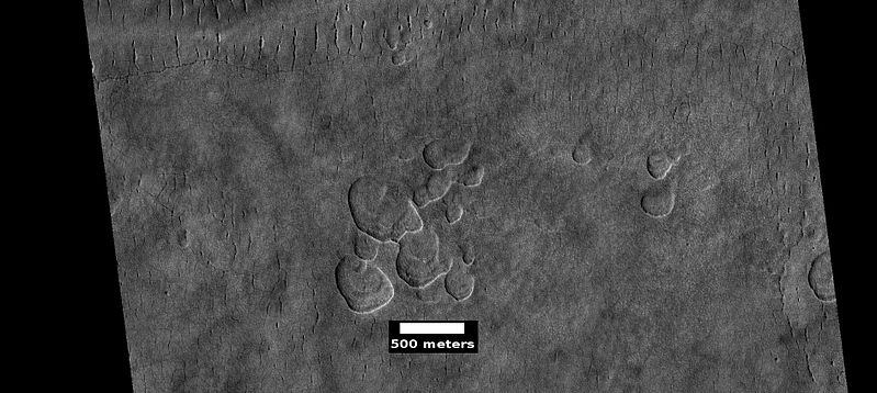
| 16:01, 6 December 2019 | 37461 2255scallopedscale.jpg (file) |  |
58 KB | Scalloped terrain Radar studies have shown that this type of surface contains much water ice, so it may be mined in the future by colonists. There may have been a channel running across the top of the image. The location is the Casius quadrangle at 4... | 1 |
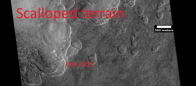
| 17:41, 21 February 2020 | 37461 2255scallopslabeled2.jpg (file) |  |
104 KB | Scalloped terrain, as seen by HiRISE under HiWish program Source: http://hirise.lpl.arizona.edu/ESP_059619_1845 Image credit: NASA/JPL/University of Arizona | 1 |
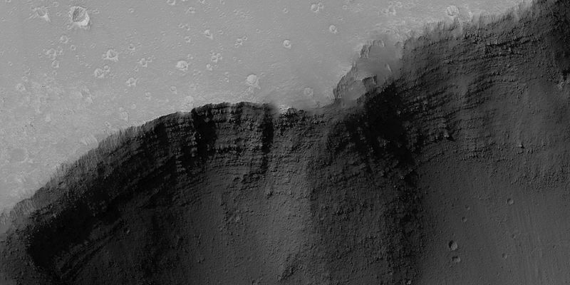
| 09:23, 3 March 2020 | 39446 1785layershebes.jpg (file) |  |
256 KB | Layers in Hebes Chasma, as seen by HiRISE The location is the Coprates quadrangle. Image credit is NASA/JPL/University of Arizona. This was described in a caption on the HiRISE site. Source: https://www.uahirise.org/ESP_39446_1785 | 1 |
| 17:40, 21 February 2020 | 40162 2065conesarrows2.jpg (file) |  |
229 KB | Rootless cones, as seen by HiRISE under HiWish program Source: http://hirise.lpl.arizona.edu/ESP_040162_2065 Image credit: NASA/JPL/University of Arizona | 1 |
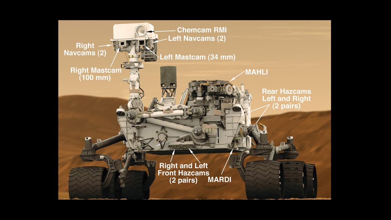
| 13:25, 28 December 2018 | 4077 malin-4rovercam-full.jpg (file) |  |
399 KB | Cameras on Curiosity This graphic shows the locations of the cameras on NASA's Curiosity rover. The rover's mast features seven cameras: the Remote Micro Imager, part of the Chemistry and Camera suite; four black-and-white Navigation Cameras (two on t... | 1 |
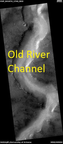
| 17:40, 21 February 2020 | 41974 1740channellabeled.jpg (file) |  |
48 KB | Channel, as seen by HiRISE under HiWish program Source: http://hirise.lpl.arizona.edu/ESP_041974_1740 Image credit: NASA/JPL/University of Arizona | 1 |
| 09:27, 14 November 2018 | 43376 1710layersclose.jpg (file) |  |
54 KB | Close up of layers in coprates quadrangle, as seen by hirise under HiWish program Source http://hirise.lpl.arizona.edu/ESP_43376_1710 Image credit: NASA/JPL/University of Arizona | 1 |
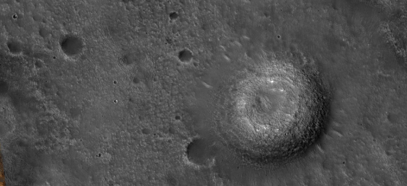
| 16:33, 21 February 2020 | 43580 2120mud.jpg (file) |  |
349 KB | Possible mud volcano, as seen by HiRISE under HiWish program Source: http://hirise.lpl.arizona.edu/ESP_043580_2120 Image credit: NASA/JPL/University of Arizona | 1 |
| 16:32, 21 February 2020 | 43580 2120mud2.jpg (file) |  |
245 KB | Cone, as seen by HiRISE under HiWish program This may be a mud volcano Source: http://hirise.lpl.arizona.edu/ESP_043580_2120 Image credit: NASA/JPL/University of Arizona | 1 |
| 16:35, 21 February 2020 | 43821 2555dunesdefrosting2.jpg (file) |  |
178 KB | Close view of dunes defrosting, as seen by HiRISE under HiWish program Source: http://hirise.lpl.arizona.edu/ESP_043821_2555 Image credit: NASA/JPL/University of Arizona | 1 |
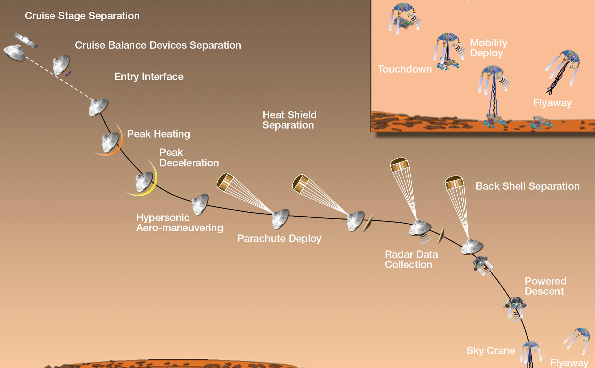
| 16:08, 28 December 2018 | 4392 edl20120809-full2landingsteps.jpg (file) |  |
165 KB | Mission Events During Curiosity's Landing Source: https://mars.nasa.gov/resources/4392/timeline-of-major-mission-events-during-curiositys-landing/ Image credit: NASA/JPL-Caltech | 1 |
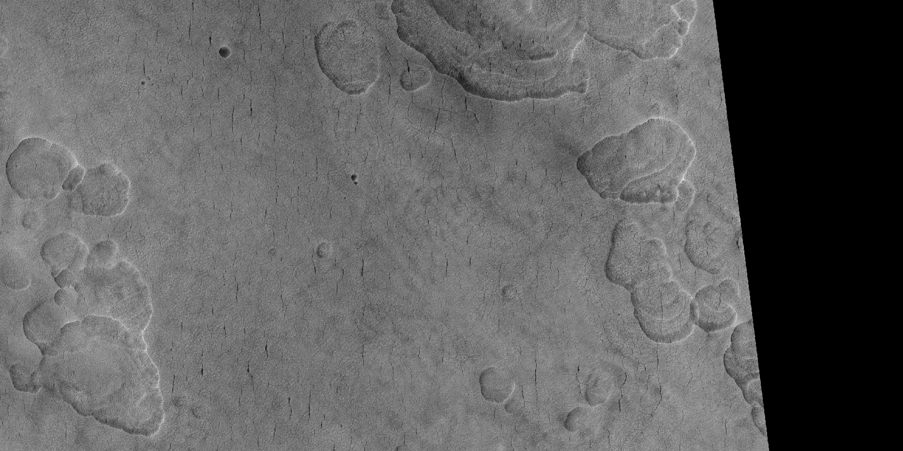
| 13:25, 18 May 2018 | 44042 2240scallopedterrain.jpg (file) |  |
734 KB | Scalloped terrain, as seen by HiRISE under HiWish program Location is Casius quadrangle Source: http://hirise.lpl.arizona.edu/ESP_44042_2240 Image credit: NASA/JPL/ University of Arizona | 1 |
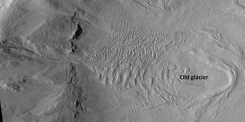
| 16:12, 8 October 2018 | 44410 2195glacier.jpg (file) |  |
83 KB | Old glacier in Casius quadrangle, as seen by HiRISE under HiWish program Source: http://hirise.lpl.arizona.edu/ESP_044410_2195 Image credit: NASA/JPL/ University of Arizona/Secosky | 1 |
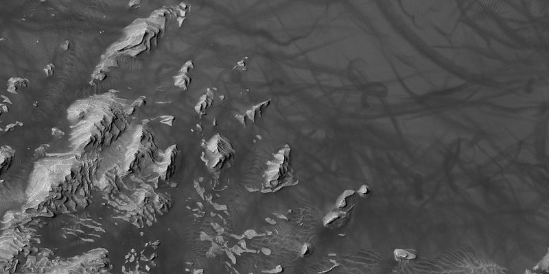
| 10:51, 16 January 2019 | 44507 1880devilslayers.jpg (file) |  |
45 KB | Layers and dust devil tracks in Dannielson Crater, as seen by HiRISE under HiWish program Source http://hirise.lpl.arizona.edu/ESP_044507_1880 Image credit: NASA/JPL/ University of Arizona | 1 |
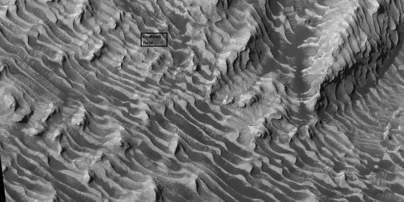
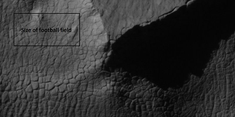
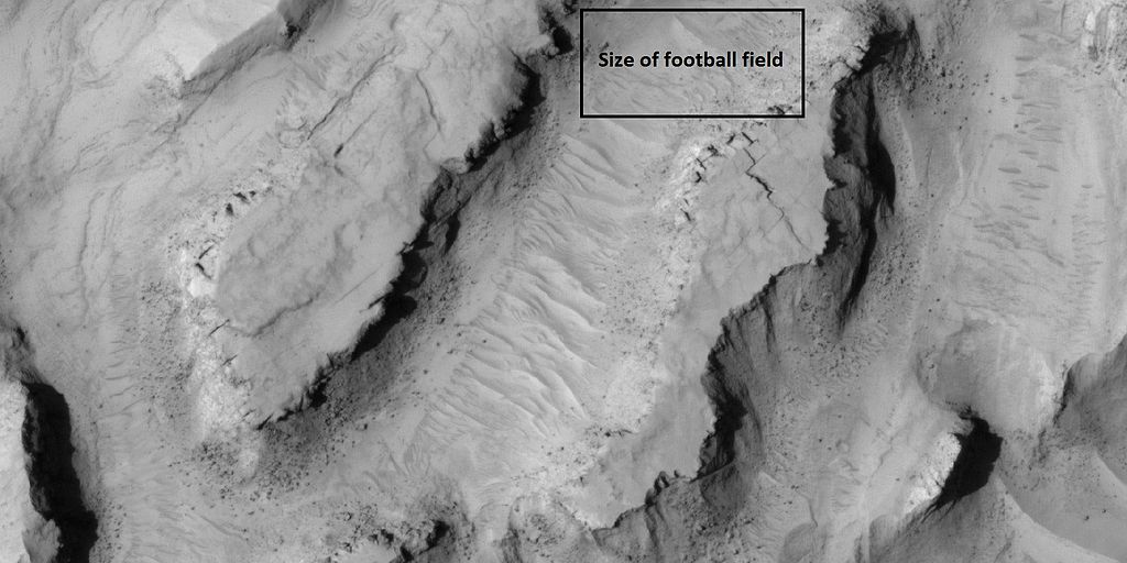
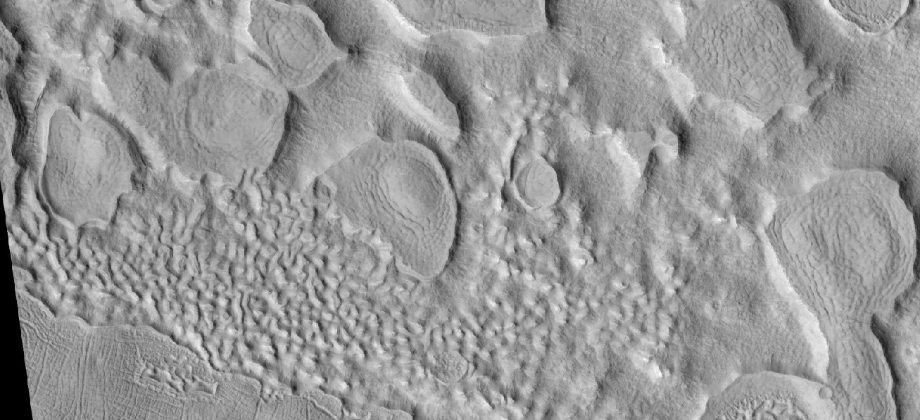
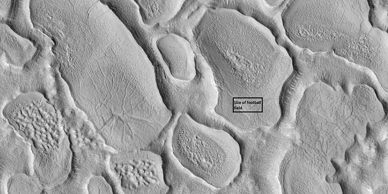
| 10:47, 16 January 2019 | 44507 1880longlayersdanielson.jpg (file) |  |
84 KB | Layers in Danielson Crater in Oxia Palus, as seen by hirise under HiWish program Box shows size of football field. Source http://hirise.lpl.arizona.edu/ESP_044507_1880 Image credit: NASA/JPL/ University of Arizona | 1 |
| 15:53, 31 March 2018 | 44757 2185closeleft.jpg (file) |  |
52 KB | Fractured surface enlarged greatly, as seen by hirise under HiWish program, location Ismenius Lacus Source: http://hirise.lpl.arizona.edu/ESP_044757_2185 Image credit: NASA/JPL/ University of Arizona/Secosky | 1 |
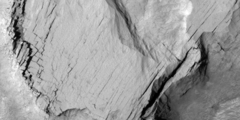
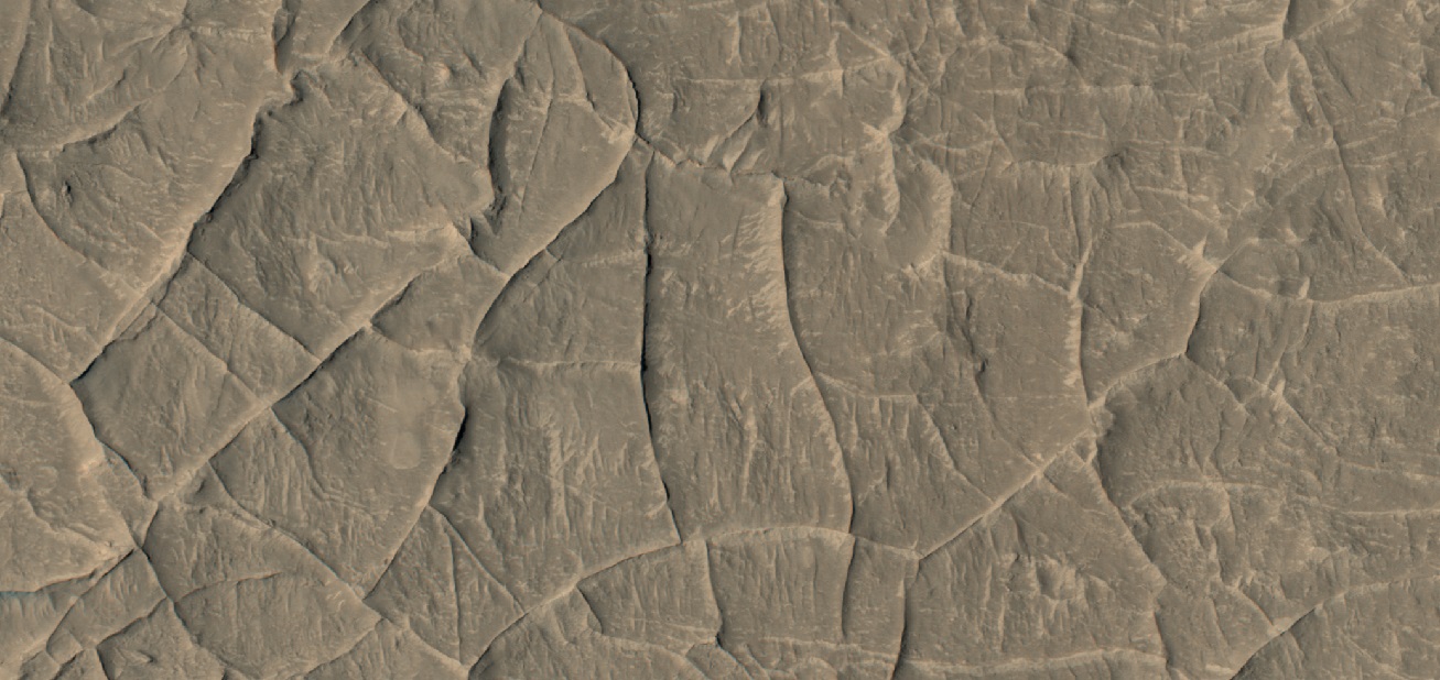
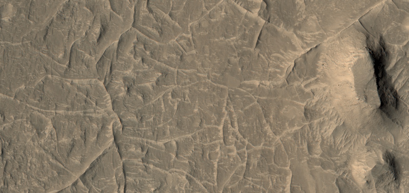
| 12:27, 27 February 2020 | 44757 2185fracturesblocks.jpg (file) |  |
49 KB | Close up view of straight fractures Rocks will often break along straight lines and form large blocks. Picture taken with HiRISE under HiWish program The location is Ismenius Lacus quadrangle at 37.938 N and 3.9 E (ESP_044757_2185). Source: http://hirise.lpl.arizona.edu/ESP_44757_2185 Image credit is NASA/JPL/University of Arizona. | 1 |
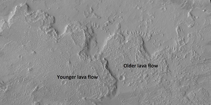
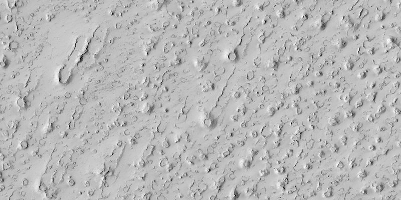
| 09:06, 6 February 2018 | 44828 2030lavaflow.jpg (file) |  |
60 KB | Lava flow on the northern edge of Olympus Mons, as seen by HiRISE under HiWish program. | 1 |
| 10:44, 25 January 2019 | 45029 1785layersclose.jpg (file) |  |
67 KB | Close view of layers in Aeolis quadrangle, as seen by hirise under HiWish program Date 11 May 2016 Source http://hirise.lpl.arizona.edu/ESP_045029_1785 NASA/JPL/ University of Arizona | 1 |
| 08:37, 2 April 2018 | 45070 1440polygonscloseshadows.jpg (file) |  |
43 KB | High center polygons, as seen by hirise under HiWish program Box indicates size of football field. Source: http://hirise.lpl.arizona.edu/ESP_045070_1440 Image credit: NASA/JPL/ University of Arizona | 1 |
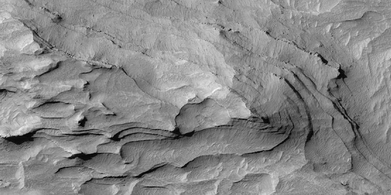
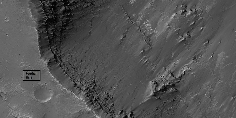
| 07:55, 29 January 2019 | 45075 1715layersclose.jpg (file) |  |
53 KB | Layers in Aurorae Chaos in Margaritifer Sinus quadrangle, as seen by hirise under HiWish program Box shows size of football field. Source http://hirise.lpl.arizona.edu/ESP_045075_1715 NASA/JPL/ University of Arizona | 1 |
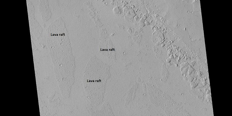
| 15:30, 31 March 2018 | 45133 1970lvarafts.jpg (file) |  |
49 KB | Rafts of lava in Amazonis quadrangle, as seen by hirise under HiWish program Source: http://hirise.lpl.arizona.edu/ESP_045133_1970 Image credit: NASA/JPL/ University of Arizona | 1 |
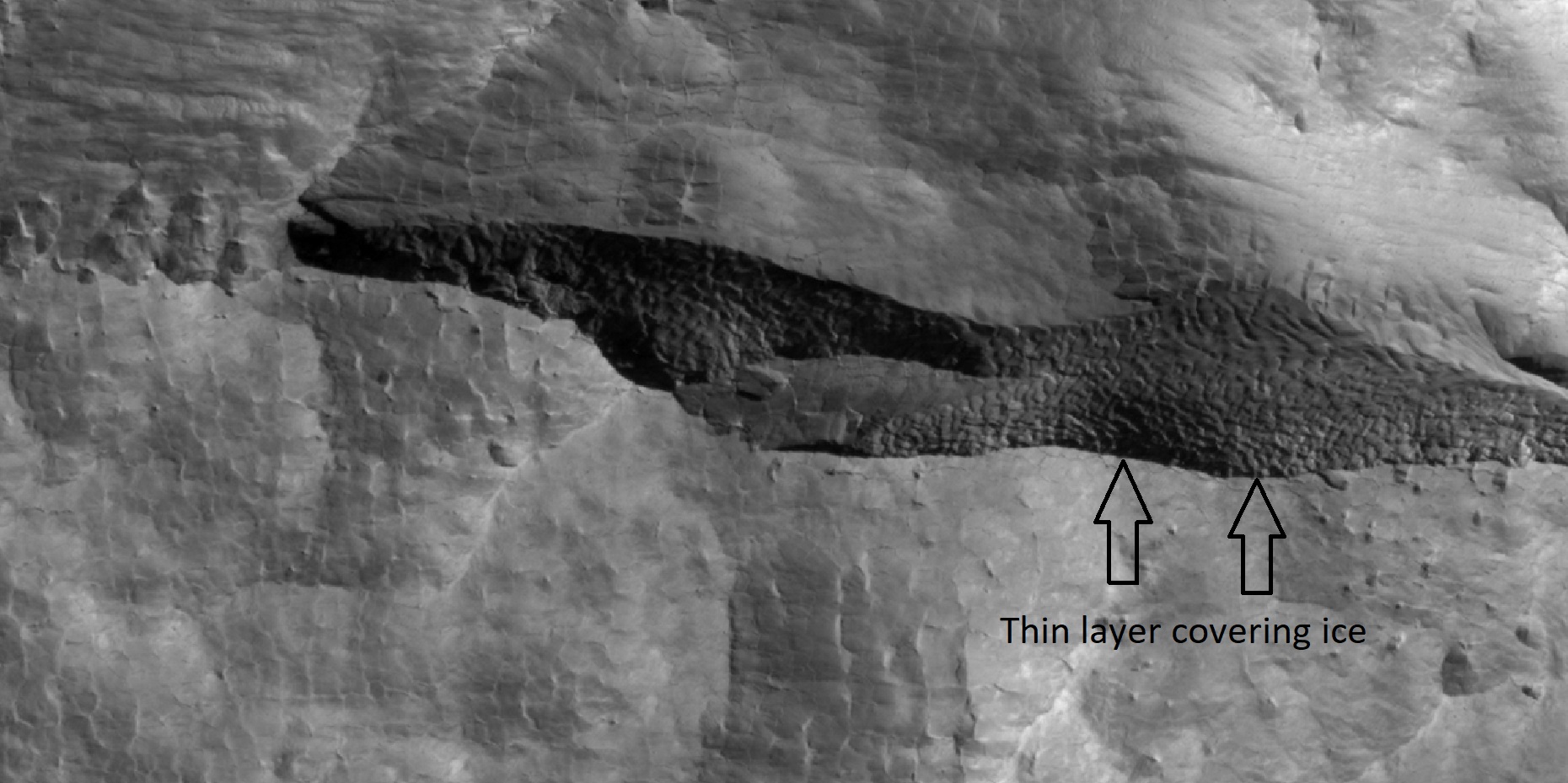
| 14:15, 28 February 2018 | 45290 2350icelayerscloseer.jpg (file) |  |
404 KB | Close view of depression that contains layers of ice under only 1-2 meters of covering debris, as seen by HiRISE under HiWish program Location is the Diacria quadrangle. Arrows indicate thin covering over ice layers. Source: http://hirise.lpl.arizona.... | 1 |
| 12:44, 27 February 2020 | 45377 2170blocks2.jpg (file) |  |
89 KB | Close up view of straight fractures Rocks will often break along straight lines and form large blocks. Picture taken with HiRISE under HiWish program The location is Ismenius Lacus quadrangle at 37.938 N and 3.9 E (ESP_044757_2185). Source: http://hirise.lpl.arizona.edu/ESP_44757_2185 Image credit is NASA/JPL/University of Arizona. | 1 |
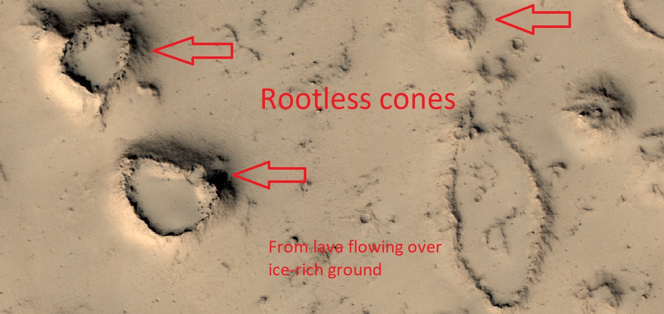
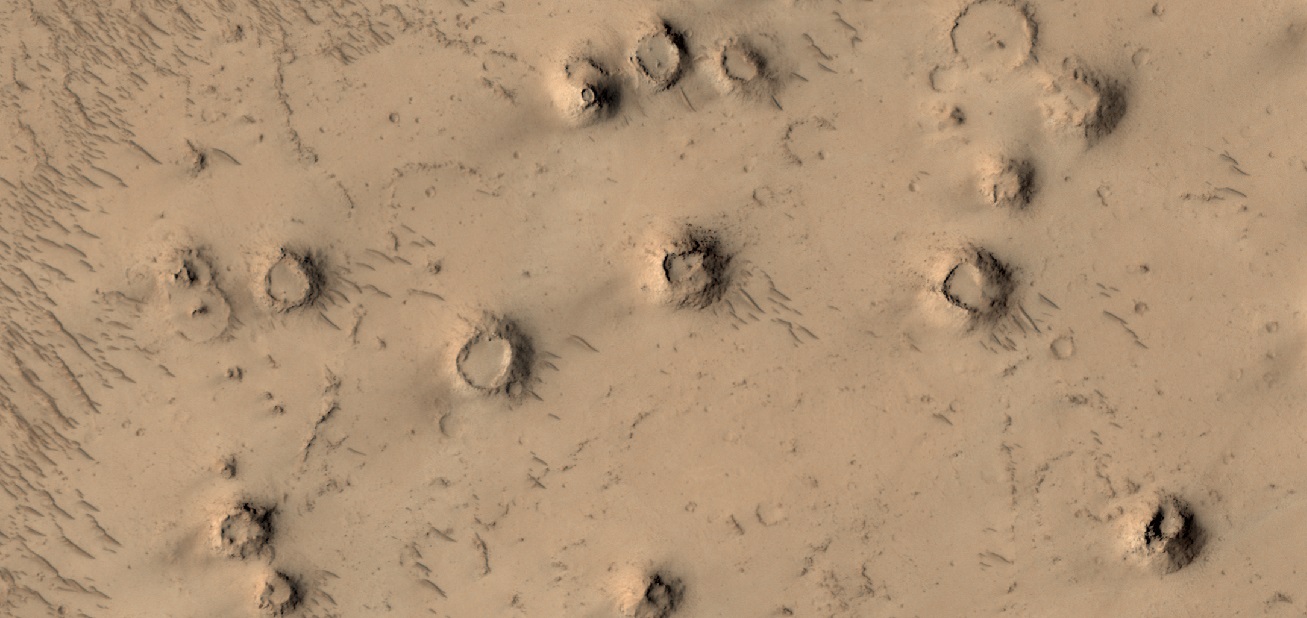
| 15:34, 31 March 2018 | 45384 2065cones.jpg (file) |  |
71 KB | Rootless cones caused by lava flowing over ice-rich ground in Elysium quadrangle, as seen by hirise under HiWish program Source: http://hirise.lpl.arizona.edu/ESP_045384_2065 Image credit: NASA/JPL/ University of Arizona | 1 |
| 16:30, 21 February 2020 | 45384 2065cones2.jpg (file) |  |
215 KB | Wide view of rootless cones, as seen by HiRISE under HiWish program Source: http://hirise.lpl.arizona.edu/ESP_045384_2065 Image credit: NASA/JPL/University of Arizona | 1 |
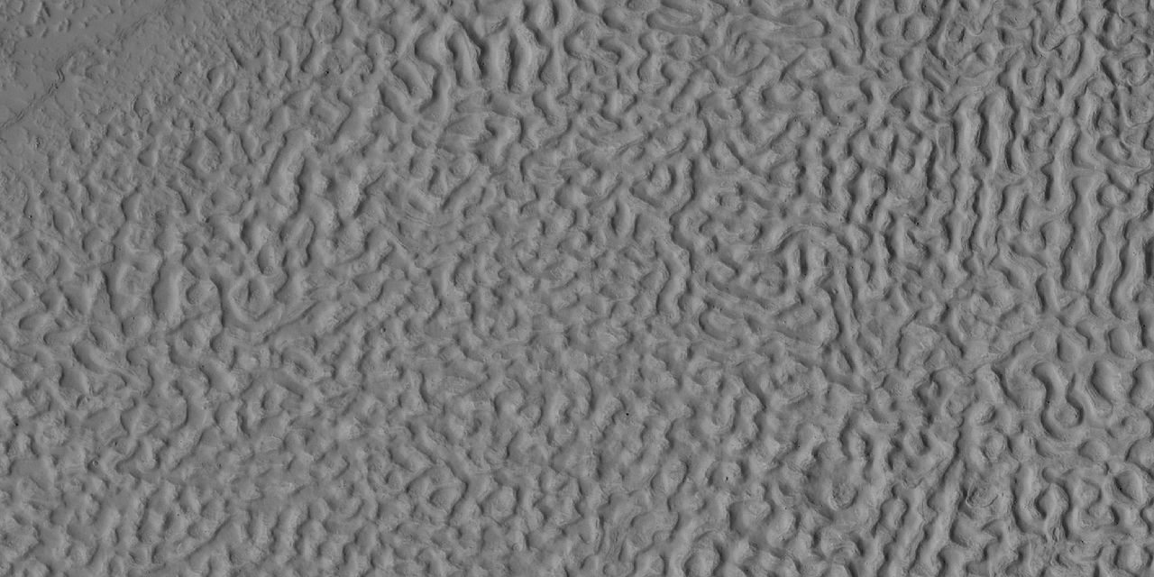
| 06:56, 23 May 2018 | 45507 2200brains.jpg (file) |  |
136 KB | Brain terrain, as seen by hirise under HiWish program Source: http://hirise.lpl.arizona.edu/ESP_045507_2200 Image credit: NASA/JPL/University of Arizona | 1 |
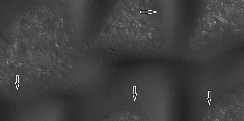
| 16:54, 31 March 2018 | 45575 2535dunebouldertracks.jpg (file) |  |
36 KB | close view of dunes showing boulders with arrows, as seen by hirise under HiWish program Source: http://hirise.lpl.arizona.edu/ESP_045575_2535 Image credit: NASA/JPL/University of Arizona | 1 |
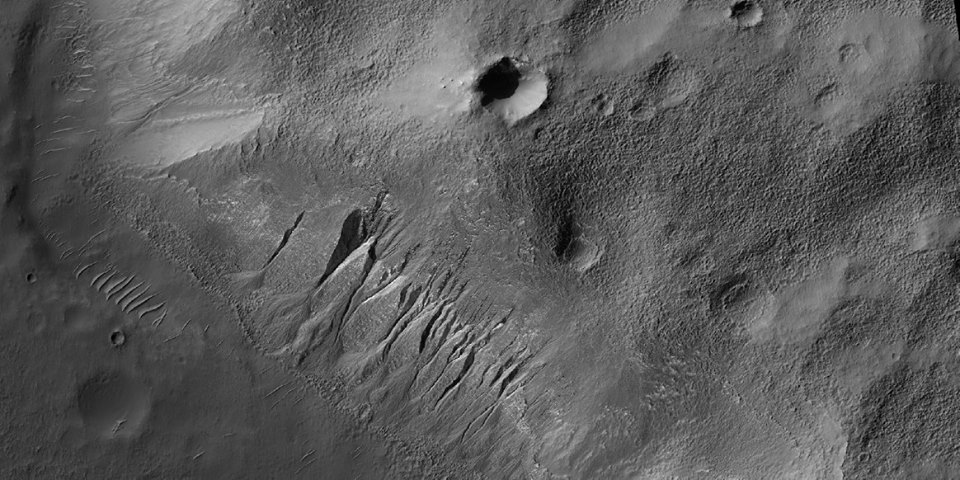
| 12:28, 1 June 2018 | 45752 1410gullies.jpg (file) |  |
126 KB | Gullies, as seen by HiRISE under HiWish program The location is the Phaethontis quadrangle at 38.908 S and 212.491 E (ESP_045752_1410). Image credit is NASA/JPL/University of Arizona. Source: http://hirise.lpl.arizona.edu/ESP_045752_1410 | 1 |
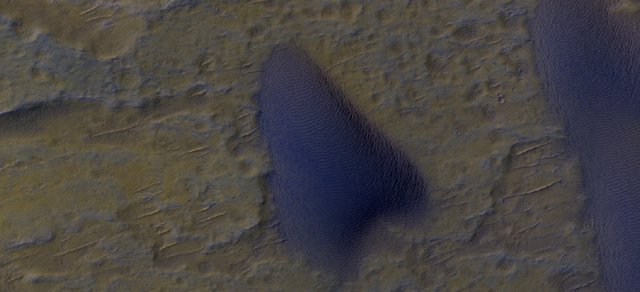
| 10:39, 17 March 2020 | 45822 1688duneirb.jpg (file) |  |
225 KB | Dune, as seen by HiRISE under HiWish program Source: http://hirise.lpl.arizona.edu/ESP_045822_1688 Image Credit: NASA/JPL/University of Arizona/Secosky | 1 |
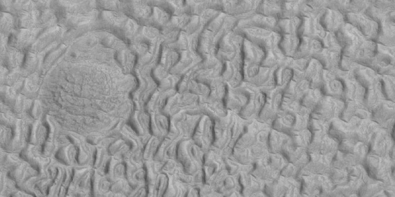
| 07:51, 31 March 2018 | 45917 2220brainsforming.jpg (file) |  |
46 KB | Brain terrain forming in Ismenius Lacus quadrangle, as seen by hirise under HiWish program Source: http://hirise.lpl.arizona.edu/ESP_045917_2220 Image credit: NASA/JPL/Jim Secosky | 1 |
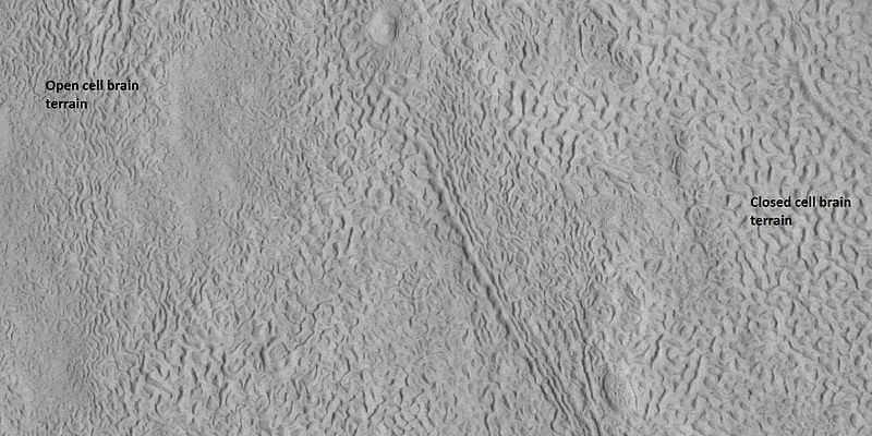
| 16:42, 26 February 2018 | 45917 2220brainsopenclosed.jpg (file) |  |
140 KB | Labeled picture of open and closed brain terrain, as seen by HiRISE under HiWish program Source: http://hirise.lpl.arizona.edu/ESP_045917_2220 Image credit: NASA/JPL/University of Arizona | 1 |
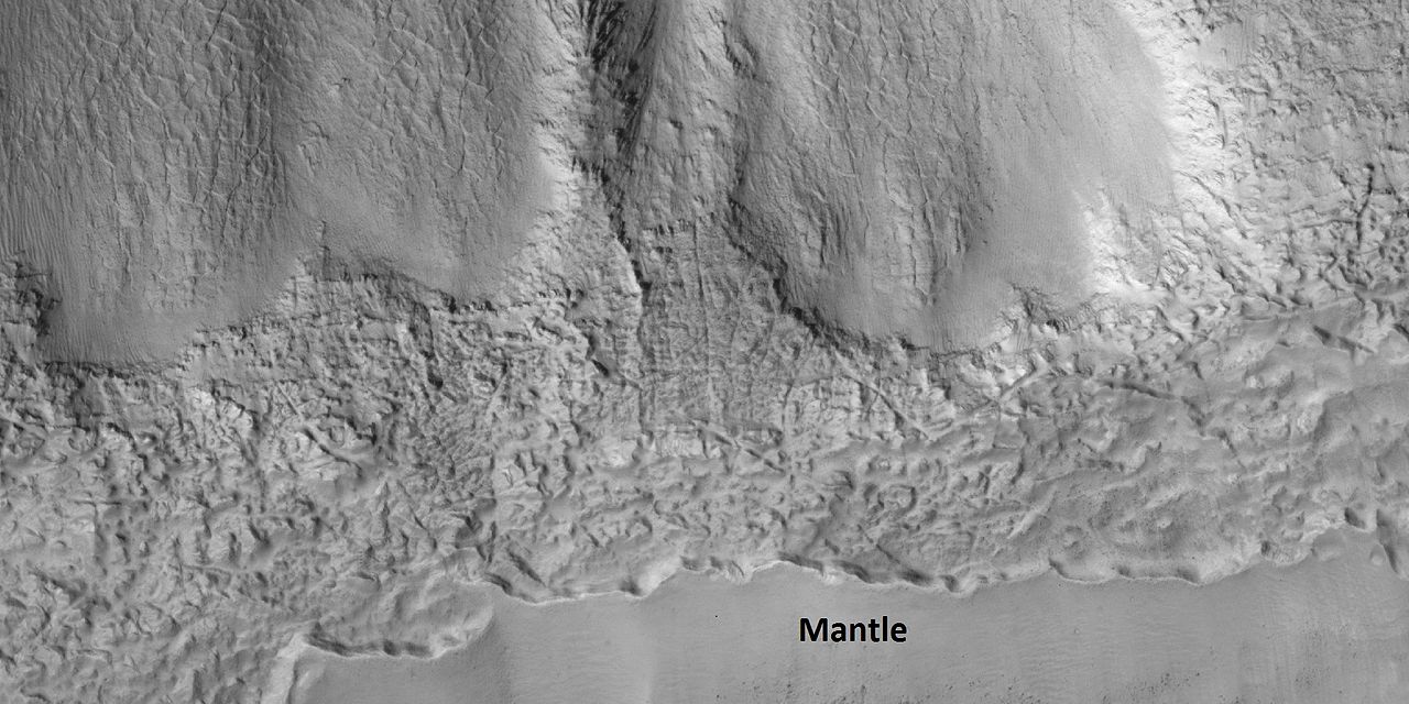
| 12:03, 27 February 2018 | 45917 2220gulliesmantle.jpg (file) |  |
164 KB | Close view of latitude dependent mantle, as seen by HiRISE under HiWish program A certain percentage of the mantle is ice; hence we may obtain water from this for future colonists. Source: http://hirise.lpl.arizona.edu/ESP_045917_2220 Image Credit:... | 1 |
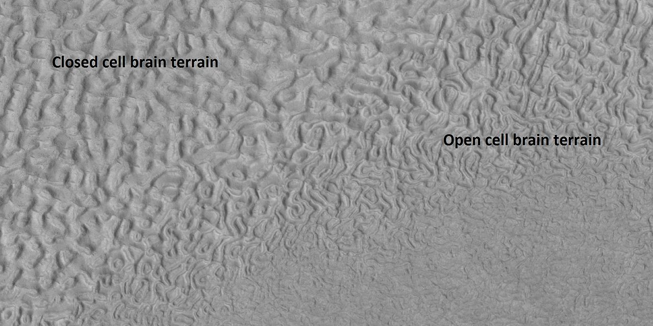
| 07:58, 31 March 2018 | 45917 2220openclosedbrains.jpg (file) |  |
83 KB | Labeled picture of open and closed brain terrain, as seen by hirise under HiWish program in the Ismenius Lacus quadrangle Source: http://hirise.lpl.arizona.edu/ESP_045917_2220 Image credit: NASA/JPL/Jim Secosky | 1 |
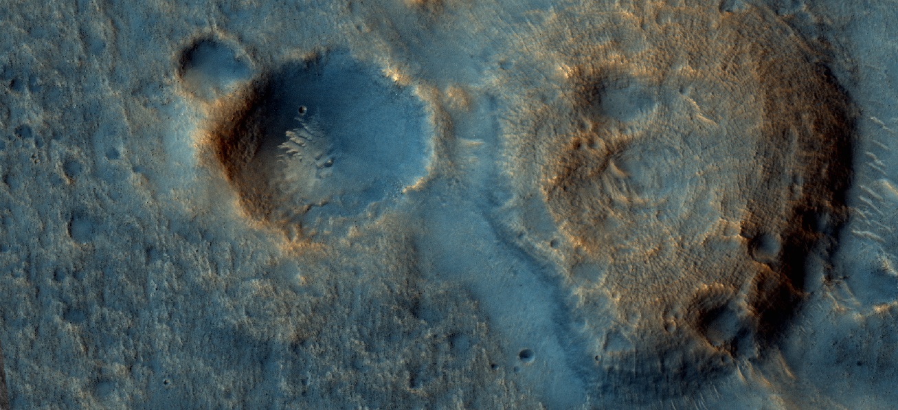
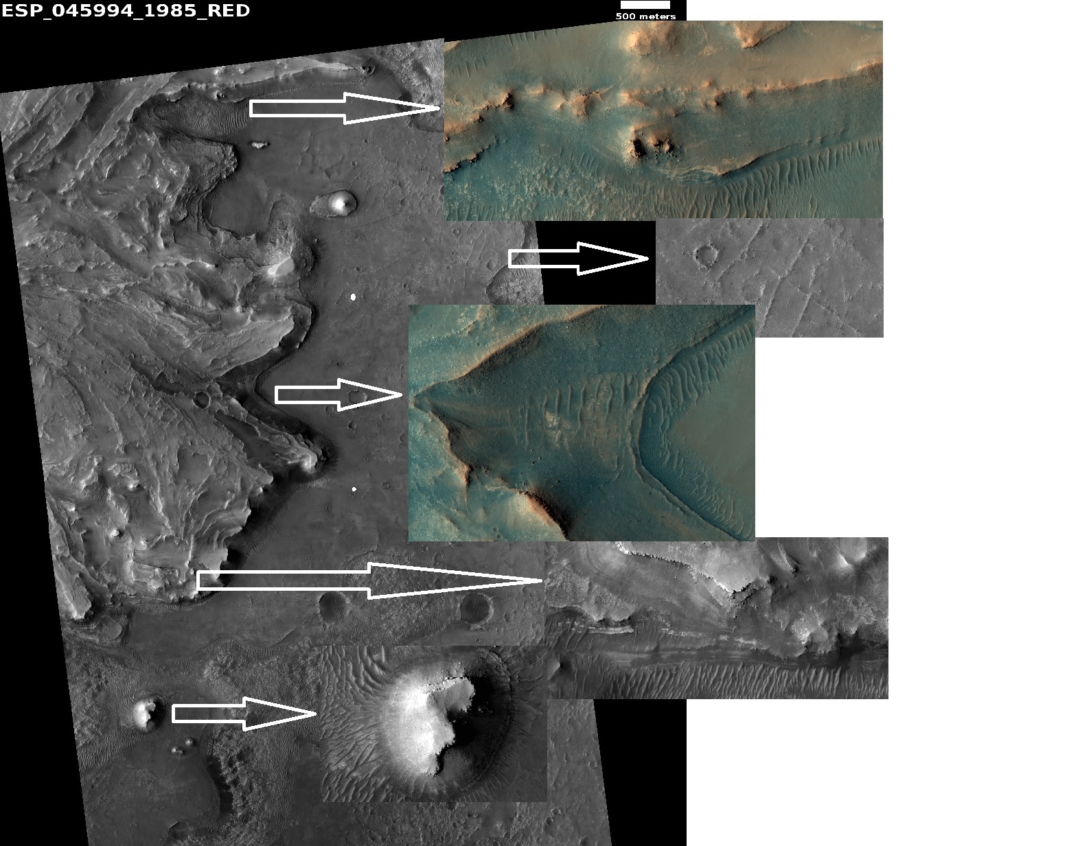
| 09:23, 20 February 2021 | 45994 1985jezweocompositecompositearrows.jpg (file) |  |
570 KB | Jezero crater as seen by HiRISE. Arrows show enlargements of features around delta. Source: hirise.lpl.arizona.edu/ESP_45994_1985 Image credit: NASA/JPL/University of Arizona | 1 |
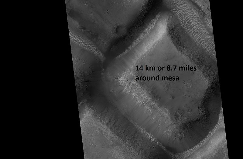
| 11:03, 1 April 2018 | 46050 1775race.jpg (file) |  |
44 KB | Mesa with a perimeter of 8.7 miles, as seen by hirise under HiWish program Source: http://hirise.lpl.arizona.edu/ESP_46050_1775 Image credit: NASA/JPL/University of Arizona/Secosky | 1 |
| 14:19, 26 February 2018 | 46061 2190closelvf..jpg (file) |  |
261 KB | Close view of lineated valley fill, as seen by HiRISE under HiWish program Image credit: NASA/JPL/University of Arizona | 1 |
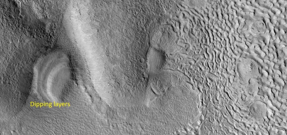
| 17:38, 21 February 2020 | 46180 2225dippinglayers.jpg (file) |  |
99 KB | Dipping layers, as seen by HiRISE under HiWish program Source: http://hirise.lpl.arizona.edu/ESP_059619_1845 Image credit: NASA/JPL/University of Arizona | 1 |
| 16:50, 16 December 2019 | 46269 1770ridges2.jpg (file) |  |
263 KB | Ridge network, as seen by HiRISE under HiWish program Source: https://hirise.lpl.arizona.edu/ESP_46269_1770 Image credit: NASA/JPL/University of Arizona/Secosky | 1 |
| 16:51, 16 December 2019 | 46269 1770ridgesmesa.jpg (file) |  |
257 KB | Ridge network, as seen by HiRISE under HiWish program Note that ridges are under the mesa; hence they formed before the mesa. Source: https://hirise.lpl.arizona.edu/ESP_46269_1770 Image credit: NASA/JPL/University of Arizona/Secosky | 1 |
| 07:54, 2 April 2018 | 46294 1395mantle.jpg (file) |  |
47 KB | Mantle in Eridania quadrangle, as seen by hirise under HiWish program Source: http://hirise.lpl.arizona.edu/ESP_046294_1395 Image credit: NASA/JPL/Jim Secosky | 1 |
| 17:37, 21 February 2020 | 46325 2225hollows4.jpg (file) |  |
306 KB | Hollows, as seen by HiRISE under HiWish program Source: http://hirise.lpl.arizona.edu/ESP_046325_2225 Image credit: NASA/JPL/University of Arizona | 1 |
| 11:46, 18 May 2018 | 46325 2225hollowsclose2.jpg (file) |  |
85 KB | Hollows formed in ribbed terrain in the Ismenius Lacus quadrangle, as seen by HiRISE under HiWish program Source: http://hirise.lpl.arizona.edu/ESP_046325_2225 Image Credit: NASA/JPL/University of Arizona/Jim Secosky | 1 |
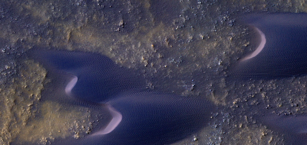
| 17:06, 16 December 2019 | 46378 1415dunesirb.jpg (file) |  |
369 KB | Close view of Dunes, as seen by HiRISE under HiWish program Color is processed as IRB. Source: http://hirise.lpl.arizona.edu/ESP_046378_1415dunefield.jpg Image credit: NASA/JPL/University of Arizona | 1 |


