File:MOLA spiritlandingmap.jpg
No higher resolution available.
MOLA_spiritlandingmap.jpg (600 × 600 pixels, file size: 96 KB, MIME type: image/jpeg)
Summary
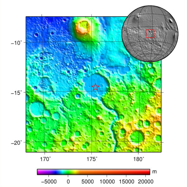
Map and globe showing Spirit's landing location. Colors relate to elevation.
Source: plotted using GMT and gridded MOLA data archive meg0031t.grd
https://commons.wikimedia.org/wiki/File:MOLA_spirit.jpg
Author: Martin Paue
Licensing
Public domain images are available for anybody to use without any licenses, royalties, or special permissions.
File history
Click on a date/time to view the file as it appeared at that time.
| Date/Time | Thumbnail | Dimensions | User | Comment | |
|---|---|---|---|---|---|
| current | 19:32, 17 December 2018 | | 600 × 600 (96 KB) | Suitupandshowup (talk | contribs) | Map and globe showing Spirit's landing location. Colors relate to elevation. Source: plotted using GMT and gridded MOLA data archive meg0031t.grd https://commons.wikimedia.org/wiki/File:MOLA_spirit.jpg Author: Martin Paue |
You cannot overwrite this file.
File usage
The following page uses this file:


