File:USGS-Mars-MC-28-HellasRegion-mola.png
Size of this preview: 600 × 600 pixels. Other resolutions: 240 × 240 pixels | 480 × 480 pixels | 768 × 768 pixels | 1,024 × 1,024 pixels | 2,999 × 2,999 pixels.
Original file (2,999 × 2,999 pixels, file size: 7.79 MB, MIME type: image/png)
Summary
| Description |
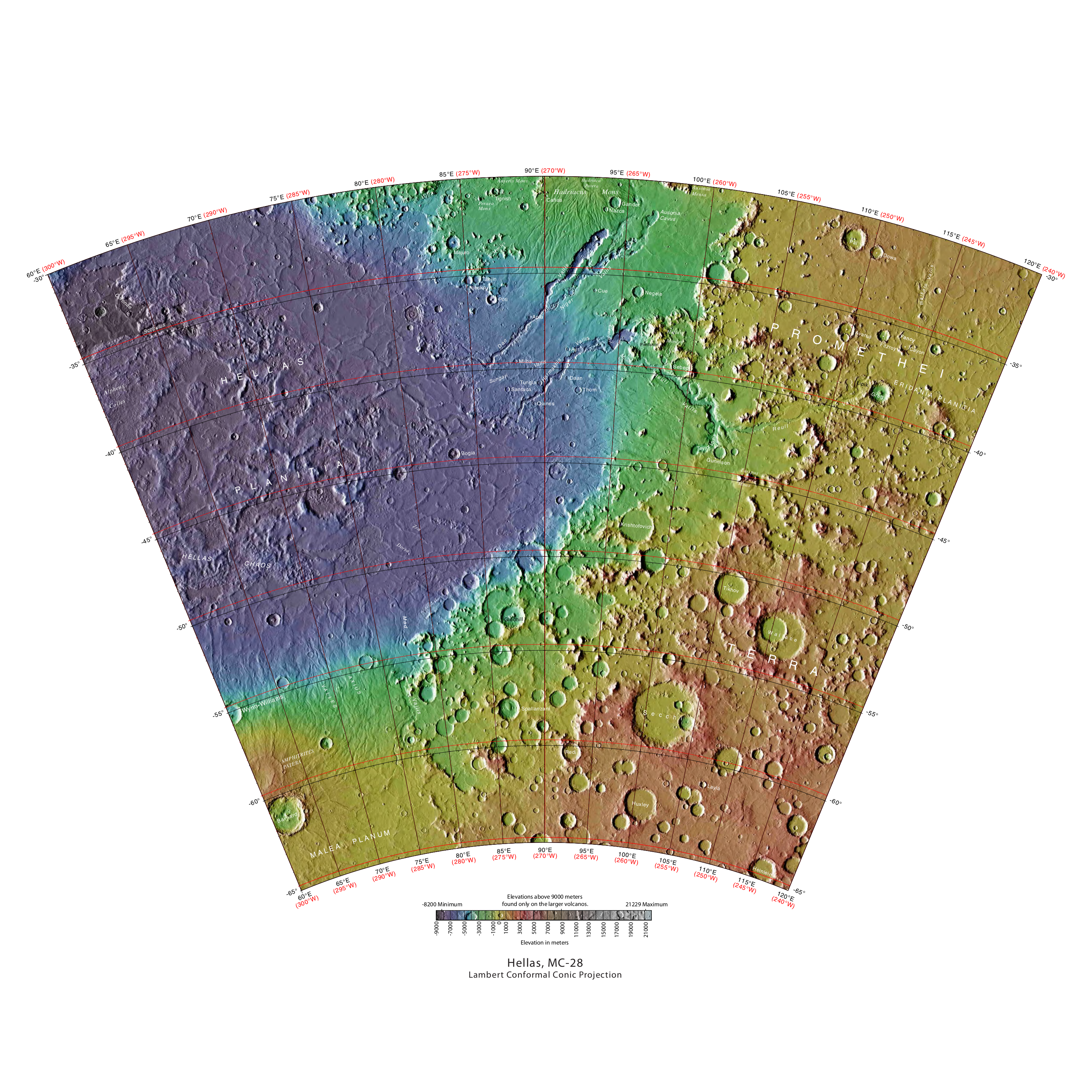
English: MOLA Topographic Map of Hellas Quadrangle (MC-28) on the planet Mars. NOTE: Converted the original PDF file to a PNG File (via GIMP v2.8.4 program) - and uploaded to Wikimedia Commons. |
| Date | 08/27/2012 09:23:30 AM |
| Source | http://planetarynames.wr.usgs.gov/images/mc28_mola.pdf |
| Author | USGS (United States Geological Survey) |
Licensing
This image is in the public domain in the United States because it only contains materials that originally came from the United States Geological Survey, an agency of the United States Department of the Interior. For more information, see the official USGS copyright policy.
|
File history
Click on a date/time to view the file as it appeared at that time.
| Date/Time | Thumbnail | Dimensions | User | Comment | |
|---|---|---|---|---|---|
| current | 13:13, 17 May 2013 | | 2,999 × 2,999 (7.79 MB) | Drbogdan | User created page with UploadWizard |
File usage
The following 2 pages use this file:


