File:Marspedialanders.png

Size of this preview: 800 × 314 pixels. Other resolutions: 320 × 126 pixels | 1,348 × 529 pixels.
Original file (1,348 × 529 pixels, file size: 435 KB, MIME type: image/png)
Summary
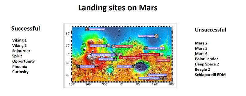
Topographic map showing landing site of successful and unsuccessful missions
Image credit: NASA/USGS/USGS Astrogeology Center/Secosky
Licensing
Public domain images are available for anybody to use without any licenses, royalties, or special permissions.
File history
Click on a date/time to view the file as it appeared at that time.
| Date/Time | Thumbnail | Dimensions | User | Comment | |
|---|---|---|---|---|---|
| current | 12:13, 27 April 2018 | 1,348 × 529 (435 KB) | Suitupandshowup (talk | contribs) | Topographic map showing landing site of successful and unsuccessful missions Image credit: NASA/USGS/USGS Astrogeology Center/Secosky |
You cannot overwrite this file.
File usage
The following page uses this file:


