Uploads by Ioneill
This special page shows all uploaded files.
| Date | Name | Thumbnail | Size | Description | Versions |
|---|---|---|---|---|---|
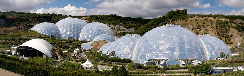
| 23:29, 16 December 2007 | Eden project.jpg (file) |  |
73 KB | :Image credit: [http://commons.wikimedia.org/wiki/User:J%C3%BCrgenMatern Jürgen Matern] :Source: http://en.wikipedia.org/wiki/Image:Eden_Project_geodesic_domes_panorama.jpg ===Description=== Panoramic view of the geodesic dome structures of the Eden Pro | 1 |
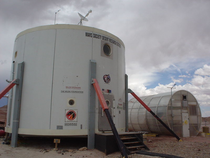
| 19:26, 15 December 2007 | Mdrs.jpg (file) |  |
55 KB | Mars Desert Research Station (MDRS) front entry and greenhab. :Credit: McKay Salisbury :Source: http://en.wikipedia.org/wiki/Image:DSC01694.jpg | 1 |
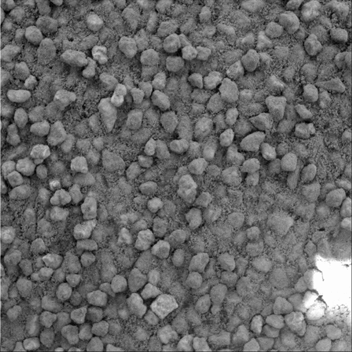
| 20:49, 7 December 2007 | Cliffhanger Sand.png (file) |  |
179 KB | ===Description=== A basic tenet of sedimentology, the field of geology that studies sedimentary processes, is that the farther a piece of rock travels from its source, the smaller and rounder in shape it becomes as the materials suffer impacts with other | 1 |
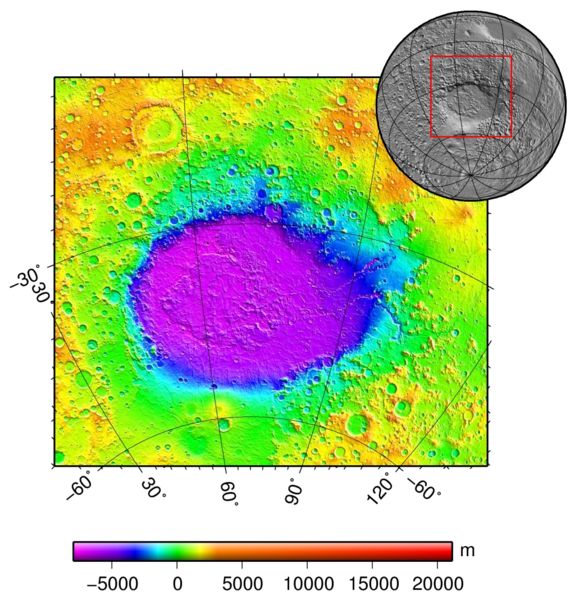
| 14:55, 7 December 2007 | Hellas basin.jpg (file) |  |
77 KB | ===Description=== Hellas basin (Mars) topography using the Mars Orbiter Laser Altimeter (MOLA) instrument on the Mars Global Surveyor orbiter. :Image credit: Martin Pauer (http://commons.wikimedia.org/wiki/User:Power) :Source: http://en.wikipedia.or | 1 |
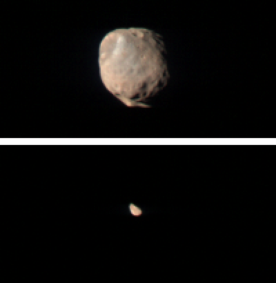
| 00:14, 28 November 2007 | Mro moons.png (file) |  |
41 KB | Two images of Phobos and Deimos taken by the Compact Reconnaissance Imaging Spectrometer for Mars (CRISM) instrument on the Mars Reconnaissance Orbiter on Nov 27, 2007. ===Text from release notes:=== These two images taken by the Compact Reco | 1 |
| 13:10, 27 November 2007 | Asteroids.png (file) |  |
344 KB | The inner Solar System, from the Sun to Jupiter. Also includes the Main Asteroid Belt (the white donut-shaped cloud), the Hildas (the orange "triangle" just inside the orbit of Jupiter) and the Jovian Trojans (green). The group that leads Jupiter are call | 1 |
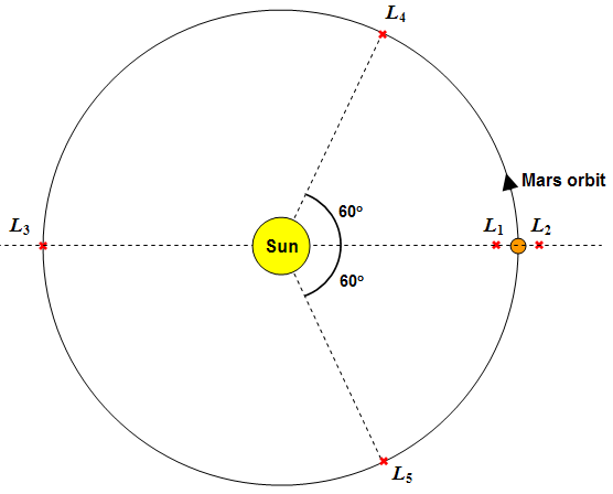
| 22:02, 26 November 2007 | Lagrange.png (file) |  |
24 KB | The gravitationally stable points for the Mars-Sun system. The Lagrange points L<sub>1</sub> to L<sub>5</sub> are listed. :Image created by ~~~ category:Images | 1 |
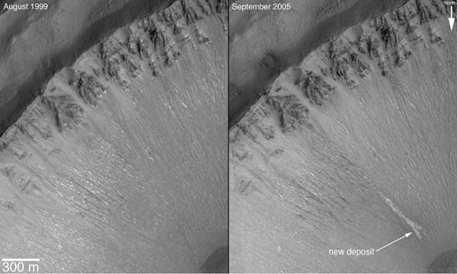
| 22:02, 24 November 2007 | Water deposit.jpg (file) |  |
30 KB | :Source: http://mars.jpl.nasa.gov/mgs/newsroom/20061206a.html :Credit: NASA/JPL ===Image description=== (Text taken directly from source) This set of images shows a comparison of the gully site as it appeared on Dec. 22, 2001 (left), with a mosaic of tw | 1 |
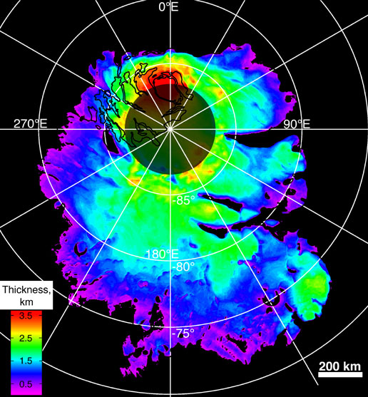
| 21:59, 24 November 2007 | MARSIS.jpg (file) |  |
99 KB | :Source: http://www.nasa.gov/mission_pages/mars/images/pia09224.html :Credit: NASA/JPL/ASI/ESA/Univ. of Rome/MOLA Science Team/USGS ===Image description=== (Text taken directly from source) This map shows the thickness of the south polar layered deposit | 1 |
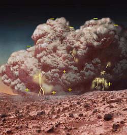
| 17:01, 24 November 2007 | Elec dust storm.jpg (file) |  |
14 KB | An artists impression of a martian dust storm exhibiting electrical discharge. :Credit: NASA :Source: http://www.berkeley.edu/news/media/releases/2006/07/31_peroxide.shtml category:Images | 1 |
| 13:37, 21 November 2007 | Red ring.png (file) |  |
874 bytes | This ring should be placed at the top of an article when it is featured on the Marspedia front page. Refer to Template:Featured_red_ring for (restricted use) of the graphic. :Credit: ~~~~ category:Images category:Templates | 1 |
| 20:22, 20 November 2007 | Mgs orbiter.jpg (file) |  |
193 KB | An artists impression of the NASA Mars Global Surveyor in orbit around the Red Planet. :credit: NASA category:Image | 1 |


