File list
This special page shows all uploaded files.
| Date | Name | Thumbnail | Size | User | Description | Versions |
|---|---|---|---|---|---|---|
| 14:12, 11 September 2020 | 2017 TMS Conv Art.jpg (file) |  |
389 KB | Frank C | 1 | |
| 14:12, 11 September 2020 | 2017 TMS Conv Sched.pdf (file) | 318 KB | Frank C | 1 | ||
| 14:12, 11 September 2020 | 2018 TMS Conv Art.jpg (file) |  |
373 KB | Frank C | 1 | |
| 14:13, 11 September 2020 | 2018 TMS Conv Sched.pdf (file) | 338 KB | Frank C | 1 | ||
| 14:14, 11 September 2020 | 2019 TMS Conv Art.jpg (file) |  |
480 KB | Frank C | 1 | |
| 14:14, 11 September 2020 | 2019 TMS Conv Sched.pdf (file) | 1.28 MB | Frank C | 1 | ||
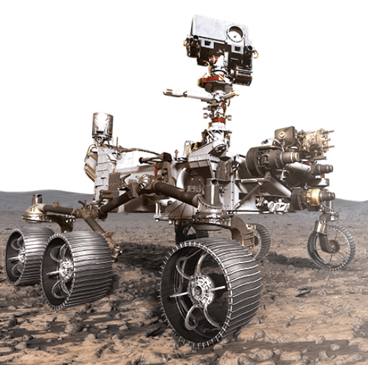
| 17:07, 3 July 2020 | 2020RoverArtistsConception.png (file) |  |
419 KB | Jburk | Mars 2020 Perseverance Rover artists conception. (NASA) | 1 |
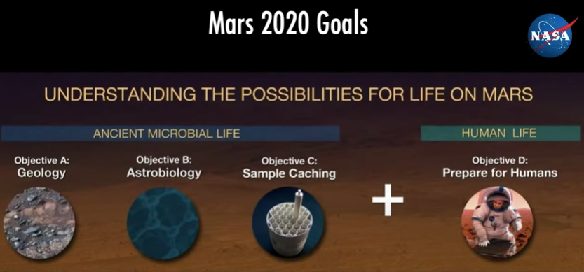
| 17:07, 3 July 2020 | 2020RoverGoals.png (file) |  |
365 KB | Jburk | Image 4: Mars 2020 Perseverance Rover Goals. (NASA) | 1 |
| 14:14, 11 September 2020 | 2020 TMS Conv Art.jpg (file) |  |
209 KB | Frank C | 1 | |
| 12:08, 12 June 2022 | 2021 TMS Conv Art.jpg (file) |  |
78 KB | Jburk | 1 | |
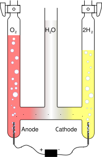
| 13:05, 16 March 2010 | 209px-Hofmann voltameter.fr.version.svg.png (file) |  |
13 KB | Rfc | Source: http://en.wikipedia.org/wiki/File:209px-Hofmann_voltameter.fr.version.svg.png Terms of the ''GNU Free Documentation License apply''. | 1 |
| 10:38, 15 February 2019 | 22280 PIA22959windshield.jpg (file) |  |
160 KB | Suitupandshowup | InSight Deploys Its Wind and Thermal Shield on its seismometer Source: https://mars.nasa.gov/insight/multimedia/images/?page=0&per_page=25&order=pub_date+desc&search=&category=51%3A183&fancybox=true&url_suffix=%3Fsite%3Dinsight Credit: NASA/ | 1 |
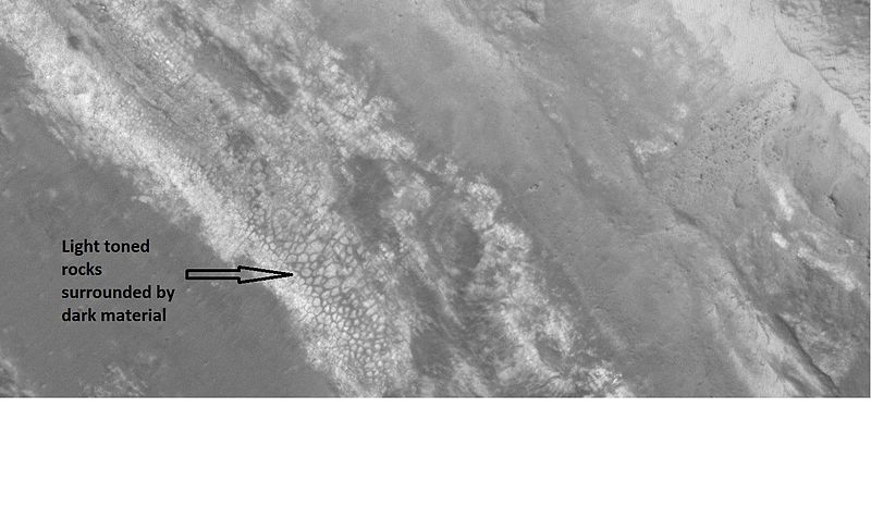
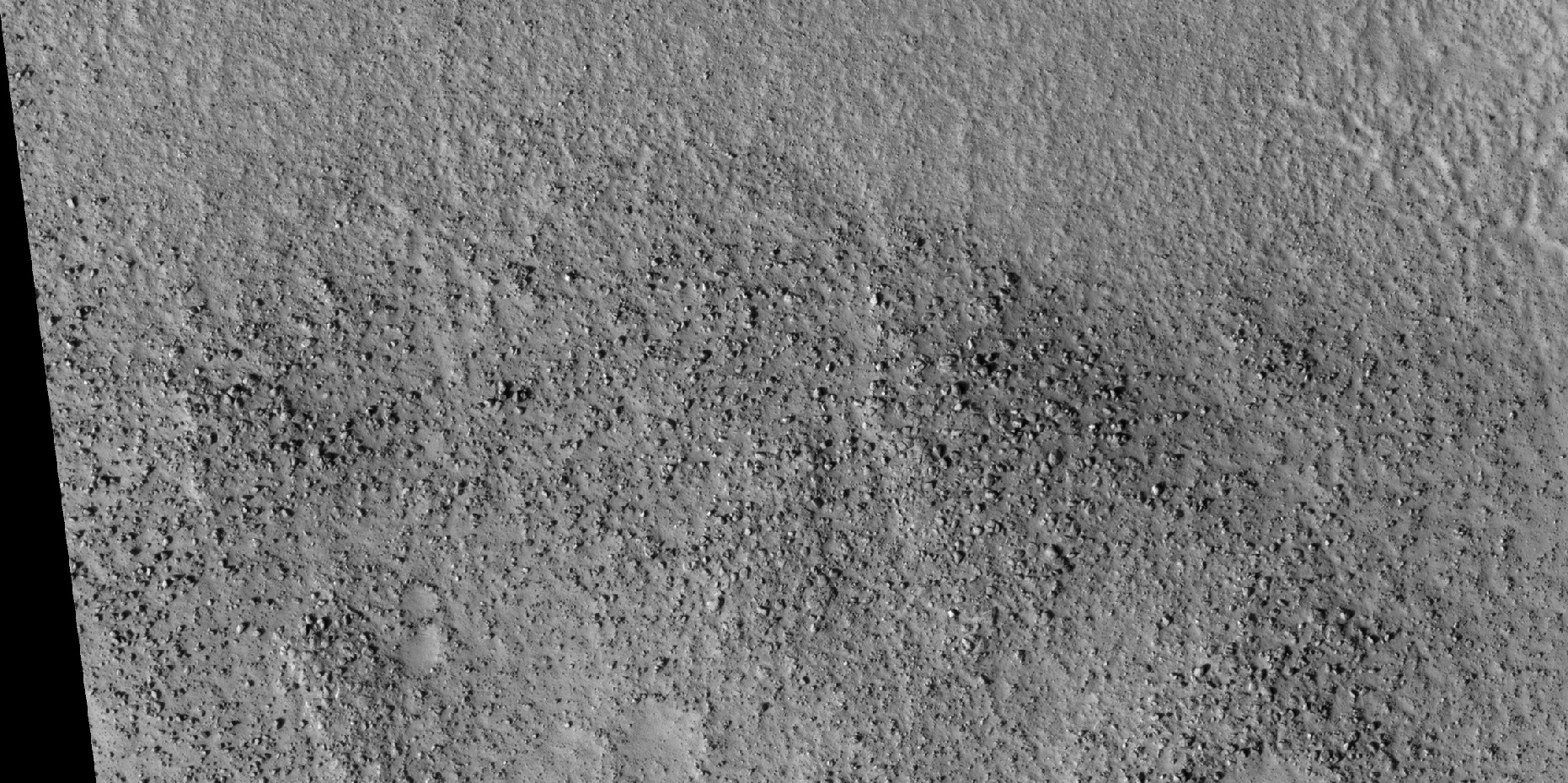
| 10:57, 17 January 2019 | 23659largecellslightdark.jpg (file) |  |
54 KB | Suitupandshowup | Surface near wall of crater in Oxia Palus quadrangle, located at 17.1 N and 217.3 E. Photo by hirise under HiWish program. Source http://hirise.lpl.arizona.edu/ESP_023659_1975 Image credit: NASA/JPL/University of Arizona/ | 1 |
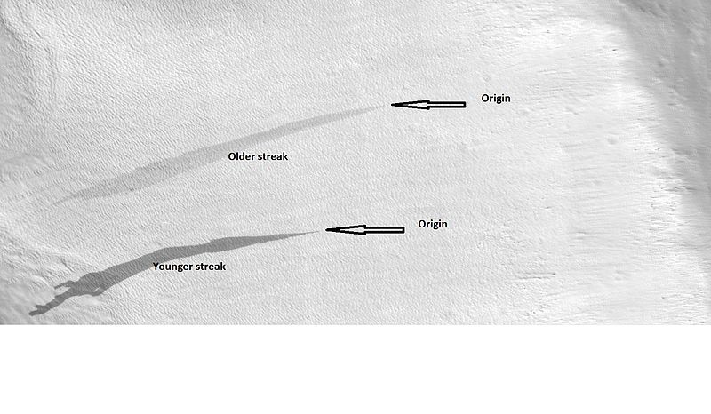
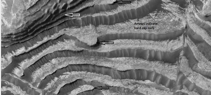
| 10:43, 12 September 2018 | 23677streakslabeled.jpg (file) |  |
64 KB | Suitupandshowup | Labeled view of streaks showing origins and relative age, as seen by HiRISE under HiWish program Location at 33.9N and 48.9 E in the Diacria quadrangle. Source: http://hirise.lpl.arizona.edu/ESP_023677_2140 Image credit: NASA/JPL/University of A... | 1 |
| 22:04, 28 July 2019 | 244 days.jpg (file) |  |
125 KB | Michel Lamontagne | 1 | |
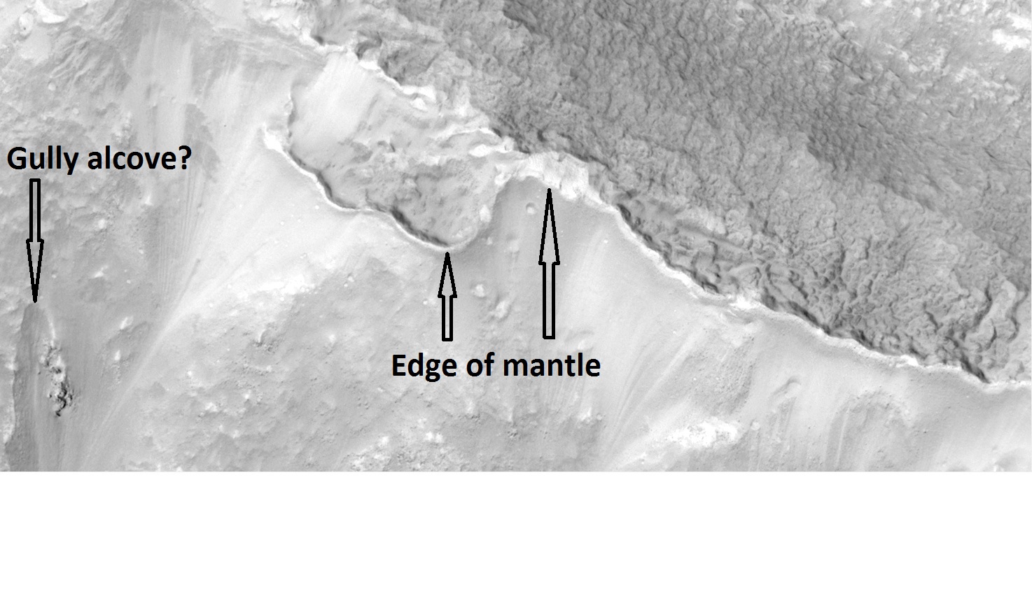
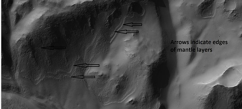
| 13:14, 6 January 2019 | 24589mantle.jpg (file) |  |
299 KB | Suitupandshowup | Layers in mantle as seen by hirise under HiWish program. Location is 37.5 N and 159.2 E. Source http://hirise.lpl.arizona.edu/ESP_024589_2180 Image Credit: NASA/JPL/University of Arizona/Secosky | 1 |
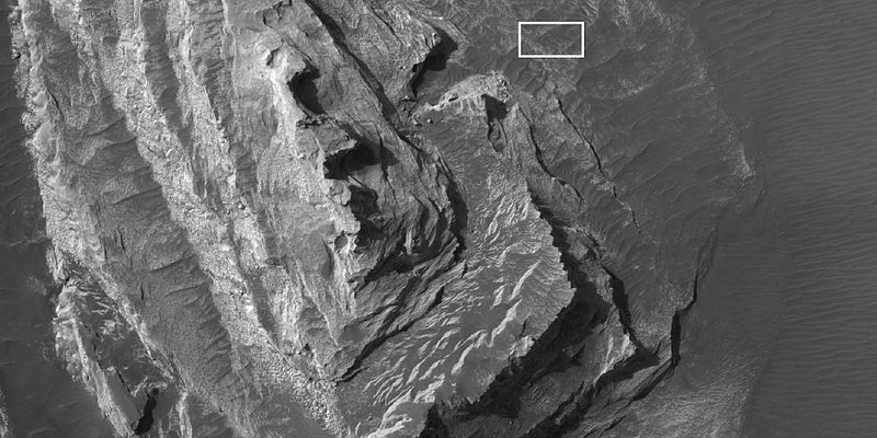
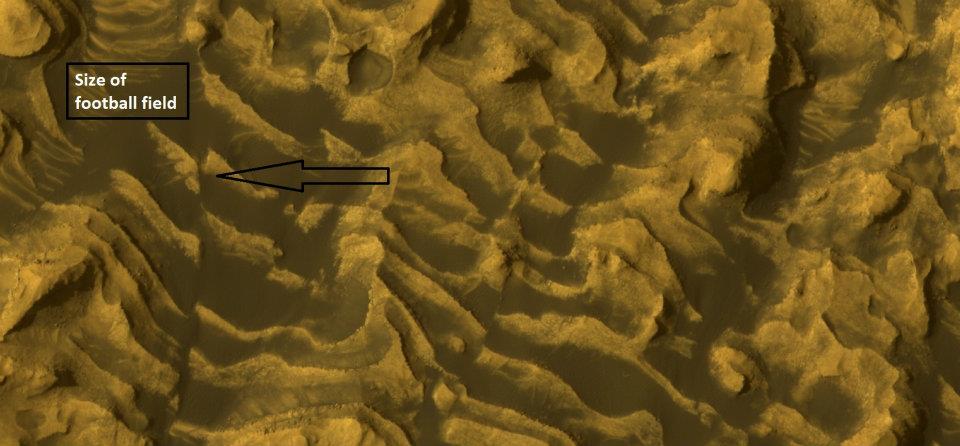
| 10:16, 15 March 2018 | 24807whitebuttei.jpg (file) |  |
75 KB | Suitupandshowup | White butte in Margartifer Sinus quadrangle, as seen by HiRISE under HiWish program Box shows size of a football field. Source: http:hirise.lpl.arizona.edu/ESP_024807_1755 Picture credit: NASA/JPL/University of Arizona/Secosky | 1 |
| 09:25, 22 January 2019 | 24943straightedgeshadows.jpg (file) |  |
52 KB | Suitupandshowup | Enlarged view of valleys, as seen by hirise, under HiWish program. Location is 54.3 N and 212 E. Source http://hirise.lpl.arizona.edu/ESP_024943_2345 Image credit: NASA/JPL/University of Arizona/Secosky | 1 |
| 09:28, 22 January 2019 | 24943straightedgeshawodsclose.jpg (file) |  |
46 KB | Suitupandshowup | Extreme close up of straight edged valleys, as seen by hirise, under HiWish program. Location is 54.3 N and 212 E. Source http://hirise.lpl.arizona.edu/ESP_024943_2345 Image credit: NASA/JPL/University of Arizona/Secosky | 1 |
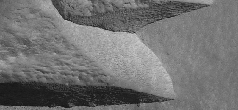
| 07:47, 2 April 2018 | 2509mantlelayers.jpg (file) |  |
46 KB | Suitupandshowup | Layers in mantle, as seen by hirise under HiWish program. Location is 33.6 S and 169.7 E. Source: http://hirise.lpl.arizona.edu/ESP_025090_1460 Image credit: NASA/JPL/University of Arizona | 1 |
| 16:20, 27 February 2020 | 25174 2245ribscolor.jpg (file) |  |
232 KB | Suitupandshowup | Close color view of ribbed terrain, as seen by HiRISE under HiWish program Source: http://hirise.lpl.arizona.edu/ESP_025174_2245 Image credit: NASA/JPL/University of Arizona/Secosky | 1 |
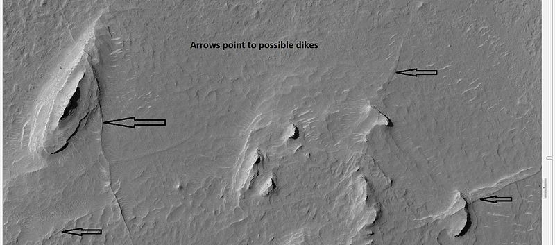
| 13:28, 17 January 2019 | 25558dikes.jpg (file) |  |
54 KB | Suitupandshowup | Buttes and dikes, as seen by hirise, under HiWish program. Location is 6.9 N and 348.6 E. Source http://hirise.lpl.arizona.edu/ESP_025558_1870 Image credit: NASA/JPL/University of Arizona/Secosky | 1 |
| 13:06, 27 February 2020 | 25755 2185concentriccracksvolcano.jpg (file) |  |
131 KB | Suitupandshowup | Concentric fractures formed by a volcano erupting under ice. Picture taken with HiRISE under HiWish program Source: http://hirise.lpl.arizona.edu/ESP_25755_2185 Image credit is NASA/JPL/University of Arizona. | 1 |
| 13:07, 27 February 2020 | 25755 2200collapsevolcanoclose.jpg (file) |  |
122 KB | Suitupandshowup | Close view of concentric fractures formed by a volcano erupting under ice. Picture taken with HiRISE under HiWish program Source: http://hirise.lpl.arizona.edu/ESP_25755_2185 Image credit is NASA/JPL/University of Arizona/Secosky. | 1 |
| 13:08, 27 February 2020 | 25755 2200volcano2.jpg (file) |  |
119 KB | Suitupandshowup | Close view of concentric fractures formed by a volcano erupting under ice. Picture taken with HiRISE under HiWish program Source: http://hirise.lpl.arizona.edu/ESP_25755_2185 Image credit is NASA/JPL/University of Arizona/Secosky. | 1 |
| 16:50, 26 February 2018 | 26055cratermesaswide.jpg (file) |  |
151 KB | Suitupandshowup | Wide view of ring-mold craters, as seen by HiRISE under HiWish program Source: http://hirise.lpl.arizona.edu/ESP_026055_1445 | 1 |
| 16:52, 26 February 2018 | 26055ringmoldcrater.jpg (file) |  |
198 KB | Suitupandshowup | Close view of ring mold crater, as seen by HiRISE under HiWish program Source: http://hirise.lpl.arizona.edu/ESP_026055_1445 | 1 |
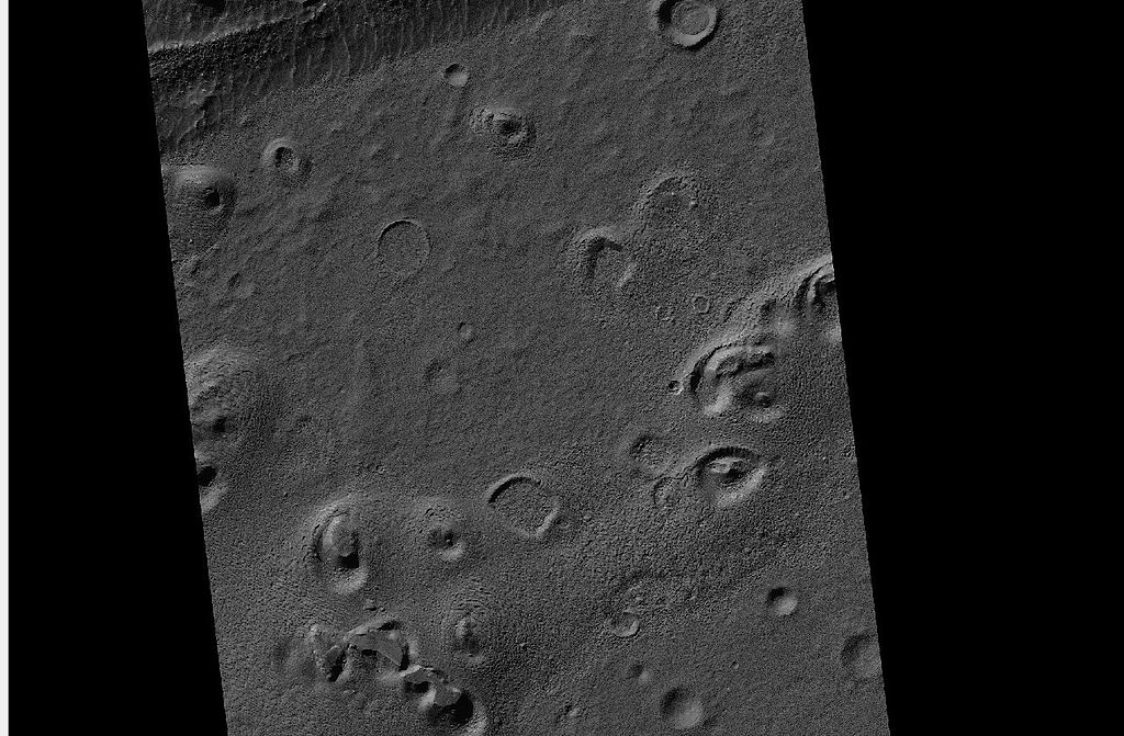
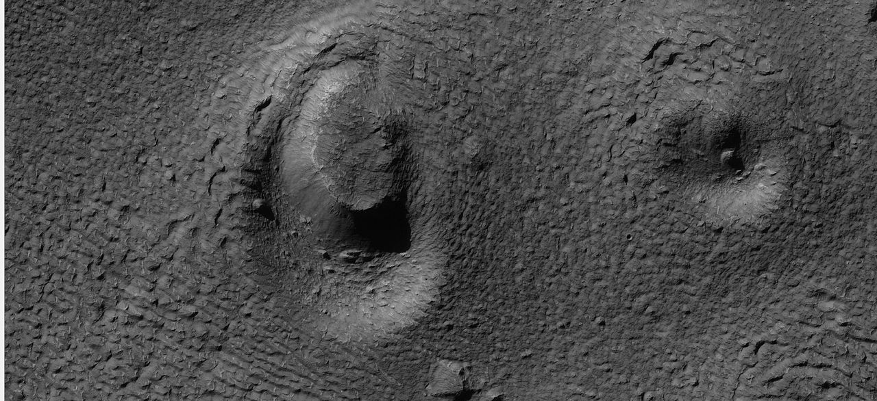
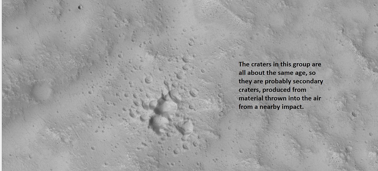
| 09:05, 2 April 2018 | 26079secondaries.jpg (file) |  |
49 KB | Suitupandshowup | Example of a group of secondary craters, as seen by hirise under HiWish program. Location is 30.1 N and 162.6 E. Source=http://hirise.lpl.arizona.edu/ESP_026079_2105 Image credit: NASA/JPL/University of Arizona | 1 |
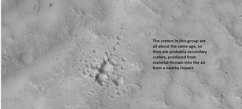
| 19:56, 5 January 2019 | 26079secondariescebrenia.jpg (file) |  |
117 KB | Suitupandshowup | Example of a group of secondary craters, as seen by hirise under HiWish program. Location is 30.1 N and 162.6 E. Source Source=http://hirise.lpl.arizona.edu/ESP_026079_2105 Image credit: NASA/JPL/University of Arizona/Secosky | 1 |
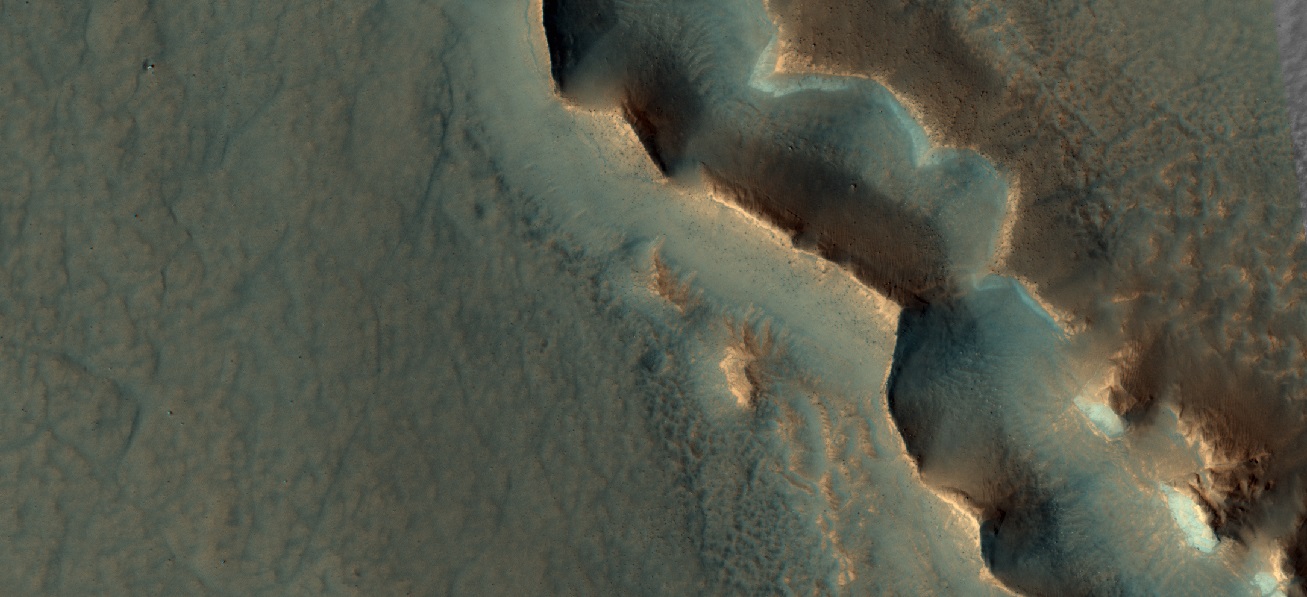
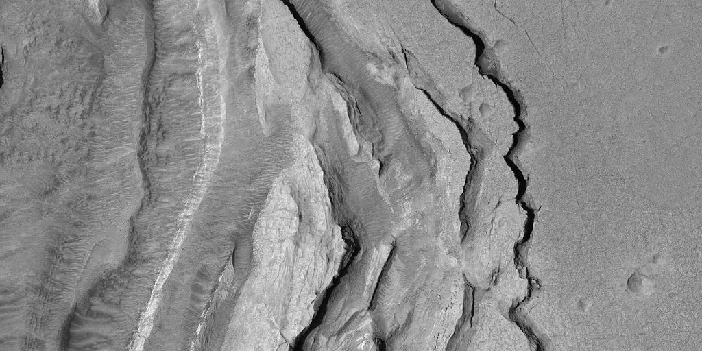
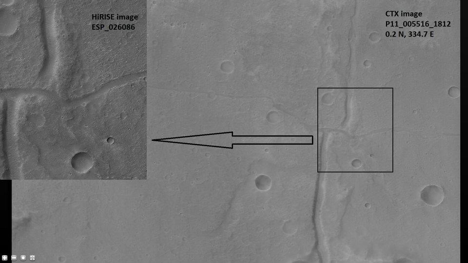
| 07:50, 7 April 2020 | 26086 1800fault.jpg (file) |  |
54 KB | Suitupandshowup | Strike-slip fault in Hydaspis Chaos. Location is 0.2 N and 334.7 E (ESP_026086_1800). Background image is CTX image P11_005516_1812. Source: http://hirise.lpl.arizona.edu/ESP_ 26086_1800 Image credit is NASA/JPL/University of Arizona. Image credit is NASA/JPL-Caltech/Malin Space Science Systems for CTX image. | 1 |
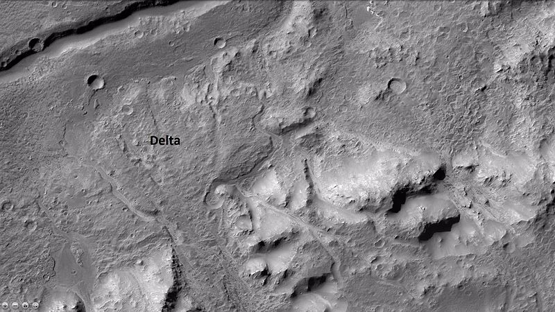
| 09:44, 16 November 2018 | 26126contextb22 018333 1548delta.jpg (file) |  |
104 KB | Suitupandshowup | Wide view of delta in holden crater as seen by ctx Source http://viewer.mars.asu.edu/planetview/inst/ctx/B22_018333_1548_XI_25S033W#P=B22_018333_1548_XI_25S033W&T=2 Image credit: NASA/Malin Space Science Systems | 1 |
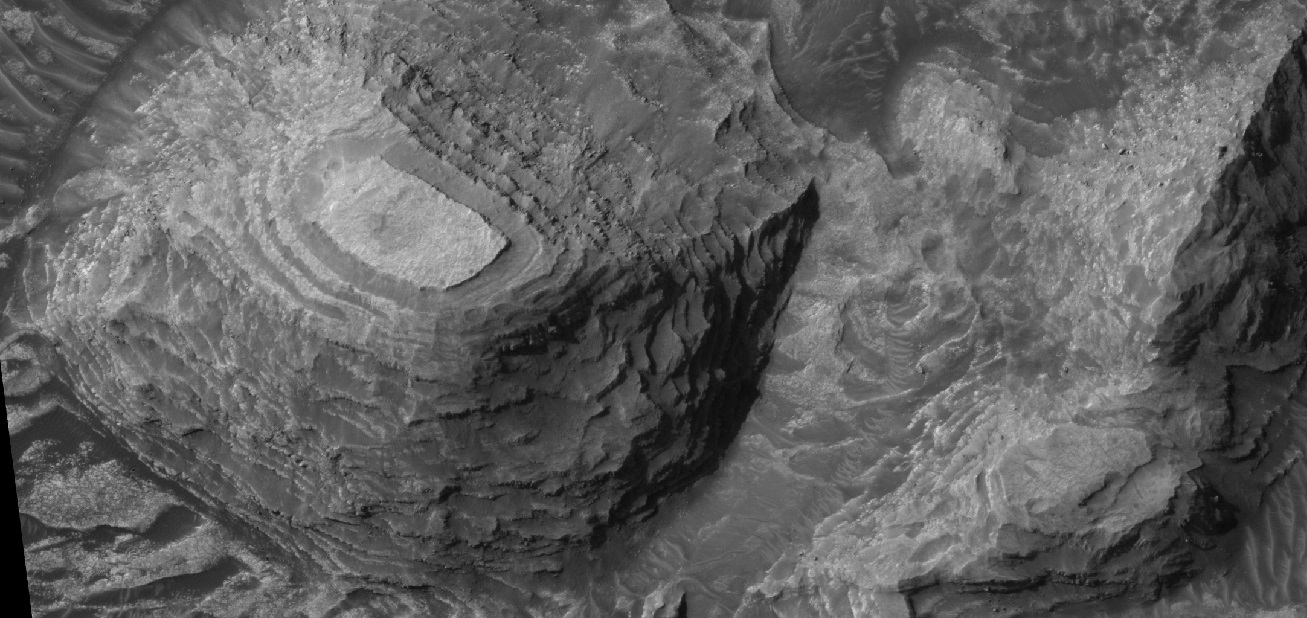
| 10:41, 11 April 2019 | 26270 1820layers3.jpg (file) |  |
299 KB | Suitupandshowup | Layered mesa in Firsoff Crater, as seen by HiRISE under HiWish program This is a stereo photo with ESP_026270_1820. | 1 |
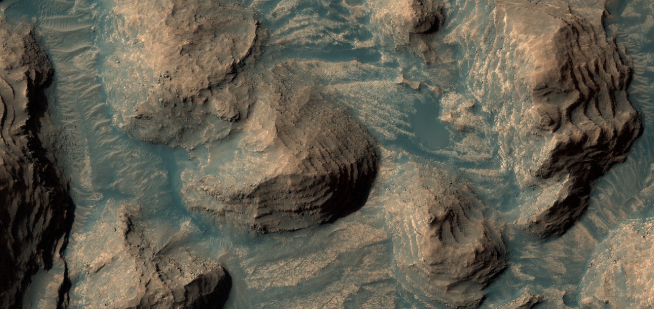
| 06:49, 10 April 2019 | 26270 1820layerscolor.jpg (file) |  |
321 KB | Suitupandshowup | Layers The dark areas are probably basalt sand. Location is Firsoff Crater, western Arabia Terra in the Oxia Palus quadrangle at 2.163 N and 350.961 E (ESP_027747_1820). This is a stereo image with ESP_026270_1820). Two images were taken at slightly di... | 1 |
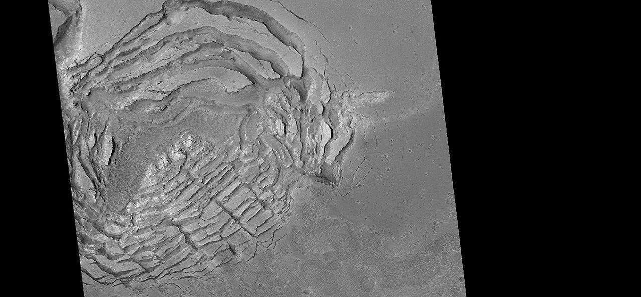
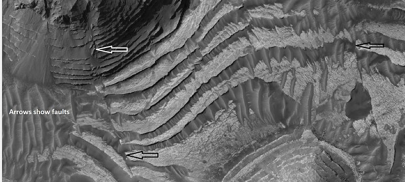
| 10:21, 16 January 2019 | 26270faultsfirsoff.jpg (file) |  |
70 KB | Suitupandshowup | Faults in layered materials, as seen by hirise under HiWish program. Location is Firsoff Crater Date 5/7/12 Source Source=http://hirise.lpl.arizona.edu/ESP_026270_1820 Image credit: NASA/JPL/University of Arizona/Secosky | 1 |
| 10:05, 16 January 2019 | 26270layersclosearrows.jpg (file) |  |
63 KB | Suitupandshowup | Wide view of layers in Firsoff Crater Picture was taken by HiRISE under HiWish program. Location is 2.2 N and 351 E. Source Source=http://hirise.lpl.arizona.edu/ESP_026270_1820 Image credit: NASA/JPL/University of Arizona/Secosky | 1 |
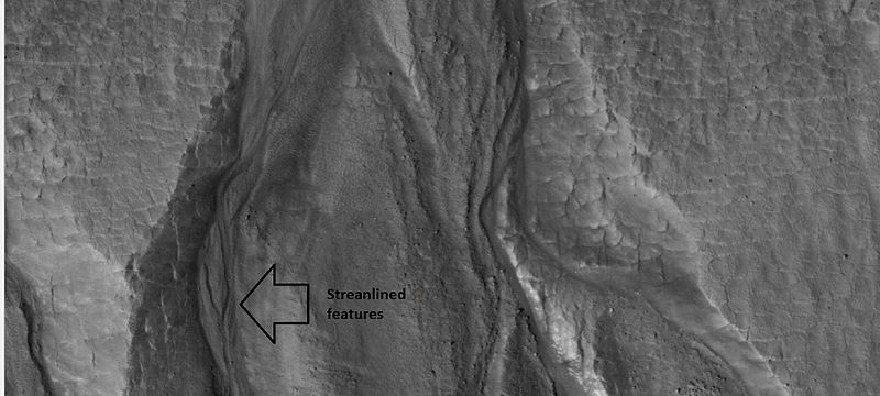
| 15:19, 1 June 2018 | 26420gulliesclose.jpg (file) |  |
52 KB | Suitupandshowup | Close-up of gullies, as seen by hirise under HiWish program. Location is 55.8 N and 208.1 E. Arrow points to streamlined features. Source: http://hirise.lpl.arizona.edu/ESP_026420_2360 Image credit: NASA/JPL/University of Arizona/Secosky | 1 |
| 09:39, 22 January 2019 | 26420gullieswide.jpg (file) |  |
66 KB | Suitupandshowup | Wide view of group of gullies in crater, as seen by HiRISE under HiWish program. Location is 55.8 N and 208.1 E. Source http://hirise.lpl.arizona.edu/ESP_026420_2360 Image credit: NASA/JPL/University of Arizona/Secosky | 1 |
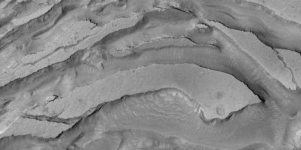
| 13:27, 6 February 2018 | 26997layersclose.jpg (file) |  |
88 KB | Suitupandshowup | Close view of layers in north wall of Valles Marineris, as seen by HiRISE under HiWish program | 1 |
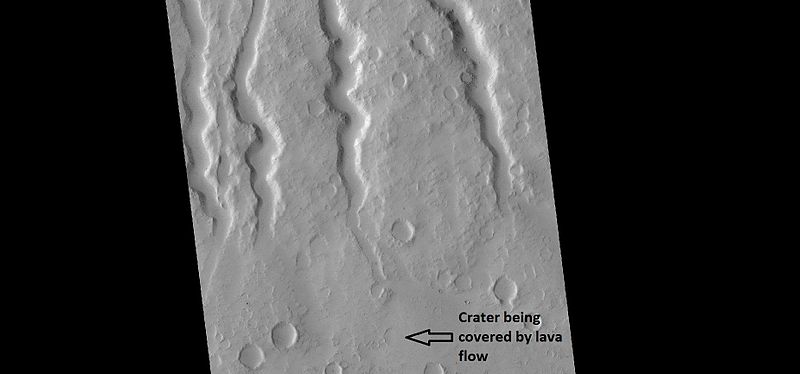
| 09:13, 15 February 2018 | 27108hecatechannels.jpg (file) |  |
28 KB | Suitupandshowup | Lava channels on Hecates Tholus, as seen by HiRISE under HiWish program Author: Jim Secosky Source: Source http://hirise.lpl.arizona.edu/ESP_027108_2110 Image Credit: Credit:NASA/JPL/University of Arizona | 1 |
| 17:59, 21 February 2020 | 27615 1880faults.jpg (file) |  |
63 KB | Suitupandshowup | Faults, as seen by HiRISE under HiWish program Source: http://hirise.lpl.arizona.edu/ESP_027615_1880 Image credit: NASA/JPL/University of Arizona | 1 |
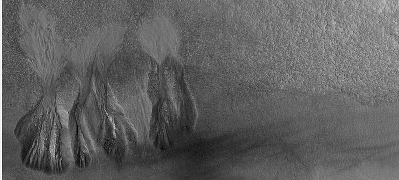
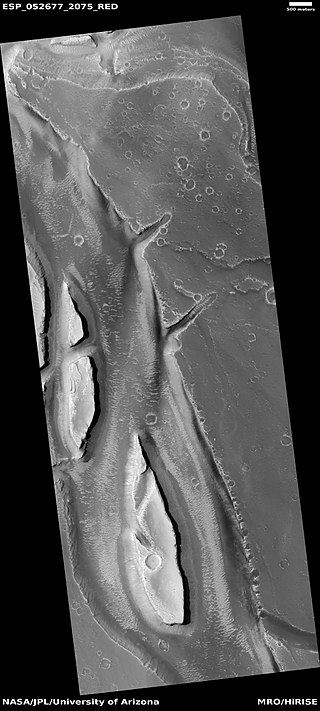
| 08:53, 22 October 2018 | 27657392 10211535607485206 6751244250901339355 nstreamlined.jpg (file) |  |
44 KB | Suitupandshowup | Streamlined features in channel The location is the Elysium quadrangle at 27.4° N and 135.7 E(ESP_052677_2075). Image credit is NASA/JPL/University of Arizona. Source: http://hirise.lpl.arizona.edu/ESP_052677_2075 | 1 |
| 12:09, 23 February 2020 | 28207 2250cratermesa.jpg (file) |  |
79 KB | Suitupandshowup | Layered mesa in crater, as seen by HiRISE under HiWish program Source: http://hirise.lpl.arizona.edu/ESP_028207_2250 Image credit: NASA/JPL/University of Arizona | 1 |
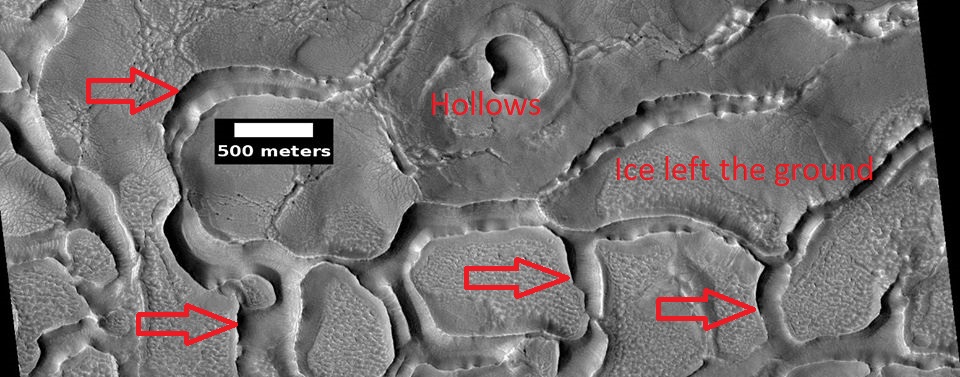
| 17:50, 21 February 2020 | 28207 2250hollowsarrows.jpg (file) |  |
141 KB | Suitupandshowup | Hollows, as seen by HiRISE under HiWish program Source: http://hirise.lpl.arizona.edu/ESP_028207_2250 Image credit: NASA/JPL/University of Arizona | 1 |
| 11:05, 27 February 2020 | 28339 2245ribbbed.jpg (file) |  |
50 KB | Suitupandshowup | Ribbed terrain Small cracks become larger and larger because the more surface area the more sublimation. Source: http://hirise.lpl.arizona.edu/ESP_028339_2245 Lat: 44° N Long: 26.2°E Image credit: NASA/JPL/University of Arizona | 1 |
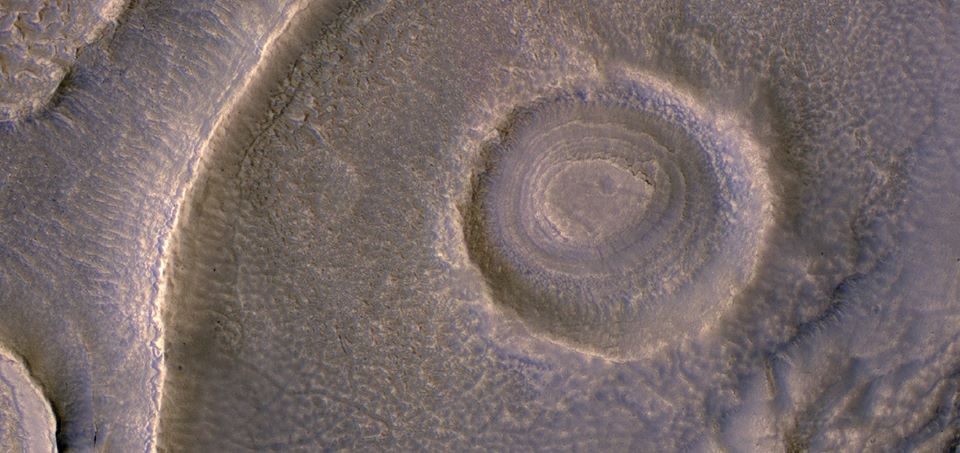
| 16:34, 21 February 2020 | 28415 1390sadfacecrater.jpg (file) |  |
83 KB | Suitupandshowup | Deposit in crater, as seen by HiRISE under HiWish program Source: http://hirise.lpl.arizona.edu/ESP_028415_1390 Image credit: NASA/JPL/University of Arizona | 1 |
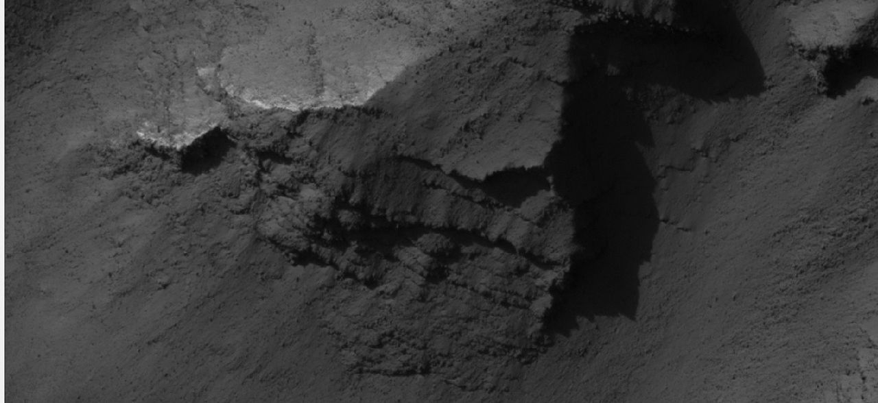
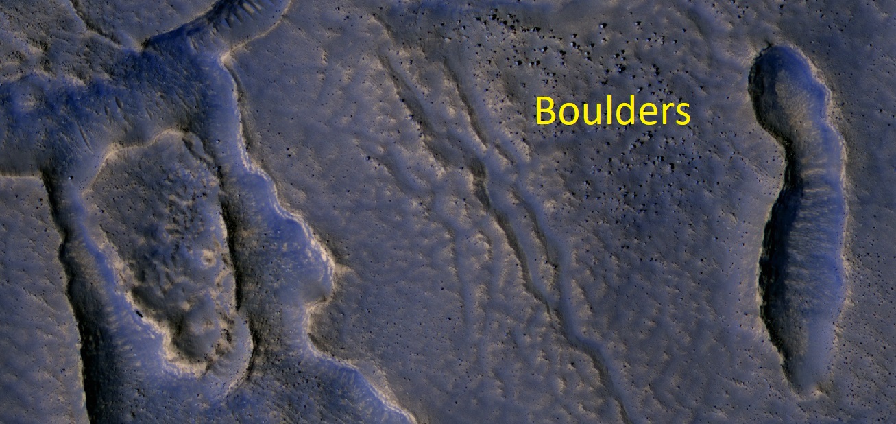
| 17:49, 21 February 2020 | 28497 2250boulderslabeled.jpg (file) |  |
313 KB | Suitupandshowup | Boulders, as seen by HiRISE under HiWish program Source: http://hirise.lpl.arizona.edu/ESP_028497_2250 Image credit: NASA/JPL/University of Arizona | 1 |
| 08:28, 27 September 2018 | 28537 2270tsunamisboulders.jpg (file) |  |
860 KB | Suitupandshowup | Boulders making up channels from previous image, as seen by HiRISE These boulders were carried by tsunamis Image credit: NASA/JPL/University of Arizona/Secosky Source: http://hirise.lpl.arizona.edu/ESP_028537_2270 | 1 |
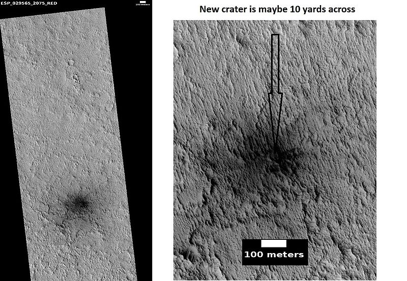
| 13:12, 30 March 2018 | 29565 2075newcratercomposite.jpg (file) |  |
138 KB | Suitupandshowup | Pictures of a new crater in Arabia, as seen by HiRISE under HiWish program Source: http://hirise.lpl.arizona.edu/ESP_029565_2075 Image credit: NASA/JPL/University of Arizona/Secosky | 1 |
| 13:55, 13 July 2019 | 300 kW wind turbine.jpg (file) |  |
226 KB | Michel Lamontagne | 1 | |
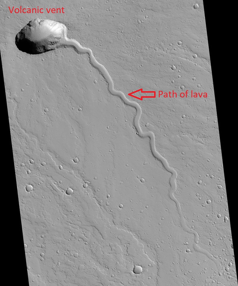
| 17:48, 21 February 2020 | 30348 1925vent2.jpg (file) |  |
181 KB | Suitupandshowup | Volcanic vent, as seen by HiRISE under HiWish program Source: http://hirise.lpl.arizona.edu/ESP_030348_1925 Image credit: NASA/JPL/University of Arizona | 1 |


