File list
This special page shows all uploaded files.
| Date | Name | Thumbnail | Size | User | Description | Versions |
|---|---|---|---|---|---|---|
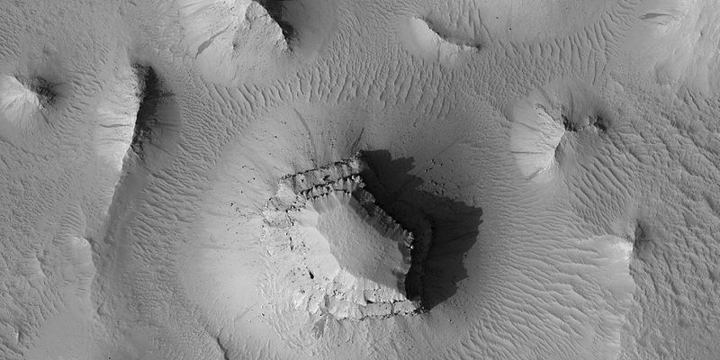
| 08:48, 29 January 2019 | Miyamoto Crater.JPG (file) |  |
34 KB | Suitupandshowup | Miyamoto Crater, as seen by hirise. The location is 3 degrees south latitude and 352.1 degrees east longitude. Image was taken by the Mars Reconnaissance Orbiter's HiRISE. The HiRISE camera was built by Ball Aerospace and Technology orporation and is o... | 1 |
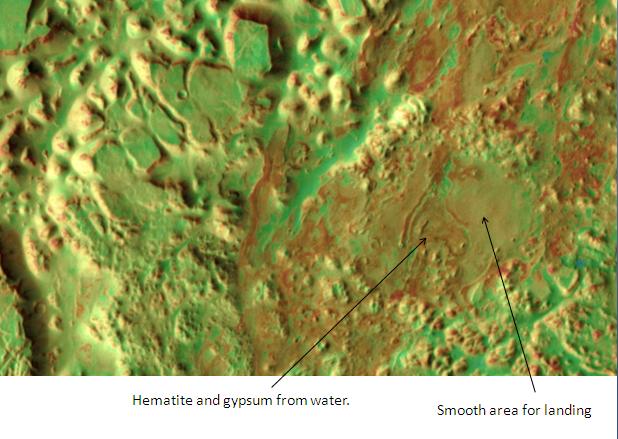
| 08:46, 29 January 2019 | Landing zone in Iani Chaos.JPG (file) |  |
51 KB | Suitupandshowup | Landing zone in Iani Chaos, as seen by themis. The picture is located at 1.9 degrees south latitude and 17.9 degrees west longitude. Resolution is 330 feet/pixel. Picture taken with Mars Odyssey's THEMIS. Photo credit NASA/JPL/ASU. Source http://the... | 1 |
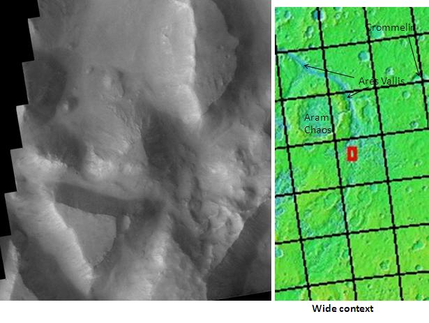
| 08:44, 29 January 2019 | Iani Chaos.JPG (file) |  |
44 KB | Suitupandshowup | Iani Chaos, as seen by Mars Odyssey's THEMIS. The location is 1.7 degrees south latitude and 341.6n degrees east longitude. Source http://themis.asu.edu/zoom-20051017a NASA/JPL/ASU, modified by Jim Secosky | 1 |
| 08:41, 29 January 2019 | Holden Crater Close-up.JPG (file) |  |
36 KB | Suitupandshowup | Holden Crater, Close-up of western rim, as seen by themis. Source http://themis.asu.edu/zoom-20090707a NASA/JPL/ASU | 1 |
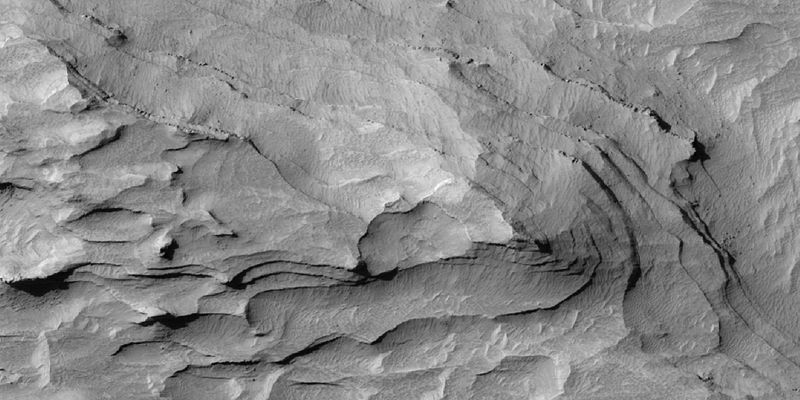
| 08:38, 29 January 2019 | 47633 1765layerswide.jpg (file) |  |
55 KB | Suitupandshowup | Layers in Margaritifer Sinus quadrangle, as seen by HiRISE under HiWish program Source http:hirise.lpl.arizona.edu/ESP_047633_1765 NASA/JPL/University of Arizona/Secosky | 1 |
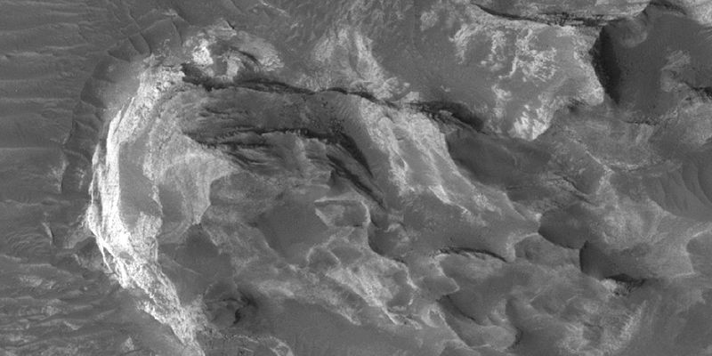
| 08:36, 29 January 2019 | 47633 1765layersclose.jpg (file) |  |
52 KB | Suitupandshowup | Layers in Margaritifer Sinus quadrangle, as seen by HiRISE under HiWish program Source http:hirise.lpl.arizona.edu/ESP_047633_1765 NASA/JPL/University of Arizona/Secosky | 1 |
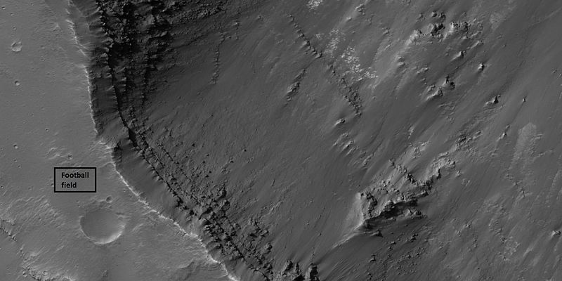
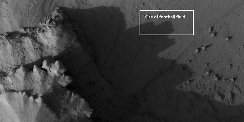
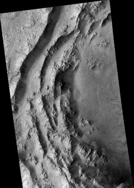
| 07:55, 29 January 2019 | 45075 1715layersclose.jpg (file) |  |
53 KB | Suitupandshowup | Layers in Aurorae Chaos in Margaritifer Sinus quadrangle, as seen by hirise under HiWish program Box shows size of football field. Source http://hirise.lpl.arizona.edu/ESP_045075_1715 NASA/JPL/ University of Arizona | 1 |
| 07:51, 29 January 2019 | 042055 1580layerswide.jpg (file) |  |
75 KB | Suitupandshowup | Wide view of layers, as seen by hirise under HiWish program Source http://hirise.lpl.arizona.edu/ESP_042055_1580 NASA/JPL/ University of Arizona | 1 |
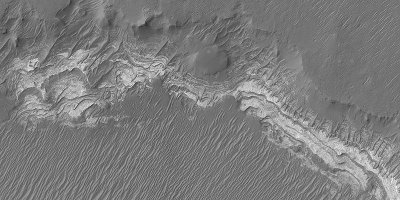
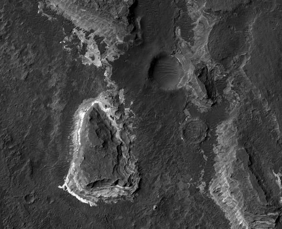
| 19:46, 28 January 2019 | ESP 028618 1760layers.jpg (file) |  |
43 KB | Suitupandshowup | Layered butte, as seen by hirse under HiWish program. Location is 3.895 S and 333.802 E. Source http://hirise.lpl.arizona.edu/ESP_028618_1760 NASA/JPL/University of Arizona/Secosky | 1 |
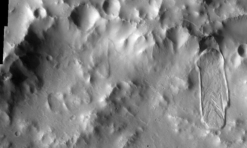
| 19:43, 28 January 2019 | Aureum Chaos from Themis.JPG (file) |  |
49 KB | Suitupandshowup | Aureum Chaos is a large crater that was filled with sediment after its formation. After the infilling of sediment, something occurred that caused the sediment to be broken up into large, slumped blocks and smaller knobs. Currently, it is believed that... | 1 |
| 19:40, 28 January 2019 | Canyons and Mesas of Aureum Chaos in Oxia Palus.JPG (file) |  |
37 KB | Suitupandshowup | Canyons and Mesas of Aureum Chaos in Oxia Palus. Loacation is 1.6 degrees south latitude and 26.8 degrees west longitude. This picture was taken by the Mars 2001 Odyssey Thermal Emission Imaging System (THEMIS). The picture credit is NASA/JPL/Arizona... | 1 |
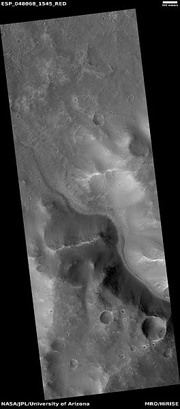
| 19:33, 28 January 2019 | ESP 048068 1545channel.jpg (file) |  |
24 KB | Suitupandshowup | Channel in Margaritifer Sinus quadrangle, as seen by HiRISE under HiWish program Source http://hirise.lpl.arizona.edu/ESP_047068_1545 NASA/JPL/University of Arizona | 1 |
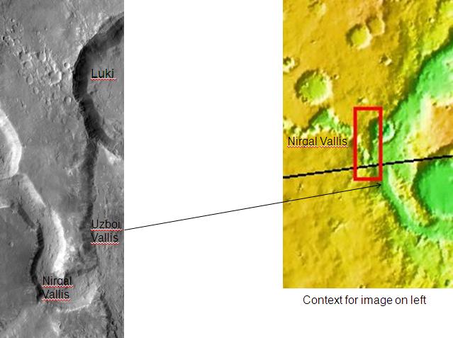
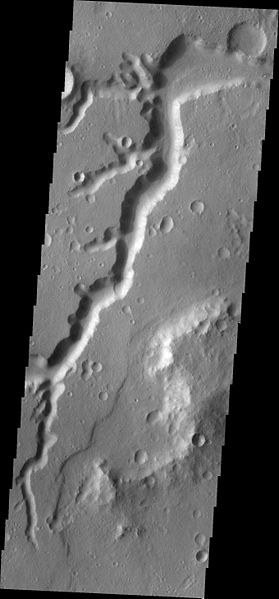
| 19:30, 28 January 2019 | Nirgal Vallis Close-up.JPG (file) |  |
77 KB | Suitupandshowup | Close-up of Nirgal Vallis, as seen by themis. Location is 27.6 S and 315.2 E. Image is 18.3 km wide. Source http://themis.asu.edu/zoom-20090706a Image credit: NASA/ASU | 1 |
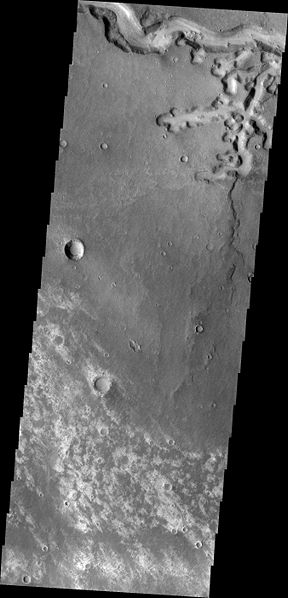
| 19:27, 28 January 2019 | Nirgal Valliswide.jpg (file) |  |
29 KB | Suitupandshowup | Nirgal Vallis, as seen by themis. Location is 27.6 S and 315.2 E. Image is 18.3 km wide. Source http://themis.asu.edu/zoom-20090706a Image Credit; NASA/ASU | 1 |
| 19:24, 28 January 2019 | Uzboi Vallis.JPG (file) |  |
40 KB | Suitupandshowup | Uzboi Vallis. Location is 29.7 degrees south latitude and 322.1 degrees east longitude. Picture taken with Mars Odyssey's THEMIS. Photo credit NASA/JPL/ASU. Source http:themis.asu.edu/zoom-20020409a NASA/JPL/University of Arizona | 1 |
| 19:20, 28 January 2019 | Ladon Valles.JPG (file) |  |
51 KB | Suitupandshowup | Ladon Valles layers, as seen by hirise. Location is 20.5 South and 330.1 East. Image was taken by the Mars Reconnaissance Orbiter's HiRISE. The HiRISE camera was built by Ball Aerospace and Technology Corporation and is operated by the University of Ar... | 1 |
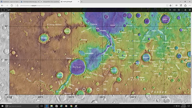
| 19:17, 28 January 2019 | Mapjonesmartopo.jpg (file) |  |
137 KB | Suitupandshowup | Topo map showing the location of Jones crater and other nearby features Source https://planetarynames.wr.usgs.gov/images/mc19_2014.pdf Image credit: NASA/USGS/Secosky | 1 |
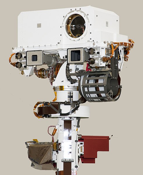
| 10:21, 28 January 2019 | 20110406 PIA13809 D2011 0404 D036 cropped-fullcuriosity.jpg (file) |  |
60 KB | Suitupandshowup | Top of Mars Rover Curiosity's Remote Sensing Mast The remote sensing mast on NASA Mars rover Curiosity holds two science instruments for studying the rover's surroundings and two stereo navigation cameras for use in driving the rover and planning rover... | 1 |
| 14:07, 27 January 2019 | PIA16768-MarsCuriosityRover-AeolisMons-20120920.jpg (file) | 16 KB | Suitupandshowup | PIA16768: Mount Sharp Panorama in White-Balanced Colors http://photojournal.jpl.nasa.gov/catalog/PIA16768 Target Name: Mars Is a satellite of: Sol (our sun) Mission: Mars Science Laboratory (MSL) Spacecraft: Curiosity Instrument: Mastcam Product Size:... | 1 | |
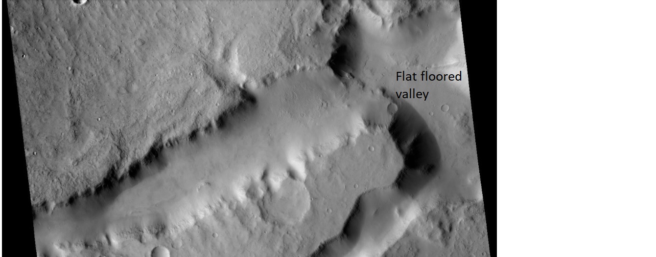
| 11:58, 27 January 2019 | Terrainneargale.jpg (file) |  |
138 KB | Suitupandshowup | Fretted terrain near Gale Crater Note the flat floored valley Source: http://viewer.mars.asu.edu/planetview/inst/ctx/G06_020568_1755_XI_04S217W#P=G06_020568_1755_XI_04S217W&T=2 NASA/MSSS | 1 |
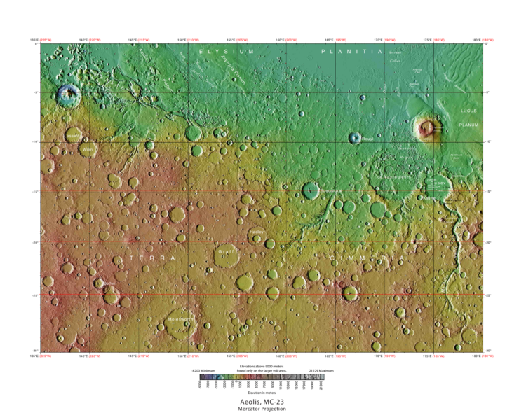
| 08:58, 26 January 2019 | USGS-Mars-MC-23-AeolisRegion-mola.png (file) |  |
664 KB | Suitupandshowup | MOLA Topographic Map of Aeolis Quadrangle (MC-23) on the planet Mars. NOTE: Converted the original PDF file to a PNG File (via GIMP v2.8.4 program) - and uploaded to Wikimedia Commons. Date 04/03/2013 11:52:31 AM Source http://planetarynames.wr.usgs.g... | 1 |
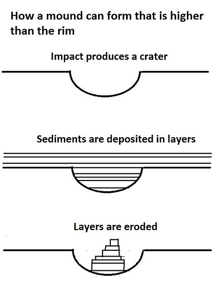
| 16:51, 25 January 2019 | Moundshighdiagram.jpg (file) |  |
24 KB | Suitupandshowup | Drawings showing how a mound can form in a crater on Mars that is higher than the rim. Date 12/1/11 Source Own work Author Jimmarsmars | 1 |
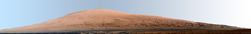
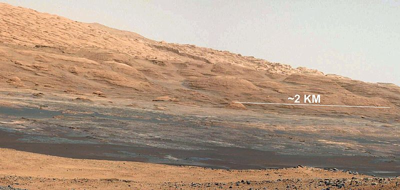
| 16:49, 25 January 2019 | PIA16068 - Mars Curiosity Rover - Aeolis Mons - 20120817.jpg (file) |  |
65 KB | Suitupandshowup | he Promised Land This image (cut out from a mosaic) shows the view from the landing site of NASA's Curiosity rover toward the lower reaches of Mount Sharp, where Curiosity is likely to begin its ascent through hundreds of feet (meters) of layered depos... | 1 |
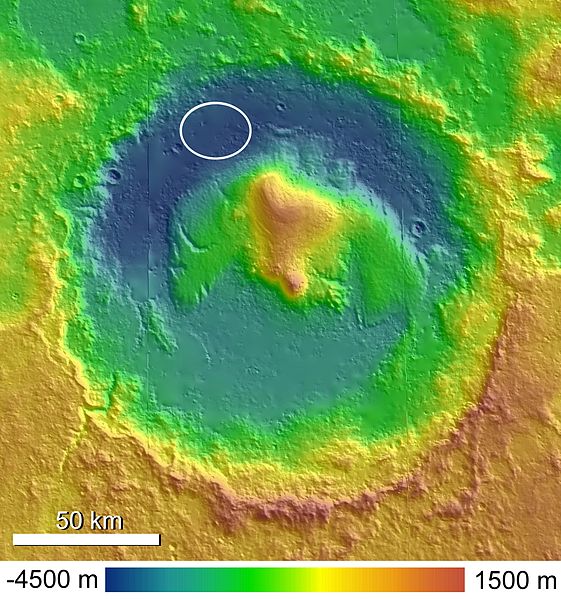
| 16:46, 25 January 2019 | Topographic Map of Gale Crater.jpg (file) |  |
94 KB | Suitupandshowup | A shaded and colorized topographic map of Gale Crater, Mars, based on publicly released High Resolution Stereo Camera (HRSC) data. The MSL landing ellipse is indicated in the northwestern crater floor. Date 14 September 2010 Source Anderson and Bell,... | 1 |
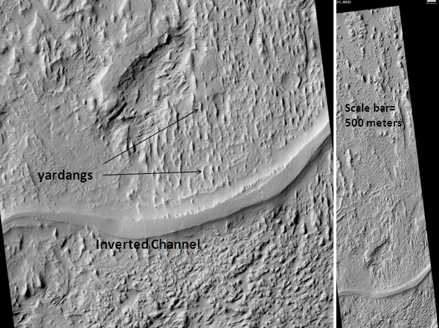
| 16:39, 25 January 2019 | Aeolis Mensae Yardangs.JPG (file) |  |
74 KB | Suitupandshowup | Aeolis Mensae Yardangs and inverted channel, as seen by hirise. Location is 6.3 degrees south latitude and 151.1 degrees east longitude. Image was taken by the Mars Reconnaissance Orbiter's HiRISE. The HiRISE camera was built by Ball Aerospace and Tech... | 1 |
| 16:35, 25 January 2019 | Apollinarisandmedusae.JPG (file) |  |
63 KB | Suitupandshowup | Medusae Fossae Formation near Apollinaris Patera. Location is 10.2 degrees south latitude and 183.6 degrees wast longitude. Picture was taken with the Mars Reconnaissance Orbiter's HiRISE. Picture credit is NASA/JPL/ University of Arizona. Source htt... | 1 |
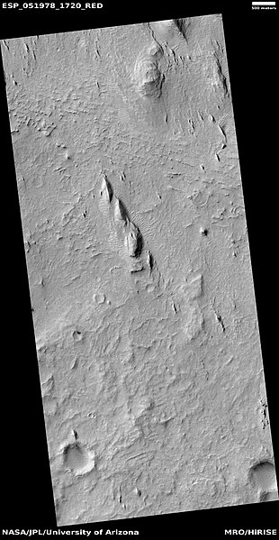
| 16:32, 25 January 2019 | ESP 051978 1720yardangslayers.jpg (file) |  |
57 KB | Suitupandshowup | Layers and yardangs in Aeolis quadrangle, as seen by HiRISE under HiWish program Source http://hirise.lpl.arizona.edu/ESP_051978_1720 NASA/JPL/University of Arizona | 1 |
| 16:04, 25 January 2019 | Apollinaris Patera (PIA02006).jpg (file) | .jpg) |
55 KB | Suitupandshowup | This month (April 1999), the Mars Global Surveyor Mars Orbiter Camera (MOC) passed over the Apollinaris Patera volcano and captured a patch of bright clouds hanging over its summit in the early martian afternoon. This ancient volcano is located near th... | 1 |
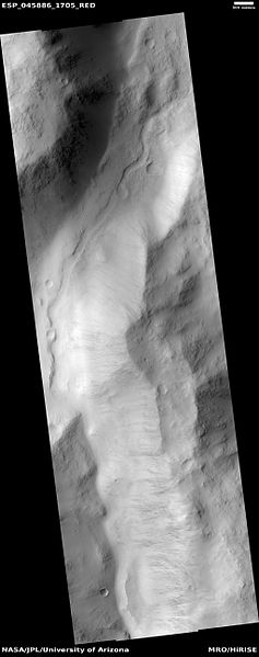
| 16:00, 25 January 2019 | ESP 045886 1705channel.jpg (file) |  |
20 KB | Suitupandshowup | Channel in Aeolis quadrangle, as seen by HiRISE under HiWish program Source http://hirise.lpl.arizona.edu/ESP_045886_1705 NASA/JPL/Jim Secosky | 1 |
| 15:56, 25 January 2019 | 51978 1720layers.jpg (file) |  |
75 KB | Suitupandshowup | Yardangs in Aeolis quadrangle, as seen by HiRISE under HiWish program Source http://hirise.lpl.arizona.edu/ESP_051978_1720 NASA/JPL/University of Arizona/Secosky | 1 |
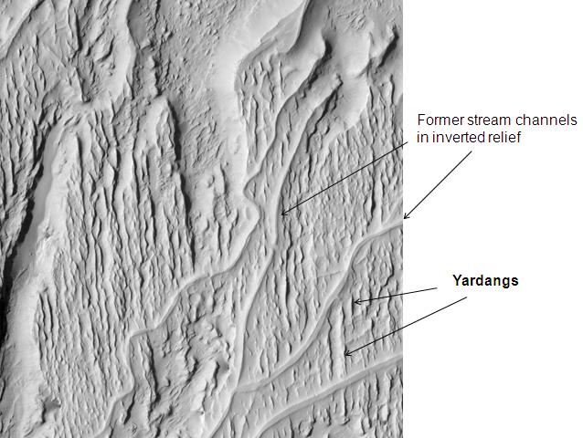
| 15:51, 25 January 2019 | Ridges in Aeolis.JPG (file) |  |
58 KB | Suitupandshowup | Ridges in Aeolis. Possible inverted relief and yardangs. The location is 6.2 degrees south latitude and 151.4 degrees east longitude. Picture was taken with the Mars Reconnaissance Orbiter's HiRISE. Picture credit is NASA/JPL/ University of Arizona. Da... | 1 |
| 15:47, 25 January 2019 | Sinuous Ridges in Medusae Formation.jpg (file) |  |
70 KB | Suitupandshowup | Sinuous ridges in medusae formation, as seen by hirise. Location is 4.7 S and 154.9 E. Source http://hirise.lpl.arizona.edu/PSP_007975_1755 Image credit: NASA/JPL/University of Arizona/Secosky | 1 |
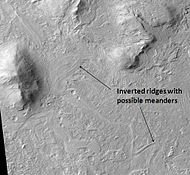
| 15:45, 25 January 2019 | Meandering Ridges.JPG (file) |  |
10 KB | Suitupandshowup | Meandering Ridges, as seen by hirise. Location is 5.4 degrees south latitude and 154.6 degrees east longitude. Image was taken by the Mars Reconnaissance Orbiter's HiRISE. The HiRISE camera was built by Ball Aerospace and Technology Corporation and is... | 1 |
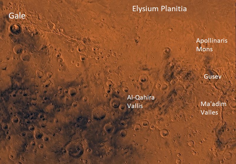
| 15:41, 25 January 2019 | PIA00183-MC-23-AeolisRegion-19980605.jpg (file) |  |
170 KB | Suitupandshowup | PIA00183: MC-23 Aeolis Region http://photojournal.jpl.nasa.gov/catalog/pia00183 Mars digital-image mosaic merged with color of the MC-23 quadrangle, Aeolis region of Mars. The southern part is dominated by heavily cratered highlands that are cut by tw... | 1 |
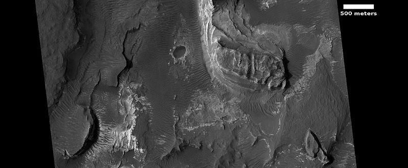
| 10:44, 25 January 2019 | 45029 1785layersclose.jpg (file) |  |
67 KB | Suitupandshowup | Close view of layers in Aeolis quadrangle, as seen by hirise under HiWish program Date 11 May 2016 Source http://hirise.lpl.arizona.edu/ESP_045029_1785 NASA/JPL/ University of Arizona | 1 |
| 10:41, 25 January 2019 | Wikiesp036510 1735moundsmedussa.jpg (file) |  |
90 KB | Suitupandshowup | Field of mounds, as seen by HiRISE under HiWish program Source http://hirise.lpl.arizona.edu/ESP_036510_1735 NASA/JPL/University of Arizona/Secosky | 1 |
| 10:39, 25 January 2019 | ESP 039740 1730layeredpyramid.jpg (file) |  |
67 KB | Suitupandshowup | Close-up of layers, as seen by hirise under HiWish program Source http://hirise.lpl.arizona.edu/ESP_039740_1730 NASA/JPL/University of Arizona/Secosky | 1 |
| 10:34, 25 January 2019 | 47441 1800pyramidrock.jpg (file) |  |
41 KB | Suitupandshowup | Layered butte in Aeolis quadrangle, as seen by HiRISE under HiWish program Source http:hirise.lpl.arizona.edu/ESP_047441_1800 NASA/JPL/University of Arizona/Secosky | 1 |
| 10:31, 25 January 2019 | 47441 1800blocks.jpg (file) |  |
37 KB | Suitupandshowup | Blocks in Aeolis quadrangle, as seen by HiRISE under HiWish program Source http:hirise.lpl.arizona.edu/ESP_047441_180 NASA/JPL/University of Arizona/Secosky | 1 |
| 10:26, 25 January 2019 | 47441 1800moundsstreaks.jpg (file) |  |
65 KB | Suitupandshowup | Layered butte in Aeolis quadrangle, as seen by HiRISE under HiWish program Source http:hirise.lpl.arizona.edu/ESP_047441_1800 NASA/JPL/University of Arizona/Secosky | 1 |
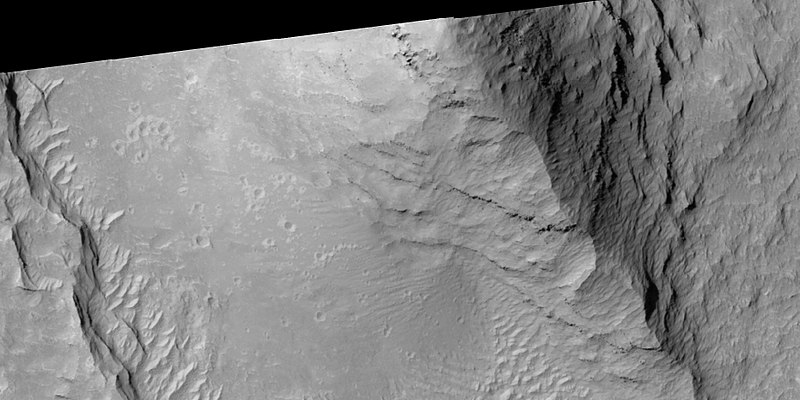
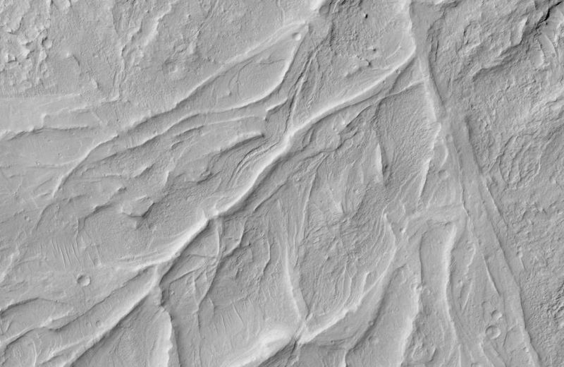
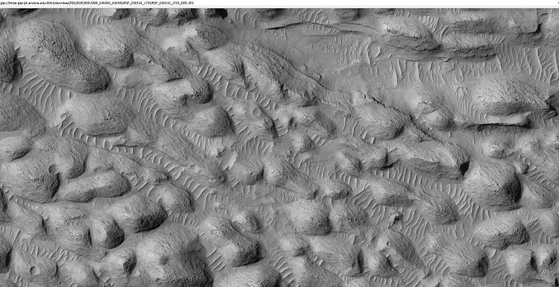
| 10:17, 25 January 2019 | 52545 1720ridgescloseforwalkaeolis.jpg (file) |  |
81 KB | Suitupandshowup | Ridges in Aeolis quadrangle, as seen by HiRISE under HiWish program Source http://ESP_052545_1720 NASA/JPL/University of Arizona/Secosky | 1 |
| 10:15, 25 January 2019 | 52545 1720ridgesandcoveraeolis.jpg (file) |  |
109 KB | Suitupandshowup | Ridges in Aeolis quadrangle, as seen by HiRISE under HiWish program Source http://ESP_052545_1720 NASA/JPL/University of Arizona/Secosky | 1 |
| 17:16, 23 January 2019 | Nanedi Valles.jpg (file) |  |
24 KB | Suitupandshowup | Nanedi Vallis, as seen by themis. Location is 5.8 N and 311 E. Image is 18.6 km wide. Source http://themis.asu.edu/zoom-20090126a NASA/ASU | 1 |
| 17:13, 23 January 2019 | ESP 056904 2015valley.jpg (file) |  |
29 KB | Suitupandshowup | Channels in the Lunae Palus quadrangle, as seen by HiRISE under HiWish program Source http://hirise.lpl.arizona.edu/ESP_056904_2015 NASA/JPL/University of Arizona/Secosky | 1 |
| 16:40, 23 January 2019 | Montevallo Crater.jpg (file) |  |
60 KB | Suitupandshowup | Montevallo Crater, as seen by themis. Location is 15.7 N and 54.3 W. Picture is 18.9 km wide. Picture taken with Mars Odyssey's THEMIS. Photo credit NASA/JPL/ASU. Source http://themis.asu.edu/zoom-20080425a NASA/JPL/University of Arizona/Secosky | 1 |
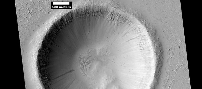
| 16:36, 23 January 2019 | Santa Fe Crater wide view.jpg (file) |  |
48 KB | Suitupandshowup | Santa Fe Crater as seen by hirise. Location is 19.2 N and 311.9 E. Source http://hirise.lpl.arizona.edu/ESP_016052_1995 NASA/JPL/University of Arizona | 1 |
| 16:32, 23 January 2019 | WikiESP 034567 1960craterlunaepalus.jpg (file) |  |
42 KB | Suitupandshowup | Crater with layers, as seen by HiRISE under HiWish program Source http://hirise.lpl.arizona.edu/ESP_034567_1960 Image credit: NASA/JPL/University of Arizona/Secosky | 1 |
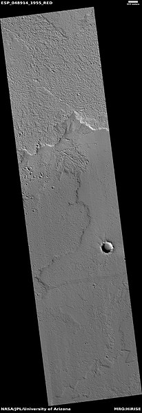
| 16:18, 23 January 2019 | ESP 048914 1955lavaflows.jpg (file) |  |
29 KB | Suitupandshowup | Lava flow in Lunae Palus quadrangle, as seen by HiRISE under HiWish program Source http://hirise.lpl.arizona.edu/ESP_048914_1955 NASA/JPL/University of Arizona/Secosky | 1 |
| 15:50, 23 January 2019 | 55568 2050layers.jpg (file) |  |
87 KB | Suitupandshowup | Close view of layers in the Lunae Palus quadrangle, as seen by HiRISE under HiWish program Source http://hirise.lpl.arizona.edu/ESP_055568_2050 NASA/JPL/University of Arizona/Secosky | 1 |
| 15:46, 23 January 2019 | ESP 055568 2050layers.jpg (file) |  |
36 KB | Suitupandshowup | Layers in the Lunae Palus quadrangle, as seen by HiRISE under HiWish program Source http://hirise.lpl.arizona.edu/ESP_055568_2050 NASA/JPL/University of Arizona | 1 |


