File:Mars MGS colorhillshade mola 1024volcanoessyrtis.jpg
Size of this preview: 800 × 400 pixels. Other resolutions: 320 × 160 pixels | 1,024 × 512 pixels.
Original file (1,024 × 512 pixels, file size: 225 KB, MIME type: image/jpeg)
Summary
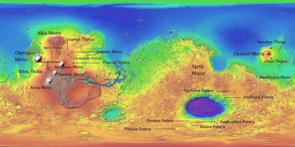
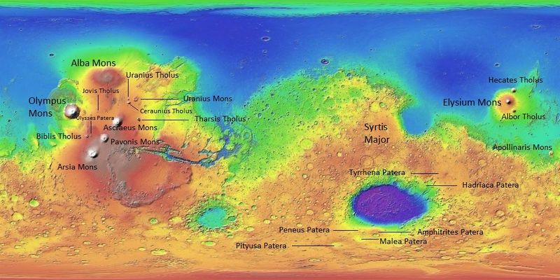
Topographic map with Martian volcanoes labeled including Tharsis volcanoes to the left
Feel free to use this. I labeled the volcanoes and give my permission to use this map.
Source: https://planetarynames.wr.usgs.gov/
Image Credit: NASA/USGS/USGS Astrogeology Center/Secosky
Licensing
Public domain images are available for anybody to use without any licenses, royalties, or special permissions.
File history
Click on a date/time to view the file as it appeared at that time.
| Date/Time | Thumbnail | Dimensions | User | Comment | |
|---|---|---|---|---|---|
| current | 07:45, 25 April 2018 | | 1,024 × 512 (225 KB) | Suitupandshowup (talk | contribs) | Topographic map with Martian volcanoes labeled including Tharsis volcanoes to the left Feel free to use this. I labeled the volcanoes and give my permission to use this map. Source: https://planetarynames.wr.usgs.gov/ Image Credit: NASA/USGS/USGS A... |
You cannot overwrite this file.
File usage
The following 2 pages use this file:


