Difference between revisions of "File:Viking Teardrop Islands.jpg"
(Teardrop shaped islands, as seen by Viking 1. Location is 21 N and 31 W. These were shaped by floods. Source http://history.nasa.gov/SP-441/ch4.htm Image credit: NASA/Secosky) |
(No difference)
|
Latest revision as of 14:29, 3 November 2018
Summary
Teardrop shaped islands, as seen by Viking 1. Location is 21 N and 31 W. These were shaped by floods.
Source http://history.nasa.gov/SP-441/ch4.htm Image credit: NASA/Secosky
Licensing
Public domain images are available for anybody to use without any licenses, royalties, or special permissions.
File history
Click on a date/time to view the file as it appeared at that time.
| Date/Time | Thumbnail | Dimensions | User | Comment | |
|---|---|---|---|---|---|
| current | 14:29, 3 November 2018 | 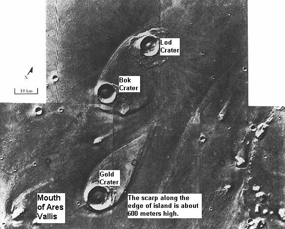 | 582 × 467 (62 KB) | Suitupandshowup (talk | contribs) | Teardrop shaped islands, as seen by Viking 1. Location is 21 N and 31 W. These were shaped by floods. Source http://history.nasa.gov/SP-441/ch4.htm Image credit: NASA/Secosky |
You cannot overwrite this file.
File usage
The following file is a duplicate of this file (more details):
- File:Viking Teardrop Islands.jpg from Wikimedia Commons
The following 4 pages use this file:


