Difference between revisions of "File:Ridgesmappedbycitizens.jpg"
(Map of ridges that were mapped by citizen scientists. Source: https://news.asu.edu/20220405-citizen-scientists-help-map-ridge-networks-may-hold-records-ancient-groundwater-mars Credit: NASA/JPL/GSFC.) |
(No difference)
|
Latest revision as of 06:53, 22 September 2022
Summary
Map of ridges that were mapped by citizen scientists.
Credit: NASA/JPL/GSFC.
Licensing
Public domain images are available for anybody to use without any licenses, royalties, or special permissions.
File history
Click on a date/time to view the file as it appeared at that time.
| Date/Time | Thumbnail | Dimensions | User | Comment | |
|---|---|---|---|---|---|
| current | 06:53, 22 September 2022 | 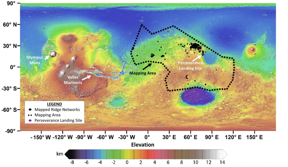 | 960 × 557 (451 KB) | Suitupandshowup (talk | contribs) | Map of ridges that were mapped by citizen scientists. Source: https://news.asu.edu/20220405-citizen-scientists-help-map-ridge-networks-may-hold-records-ancient-groundwater-mars Credit: NASA/JPL/GSFC. |
You cannot overwrite this file.
File usage
The following page uses this file:


